Maps
Maps For Sale
Color: Black
The Travel Sale: Natural History and Maps. November 2001: Sotheby's London
By Sotheby's
Located in valatie, NY
The Travel Sale: Natural History and Maps. November 2001: Sotheby's London. 1st Ed softcover. Lots 1-16; New Zealand 17-22; China Trade and Far East Asia 23-51; India 52-74; Africa 7...
Category
21st Century and Contemporary English Maps
Materials
Paper
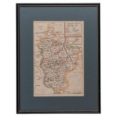
Map Bedfordshire General Framed
Located in BUNGAY, SUFFOLK
A general map of Bedfordshire with its hundreds
A scale of 5 miles
in the original green mount and traditional black and gold frame. Measures: 36cm 14" high.
Category
18th Century English Georgian Antique Maps
Materials
Paper
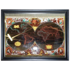
Vintage World Map Mirror Based on the Original by Johnson 1882 Military Campaign
Located in GB
We are delighted to offer for sale this lovely Antique style pictorial plan map of the globe based on the original by Johnson in 1882
This is a very interesting and decorative pie...
Category
20th Century English Campaign Maps
Materials
Mirror
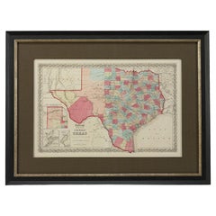
1859 "Colton's New Map of the State of Texas..." by Johnson & Browning
Located in Colorado Springs, CO
Presented is "Colton's New Map of the State of Texas Compiled from De Cordova's Large Map", published in Alivin J. Johnson’s “New Illustrated Family Atlas.” The map was published in ...
Category
1850s American Antique Maps
Materials
Paper
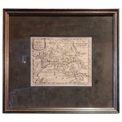
Antique Map of Asia 'circa 1739'
Located in Langweer, NL
Antique map titled 'Asia Dividida em suas Regioens & Principaes Estados'. Rare and uncommon map of Asia. Signed '1739'. Source unknown, to be determined.
...
Category
Mid-18th Century Antique Maps
Materials
Paper
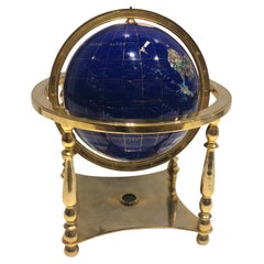
Globe, Solid Rotating Brass Frame with Spinning Globe
Located in Dallas, TX
Globe, solid rotating brass frame with spinning globe, faux hardstone.
Category
Mid-20th Century French Maps
Materials
Brass
1873 "Map of the States of California and Nevada" by Chas. Drayton Gibbes
Located in Colorado Springs, CO
Presented is Warren Holt and Charles Drayton Gibbes' 1873 “Map of California and Nevada.” This map is considered to be one of the finest large-scale ...
Category
1870s American Antique Maps
Materials
Paper
Antique Print of the Village of Joure, Friesland in the The Netherlands, 1863
Located in Langweer, NL
Antique print titled 'Joure'. View of the village of Joure, Friesland, The Netherlands. This original antique print originates from 'Het koningrijk der Nederlanden voorgesteld in een...
Category
19th Century Antique Maps
Materials
Paper
1912 "Panoramic View of New York City and Vicinity" by Jacob Ruppert
Located in Colorado Springs, CO
This is an attractive and very scarce map of New York, published by the Yorkville brewer Jacob Ruppert in 1912. The map shows an expansive view of the region reaching from Sandy Hook in the south and Yonkers to the north, to Hicksville in the east and past Newark to the west. This beautifully colored birds eye view shows waterways with all shipping traffic, boroughs, and clearly labeled railroad routes. It is presented on period dowels and backed on its original linen.
Jacob Ruppert was born in New York City in 1842 to Bavarian immigrants. His father owned a brewery in Manhattan where young Jacob learned the business of brewing. In 1862, Jacob established the Jacob...
Category
1910s American Vintage Maps
Materials
Paper
Portrait of Fernando Alvarez de Toledo y Pimentel, Grand duke of Alba, c.1690
Located in Langweer, NL
Antique print, titled: 'Ferdinand de Tolede. Duc d'Albe.'
Portrait of Fernando Alvarez de Toledo y Pimentel, Grand duke of Alba (1507-1582). Source un...
Category
1690s Antique Maps
Materials
Paper
Inside View of Magdalen Chapel in the Cowgate in Edinburgh. Scotland, 1790
Located in Langweer, NL
Antique print titled 'Inside View of Magdalen Chapel, near Winchester, from the West'. Inside view of the Magdalen Chapel taken from the Chancel from the West. Artists and Engravers:...
Category
18th Century Antique Maps
Materials
Paper
1948 "A Hysterical Map of Yellowstone National Park" by Jolly Lindgren, 2nd Ed.
Located in Colorado Springs, CO
Presented is a second edition printing of Jolly Lindgren’s “Hysterical Map of Yellowstone National Park.” This comical pictorial map highlights the famous Yellowstone National Park. ...
Category
1940s American Vintage Maps
Materials
Paper
Antique Engraving with a Description of the Monkey Temple in Japan, 1669
Located in Langweer, NL
Antique print, titled: 'Beschryving van de Japansche Apen-tempel.' - ('Description of the Japanese Monkey Temple').
Interior of a temple filled wit...
Category
1660s Antique Maps
Materials
Paper
Vintage Afghan Pictorial Map Rug
Located in New York, NY
A vintage Afghan Pictorial map rug from the mid-20th century.
Measures: 3' 0" x 4' 10"
Category
Mid-20th Century Afghan Folk Art Maps
Materials
Wool
Antique American "Rand Menally Co." Chicago Table-Top Globe on Stand, Circa 1900
Located in New Orleans, LA
Antique American "Rand Menally Co.," Chicago table-top globe on stand with map made By "G.W. Bacon & Co." of London, England, Circa 1900.
Some normal wear and tear: per the last 2 ...
Category
Early 20th Century American Maps
Materials
Metal
Rare Antique Engraving of Mount Fuji During an Earthquake in Tokyo, Japan, 1669
Located in Langweer, NL
Antique print, titled: 'Aertbeevinge tot Jedo.' - ('Earthquake in Edo').
A temple falls to ruins because of an earthquake in Yedo (or Edo, Jeddo; now Tokyo). Men and women lament...
Category
1660s Antique Maps
Materials
Paper
1847 Ornamental Map of the United States & Mexico by H. Phelps
Located in Colorado Springs, CO
Offered is an original 1847 ornamental map of the U.S. entitled "Ornamental Map of the United States & Mexico" by Humphrey Phelps. The map was issued as an act of Congress by Phelps on Fulton Street, New York. The broadside is elaborately hand-colored.
This is a very detailed and graphic propaganda map of the United States expressing U.S. dominance of the North American continent. The hand-colored map proclaims the Manifest Destiny, with the recent acquisition of Upper California and Texas at the conclusion of the Mexican-American War. The newly acquired land is boldly colored, standing in stark contrast to the rest of the U.S. The map details a potential route for a railroad running from New York City, to Buffalo, to Chicago, then west along the Oregon Trail to Oregon City. This route anticipates the construction of the transcontinental railroad by nearly 20 years.
The map includes elaborately detailed renderings of George Washington, Hernan Cortez, and Montezuma at top to represent European expansion to the Americas. At bottom are four inset designs with text showing the following: a chronological history of the U.S. beginning from settlement to the U.S. victory in the Mexican-American war; an illustration of General Zachary Taylor with details on the Oregon Territory; an illustration of the Aztec Temple of the Sun in Tenochtitlan and a chronology of the Conquest of the Aztec Empire under Cortez; a portrait of General Antonio Lopez de Santa Anna...
Category
1840s American Antique Maps
Materials
Paper
South America: Hand-colored 18th Century Framed Map by Thomas Jefferys
Located in Alamo, CA
This detailed hand-colored map of South America by Thomas Jefferys was published in London in 1750. The map shows countries, early colonial possessions, towns, rivers, mountains, and...
Category
Mid-18th Century English Antique Maps
Materials
Paper
1812 United States Map, by Pierre Tardieu, Antique French Map Depicting the U.S.
Located in Colorado Springs, CO
1812 "United States of Nth America -- Carte des Etats-Unis De L'Amerique Septentrionale" Two-Sheet Map by Tardieu
This attractive map, published in Paris in 1812, is one of the most rare large format maps from the period. It features a view of the East Coast of the U.S. from Maryland to just below South Carolina. Additionally, Ellicott’s plan for the City of Washington D.C. is included at the top right and an illustration of Niagara Falls is shown at the bottom right with a description in both French and English. This extremely detailed map not only depicts the mountainous regions of the southeastern U.S., but also includes names of regions, rivers, and towns.
Based on the first state of Arrowsmith’s 4-sheet map of the United States, this map is completely engraved by Tardieu in Paris and showcases high quality engravings. This detailed map of the recently independent United States includes one of the largest and earliest examples of the Ellicott plan of Washington DC.
The artist, Pierre François Tardieu (PF Tardieu) was a very well-known map engraver, geographer, and illustrator. Awarded a bronze medal by King Louis-Phillipe for the accuracy and beauty of his map-making, Tardieu produced many fine works including maps of Louisiana...
Category
1810s French Antique Maps
Materials
Paper
Antique Map of Paris, "Carte Routiere des Environs de Paris" 1841
Located in Colorado Springs, CO
This beautiful hand-colored road map of Paris was published in 1841. The map shows Paris and the surrounding area in a folding pocket map. Organized and detailed for travelers, this ...
Category
1840s French Antique Maps
Materials
Paper
University Chart “Black Map of North America
Located in Chillerton, Isle of Wight
University Chart “Black Map of North America
W&A K Johnston’s Charts of Physical Maps By G W Bacon,
This is a Black Physical map of North A...
Category
Early 20th Century Industrial Maps
Materials
Linen
1855 "New-York City & County Map" by Charles Magnus
By Charles Magnus
Located in Colorado Springs, CO
This is a beautiful hand-colored map titled “New York City & County Map with Vicinity entire Brooklyn, Williamsburgh, Jersey City &c.” The work was published in 1855 by Charles Magnu...
Category
1850s American Antique Maps
Materials
Paper
Facsimile with 30 VOC Nautical Charts, the Treasure of Corpus Christi
Located in Langweer, NL
Facsimile with 30 large format VOC nautical charts in limited and numbered edition. Sjoerd de Meer, Frits Loomeijer (The Treasure of Corpus Christi) - ...
Category
21st Century and Contemporary Maps
Materials
Paper
1877 "Geological and Geographical Atlas of Colorado" by F. V. Hayden
Located in Colorado Springs, CO
This is F. V. Hayden's Geological and Geographical Atlas of Colorado and Portions of Adjacent Territory, an unmatched geological record for its time. Published by the Department of the Interior in 1877, the Atlas of Colorado consists of twenty double elephant sized sheets, divided into two series. The first series, four sheets, embrace the entire area on a scale of twelve miles to an inch, and include Triangulations, Drainage, an Economic Map, and a General Geological map...
Category
1870s American Antique Maps
Materials
Paper
Civil War Panorama of the Seat of War by John Bachmann, Antique Print circa 1864
Located in Colorado Springs, CO
Panorama of the seat of war. Bird's-eye View of Virginia, Maryland, Delaware and the District of Columbia.
This third state of this fascinating bird's eye view of the northernmost p...
Category
1860s American Antique Maps
Materials
Paper
Engraving Depicting 16th Century Map of Terra Sancta
Located in Buchanan, MI
Abraham Ortelius (Flemish, 1527-1598) Terra Sancta.
Engraving depicting 16th century map of Terra Sancta. Site 15" x 19.5.
Category
18th Century and Earlier Antique Maps
Materials
Paper
Related Items
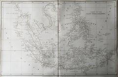
Original Antique Map of South East Asia, Arrowsmith, 1820
Located in St Annes, Lancashire
Great map of South East Asia
Drawn under the direction of Arrowsmith
Copper-plate engraving
Published by Longman, Hurst, Rees, Orme and Brown, 1820
Unframed.
Category
1820s English Antique Maps
Materials
Paper
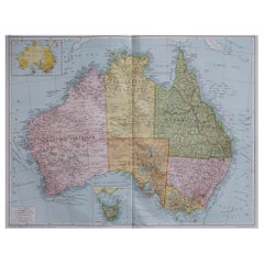
Large Original Vintage Map of Australia, circa 1920
Located in St Annes, Lancashire
Great map of Australia
Original color. Good condition
Published by Alexander Gross
Unframed.
Category
1920s English Vintage Maps
Materials
Paper
Large Original Vintage Map of The World, circa 1920
Located in St Annes, Lancashire
Great map of The World
Original color.
Good condition / minor foxing
Published by Alexander Gross
Unframed.
Category
1920s English Vintage Maps
Materials
Paper
The Duke and Duchess of Windsor Sotheby's Auction Catalogs, Set of Three
By Sotheby's
Located in London, GB
Sotheby's catalogues from the Duke and Duchess of Windsor Auction from September 11-19, 1997. New York: Sotheby's, 1997.
First edition ...
Category
20th Century American Maps
Materials
Paper
Original Antique Map of India. C.1780
Located in St Annes, Lancashire
Great map of India
Copper-plate engraving
Published C.1780
Three small worm holes to right side of map and one bottom left corner
Unframed.
Category
Early 1800s English Georgian Antique Maps
Materials
Paper
Antique Hand Colored Framed Map of Europe
Located in West Palm Beach, FL
Antique reproduction copied from an edition dated 1595 by Ortelius.
Category
Late 19th Century Antique Maps
New Life for the Noble Tree: Masterworks by George Nakashima 'Sotheby's'
Located in New York, NY
Catalog of a sale held at Sotheby’s, New York, on December 15, 2006, showcasing the Arthur and Evelyn Krosnick collection of George Nakashima furniture and lighting, or actually the second collection, as the first—112 pieces-- was completely destroyed by fire in 1989. George Nakashima essentially stopped what he was doing and focused on rebuilding the collection replacing the lost items with what he deemed better examples, owing to his own technical and artistic maturation, though many were completed under the guidance of his daughter, Mira, after George passed away in 1990. Highlights include an important “Arlyn” table, lot 313, that fetched $822,000 (a record for the artist) on a pre-sale estimate of $300,000-$500,000; a superb “Minguren II” table that brought $180,000; a magnificent “Arlyn II” coffee table that sold for $204,000; and a set of eight Conoid chairs that sold for $96,000. The catalog of the Krosnick sale remains a touchstone for collectors interested in the work of George Nakashima. 103 pages with 85 lots, mostly with full color illustrations, printed wrappers. Price results...
Category
Early 2000s American American Craftsman Maps
Materials
Paper
H 10.75 in W 8.25 in D 0.25 in
Elton John Sotheby's Sale 1988 Four-Volume Catalogue(Book)
Located in North Yorkshire, GB
This is the 4 volume set of sales catalogues produced by Sotheby's for the Elton John sale in 1988. The collection is amazing and the stage costumes and glasses are probably as expec...
Category
20th Century Maps
Materials
Paper
Original Antique Map of Ancient Greece- Boeotia, Thebes, 1787
Located in St Annes, Lancashire
Great map of Ancient Greece. Showing the region of Boeotia, including Thebes
Drawn by J.D. Barbie Du Bocage
Copper plate engraving by P.F T...
Category
1780s French Other Antique Maps
Materials
Paper
Jacqueline Kennedy Onassis, Sotheby's Auction Catalogue, New in Wrapper
By Sotheby's
Located in Philadelphia, PA
Jacqueline Kennedy Onassis, Sotheby's Auction Catalogue
New in Wrapper - Softcover
"A catalogue of the Sotheby's auction for the estate of Jacqueline Kennedy Onassis. Pieces include Jack Kennedy's oak rocking chair, a study for the White House portrait of Jackie, a collection of Lettuce Ware...
Category
1990s American Modern Maps
Materials
Paper
Original Antique Map of Ancient Greece, Achaia, Corinth, 1786
Located in St Annes, Lancashire
Great map of Ancient Greece. Showing the region of Thessaly, including Mount Olympus
Drawn by J.D. Barbie Du Bocage
Copper plate engraving by P.F Tardieu
Original hand color...
Category
1780s French Other Antique Maps
Materials
Paper
Original Antique Map of Asia. C.1780
Located in St Annes, Lancashire
Great map of Asia
Copper-plate engraving
Published C.1780
Two small worm holes to right side of map
Unframed.
Category
Early 1800s English Georgian Antique Maps
Materials
Paper
Previously Available Items
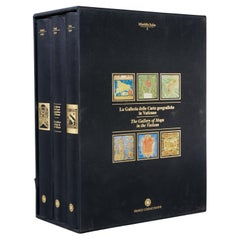
La Galleria Delle Carte Geografiche in Vaticano, Maps in the Vatican, 3 Vols
By Fra Egnazio Danti
Located in Morristown, NJ
La Galleria delle Carte geografiche in Vaticano / The Gallery of Maps in the Vatican, Mirabilia Italiae / Franco Cosimo Panini, (3) vols. in black silk cloth, slipcase with golden ti...
Category
1990s Italian Renaissance Maps
Materials
Linen, Paper
H 13 in W 5.5 in D 10 in
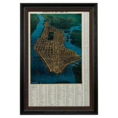
1945, "Supervue of New York City"
Located in Colorado Springs, CO
This bird’s eye view of New York City was published in 1945 by the Supervue Map and Guide Organization. The map shows the roads and major points of interest, which, coupled with a detailed index surrounding the map, helped tourists locate key attractions, historical sites, steamship piers, parks and squares, and bridges.
The map was originally issued folded into printed paper covers with black and white photographic images of the city. On the verso of the map are small black and white maps...
Category
1940s American Vintage Maps
Materials
Paper
1987 "the Ian Fleming Thriller Map" by Aaron Silverman and Molly Maguire
Located in Colorado Springs, CO
Presented is an original “Ian Fleming Thriller Map,” which features the travels of MI6 Agent 007, James Bond, from author Ian Fleming’s series of fourteen spy novels. The pictorial m...
Category
1980s American Vintage Maps
Materials
Paper
1937 "The Dole Map of the Hawaiian Islands, U.S.A"
Located in Colorado Springs, CO
Offered is a stunning "Dole Map of the Hawaiian Islands'' from 1937. The work was designed by Parker Edwards and published in Honolulu by Hawaiian Pineapple C...
Category
1930s Vintage Maps
Materials
Paper
1911 Rand-McNally Pocket Map and Shippers' Guide of Montana
Located in Colorado Springs, CO
1911 Rand-McNally Indexed County and Township Pocket Map and Shippers' Guide of Montana
This is a 1911 Indexed County and Township Pocket Map and Shipper’s...
Category
1910s Vintage Maps
Materials
Paper
19th Century French Map Globe on a Metal Base, 1890s
Located in LEGNY, FR
Rare celestial globe from the Forest Publisher house on its cast iron tripod support. We report some wear and a very slight depression.
Category
1890s European Antique Maps
Materials
Metal
1828 "Map of the United States" by T. Ensign
Located in Colorado Springs, CO
Presented is Timothy Ensign’s “Map of the United States,” published in 1828. The map is one of the first to show the United States stretching all the way to the Pacific Ocean. The map’s area covers Oregon to the Atlantic Ocean and Canada to Mexico. It also features a very prominent engraved portrait of George Washington, with inset views and maps of the Capitol, Washington, DC, Boston and a small map of North America.
Because this map predates the Texas Revolution, the Mexican American War, and the 1846 Treaty of Guadalupe Hidalgo, Mexico comprises much of the southwest, including California, Arizona, New Mexico, Nevada, Utah, and Texas. And yet, by including the large expanse of territory between the Mississippi River and the Pacific, the map is a mirror of American expansionist ambitions of the time.
Territorial expansion of the boundaries of the United States westward to the Pacific and beyond was at its peak at the time of this map’s publication. In 1803, President Thomas Jefferson’s Louisiana Purchase doubled the size of the country and the Lewis & Clark expedition of 1803-1806 sparked interest in the exploration and settlement of the newly acquired land. Expansionists eager to acquire Spanish Florida were part of the drive for the War of 1812 and Andrew Jackson’s invasion of Florida in 1818 and the subsequent Adams-Onís Treaty established an American claim to the Pacific Northwest as Spain renounced its claim to the Oregon Country...
Category
1820s American Antique Maps
Materials
Paper
1847 "Pictorial Map of the United States" by Ensign and Thayer
Located in Colorado Springs, CO
Offered is a scarce map of the United States and Mexico by Ensign and Thayer. This pictorial map features a unique view of the U.S. with exquisite hand-coloring and well-defined terr...
Category
1840s American Antique Maps
Materials
Paper
1904 Map of the Denver and Rio Grande & Rio Grande Western System, Rand McNally
Located in Colorado Springs, CO
1904 Map of the Denver and Rio Grande and the Rio Grande Western System by Rand McNally & Co.
This map details the Denver & Rio Grande Western Railroad. First published in 1885, t...
Category
Early 1900s American Antique Maps
Materials
Paper
H 10.25 in W 28 in D 1 in
History of Old Kinderhook by Edward Augustus Collier
Located in valatie, NY
A History of Old Kinderhook by Edward Augustus Collier. G. P. Putnam's and Sons, NY, 1914 (original), reprinted by Higginson Book Co, MA. A reprinted hardcover. Including the Story o...
Category
1990s American Maps
Materials
Paper
Vintage Botanical West German Biology Print Chart by Hagemann, Germany, 1960s
Located in Antwerp, BE
1960s canvas wall school chart, Pull down chart with beautiful illustration of a flower. It shows the details of the flower Taraxacum on a bla...
Category
Mid-20th Century German Hollywood Regency Maps
Materials
Canvas, Paper
H 45.28 in W 33.47 in D 0.4 in
Charles Darwin, Geological Observations on the Volcanic Islands, circa 1891
Located in valatie, NY
Geological Observations on the Volcanic Islands and Parts of South America visited during the Voyage of H.M.S. 'Beagle' by Charles Darwin. Appleton & Co...
Category
1890s English Antique Maps
Materials
Paper
H 7.75 in W 5.5 in D 1.75 in
Recently Viewed
View AllMore Ways To Browse
Antique Sailing Map
Antique Sailing Maps
Bay Area Antique Furniture
West Coat Of Arms
Greek Asia Minor
Hemisphere World Map
Speed Map
Antique Maps Canada
Antique Map Canada
Canada Antique Map
Malaysian Antique
West Indies Map
Blaeu World Map
Charing Cross
Antique Maps Of Canada
Bali Map
Antique Portuguese Plates
Map Of Brazil

