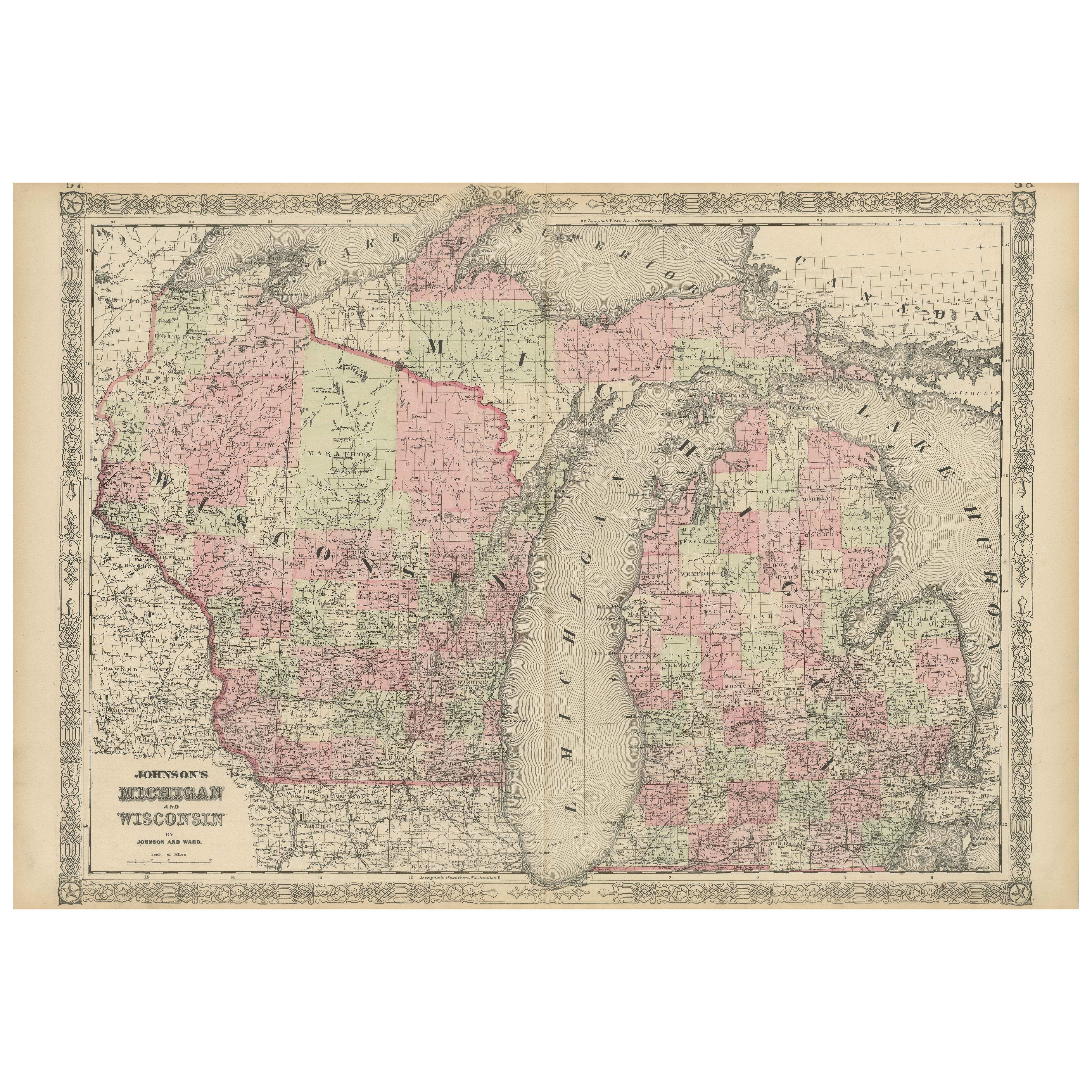
Grant's Siege of Vicksburg, Civil War Era Military Map, circa 1863
View Similar Items
Want more images or videos?
Request additional images or videos from the seller
1 of 5
Grant's Siege of Vicksburg, Civil War Era Military Map, circa 1863
About the Item
- Dimensions:Height: 39.5 in (100.33 cm)Width: 37.75 in (95.89 cm)Depth: 1.75 in (4.45 cm)
- Materials and Techniques:
- Place of Origin:
- Period:
- Date of Manufacture:1863
- Condition:Additions or alterations made to the original: Archival framing. Wear consistent with age and use. Overall very good condition. This 1863 map has toning along a horizontal fold line, but no other notable damage.
- Seller Location:Colorado Springs, CO
- Reference Number:Seller: M0811stDibs: LU90974627273
About the Seller
4.9
Platinum Seller
Premium sellers with a 4.7+ rating and 24-hour response times
Established in 2010
1stDibs seller since 2011
453 sales on 1stDibs
Typical response time: 1 hour
Authenticity Guarantee
In the unlikely event there’s an issue with an item’s authenticity, contact us within 1 year for a full refund. DetailsMoney-Back Guarantee
If your item is not as described, is damaged in transit, or does not arrive, contact us within 7 days for a full refund. Details24-Hour Cancellation
You have a 24-hour grace period in which to reconsider your purchase, with no questions asked.Vetted Professional Sellers
Our world-class sellers must adhere to strict standards for service and quality, maintaining the integrity of our listings.Price-Match Guarantee
If you find that a seller listed the same item for a lower price elsewhere, we’ll match it.Trusted Global Delivery
Our best-in-class carrier network provides specialized shipping options worldwide, including custom delivery.More From This Seller
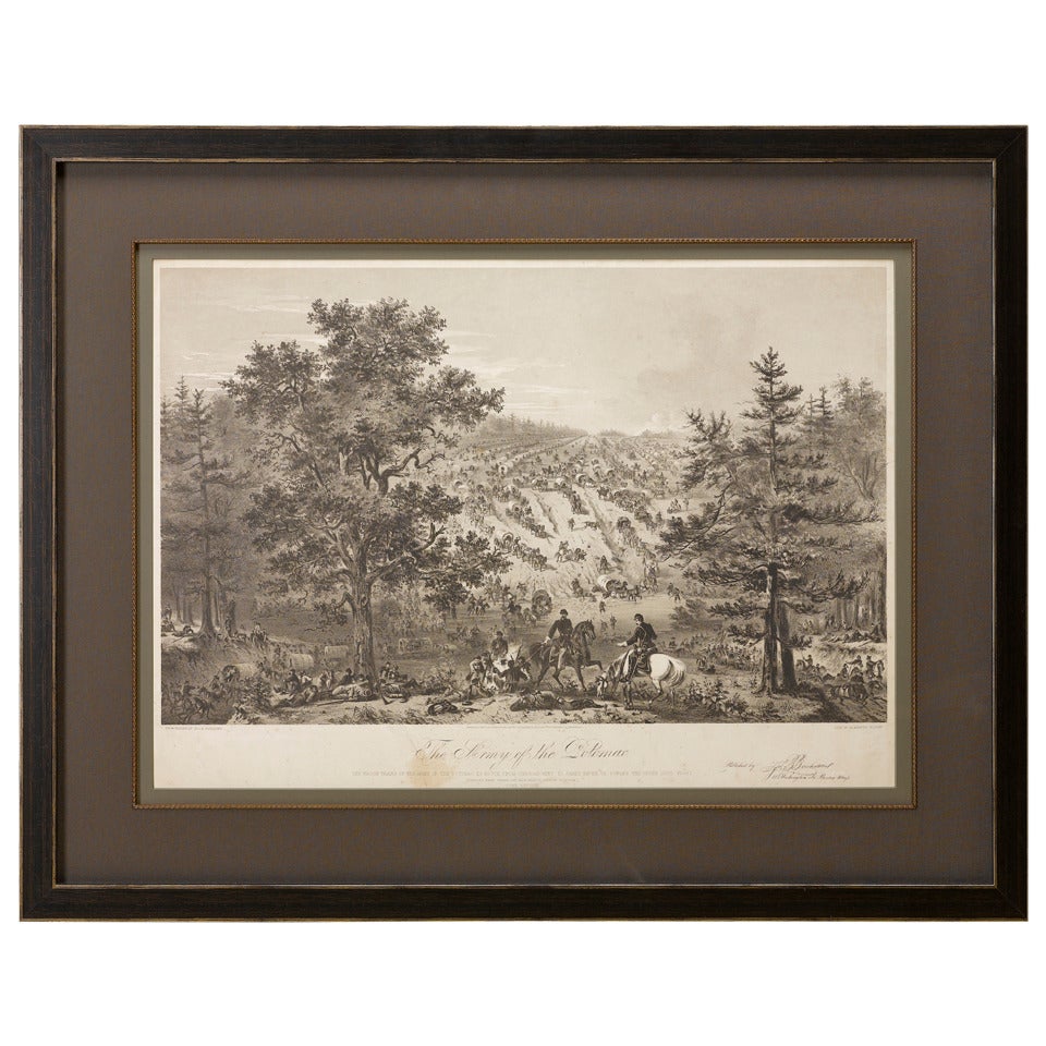
View All"Army of the Potomac" by John Bachelder, Civil War Era Lithograph, circa 1863
Located in Colorado Springs, CO
Fully-entitled: Army of the Potomac. The Wagon Trains of the Army of the Potomac en Route from Chickahominy to James River VA. During the Seven...
Category
Antique 19th Century American Prints
Materials
Paper
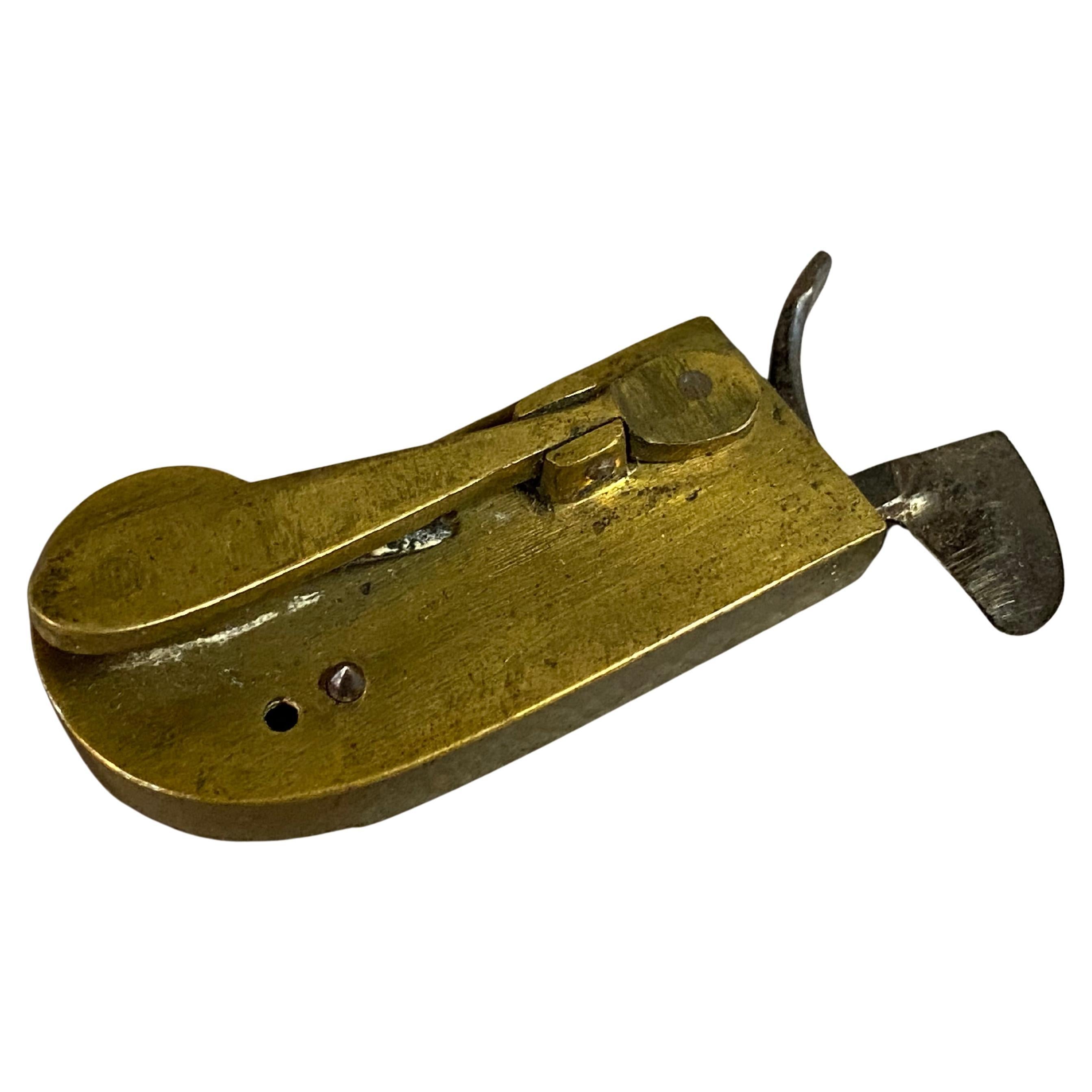
Antique Civil War Binoculars, Used by Col. Francis L. Lee
Located in Colorado Springs, CO
Presented is an original pair of Civil War-used binoculars, with their original leather carrying case. The binoculars were used by Colonel Francis L. Lee of Massachusetts during the ...
Category
Antique 1860s Unknown Historical Memorabilia
Materials
Brass

1863 "Lloyd's New Map of the United States, the Canadas, and New Brunswick"
Located in Colorado Springs, CO
Presented is “Lloyd's New Map of the United States, the Canadas and New Brunswick, From the latest Surveys, Showing Every Railroad & Station Finished to June 1863, and the Atlantic and Gulf Coasts.” A large, Civil War-era hanging map of the United States and adjacent territories, this map covers the area from the Atlantic Ocean and extends as far west as the 103 meridian, to “Dacotah,” Nebraska, Kansas, "Indian Territory," and Texas. The southern continuation of Florida is shown in an inset map along the right margin. This map was published by J. T. Lloyd, in New York, in 1863. According to the publisher’s marking at lower right, this map was originally issued in two states: "in Sheets, Colored" for 50 cents, and "Varnished nicely, with Rollers" for $1.
Throughout the map, the counties are colored and the towns and cities well labeled. A reference key in the bottom margin provides symbols for railroads, turnpikes and wagon roads, state capitals, cities and towns, and village post offices. As emphasized in the map’s title, this map is especially notable for the countless railway lines and stations depicted, with distances noted between points, listing “every railroad and finished station to June 1863.” Additionally, two shipping agents and their routes are drawn out of New York City. The map includes details of the steamship routes into New York and Philadelphia from Liverpool and on to California and Oregon via an overland Nicaraguan trek, presumably to assist gold rush emigrants.
This expansive and impressive map depicts the eastern half of the United States in the third year of the Civil War. In order not to recognize the legitimacy of the Confederate States of America, each state is shown in the same manner as the Union states. The only indication that the American Civil War was in progress when this map was published is a printed notice that Gideon Wells, Secretary of the Navy, wishes to acquire a quote on 100 copies of Lloyd’s Mississippi River map...
Category
Antique 1860s American Maps
Materials
Linen, Wood, Paper

The Photographic History of the Civil War in Ten Volumes, by Francis T. Miller
Located in Colorado Springs, CO
Miller, Francis Trevelyan (editor). The Photographic History of the Civil War in Ten Volumes. New York: The Review of Reviews Co., 1912. Quarto, ten volume set, in original blue cloth gilt bindings. Illustrated with thousands of photographs, plus maps.
This is an important 10-volume photographic history of the Civil War, edited by Francis Trevelyan Miller. The set was first published in 1911, the 50 year anniversary of the start of the Civil War. This 1912 edition contains “thousands of scenes photographed 1861-65, with text by many special authorities.”
This mammoth work contains written contributions from over 39 academics, writers, veteran officers of both Union and Confederate forces, and President William H. Taft. A number of the photographs are from the collections of private individuals, as well as the extensive Eldridge Collection of Mathew Brady Civil War photographs...
Category
Vintage 1910s American Books
Materials
Fabric, Paper

Civil War Bible, Presented to James Robberts, of 1st Maryland Vol. Group, 1864
Located in Colorado Springs, CO
The New Testament of our Lord and Saviour Jesus Christ: Translated out of the Original Greek and with the Former Translations Diligently Compared and Revised. New York: American Bibl...
Category
Antique 1860s American Historical Memorabilia
Materials
Leather, Fabric, Paper

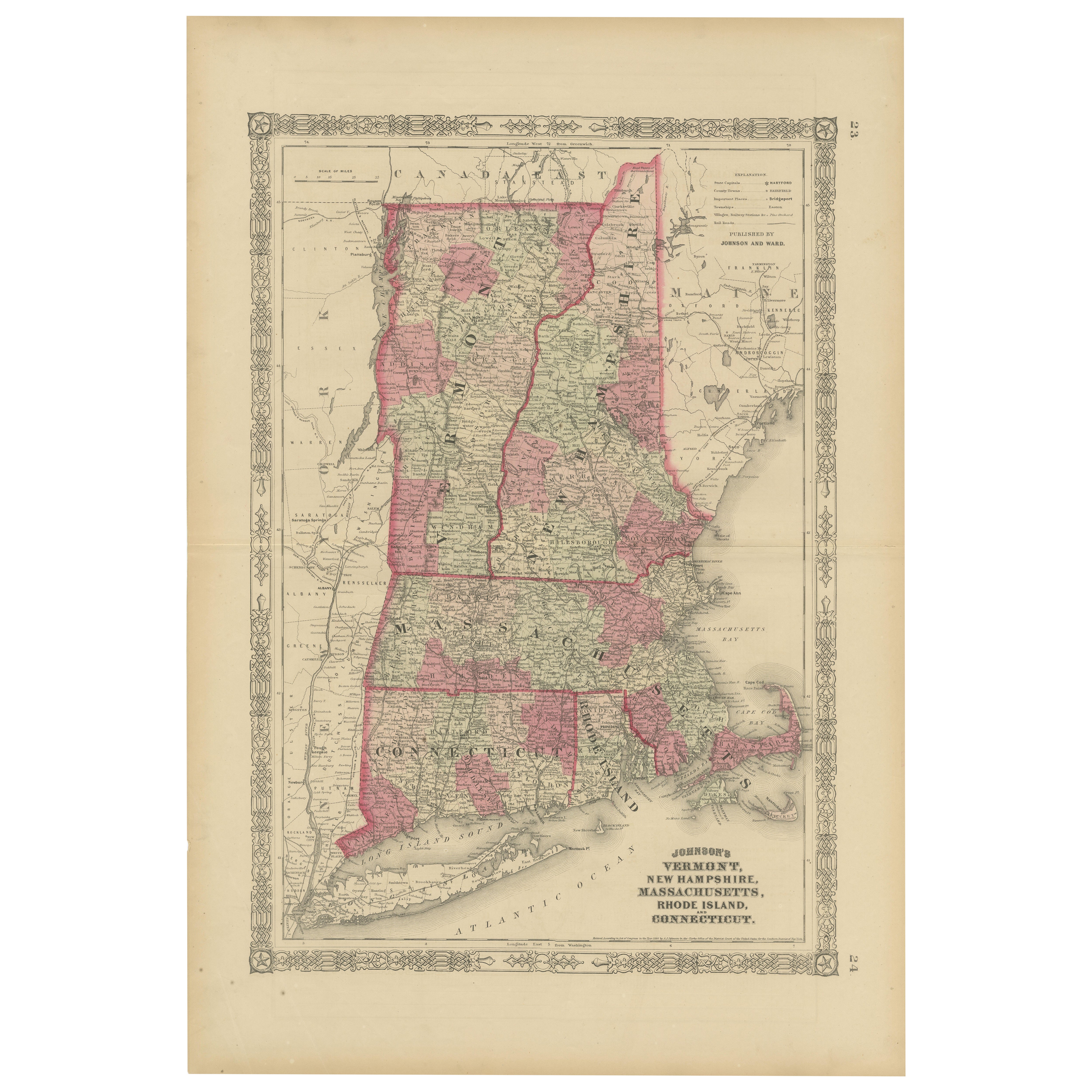
1854 Map of Massachusetts, Connecticut and Rhode Island, Antique Wall Map
Located in Colorado Springs, CO
This striking wall map was published in 1854 by Ensign, Bridgman & Fanning and has both full original hand-coloring and original hardware. This impression is both informative and highly decorative.
The states are divided into counties, outlined in red, green, and black, and subdivided into towns. Roads, canals, and railroad lines are prominently depicted, although they are not all labeled. The mapmakers also marked lighthouses, banks, churches, and prominent buildings, with a key at right. The map is an informative and comprehensive overview of the infrastructural development of New England prior to the Civil War. Physical geographies depicted include elevation, conveyed with hachure marks, rivers and lakes. The impression features an inset map of Boston...
Category
Antique 19th Century American Maps
Materials
Paper

You May Also Like
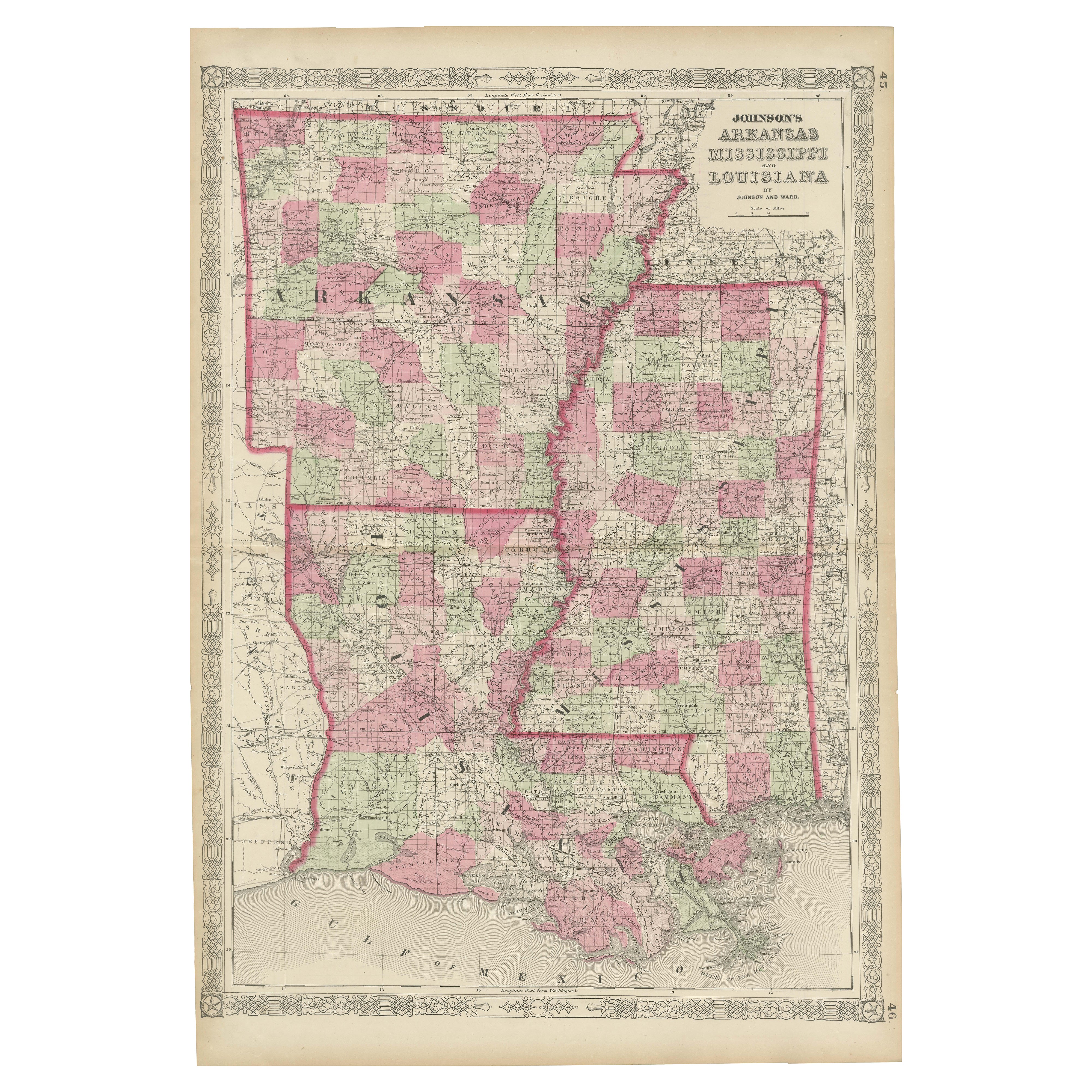
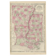
Rare 1864 Civil War Era Map of Arkansas, Mississippi, and Louisiana
Located in Langweer, NL
Title: Rare 1864 Civil War Era Map of Arkansas, Mississippi, and Louisiana
Description: This captivating antique map, titled "Johnson's Arkansas, Mississippi, and Louisiana," was pu...
Category
Antique 1860s Maps
Materials
Paper
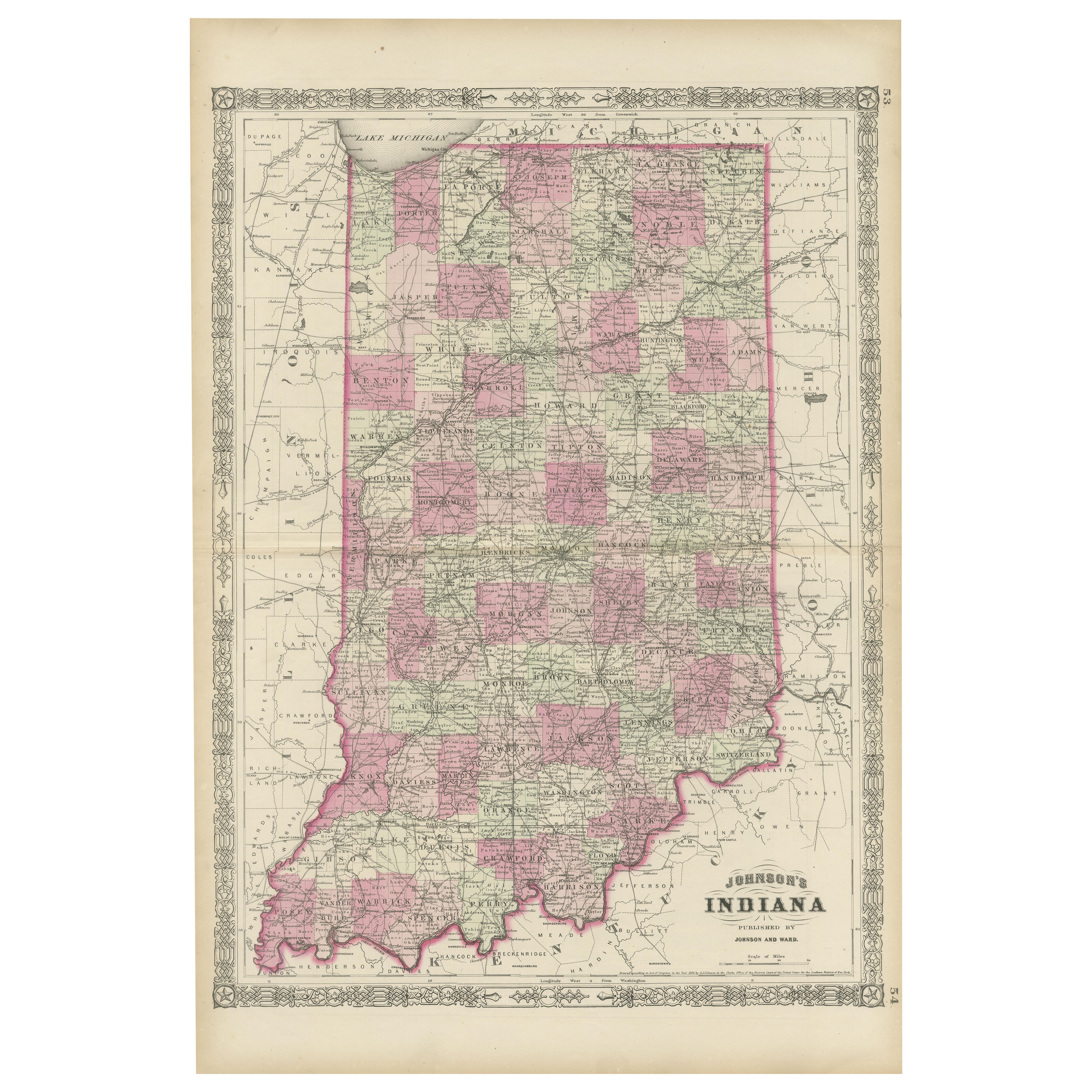
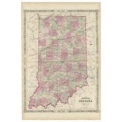
Decorative 1864 Civil War Era Map of Indiana with Lake Michigan Detail
Located in Langweer, NL
Title: Rare 1864 Civil War Era Map of Indiana with Lake Michigan Detail
Description: This finely detailed antique map, titled "Johnson's Indiana," was published in 1864 by Johnson a...
Category
Antique 1860s Maps
Materials
Paper
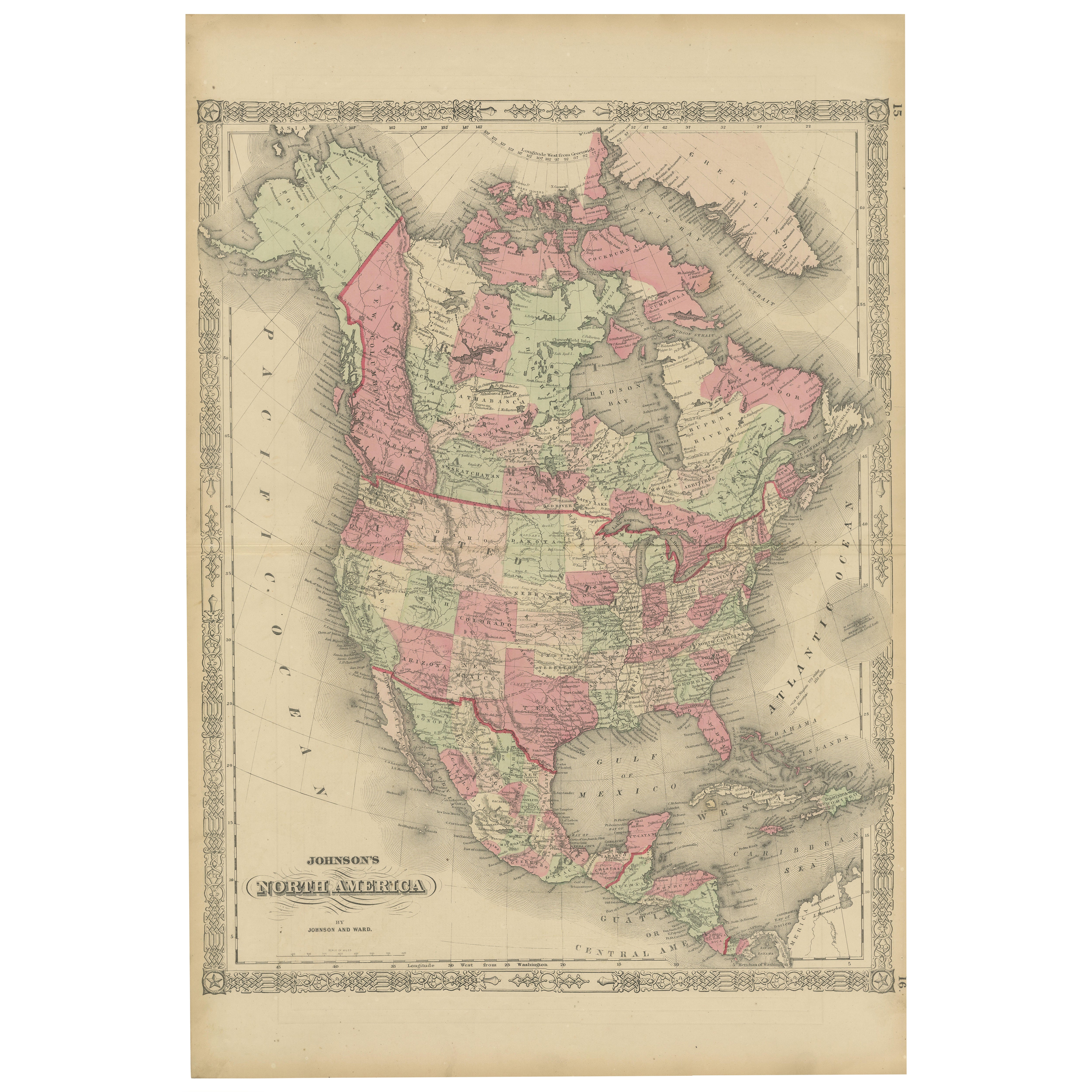
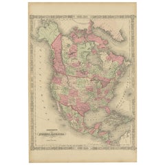
Rare 1864 Civil War Era Map of North America with Detailed Borders
Located in Langweer, NL
Title: Rare 1864 Civil War Era Map of North America with Detailed Borders
Description: This remarkable antique map, titled "Johnson's North America," was published in 1864 by Johnso...
Category
Antique 1860s Maps
Materials
Paper
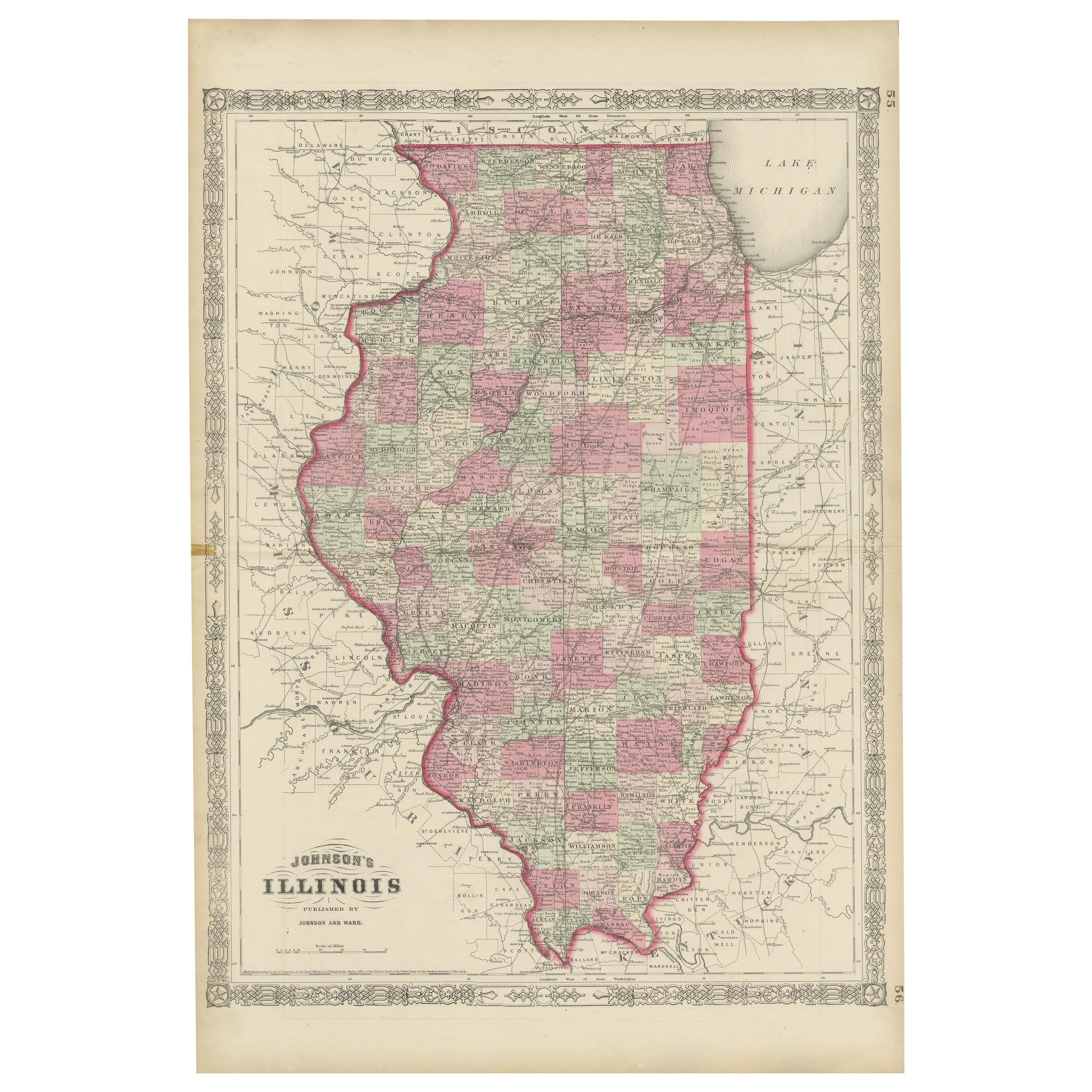
Rare 1864 Civil War Era Map of Illinois with Lake Michigan Detail
Located in Langweer, NL
Title: Rare 1864 Civil War Era Map of Illinois with Lake Michigan Detail
Description: This intricately detailed antique map, titled "Johnson's Illinois," was published in 1864 by Jo...
Category
Antique 1860s Maps
Materials
Paper

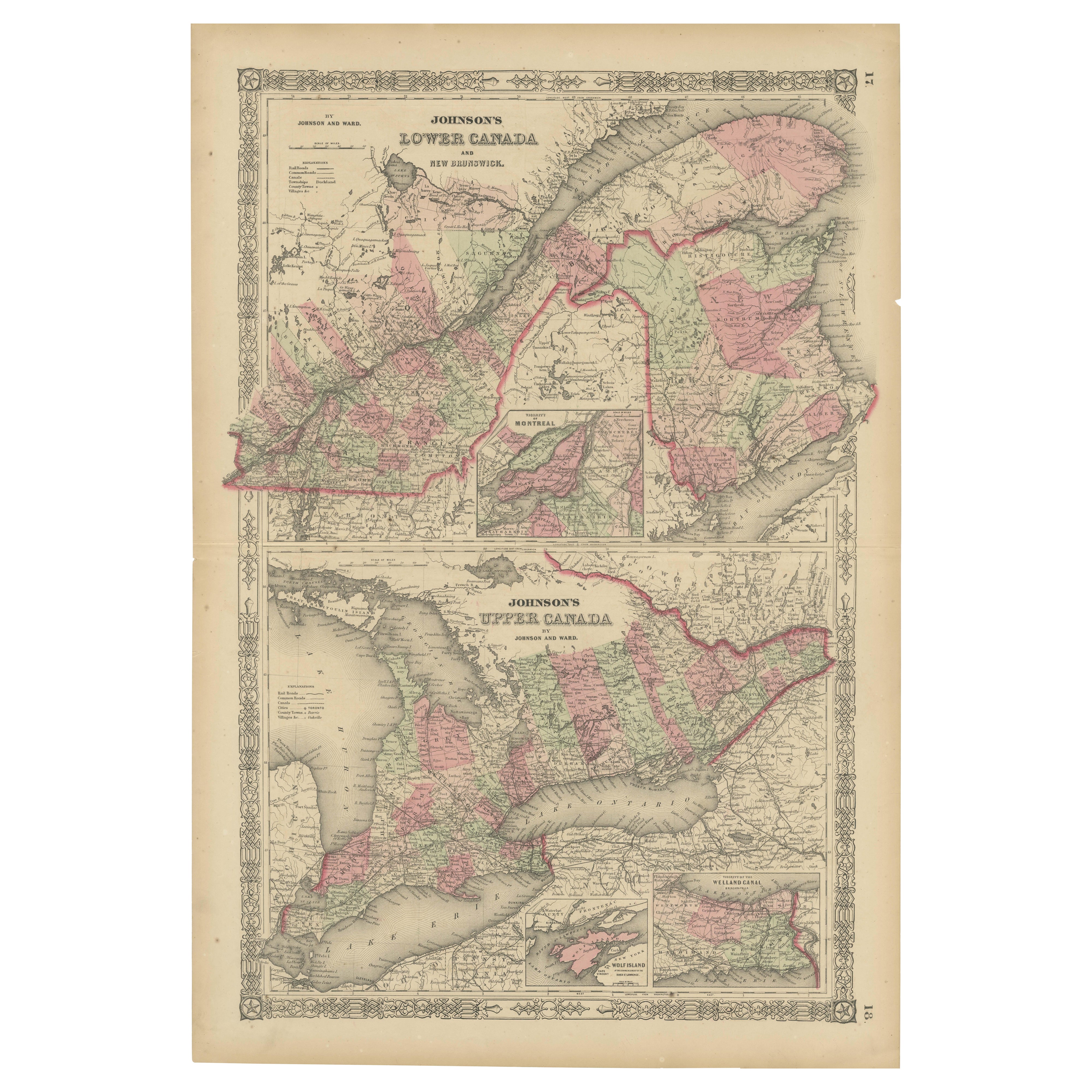
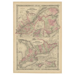
Historic 1864 Civil War Era Map of Canada with Great Lakes Detail
Located in Langweer, NL
Title: Rare 1864 Civil War Era Map of Canada with Great Lakes Detail
Description: This finely detailed antique map, titled "Johnson's Canada," was published in 1864 by Johnson and W...
Category
Antique 1860s Maps
Materials
Paper
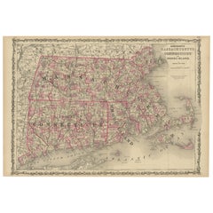
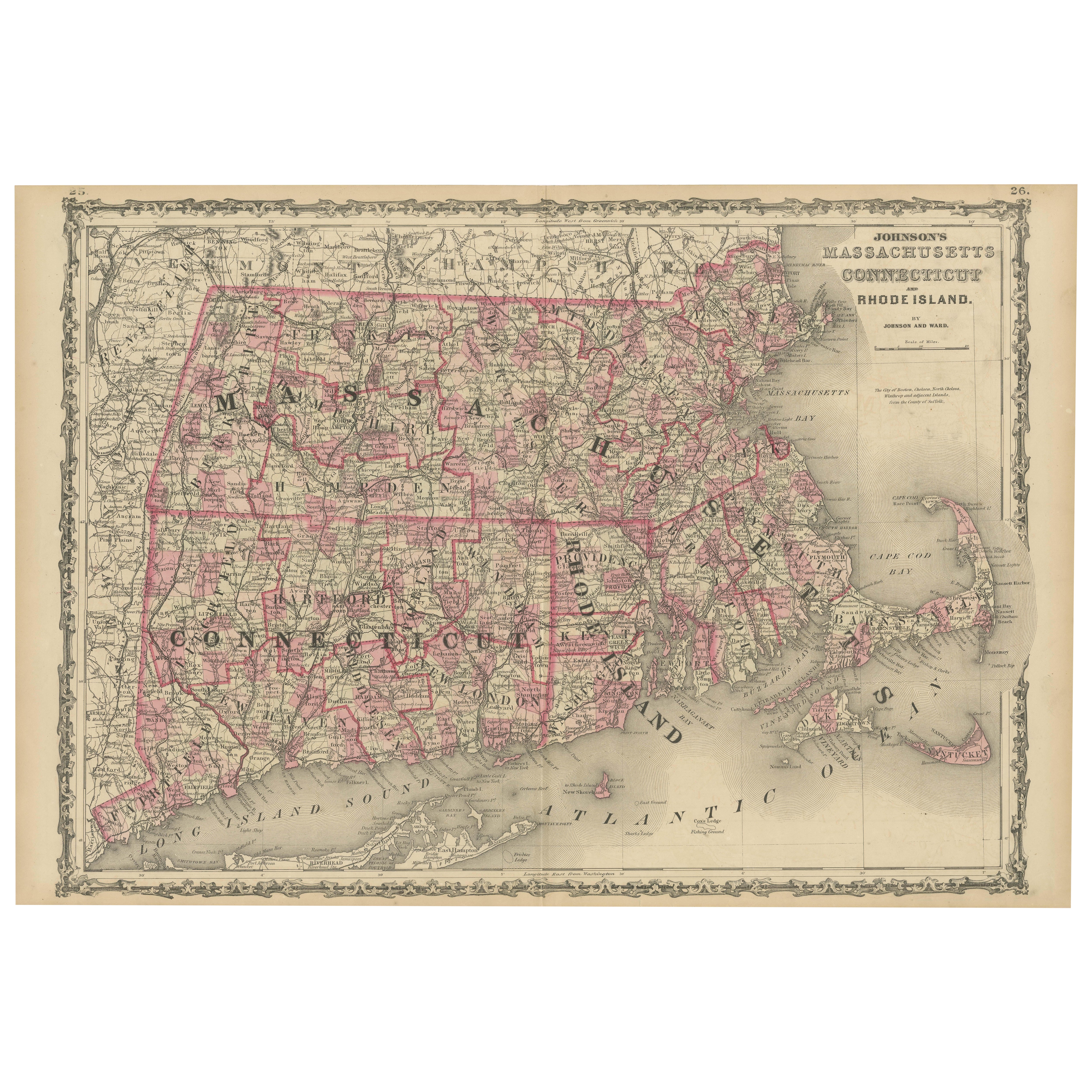
Rare 1864 Civil War Era Map of Massachusetts, Connecticut, and Rhode Island
Located in Langweer, NL
Title: Rare 1864 Civil War Era Map of Massachusetts, Connecticut, and Rhode Island
Description: This exquisite antique map, titled "Johnson's Massachusetts, Connecticut, and Rhode I...
Category
Antique 1860s Maps
Materials
Paper