Items Similar to Large Antique Map of the State of Texas, 1861


Want more images or videos?
Request additional images or videos from the seller
1 of 6
Large Antique Map of the State of Texas, 1861
About the Item
Antique map titled 'Johnson's New Map of the State of Texas' Large map of Texas, shows railroads, wagon roads, the U.S. Mail Route, rivers, ports, large towns, and villages of the mid-19th century. Much of the western portion of the state is divided into large counties that had yet to be properly surveyed. The map also includes an inset of Sabine Lake on the border of Texas and Louisiana and another inset map of Galveston Bay. Published by Johnson and Browning, 1861.
The Johnson company was one of the better American mapmakers of the 19th century, and were known for keeping current with all the changes that were occurring.
- Dimensions:Height: 18.04 in (45.8 cm)Width: 26.58 in (67.5 cm)Depth: 0.02 in (0.5 mm)
- Materials and Techniques:
- Period:
- Date of Manufacture:1861
- Condition:General age-related toning. Original folding line. Minor wear and soiling, blank verso. Please study image carefully.
- Seller Location:Langweer, NL
- Reference Number:Seller: BG-135621stDibs: LU3054336049852
About the Seller
5.0
Recognized Seller
These prestigious sellers are industry leaders and represent the highest echelon for item quality and design.
Gold Seller
Premium sellers maintaining a 4.3+ rating and 24-hour response times
Established in 2009
1stDibs seller since 2017
2,446 sales on 1stDibs
Typical response time: 1 hour
- ShippingRetrieving quote...Shipping from: Langweer, Netherlands
- Return Policy
Authenticity Guarantee
In the unlikely event there’s an issue with an item’s authenticity, contact us within 1 year for a full refund. DetailsMoney-Back Guarantee
If your item is not as described, is damaged in transit, or does not arrive, contact us within 7 days for a full refund. Details24-Hour Cancellation
You have a 24-hour grace period in which to reconsider your purchase, with no questions asked.Vetted Professional Sellers
Our world-class sellers must adhere to strict standards for service and quality, maintaining the integrity of our listings.Price-Match Guarantee
If you find that a seller listed the same item for a lower price elsewhere, we’ll match it.Trusted Global Delivery
Our best-in-class carrier network provides specialized shipping options worldwide, including custom delivery.More From This Seller
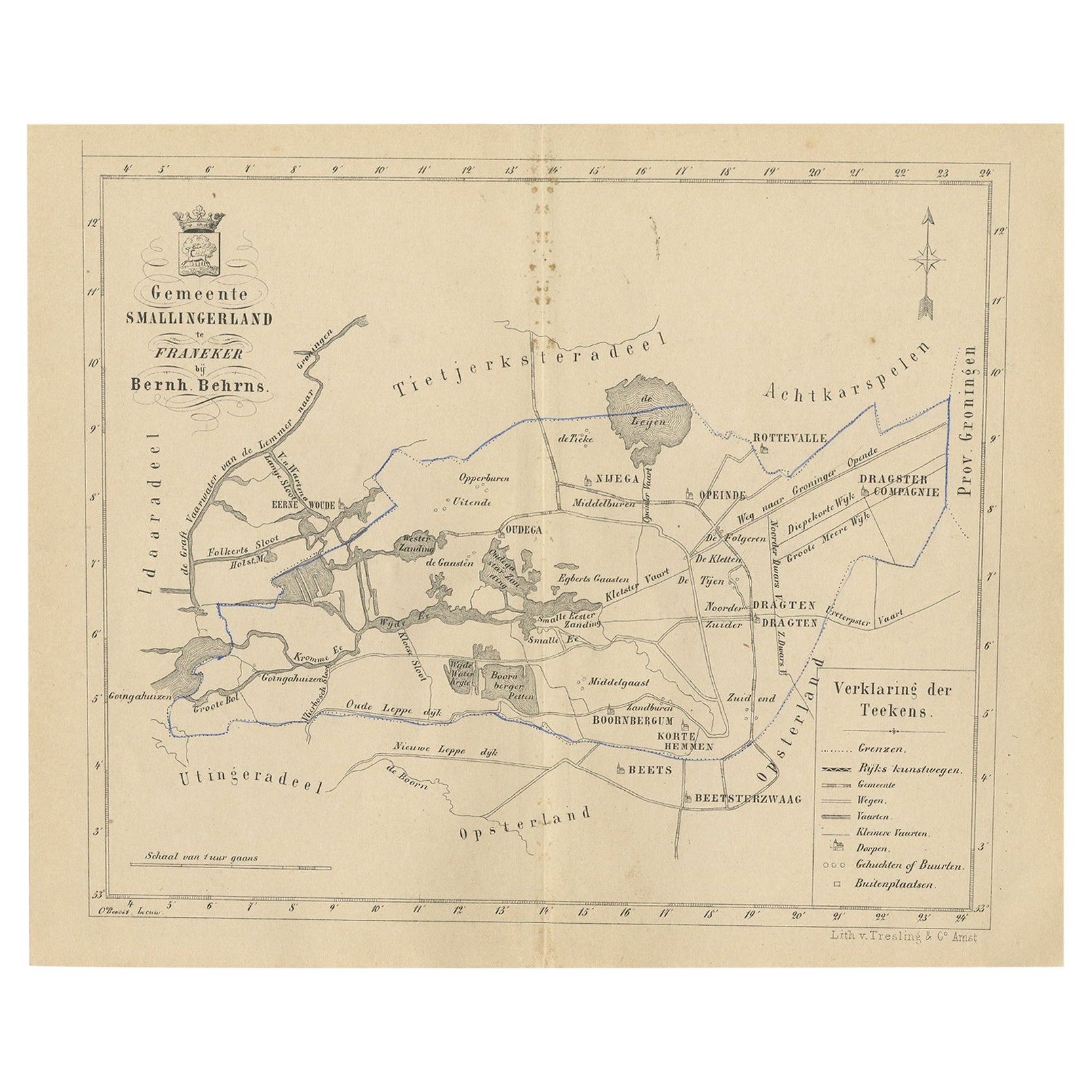
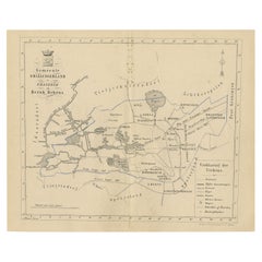
View AllAntique Map of The Dutch Smallingerland Township, 1861
Located in Langweer, NL
Antique map titled 'Gemeente Smallingerland'. Old map depicting the Smallingerland township including cities and villages like Eernewoude, Oudega, Boornbergum, Opeinde and Drachten. ...
Category
Antique 19th Century Maps
Materials
Paper
$92 Sale Price
20% Off
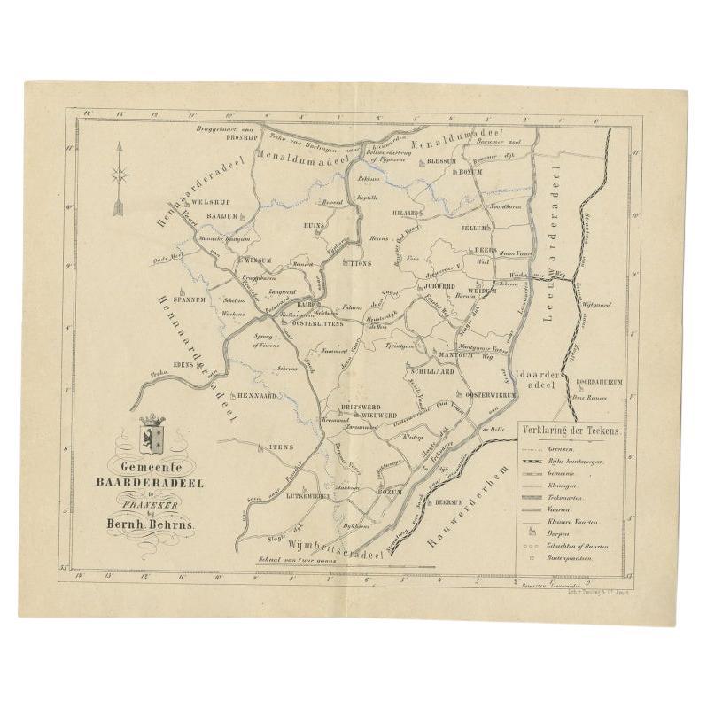
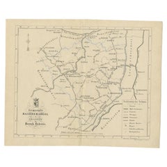
Antique Map of the Dutch Township Baarderadeel, 1861
Located in Langweer, NL
Antique map titled 'Gemeente Baarderadeel'. Old map depicting the Baarderadeel township including cities and villages like Baard, Hilaard, Jorwerd, Oosterlittens and Oosterwierum. Th...
Category
Antique 19th Century Maps
Materials
Paper
$111 Sale Price
20% Off
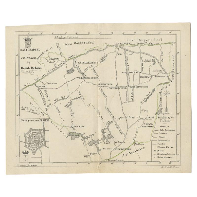
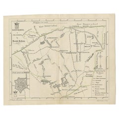
Antique Map of the Dutch Dantumadeel Township, 1861
Located in Langweer, NL
Antique map titled 'Gemeente Dantumadeel'. Old map depicting the Dantumadeel township including cities and villages like Birdaard, Roodkerk, Veenwouden, Dantumawoude and Dokkum. This...
Category
Antique 19th Century Maps
Materials
Paper
$120 Sale Price
20% Off
Antique Map of The Dutch Township Rauwerderhem, 1861
Located in Langweer, NL
Antique map titled 'Gemeente Rauwerderhem'. Old map depicting the Rauwerderhem township including cities and villages like Deersum, Poppingawier, Rauwerd and Irnsum. This map orginat...
Category
Antique 19th Century Maps
Materials
Paper

$111 Sale Price
20% Off
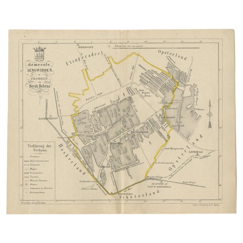
Antique Map of the Dutch Township Aengwirden, 1861
Located in Langweer, NL
Antique map titled 'Gemeente Aengwirden'. Old map depicting the Aengwirden township including cities and villages like Tjalleberd, Luinjeberd, Terband and Gersloot. This map orginate...
Category
Antique 19th Century Maps
Materials
Paper

$111 Sale Price
20% Off
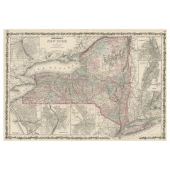
Large Antique Map of New York State with Inset Maps
Located in Langweer, NL
Antique map titled 'Johnson's New York' Large map of New York State. With insets of Albany, Oswego, Buffalo, Rochester, Syracuse, Troy and NYC. Published by Johnson and Browning, 186...
Category
Antique Mid-19th Century Maps
Materials
Paper
$454 Sale Price
20% Off
You May Also Like
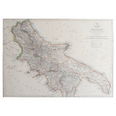
Large Original Antique Map of The South of Italy. John Dower, 1861
Located in St Annes, Lancashire
Great map of the South of Italy
Lithograph engraving by John Dower
Original colour
Published, 1861
Unframed
Good condition
Free shipping
Category
Antique 1860s English Victorian Maps
Materials
Paper
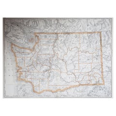
Large Original Antique Map of The State of Washington, USA, 1894
By Rand McNally & Co.
Located in St Annes, Lancashire
Fabulous map of Washington.
Original color.
By Rand, McNally & Co.
Published, 1894.
Unframed.
Free shipping.
Category
Antique 1890s American Maps
Materials
Paper
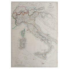
Large Original Antique Map of Italy. John Dower, 1861
Located in St Annes, Lancashire
Great map of Italy
Lithograph engraving by John Dower
Original colour
Published, 1861
Unframed
Good condition / repair to top right corner seen in last image
Category
Antique 1860s English Victorian Maps
Materials
Paper
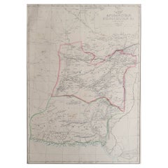
Large Original Antique Map of Afghanistan. Edward Weller, 1861
Located in St Annes, Lancashire
Great map of Afghanistan
Lithograph engraving by Edward Weller
Original colour
Published, 1861
Unframed
Good condition
Category
Antique 1860s English Victorian Maps
Materials
Paper
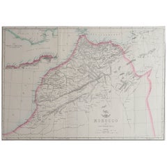
Large Original Antique Map of Morocco. Edward Weller, 1861
Located in St Annes, Lancashire
Great map of Morocco
Lithograph engraving by Edward Weller
Original colour
Published, 1861
Unframed
Good condition.
Category
Antique 1860s English Victorian Maps
Materials
Paper
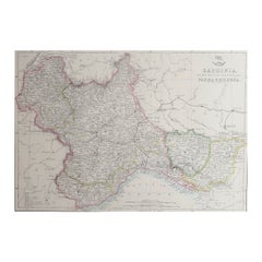
Large Original Antique Map of Piedmont, Italy. John Dower, 1861
Located in St Annes, Lancashire
Great map of Piedmont
Lithograph engraving by John Dower
Original colour
Published, 1861
Unframed
Good condition
Free shipping
Category
Antique 1860s English Victorian Maps
Materials
Paper
Recently Viewed
View AllMore Ways To Browse
Antique Wagons
Masculine Rug
Matching Curved Sofas
Meditation Carpet
Metal Gio Ponti Chair
Mid Century Denmark Cord Chairs
Mid Century Modern Octagon Dining Table
Mid Century Modern Octagonal Dining Table
Mid Century Spices
Mid Century Wine Rack
Ming Dynasty Table
Modern Creamer Midcentury
Moroccan Game Table
Naive Chair
Needlepoint Seat Chair
Ng Design
Niels Moller Teak Dining Chairs
Off White Cocktail Table