Items Similar to Long Island New York Antique Map c.1888 – The Empire State, Railroads


Video Loading
Want more images or videos?
Request additional images or videos from the seller
1 of 11
Long Island New York Antique Map c.1888 – The Empire State, Railroads
$548.26
£405.98
€460
CA$753.94
A$838.57
CHF 438.89
MX$10,227.85
NOK 5,514.84
SEK 5,187.42
DKK 3,502.12
About the Item
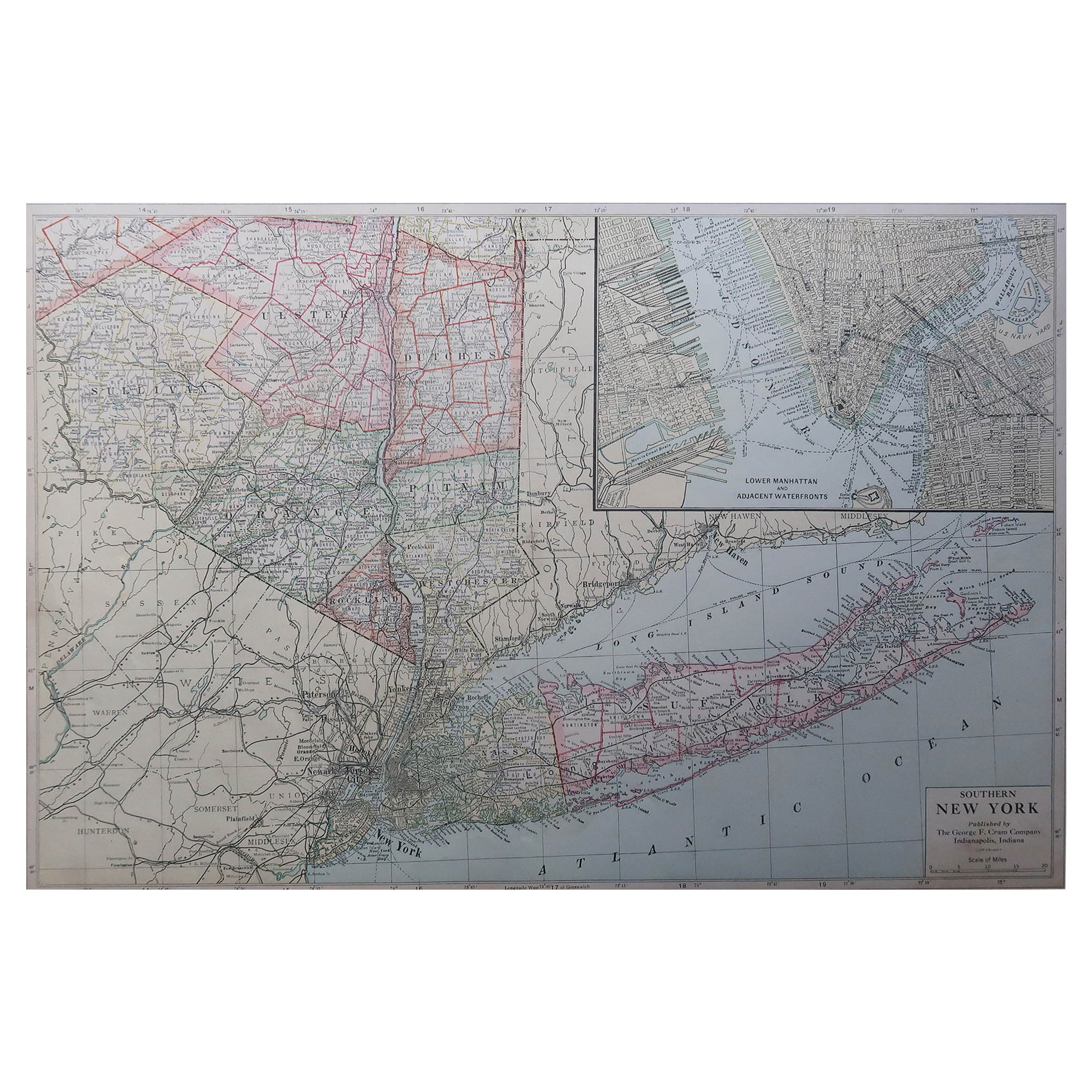
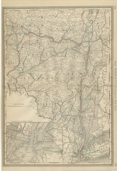
Antique Map of Long Island, New York – Rand McNally, circa 1888
This antique map of Long Island, New York, was published by Rand, McNally & Co. around 1888. Taken from their late 19th-century atlas series, it presents a finely detailed view of the island and surrounding regions, including New York City, Long Island Sound, and parts of New Jersey and Connecticut.
The map highlights the counties of Kings, Queens, Suffolk, and part of Nassau (established as a separate county in 1899, after this map’s publication). Brooklyn and Queens are shown as developing urban centers, while much of Long Island appears still rural, marked by smaller towns and agricultural villages.
Railroads dominate the map, shown in red and blue lines, illustrating the expanding connections from Brooklyn and Queens eastward through Long Island. These routes foreshadow the transformation of Long Island into a commuter hub for New York City. Ferry routes and shipping lines are also indicated, reflecting the region’s importance as both a commercial and residential extension of the city.
At the bottom of the map, descriptive text offers historical and geographical commentary, including references to Long Island’s Dutch settlement origins, its beaches, and its growing reputation as a seaside resort destination in the late 19th century. This combination of cartography and description makes it a particularly engaging plate.
Collectors of New York history, Long Island development, or Rand McNally’s atlas maps will find this example especially desirable for its blend of geographic detail and period commentary.
Condition report:
Good condition with even toning and minor spotting at the upper margin. Original center fold as issued. Plate mark visible. Strong impression with crisp engraved detail.
Framing tips:
This map displays beautifully in a black or dark oak frame with a cream mat. A double mat with ivory outer and pale blue inner will highlight the coastal setting, especially Long Island Sound and the Atlantic shoreline.
Technique: Lithograph with original outline color
Maker: Rand, McNally & Co., Chicago, circa 1888
- Dimensions:Height: 14.18 in (36 cm)Width: 20.67 in (52.5 cm)Depth: 0.01 in (0.2 mm)
- Materials and Techniques:Paper,Engraved
- Place of Origin:
- Period:
- Date of Manufacture:1888
- Condition:Good condition with even toning and minor spotting at the upper margin. Original center fold as issued. Plate mark visible. Strong impression with crisp engraved detail.
- Seller Location:Langweer, NL
- Reference Number:Seller: BG-12794-201stDibs: LU3054346449532
About the Seller
5.0
Recognized Seller
These prestigious sellers are industry leaders and represent the highest echelon for item quality and design.
Platinum Seller
Premium sellers with a 4.7+ rating and 24-hour response times
Established in 2009
1stDibs seller since 2017
2,599 sales on 1stDibs
Typical response time: <1 hour
- ShippingRetrieving quote...Shipping from: Langweer, Netherlands
- Return Policy
Authenticity Guarantee
In the unlikely event there’s an issue with an item’s authenticity, contact us within 1 year for a full refund. DetailsMoney-Back Guarantee
If your item is not as described, is damaged in transit, or does not arrive, contact us within 7 days for a full refund. Details24-Hour Cancellation
You have a 24-hour grace period in which to reconsider your purchase, with no questions asked.Vetted Professional Sellers
Our world-class sellers must adhere to strict standards for service and quality, maintaining the integrity of our listings.Price-Match Guarantee
If you find that a seller listed the same item for a lower price elsewhere, we’ll match it.Trusted Global Delivery
Our best-in-class carrier network provides specialized shipping options worldwide, including custom delivery.More From This Seller
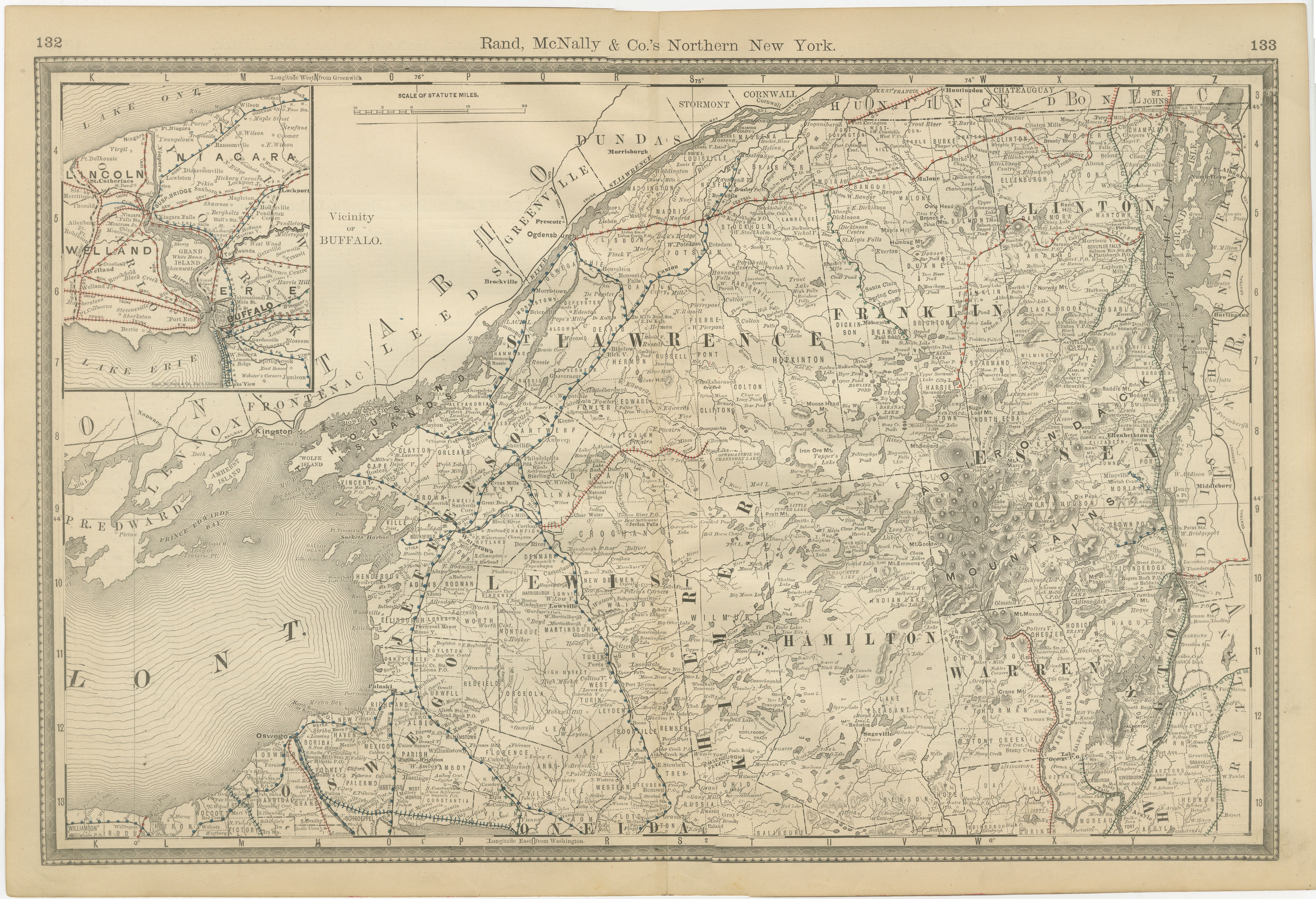
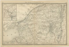
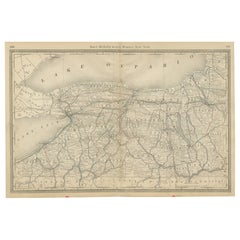
View AllAntique Map of Northern New York – Rand McNally, circa 1888
Located in Langweer, NL
Antique Map of Northern New York – Rand McNally, circa 1888
This antique map of northern New York was published by Rand, McNally & Co. around 1888. Taken from one of their late 19th...
Category
Antique Late 19th Century American Maps
Materials
Paper
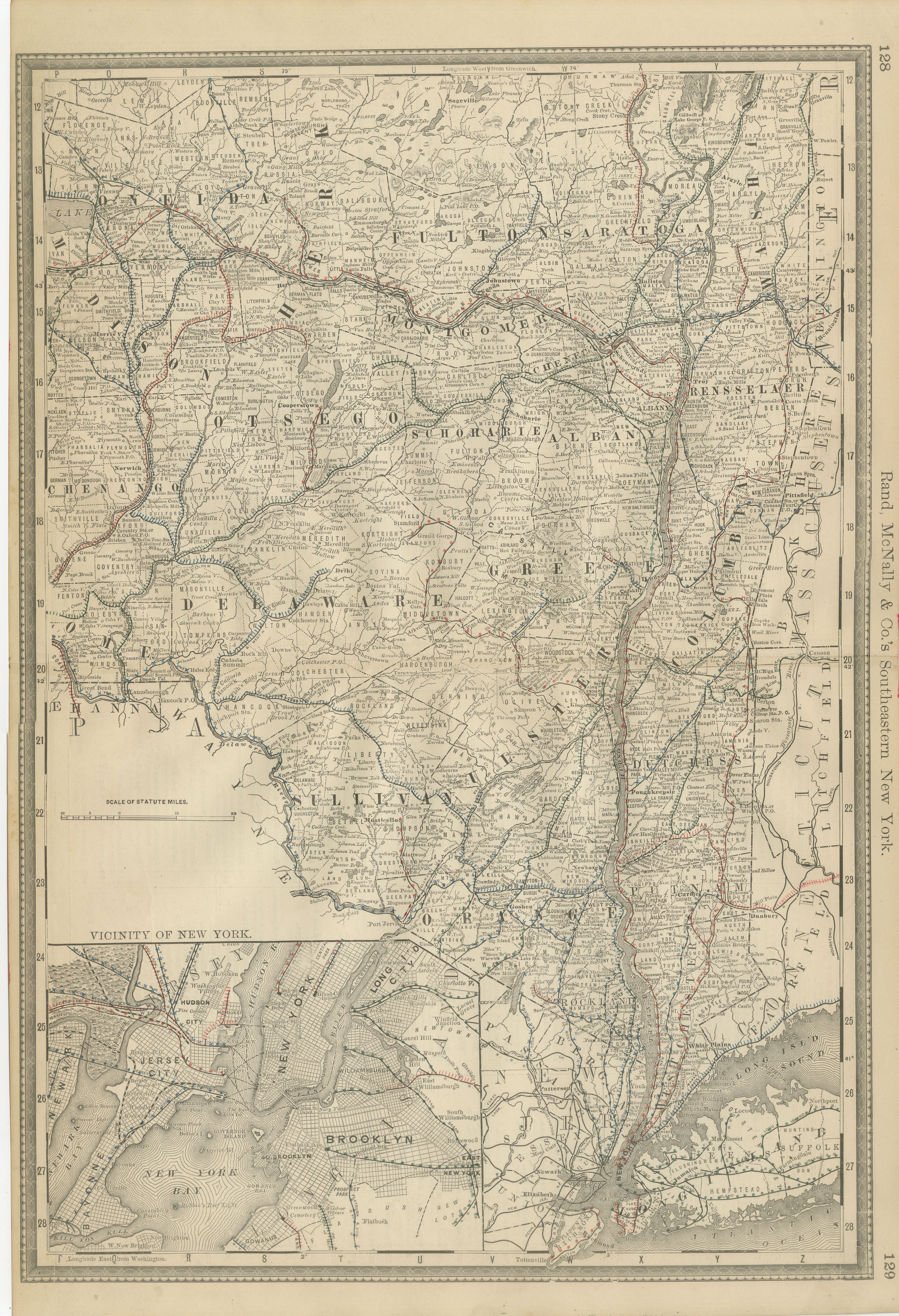
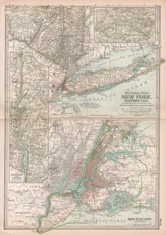
Antique Map of Southeastern New York – Rand McNally, circa 1888
Located in Langweer, NL
Antique Map of Southeastern New York – Rand McNally, circa 1888
This antique map of southeastern New York was published by Rand, McNally & Co. around 1888. It offers a detailed depi...
Category
Antique Late 19th Century American Maps
Materials
Paper
1864 Johnson's Map of New York State with City Insets
Located in Langweer, NL
Title: 1864 Johnson's Map of New York State with City Insets
Description: This 1864 map, titled "Johnson's New York," was published by Johnson and Ward and features a detailed depic...
Category
Antique 1860s Maps
Materials
Paper

$267 Sale Price
20% Off
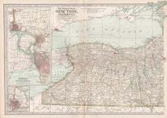
Western New York Antique Map – The Empire State, Railroads & Counties, c.1888
Located in Langweer, NL
Antique Map of Western New York – Rand McNally, circa 1888
This antique map of western New York was published by Rand, McNally & Co. around 1888. It presents a detailed view of the ...
Category
Antique Late 19th Century American Maps
Materials
Paper
Large Antique Map of New York State with Inset Maps
Located in Langweer, NL
Antique map titled 'Johnson's New York' Large map of New York State. With insets of Albany, Oswego, Buffalo, Rochester, Syracuse, Troy and NYC. Published by Johnson and Browning, 186...
Category
Antique Mid-19th Century Maps
Materials
Paper

$468 Sale Price
20% Off
Antique Map of New York by Johnson '1872'
Located in Langweer, NL
Antique map titled 'Johnson's New York'. Original map showing New York, with an inset map of Long Island. This map originates from 'Johnson's New Il...
Category
Antique Late 19th Century Maps
Materials
Paper

$238 Sale Price
20% Off
You May Also Like
New York. Southern Part. USA. Century Atlas state antique vintage map
Located in Melbourne, Victoria
'The Century Atlas. New York. Southern Part.'
Original antique map, 1903.
Inset maps of 'New York City and Vicinity' and 'The Hudson'.
Central fold as issued. Map name and number p...
Category
Early 20th Century Victorian More Prints
Materials
Lithograph
Large Original Antique Map of New York State( Southern ), USA, C.1900
Located in St Annes, Lancashire
Fabulous map of Southern New York . With a vignette of Lower Manhattan
Original color.
Engraved and printed by the George F. Cram Company, Indianapolis.
Published, C.1900.
Unfram...
Category
Antique 1890s American Maps
Materials
Paper

Original Antique Map of the American State of New York ( Western Part ) 1903
Located in St Annes, Lancashire
Antique map of New York ( Western Part )
Published By A & C Black. 1903
Original colour
Good condition
Unframed.
Free shipping
Category
Antique Early 1900s English Maps
Materials
Paper

Original Antique Map of the American State of New York ( Southern Part ) 1903
Located in St Annes, Lancashire
Antique map of New York ( Southern Part )
Published By A & C Black. 1903
Original colour
Good condition
Unframed.
Free shipping
Category
Antique Early 1900s English Maps
Materials
Paper

New York, Western Part. USA. Century Atlas state antique vintage map
Located in Melbourne, Victoria
'The Century Atlas. New York, Western Part'
Original antique map, 1903.
Central fold as issued. Map name and number printed on the reverse corners.
Sheet 29.5cm by 40cm.
Category
Early 20th Century Victorian More Prints
Materials
Lithograph
1858 Colton's Map of New York, Ric.B011
Located in Norton, MA
An 1858 Colton's map of New York
Ric.b011
Colton’s New York, 1858 - A large original color engraved and very detailed map of the state of New York,...
Category
Antique 19th Century Unknown Maps
Materials
Paper
