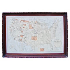
Map of American Indian Reservations 1884 in Period Walnut Frame
View Similar Items


Want more images or videos?
Request additional images or videos from the seller
1 of 16
Map of American Indian Reservations 1884 in Period Walnut Frame
About the Item
- Dimensions:Height: 23.25 in (59.06 cm)Width: 34.5 in (87.63 cm)Depth: 0.25 in (6.35 mm)
- Materials and Techniques:
- Place of Origin:
- Period:
- Date of Manufacture:1884
- Condition:Wear consistent with age and use. Dimensions are for framed image overall. Dimensions of sheet are 34.5 inches by 23.5 inches. Overall framed dimension is W: 40 inches H: 28 inches D: 3 inches.
- Seller Location:San Francisco, CA
- Reference Number:Seller: P620-31stDibs: LU855222754042
About the Seller
5.0
Recognized Seller
These prestigious sellers are industry leaders and represent the highest echelon for item quality and design.
Platinum Seller
These expertly vetted sellers are 1stDibs' most experienced sellers and are rated highest by our customers.
Established in 1982
1stDibs seller since 2008
313 sales on 1stDibs
Typical response time: 1 hour
Associations
The Art and Antique Dealers League of AmericaAntiques Associations Members
More From This SellerView All
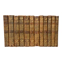
- David, Francois-Anne The Antiquities of Herculaneum 12 Volumes Period BindingsLocated in San Francisco, CAThe Antiquities of Herculaneum with their explanations in French. Published, Paris, 1781-1803. This profusely illustrated set consists of 12 volumes retaining their original marbled ...Category
Antique Late 18th Century French Louis XVI Books
MaterialsLeather, Paper
- Scarce U.S. Coast Survey Map Depicting Entrance to San Francisco Bay Dated 1856Located in San Francisco, CAA fine example of the 1856 U.S. Coast lithographic survey nautical chart of the entrance to San Francisco bay and the city. Published in 1856 by the Office of the Coast Survey the of...Category
Antique Mid-19th Century American Maps
MaterialsPaper
 $1,036 Sale Price30% Off
 - The Works of Francis Rabelais in 4 Leatherbound Volumes Published In London 1784Located in San Francisco, CAThe works of Francis Rabelais, translated from the French in 4 full original calf bindings with gilt tooled spines published in London by T. Evans in the Strand in 1784. Rabelais was...Category
Antique Mid-18th Century English Georgian Books
MaterialsLeather, Paper
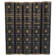
- Works of F. Crawford in 5 Volumes Bound in Blue Morocco Leather with Gilt SpinesLocated in San Francisco, CAThe works of Victorian period American author F. Marion Crawford (1854-1909) an erudite novelist born in Italy, the son of a sculptor. The set includes some of his better known works...Category
Antique Late 19th Century American Books
MaterialsLeather, Paper
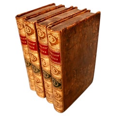
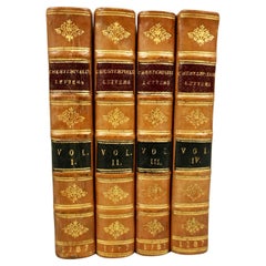
- Letters of the Earl of Chesterfield to His Son in 4 Volumes Published 1787Located in San Francisco, CAEarl of Chesterfield's letters to his son and luminaries of the day in 4 volumes in their original full leather bindings, published London J. Dodsley 1787. The spines have raised ban...Category
Antique Late 18th Century English George III Books
MaterialsPaper, Leather
- Beacon Lights of History by John Lord in 5 volumesLocated in San Francisco, CAA five volume leather bound set titled "Beacon Lights of History" by John Lord published in New York in 1884 by Fords, Howard and Hulbert profiling various historical luminaries from...Category
Antique 1880s American Books
MaterialsLeather, Paper
You May Also Like
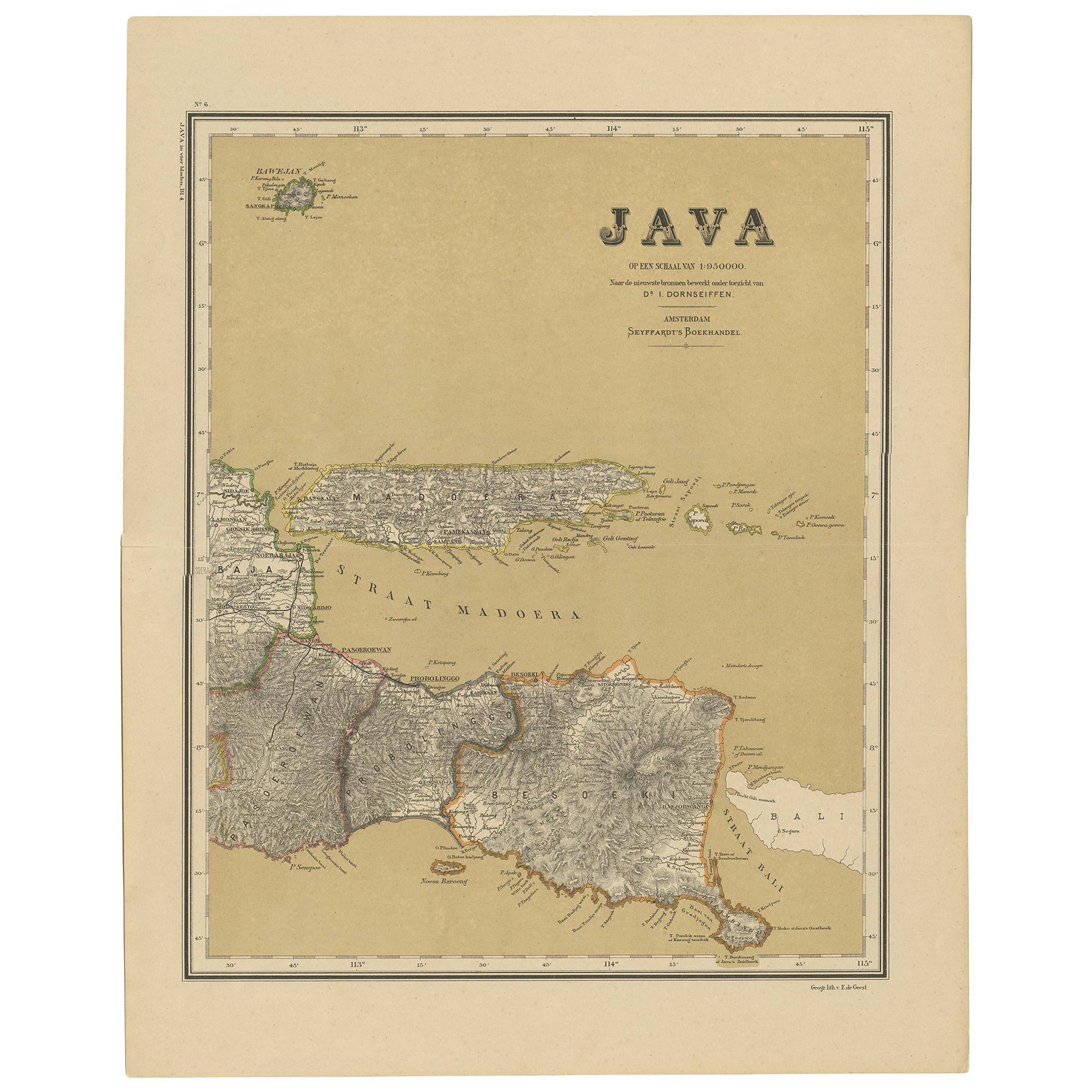
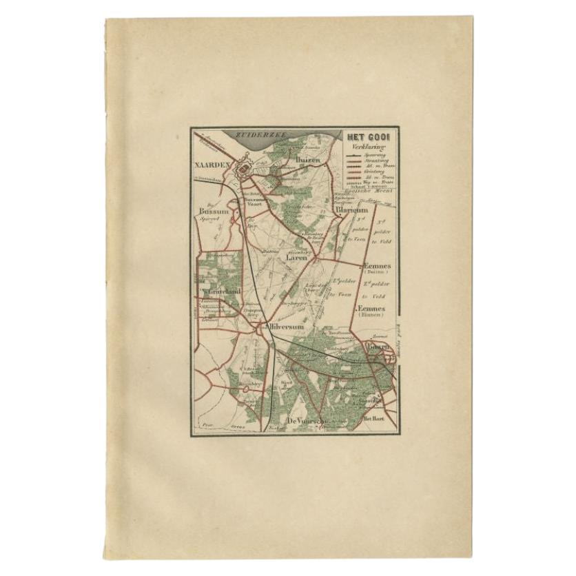
- Antique Map of Java in 4 sheets by Dornseiffen, 1884Located in Langweer, NLDetailed map of Java in 4 sheets, with an inset map of Batavia (Jakarta). This map originates from 'Atlas van Nederlandsch Oost- en West-Indie' by Dr. I. Dornseiffen. Published by Se...Category
Antique Late 19th Century Maps
MaterialsPaper
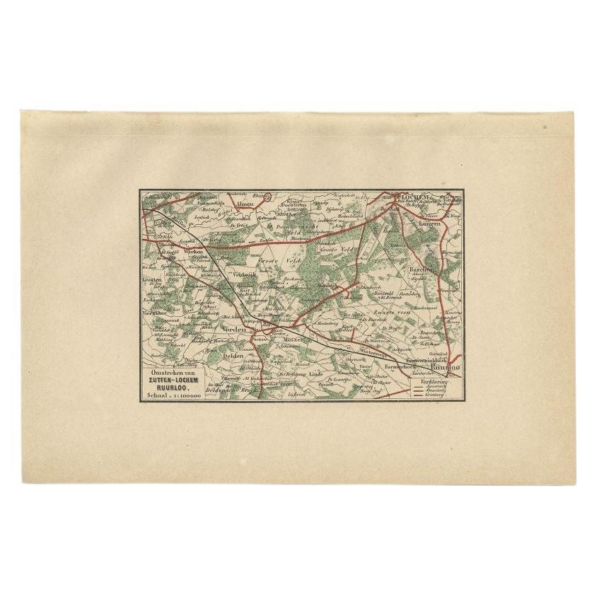
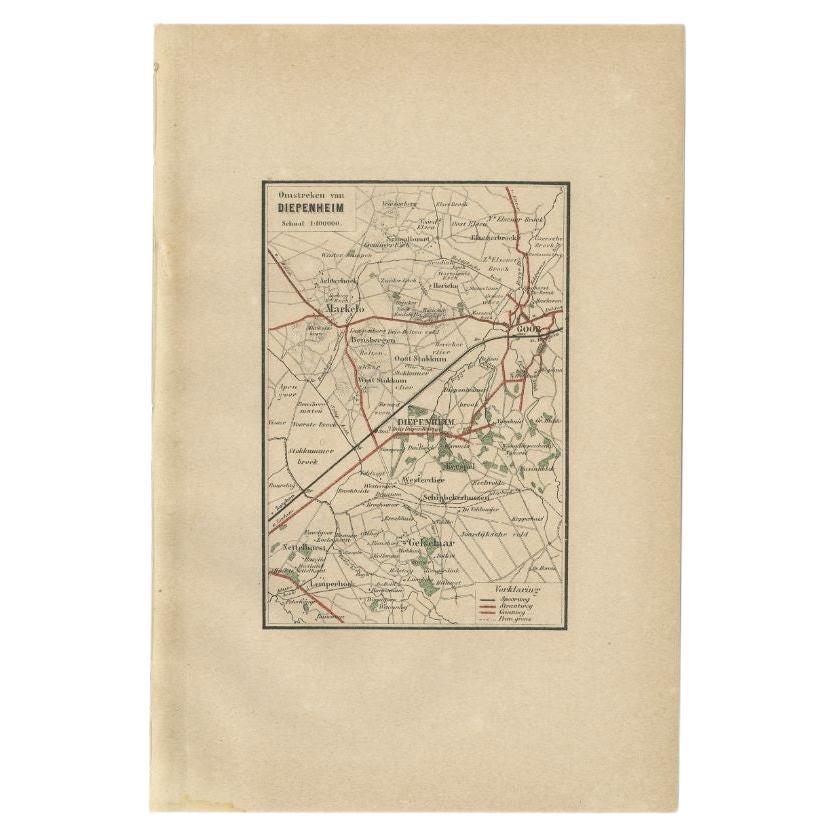
- Antique Map of the Region of Zutphen by Craandijk, 1884Located in Langweer, NLAntique map titled 'Omstreken van Zutfen - Lochem Ruurlo'. Old map of the region of Zutphen also including cities and villages like Veldwijk, Vorden and Delden. This map orginates fr...Category
Antique 19th Century Maps
MaterialsPaper
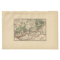
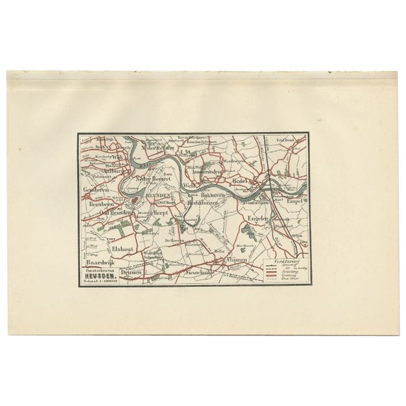
- Antique Map of the Region of Heusden by Craandijk, 1884Located in Langweer, NLAntique map titled 'Omstreken van Heusden'. Old map of the region of Heusden also including cities and villages like Elshout, Aalburg, Hedel and Vlijmen. This map orginates from 'Atl...Category
Antique 19th Century Maps
MaterialsPaper
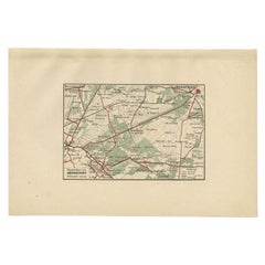
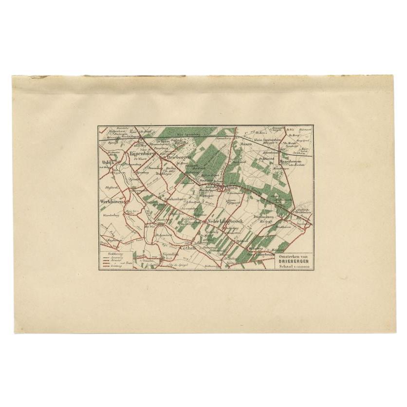
- Antique Map of the Region of Amersfoort by Craandijk, 1884Located in Langweer, NLAntique map titled 'Omstreken van Amersfoort'. Old map of the region of Amersfoort also including cities and villages like De Bilt, Zeist and Leusden. This map orginates from 'Atlas ...Category
Antique 19th Century Maps
MaterialsPaper
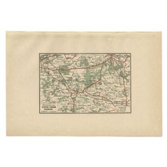
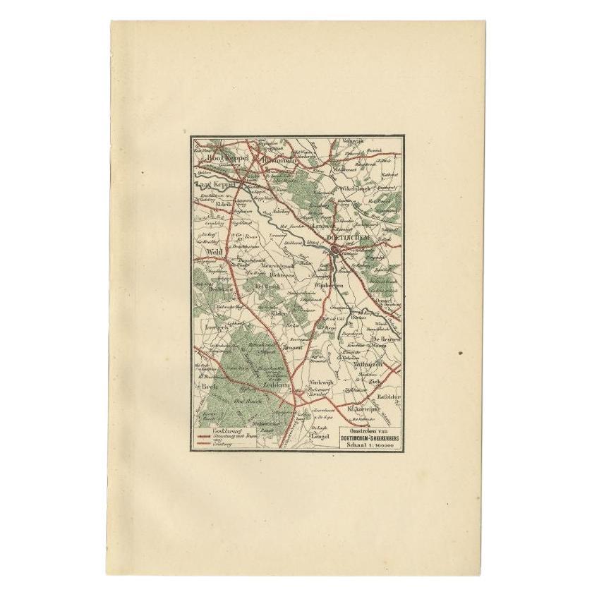
- Antique Map of the Region of Arnhem by Craandijk, 1884Located in Langweer, NLAntique map titled 'Omstreken van Arnhem - Dieren'. Old map of the region of Arnhem also including cities and villages like Rozendaal, Velp and Dieren. This map orginates from 'Atlas...Category
Antique 19th Century Maps
MaterialsPaper
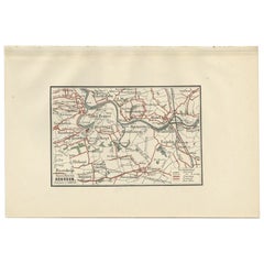
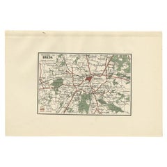
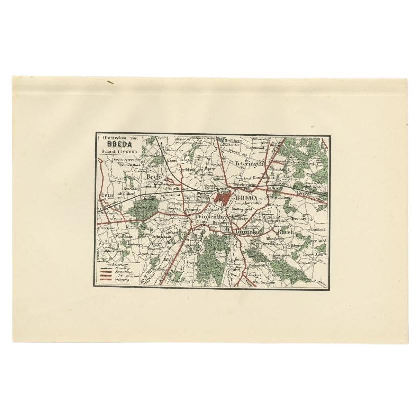
- Antique Map of the Region of Breda by Craandijk, 1884Located in Langweer, NLAntique map titled 'Omstreken van Breda'. Old map of the region of Breda also including cities and villages like Beek, Bavel, Leur, and Teteringen. This map orginates from 'Atlas beh...Category
Antique 19th Century Maps
MaterialsPaper