Items Similar to Map of Liverpool and Birkenhead by Bartholomew, circa 1880, with Key Buildings


Want more images or videos?
Request additional images or videos from the seller
1 of 11
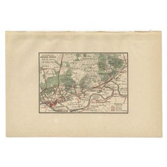
Map of Liverpool and Birkenhead by Bartholomew, circa 1880, with Key Buildings
$231.04
$288.8020% Off
£171.05
£213.8220% Off
€192
€24020% Off
CA$319.89
CA$399.8720% Off
A$349.25
A$436.5620% Off
CHF 183.10
CHF 228.8720% Off
MX$4,241.76
MX$5,302.1920% Off
NOK 2,286.58
NOK 2,858.2220% Off
SEK 2,159.14
SEK 2,698.9220% Off
DKK 1,461.74
DKK 1,827.1720% Off
About the Item
Map of Liverpool and Birkenhead by J. Bartholomew, circa 1880, with key buildings
Detailed city plan titled 'Liverpool and Birkenhead with the surrounding districts', drawn by J. Bartholomew. Shows Liverpool north to south across the River Mersey, including docks, public buildings, parks, railways, and ferry routes. Birkenhead and adjacent areas are illustrated below the river, with a full reference key listing important sites. Likely published circa 1880.
Technique and material: Lithographed city plan with original colour tinting
Condition report: Very good condition. Strong print with original tinting. Light fold at center as issued. Minor age toning and faint handling marks in margins. No tears or repairs.
Framing tip:
Use a wide, off-white or pale grey mat to contrast the blue tinting of the Mersey. A classic dark wood or black frame adds elegance. Ensure archival mounting and UV-protective glazing to preserve colour and paper integrity.
- Dimensions:Height: 10.44 in (26.5 cm)Width: 13 in (33 cm)Depth: 0.01 in (0.2 mm)
- Materials and Techniques:
- Period:
- Date of Manufacture:circa 1880
- Condition:Very good condition. Strong print with original tinting. Light fold at center as issued. Minor age toning and faint handling marks in margins. No tears or repairs.
- Seller Location:Langweer, NL
- Reference Number:Seller: BG-027191stDibs: LU3054344633072
About the Seller
5.0
Recognized Seller
These prestigious sellers are industry leaders and represent the highest echelon for item quality and design.
Platinum Seller
Premium sellers with a 4.7+ rating and 24-hour response times
Established in 2009
1stDibs seller since 2017
2,641 sales on 1stDibs
Typical response time: <1 hour
- ShippingRetrieving quote...Shipping from: Langweer, Netherlands
- Return Policy
Authenticity Guarantee
In the unlikely event there’s an issue with an item’s authenticity, contact us within 1 year for a full refund. DetailsMoney-Back Guarantee
If your item is not as described, is damaged in transit, or does not arrive, contact us within 7 days for a full refund. Details24-Hour Cancellation
You have a 24-hour grace period in which to reconsider your purchase, with no questions asked.Vetted Professional Sellers
Our world-class sellers must adhere to strict standards for service and quality, maintaining the integrity of our listings.Price-Match Guarantee
If you find that a seller listed the same item for a lower price elsewhere, we’ll match it.Trusted Global Delivery
Our best-in-class carrier network provides specialized shipping options worldwide, including custom delivery.More From This Seller
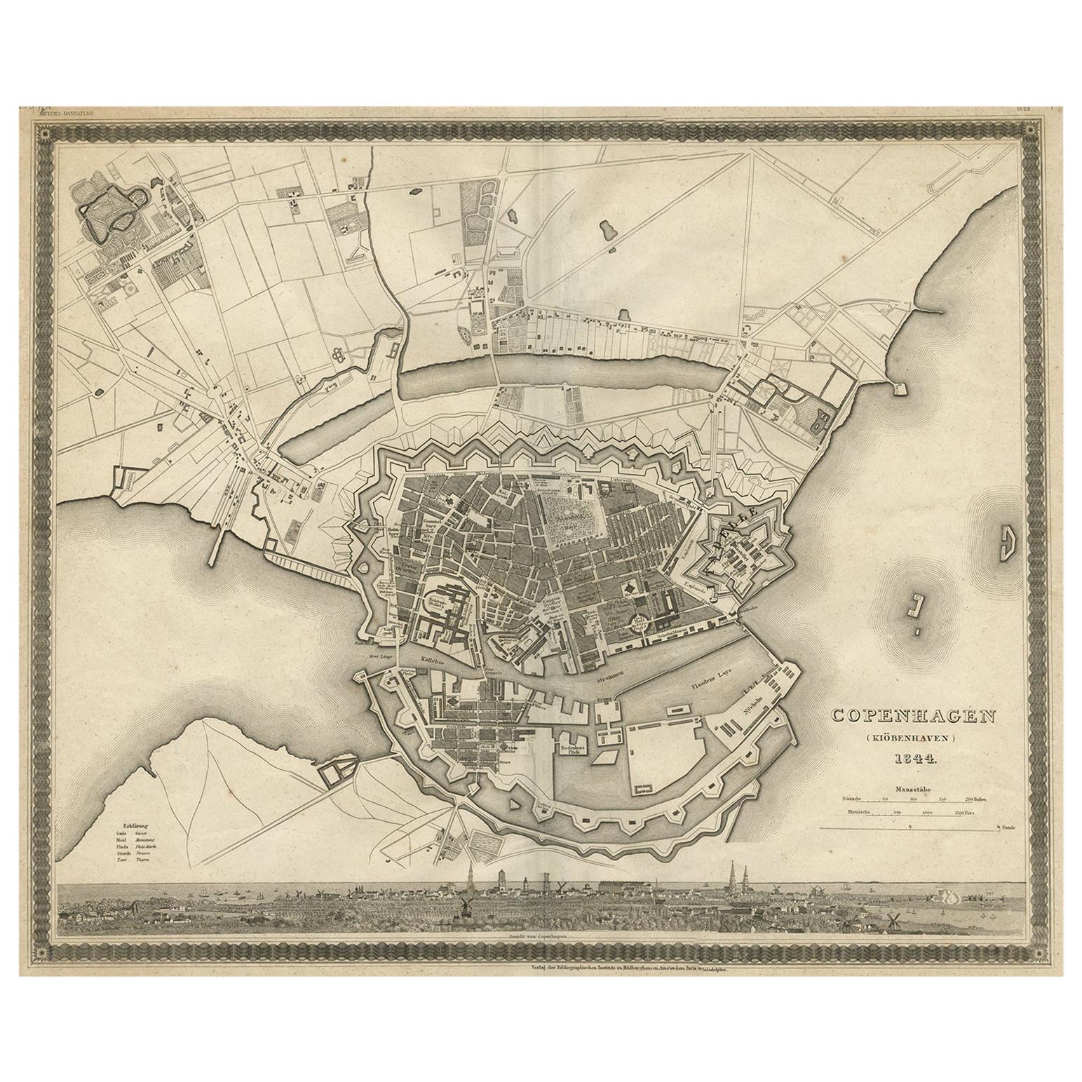
View AllCopenhagen (Kiöbenhaven) Map with City View – Antique German Atlas Print, 1844
Located in Langweer, NL
Copenhagen (Kiöbenhaven) Map with City View – Antique German Atlas Print, 1844
This finely detailed antique map titled 'Copenhagen (Kiöbenhaven)' presents a historical view of Denma...
Category
Antique Mid-19th Century German Maps
Materials
Paper
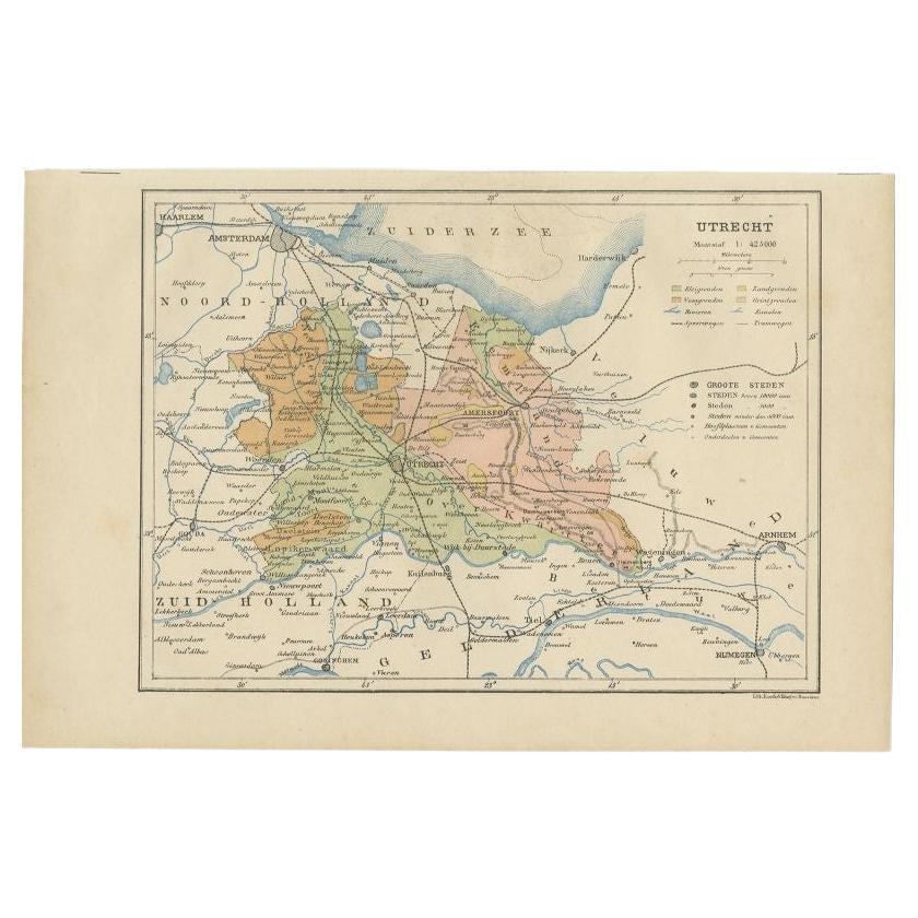
Antique Map of Utrecht in The Netherlands, 1883
Located in Langweer, NL
Antique map titled 'Utrecht'. Map of Utrecht, a province of the Netherlands. This map originates from 'Atlas van Nederland volgens de nieuwe spelregels' by J. Kuyper.
Artists and En...
Category
Antique 19th Century Maps
Materials
Paper

$211 Sale Price
20% Off
Antique Map of the City of London by Balbi '1847'
Located in Langweer, NL
Antique map titled 'London'. Original antique map of the city of London. This map originates from 'Abrégé de Géographie (..)' by Adrien Balbi. Published 1847.
Category
Antique Mid-19th Century Maps
Materials
Paper

$192 Sale Price
20% Off
Antique Map of the Region of Arnhem by Craandijk, 1884
Located in Langweer, NL
Antique map titled 'Omstreken van Arnhem - Dieren'. Old map of the region of Arnhem also including cities and villages like Rozendaal, Velp and Dieren. This map orginates from 'Atlas...
Category
Antique 19th Century Maps
Materials
Paper
$83 Sale Price
20% Off
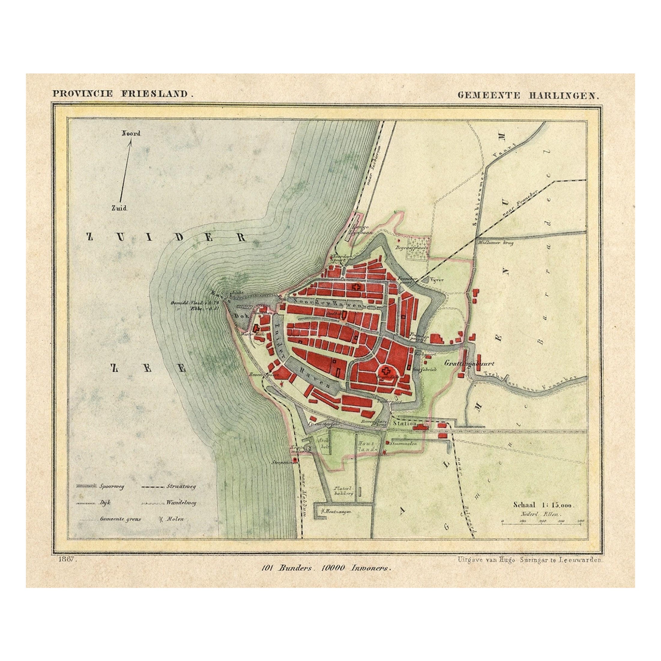
Antique Map of Harlingen, a Harbour City in Friesland, The Netherlands, 1868
Located in Langweer, NL
Antique map titled 'Provincie Friesland - Gemeente Harlingen'.
Map of the township of Harlingen, Friesland. This map originates from 'Gemeente-Atlas van Nederland' by J. Kuyper. ...
Category
Antique 19th Century Maps
Materials
Paper

$134 Sale Price
20% Off
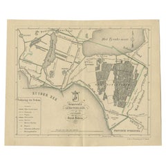
Antique Map of the Lemsterland Township by Behrns, 1861
Located in Langweer, NL
Antique map titled 'Gemeente Lemsterland'. Old map depicting the Lemsterland township including cities and villages like Lemmer, Follega, Oosterzee en Echten. This map orginates from...
Category
Antique 19th Century Maps
Materials
Paper
$85 Sale Price
20% Off
You May Also Like
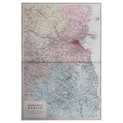
Large Original Antique Map of The Environs of Dublin, Ireland, circa 1880
Located in St Annes, Lancashire
Great map of The Environs of Dublin
Published circa 1880
Unframed
Free shipping.
Category
Antique 1880s Scottish Maps
Materials
Paper
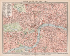
London, City and West End. Antique Map City Plan Chromolithograph, circa 1895
Located in Melbourne, Victoria
'London (City Und Westend)'
Colour lithograph. 1895.
250mm by 305mm (sheet).
Late 19th century German lithograph plan of London, City and West End.
Central vertical fold.
Category
Late 19th Century Victorian More Prints
Materials
Lithograph
1840 "New Map of the City of New York With Part of Brooklyn & Williamsburg"
Located in Colorado Springs, CO
Presented is a hand-colored, engraved folding map titled "New Map of the City of New York With Part of Brooklyn & Williamsburg" by J. Calvin Smith. The map was issued bound in the bo...
Category
Antique 1840s American Maps
Materials
Paper

Large Original Antique City Plan of Montreal, Canada, circa 1900
By Rand McNally & Co.
Located in St Annes, Lancashire
Fabulous colorful map of Montreal
Original color
By Rand, McNally & Co.
Published, circa 1900
Unframed
Minor edge tears
Free shipping.
Category
Antique Early 1900s American Maps
Materials
Paper

Chart of the Harbour of Liverpool
Located in Cheshire, GB
PL Burdett A Chart of the Harbour of Liverpool hand coloured. Encased in an ebonised frame.
Dimensions
Height 23.5 Inches
Width 28 Inches
Depth 1 Inches
Category
Early 20th Century British Maps
Materials
Paper

$633 Sale Price
20% Off
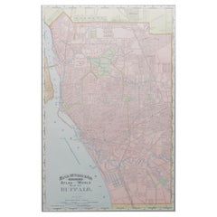
Original Antique City Plan of Buffalo, New York, USA, circa 1900
By Rand McNally & Co.
Located in St Annes, Lancashire
Fabulous colorful map of Buffalo
Original color
By Rand, McNally & Co.
Published, circa 1900
Unframed
Minor edge tears
Free shipping.
Category
Antique 1890s American Maps
Materials
Paper
More Ways To Browse
Antique Furniture Liverpool
Leather Pouf And Ottomans
Low Side Tables
Set Of Four Italian Dining Chairs
Silk Runner Carpet
3x5 Rugs
Italian Lacquer Dining Room Sets
Round Brass Table
Round Table Base
Belgian Antiques
Cream Soup
Early English Silver
James Bond
Paisley Rugs and Carpets
Antique Pagoda
Black And Chrome Lounge Chair
Ceramic 1960s Italy
Vintage 1930 Dining Room Set