Parchment Paper Maps
to
1
2
2
1
2
945
5,601
122
55
34
1
1
1
1
1
2
2
2
Material: Parchment Paper
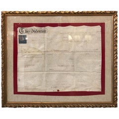
Early 19th Century Original Framed Land Indenture, England, 1810
Located in Lambertville, NJ
A large hand written land indenture document England, 1810, framed. The beautifully hand written document mounted on board with a red velvet border and ...
Category
1810s English Regency Antique Parchment Paper Maps
Materials
Glass, Giltwood, Parchment Paper
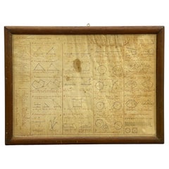
1852 Geometrical Constructions Chart by C. W. Knudsen
Located in Garnerville, NY
Twenty two (22) meticulously rendered hand written and drawn geometrical constructions by C. W. Knudsen, circa 1952. The piece is inscribed in red lower left, C. W. Knudsen, August 1...
Category
1850s American Schoolhouse Antique Parchment Paper Maps
Materials
Glass, Wood, Paper, Parchment Paper
$708 Sale Price
20% Off
Related Items
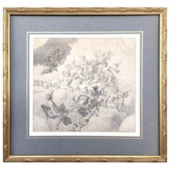
Original Drawing, Circle of Giovanni Battista Tiepolo 1696-1770 Venice, Italy
By Giovanni Battista Tiepolo
Located in Vero Beach, FL
Original Drawing, Circle of Giovanni Battista Tiepolo 1696-1770 Venice, Italy
Although we offer this old master drawing as circle of Tiepolo, we are convinced, based on the composi...
Category
18th Century Italian Rococo Antique Parchment Paper Maps
Materials
Paper
$8,200
H 19.25 in W 20.25 in D 0.5 in
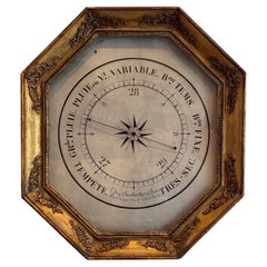
Early 19th Century French Barometer
Located in Charlottesville, VA
This elegant 19th-century French barometer is a beautifully crafted antique weather instrument housed in an octagonal giltwood frame. The a...
Category
Early 19th Century French Antique Parchment Paper Maps
Materials
Giltwood, Paint
Early 19th Century Marionette Puppets
Located in London, GB
Early 19th Century Marionette Puppets
A rare untouched example of two hand crafted early 19th century marionette puppets, likely to be French in...
Category
1820s French Antique Parchment Paper Maps
Materials
Fabric, Pine, Paper
Early 19th Century Italian Altar
Located in Baton Rouge, LA
This early 19th century Italian altar is made of worn painted wood and worn fabric details. This is a highly decorative altar for the unknown Catholic saint...
Category
19th Century Italian Antique Parchment Paper Maps
Materials
Fabric, Wood, Paint
Early 19th Century Austrian Hiking Staff
Located in Chicago, IL
This one-of-a-kind Austrian hiking staff has been handcrafted from solid oak. Oak is a relatively lightweight yet sturdy material, which lends itself perf...
Category
Early 19th Century Austrian Folk Art Antique Parchment Paper Maps
Materials
Silver, Brass
19th Century Chart of New England Coast, 1847
By U.S. Government
Located in Nantucket, MA
19th Century Chart of New England Coast: the U.S. Coast Survey Sketch A - Section 1, a triangulation chart showing the progress of the survey and details along the New England coas...
Category
1840s American Other Antique Parchment Paper Maps
Materials
Paper
18th / Early 19th Century Miniature Painting
Located in Delft, NL
An 18th / early 19th century miniature painting
An 18th / early 19th century miniature painting painted on glass and framed.
The copper framed miniature painting in another copp...
Category
Late 18th Century European Antique Parchment Paper Maps
Materials
Copper
Delightful Early 19th Century Horse Tricycle
Located in Round Top, TX
A very charming early 19th century child's horse tricycle in wood and iron. A wonderful accent piece.
Category
Early 19th Century French Antique Parchment Paper Maps
Materials
Iron
Impressive Early 19th Century Model Chateau
Located in Pease pottage, West Sussex
Extraordinary Early 19th Century Chateau Model found untouched in its original painted finish. impressive attention to detail with some carved brickwork,...
Category
Early 19th Century French Antique Parchment Paper Maps
Materials
Wood
Antique Map of North America by Lowry '1852'
Located in Langweer, NL
Antique map titled 'North America'. Original map of North America. This map originates from 'Lowry's Table Atlas constructed and engraved from the...
Category
Mid-19th Century Antique Parchment Paper Maps
Materials
Paper
Early 18th Century English Framed Indenture Document, Framed
Located in Bradenton, FL
A Large Early 18th Century Framed Indenture Document. The document (deed) is written in lengthy hand-written detail. Issued in three parts, indentures were legal documents cut with w...
Category
Early 18th Century English George II Antique Parchment Paper Maps
Materials
Animal Skin, Wood
Original Concorde Design Drawing, England, c. 1960
Located in Royal Tunbridge Wells, Kent
An extremely rare and original design drawing of the world renowned and much loved Concorde Aircraft. Concorde memorabilia is becoming more and mo...
Category
20th Century English Parchment Paper Maps
Materials
Paper
Previously Available Items
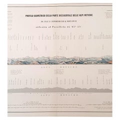
1880s Map of The Italian Alps from Milan to Lake Garda
Located in Florence, Tuscany
Geographical Map of the Profile and Elevation of the Italian Alps from Milano to Lake Garda. The map features the name of each peak and key cities including Monza, Brescia and Bergam...
Category
1880s Italian Antique Parchment Paper Maps
Materials
Parchment Paper
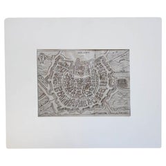
17th Century Miniature Map of Milan
Located in Florence, Tuscany
An extraordinary miniature map of the ancient city of Milan published in Padua by Matteo Cadorin in the 1670 edition of Francesco Scoto's 'Itinerary of Italy' guide.
This delightfu...
Category
1670s Italian Antique Parchment Paper Maps
Materials
Parchment Paper
Antique Italian Map of Viaggio da Roma a Napoli 1775
Located in Florence, Tuscany
An original print from 1775 showing an early route map of the journey from Rome to Naples. This route map was part of a collection of travellers routes published in a book translated...
Category
1770s Italian Antique Parchment Paper Maps
Materials
Parchment Paper
17th Century Geographical Map of Italy
By Matthäus Merian the Elder
Located in Florence, Tuscany
This beautifully detailed geographical map of Italy was printed in 1640. It was made by the expert Swiss engraver Matthaus Merian the Elder (1593-1650). Its high quality uniform inki...
Category
Mid-17th Century Italian Antique Parchment Paper Maps
Materials
Parchment Paper
Italian Parchment Map of the City of Lucca Dated 1640
By Matthäus Merian the Elder
Located in Florence, Tuscany
An antique map of the Tuscan city of Lucca engraved for The 'Itinerarium Italiæ Nov-antiquæ' by Matthäus Merian the Elder and printed in 1640...
Category
1640s Italian Antique Parchment Paper Maps
Materials
Paper, Parchment Paper
Arts & Crafts Wooden Screen with Madrid Map Engraving
Located in Valladolid, ES
An amazing wooden screen, Arts & Crafts, circa 1900, with an engraving. A Madrid map, from the same epoca. The original engraving was made in 1656 by Pedro ...
Category
Early 20th Century Spanish Arts and Crafts Parchment Paper Maps
Materials
Hardwood, Parchment Paper
Replogle Globes Chicago 1950s Papiermache, Wood and Metal World Globe
Located in Valladolid, ES
Replogle globe have been making globes since 1920s, recognised as the worlds, leading manufactures of world globes, it has a well-earned reputation for its constant production and in...
Category
1950s American Mid-Century Modern Vintage Parchment Paper Maps
Materials
Metal
H 21.26 in W 11.82 in L 21.26 in
17th Century Miniature Map of Florence
Located in Florence, Tuscany
An extraordinary miniature map of the ancient city of Florence. Published in Padua by Matteo Cadorin in the 1670 edition of Francesco Scoto's 'Itinerary of Italy' guide.
This delig...
Category
1670s Italian Antique Parchment Paper Maps
Materials
Parchment Paper
17th Century Miniature Map of Venice
Located in Florence, Tuscany
An extraordinary miniature map of the ancient city of Venice published in Padua by Matteo Cadorin in the 1670 edition of Francesco Scoto's 'Itinerary of Italy' guide.
This delightf...
Category
1670s Italian Antique Parchment Paper Maps
Materials
Parchment Paper
Recently Viewed
View AllMore Ways To Browse
Antique Wellington Chests
Antonio Cassi Ramelli
Archimede Seguso Birds
Art Deco Coasters
Art Deco Footballer
Art Deco Music Cabinet
Art Deco Waterfall Bedroom Furniture
Art Deco Waterfall Bedroom
Art Deco Whisky
Art Foulard
Art Nouveau Sunflower
Arts And Crafts Silver Coffee Pot
Asian Pink Bowl
Avesn Vase
Baccarat Carafe
Bakelite Bird
Bakelite Cocktail Picks
Bamboo Ikebana Vase
