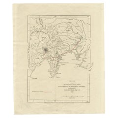
Old Map of Japan with the Track from Yedo to the Mount Fusi-Yama, 1861
View Similar Items

Want more images or videos?
Request additional images or videos from the seller
1 of 5
Old Map of Japan with the Track from Yedo to the Mount Fusi-Yama, 1861
About the Item
- Dimensions:Height: 7.29 in (18.5 cm)Width: 8.86 in (22.5 cm)Depth: 0 in (0.01 mm)
- Materials and Techniques:
- Period:
- Date of Manufacture:1861
- Condition:
- Seller Location:Langweer, NL
- Reference Number:Seller: BG-035601stDibs: LU3054326375242
About the Seller
5.0
Recognized Seller
These prestigious sellers are industry leaders and represent the highest echelon for item quality and design.
Platinum Seller
Premium sellers with a 4.7+ rating and 24-hour response times
Established in 2009
1stDibs seller since 2017
2,436 sales on 1stDibs
Typical response time: 1 hour
Authenticity Guarantee
In the unlikely event there’s an issue with an item’s authenticity, contact us within 1 year for a full refund. DetailsMoney-Back Guarantee
If your item is not as described, is damaged in transit, or does not arrive, contact us within 7 days for a full refund. Details24-Hour Cancellation
You have a 24-hour grace period in which to reconsider your purchase, with no questions asked.Vetted Professional Sellers
Our world-class sellers must adhere to strict standards for service and quality, maintaining the integrity of our listings.Price-Match Guarantee
If you find that a seller listed the same item for a lower price elsewhere, we’ll match it.Trusted Global Delivery
Our best-in-class carrier network provides specialized shipping options worldwide, including custom delivery.More From This Seller
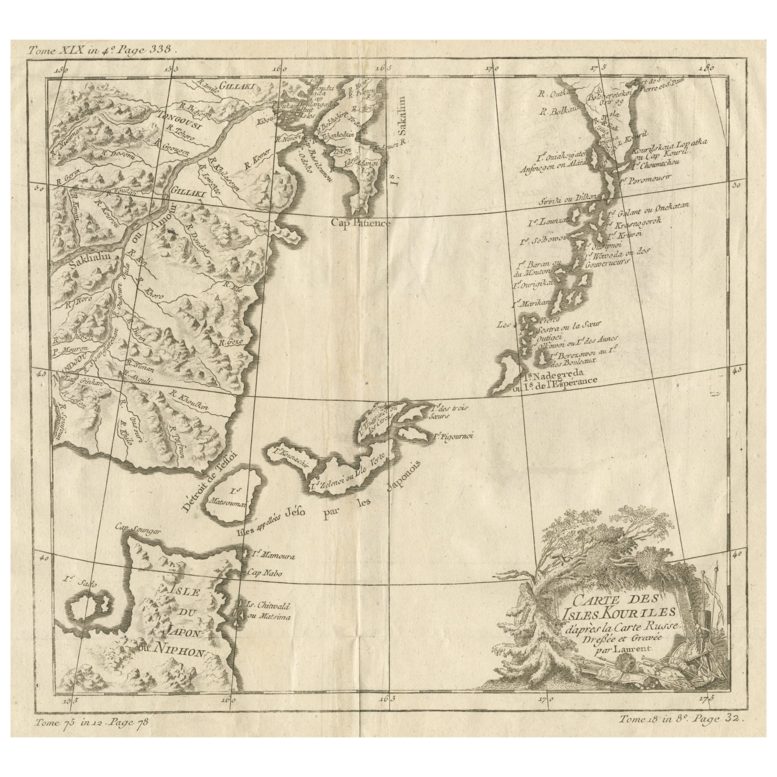
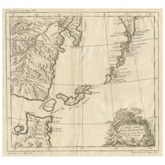
View AllOld Map of The Kurile Islands, from Hokkaido, Japan to Kamchatka, Russia, c.1750
Located in Langweer, NL
Antique map titled 'Carte des Iles Kouriles'. Original antique map of the Kuril Islands.
The Kuril Islands or Kurile Islands are a volcanic archipelago that stretches approximate...
Category
Antique 1750s Maps
Materials
Paper
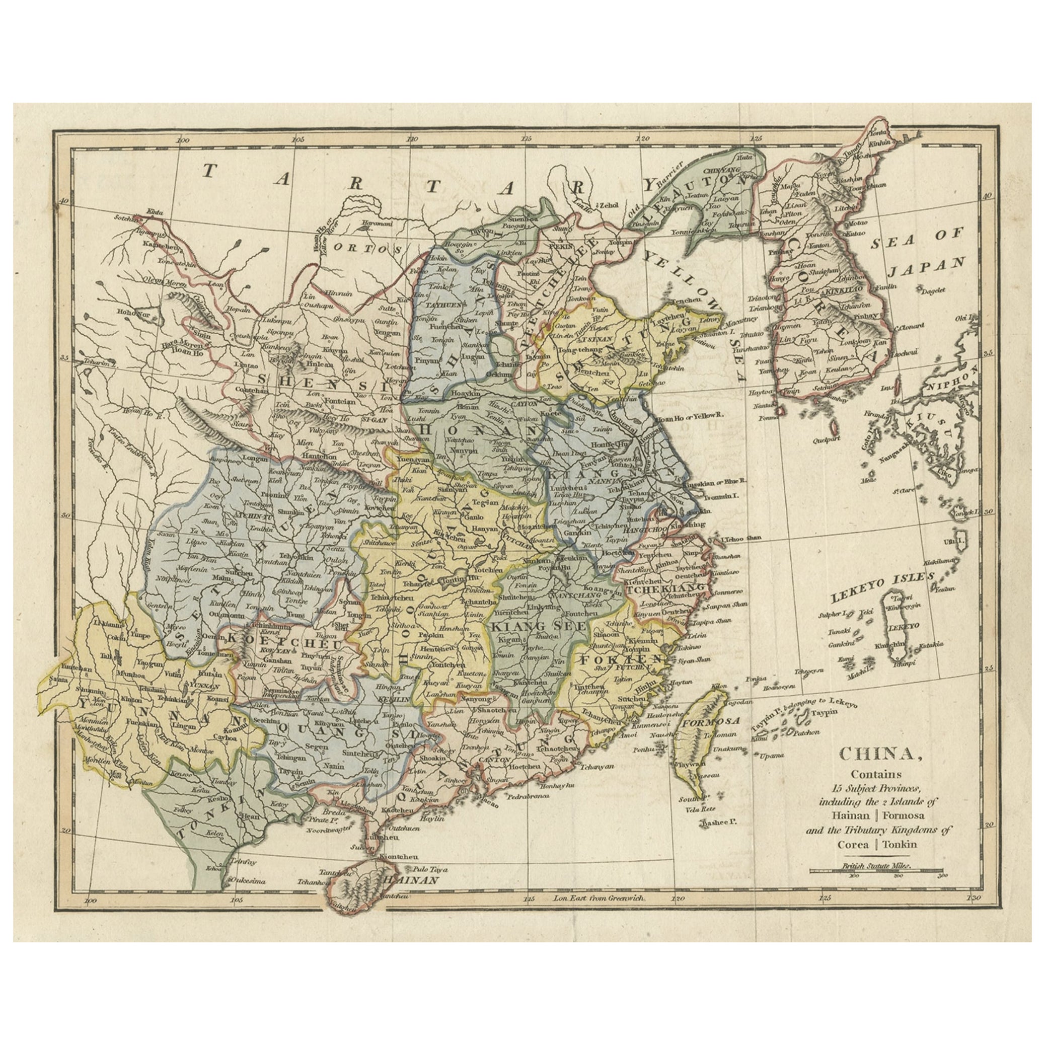
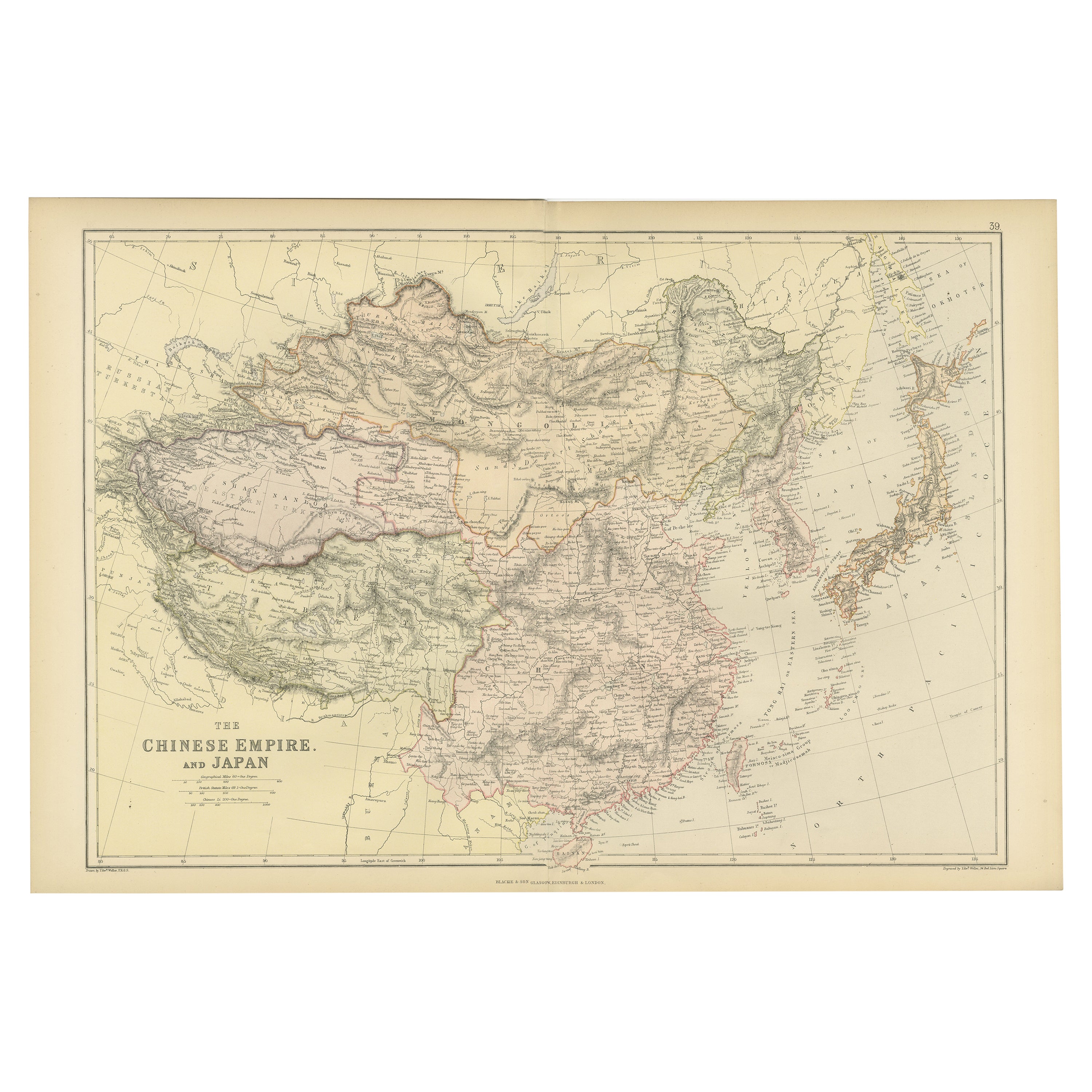
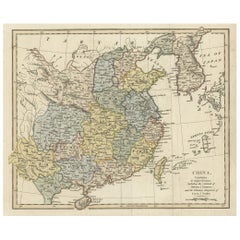
Original Old China Map, From Korea and the Sea of Japan to Teypin Island, 1803
Located in Langweer, NL
Antique map titled 'China, Contains 15 Subject Provinces Including the 2 Islands of Hainan, Formosa and the Tributary Kingdoms of Corea, Tonkin'.
Old map depicting China, extendi...
Category
Antique Early 1800s Maps
Materials
Paper
$511 Sale Price
20% Off
Antique Map of The Dutch Township Rauwerderhem, 1861
Located in Langweer, NL
Antique map titled 'Gemeente Rauwerderhem'. Old map depicting the Rauwerderhem township including cities and villages like Deersum, Poppingawier, Rauwerd and Irnsum. This map orginat...
Category
Antique 19th Century Maps
Materials
Paper

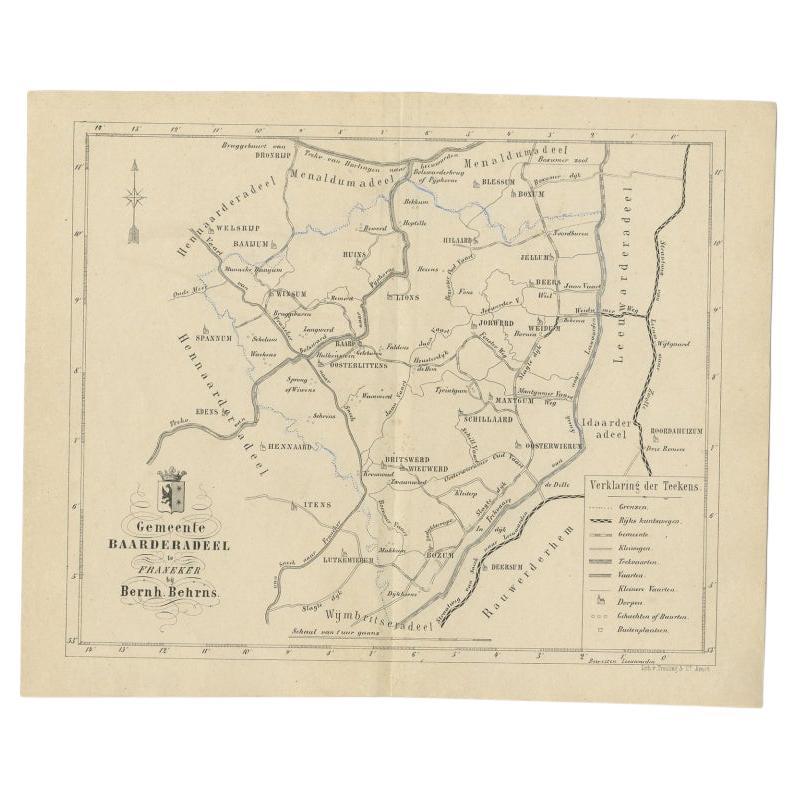
Antique Map of the Dutch Township Baarderadeel, 1861
Located in Langweer, NL
Antique map titled 'Gemeente Baarderadeel'. Old map depicting the Baarderadeel township including cities and villages like Baard, Hilaard, Jorwerd, Oosterlittens and Oosterwierum. Th...
Category
Antique 19th Century Maps
Materials
Paper
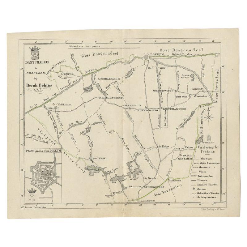
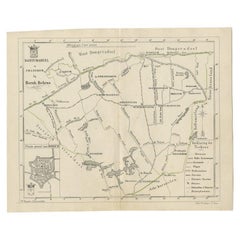
Antique Map of the Dutch Dantumadeel Township, 1861
Located in Langweer, NL
Antique map titled 'Gemeente Dantumadeel'. Old map depicting the Dantumadeel township including cities and villages like Birdaard, Roodkerk, Veenwouden, Dantumawoude and Dokkum. This...
Category
Antique 19th Century Maps
Materials
Paper
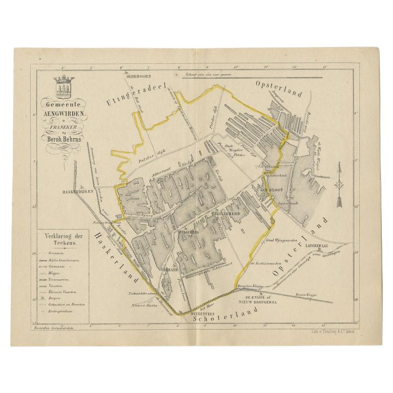
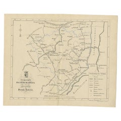
Antique Map of the Dutch Township Aengwirden, 1861
Located in Langweer, NL
Antique map titled 'Gemeente Aengwirden'. Old map depicting the Aengwirden township including cities and villages like Tjalleberd, Luinjeberd, Terband and Gersloot. This map orginate...
Category
Antique 19th Century Maps
Materials
Paper

You May Also Like
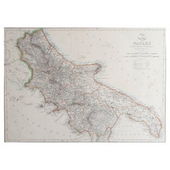
Large Original Antique Map of The South of Italy. John Dower, 1861
Located in St Annes, Lancashire
Great map of the South of Italy
Lithograph engraving by John Dower
Original colour
Published, 1861
Unframed
Good condition
Free shipping
Category
Antique 1860s English Victorian Maps
Materials
Paper
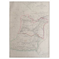
Large Original Antique Map of Afghanistan. Edward Weller, 1861
Located in St Annes, Lancashire
Great map of Afghanistan
Lithograph engraving by Edward Weller
Original colour
Published, 1861
Unframed
Good condition
Category
Antique 1860s English Victorian Maps
Materials
Paper
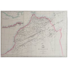
Large Original Antique Map of Morocco. Edward Weller, 1861
Located in St Annes, Lancashire
Great map of Morocco
Lithograph engraving by Edward Weller
Original colour
Published, 1861
Unframed
Good condition.
Category
Antique 1860s English Victorian Maps
Materials
Paper
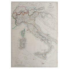
Large Original Antique Map of Italy. John Dower, 1861
Located in St Annes, Lancashire
Great map of Italy
Lithograph engraving by John Dower
Original colour
Published, 1861
Unframed
Good condition / repair to top right corner seen in last image
Category
Antique 1860s English Victorian Maps
Materials
Paper
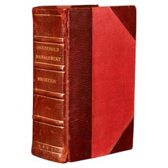
1861 The Book of Household Management
By Isabella Beeton
Located in Bath, GB
The first edition of Mrs Isabella Beeton's important cookery work, one of the most influential of its genre ever publisher, complete here with the original colour plates.
The first ...
Category
Antique 1860s Books
Materials
Paper
Old Horizontal Map of England
By Tasso
Located in Alessandria, Piemonte
ST/520 - Old rare Italian map of England, dated 1826-1827 - by Girolamo Tasso, editor in Venise, for the atlas of M.r Le-Sage.
Category
Antique Early 19th Century Italian Other Prints
Materials
Paper
