Items Similar to Old Map of the Spice Islands, Moluccas by Bellin, Published in 1771

Want more images or videos?
Request additional images or videos from the seller
1 of 10
Old Map of the Spice Islands, Moluccas by Bellin, Published in 1771
$190.33
$237.9220% Off
£141
£176.2520% Off
€160
€20020% Off
CA$261.79
CA$327.2420% Off
A$291.19
A$363.9920% Off
CHF 152.76
CHF 190.9520% Off
MX$3,553.17
MX$4,441.4620% Off
NOK 1,917.30
NOK 2,396.6220% Off
SEK 1,806.82
SEK 2,258.5320% Off
DKK 1,218.22
DKK 1,522.7720% Off
About the Item
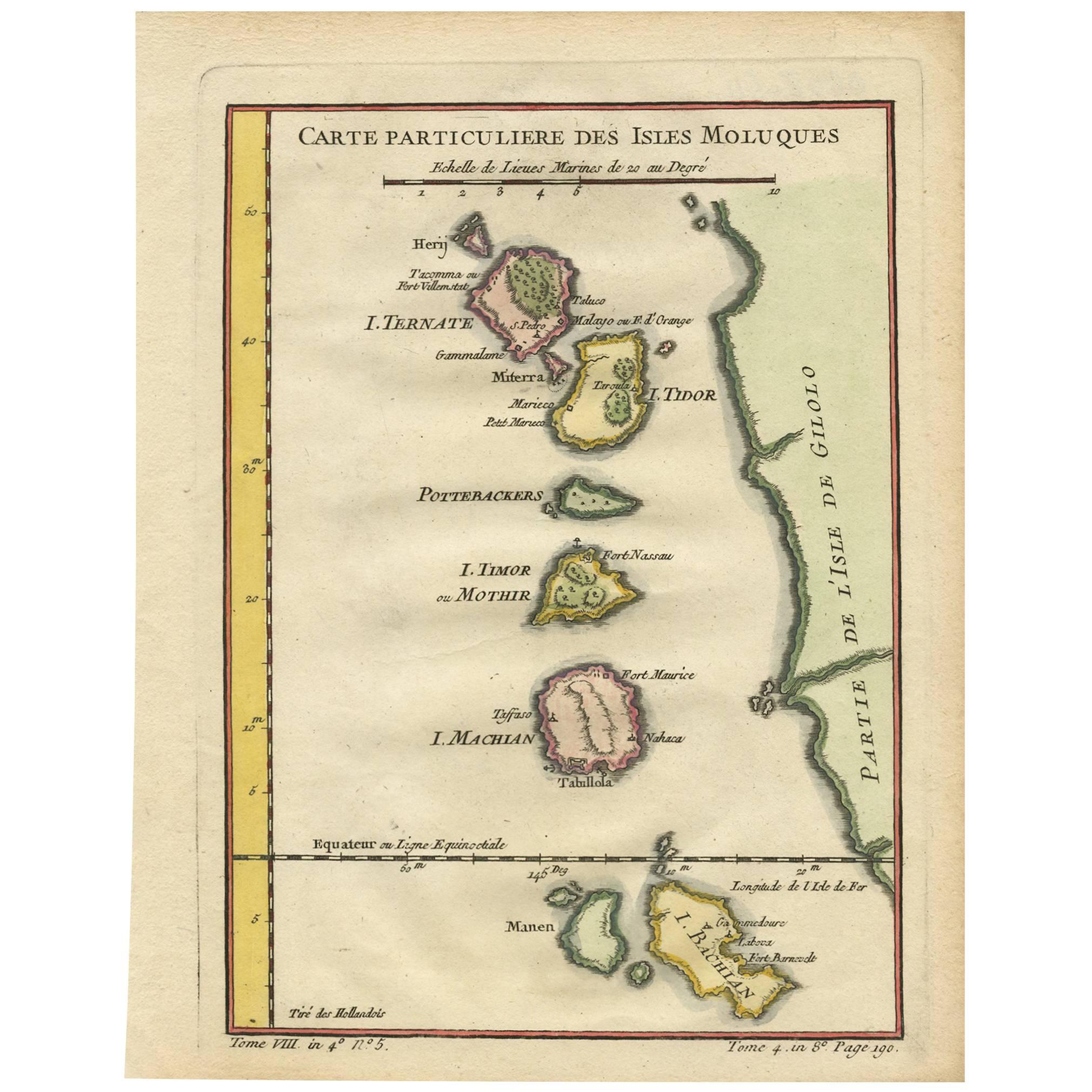
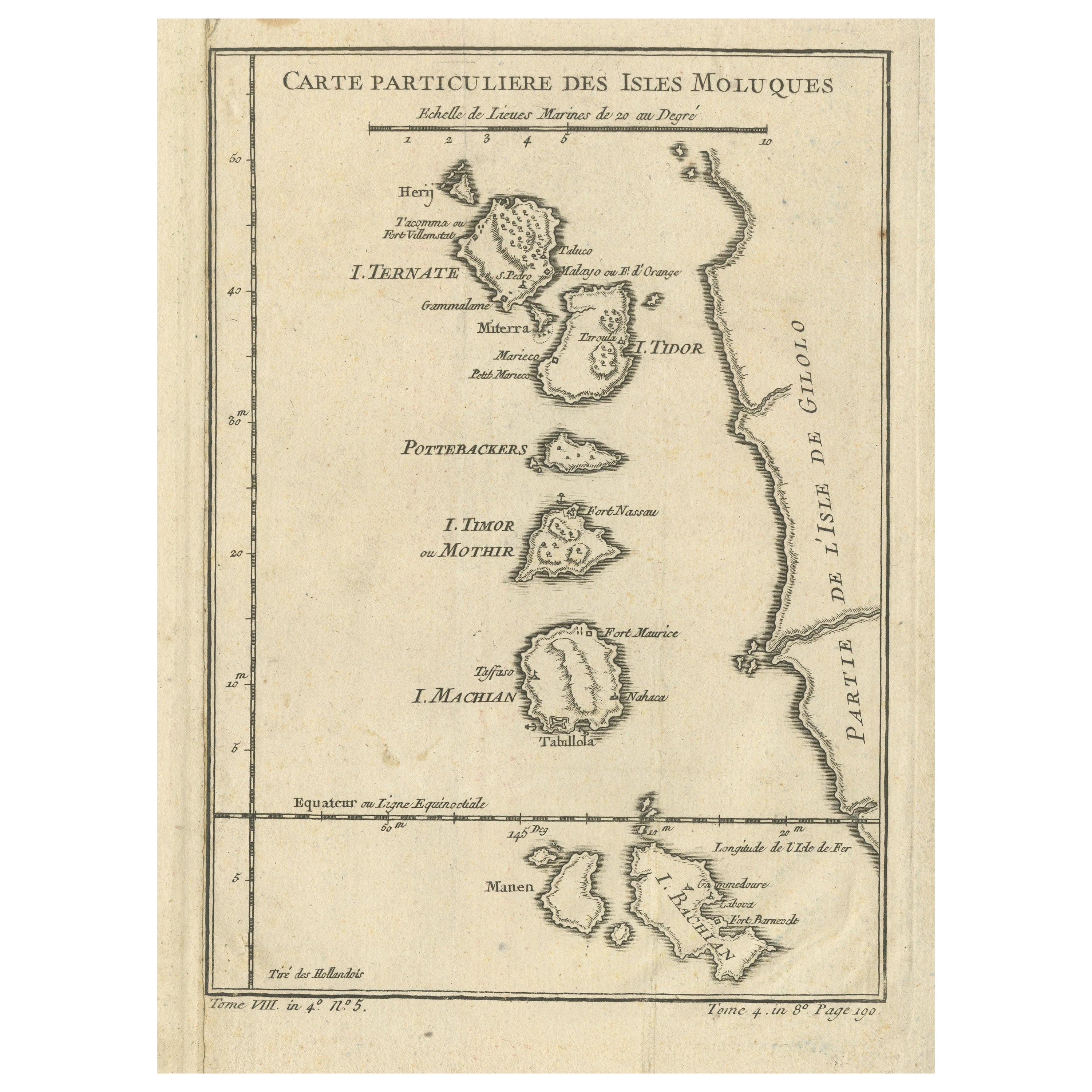
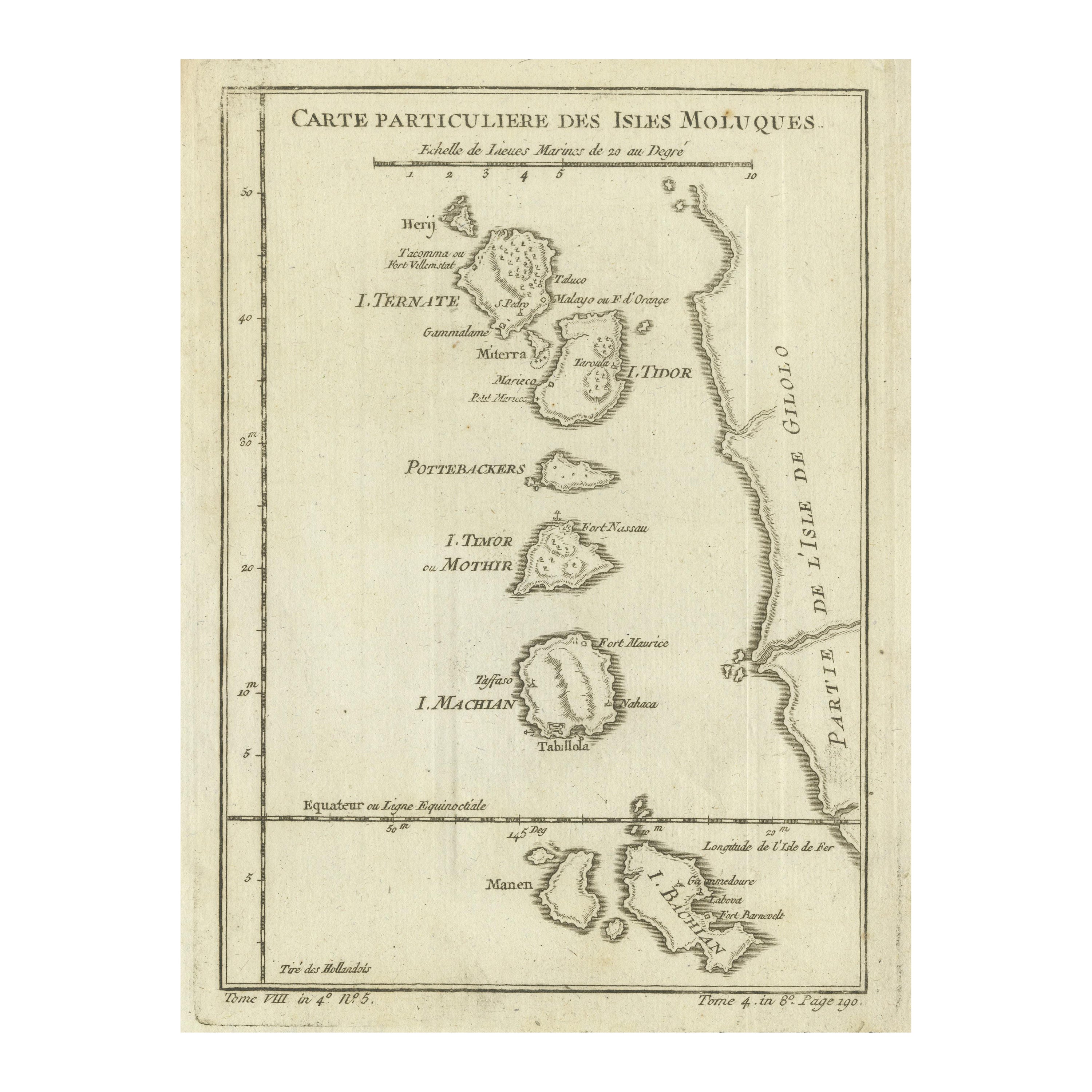
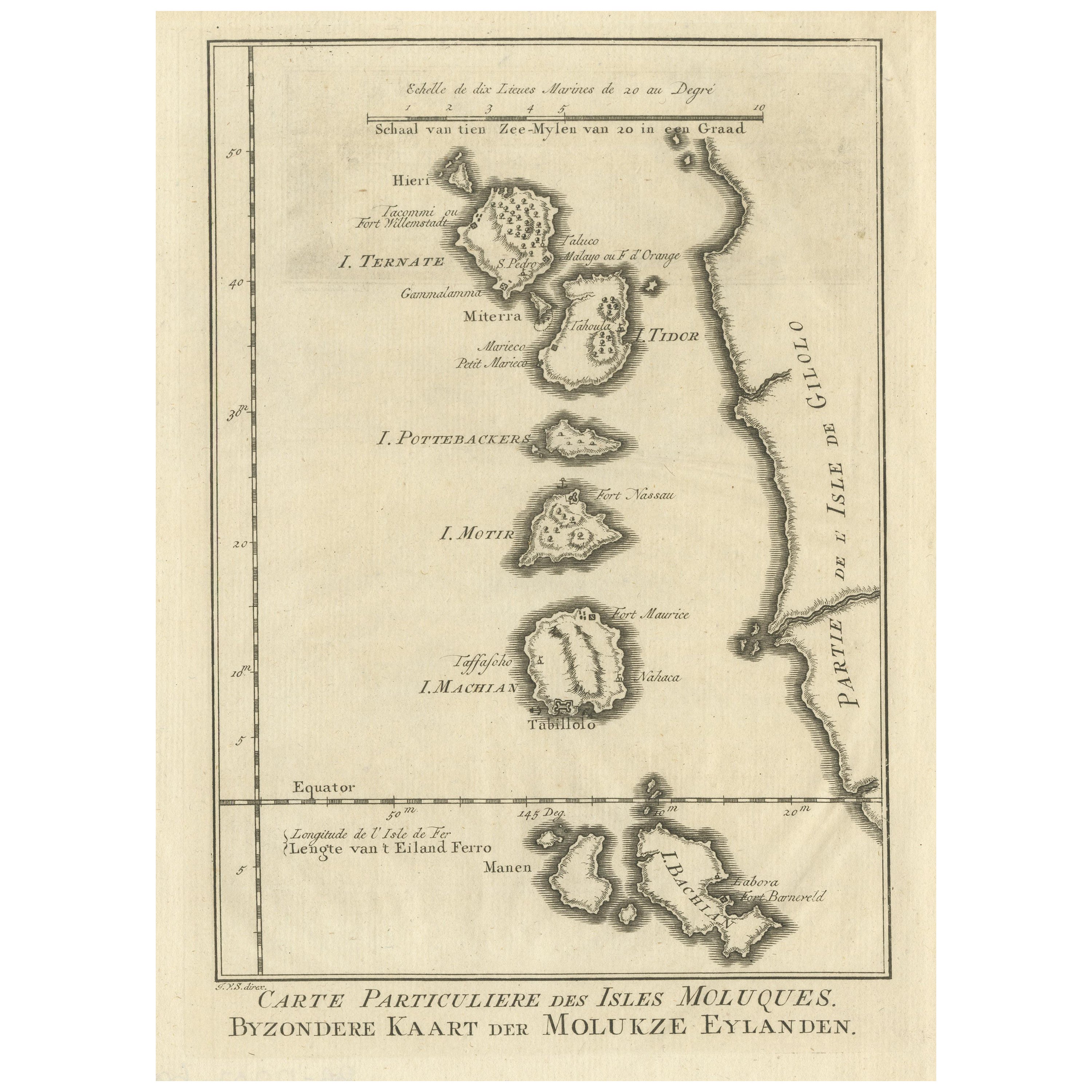
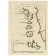
Title: 1771 Jacques-Nicolas Bellin Map of the Moluccas, the Spice Islands of Indonesia
Description: This finely engraved eighteenth-century map, titled Carte Particulière des Isles Moluques and Byzondere Kaart der Molukze Eylanden, was published in 1771 by the renowned French cartographer Jacques-Nicolas Bellin. The map offers a detailed depiction of the Moluccas, also known as the Spice Islands, a region in present-day Indonesia that was of immense economic and strategic importance during the European colonial period.
The Moluccas were highly sought after by European powers due to their monopoly on valuable spices such as nutmeg, cloves, and mace. The islands were central to the conflicts between the Portuguese, Dutch, and British, as they all sought control over the lucrative spice trade. This map specifically highlights the key islands of the northern Moluccas, including Ternate, Tidore, Motir, Machian, and Bacan, along with a portion of Gilolo, now known as Halmahera. The region's significance in the global spice trade made it one of the most contested territories in the East Indies.
The map includes various fortifications, settlements, and European trading posts. Among the notable features are Ternate, where Fort Williamstadt is labeled, a major trading hub controlled by the Dutch East India Company. Tidore, historically governed by a powerful sultanate allied with the Spanish and later the Dutch, is also marked with important settlements. The islands of Motir and Machian are identified with key forts such as Fort Nassau and Fort Maurice, which were used to secure Dutch interests in the region. Bacan, another major island in the chain, is labeled with locations including Taboua and Barneveld. The map also depicts the coastline of Gilolo, showing the limited settlements on this large but sparsely populated island.
The cartography reflects Bellin’s meticulous attention to detail, incorporating place names in both French and Dutch, highlighting the region’s European influence. The inclusion of a double-scale bar in both French and Dutch nautical miles demonstrates the map’s practical use for navigation. The careful engraving of coastlines, islands, and settlements showcases the high-quality craftsmanship of Bellin’s work, produced at a time when European knowledge of Southeast Asia was rapidly expanding.
This map is an excellent representation of the geopolitical significance of the Moluccas during the eighteenth century. It provides valuable insight into European exploration, colonial ambitions, and maritime trade networks that shaped global commerce.
Cartographer and Source:
Jacques-Nicolas Bellin, who lived from seventeen hundred three to seventeen hundred seventy-two, was a French hydrographer and cartographer serving as the chief cartographer for the French Navy’s Dépôt des Cartes et Plans de la Marine. His maps were widely published in maritime atlases and travel accounts, providing some of the most detailed contemporary representations of colonial territories and trade routes. This map was created as part of a larger effort to document French naval and commercial interests in the East Indies.
Condition Report:
The paper is well-preserved, exhibiting the fine laid texture and visible chain lines characteristic of eighteenth-century French printing. The engraving remains sharp, with clear labels and finely detailed coastlines.
There is light age-toning, particularly along the edges, which is common for maps of this period. The original hand-coloring remains vibrant, with carefully applied shading distinguishing the individual islands. The map has no significant stains, tears, or repairs, making it a fine and collectible example of an early European map of the Moluccas.
Framing Recommendations:
To properly preserve and display this antique map, archival-quality materials are recommended.
For matting and backing, use acid-free, museum-grade board to prevent deterioration. A double mat with a neutral outer mat and a soft beige or pale gold inner accent will highlight the delicate coloring of the engraving.
A classic dark walnut, black, or gilded wooden frame will enhance the historical nature of the piece. A simple yet elegant frame will help maintain focus on the map’s fine details and artistic engraving.
To ensure longevity, UV-resistant museum glass or acrylic is recommended to prevent fading while maintaining clarity. Anti-reflective glass allows for optimal viewing without glare.
For mounting, avoid adhesives that can damage the paper. Instead, use archival-quality corner mounts or Japanese paper hinges to secure the map safely.
The framed map should be displayed in a stable environment, away from direct sunlight, humidity, and extreme temperature changes. Ideal locations for display include a study, library, or gallery, where its historical and artistic value can be fully appreciated.
This seventeen seventy-one Bellin map of the Moluccas is a valuable historical artifact, reflecting European exploration, maritime trade, and colonial ambitions in Indonesia. It is an excellent addition to collections focused on antique maps, Southeast Asian history, and early European navigation.
- Dimensions:Height: 10.36 in (26.3 cm)Width: 7.72 in (19.6 cm)Depth: 0.01 in (0.2 mm)
- Materials and Techniques:Paper,Engraved
- Period:1770-1779
- Date of Manufacture:1771
- Condition:Goodf with light age-toning, particularly along the edges. The original hand-coloring remains vibrant, with carefully applied shading distinguishing the individual islands. The map has no significant stains, tears or repairs.
- Seller Location:Langweer, NL
- Reference Number:Seller: BG-035431stDibs: LU3054343934802
About the Seller
5.0
Recognized Seller
These prestigious sellers are industry leaders and represent the highest echelon for item quality and design.
Platinum Seller
Premium sellers with a 4.7+ rating and 24-hour response times
Established in 2009
1stDibs seller since 2017
2,593 sales on 1stDibs
Typical response time: <1 hour
- ShippingRetrieving quote...Shipping from: Langweer, Netherlands
- Return Policy
Authenticity Guarantee
In the unlikely event there’s an issue with an item’s authenticity, contact us within 1 year for a full refund. DetailsMoney-Back Guarantee
If your item is not as described, is damaged in transit, or does not arrive, contact us within 7 days for a full refund. Details24-Hour Cancellation
You have a 24-hour grace period in which to reconsider your purchase, with no questions asked.Vetted Professional Sellers
Our world-class sellers must adhere to strict standards for service and quality, maintaining the integrity of our listings.Price-Match Guarantee
If you find that a seller listed the same item for a lower price elsewhere, we’ll match it.Trusted Global Delivery
Our best-in-class carrier network provides specialized shipping options worldwide, including custom delivery.More From This Seller
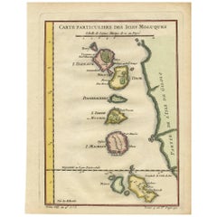
View AllAntique Map of the Moluques Islands, Part of Indonesia, circa 1750
Located in Langweer, NL
Map of the Moluques (also known as the Moluccas, Moluccan Islands or simply Maluku). Depicts the islands of Herij, Ternate, Tidor, Pottebackers, Timor, Machian and Bachian.
Category
Antique Mid-18th Century Maps
Materials
Paper
$199 Sale Price
20% Off
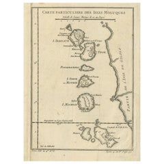
Antique Map of the Maluku Islands or Moluccas, Indonesia
Located in Langweer, NL
Antique map titled 'Carte Particuliere des Isles Moluques'. This map depicts the islands of Herij, Ternate, Tidor, Pottebackers, Timor, Machian and Bachian. The Moluccan islands were...
Category
Antique Mid-18th Century Maps
Materials
Paper
$142 Sale Price
20% Off
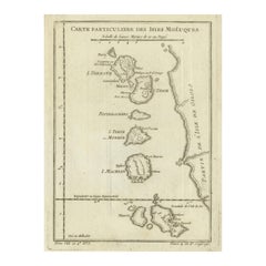
Original Antique Map of the Maluku Islands or Moluccas, Indonesia
Located in Langweer, NL
Antique map titled 'Carte Particuliere des Isles Moluques'. This map depicts the islands of Herij, Ternate, Tidor, Pottebackers, Timor, Machian and Bachian. The Moluccan islands were...
Category
Antique Mid-18th Century Maps
Materials
Paper
$104 Sale Price
20% Off
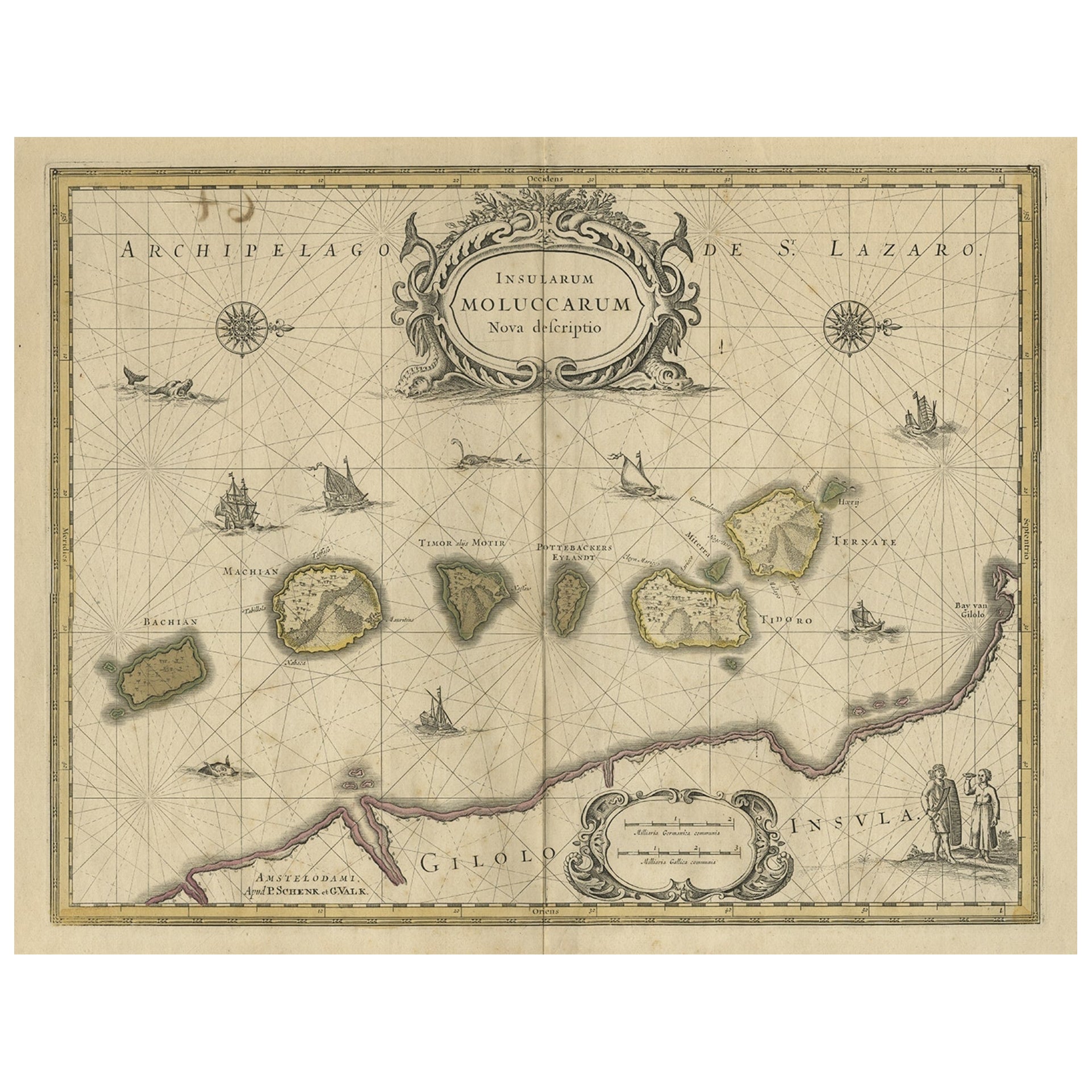
Old Map of the Moluccas, Known as the Famous Spice Islands, Indonesia, ca.1730
Located in Langweer, NL
Antique map titled 'Insularum Moluccarum Nova Descriptio.'
Old map of the Moluccas. The famous Spice Islands, the cornerstone of the Dutch trading empire in the East Indies throughout the 17th Century, is the focus of this exquisite map. Similar to Blaeu's map, except that it extends further south...
Category
Antique 1730s Maps
Materials
Paper

$656 Sale Price
20% Off
Antique Map of the Maluku Islands by Bellin, c.1750
By Jacques-Nicolas Bellin
Located in Langweer, NL
Antique map titled 'Carte Particuliere des Isles Moluques'. This map depicts the islands of Herij, Ternate, Tidor, Pottebackers, Timor, Machian and Bachian. The Moluccan islands were...
Category
Antique 18th Century Maps
Materials
Paper

$118 Sale Price
20% Off
Original Antique Map of the Maluku Islands or Moluccas
Located in Langweer, NL
Antique map titled 'Carte Particuliere des Isles Moluques - Byzondere Kaart der Molukze Eylanden'. This map depicts the islands of Herij, Ternate, Tidor, Pottebackers, Timor, Machian...
Category
Antique Mid-18th Century Maps
Materials
Paper
$180 Sale Price
20% Off
You May Also Like
Antique French Map of Asia Including China Indoneseia India, 1783
Located in Amsterdam, Noord Holland
Very nice map of Asia. 1783 Dedie au Roy.
Additional information:
Country of Manufacturing: Europe
Period: 18th century Qing (1661 - 1912)
Condition: Overall Condition B (Good Used)...
Category
Antique 18th Century European Maps
Materials
Paper

$648 Sale Price
20% Off
Large Original Vintage Map of The Pacific Islands Including Hawaii
Located in St Annes, Lancashire
Great map of The Pacific Islands
Unframed
Original color
By John Bartholomew and Co. Edinburgh Geographical Institute
Published, circa 1...
Category
Vintage 1920s British Maps
Materials
Paper

Captain Cook's Exploration of Tahiti: 18th C. Hand-colored Map by Bellin
By Jacques-Nicolas Bellin
Located in Alamo, CA
This beautiful 18th century hand-colored copper plate engraved map is entitled "Carte de l'Isle de Taiti, par le Lieutenant J. Cook" was created by Jacques Nicolas Bellin and publish...
Category
Late 18th Century Landscape Prints
Materials
Engraving

Original Antique Map of US Possessions In The Pacific Ocean, C.1900
Located in St Annes, Lancashire
Fabulous map of US possessions in the Pacific Ocean
Original color.
Engraved and printed by the George F. Cram Company, Indianapolis.
Published, C.1900.
Unframed.
Free shipping.
Category
Antique 1890s American Maps
Materials
Paper

Original Antique Map of South East Asia by Thomas Clerk, 1817
Located in St Annes, Lancashire
Great map of South East Asia
Copper-plate engraving
Drawn and engraved by Thomas Clerk, Edinburgh.
Published by Mackenzie And Dent, 1817
Unframed.
Category
Antique 1810s English Maps
Materials
Paper

Large Original Antique Map of The Canary Islands. 1894
Located in St Annes, Lancashire
Superb Antique map of The Canary Islands
Published Edward Stanford, Charing Cross, London 1894
Original colour
Good condition
Unframed.
Free shipping
Category
Antique 1890s English Maps
Materials
Paper

More Ways To Browse
Antique Spices
French Matting
East India Trading Company
Stained Glass Dutch
Old Spice
Antique Key Chain
Spanish Wooden Bar
Acrylic Trolley
British East India Company
Portuguese Colonial Furniture
Live Edge Black Walnut
Antique Wooden Carts
Antique Wooden Trolley
Live Edge Bar
Antique Serving Carts
Expanding Bar Cart
Indonesian Mat
British East Indies