American Maps
63
1
to
6
64
51
64
64
64
7
4
3
2
2
44
19
1
10
7
1
2
4
2
1
2
1
59
17
10
5
4
131
71
64
52
31
3
1
1
1
1
Item Ships From: USA
Place of Origin: American
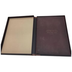
1877 "Geological and Geographical Atlas of Colorado" by F. V. Hayden
Located in Colorado Springs, CO
This is F. V. Hayden's Geological and Geographical Atlas of Colorado and Portions of Adjacent Territory, an unmatched geological record for its time. Published by the Department of the Interior in 1877, the Atlas of Colorado consists of twenty double elephant sized sheets, divided into two series. The first series, four sheets, embrace the entire area on a scale of twelve miles to an inch, and include Triangulations, Drainage, an Economic Map, and a General Geological map...
Category
1870s Antique American Maps
Materials
Paper
Mid-Century Illuminated Replogle World Floor Globe in Wood and Glass, Chicago
By Replogle Globes
Located in Haddonfield, NJ
American 1950's back light green painted floor globe by Replogle, Mid-Century Modern.
Remarkable and charming Chicago made world globe featur...
Category
Mid-20th Century Mid-Century Modern American Maps
Materials
Steel
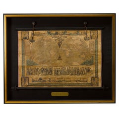
1847 “World at One View” Antique Hand-Colored Wall Map of the World
Located in Colorado Springs, CO
This is a highly desirable hanging wall map of the "World at One View", published in 1847 by Ensign and Thayer, New York.
This pictorial map was printed as a broadside and features...
Category
19th Century Antique American Maps
Materials
Paper
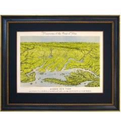
Civil War Panorama of the Seat of War by John Bachmann, Antique Print circa 1864
Located in Colorado Springs, CO
Panorama of the seat of war. Bird's-eye View of Virginia, Maryland, Delaware and the District of Columbia.
This third state of this fascinating bird's eye view of the northernmost p...
Category
1860s Antique American Maps
Materials
Paper
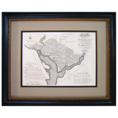
Plan for the City of Washington by Andrew Ellicott, Antique Print, 19th Century
Located in Colorado Springs, CO
By Andrew Ellicott (1754-1820) and Pierre Charles L'Enfant (1754-1825). Plan of the City of Washington. Published by Thackara & Vallance, Philadelphia, 1792. Later impression printed on 19th century wove paper.
This is a fine 19th century printing of the "official" plan of Washington, D.C. First printed in 1792 by the original publishers, Thackara & Vallance in Philadelphia, this is a later 19th century printing of the fifth recorded engraving of the L’Enfant / Ellicott city plan. The first three issues of this city plan were in published in periodicals, making the fifth edition only the second separately-issued engraving of the plan. In full, the title reads, “Plan of the City of Washington in the Territory of Columbia, ceded by the States of Virginia and Maryland to the United States of America and by them established as the Seat of their Government after the year 1800.”
The national capital city is laid out according to a plan originally proposed by Pierre Charles L'Enfant and modified by Andrew Ellicott. L'Enfant was born in Paris, where he trained to be an architect. He came to America in 1777, and served under George Washington as an engineer during the Revolutionary War. In 1791, Washington asked L'Enfant to design the new capital city in the District of Columbia. However, trouble arose between the city and L'Enfant. The City Commissioner needed a finished, printed copy of the plan in order to sell building lots but L'Enfant worked slowly and released only incomplete plans, and proved to be quite obstinate. On instruction from President Washington...
Category
Late 19th Century Antique American Maps
Materials
Paper
Mitchell's New National Wall Map Exhibiting the United States, circa 1856
Located in Colorado Springs, CO
"Mitchell's New National Map of the United States, North American British Provinces, Sandwich Islands, Mexico and Central America together with Cuba and other West India Islands."
This is the first edition of Mitchell's important 1856 wall map of the United States, Mexico and the West Indies. The map depicts the entire nation from Atlantic to Pacific, with inset maps of the World on Mercator's Projection and the World on Globular Projection, and Hawaii (The Sandwich Islands).
The map was one of the most commercially successful maps of its time, regularly amended to update the changing territorial and state borders of the West.
In his important book on "Mapping the Transmississippi...
Category
1850s Antique American Maps
Recently Viewed
View AllMore Ways To Browse
Albania Antique Map
Antique Gate Architectural Antiques
Antique Louisiana Map
Antique Map Louisiana
Antique Map Palestine
Antique Maps Of Louisiana
Antique Maps Of North Carolina
Armenia Map
Armenian Map
Brooklyn Map
Gibraltar Antique Map
Greenland Map
Hyde Park Antiques
Map Colorado
Map Of Armenia
Map Of Colorado
Map Of Gulf Of Mexico
Mughal Map
