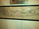
Original 1873 Map of Long Island, Beers, Comstock 55 ins w
View Similar Items


1 of 10
Original 1873 Map of Long Island, Beers, Comstock 55 ins w
About the Item
Beers, Comstock & Cline, 36 Vesey St., N.Y. 1873.
From East Hampton, to Manhattan, including Hudson County NJ
Very clear details of streets and roads in the New York City area.
- Dimensions:Height: 20 in (50.8 cm)Width: 55 in (139.7 cm)
- Place of Origin:
- Period:
- Date of Manufacture:1873 original
- Condition:some yellowing, but in very good condition.<br /> very clear print.
- Seller Location:Bridgehampton, NY
- Reference Number:1stDibs: U1102247781186
You May Also Like
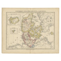
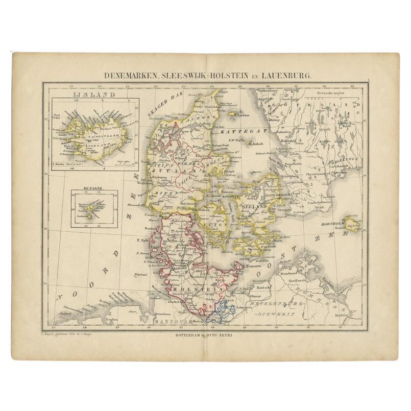
- Antique Map of Denmark with Insets of Iceland and the Faroe Islands, c.1873Located in Langweer, NLAntique map titled 'Denemarken, Sleeswijk-Holstein en Lauenburg'. Old map depicting Denmark, with inset maps of Iceland and the Faroe Islands. This map originates from 'School-Atlas ...Category
Antique 19th Century Maps
MaterialsPaper
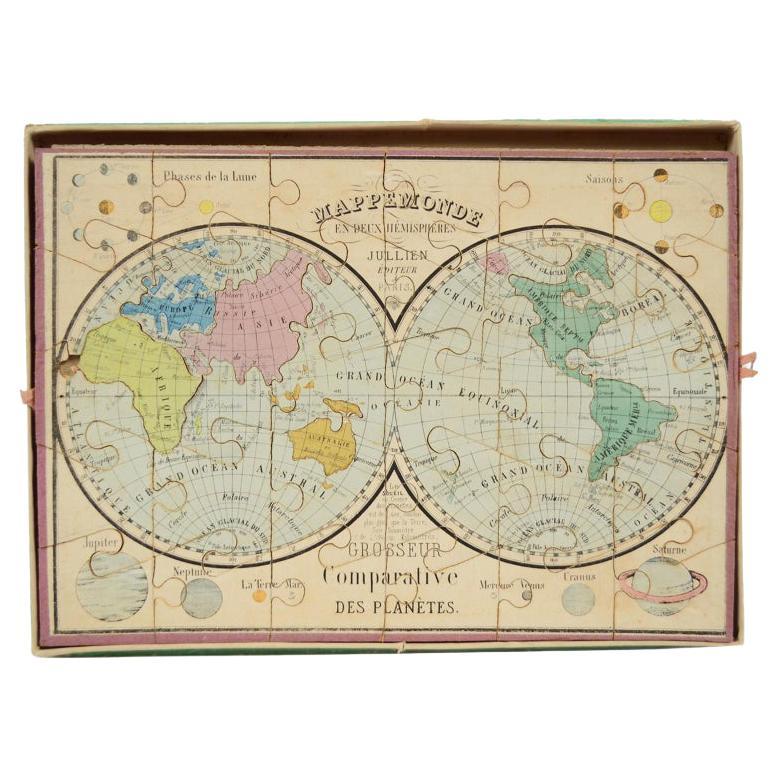
- Antique Puzzle of Colored Cardboard Depicting World Map, Europe and FranceLocated in Milan, ITEducational puzzle of colored cardboard composed of three folders depicting world map, Europe and France. The world map in addition to the territorial map of the continents depicts t...Category
Antique 1850s French Games
MaterialsPaper
- Original Antique Map of the Cape Verde Islands, 1746Located in Langweer, NLAntique map titled 'Carte Des Isles Du Cap Verd.' Original antique map of the Cape Verde Islands. Decorative cartouche and compass rose. Extends from Isle d...Category
Antique 18th Century Maps
MaterialsPaper
 $148 Sale Price20% Off
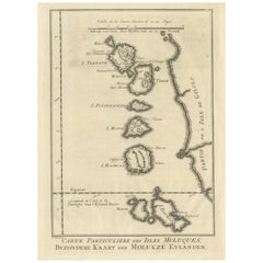
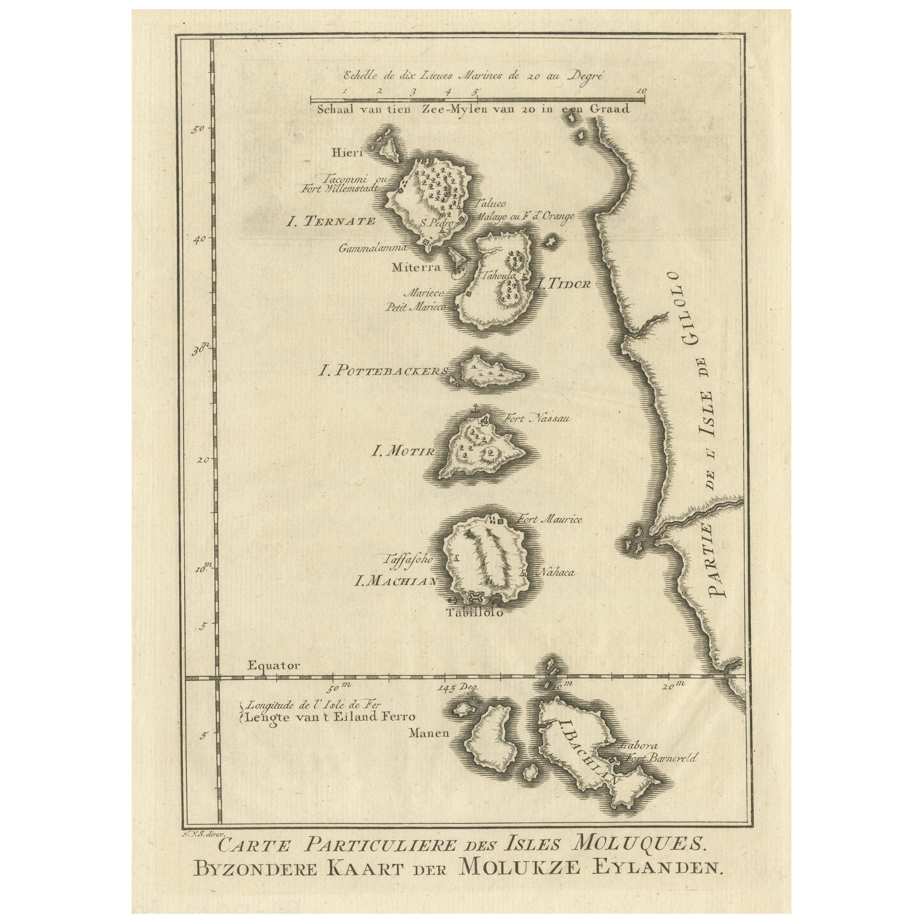
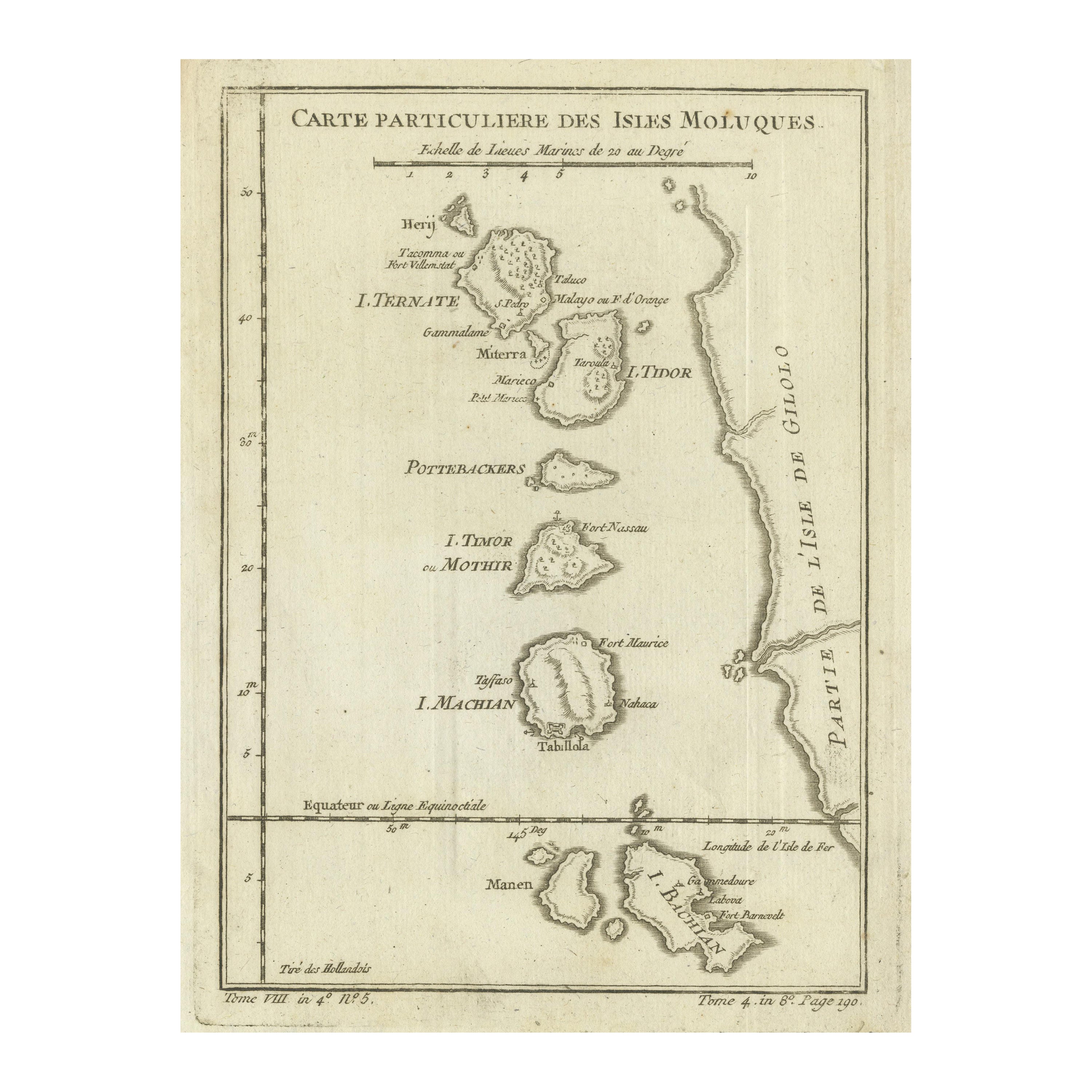
 - Original Antique Map of the Maluku Islands or MoluccasLocated in Langweer, NLAntique map titled 'Carte Particuliere des Isles Moluques - Byzondere Kaart der Molukze Eylanden'. This map depicts the islands of Herij, Ternate, Tidor, Pottebackers, Timor, Machian...Category
Antique Mid-18th Century Maps
MaterialsPaper
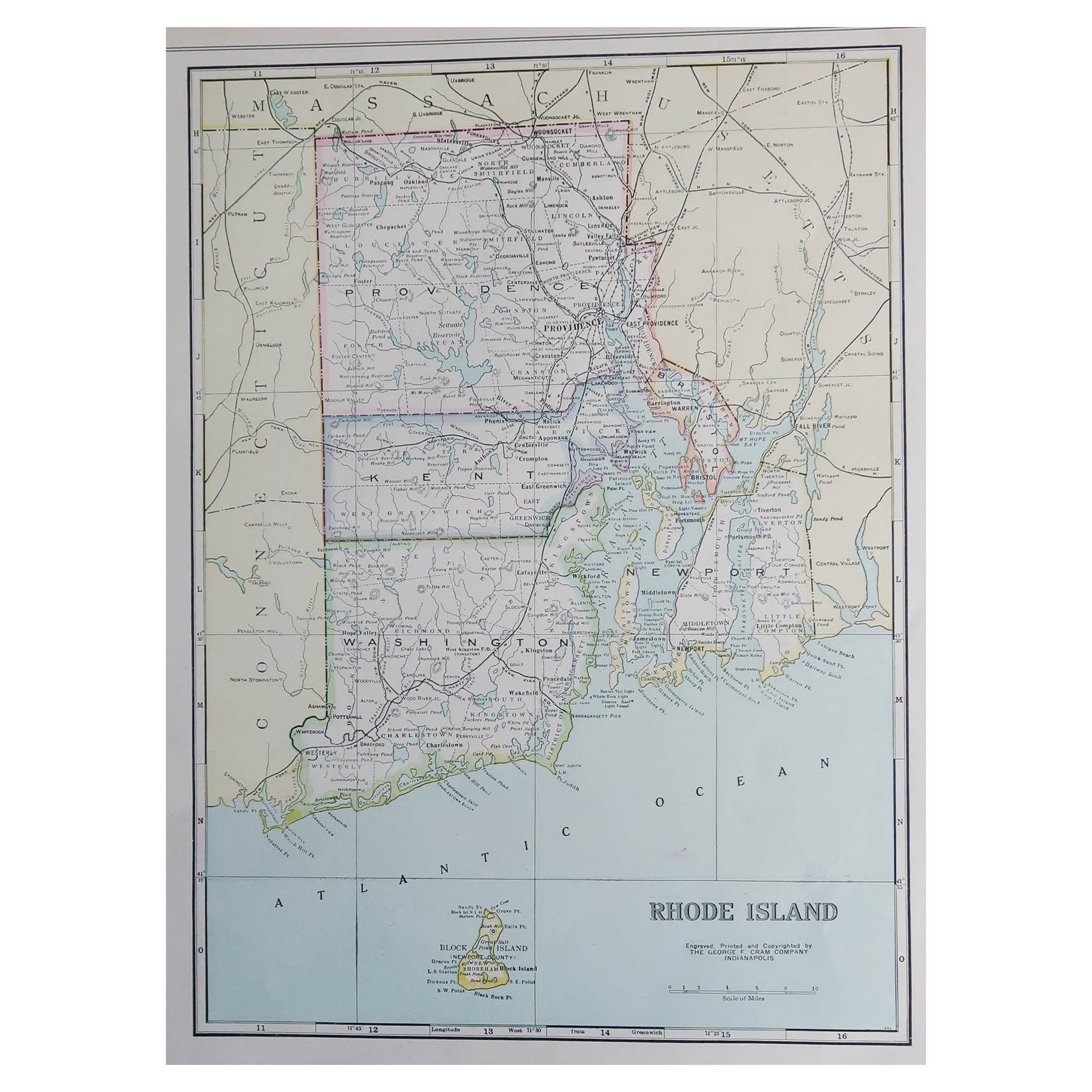
- Large Original Antique Map of Rhode Island, USA, C.1900Located in St Annes, LancashireFabulous map of Rhode Island Original color Engraved and printed by the George F. Cram Company, Indianapolis. Published, C.1900 Unframed Free ...Category
Antique 1890s American Maps
MaterialsPaper
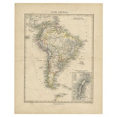
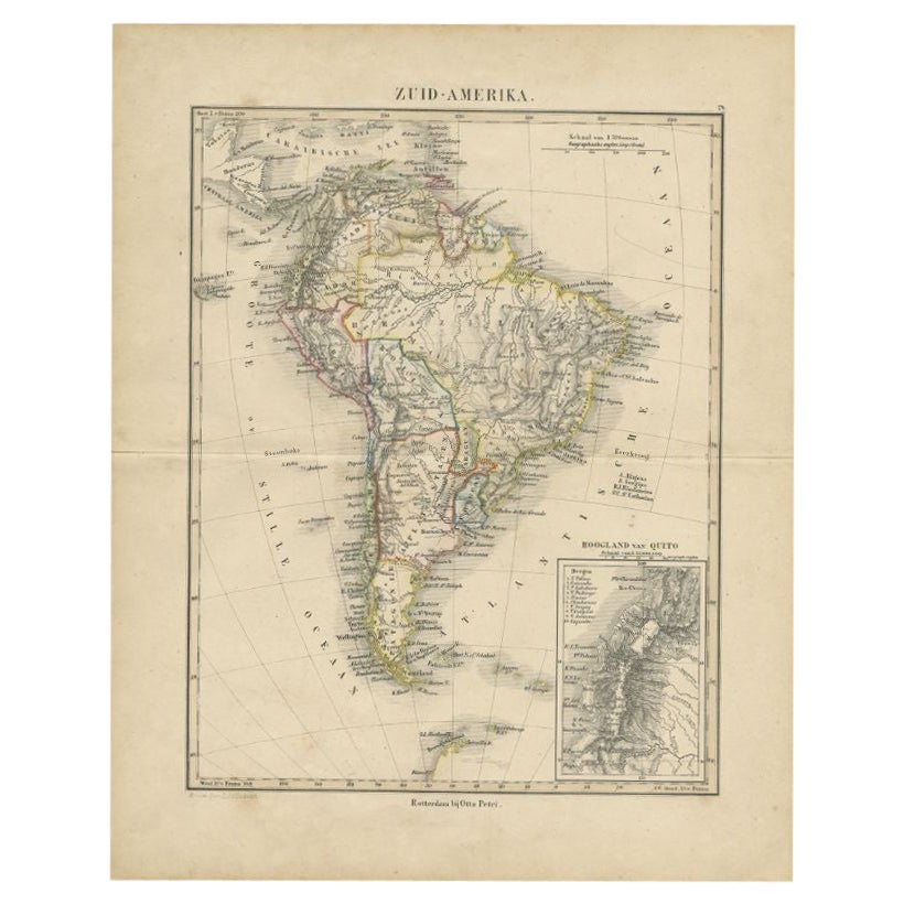
- Antique Map of South America by Petri, c.1873By Thomas KitchinLocated in Langweer, NLAntique map titled 'Zuid-Amerika'. Old map depicting South America, with an inset map of the highland of Quito. This map originates from 'School-Atlas van alle Deelen der Aarde'. Art...Category
Antique 19th Century Maps
MaterialsPaper