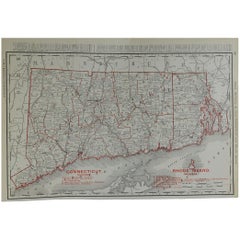
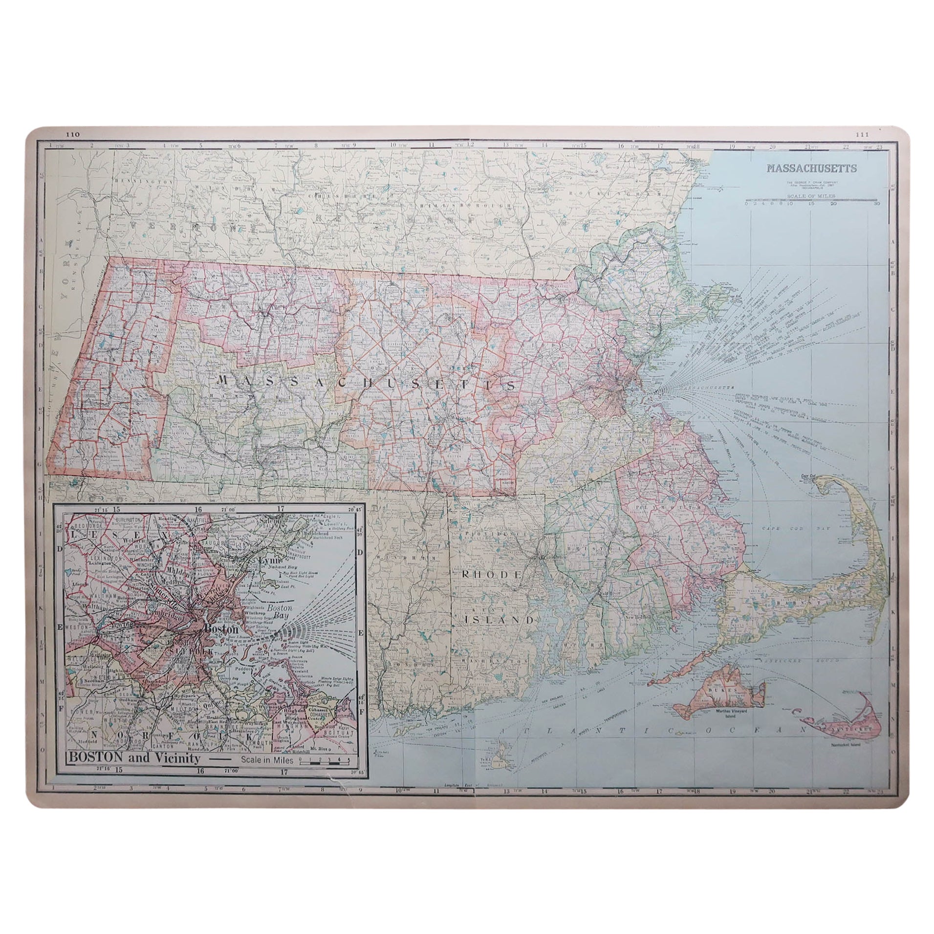
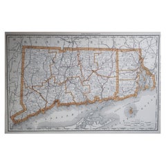
Original Antique Map of Connecticut & Rhode Island by Rand McNally, circa 1900
View Similar Items


Want more images or videos?
Request additional images or videos from the seller
1 of 5
Original Antique Map of Connecticut & Rhode Island by Rand McNally, circa 1900
About the Item
- Creator:Rand McNally & Co. (Maker)
- Dimensions:Height: 14 in (35.56 cm)Width: 20.5 in (52.07 cm)Depth: 0.07 in (1.78 mm)
- Style:Edwardian (Of the Period)
- Materials and Techniques:Paper,Other
- Place of Origin:
- Period:1900-1909
- Date of Manufacture:1900
- Condition:Wear consistent with age and use. Minor edge tears.
- Seller Location:St Annes, GB
- Reference Number:1stDibs: LU1836321870122
About the Seller
4.9
Platinum Seller
These expertly vetted sellers are 1stDibs' most experienced sellers and are rated highest by our customers.
1stDibs seller since 2016
2,646 sales on 1stDibs
Associations
International Confederation of Art and Antique Dealers' Associations
More From This SellerView All
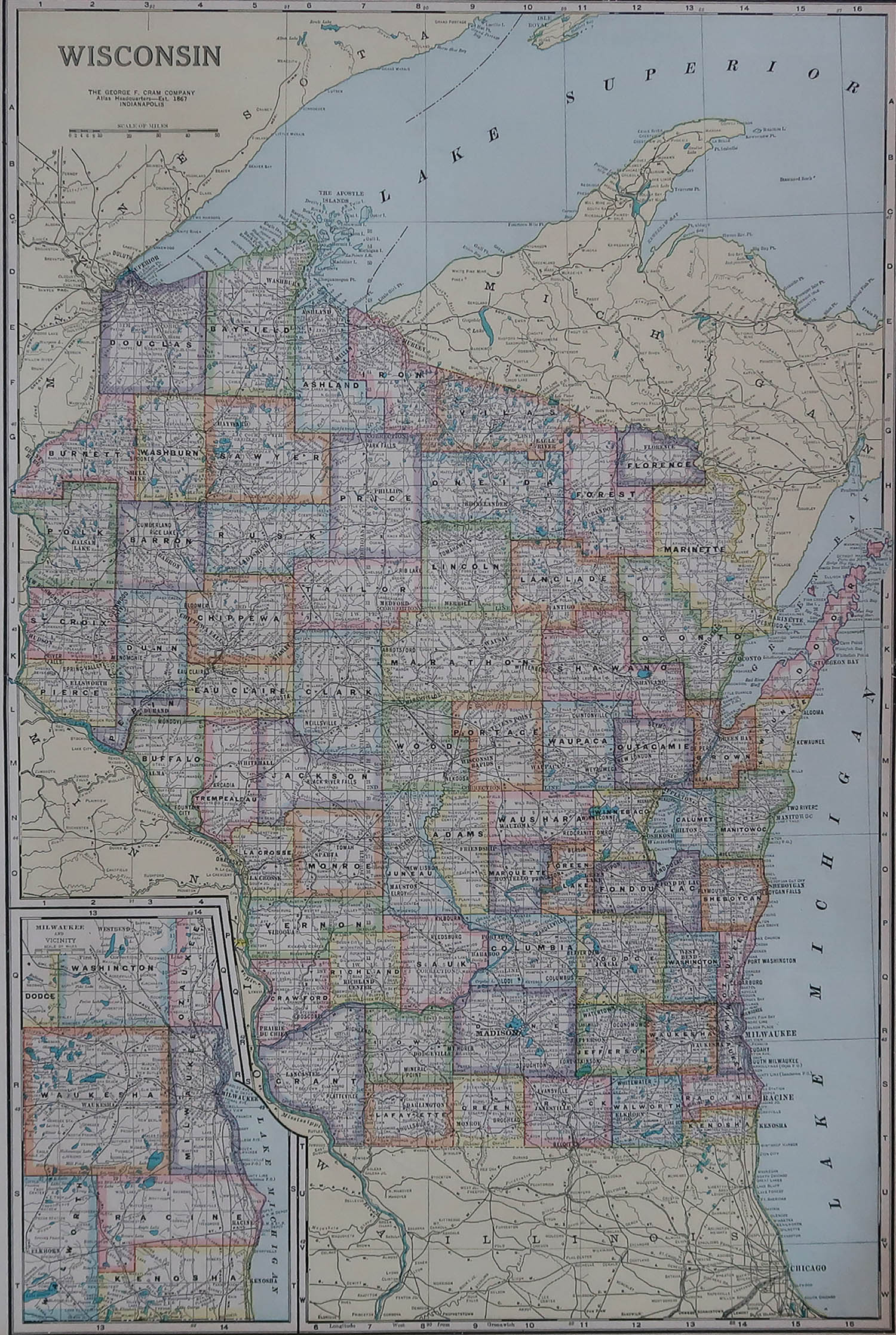
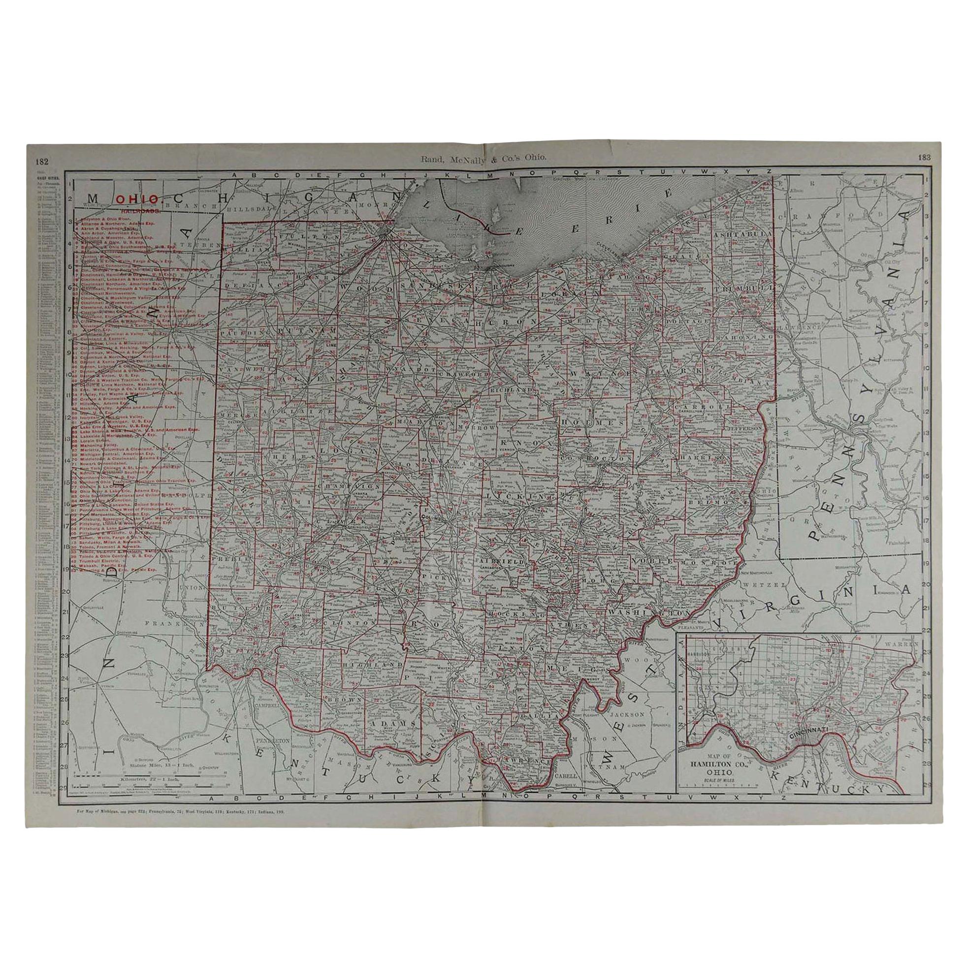
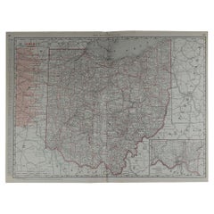
- Large Original Antique Map of Ohio by Rand McNally, circa 1900By Rand McNally & Co.Located in St Annes, LancashireFabulous monochrome map with red outline color Original color By Rand, McNally & Co. Published, circa 1900 Unframed Repairs to minor edge tears.Category
Antique Early 1900s American Edwardian Maps
MaterialsPaper
- Original Antique Map of South Dakota by Rand McNally, circa 1900By Rand McNally & Co.Located in St Annes, LancashireFabulous monochrome map with red outline color Original color By Rand, McNally & Co. Published, circa 1900 Unframed Minor edge tears.Category
Antique Early 1900s American Edwardian Maps
MaterialsPaper
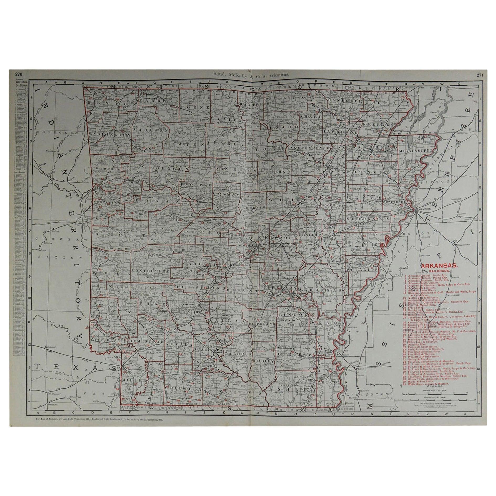
- Large Original Antique Map of Arkansas by Rand McNally, circa 1900By Rand McNally & Co.Located in St Annes, LancashireFabulous monochrome map with red outline color Original color By Rand, McNally & Co. Published, circa 1900 Unframed Minor edge tears.Category
Antique Early 1900s American Edwardian Maps
MaterialsPaper
- Large Original Antique Map of Connecticut, USA, 1894By Rand McNally & Co.Located in St Annes, LancashireFabulous map of Connecticut and Rhode Island Original color By Rand, McNally & Co. Published, 1894 Unframed Free shipping.Category
Antique 1890s American Maps
MaterialsPaper
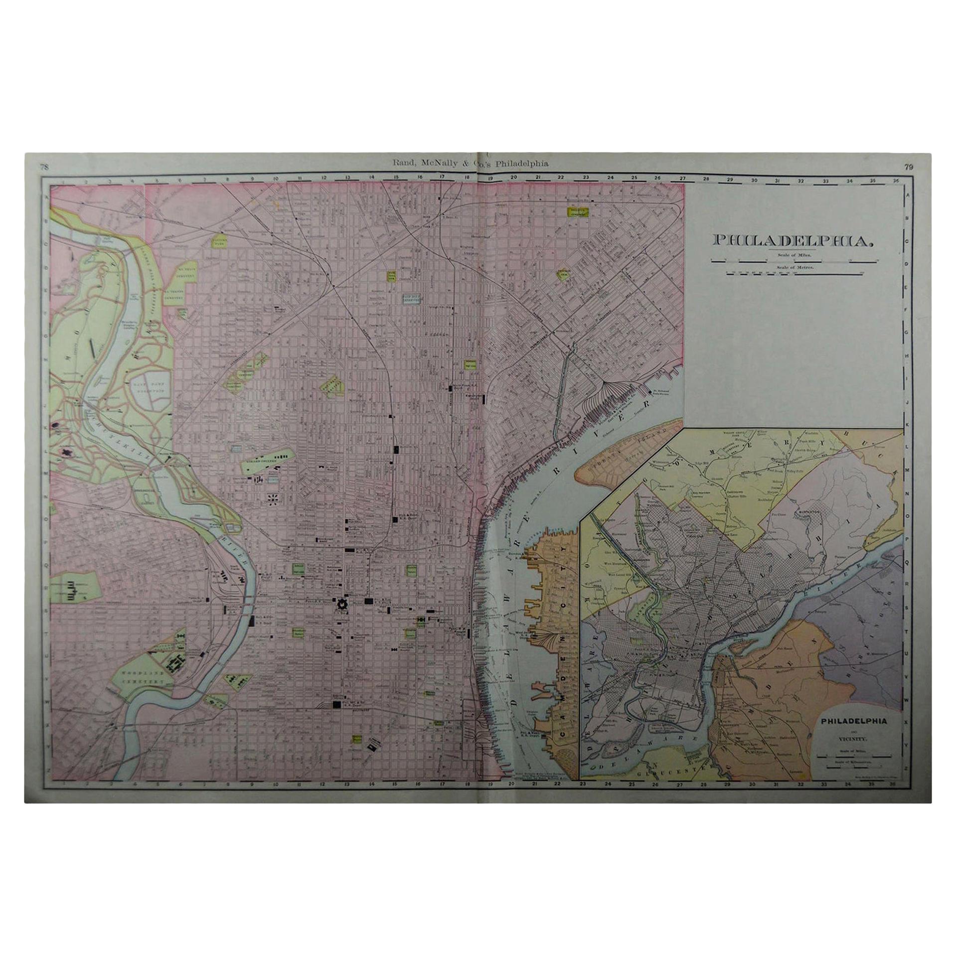
- Large Original Antique City Plan of Philadelphia, USA, circa 1900By Rand McNally & Co.Located in St Annes, LancashireFabulous colorful map of Philadelphia Original color By Rand, McNally & Co. Published, circa 1900. Unframed Free shipping.Category
Antique Early 1900s American Maps
MaterialsPaper
- Large Original Antique City Plan of Montreal, Canada, circa 1900By Rand McNally & Co.Located in St Annes, LancashireFabulous colorful map of Montreal Original color By Rand, McNally & Co. Published, circa 1900 Unframed Free shipping.Category
Antique Early 1900s American Maps
MaterialsPaper


You May Also LikeView All
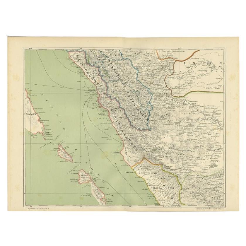
- Antique Map of the Mentawai Islands, Sumatra, 1900Located in Langweer, NLAntique map of the Mentawai Islands, Sumatra. Also depicting the region of Padang. This map originates from 'Atlas van Nederlandsch Oost- en West-Indië' by I. Dornseiffen. Artists ...Category
20th Century Maps
MaterialsPaper
- Antique Railroad Map of the United States by Rand, McNally & Co, 1900Located in Langweer, NLAntique map titled 'Rand, McNally & Co's New Official Railroad map of the United States with portions of The Dominion of Canada, The Republic of Mexico and the West Indies'. Large railroad map of the United States, sectionalised and laid on linen. Map shows state boundaries for the United States, Mexico, the West Indies, and lower portion of Canada; major cities and towns, military posts, Native American reservations, and railroads; Oklahoma and "Indian Territory." Inset: "Map of Alaska...Category
20th Century Maps
MaterialsLinen, Paper
 $2,213 Sale Price20% OffFree Shipping
 - Antique Map of the Island of Borneo by Janssonius, circa 1650Located in Langweer, NLAntique map titled 'Insula Borneo et Occidentalis pars Celebis cum adjacentibus Insulis'. Rare sea chart of the island of Borneo. Published by J. Janssonius, circa 1650.Category
Antique Mid-17th Century Maps
MaterialsPaper
 $1,632 Sale Price24% Off
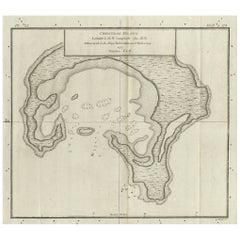
 - Antique Map of Christmas Island by Cook, C.1781Located in Langweer, NLAntique map Kiribati titled 'Christmas Island (..)'. Antique map of Christmas Island, also known as Kiritimati. Originates from an edition of Cook's Voyages. Artists and Engravers: Engraved by Duff. Condition: Good, some wear and age-related toning. Please study image carefully. Date: c.1781 Overall size: 27.5 x 21.5 cm. Image size: 20.5 x 18 cm. We sell original antique maps to collectors, historians, educators and interior decorators all over the world. Our collection includes a wide range of authentic antique maps...Category
Antique 18th Century Maps
MaterialsPaper
- Antique Map of Celebes 'Sulawesi', Island in Indonesia, c.1750By Jacques-Nicolas BellinLocated in Langweer, NLAntique map titled 'Carte De L'Isle Celebes ou Macassar'. Detailed copper engraved map of Celebes (Sulawesi, Indonesia), showing Makassar, which was the most important trading city o...Category
Antique 18th Century Maps
MaterialsPaper
 $159 Sale Price20% Off
 - Antique Map of Coiba Island, Panama, South America, C.1740Located in Langweer, NLAntique map titled 'Plan de la partie orientale de l'Isle de Quibo'. Map of the eastside of Coiba Island (Quibo), Panama, showing the shoreline around Port de Dames indicating soft s...Category
Antique 18th Century Maps
MaterialsPaper