Items Similar to Original Hand-Colored Antique Map of America by Danckerts, circa 1680


Want more images or videos?
Request additional images or videos from the seller
1 of 6
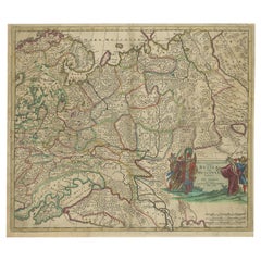
Original Hand-Colored Antique Map of America by Danckerts, circa 1680
About the Item
Antique map titled 'Novissima et Accuratissima Totius Americae Descriptio per I. Danckerts'. Striking map of America. California is shown as an island, Based Upon Sanson's model. The Great Lakes are shown with an open western coastline. No Northwestern Coast beyond 40 degrees. The seven cities of Cibola appear in the Southwestern US. The conception of the Mississippi River is still very vague and pushed far west of its true mouth. The large lake in the Southeastern US first seen on Le Moyne's map is still present. South America retains its excessively wide format. A hopeful extension from Button's Bay is shown portending a possible Northwest Passage. The map is richly embellished with two cartouches, 9 sailing vessels and elaborate vignettes of native villages, native warriors and indigenous animals. While the Visscher and De Wit editions of this map appear on the market with some frequency, this Danckerts edition is quite scarce.
- Dimensions:Height: 20.48 in (52 cm)Width: 24.22 in (61.5 cm)Depth: 0.02 in (0.5 mm)
- Materials and Techniques:
- Period:Late 17th Century
- Date of Manufacture:circa 1680
- Condition:Good, given age. A few tiny tears bottom edge, not affecting image. Minimal paper separation in the lower middle fold. Some tiny spots. A few soft vertical creases. Strong impression. General age-related toning. Please study images carefully.
- Seller Location:Langweer, NL
- Reference Number:Seller: PCT-580221stDibs: LU3054321366342
About the Seller
5.0
Recognized Seller
These prestigious sellers are industry leaders and represent the highest echelon for item quality and design.
Gold Seller
Premium sellers maintaining a 4.3+ rating and 24-hour response times
Established in 2009
1stDibs seller since 2017
2,467 sales on 1stDibs
Typical response time: 1 hour
- ShippingRetrieving quote...Shipping from: Langweer, Netherlands
- Return Policy
Authenticity Guarantee
In the unlikely event there’s an issue with an item’s authenticity, contact us within 1 year for a full refund. DetailsMoney-Back Guarantee
If your item is not as described, is damaged in transit, or does not arrive, contact us within 7 days for a full refund. Details24-Hour Cancellation
You have a 24-hour grace period in which to reconsider your purchase, with no questions asked.Vetted Professional Sellers
Our world-class sellers must adhere to strict standards for service and quality, maintaining the integrity of our listings.Price-Match Guarantee
If you find that a seller listed the same item for a lower price elsewhere, we’ll match it.Trusted Global Delivery
Our best-in-class carrier network provides specialized shipping options worldwide, including custom delivery.More From This Seller
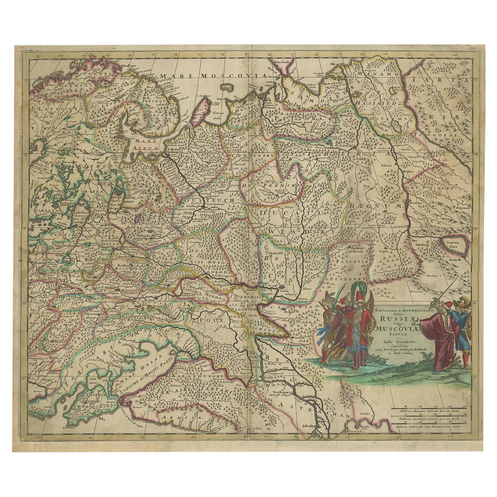
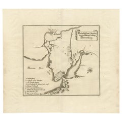
View AllAntique Hand-Colored Map of Western Russia and Ukraine, c.1680
Located in Langweer, NL
Description: Antique map titled 'Novissima et Accuratissima Totius Russiae vulgo Muscoviae Tabula'.
Antique map of Western Russia and Ukraine, published by Justus Danckerts. The ma...
Category
Antique 1680s Maps
Materials
Paper
$705 Sale Price
20% Off
Antique Map of Madagascar by N. Sanson, circa 1680
By Nicolas Sanson
Located in Langweer, NL
Antique map titled 'Isle de Madagascar ou de St. Laurens. Tiree de Sanutu &c'. Antique map of Madagascar, first published by Sanson in 1657. Sanson n...
Category
Antique Late 17th Century Maps
Materials
Paper

$235 Sale Price
20% Off
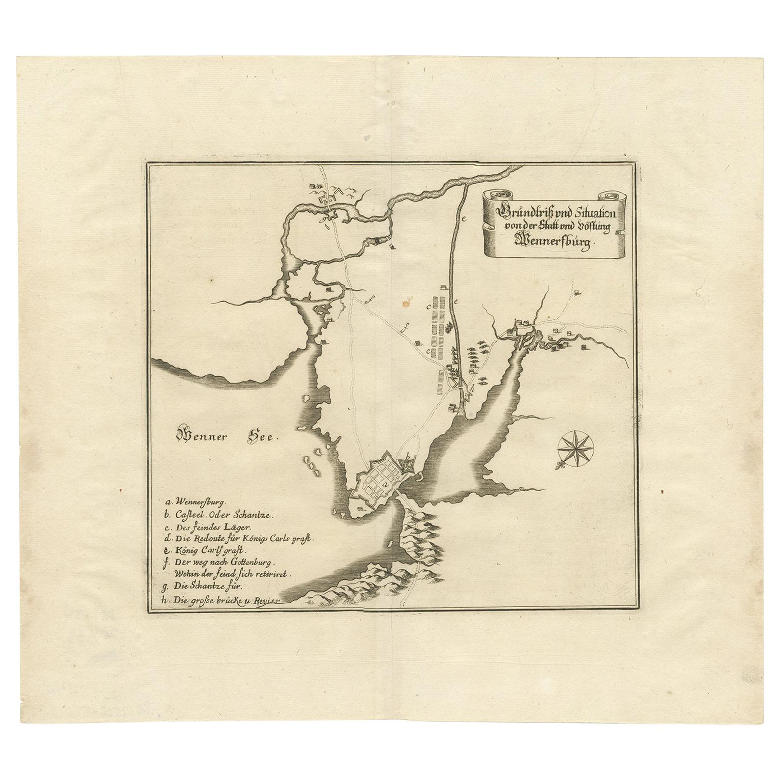
Antique Map of Vänersborg by Merian 'circa 1680'
Located in Langweer, NL
Antique map titled 'Grundtriss und Situation von der Statt und Vöstung Wennersburg'. Copper engraved plan of Vänersborg, Sweden. This map orginates from 'Theatrum Europaeum' by Meria...
Category
Antique Late 17th Century Maps
Materials
Paper
$282 Sale Price
20% Off
Original Hand-Colored Antique Map of Africa by Elwe '1792'
Located in Langweer, NL
Antique map titled 'l'Afrique Divisée en ses Empires, Royaumes, et Etats'. Decorative large map of Africa. The cartography is typical for the 17th century with the Nile originating i...
Category
Antique Late 18th Century Maps
Materials
Paper

$940 Sale Price
20% Off
Original Hand-colored Antique Map of Denmark by S. Neele, 1790
Located in Langweer, NL
Antique very decorative engraving of Denmark engraved by S. Neele. Published in November 1790 by John Trusler. Tape on verso.
Category
Antique Late 18th Century Maps
Materials
Paper

$197 Sale Price
20% Off
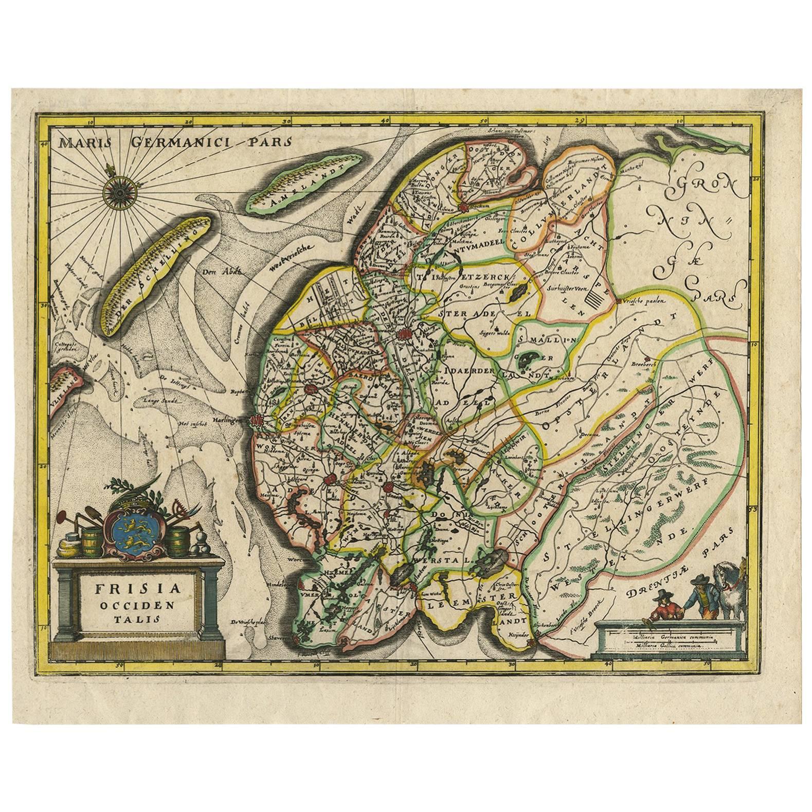
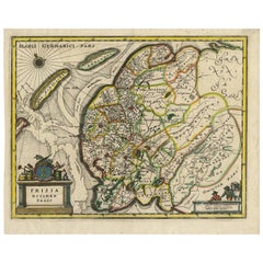
Original Antique Hand-Colored Map of Friesland by C. Merian, 1659
Located in Langweer, NL
This is a hand-colored engraving of the province of Friesland in the Netherlands, created by the Swiss-born engraver and artist Matthäus Merian (1593–1650) and included in "Topograph...
Category
Antique Mid-17th Century Maps
Materials
Paper
You May Also Like
Original Antique Map of South America. C.1780
Located in St Annes, Lancashire
Great map of South America
Copper-plate engraving
Published C.1780
Two small worm holes to left side of map
Unframed.
Category
Antique Early 1800s English Georgian Maps
Materials
Paper

North & South America: A 17th Century Hand-colored Map by Jansson & Goos
By Johannes Janssonius
Located in Alamo, CA
A 17th century hand-colored map of North & South America entitled "Americae Descriptio" by the cartographer Johannes Jansson, published in Jansson's Atlas Minor in Amsterdam in 1628....
Category
Antique 1620s Dutch Maps
Materials
Paper

South America: Hand-colored 18th Century Framed Map by Thomas Jefferys
By Thomas Jefferys
Located in Alamo, CA
This detailed hand-colored map of South America by Thomas Jefferys was published in London in 1750. The map shows countries, early colonial possessions, towns, rivers, mountains, and...
Category
Antique Mid-18th Century English Maps
Materials
Paper

Original Antique Map of Central America / Florida, Arrowsmith, 1820
Located in St Annes, Lancashire
Great map of Central America.
Drawn under the direction of Arrowsmith.
Copper-plate engraving.
Published by Longman, Hurst, Rees, Orme and Brown, 1820
Unframed.
Category
Antique 1820s English Maps
Materials
Paper

Original Antique Map of Spain and Portugal, circa 1790
Located in St Annes, Lancashire
Super map of Spain and Portugal
Copper plate engraving by A. Bell
Published, circa 1790.
Unframed.
Category
Antique 1790s English Other Maps
Materials
Paper

England, Scotland & Ireland: A Hand Colored Map of Great Britain by Tirion
By Isaak Tirion
Located in Alamo, CA
This is a hand-colored double page copperplate map of Great Britain entitled "Nieuwe Kaart van de Eilanden van Groot Brittannien Behelzende de Kon...
Category
Antique Mid-18th Century Dutch Maps
Materials
Paper

Recently Viewed
View AllMore Ways To Browse
Nesting Bench
News Rack
Niels Moller 56
No Moller 78
Norman Cherner Pretzel
North American Cherry Benches
North American Fiberglass Benches
North American Rosewood Dining Room Chairs
Oak Library Ladder
Oak Octagon End Table
Oak Parquetry Coffee Table
Octagonal Book Table
Oddities And Curiosities
Off White Umbrella
Old Vintage Coolers
Ole Bjorn Kruger
Ole Wanscher Senator France
Olivetti Spazio