Items Similar to Quebec Antique Railroad Map c.1888 – La Belle Province, Cities & Towns
Video Loading
Want more images or videos?
Request additional images or videos from the seller
1 of 11
Quebec Antique Railroad Map c.1888 – La Belle Province, Cities & Towns
$548.74
£405.69
€460
CA$754.78
A$838.99
CHF 439.78
MX$10,246.07
NOK 5,490.39
SEK 5,165.43
DKK 3,501.97
About the Item
Antique Map of Quebec, Canada – Rand McNally, circa 1888
This antique map of Quebec was published by Rand, McNally & Co. around 1888. Drawn from their late 19th-century atlas series, it presents a detailed portrait of the province, with emphasis on its railroads, towns, rivers, and geographic features.
The map focuses on southern Quebec, stretching from the U.S. border to the Gulf of St. Lawrence, with Montreal, Quebec City, and Trois-Rivières prominently marked. The St. Lawrence River dominates the composition, engraved with fine wave patterns and carefully tracing its many tributaries and islands. Anticosti Island is included at the top, while the Ottawa River and cross-border towns illustrate Quebec’s close links with Ontario and the northeastern United States.
Railroads, shown in red and blue, form a dense network around Montreal and Quebec City, extending outward to connect the province with Ontario, New Brunswick, and New England. This reflects Quebec’s growing role as both an industrial center and a key transportation hub in the late 19th century.
Smaller settlements, rivers, and lakes are finely drawn, capturing both the inhabited south and the more rugged northern expanses. The map is historically significant as it portrays Quebec during a formative period of industrial and cultural development.
Condition report:
Very good condition with light toning and faint darkening along the original center fold. Plate mark visible. Clean margins with only minor handling wear. Strong impression with crisp engraved detail.
Framing tips:
A walnut or dark oak frame with a cream mat will highlight the engraving. A double mat with ivory outer and muted blue inner will emphasize the waterways of the St. Lawrence River, creating a balanced presentation.
Technique: Lithograph with original outline color
Maker: Rand, McNally & Co., Chicago, circa 1888
- Dimensions:Height: 14.18 in (36 cm)Width: 20.67 in (52.5 cm)Depth: 0.01 in (0.2 mm)
- Materials and Techniques:Paper,Engraved
- Place of Origin:
- Period:
- Date of Manufacture:1888
- Condition:Very good condition with light toning and faint darkening along the original center fold. Plate mark visible. Clean margins with only minor handling wear. Strong impression with crisp engraved detail.
- Seller Location:Langweer, NL
- Reference Number:Seller: BG-12794-111stDibs: LU3054346475682
About the Seller
5.0
Recognized Seller
These prestigious sellers are industry leaders and represent the highest echelon for item quality and design.
Platinum Seller
Premium sellers with a 4.7+ rating and 24-hour response times
Established in 2009
1stDibs seller since 2017
2,604 sales on 1stDibs
Typical response time: <1 hour
- ShippingRetrieving quote...Shipping from: Langweer, Netherlands
- Return Policy
Authenticity Guarantee
In the unlikely event there’s an issue with an item’s authenticity, contact us within 1 year for a full refund. DetailsMoney-Back Guarantee
If your item is not as described, is damaged in transit, or does not arrive, contact us within 7 days for a full refund. Details24-Hour Cancellation
You have a 24-hour grace period in which to reconsider your purchase, with no questions asked.Vetted Professional Sellers
Our world-class sellers must adhere to strict standards for service and quality, maintaining the integrity of our listings.Price-Match Guarantee
If you find that a seller listed the same item for a lower price elsewhere, we’ll match it.Trusted Global Delivery
Our best-in-class carrier network provides specialized shipping options worldwide, including custom delivery.More From This Seller
View AllManitoba Antique Railroad Map c.1888 – Keystone Province Cities & Towns
Located in Langweer, NL
Antique Map of Manitoba, Canada – Rand McNally, circa 1888
Description:
This antique map of Manitoba was published by Rand, McNally & Co. around 1888. It offers a detailed look at t...
Category
Antique Late 19th Century American Maps
Materials
Paper
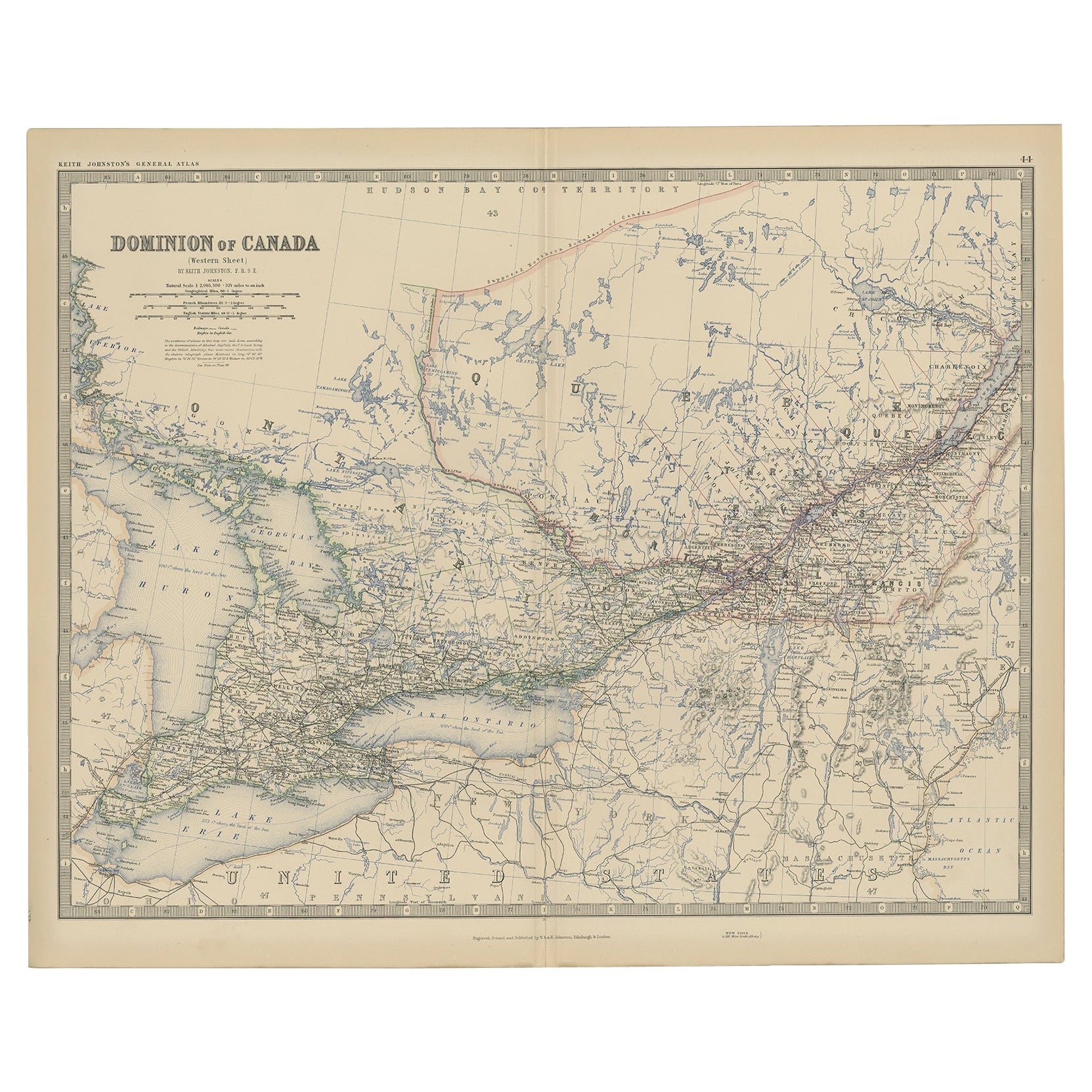
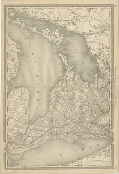
Ontario Antique Map c.1888 – Western Counties, Heartland Province Railroads
Located in Langweer, NL
Antique Map of Western Ontario, Canada – Rand McNally, circa 1888
This antique map of western Ontario was published by Rand, McNally & Co. around 1888. Labeled “Ontario No. 1,” it p...
Category
Antique Late 19th Century American Maps
Materials
Paper
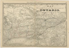
Eastern Ontario Antique Map c.1888 – The Heartland Province, Railroads
Located in Langweer, NL
Antique Map of Eastern Ontario, Canada – Rand McNally, circa 1888
This antique map of eastern Ontario was published by Rand, McNally & Co. around 1888. Labeled “Ontario No. 2,” it p...
Category
Antique Late 19th Century American Maps
Materials
Paper
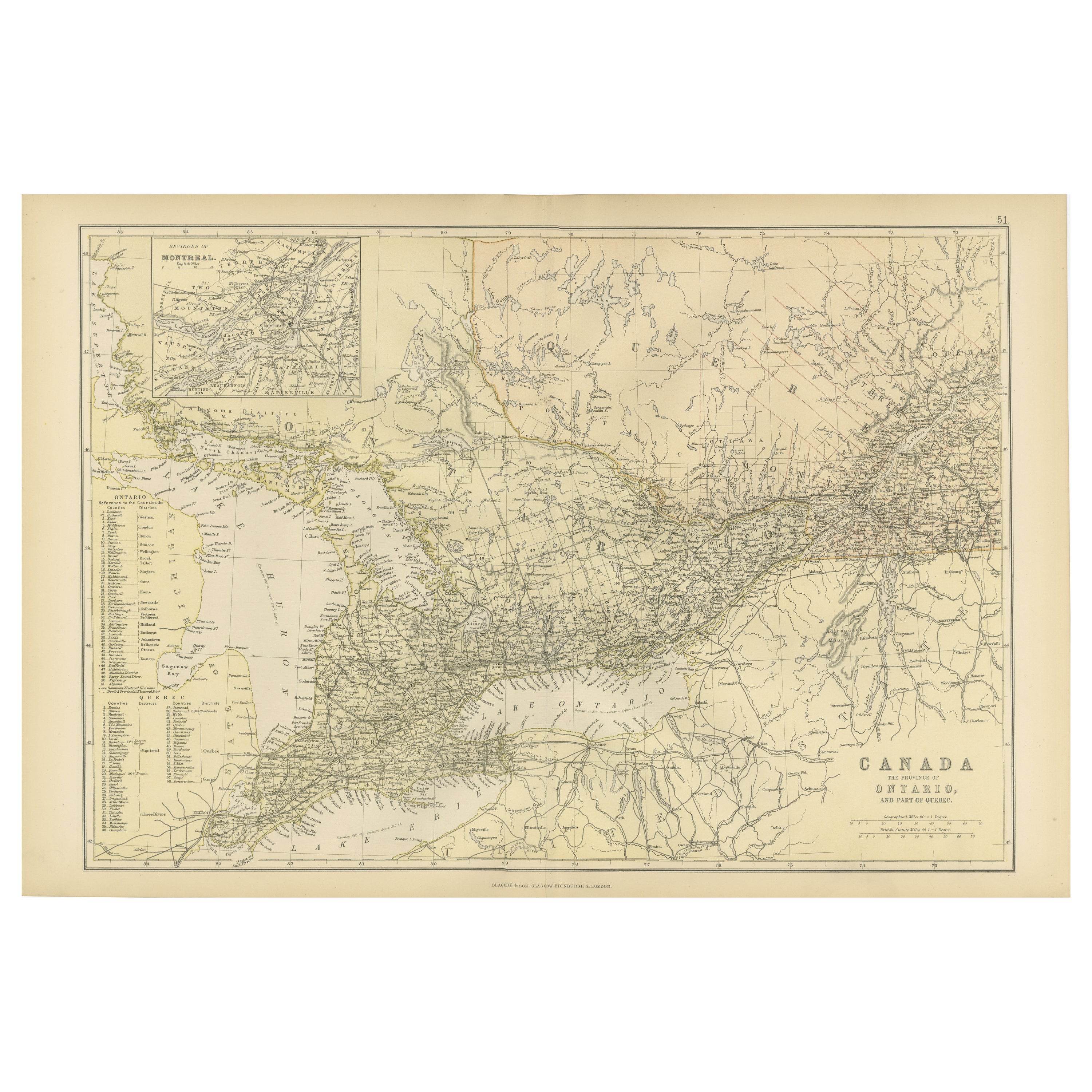
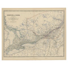
Antique Map of Canada, The Province of Ontario and Part of Quebec, 1882
Located in Langweer, NL
This is a historical map from the 1882 Blackie Atlas, this time detailing "The Province of Ontario, and Part of Quebec" in Canada. The map presents a detailed illustration of Ontario...
Category
Antique 1880s Maps
Materials
Paper

$238 Sale Price
20% Off
Free Shipping
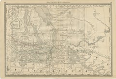
Old Original Antique Map of Western Canada, 1882
Located in Langweer, NL
Antique map titled 'Dominion of Canada'.
Old map of Western Canada. This map originates from 'The Royal Atlas of Modern Geography, Exhibiting, in a ...
Category
Antique 1880s Maps
Materials
Paper
$267 Sale Price
20% Off
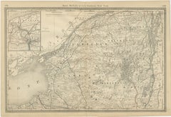
Antique Map of Northern New York – Rand McNally, circa 1888
Located in Langweer, NL
Antique Map of Northern New York – Rand McNally, circa 1888
This antique map of northern New York was published by Rand, McNally & Co. around 1888. Taken from one of their late 19th...
Category
Antique Late 19th Century American Maps
Materials
Paper
You May Also Like
Quebec. Canada. Century Atlas antique vintage map
Located in Melbourne, Victoria
'The Century Atlas. Quebec'
Original antique map, 1903.
Inset maps 'Sketch Map of Quebec', Quebec and Vicinity; and 'Montreal and Vicinity'.
Central fo...
Category
Early 20th Century Victorian More Prints
Materials
Lithograph

Large Original Antique City Plan of Montreal, Canada, circa 1900
By Rand McNally & Co.
Located in St Annes, Lancashire
Fabulous colorful map of Montreal
Original color
By Rand, McNally & Co.
Published, circa 1900
Unframed
Minor edge tears
Free shipping.
Category
Antique Early 1900s American Maps
Materials
Paper

Original Antique Map of New Brunswick and Nova Scotia, 1889
Located in St Annes, Lancashire
Great map of New Brunswick and Nova Scotia
Drawn and Engraved by W. & A.K. Johnston
Published By A & C Black, Edinburgh.
Original colour
Unfr...
Category
Antique 1880s Scottish Victorian Maps
Materials
Paper

Canada and Newfoundland. Century Atlas antique vintage map
Located in Melbourne, Victoria
'The Century Atlas. Dominion of Canada and Newfoundland.'
Original antique map, 1903.
Central fold as issued. Map name and number printed on the reverse corners.
Sheet 29.5cm by 40...
Category
Early 20th Century Victorian More Prints
Materials
Lithograph

Large Original Antique Map of New York State ( Northern ), USA, C.1900
Located in St Annes, Lancashire
Fabulous map of Northern New York
Original color.
Engraved and printed by the George F. Cram Company, Indianapolis.
Published, C.1900.
Unframed.
Repairs to minor edge tears
Fr...
Category
Antique 1890s American Maps
Materials
Paper
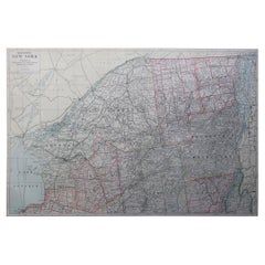
Original Antique Map of the American State of New York ( Western Part ) 1903
Located in St Annes, Lancashire
Antique map of New York ( Western Part )
Published By A & C Black. 1903
Original colour
Good condition
Unframed.
Free shipping
Category
Antique Early 1900s English Maps
Materials
Paper
