Items Similar to Rare 1572 Map of Ancient Rome with Monuments by Ligorio, Braun & Hogenberg
Want more images or videos?
Request additional images or videos from the seller
1 of 10
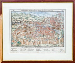
Rare 1572 Map of Ancient Rome with Monuments by Ligorio, Braun & Hogenberg
$2,264.55
£1,676.89
€1,900
CA$3,114.10
A$3,463.68
CHF 1,812.82
MX$42,245.46
NOK 22,778.69
SEK 21,426.30
DKK 14,465.29
About the Item
Rare 1572 Map of Ancient Rome with Monuments by Ligorio, Braun & Hogenberg
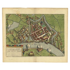
This remarkable 16th-century map, *Urbis Romae Situs cum ils quae adhuc Conspiciuntur Veter. Monumet Reliquiis*, was created by the Italian architect and antiquarian Pyrrho Ligorio and published by Braun and Hogenberg in 1572. It is a visually captivating depiction of ancient Rome, complete with its topographical layout, monuments, and surviving antiquities from the Roman Empire.
The map intricately portrays the city as it was imagined in antiquity, highlighting famous landmarks such as the Colosseum, the Roman Forum, the Circus Maximus, and the Pantheon. Rivers, bridges, temples, theaters, and public baths are labeled, with meticulous attention to detail. Ligorio’s expertise in Roman archaeology is evident, as he combined historical accuracy with artistic embellishments.
The hand-colored engraving features the ancient city walls, the Tiber River, and surrounding areas, offering a unique glimpse into the Renaissance interpretation of ancient Rome. In the lower-right corner, elegantly dressed figures add a human scale to the illustration, further enhancing its charm.
This map is a fine example of Renaissance cartography, blending historical knowledge with decorative artistry. Braun and Hogenberg’s Civitates Orbis Terrarum, where this map appeared, was one of the most important and influential city atlas collections of the 16th century.
Condition: very good condition with vivid hand-coloring and crisp engraving. Margins are clean and the map is free from significant imperfections.
Matting and Framing Tips: Use acid-free matting and UV-protective glass to preserve its colors and paper. A gold-accented or dark wood frame will enhance its antique appeal. Ensure proper spacing between the glass and the map to prevent damage. Display in a low-light environment, away from direct sunlight and humidity, to maintain its excellent condition.
- Dimensions:Height: 16.62 in (42.2 cm)Width: 21.86 in (55.5 cm)Depth: 0.01 in (0.2 mm)
- Materials and Techniques:Paper,Engraved
- Place of Origin:
- Period:
- Date of Manufacture:1572
- Condition:Condition: very good condition with vivid hand-coloring and crisp engraving. Margins are clean and the map is free from significant imperfections. French text on Reverse. Study the images carefully.
- Seller Location:Langweer, NL
- Reference Number:Seller: BHZ127051stDibs: LU3054343448222
About the Seller
5.0
Recognized Seller
These prestigious sellers are industry leaders and represent the highest echelon for item quality and design.
Platinum Seller
Premium sellers with a 4.7+ rating and 24-hour response times
Established in 2009
1stDibs seller since 2017
2,599 sales on 1stDibs
Typical response time: <1 hour
- ShippingRetrieving quote...Shipping from: Langweer, Netherlands
- Return Policy
Authenticity Guarantee
In the unlikely event there’s an issue with an item’s authenticity, contact us within 1 year for a full refund. DetailsMoney-Back Guarantee
If your item is not as described, is damaged in transit, or does not arrive, contact us within 7 days for a full refund. Details24-Hour Cancellation
You have a 24-hour grace period in which to reconsider your purchase, with no questions asked.Vetted Professional Sellers
Our world-class sellers must adhere to strict standards for service and quality, maintaining the integrity of our listings.Price-Match Guarantee
If you find that a seller listed the same item for a lower price elsewhere, we’ll match it.Trusted Global Delivery
Our best-in-class carrier network provides specialized shipping options worldwide, including custom delivery.More From This Seller
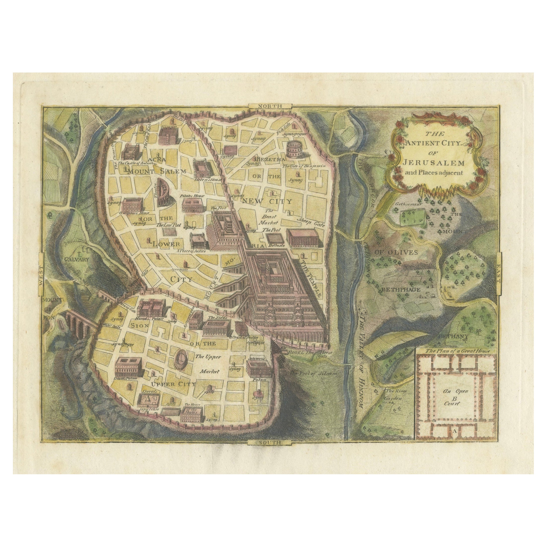
View AllThe Antient City of Jerusalem and Places Adjacent, Hand-Colored Map, 1699
Located in Langweer, NL
Title: "1699 Hand-Colored Bird's-Eye Plan of Jerusalem with Ancient and Biblical Landmarks"
This beautifully hand-colored, imaginary bird's-eye plan of Jerusalem, published in 1699,...
Category
Antique 1690s Maps
Materials
Paper
$247 Sale Price
20% Off
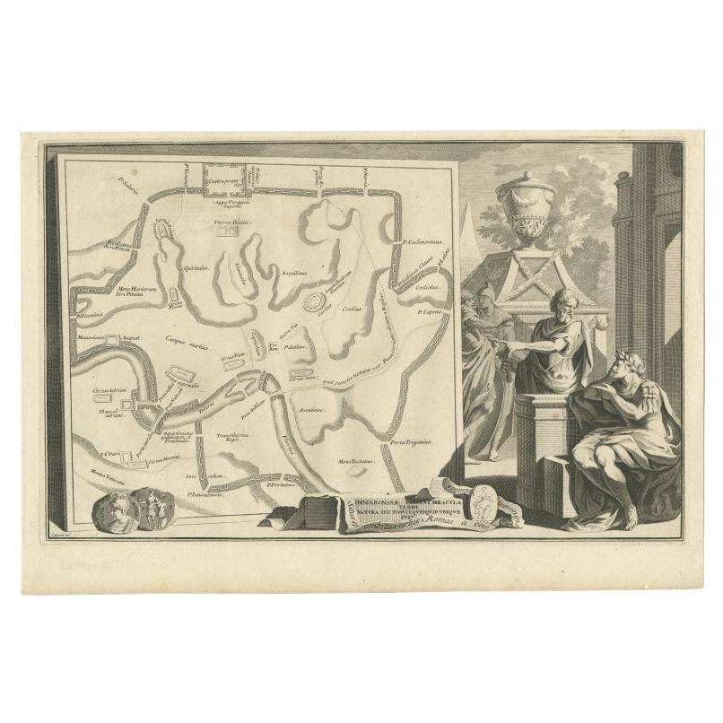
Old Map of Ancient Rome Illustrating Major Monuments and the Seven Hills, c.1704
Located in Langweer, NL
Antique map Rome titled 'Omnia Romanae cedant Miracula Terrae (..)'. Map of Ancient Rome Illustrating Major Monuments and the Seven Hills. This map or...
Category
Antique 18th Century Maps
Materials
Paper
$362 Sale Price
20% Off
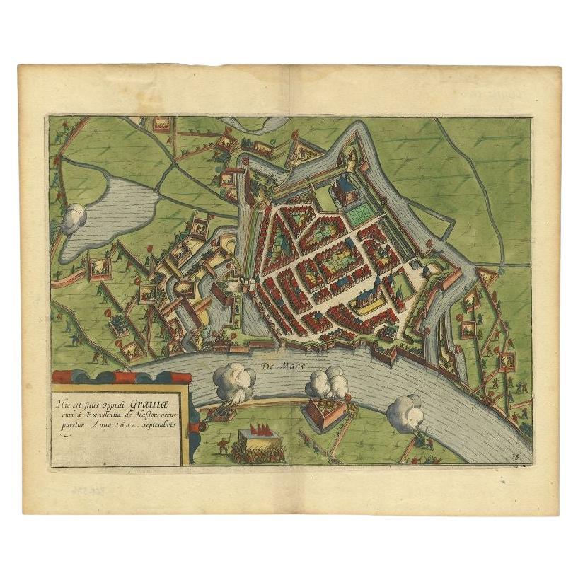
Antique Plan of the Siege of Grave by Guicciardini, c.1608
Located in Langweer, NL
Antique map titled 'Hic est situs oppidi Grauiae (..)'. Bird's eye view plan of Grave, The Netherlands, Holland. Showing the siege of Grave in the year 1602. Source unknown, to be de...
Category
Antique 17th Century Maps
Materials
Paper
$457 Sale Price
20% Off
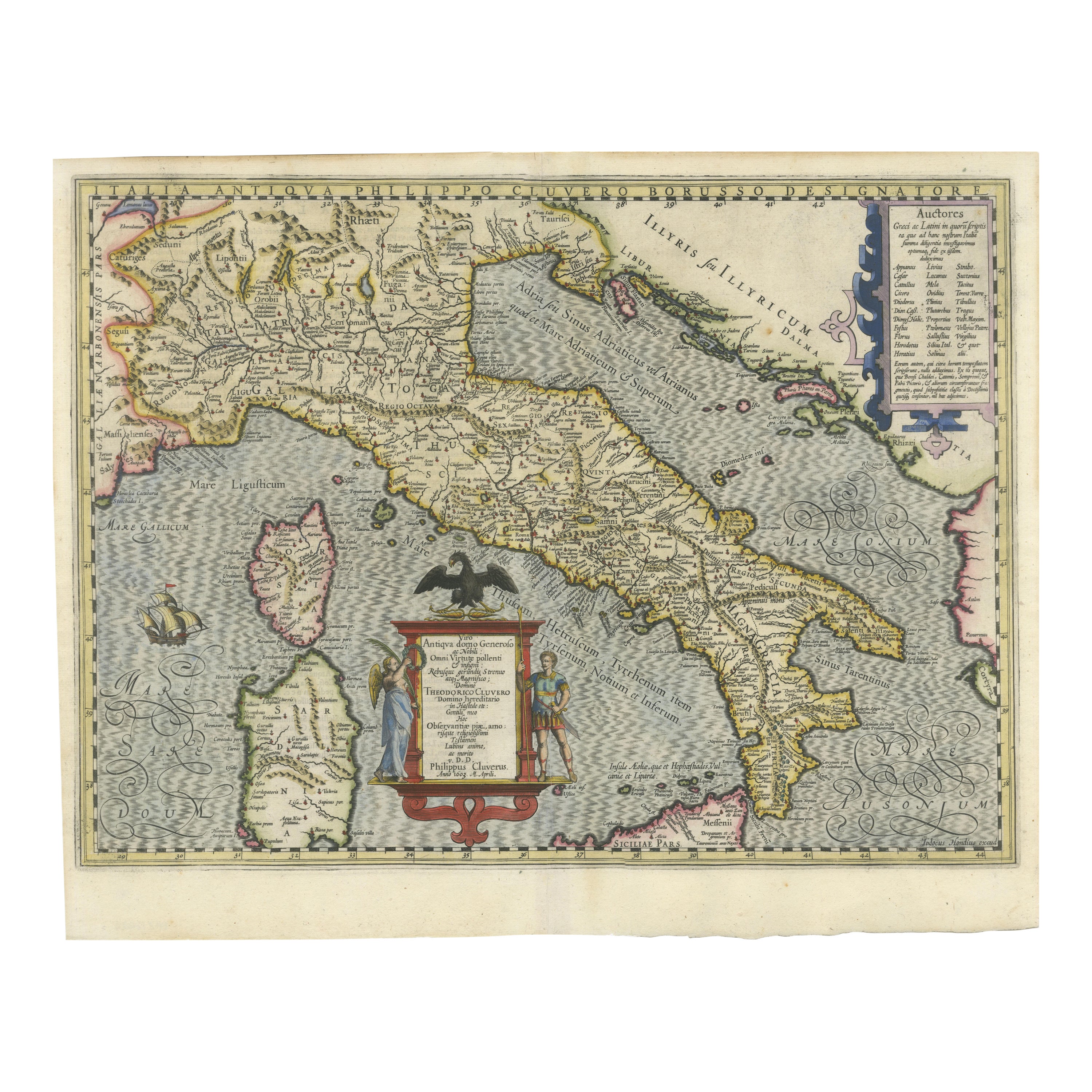
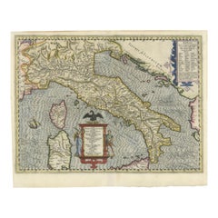
Italia Antiqua Philippo Cluvero – 1603 Hondius Map of Ancient Italy, Handcolored
Located in Langweer, NL
Italia Antiqua Philippo Cluvero – 1603 Hondius Map of Ancient Italy with Hand Color
This stunning early 17th-century map, *Italia Antiqua Philippo Cluvero Borusso Designatore*, wa...
Category
Antique Early 1600s Maps
Materials
Paper
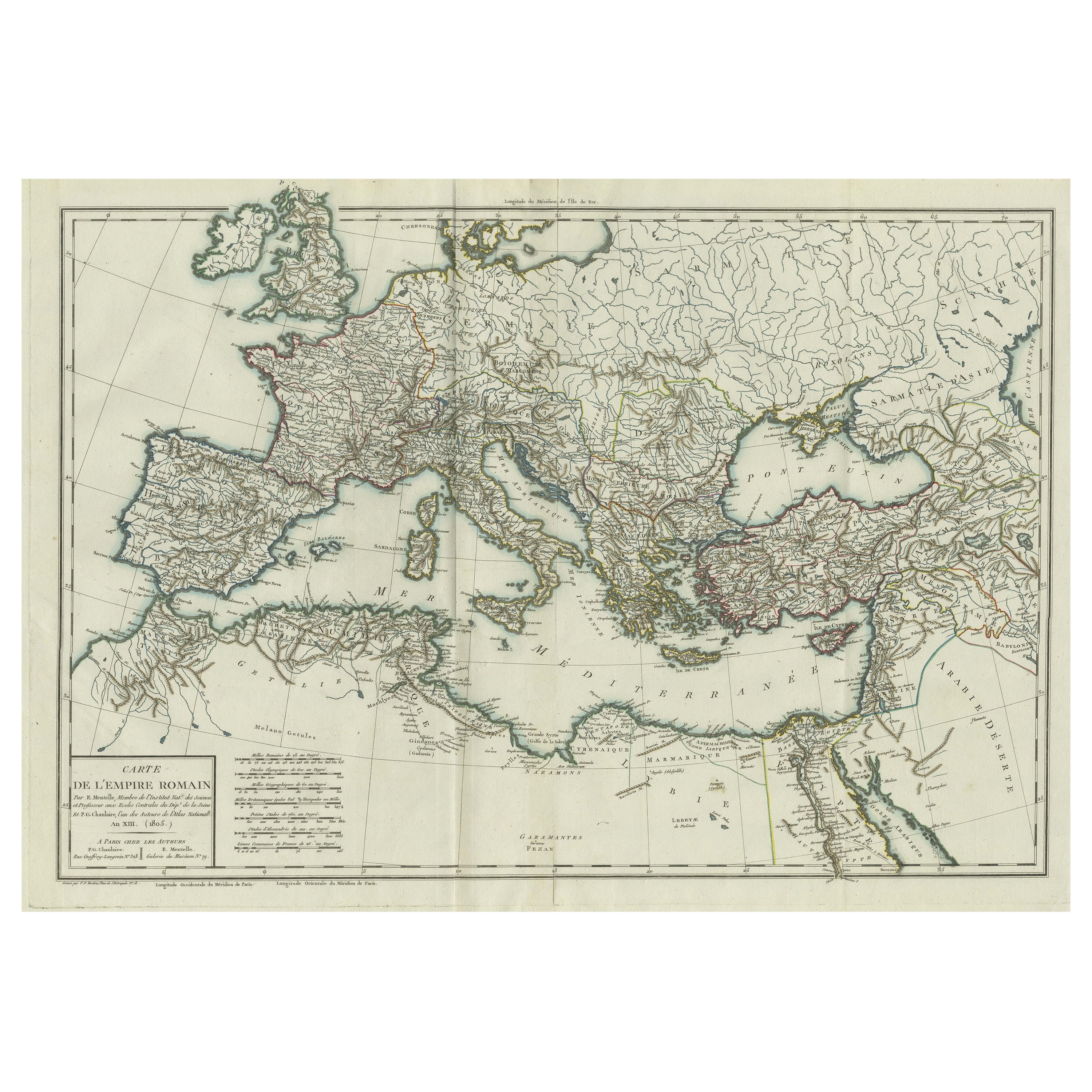
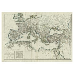
Original Antique Map of the Roman Empire
Located in Langweer, NL
Antique map titled 'Carte de l'Empire Romain'. Original antique map of the Roman Empire, two sheets joined. Engraved by Pierre Francois Tardieu and published by Edme Mentelle, circa ...
Category
Antique Late 18th Century Maps
Materials
Paper
$657 Sale Price
20% Off
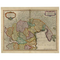
Antique Map of the Area Around Venice in Italy by H. Hondius, circa 1606
By Jodocus Hondius, Gerard Mercator
Located in Langweer, NL
Attractive and early map of the area around Venice, Italy. With South-Tirol in the North, areas of Krain (Slovenia), Croatia, Ferrara, Modena and Piacenza. In the east with areas aro...
Category
Antique Early 17th Century Dutch Maps
Materials
Paper
You May Also Like
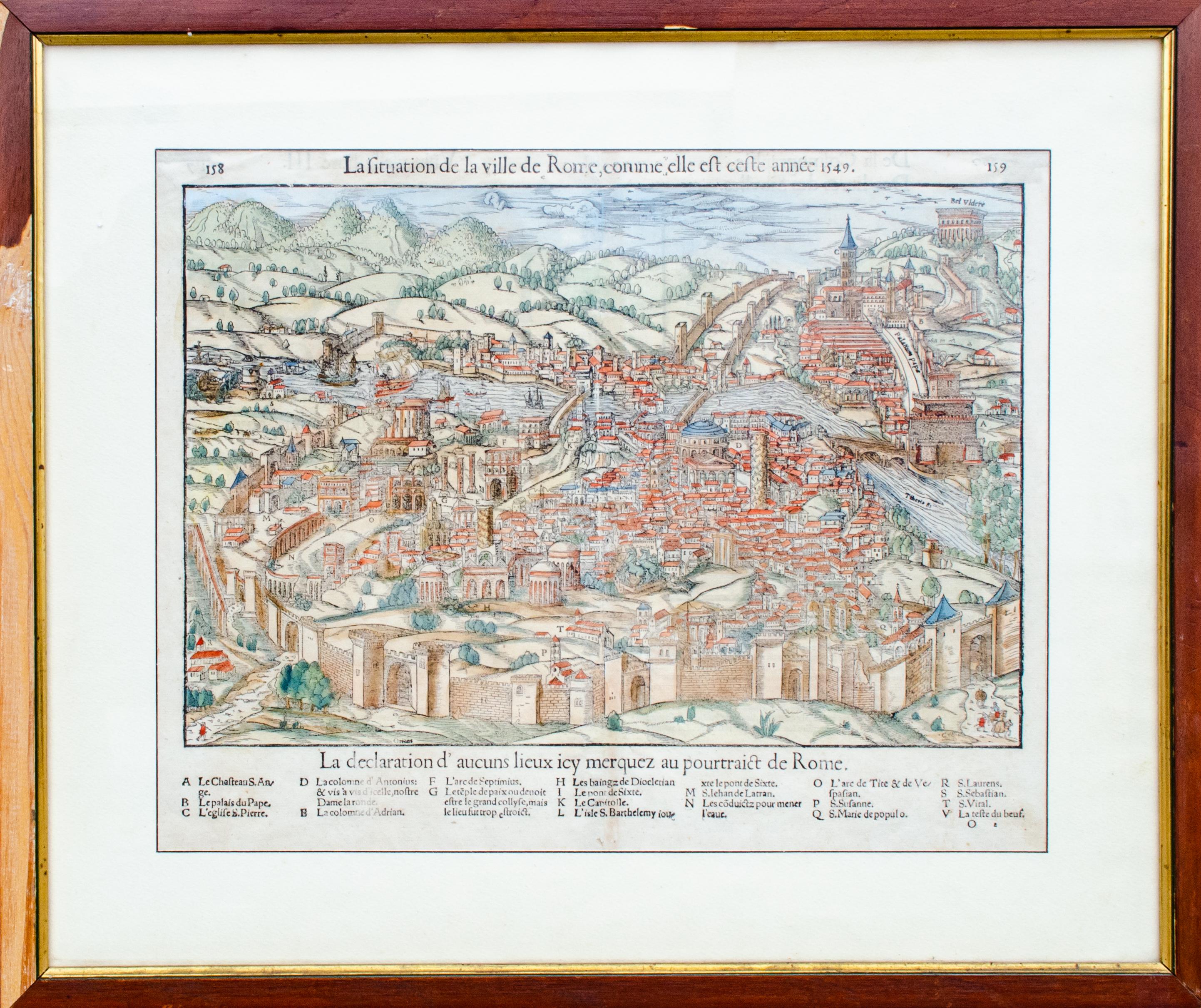
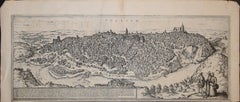
Antique Map of The City of Rome by Sebastian Münster, 1549
By Sebastian Münster
Located in New York, NY
Sebastian Münster (German, 1488-1552)
LA SITUATION DE LA VILLE DE ROME
Antique Map of Rome, 1549
Possibly printed in 1964
Print on paper
Publisher:...
Category
1960s Realist Figurative Prints
Materials
Woodcut
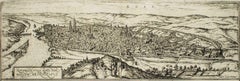
Toledo, Map from "Civitates Orbis Terrarum" - by F. Hogenberg - 1575
By Franz Hogenberg
Located in Roma, IT
Braun G., Hogenberg F., "Toledo", from the collection "Civitates Orbis Terrarum", Cologne, T. Graminaeus, 1572-1617. Image Dim: cm 19 x 48 , Dim: cm 22. 5 x 52.5 .
Very nice B/W Aquatint representing a View of Toledo...
Category
16th Century Figurative Prints
Materials
Etching, Aquatint
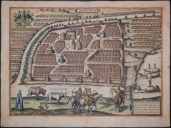
Original Antique Map or City Plan of Rome, Italy. Circa 1835
Located in St Annes, Lancashire
Nice map of Rome
Drawn and engraved by J.Dower
Published by Orr & Smith. C.1835
Unframed.
Free shipping
Category
Antique 1830s English Maps
Materials
Paper

1597 German Map of Alexandria by Georg Braun and Frans Hogenberg
By Georg Braun and Frans Hogenberg
Located in Chapel Hill, NC
1597 Map of Alexandria by Georg Braun and Frans Hogenberg, Germany. From "Civitas Orbis Terrarum", part 2, published in Cologne by Bertram Buchholz. Printed in 2 parts. Title: "Alexa...
Category
Antique 16th Century German Renaissance Maps
Materials
Paper

Rotomagus, Map from "Civitates Orbis Terrarum" - by F. Hogenberg - 1572/1617
By Franz Hogenberg
Located in Roma, IT
Rotomagus, from the collection Civitates Orbis Terrarum, Cologne, T. Graminaeus, 1572-1617.
Good conditions.
The “Civitates Orbis Terrarum” (Atlas of Cities of the World) was the se...
Category
16th Century Figurative Prints
Materials
Etching, Aquatint
Moscow /Moscovia Antique Map, Civitates Orbis Terrarum by Braun and Hogenberg
By Franz Hogenberg
Located in Roma, IT
Hand colored Etching from Civitates Orbis Terrarum. One of the first printed views of Moscow, and the first of Braun and Hogenberg,The table shows ...
Category
17th Century Landscape Prints
Materials
Watercolor, Etching
More Ways To Browse
Temple Rome Antique
16th Century Dress
Gold Frame 16th Century
Antique Forum
Circus Collectibles
Carlo Scarpa 1934 Chairs
Christofle Marly
1900 Antique Chairs
Glass Table Italian Round
Alvar Aalto Poster
Geometric Metal Table
Post Modern High Chairs
Vintage Vine Rug
Cancel An Order
Antique Framing Square
Silver Metal Chair
Swedish Kilim
Vintage Scandanavian Chairs