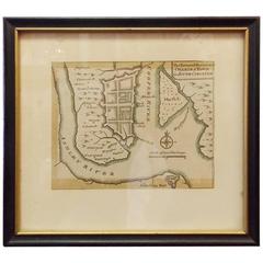
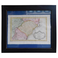
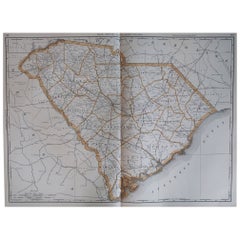
Rare Charleston, South Carolina Engraved Map "Town and Harbor, " Circa 1747
View Similar Items

Want more images or videos?
Request additional images or videos from the seller
1 of 6
Rare Charleston, South Carolina Engraved Map "Town and Harbor, " Circa 1747
About the Item
- Creator:Bowen (Maker)
- Dimensions:Height: 8.25 in (20.96 cm)Width: 9 in (22.86 cm)Depth: 1 in (2.54 cm)
- Style:American Colonial (Of the Period)
- Place of Origin:
- Period:1740-1749
- Date of Manufacture:Circa 1747
- Condition:Wear consistent with age and use.
- Seller Location:Hollywood, SC
- Reference Number:Seller: # 39411stDibs: LU88723226172
About the Seller
4.7
Vetted Seller
These experienced sellers undergo a comprehensive evaluation by our team of in-house experts.
Established in 1970
1stDibs seller since 2010
398 sales on 1stDibs
Typical response time: 11 hours
More From This SellerView All
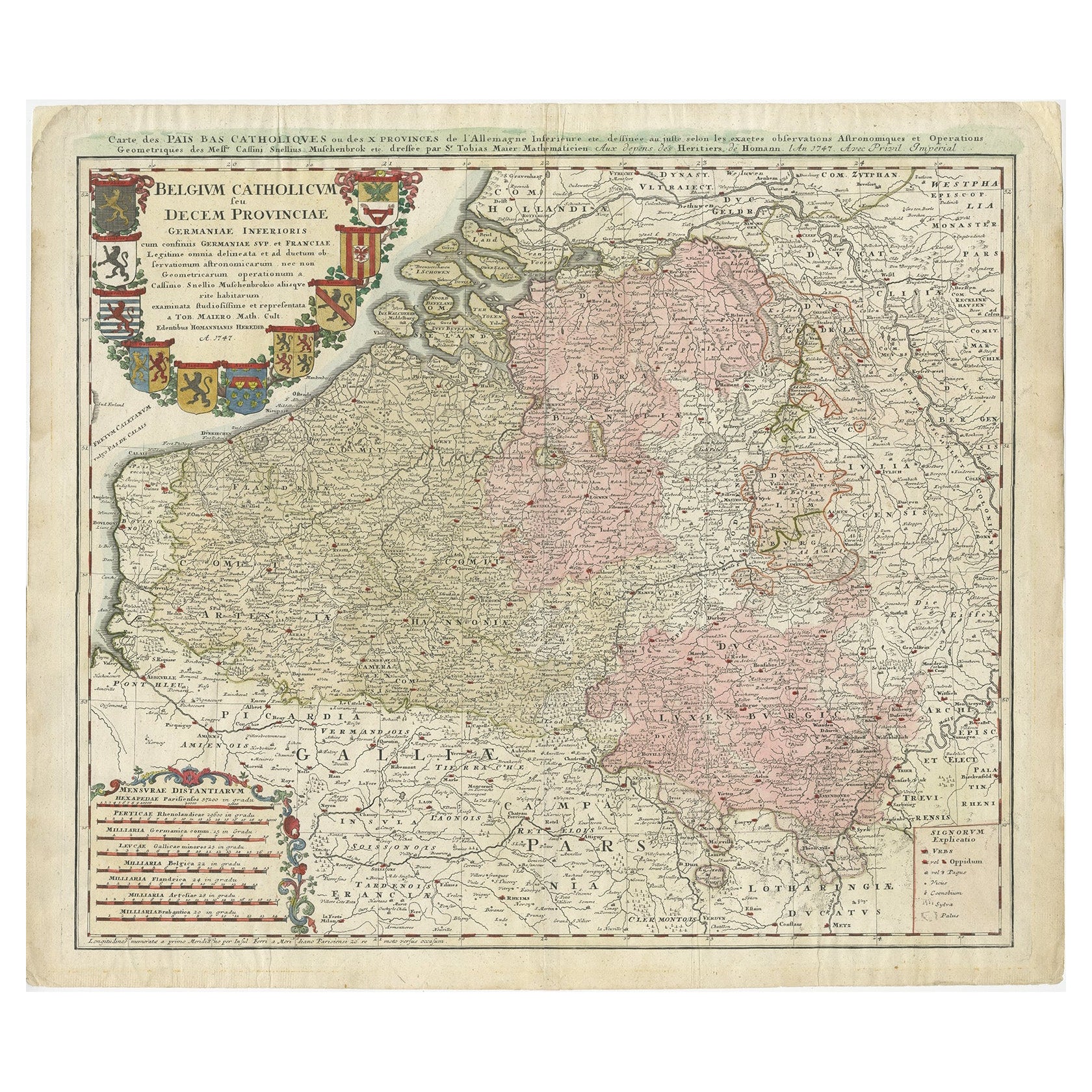
- French Framed Copper Engraved Hand Colored Map of Carolina & Georgia, Circa 1757Located in Hollywood, SCFrench copper engraved hand colored map of Carolina & Georgia matted under glass with a painted frame, mid-18th centuryCategory
Antique 1750s French Louis XV Maps
MaterialsPaper, Paint, Wood, Glass
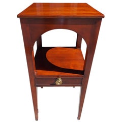
- Charleston Cherry Arched Frieze Basin Stand, South Carolina, Circa 1800Located in Hollywood, SCAmerican Cherry basin stand with carved arched friezes, single drawer with the original brass knob, and terminating on tapered squared inlaid double cuffed...Category
Antique Early 1800s American American Colonial Side Tables
MaterialsBrass
- English Engraved Hand Colored Map of the North Eastern United States, circa 1817Located in Hollywood, SCEnglish copper engraved hand colored map of the North Eastern United States matted under glass in a gilt frame, Early 19th Century. Drawn and Engraved for Thomson's New General Atlas...Category
Antique 1810s English George III Maps
MaterialsPaper, Paint, Giltwood, Glass
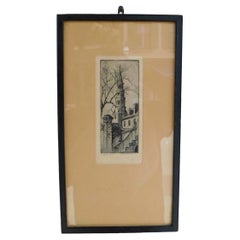
- Elizabeth O'Neil Verner Framed Etching St. Phillips Steeple, Charleston, SC 1925Located in Hollywood, SCElizabeth O'Neil Verner framed dry point etching of St. Phillips Church Steeple, Charleston, SC. Early 20th CenturyCategory
Vintage 1920s American Art Nouveau Drawings
MaterialsGlass, Wood, Paper
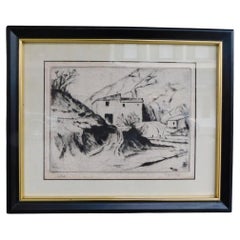
- American Dry Point Engraved Etching Italian House on Hill Side, A. Hutty C 1920By Alfred HuttyLocated in Hollywood, SCAmerican dry point engraved landscape etching Italian House on Hill Side, Alfred H. Hutty, Early 20th centuryCategory
Vintage 1920s American Modern Drawings
MaterialsPaper
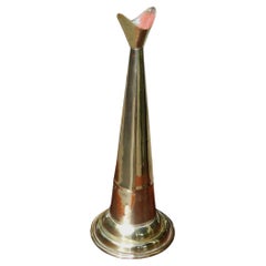
- American Cast Brass Engraved Yachtsman's Speaking Trumpet, Circa 1830Located in Hollywood, SCAmerican hand held cast brass engraved Yachtsman's speaking trumpet with bell shaped soldered mouthpiece, coned-shaped column with original interior red paint, and terminating on a r...Category
Antique 1830s American American Empire Nautical Objects
MaterialsBrass

You May Also Like
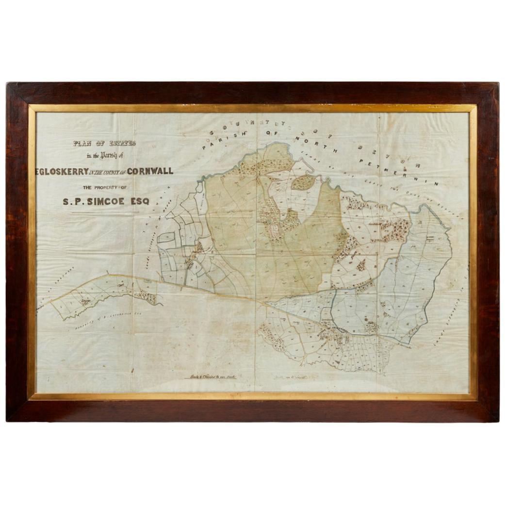
- Antique Framed Pen and Ink on Fabric Map of Cornwall from Early 19th CenturyLocated in Los Angeles, CAEarly 19th-century English pen-and-ink fabric map of Cornwall. With beautiful hand-drawn details and faded sepia tones, this framed piece turns history into art. England, circa 181...Category
Antique Early 19th Century English Drawings
MaterialsFabric, Walnut
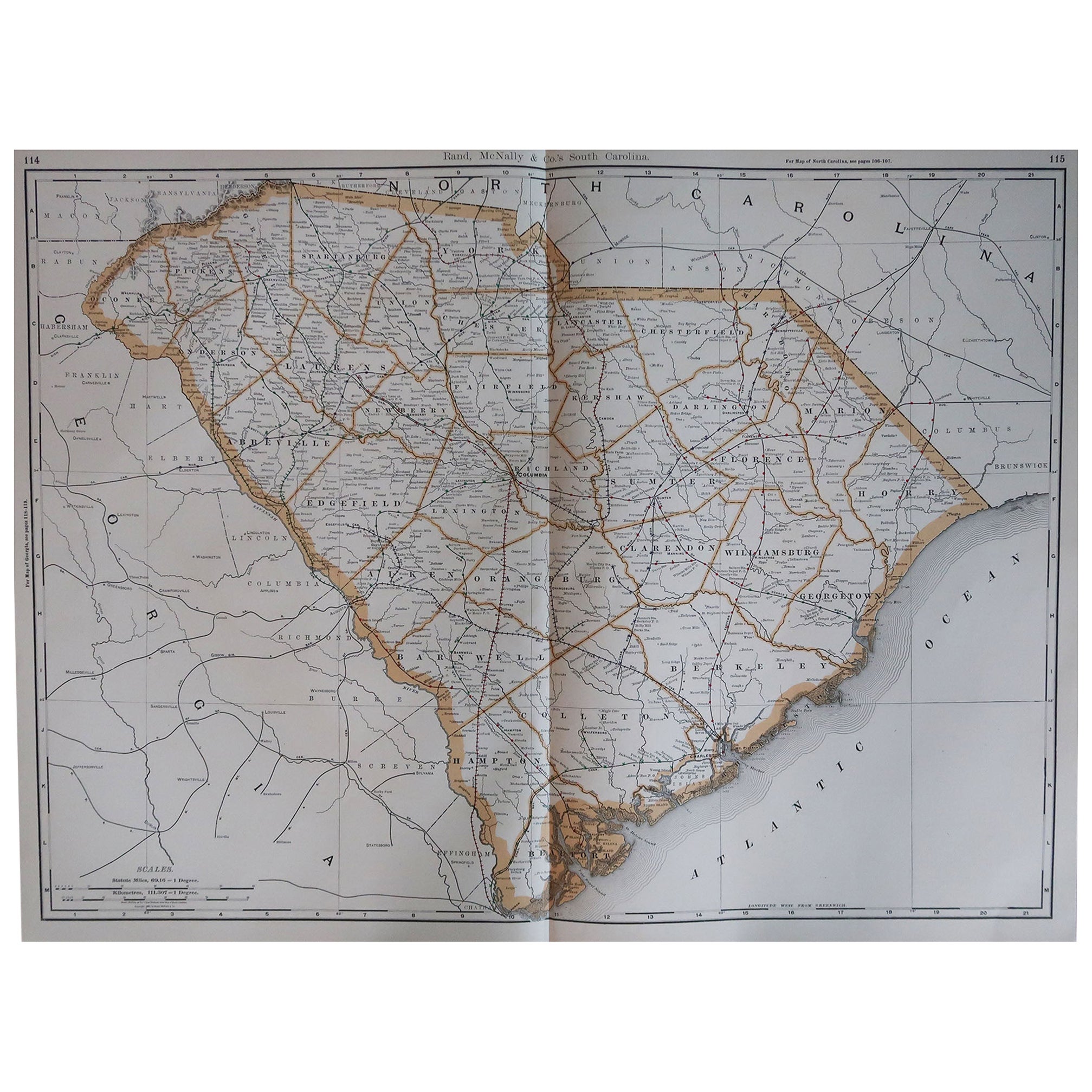
- Large Original Antique Map of South Carolina, USA, 1894By Rand McNally & Co.Located in St Annes, LancashireFabulous map of South Carolina Original color By Rand, McNally & Co. Published, 1894 Unframed Free shipping.Category
Antique 1890s American Maps
MaterialsPaper
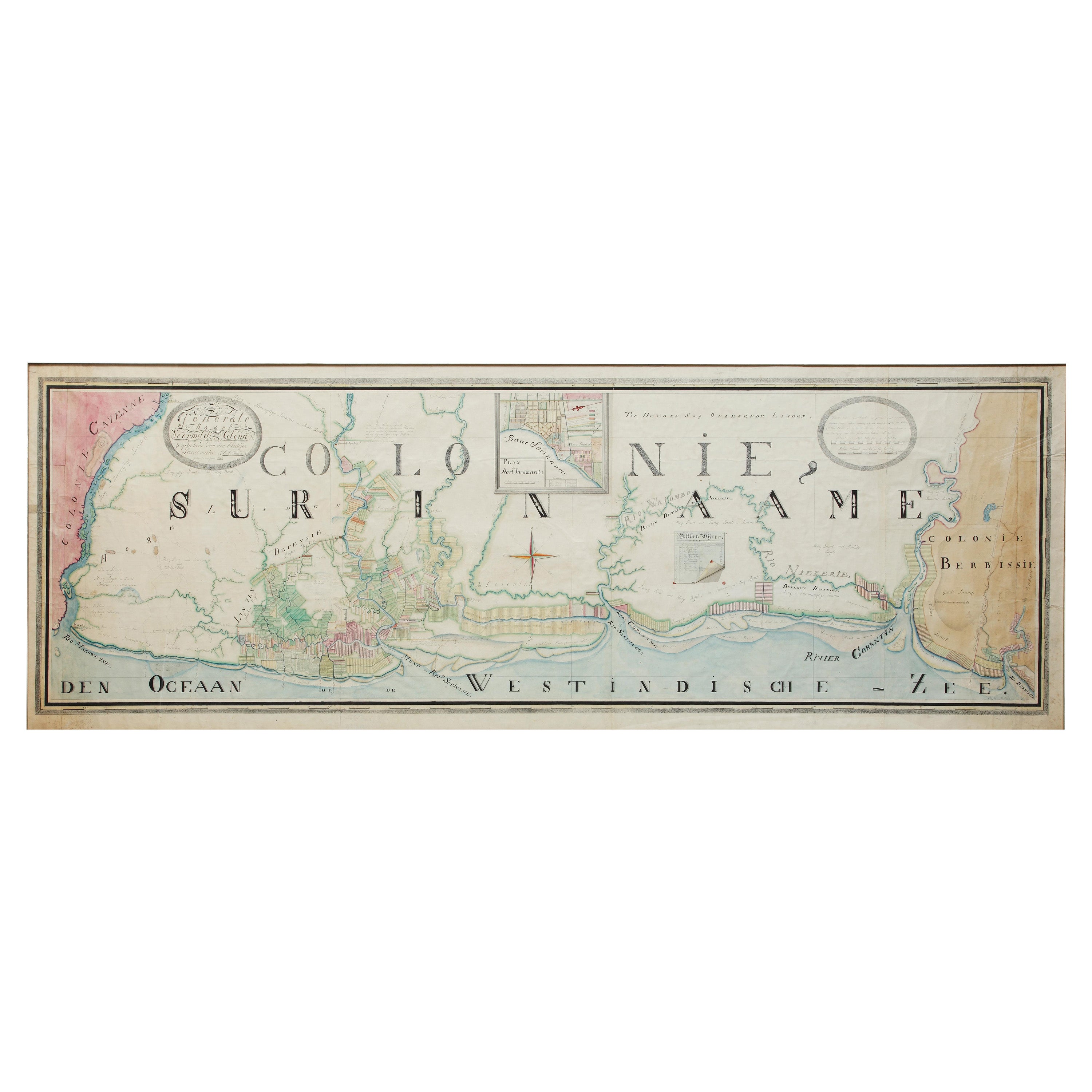
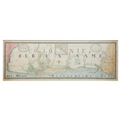
- Extremely Large Hand-Drawn Manuscript Map of Surinam, 1830, History of SlaveryLocated in Amsterdam, NLA unique large hand-drawn map of Surinam by Albrecht Helmut Hiemcke (German, 1760-1839) ? 'Colonie Surinaame', 1830 A large hand-drawn and coloured map of the colony of Suri...Category
Antique Mid-19th Century Surinamer Maps
MaterialsPaper
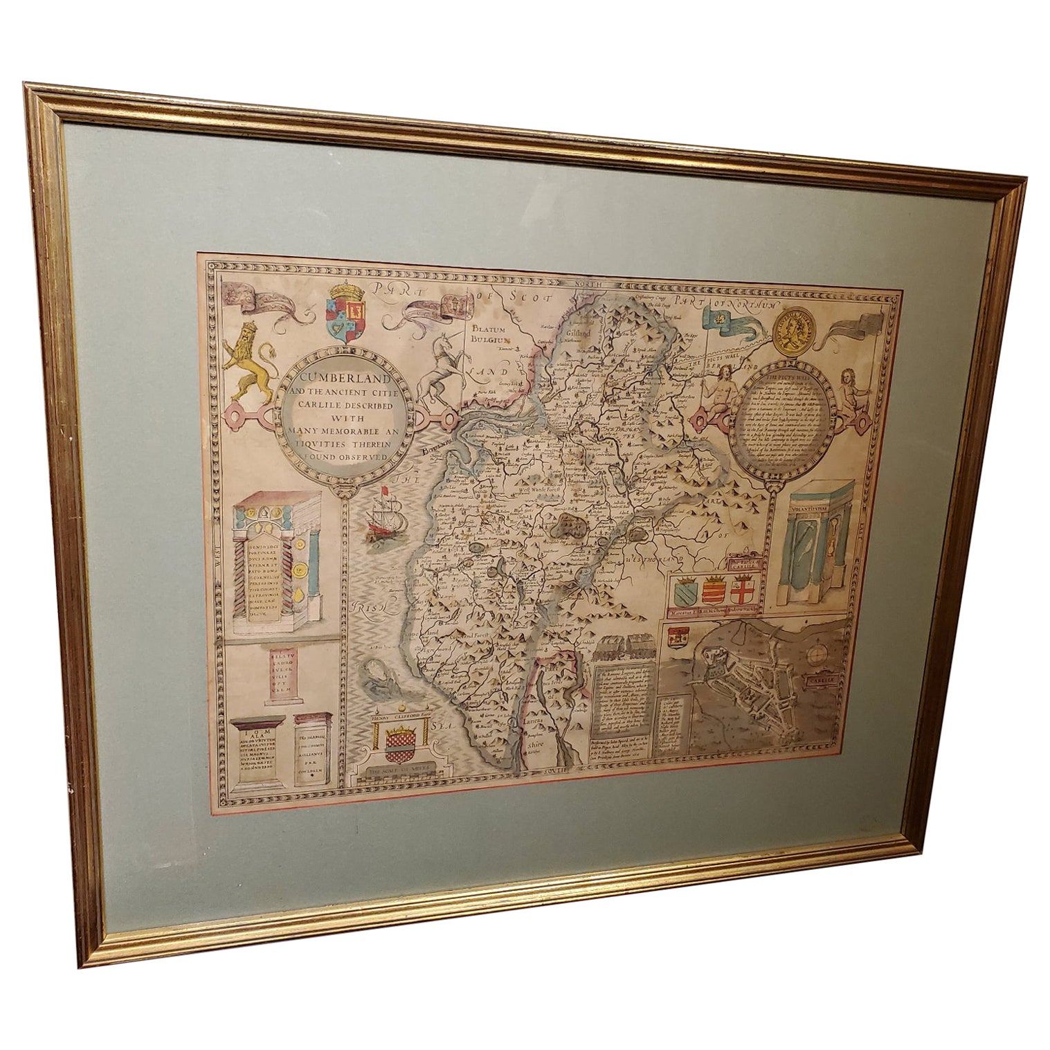
- 17th Century Map of Cumberland County in Northwest England Printed by John SpeedBy John SpeedLocated in Middleburg, VARare extremely early map of the county of Cumberland in the Northwest of England. Printed by John Speed, hand colored. Excellent condition. English. Dated...Category
Antique Early 17th Century English Maps
MaterialsPaper
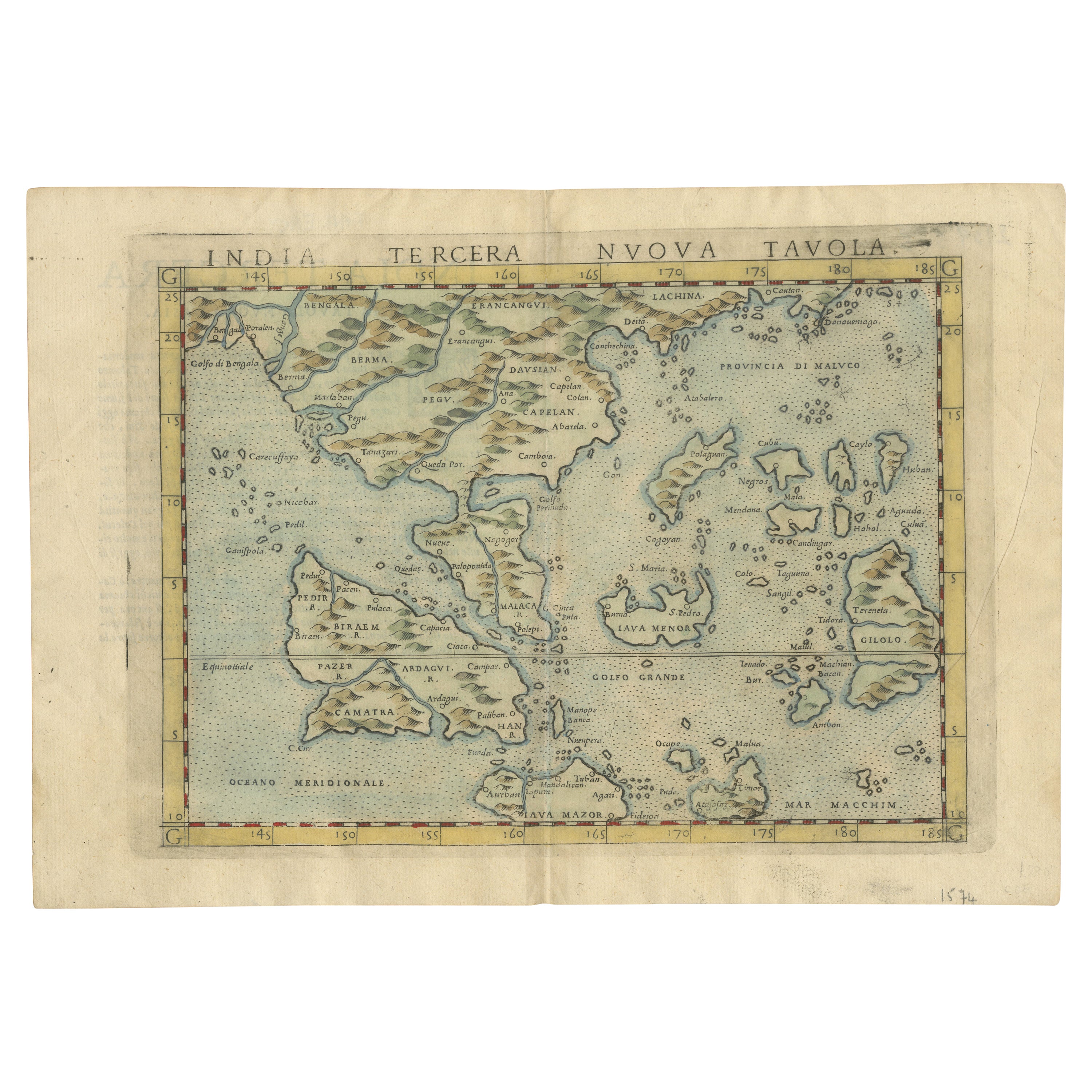
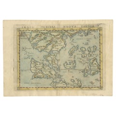
- Rare and Very Old Antique Map of South East Asia, Published circa 1574Located in Langweer, NLA very fine impression of this map of the Malay Peninsula, Sumatra, Java, with Singapore denoted as 'Cinca Pula'. Highly distorted and inaccurate map by Girolamo Ruscelli after J...Category
Antique 16th Century Maps
MaterialsPaper
 $1,055 Sale Price20% OffFree Shipping
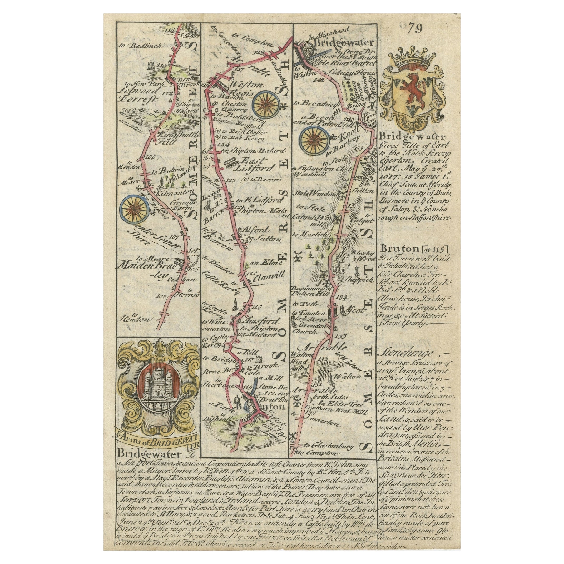
 - Rare Antique Map of the Route from Maiden Bridge to Dulverton, England, c.1720By BowenLocated in Langweer, NLAntique map titled 'Bridgewater, Bruton'. Double sided road strip map showing the route from Maiden Bridge to Dulverton, via Bruton, Weston Regis, Bridgewater and Dulverton. This map originates from 'Britannia Depicta or Ogilby Improv'd' by J. Owen and E. Bowen. Artists and Engravers: The Owen and Bowen road strip maps were based on the far larger ones done by John Ogilby in the 1670s. Each map was finely engraved by Emanuel Bowen, who was one of the most renowned and prolific map makers of the 18th century. The maps also had the added feature of copius amounts of information, written by John Owen...Category
Antique 18th Century Maps
MaterialsPaper
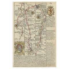 $123 Sale Price20% Off

Recently Viewed
View AllMore Ways To Browse
Charleston Used Office Furniture
Carolina Map
Antique South Carolina Map
Antique Map South Carolina
Antique Maps South Carolina
Antique South Carolina Maps
Antique Maps Of South Carolina
Map Of South Carolina
South Carolina Maps
South Carolina Map
Antique Blackwood Furniture
Antique Map Of New York City
Antique Maps Of New York City
Antique Linen Map
Boston Map
Map Of Boston
Malaysian Antique Furniture
Antique Furniture Malaysia