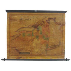
Small David Burr Wall Map of NY State 1829
View Similar Items


1 of 9
Small David Burr Wall Map of NY State 1829
About the Item
- Dimensions:Height: 23 in (58.42 cm)Width: 32 in (81.28 cm)Depth: 1 in (2.54 cm)
- Place of Origin:
- Period:
- Date of Manufacture:1839
- Condition:Wear consistent with age and use. Minor losses. Minor structural damages. Minor fading. Stable and displayable but fragile. considerable overall varnish darkening. splitting of paper and minor losses. dark staining to upper right into center and to the bottom left.
- Seller Location:North Egremont, MA
- Reference Number:1stDibs: LU91741502952
You May Also LikeView All
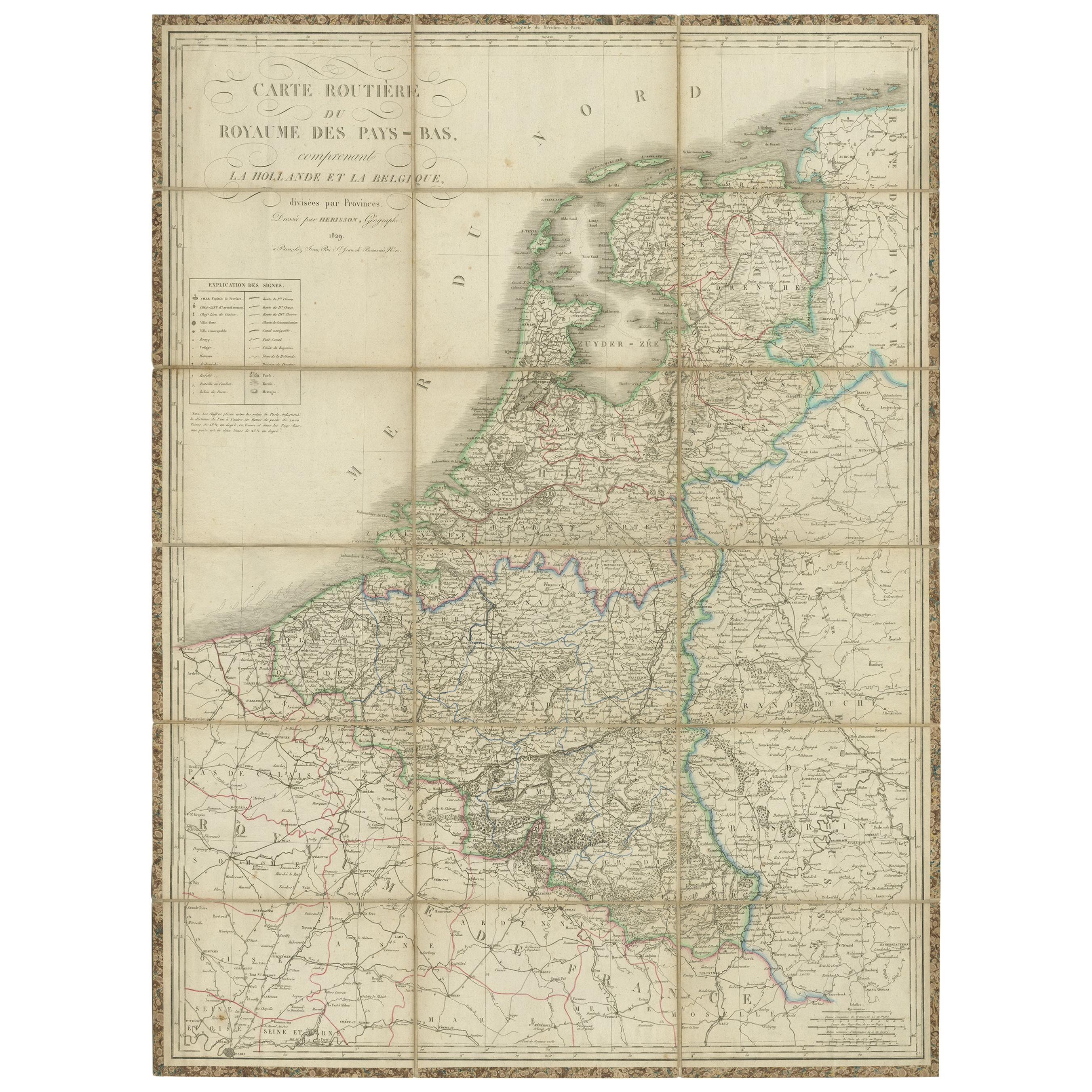
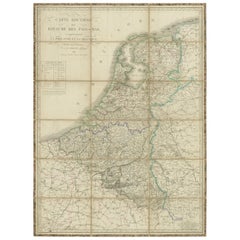
- Antique Map of the Netherlands and Belgium by Hérisson, 1829Located in Langweer, NLFor your online catalogue, here is a detailed description of the antique map titled 'Carte Routière du Royaume des Pays-Bas comprenant la Hollande et la Belgique,' published by Eustache Hérisson in 1829: **Title**: 'Carte Routière du Royaume des Pays-Bas comprenant la Hollande et la Belgique' **Publisher**: Eustache Hérisson **Publication Year**: 1829 This original antique map is a detailed depiction of the Netherlands and Belgium, dating back to 1829. As a 'Carte Routière', it focuses on the road networks of the region, providing valuable historical insights into the transportation and geographical understanding of the early 19th century. The map's delineation of the Kingdom of the Netherlands, including both Holland and Belgium, is particularly noteworthy as it represents the political geography of the period shortly before Belgium's independence in 1830. The map is sectionalised and laid on linen, a common practice in the 19th century for preserving and reinforcing maps, making them more durable and portable. This method of mounting also suggests that the map was intended for practical use, possibly by travelers or for educational purposes. **Artist and Publisher**: Eustache Hérisson, the publisher of this map, was a known figure in the cartographic and publishing world of the early 19th century. His work is characterized by attention to detail and accuracy, making this map not only a beautiful piece of art but also a reliable historical document. This map is a valuable historical artifact, offering insights into the geographical and political landscape of the Netherlands...Category
Antique Mid-19th Century Maps
MaterialsPaper
 $663 Sale Price20% Off
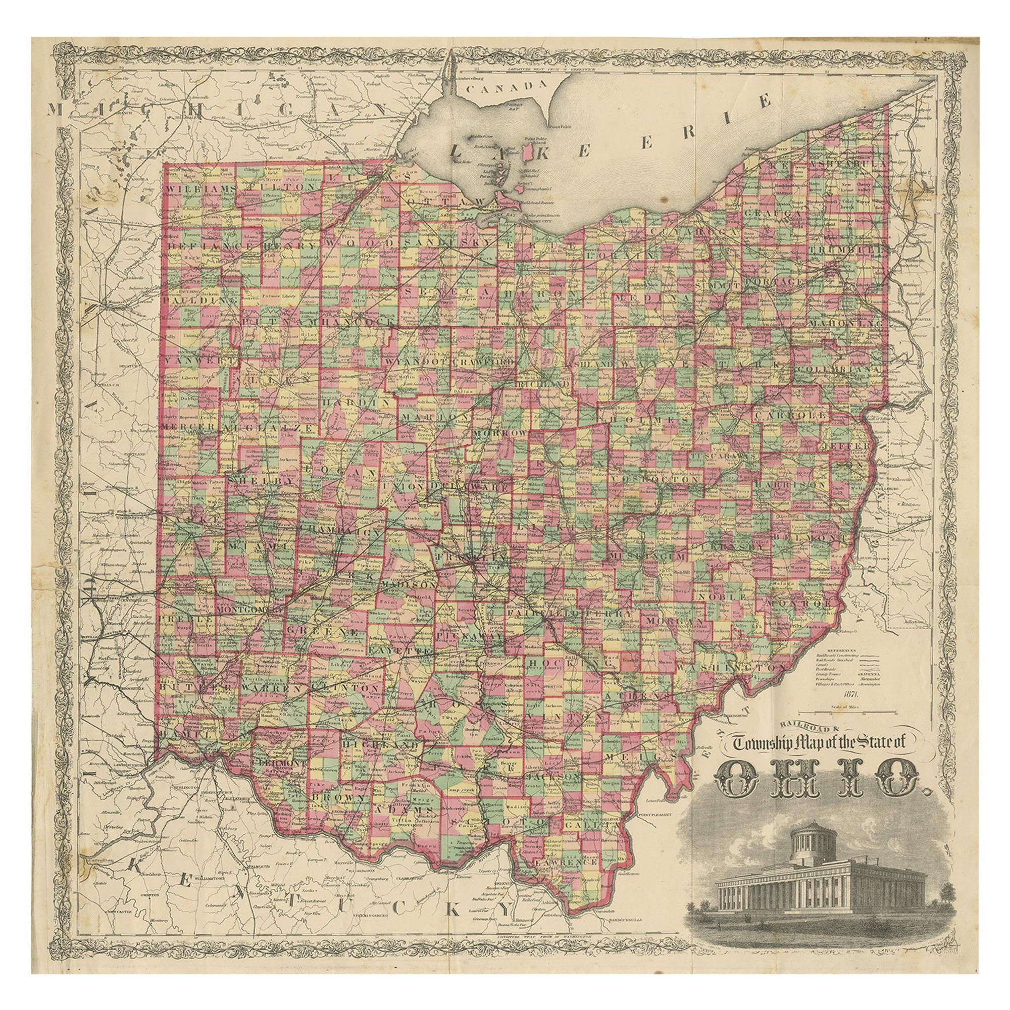
 - Antique Map of the State of Ohio by Titus '1871'Located in Langweer, NLAntique map titled 'Railroad & Township Map of the State of Ohio'. Original antique map of the State of Ohio. This map originates from 'Atlas of Preble County Ohio' by C.O. Titus. Pu...Category
Antique Late 19th Century Maps
MaterialsPaper
 $995 Sale Price25% Off
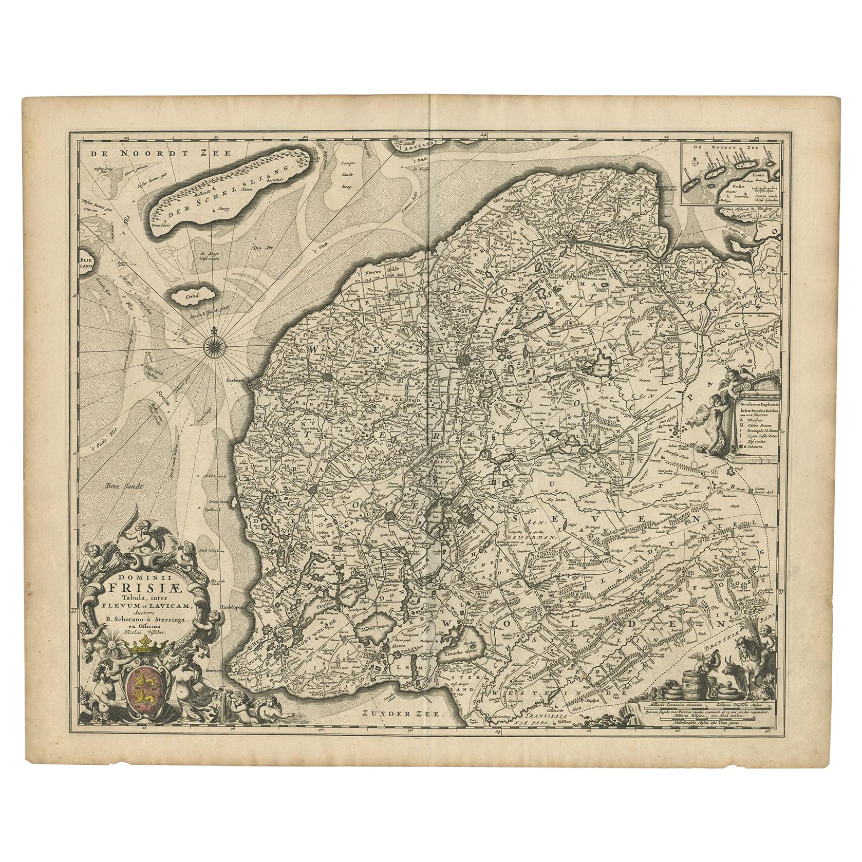
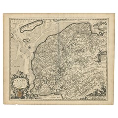
 - Beautiful First State Map of Friesland, the Netherlands, c.1665Located in Langweer, NLAntique map titled 'Dominii Frisiae Tabula, inter Flevum et Lavicam'. Beautiful first state map of Friesland, the Netherlands. With small inset map of the Frisian Wadden islands Vlie...Category
Antique 17th Century Maps
MaterialsPaper
 $774 Sale Price20% Off
 - Small Map of the United StatesLocated in Langweer, NLAntique map titled 'Amérique septe. Physique'. Small map of the United States. lithographed by C. Callewaert brothers in Brussels circa 1870.Category
Antique Mid-19th Century Maps
MaterialsPaper
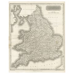
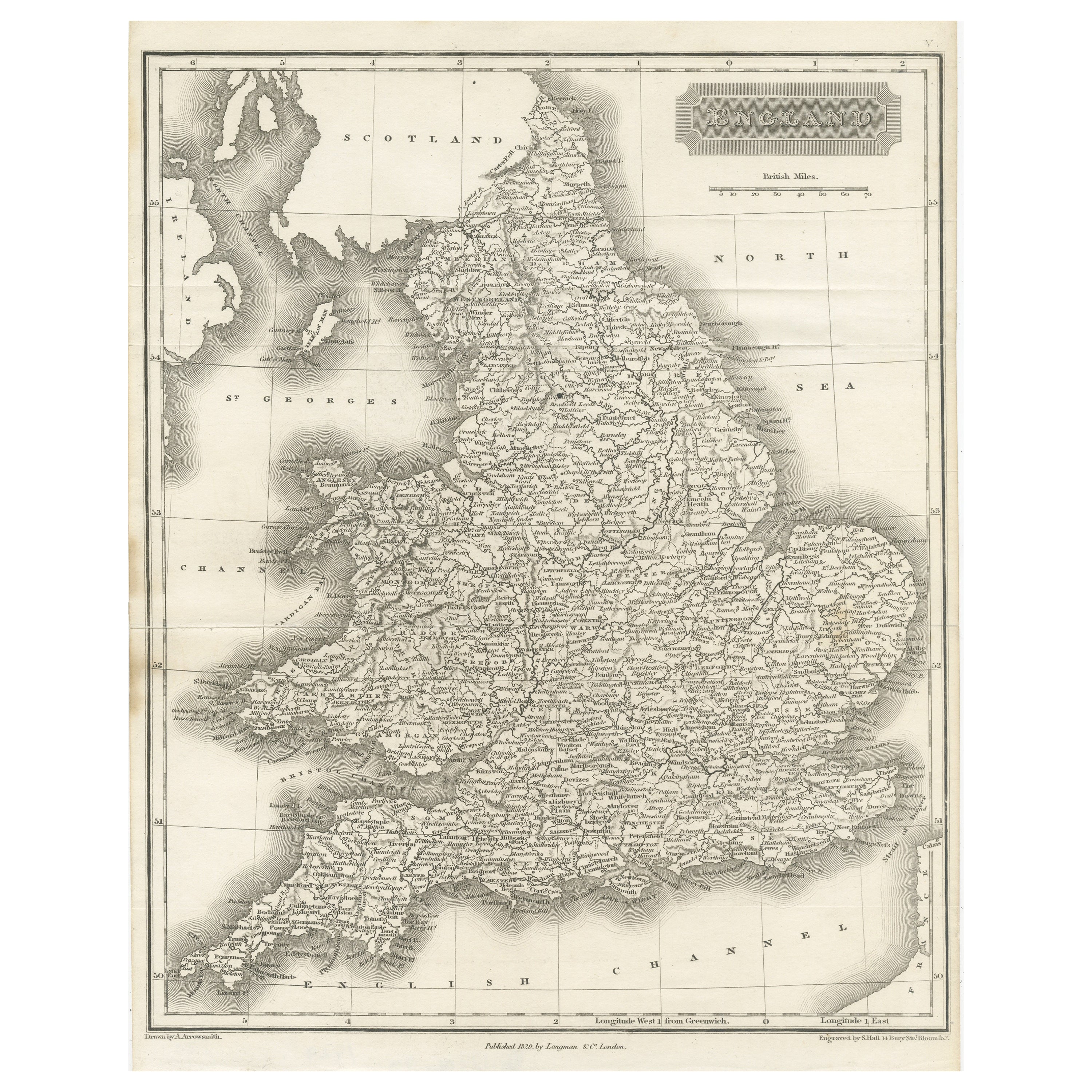
- Small Steel Engraved Map of EnglandLocated in Langweer, NLAntique map titled 'England'. Original steel engraved map of England. Drawn by A. Arrowsmith, engraved by S. Hall. Published 1829 by Longman & Co, London.Category
Antique Mid-19th Century Maps
MaterialsPaper
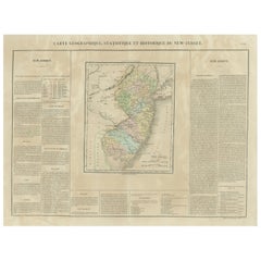
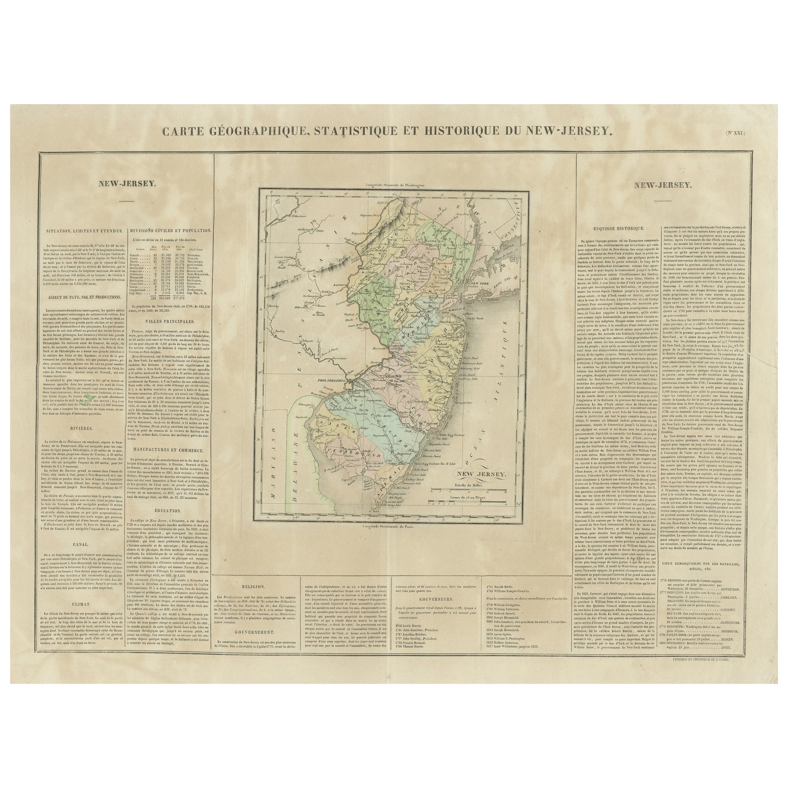
- Original Antique Map of the State of New Jersey Published in FranceLocated in Langweer, NLOriginal antique map titled 'Carte Géographique Statistique et Historique du New-Jersey'. One of the earliest obtainable maps of the State of New Jersey published outside of the Unit...Category
Antique Early 19th Century Maps
MaterialsPaper