High Victorian Maps
to
1
1
2
82
35
19
12
9
6
4
4
4
3
1
1
2
2
1
1
1
1
2
2
2
1
Style: High Victorian
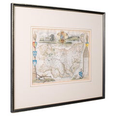
Antique County Map, Suffolk, English, Framed Lithograph, Cartography, Victorian
Located in Hele, Devon, GB
This is an antique lithography map of Suffolk. An English, framed atlas engraving of cartographic interest, dating to the mid 19th century and later.
Superb lithography of Suffolk ...
Category
Mid-19th Century British Antique High Victorian Maps
Materials
Paper
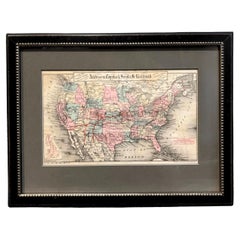
1879 Map of the United States, Showing the Santa Fe Railroad by GW & CB Colton
Located in Colorado Springs, CO
Presented is an original "General Map of the United States Showing the Lines of the Atchison, Topeka & Santa Fe Railroad and Its Connections with the Sea Ports". Undated, this map wa...
Category
1870s American Antique High Victorian Maps
Materials
Paper
Related Items
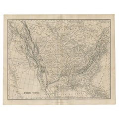
Exquisite 1850s Vintage Map of North America: A Victorian Cartographic Treasure
Located in Langweer, NL
Ornate 19th-Century Map of North America by J. Rapkin, Published by J & F Tallis
This stunning 19th-century map of North America, created by renowned cartographer J. Rapkin and ...
Category
1850s Antique High Victorian Maps
Materials
Paper
H 14.26 in W 10.95 in D 0.01 in
Antique Map of the United States by Balbi '1847'
Located in Langweer, NL
Antique map titled 'Etats-Unis'. Original antique map of the United States. This map originates from 'Abrégé de Géographie (..)' by Ad...
Category
Mid-19th Century Antique High Victorian Maps
Materials
Paper
Set of 2 Antique Maps of the United States by W. G. Blackie, 1859
Located in Langweer, NL
Antique map titled 'The United States of North America, Atlantic States and Valley of the Mississippi'. Original antique map of the United States of North America, Atlantic States an...
Category
Mid-19th Century Antique High Victorian Maps
Materials
Paper
Antique Map of the United States by Titus '1871'
Located in Langweer, NL
Antique map titled 'The United States of America'. Original antique map of the United States. This map originates from 'Atlas of Prebl...
Category
Late 19th Century Antique High Victorian Maps
Materials
Paper
Antique Map of The United States of North America, Pacific States, 1882
Located in Langweer, NL
The map is from the same 1882 Blackie Atlas and focuses on the Pacific States of the United States of America during that period. Here are some details and historical context about t...
Category
1880s Antique High Victorian Maps
Materials
Paper
Framed 1820s Hand Colored Map of the United States
Located in Stamford, CT
Framed 1820s hand colored map photos of North America and South America. As found framed in giltwood frame.
Category
1820s American Antique High Victorian Maps
Materials
Giltwood, Paper, Glass
Framed 1839 Hand Colored Map of the United States
Located in Stamford, CT
Framed hand colored map of the United States of America from 1839. Newly framed in a giltwood frame.
Category
1830s American Antique High Victorian Maps
Materials
Giltwood, Paper, Glass
Antique Map of the Coal Fields of the United States by Walker '1874'
Located in Langweer, NL
Antique map titled 'Map of the coal fields of the United States, compiled from state reports and data specially furnished by Prof. W.B. Rogers, E.T. Cox, A.H. Worthen, S.S. Lyon, Ric...
Category
Late 19th Century Antique High Victorian Maps
Materials
Paper
Antique Railroad Map of the United States by Rand, McNally & Co, 1900
Located in Langweer, NL
Antique map titled 'Rand, McNally & Co's New Official Railroad map of the United States with portions of The Dominion of Canada, The Republic of Mexico and the West Indies'. Large railroad map of the United States, sectionalised and laid on linen. Map shows state boundaries for the United States, Mexico, the West Indies, and lower portion of Canada; major cities and towns, military posts, Native American reservations, and railroads; Oklahoma and "Indian Territory." Inset: "Map of Alaska...
Category
20th Century High Victorian Maps
Materials
Linen, Paper
Antique Map of the Eastern United States with Inset Map of Texas
Located in Langweer, NL
Antique map titled 'Verein-Staaten von Nord-America mit Ausnahme Florida's und der Westlichen Territorien'. This map extends as far west as Louisiana and only includes the northern p...
Category
Mid-19th Century Antique High Victorian Maps
Materials
Paper
Antique Map of the United States of America by Lapie '1842'
Located in Langweer, NL
Antique map titled 'Carte des États-Unis d'Amérique'. Map of the United States of America (USA). This map originates from 'Atlas universel...
Category
Mid-19th Century Antique High Victorian Maps
Materials
Paper
Antique Map of the United States ' South East ' by Johnston '1909'
Located in Langweer, NL
Antique map titled 'United States of North America'. Original antique map of United States of North America ( South East Sheet ). With in...
Category
Early 20th Century High Victorian Maps
Materials
Paper
High Victorian maps for sale on 1stDibs.
Find a broad range of unique High Victorian maps for sale on 1stDibs. It’s true that these talented designers have at times inspired knockoffs, but our experienced specialists have partnered with only top vetted sellers to offer authentic pieces that come with a buyer protection guarantee.


