Gilt Maps
to
1
5
5
1
1
1
3
2
1
2
4
2
2
2
2
3
2
2
2
2
5
5
5
1
1
Technique: Gilt
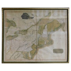
English Engraved Hand Colored Map of the North Eastern United States, circa 1817
Located in Charleston, SC
English copper engraved hand colored map of the North Eastern United States matted under glass in a gilt frame, Early 19th Century. Drawn and Engraved for Thomson's New General Atlas...
Category
1810s English George III Antique Gilt Maps
Materials
Glass, Giltwood, Paint, Paper
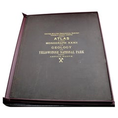
"Atlas to Accompany Monograph XXXII on the Geology of Yellowstone National Park"
By United States Geological Survey
Located in Colorado Springs, CO
This is an original 1904 "Atlas to Accompany Monograph XXXII on the Geology of the Yellowstone National Park" by Arnold Hague. Published by the Department of the Interior, the Atlas ...
Category
Early 1900s American Antique Gilt Maps
Materials
Leather, Fabric, Paper
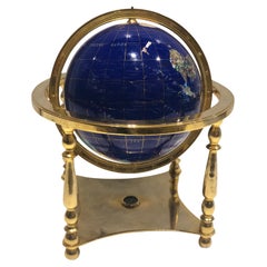
Globe, Solid Rotating Brass Frame with Spinning Globe
Located in Dallas, TX
Globe, solid rotating brass frame with spinning globe, faux hardstone.
Category
Mid-20th Century French Gilt Maps
Materials
Brass
$2,144 Sale Price
20% Off
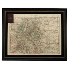
1904 "Nell's Topographical Map of the State of Colorado"
Located in Colorado Springs, CO
This highly detailed pocket map is a topographical map of the state of Colorado by Louis Nell from 1904. The map "has been compiled from all available...
Category
Early 1900s American Antique Gilt Maps
Materials
Leather, Paper
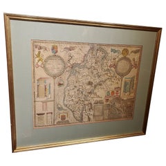
Framed 17th Century Map of Cumberland, England by John Speed, 1610
By John Speed
Located in Middleburg, VA
A fascinating and richly detailed antique map of Cumberland County in northwest England, drawn and published by the celebrated English cartographer John Spe...
Category
Early 17th Century English British Colonial Antique Gilt Maps
Materials
Copper, Gold Leaf
Related Items
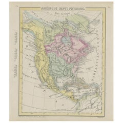
Small Map of the United States, circa 1870
Located in Langweer, NL
Antique map titled 'Amérique septe. Physique'. Small map of the United States. lithographed by C. Callewaert brothers in Brussels circa 1870.
Category
Mid-19th Century Belgian Antique Gilt Maps
Materials
Paper
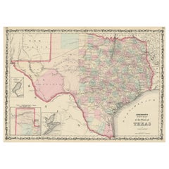
Large Antique Map of the State of Texas, 1861
Located in Langweer, NL
Antique map titled 'Johnson's New Map of the State of Texas' Large map of Texas, shows railroads, wagon roads, the U.S. Mail Route, rivers, ports, ...
Category
Mid-19th Century American Antique Gilt Maps
Materials
Paper
Vintage Rotating Gambling Chip Holder
Located in San Francisco, CA
C. 20th century
Somewhere in the 1920's / 1930's These were created
Vintage rotating gambling chip holder.
Category
20th Century Gilt Maps
Materials
Plastic
Framed 1839 Hand Colored Map of the United States
Located in Stamford, CT
Framed hand colored map of the United States of America from 1839. Newly framed in a giltwood frame.
Category
1830s American American Classical Antique Gilt Maps
Materials
Giltwood, Paper, Glass
Solid Brass Ships Porthole
Located in Norwell, MA
Highly polished ships porthole with hinged door and four dog bolts. Meticulously polished and lacquered. The tempered glass has some imperfections from y...
Category
1930s European Vintage Gilt Maps
Materials
Brass
Frame with Vellum Painting, 17th Century
Located in Madrid, ES
Carved and gilded frame with painting on vellum, "Virgin of the Rosary with Santo Domingo de Guzmán and Santa Catalina of Siena", 17th century. Registration in the back zone (Mr. Jos...
Category
17th Century European Baroque Antique Gilt Maps
Materials
Leather, Wood, Paint
Atlas of Brutalist Architecture
Located in New York, NY
This is the only book to thoroughly document the world's finest examples of Brutalist architecture. More than 850 buildings - existing and demolished, Classic and contemporary - are organized geographically into nine continental regions.
878 Buildings, 798 Architects, 102 Countries, 9 World Regions, 1 Style BRUTALISM
Presented in an oversized format with a specially bound case with three-dimensional finishes, 1000 beautiful duotone photographs throughout bring the graphic strength, emotional power, and compelling architectural presence of Brutalism to life.
From 20th century masters to contemporary architects, much-loved masterpieces in the UK and USA sit alongside lesser-known examples in Europe, Asia, Australia, and beyond - 102 countries in all.
20th century masters included in the book: Marcel Breuer, Lina Bo Bardi, Le Corbusier, Carlo Scarpa, Ernö Goldfinger, Frank Lloyd Wright, Louis Kahn, Oscar Niemeyer, and Paul Rudolph.
Contemporary architects featured include Peter Zumthor...
Category
21st Century and Contemporary Gilt Maps
Materials
Paper
Solid Brass Ships Onion Lantern
Located in Norwell, MA
Large size glass globe onion lamp from a ship well made european style oil lantern with original burner and chimney shade. The Glass globe is protected by Brass bars. There is a vent...
Category
1920s European Vintage Gilt Maps
Materials
Brass
nendo - The ultimate monograph on the legendary multidisciplinary design studio
Located in New York, NY
The ultimate monograph on one of the world's most creative, prolific, and legendary multidisciplinary design studios
nendo's extensive, idiosyncratic body of work flows seamlessly ac...
Category
21st Century and Contemporary Gilt Maps
Materials
Paper
$150 / item
H 11.38 in W 9.88 in D 2 in
Solid Brass Tic-Tac-Do Board with Brass X's and O's
Located in Los Angeles, CA
A beautifully styled Tic-Tac-Do Board in solid brass. A perfectly designed piece to play, but even better, the piece can sit on a console, cocktail table or great icebreaker for the...
Category
20th Century Modern Gilt Maps
Materials
Brass
Ciro Ferri Drawing Offering Scene Italie 17th Century
Located in Beuzevillette, FR
Italian lead pencil drawing, entourage of Ciro Ferri, depicting an offering scene in front of a temple, in the manner of the antiquity.
Measurements: 7.8/5.9 inches
...
Category
17th Century Italian Antique Gilt Maps
Materials
Paper
Antique Map of The United States of North America, Pacific States, 1882
Located in Langweer, NL
The map is from the same 1882 Blackie Atlas and focuses on the Pacific States of the United States of America during that period. Here are some details and historical context about t...
Category
1880s Antique Gilt Maps
Materials
Paper
$236 Sale Price
20% Off
H 14.97 in W 11.03 in D 0 in
Previously Available Items
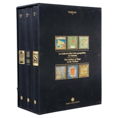
La Galleria Delle Carte Geografiche in Vaticano, Maps in the Vatican, 3 Vols
By Fra Egnazio Danti
Located in Morristown, NJ
La Galleria delle Carte geografiche in Vaticano / The Gallery of Maps in the Vatican, Mirabilia Italiae / Franco Cosimo Panini, (3) vols. in black silk cloth, slipcase with golden ti...
Category
1990s Italian Renaissance Gilt Maps
Materials
Linen, Paper
H 13 in W 5.5 in D 10 in
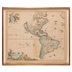
Antique Framed Hand Colored Map of the Americas by Frederick De Wit, circa 1675
By Frederick de Wit
Located in Morristown, NJ
Frederick De Wit (Dutch, 1629-1706), "Novissima et Accuratissima totius Americae Descriptio", hand-colored map engraving of North and South America with California depicted as an island, decorated with images of Native Americans and indigenous flora and fauna, framed under glass, 19.5"h x 23"l (sheet), 22.5"h x 1.75"d x 26"w (frame), From the collection of an NY corporation.
A fine example of De Wit’s map of the Americas, first published ca. 1675. This map is fascinating. It was the first Dutch map to include all five Great Lakes; Lac Superieur (Lake Superior), Lac des Puans (Lake Michigan), Mare Dulce (Lake Huron...
Category
1670s Dutch Baroque Antique Gilt Maps
Materials
Glass, Wood, Giltwood, Paint, Paper
H 22.5 in W 26 in D 1.75 in
English Map of West Indies with a Gilt Wood Frame Under Glass, Late 19th Cent
Located in Charleston, SC
English hand colored accurate map of the West Indies with a foliage gilt wood and gesso frame under glass, Late 19th century. Long West from London.
Category
Late 19th Century English Victorian Antique Gilt Maps
Materials
Gesso, Glass, Giltwood, Paint, Paper
H 13.75 in W 16.75 in D 0.75 in
Imperial Map Desk of the Habsburg Empire
Located in New Orleans, LA
This monumental, one-of-a-kind map desk hails from the Imperial Palace of the Habsburg Emperor Franz Joseph I, ruler of both Austria and Hungary from 1848 until 1916. The incredible, massive desk features 28 flat drawers — seven on each side — which were used to store not only important maps of the empire, but also irreplaceable architectural drawings of palaces, cathedrals and other civil structures. Biedermeier in style, it is crafted from birch, which was then one of the rarest, most expensive materials used by cabinet makers. It is absolutely, without question, the finest desk of its kind in existence, and it is certainly without peer in terms of engineering, craftsmanship and provenance.
The entire surface of the giant desk...
Category
19th Century Austrian Other Antique Gilt Maps
Materials
Satinwood, Walnut, Wood
Rouge Marble Globe Clock
Located in New Orleans, LA
This extraordinary globe clock is an impeccable example of the complex artistry of French timepieces. The terrestrial globe is rendered in painstaking deta...
Category
19th Century French Other Antique Gilt Maps
Materials
Marble, Silver, Bronze
Framed 18th Century Copy of French World Map by Francois Santini
Located in Sheffield, MA
18th century French world map: Nouvelle Mappe Monde dedee au progres de nos connoissances. The map is drawn and engraved, matted and has a gilt frame. The originally map was made by ...
Category
18th Century French Antique Gilt Maps
Materials
Wood
Large-Scale Map of the World After Mercator, 1569, 20th Century Printing
Located in West Palm Beach, FL
Large-scale map of the world after Mercator, 1569, 20th century printing, in 2.5 deep walnut and gilt frame.
This item is at our Atlanta GA, Location, not Pa...
Category
Late 20th Century Renaissance Gilt Maps
Materials
Plexiglass, Walnut, Paper
H 42.5 in W 59.5 in D 2.5 in
French European Framed Map Printed on Linen, Signed, Circa 1781
Located in Charleston, SC
French European framed map printed on linen with a colorful outlines and border under glass. Late 18th Century.
Measures: Map dimensions 22" Tall / 3...
Category
1780s French Louis XVI Antique Gilt Maps
Materials
Glass, Linen, Wood
A Rare French Engraved Map of The Southeastern United States. R.Bonne Circa 1780
Located in Charleston, SC
A rare framed French engraved map on paper of the southeastern United States including Virginia, North Carolina, South Carolina, and Georgia. Rigobert Bonne, Paris Circa 1780. Plat...
Category
1780s French Louis XVI Antique Gilt Maps
Materials
Paper, Wood
H 16.5 in W 21 in D 1 in
18th Century Map of Cambridgeshire
Located in Austin, TX
A handsome 18th century English map of Cambridgeshire, mounted and framed under glass.
Printed in 1722 - From an edition of Camden's Britannia (Map by Robert Morden)
Great as a gif...
Category
18th Century English Antique Gilt Maps
Materials
Glass, Wood, Paper
Recently Viewed
View AllMore Ways To Browse
Vintage Figurines Made In Italy
Vintage Gazelle Glasses
Vintage Goodwood
Vintage Hand Carved Wooden Birds
Vintage Hermes Saddle
Vintage Jade Stone
Vintage Ken Edwards Pottery
Vintage Magazine Table
Vintage Metal Calendar
Vintage Minature
Vintage Pink Rose China
Vintage Radio Case
Vintage Rattan Cabinet
Vintage Sailfish
Vintage Swan Mirror
Vintage Wet Bar
Vintage Wooden Puzzles
Vinyl Audio Cabinet
