Items Similar to View of the Hongi or Coracora Fleet from Ambon, Maluku Islands, Indonesia, 1726


Want more images or videos?
Request additional images or videos from the seller
1 of 5
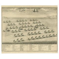
View of the Hongi or Coracora Fleet from Ambon, Maluku Islands, Indonesia, 1726
About the Item
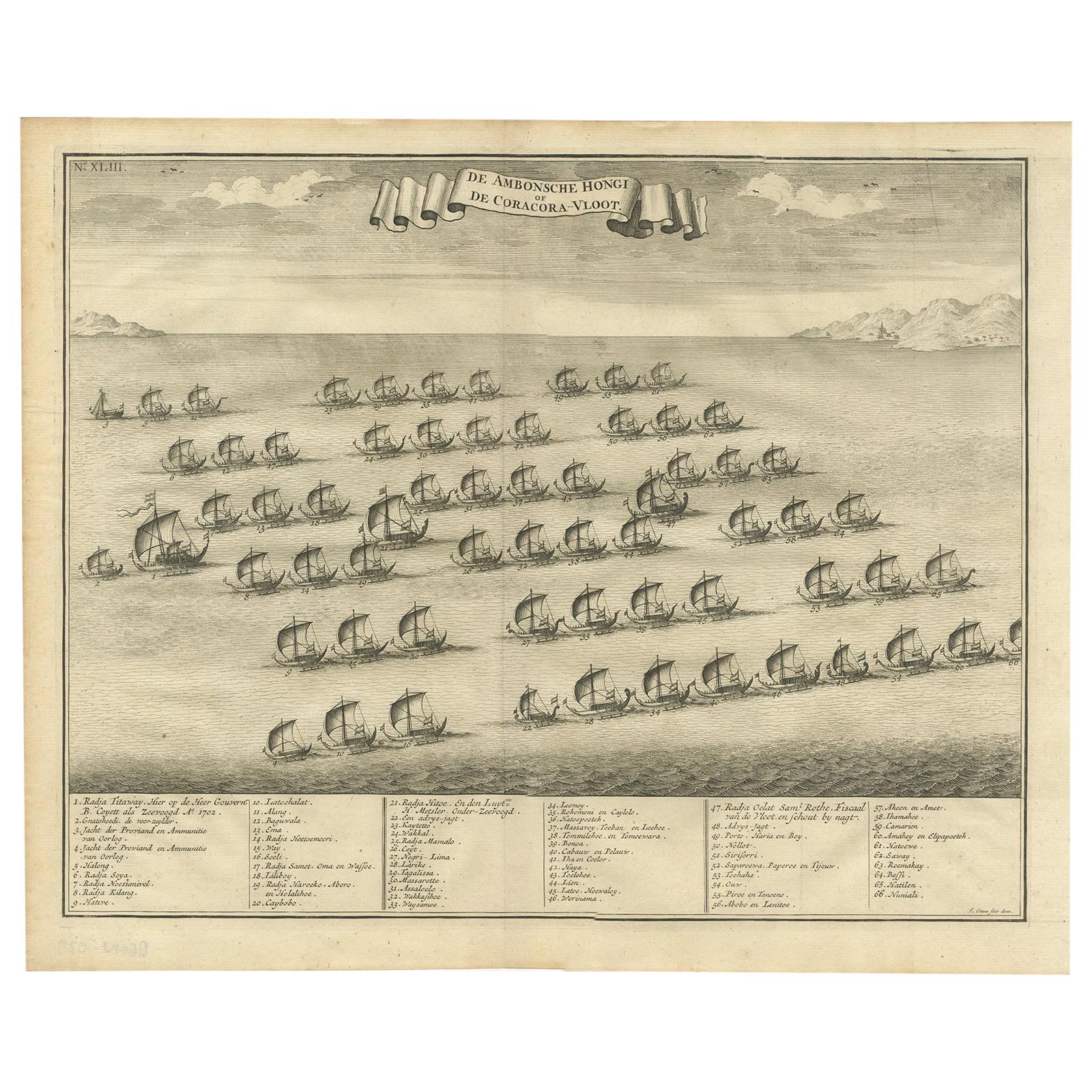
Antique print titled ‘De Ambonsche Hongi of de Coracora Vloot’. View of the Hongi or Coracora fleet from Ambon (Amboine), Maluku Islands, Indonesia. Below the image there is a numbered key (1-66) with the names of the ships. This print originates from 'Oud en nieuw Oost-Indien (..)' by F. Valentijn.
Artists and Engravers: François Valentijn / Valentyn (1666-1727), was a Dutch minister, naturalist and author. He was send by the VOC as a missionary and mostly worked at Amboina from 1684-1694 and 1705-1713. He traveled extensively in the VOC controlled territories and befriended the German naturalist Georg Eberhard Rumpf (Rumphius). He probably had access to VOC archives and compiled much in this momumental work from others as well.
- Dimensions:Height: 13 in (33 cm)Width: 15.36 in (39 cm)Depth: 0 in (0.02 mm)
- Materials and Techniques:
- Period:1720-1729
- Date of Manufacture:1726
- Condition:Condition: Good, general age-related toning. Original folding line, blank verso. Please study image carefully.
- Seller Location:Langweer, NL
- Reference Number:
About the Seller
5.0
Platinum Seller
These expertly vetted sellers are 1stDibs' most experienced sellers and are rated highest by our customers.
Established in 2009
1stDibs seller since 2017
1,933 sales on 1stDibs
Typical response time: <1 hour
- ShippingRetrieving quote...Ships From: Langweer, Netherlands
- Return PolicyA return for this item may be initiated within 14 days of delivery.
More From This SellerView All
- Antique Print of the Hongi or Coracora Fleet by Valentijn, 1726Located in Langweer, NLAntique print titled ‘De Ambonsche Hongi of de Coracora Vloot’. View of the Hongi or Coracora fleet from Ambon (Amboine), Maluku Islands, Indonesia. Below the image there is a number...Category
Antique 18th Century Prints
MaterialsPaper
- Antique Print of the Hongi/Coracora Fleet by Valentijn '1726'By F. ValentijnLocated in Langweer, NLAntique print titled 'De Ambonsche Hongi of de Coracora-Vloot'. The Hongi or Coracora fleet from Ambon (Amboine), Indonesia. Below the image there is a numbered key (1-66) with the n...Category
Antique Early 18th Century Dutch Prints
MaterialsPaper
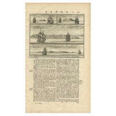
- Antique Chart of the Banda Islands or The Spice Islands, Indonesia, 1726Located in Langweer, NLAntique map titled 'Nieuwe Caart der Eylanden van Banda'. Beautiful chart of the Banda Islands including Banda Api, Banda Neira, Banda Besar, Pulau Hatta (Rosengain), Pulau Ai an...Category
Antique 1720s Maps
MaterialsPaper
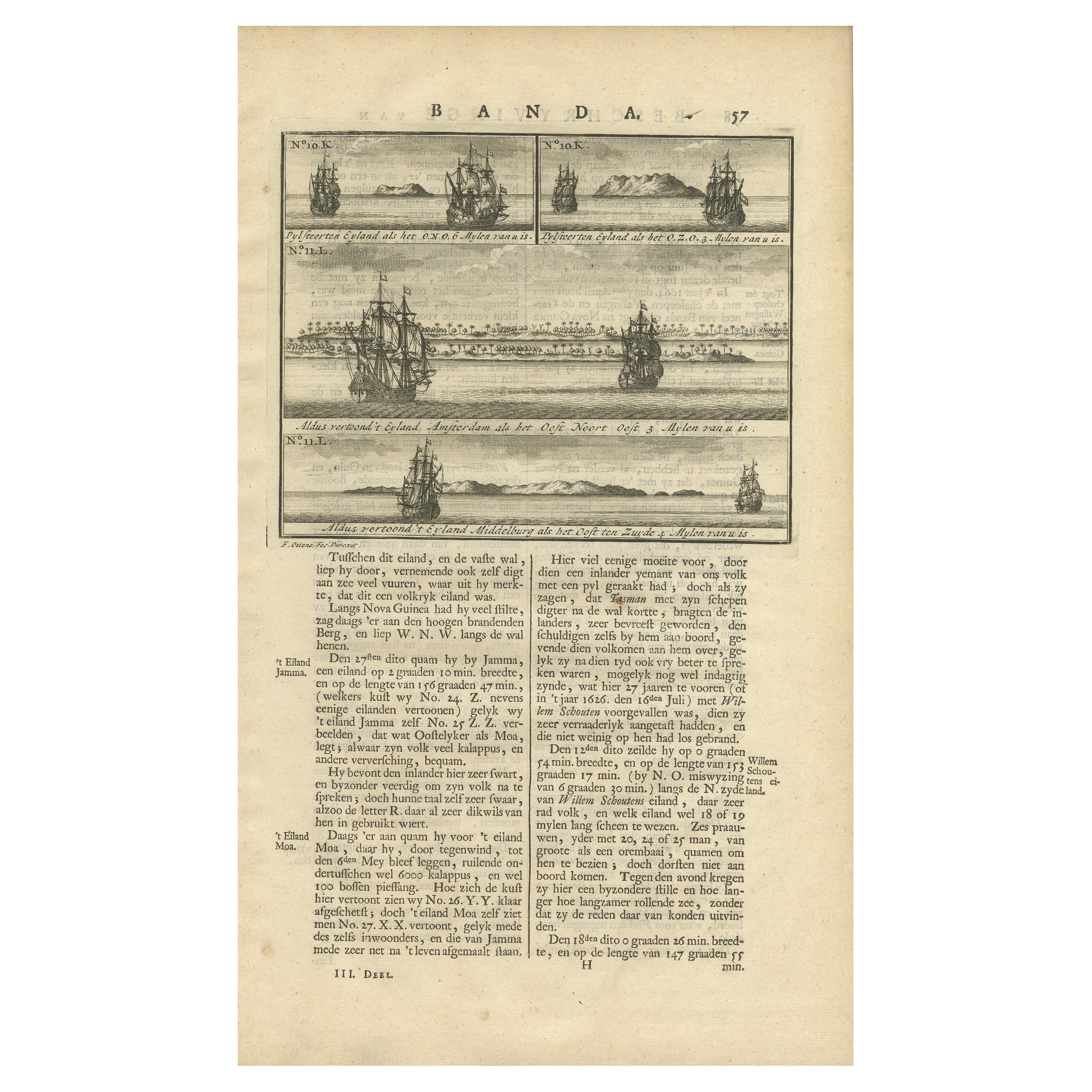
- Views of Amsterdam, Middelburg and Pylsteerten Island, Indonesia, 1726Located in Langweer, NLAntique print from an old Dutch publication of a VOC mission to nowadays Indonesia titled 'Pylsteerten Eyland als het O.N.O. 6 Mylen van u is ; Pylsteerten Eyland als het O.Z.O. 3 Mylen van u is ; Aldus vertoond t'Eyland Amsterdam als het Oost Noort Oost 3 Mylen van u is ; Aldus vertoond't Eyland Middelburg als het Oost ten Zuyde 4 Mylen van u is'. Views of Amsterdam...Category
Antique 18th Century Prints
MaterialsPaper
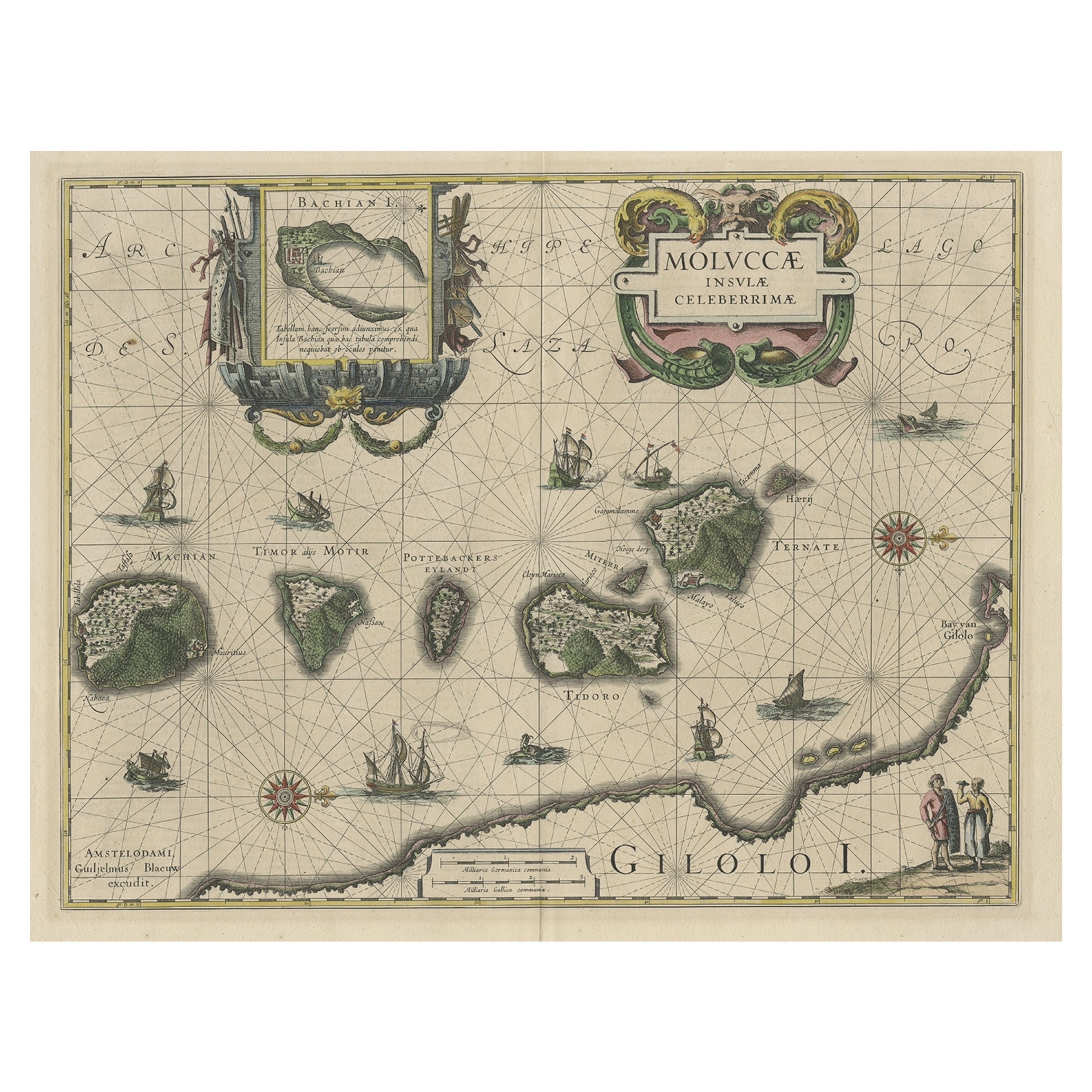
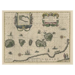
- Decorative Map of the Maluku or Moluccas or Spice Islands, Indonesia, Ca.1640Located in Langweer, NLAntique map titled 'Moluccae Insulae Celeberrimae'. Decorative map of the Maluku Islands, also known as the Moluccas or the Spice Islands. Inset of the island of Bachian (Batjan) in an elaborate frame as well as a Moluccan couple in the lower right corner in Europeanized native dress. Artists and Engravers: Willem Janszoon Blaeu (1571-1638) was a prominent Dutch geographer and publisher. Born the son of a herring merchant, Blaeu chose not fish but mathematics and astronomy for his focus. He studied with the famous Danish astronomer Tycho Brahe...Category
Antique 1640s Maps
MaterialsPaper
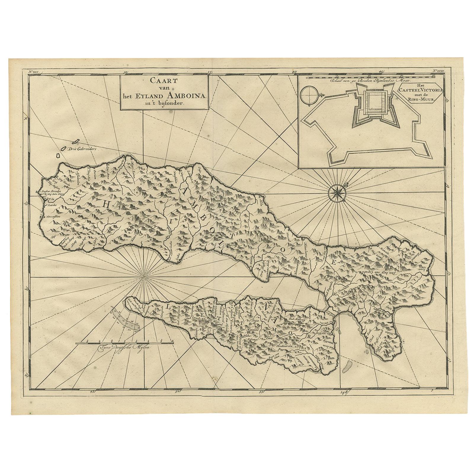
- Antique Map of Ambon Island by Valentijn, 1726By F. ValentijnLocated in Langweer, NLAntique map titled 'Caart van het Eyland Amboina in 't bijsonder'. Map of the Islands Ambon and Timor, one of the Moluccan Islands, Indonesia, with an inset of castle Victoria with t...Category
Antique Early 18th Century Dutch Maps
MaterialsPaper


You May Also Like
- Vintage "View of the Center of Paris Taken from the Air" Lithograph MapLocated in San Diego, CAA very stylish "View of the Center of Paris Taken from the Air" lithograph map published by the Paris Ministry of Tourism, circa early 1950s. The piece measures 27" x 43" and shows...Category
20th Century French Mid-Century Modern Prints
MaterialsPaper
- Alpine Ski Photograph, 'Panoramic View', Taken from Original 1930s PhotographLocated in Oxfordshire, GBVintage, antique Alpine Ski photograph. 'Panoramic View', a new mounted black and white photographic image after an original 1930s skiing photograph. Black and white alpine photos are the perfect addition to any home or ski lodge, so please do check out our other ski photos...Category
Vintage 1930s English Sporting Art Sports Equipment and Memorabilia
MaterialsPaper
- Hand-Colored 18th Century Homann Map of Denmark and Islands in the Baltic SeaBy Johann Baptist HomannLocated in Alamo, CAAn 18th century copper plate hand-colored map entitled "Insulae Danicae in Mari Balthico Sitae utpote Zeelandia, Fionia, Langelandia, Lalandia, Falstria, Fembria Mona" created by Joh...Category
Antique Early 18th Century German Maps
MaterialsPaper
- N.E. View of the United States Capitol, Washington, DC Antique Proof Print 1858Located in Colorado Springs, COThis engraved print shows a view of the United States Capitol Building, in Washington, D.C. The print depicts the neoclassical building from the northeast orientation, with a bustling street scene in front. The steel engraving is a proof printing, drawn and engraved by Henry Sartain and published in 1858. Plans began in May 1854 to build a new cast-iron dome for the United States Capitol. The then-architect of the Capitol Thomas Walter and his team were sold on the aesthetics of a new dome, as well as the utility of a fire-proof one. A year later, on March 3, 1855, President Franklin Pierce...Category
Antique 1850s American Prints
MaterialsPaper
- New Map of North America from the Latest Discoveries, 1763Located in Philadelphia, PAA fine antique 18th century map of the North American seaboard. Entitled "A New Map of North America from the Latest Discoveries 1763". By the Cartographer/Engraver - John Spil...Category
Antique Mid-18th Century English Georgian Maps
MaterialsPaper
- Three Centuries of American Prints: from the National Gallery of Art, Exhib. CatLocated in valatie, NYThree Centuries of American Prints: From the National Gallery of Art by Judith Brodie, Amy Johnston and Michael J. Lewis. Publisher Thames & Hudson Lt...Category
21st Century and Contemporary American Books
MaterialsPaper


Recently Viewed
View AllMore Ways To Browse
Collecting Antique Keys
Keys Collectible Antique
Antiques From Indonesia
Fleet Furniture
Fleet Furniture Antique
Voc Antique
Dutch Voc
18th Century Southern Antiques
Antique French Globe
South African Antique Furniture
Antique Furniture South Africa
Used Booksellers
Used Bookseller
Antique British Maps
Antique 17th Century World Map
Scotland Map
General Empire
Wood And Sons Plate