Items Similar to Western New York Antique Map – The Empire State, Railroads & Counties, c.1888


Video Loading
Want more images or videos?
Request additional images or videos from the seller
1 of 11
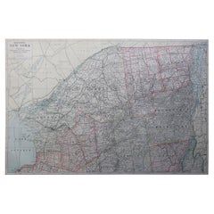
Western New York Antique Map – The Empire State, Railroads & Counties, c.1888
$548.26
£405.98
€460
CA$753.94
A$838.57
CHF 438.89
MX$10,227.85
NOK 5,514.84
SEK 5,187.42
DKK 3,502.12
About the Item
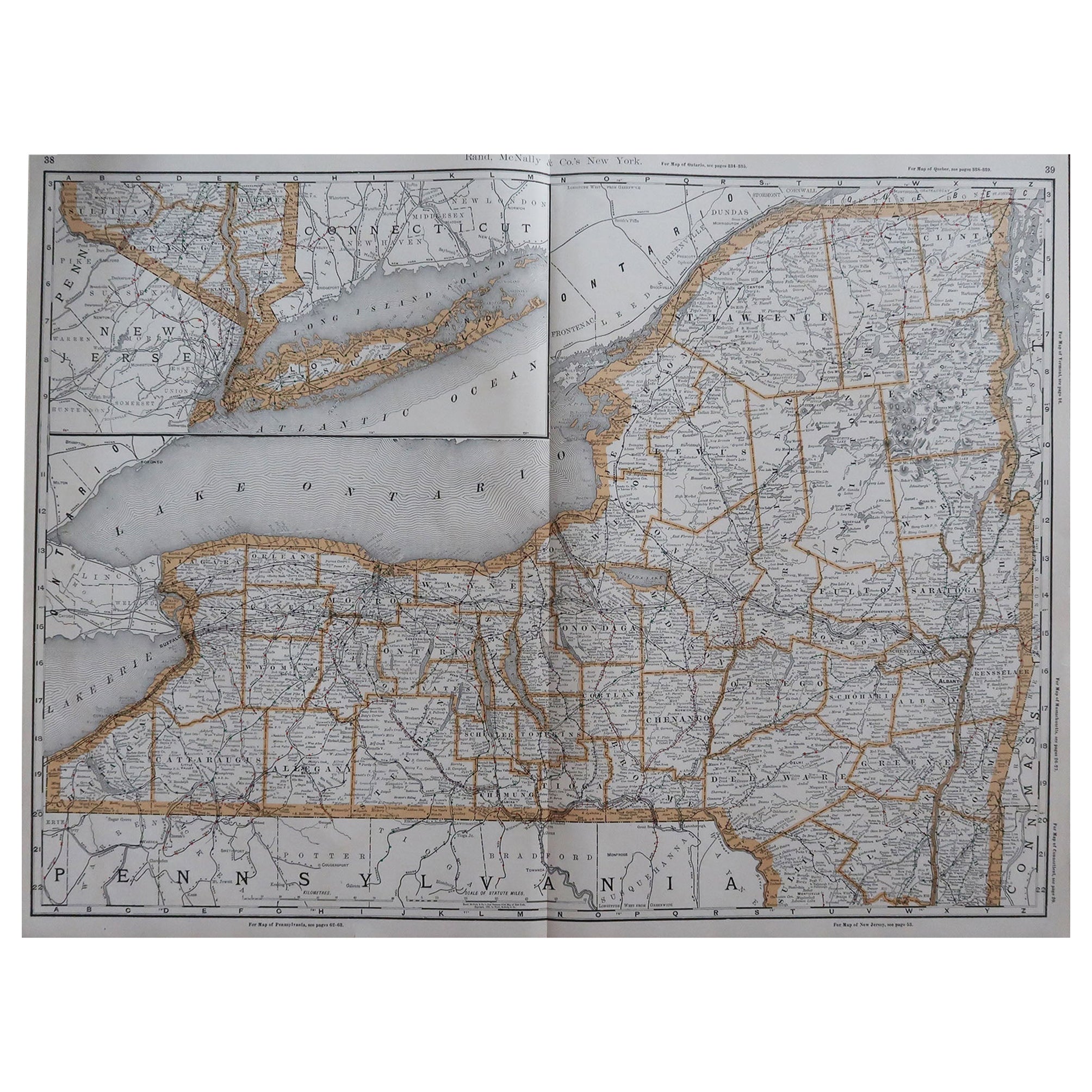
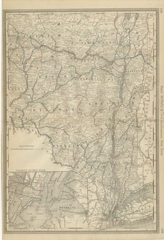
Antique Map of Western New York – Rand McNally, circa 1888
This antique map of western New York was published by Rand, McNally & Co. around 1888. It presents a detailed view of the region stretching from Lake Erie to Lake Ontario, including Buffalo, Rochester, the Finger Lakes, and the state’s northwestern counties.
The map highlights the counties of Erie, Niagara, Monroe, Ontario, Seneca, Tompkins, and surrounding areas. Major cities such as Buffalo and Rochester are marked prominently, alongside smaller towns and villages that developed rapidly with the rise of industry and transportation in the late 19th century. The Erie Canal region, Finger Lakes, and Niagara frontier are all clearly depicted.
Railroads are shown in red and blue lines, emphasizing the dense network of connections that linked the Great Lakes to the interior of New York and beyond. The waterways of Lake Erie, Lake Ontario, and the Finger Lakes are finely engraved, underscoring the importance of this region as both an industrial hub and a natural transportation corridor.
Rand McNally’s characteristic clarity and precision make this a valuable record of Western New York during the Gilded Age, reflecting its role in shipping, manufacturing, and trade. Collectors of New York history, Great Lakes cartography, or industrial America will find this map particularly appealing.
Condition report:
Good condition with even age toning and light wear along the original center fold. Plate mark visible. Margins clean with only minor handling marks. Strong impression with excellent engraved detail.
Framing tips:
This map displays well in a dark oak or walnut frame with a cream or ivory mat. A double mat with ivory outer and muted blue inner will emphasize the lakes and waterways, creating a balanced and decorative presentation.
Technique: Lithograph with original outline color
Maker: Rand, McNally & Co., Chicago, circa 1888
- Dimensions:Height: 14.18 in (36 cm)Width: 20.67 in (52.5 cm)Depth: 0.01 in (0.2 mm)
- Materials and Techniques:Paper,Engraved
- Place of Origin:
- Period:
- Date of Manufacture:1888
- Condition:Good condition with even age toning and light wear along the original center fold. Plate mark visible. Margins clean with only minor handling marks. Strong impression with excellent engraved detail.
- Seller Location:Langweer, NL
- Reference Number:Seller: BG-12794-191stDibs: LU3054346449762
About the Seller
5.0
Recognized Seller
These prestigious sellers are industry leaders and represent the highest echelon for item quality and design.
Platinum Seller
Premium sellers with a 4.7+ rating and 24-hour response times
Established in 2009
1stDibs seller since 2017
2,599 sales on 1stDibs
Typical response time: <1 hour
- ShippingRetrieving quote...Shipping from: Langweer, Netherlands
- Return Policy
Authenticity Guarantee
In the unlikely event there’s an issue with an item’s authenticity, contact us within 1 year for a full refund. DetailsMoney-Back Guarantee
If your item is not as described, is damaged in transit, or does not arrive, contact us within 7 days for a full refund. Details24-Hour Cancellation
You have a 24-hour grace period in which to reconsider your purchase, with no questions asked.Vetted Professional Sellers
Our world-class sellers must adhere to strict standards for service and quality, maintaining the integrity of our listings.Price-Match Guarantee
If you find that a seller listed the same item for a lower price elsewhere, we’ll match it.Trusted Global Delivery
Our best-in-class carrier network provides specialized shipping options worldwide, including custom delivery.More From This Seller
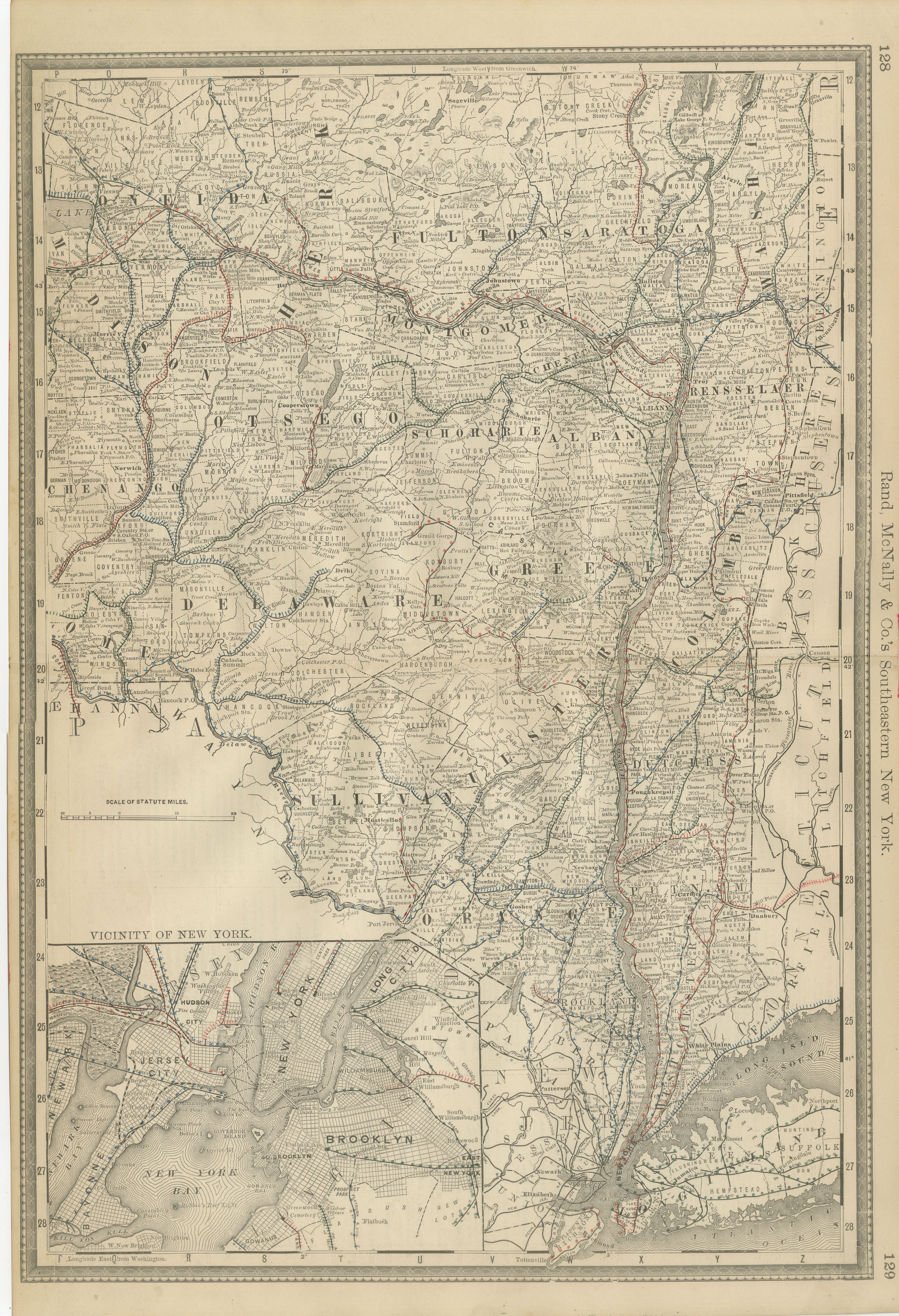
View AllAntique Map of Southeastern New York – Rand McNally, circa 1888
Located in Langweer, NL
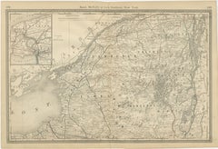
Antique Map of Southeastern New York – Rand McNally, circa 1888
This antique map of southeastern New York was published by Rand, McNally & Co. around 1888. It offers a detailed depi...
Category
Antique Late 19th Century American Maps
Materials
Paper
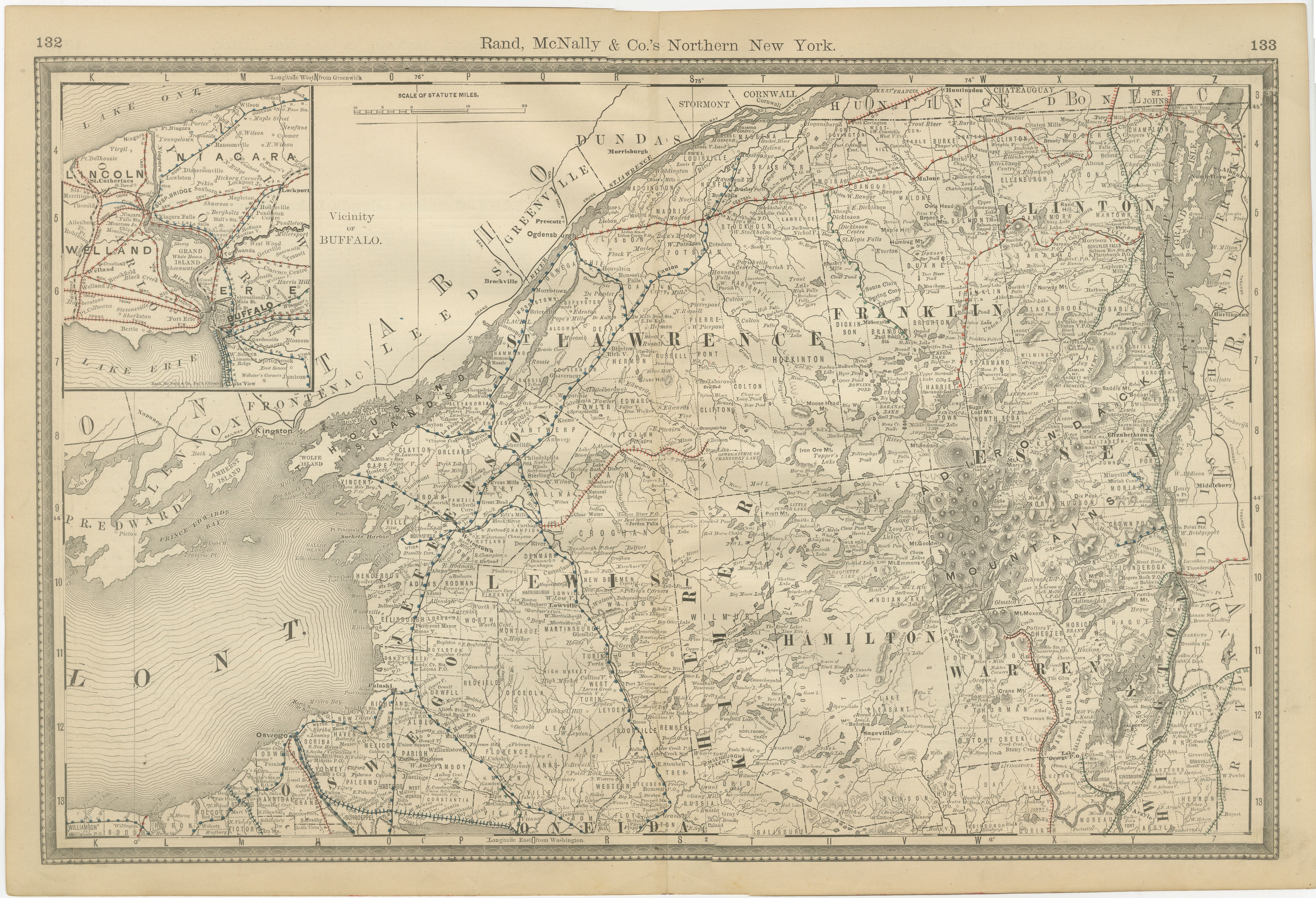
Antique Map of Northern New York – Rand McNally, circa 1888
Located in Langweer, NL
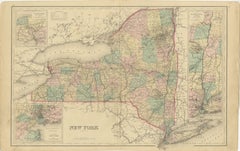
Antique Map of Northern New York – Rand McNally, circa 1888
This antique map of northern New York was published by Rand, McNally & Co. around 1888. Taken from one of their late 19th...
Category
Antique Late 19th Century American Maps
Materials
Paper
Antique Map of New York by Johnson '1872'
Located in Langweer, NL
Antique map titled 'Johnson's New York'. Original map showing New York, with an inset map of Long Island. This map originates from 'Johnson's New Il...
Category
Antique Late 19th Century Maps
Materials
Paper

$238 Sale Price
20% Off
1864 Johnson's Map of New York State with City Insets
Located in Langweer, NL
Title: 1864 Johnson's Map of New York State with City Insets
Description: This 1864 map, titled "Johnson's New York," was published by Johnson and Ward and features a detailed depic...
Category
Antique 1860s Maps
Materials
Paper

$267 Sale Price
20% Off
Large Antique Map of New York State with Inset Maps
Located in Langweer, NL
Antique map titled 'Johnson's New York' Large map of New York State. With insets of Albany, Oswego, Buffalo, Rochester, Syracuse, Troy and NYC. Published by Johnson and Browning, 186...
Category
Antique Mid-19th Century Maps
Materials
Paper

$468 Sale Price
20% Off
1876 Antique Map of New York State with Niagara and Hudson River Insets
Located in Langweer, NL
Title: Detailed Map of New York State - 1876 by Samuel Augustus Mitchell Jr.
Description: This is a hand-colored map of the state of New York from 1876, created by Samuel Augustus ...
Category
Antique 1870s Maps
Materials
Paper
$210 Sale Price
20% Off
You May Also Like
Original Antique Map of the American State of New York ( Western Part ) 1903
Located in St Annes, Lancashire
Antique map of New York ( Western Part )
Published By A & C Black. 1903
Original colour
Good condition
Unframed.
Free shipping
Category
Antique Early 1900s English Maps
Materials
Paper

Original Antique Map of the American State of New York ( Northern Part ) 1903
Located in St Annes, Lancashire
Antique map of New York ( Northern Part )
Published By A & C Black. 1903
Original colour
Good condition
Unframed.
Free shipping
Category
Antique Early 1900s English Maps
Materials
Paper

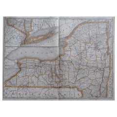
Large Original Antique Map of New York, USA, 1894
By Rand McNally & Co.
Located in St Annes, Lancashire
Fabulous map of New York.
Original color.
By Rand, McNally & Co.
Published, 1894
Unframed
Free shipping.
Category
Antique 1890s American Maps
Materials
Paper
Large Original Antique Map of New York State ( Northern ), USA, C.1900
Located in St Annes, Lancashire
Fabulous map of Northern New York
Original color.
Engraved and printed by the George F. Cram Company, Indianapolis.
Published, C.1900.
Unframed.
Repairs to minor edge tears
Fr...
Category
Antique 1890s American Maps
Materials
Paper
1858 Colton's Map of New York, Ric.B011
Located in Norton, MA
An 1858 Colton's map of New York
Ric.b011
Colton’s New York, 1858 - A large original color engraved and very detailed map of the state of New York,...
Category
Antique 19th Century Unknown Maps
Materials
Paper

Original Antique Map of the American State of New York ( Southern Part ) 1903
Located in St Annes, Lancashire
Antique map of New York ( Southern Part )
Published By A & C Black. 1903
Original colour
Good condition
Unframed.
Free shipping
Category
Antique Early 1900s English Maps
Materials
Paper
