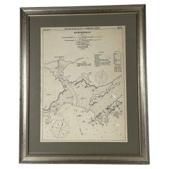
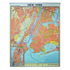
Maritime Chart of Larchmont New York
View Similar Items

Want more images or videos?
Request additional images or videos from the seller
1 of 8
Maritime Chart of Larchmont New York
About the Item
- Dimensions:Height: 23 in (58.42 cm)Width: 27 in (68.58 cm)Depth: 3 in (7.62 cm)
- Materials and Techniques:
- Period:1900-1909
- Date of Manufacture:1901
- Condition:
- Seller Location:Norwell, MA
- Reference Number:Seller: R63891stDibs: LU1741225602792
About the Seller
5.0
Vetted Professional Seller
Every seller passes strict standards for authenticity and reliability
Established in 1967
1stDibs seller since 2015
397 sales on 1stDibs
Typical response time: 2 hours
Authenticity Guarantee
In the unlikely event there’s an issue with an item’s authenticity, contact us within 1 year for a full refund. DetailsMoney-Back Guarantee
If your item is not as described, is damaged in transit, or does not arrive, contact us within 7 days for a full refund. Details24-Hour Cancellation
You have a 24-hour grace period in which to reconsider your purchase, with no questions asked.Vetted Professional Sellers
Our world-class sellers must adhere to strict standards for service and quality, maintaining the integrity of our listings.Price-Match Guarantee
If you find that a seller listed the same item for a lower price elsewhere, we’ll match it.Trusted Global Delivery
Our best-in-class carrier network provides specialized shipping options worldwide, including custom delivery.More From This Seller
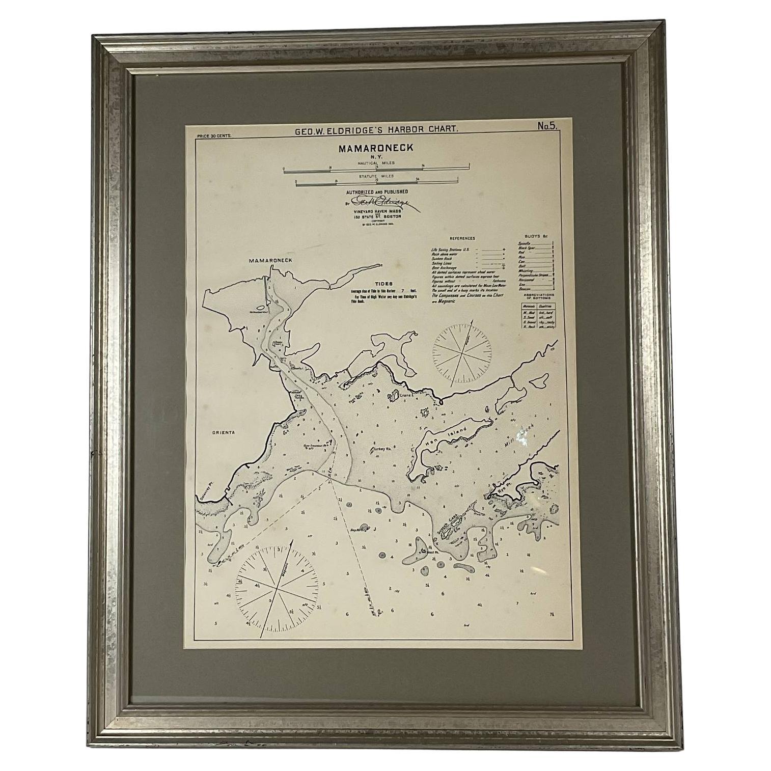
View AllMamaroneck New York Harbor Chart from 1901
Located in Norwell, MA
Original harbor chart by George Eldridge in 1801 of Mamaroneck New York. Showing Oriental Hen Island, Rye Point, Scotch Caps, Crane Island, Decency Point, etc.. Showing local water d...
Category
Antique Early 1900s North American Maps
Materials
Paper
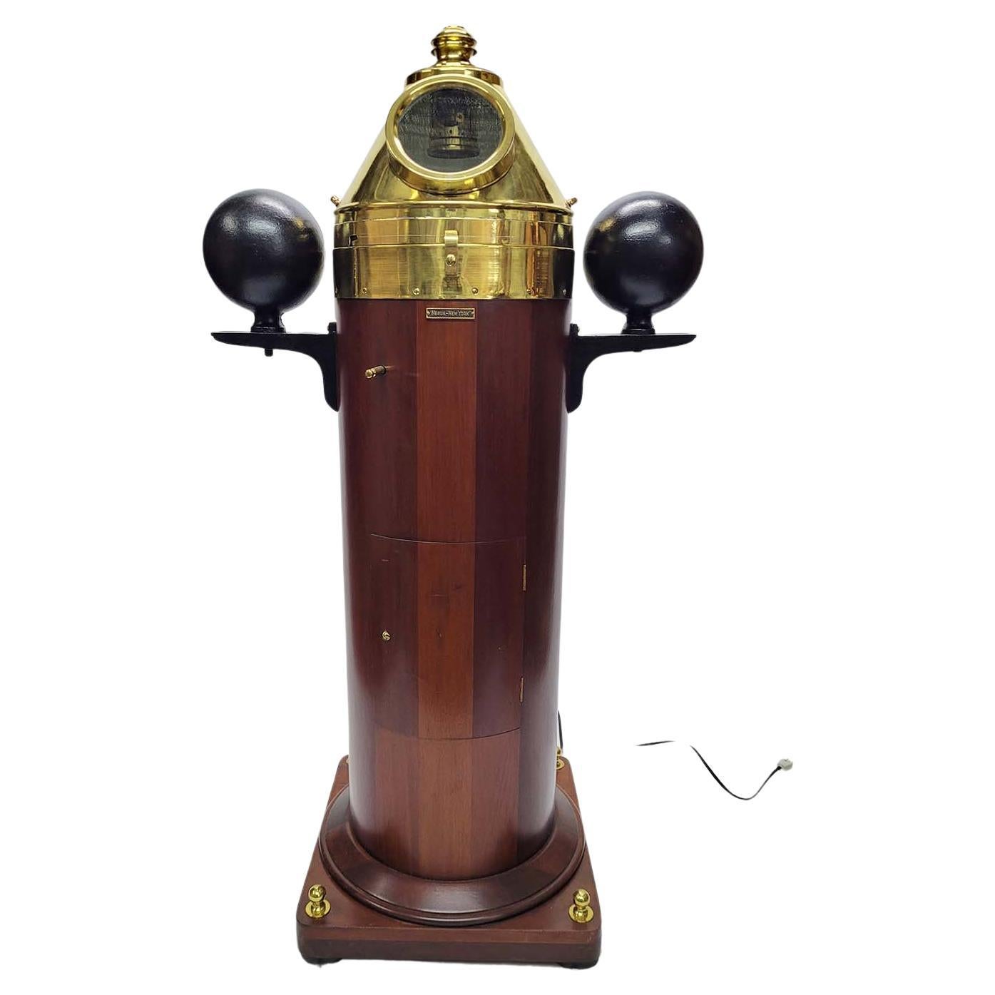
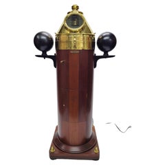
Yacht Binnacle by Negus of New York
Located in Norwell, MA
Magnificent Yacht Binnacle by American Ships chandler Negus of New York. Meticulously polished and lacquered brasses on this nautical relic. The gimballe...
Category
Vintage 1920s North American Nautical Objects
Materials
Brass
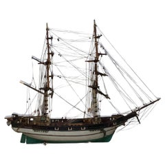
Ship Model of the Bark Jessie of New York
Located in Norwell, MA
Model of the armed brig Jessie of New York. Fitted with eight cannon on deck. Hull is painted green and white. Rigged with full standing and runnng rigging. Mounted to an inlaid crad...
Category
Vintage 1930s North American Models and Miniatures
Materials
Wood
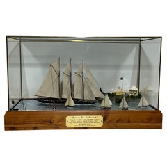
Maritime Diorama of Schooner Yacht Atlantic
Located in Norwell, MA
Outstanding deep water diorama by noted ship model builder William Hitchcock. Titled "Breezing up in Bermuda", auxiliary schooner yacht Atlantic cruises into St. George's harbor, Ber...
Category
Early 2000s North American Models and Miniatures
Materials
Wood
1898 Chart of Boston Bay
Located in Norwell, MA
Original 1898 chart showing Massachusetts Bay with the coast from Cape Ann to Cape Cod. This is a U.S. Navy Geodetic survey chart. All towns are noted along the coast. Framed with gl...
Category
Antique 1890s Nautical Objects
Materials
Paper

$1,495
Chart of Boston's North Shore
Located in Norwell, MA
Rarely found restrike of an 1804 chart by Nathanael Bowditch of the Harbors of Salem, Marblehead, Beverly, and Manchester.
Showing the Islands of Great Misery, Satan, Cuney, Winter,...
Category
Vintage 1980s North American Maps
Materials
Paper

You May Also Like
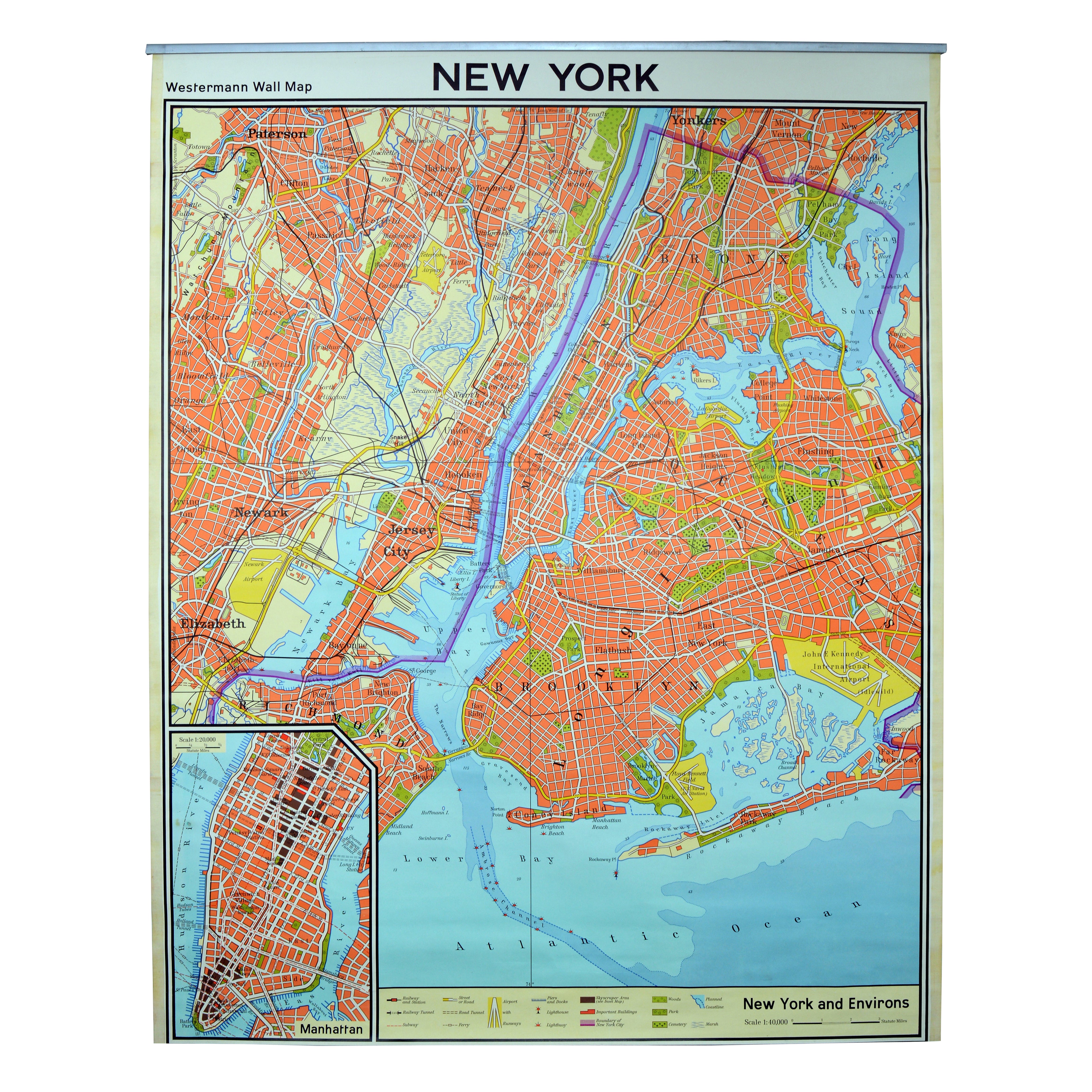
Vintage Wall Chart New York City Urban Map, USA 1950s
Located in Stockholm, SE
A classical wall chart showing a map of the city of New York. published by Westermann and with English text. Used as teaching material in Swedish schools. colorful print on paper rei...
Category
Vintage 1950s German Maps
Materials
Metal
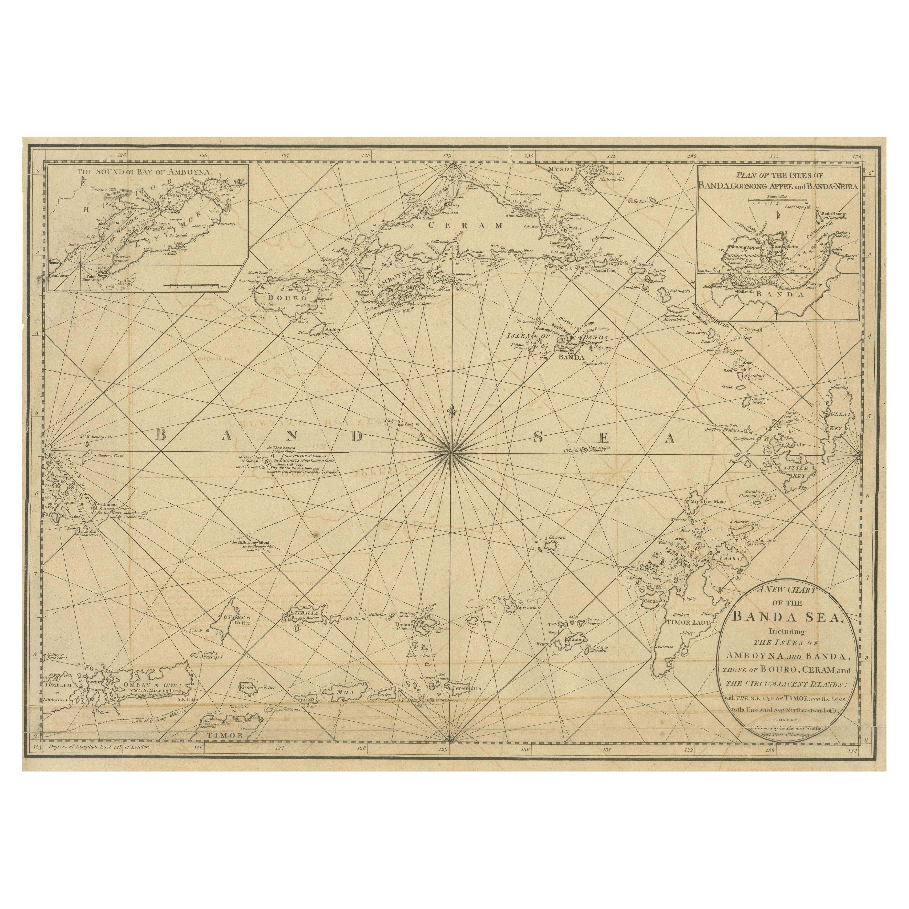
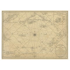
Navigating the Spice Trade: A Maritime Chart of the Banda Sea, 1799
Located in Langweer, NL
This original antique map is an 18th-century nautical chart by Laurie & Whittle, a well-known British firm that was involved in the publication of maps, charts, and maritime books. ...
Category
Antique Late 18th Century Maps
Materials
Paper
$913 Sale Price
20% Off
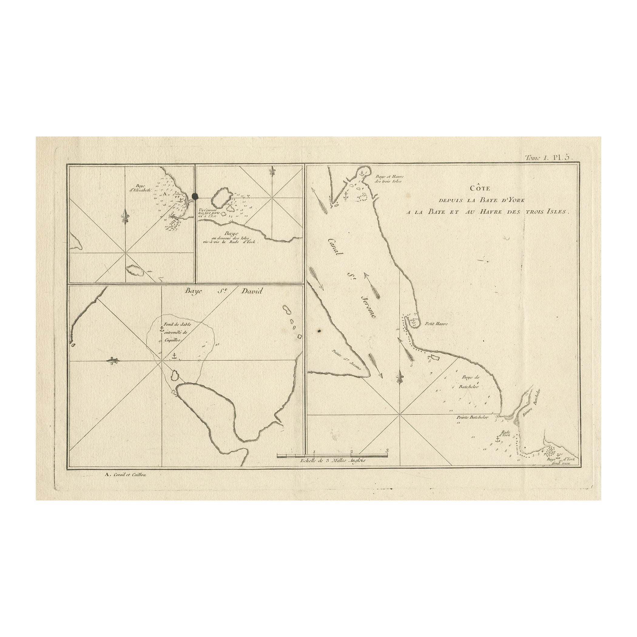
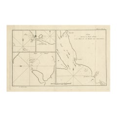
Antique Print with Charts of York's Bay and Surroundings
Located in Langweer, NL
Antique map titled 'Côte depuis la Baye d'York (..)'. Charts of York's Bay, Haven of the Three Islands, St. David's Bay, and Elizabeth's Bay.
Published in an edition of John Hawk...
Category
Antique Late 18th Century Maps
Materials
Paper
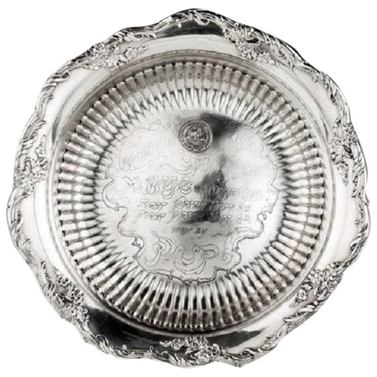
Larchmont Yacht Club Silver Racing Trophy
Located in Lymington, Hampshire
An American silver trophy bowl from the Larchmont Yacht Club, New York State, presented to the yacht 'Pup' in 1905, winner of the MBYC (Mission Bay ...
Category
Antique Early 1900s American Sports Equipment and Memorabilia

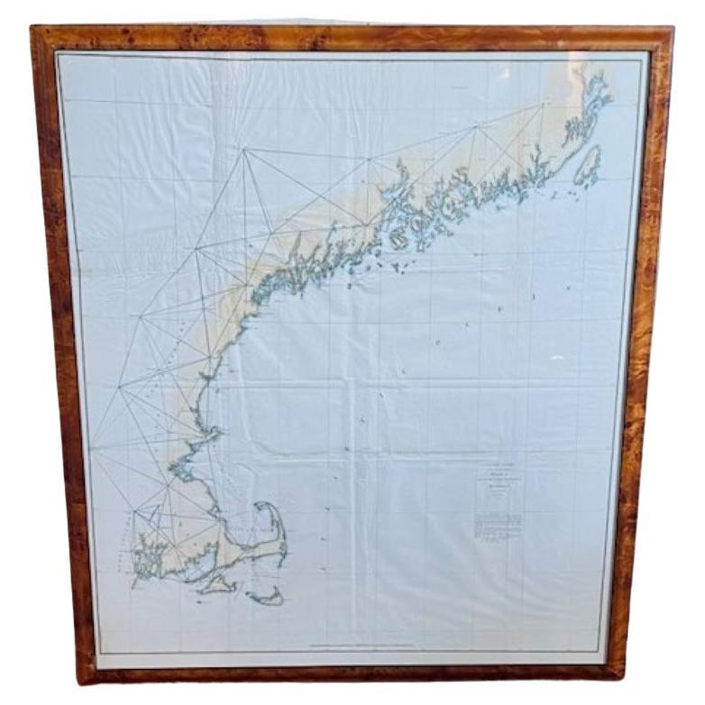
19th Century Chart of New England Coast, 1847
By U.S. Government
Located in Nantucket, MA
19th Century Chart of New England Coast: the U.S. Coast Survey Sketch A - Section 1, a triangulation chart showing the progress of the survey and details along the New England coas...
Category
Antique 1840s American Other Maps
Materials
Paper

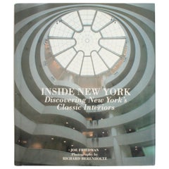
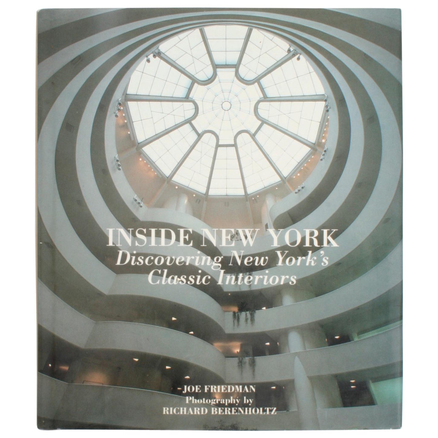
Inside New York, Discovering New York's Classic Interiors, First Edition
Located in valatie, NY
Inside New York, Discovering New York's Classic interiors by Joe Friedman. New York: Harper Collins Publishers, 1992. Stated first US edition hardcover with dust jacket. 128 pp. An o...
Category
20th Century American Books
Materials
Paper