Items Similar to Map of the Republic of Genoa


Want more images or videos?
Request additional images or videos from the seller
1 of 5
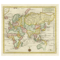
Map of the Republic of Genoa
About the Item
Framed antique hand-coloured map of the Republic of Genoa including the duchies of Mantua, Modena, and Parma.
Europe, late 18th century.
Dimension: 25.75 " W x 22.5" H x .75" D; sight 23.25" W x 19.75" H
- Dimensions:Height: 22.5 in (57.15 cm)Width: 25.75 in (65.41 cm)Depth: 0.75 in (1.91 cm)
- Place of Origin:
- Period:
- Date of Manufacture:Unknown
- Condition:Wear consistent with age and use. Minor losses. Small loss to map at middle right, some foxing and staining.
- Seller Location:New York, NY
- Reference Number:1stDibs: LU108423093762
About the Seller
4.9
Platinum Seller
These expertly vetted sellers are 1stDibs' most experienced sellers and are rated highest by our customers.
1stDibs seller since 2014
511 sales on 1stDibs
Typical response time: 1 hour
- ShippingRetrieving quote...Ships From: New York, NY
- Return PolicyA return for this item may be initiated within 3 days of delivery.
More From This SellerView All
- Antique Map of Italy by Andriveau-Goujon, 1843By Andriveau-GoujonLocated in New York, NYAntique Map of Italy by Andriveau-Goujon, 1843. Map of Italy in two parts by Andriveau-Goujon for the Library of Prince Carini at Palazzo Carini i...Category
Antique 1840s French Maps
MaterialsLinen, Paper
- David Roberts, Tombs of the MamelukesBy David RobertsLocated in New York, NYDavid Roberts, Tombs of the Mamelukes. David Roberts (1796-1864) antique lithograph of the "Tombs of the Mamelukes, Cairo" from the 1st edition in gilt frame, England, 1849. Dimensi...Category
Antique Mid-19th Century English Prints
MaterialsPaper
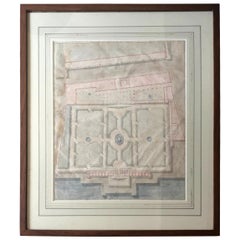
- Watercolor Landscape Study of the Palazzo Andrea Doria, GenoaLocated in New York, NYWatercolor Landscape Study of the Palazzo Andrea Doria, Genoa. Antique French architectural study of the plan and gardens of the Doria Palace in Genoa, en...Category
Antique Early 19th Century French Drawings
MaterialsPaper
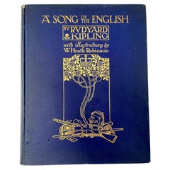
- First Edition a Song of the English by Rudyard KiplingLocated in New York, NYFirst edition a song of The English by Rudyard Kipling. Original blue cloth with front cover pictorially stamped in gilt on front cover and spine. edition of illustrated work by Robi...Category
Early 20th Century English Books
MaterialsPaper
- Sotheby's "The Duke and Duchess of Windsor Auction" Book CatalogsLocated in New York, NYSotheby's "The Duke and Duchess of Windsor Auction" book catalogs. Sotheby's catalogues from the Duke and Duchess of Windsor Auction from S...Category
20th Century American Books
MaterialsPaper
- Set of Six Engravings of Italian Regional DressBy Alessandro d'AnnaLocated in New York, NYSet of six engravings of Italian regional dress. Set of six framed antique engravings from a series of Italian regional dress after Alessandro d'...Category
Antique Late 18th Century Italian Prints
MaterialsPaper


You May Also Like
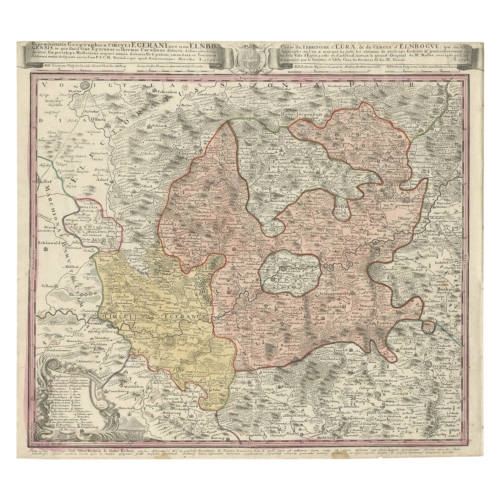
- Antique Map of the Region of Elbogen & Eger, Czech Republic & Hungary, 1742Located in Langweer, NLAntique map titled 'Repraesentatio Geographica Circuli Egerani, nec non Elnbogensis : in quo simul viae Egeranae in Thermas Carolinas distincta delineatio conspicitur (..)'. Orig...Category
Antique 1740s Maps
MaterialsPaper
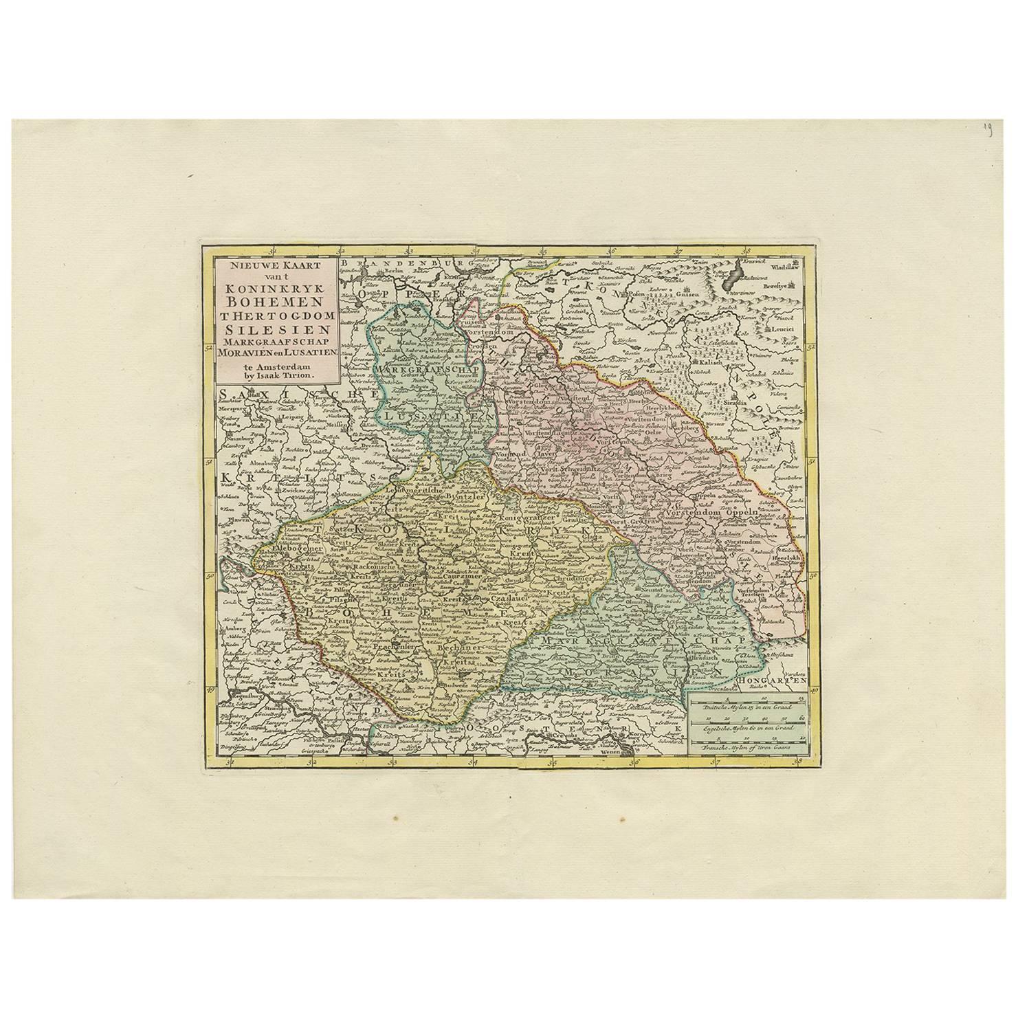
- Antique Map of Czech Republic by I. Tirion, 1747Located in Langweer, NLAntique map titled 'Nieuwe Kaart van t Koninkryk Bohemen t Hertogdom Silesien markgraafschap Moravien en Lusatien'. Including the towns of Berlin, Vienna, Regensburg.Category
Antique Mid-18th Century Maps
MaterialsPaper
- Antique Map of the United States with inset map of the region of Mexico CityLocated in Langweer, NLAntique map titled 'Verein-Staaten von Nord-America, Mexico, Yucatan u.a.'. Very detailed map of the United States of America showing the Caribbean. With an inset map of the surround...Category
Antique Mid-19th Century Maps
MaterialsPaper
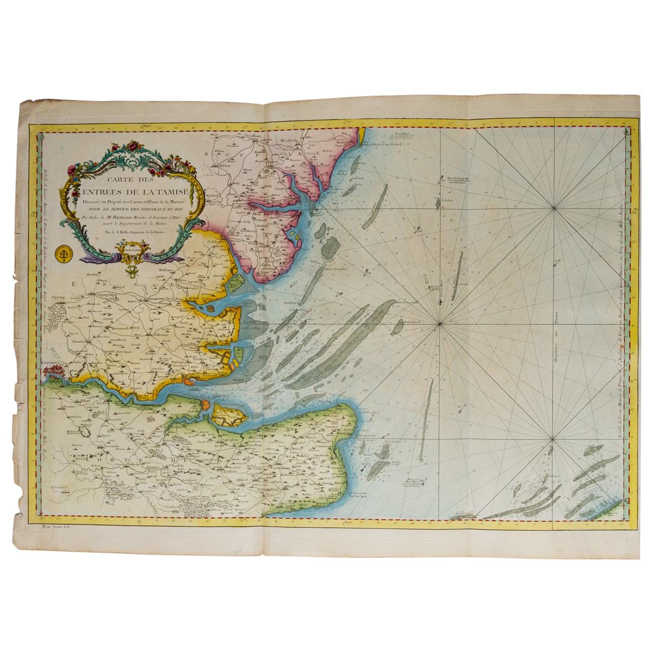
- Map "Estuary- Mouth of the Thames"Located in Alessandria, PiemonteST/426 - Antique French Map of the estuary of the Thames, map dated 1769 - "Mape of the entrance of the Thames. Designed by filing of Navy cards fo...Category
Antique Mid-18th Century French Other Prints
MaterialsPaper
- Antique Map of the Province of Overijssel, the NetherlandsLocated in Langweer, NLOriginal antique map titled 'Ditio Trans-Isulana'. Original old map of the province of Overijssel, the Netherlands. With coat of arms and two decorative cartouches. Published by J. J...Category
Antique Mid-17th Century Maps
MaterialsPaper
- Antique Map of the Eastern Part of the WorldLocated in Langweer, NLAntique map titled 'Nieuwe Kaart van het Oostelykste Deel der Weereld, diendende tot aanwyzing van de Scheepstogten der Nederlanderen Naar Oostindie'. This finely engraved map of the...Category
Antique Mid-18th Century Maps
MaterialsPaper


Recently Viewed
View AllMore Ways To Browse
Antique Parma
Antique Texas Collectables
Antique Furniture Alexandria
Victorian Fence
Alexandria Antique Furniture
Battle Maps
Antique Malaysia
Russian Antique Plates
Antique Railroad Collectables
Antique Railroad Collectibles
Floor Vase Wood
Antique Railroad Collectibles Collectibles
Map Print Set
Mariner Furniture
Antique World Globe Map
Antique Blackwood
Antique Furniture Missouri
Roman Map