Items Similar to Pair of English 12-inch Globes by William Harris, London, 1832 and 1835

Video Loading
Want more images or videos?
Request additional images or videos from the seller
1 of 22
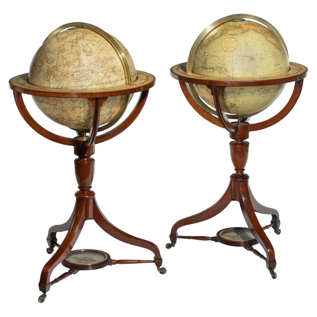
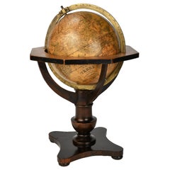
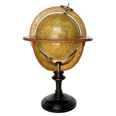
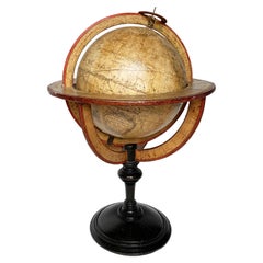
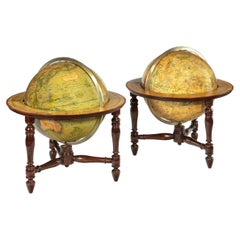
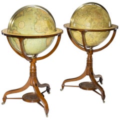
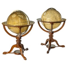
Pair of English 12-inch Globes by William Harris, London, 1832 and 1835
$21,646.07per set
£15,755.93per set
€18,000per set
CA$29,462.48per set
A$32,955.64per set
CHF 17,150.31per set
MX$405,695.17per set
NOK 218,187.47per set
SEK 204,702.86per set
DKK 136,983.92per set
Shipping
Retrieving quote...The 1stDibs Promise:
Authenticity Guarantee,
Money-Back Guarantee,
24-Hour Cancellation
About the Item
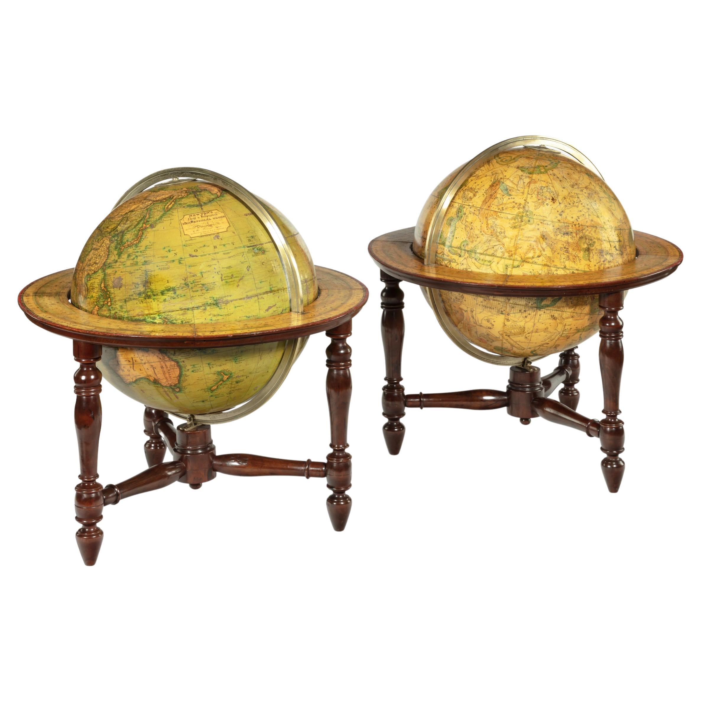
Pair of 12-inch table globes
William Harris
London, 1832 and 1835
Slight abrasions from use; few cracks
lb 11 each (kg 5)
The two terrestrial and celestial globes rest in their original Dutch style stands with four supporting turned wood columns.
Each one measures 12 in in height x 16.5 in in diameter with the diameter of the spheres measuring approximately 12 in; 48 cm in height x 42 cm in diameter x 31 cm diameter of the spheres.
The 12 inch measure was the most frequently used by British manufacturers of globes of this period.
Each globe is composed of two series of twelve printed paper gores, aligned and glued onto plaster spheres.
The brass circle of the meridian bears engravings marking the degrees of latitude. The circle on the horizon, instead, is made of wood covered with printed paper and shows in detail the amplitude, the days and months of the year and the names and symbols of the zodiac.
Each globe bears a cartouche containing two different inscriptions:
On the terrestrial globe the cartouche is affixed in the North Pacific Ocean:
HARRIS’S
TERRESTRIAL GLOBE,
on which is carefully Delineated
all the New Discoveries to the Present Time
BY W. HARRIS GLOBE MAKER TO THE KING,
N. 22 CORNHILL LONDON.
1832
On the celestial one the cartouche is affixed to the left of the Boreal Crown:
HARRIS’S
New & Improved
CELESTIAL GLOBE,
on which the Precession of the Stars
are carefully laid down to the Year 1835.
BY W. HARRIS GLOBE MAKER
TO HIS MAJESTY,
N. 22 CORNHILL LONDON.
On the terrestrial globe the exploration routes of Cook, Gore, Vancouver and La Pérouse as well as others from the previous era, are traced. Parts of central and southern Africa are unexplored: the Tanganyika Lake is outlined, but Lake Victoria is missing (it was described for the first time in 1858). In the Arctic Ocean the so-called Passage to the North West is barely sketched (it was to be definitively identified in 1906). Alaska is only partially outlined. Australia (which was already so called in 1829) is still named New Holland.
William Harris began his activity at the laboratory and sales shop that his father Thomas had started around 1808 in London at no. 20 of Duke Street. After some transfers and after his father’s death, William moved definitively to no. 22 of Cornhill, still in London. They were both renowned cartographers, engravers and manufacturers of scientific instruments, and their business prospered for almost thirty years, until 1836 (or 1838), when the company inexplicably went bankrupt.
(See Van der Krogt, P., Old Globes in the Netherlands, Utrecht, 1984, pp. 141-142 and Van der Krogt, P. - Dekker, E., Globes from the Western World, London 1993, passim. On bankruptcy see: Elwick, George, The Bankrupt Directory: Being a Complete Register of the Bankrupts, with Their Residences, Trades, and Dates when They Appeared in the London Gazette, from December 1820 to April 1843, London, 1843.)
- Creator:William Harris (Author)
- Dimensions:Height: 18.9 in (48 cm)Diameter: 16.54 in (42 cm)
- Sold As:Set of 2
- Style:William IV (Of the Period)
- Materials and Techniques:
- Place of Origin:
- Period:
- Date of Manufacture:1832-1835
- Condition:Minor losses. Minor fading. Slight abrasions from use; few cracks.
- Seller Location:Milano, IT
- Reference Number:1stDibs: LU4352213665662
About the Seller
4.3
Vetted Professional Seller
Every seller passes strict standards for authenticity and reliability
Established in 1860
1stDibs seller since 2018
21 sales on 1stDibs
Associations
International Confederation of Art and Antique Dealers' Associations
- ShippingRetrieving quote...Shipping from: Milano, Italy
- Return Policy
Authenticity Guarantee
In the unlikely event there’s an issue with an item’s authenticity, contact us within 1 year for a full refund. DetailsMoney-Back Guarantee
If your item is not as described, is damaged in transit, or does not arrive, contact us within 7 days for a full refund. Details24-Hour Cancellation
You have a 24-hour grace period in which to reconsider your purchase, with no questions asked.Vetted Professional Sellers
Our world-class sellers must adhere to strict standards for service and quality, maintaining the integrity of our listings.Price-Match Guarantee
If you find that a seller listed the same item for a lower price elsewhere, we’ll match it.Trusted Global Delivery
Our best-in-class carrier network provides specialized shipping options worldwide, including custom delivery.More From This Seller
View AllPair of Miniature Globes Lane’s on Tripod Bases, London post 1833, ante 1858
By Lane's
Located in Milano, IT
Pair of miniature globes
Lane’s, London, post 1833, ante 1858
Papier-mâché, wood and paper
They measure:
Height 9.44 in (24 cm);
Sphere diameter 2.75 in (7 cm);
Diameter of t...
Category
Antique 1840s English Early Victorian Maps
Materials
Paper, Wood
18-inch Globe, Cary's, London, 1840
By Cary’s
Located in Milano, IT
John and William Cary
Updated by George and John Cary
Terrestrial Globe
London, 1840
lb 22 (kg 10)
Slight surface abrasions due to use. A small crack on the horizon circle.
The globe rests in its original Dutch style stand with four supporting turned wood columns.
It measures 26 in in height x 23.6 in in diameter with the diameter of the sphere measuring 18 in; 66 cm in height x 60 cm in diameter with the diameter of the sphere measuring 45.72 cm.
The 18 inch...
Category
Antique 1840s English Early Victorian Globes
Materials
Paper, Wood
Pocket Globe by Nathaniel Hill, London 1754
Located in Milano, IT
Nathaniel Hill
Pocket globe
London, 1754
The globe is contained in its original case, which itself is covered in shark skin.
There are slight gaps in the original paint on the sphere. The case no longer closes.
The sphere measures 2.6 in (6.8 cm) in diameter whereas the case measures 2.9 in (7.4 cm) in diameter.
lb 0.24 (kg 0.11)
The globe is made up of twelve printed paper gores aligned and glued to the sphere.
In the North Pacific Ocean there is a scroll with the inscription:
A
New
terrestrial
Globe
by
Nath. Hill,
1754.
The celestial globe is depicted on the inside of the box.
On the terrestrial globe much of central and southern Africa is empty. North America bears only the name of some British colonies. It shows California as a peninsula and the northwest coast of America as "unknown parts" (Alaska is not described and is only partially delineated; it would become part of the United States in 1867). The route of Admiral Anson is traced (1740) and the trade winds are indicated by arrows. Australia, still named New Holland (the new name would be introduced in 1829), is part of the west coast. (See Van der Krogt, P., Old Globes in the Netherlands, Utrecht 1984, p. 146 and Van der Krogt, P. - Dekker, E., Globes from the Western World, London 1993, p. 115.)
Nathaniel Hill (London, news from 1746 to 1768) had impeccable professional credentials: he had done his apprenticeship with Richard Cushee, who at the time was carrying out surveying work for John Senex's Surrey map...
Category
Antique 1750s English George II Globes
Materials
Shagreen, Paper
German Globe by C. Abel-Klinger, Nuremberg, circa 1860
By C. Abel-Klinger
Located in Milano, IT
Terrestrial globe
Artistic company C. Abel - Klinger
Nuremberg, circa 1860
H cm 31 x 22 cm (12.20 x 8.66 in); sphere 14 cm (5.51 in) in diameter
lb 2.30 (kg 1.04)
State of conservation: good. On the sphere there are slight visible signs of accidental bumping at the poles, as well as on New Guinea and England (vertical and more visible); some ink stains, especially at the South Pole and on the meridian that crosses North America.
The globe is composed of twelve whole gores of printed paper, juxtaposed and glued on a sphere made with a chalky base mixture.
The circle of the meridian, made of brass...
Category
Antique 1860s German Other Scientific Instruments
Materials
Wood, Paper
Celestial Table Globe, Charles-François Delamarche, Paris, 1791
By Charles Francois Delamarche
Located in Milano, IT
Celestial table globe
Charles-François Delamarche
Paris, 1791
It measures: 17.13 in in height, Ø max 27.7 in; the sphere Ø 7.09 in
(h 43.5 cm x Ø max 27.7 cm; the sphere Ø 18 cm).
W...
Category
Antique 1790s French Other Scientific Instruments
Materials
Metal
Terrestrial Table Globe by Félix Delamarche, Paris, 1821
By Félix Delamarche
Located in Milano, IT
Terrestrial table globe
Félix Delamarche
Paris, 1821
It measures 20.47 in height, Ø max 14.17 in; the sphere Ø 9.44 in (h 52 cm x Ø max 36.5 cm; the sphere Ø 24 cm)
Wood, printed...
Category
Antique 1820s French Restauration Scientific Instruments
Materials
Metal
You May Also Like
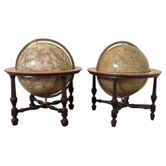
Pair of Table Globes by J & W Newton, Dated 1820
By John & William Newton
Located in Lymington, Hampshire
A pair of 12 inch table globes by J & W Newton, dated 1820, each with 12 hand coloured gores, graduated meridian rings, set within ebonised stands with t...
Category
Antique 1820s English Regency Globes
Materials
Wood
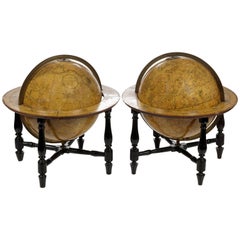
Pair of George III Globes by J&W Cary Dated 1815 and 1800
By Cary’s
Located in Lymington, Hampshire
A pair of George III 21 inch globes by J&W Cary, dated 1815 and 1800, set in mahogany stands with turned urn-shaped supports raised on three outsplayed legs with original castors fee...
Category
Antique Early 1800s English Globes
Materials
Mahogany
A Pair of English 9-Inch Terrestrial and Celestial Table Globes by Wm. Bardin
Located in San Francisco, CA
A fine pair of English 9" terrestrial and celestial globes, each with engraved meridian rings, resting in mahogany stands with turned stretchers, both signed by the maker Wm. Bardin ...
Category
Antique Late 18th Century English George III Globes
Materials
Mahogany, Paper
Pair of Fine Desk Globes by J. Cary, 1816 and 1824
Located in Amsterdam, NL
A pair of desk globes by J. Cary
“Cary’s New Terrestrial Globe delineated from the best Authorities extant; exhibiting the late discoveries toward the North Pole and every improve...
Category
Antique Early 19th Century Maps
Materials
Other
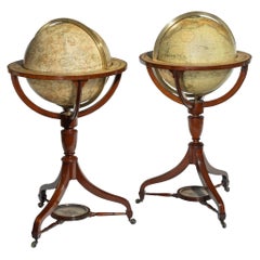
Fine Pair of Floor Globes by J & G Cary, Dated 1820 and 1833
By George & John Cary
Located in Lymington, Hampshire
A fine pair of 15 inch floor globes by J & G Cary, dated 1820 and 1833, each set into a mahogany stand with a vase shaped support and three legs centred on a compass, one with a labe...
Category
Antique Early 19th Century English Regency Globes
Materials
Mahogany
Pair of Table Globes by G & J Cary, Dated 1800 and 1821
By George & John Cary
Located in Lymington, Hampshire
A pair of 12 inch table globes by G & J Cary, dated 1800 and 1821, each with hand-painted gores, set in mahogany stands with a turned support raised on t...
Category
Antique Early 19th Century English Globes
Materials
Mahogany
More Ways To Browse
Antique Laboratory Table
Globes Terrestres Vintage
Celestial Globe Cary
Pair Globe Cary
Floor Globes By Replogle
Bellerby Globe
Jro Globe
Denoyer Geppert Globe
Pearsall Globe
Rand Mcnally Terrestrial Globe
Adrian Pearsall Globe
Arthur Krause
Repogle Globe
Denoyer Geppert Chalk Globe
Globus Table
Gustav Brueckmann
Homer Costello
Malby Globe