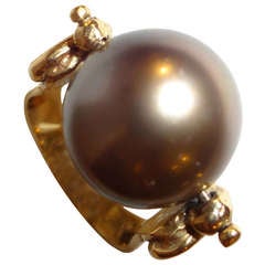
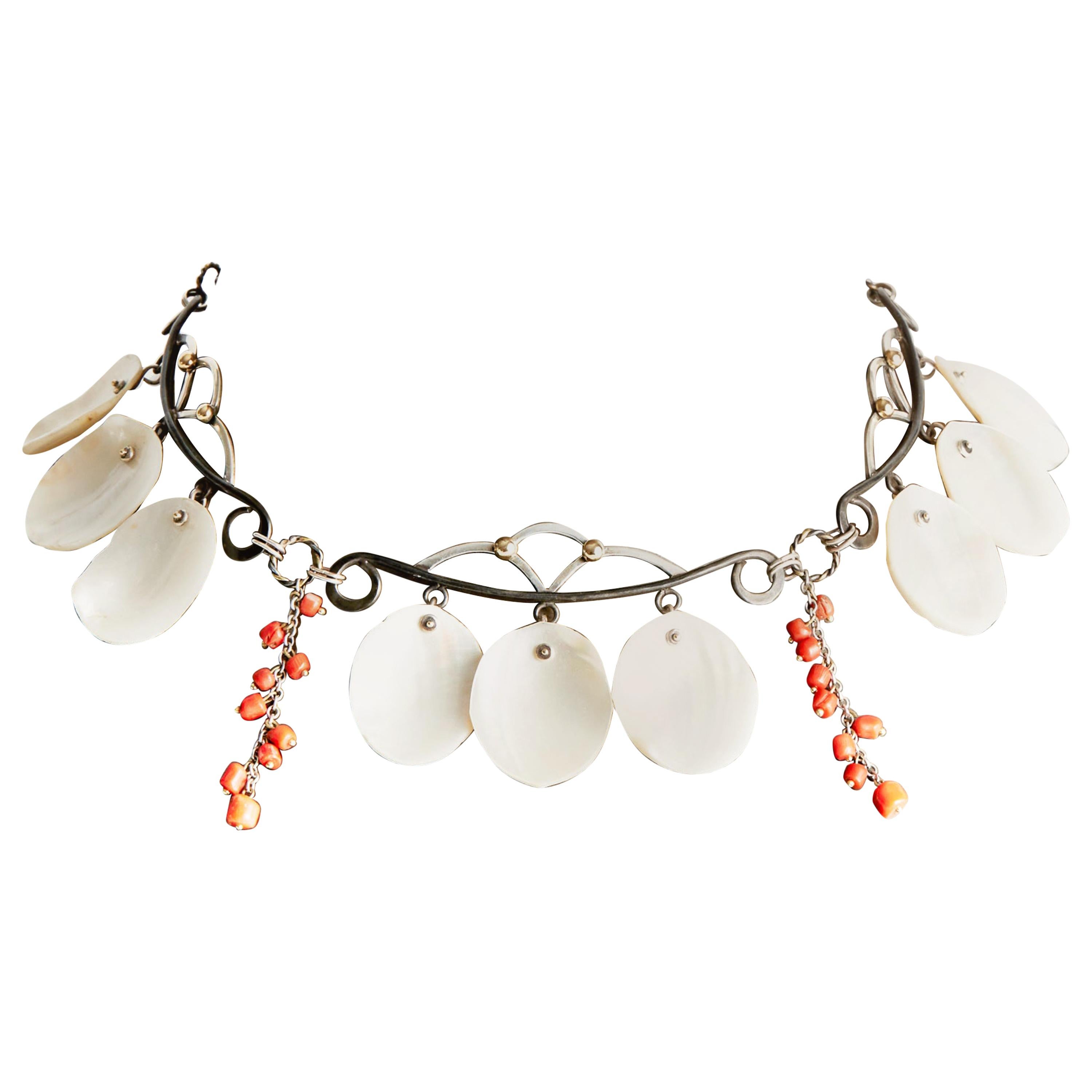
South Sea Pearl Ring
View Similar Items

1 of 4
South Sea Pearl Ring
About the Item
- Materials and Techniques:
- Place of Origin:
- Period:
- Date of Manufacture:1985
- Condition:Wear consistent with age and use.
- Seller Location:Sarasota, FL
- Reference Number:Seller: 621stDibs: LU8209978828
You May Also Like
- Brooch with South Sea Pearls and Diamonds in White GoldLocated in Münster, DEBrooch set with 6 South Sea pearls, set in 750/- white gold, brilliant-cut diamonds, approx. 1 ct. A brooch with a minimalist design that can also be worn as a pendant and which em...Category
Vintage 1980s German Modern Collectible Jewelry
MaterialsGold
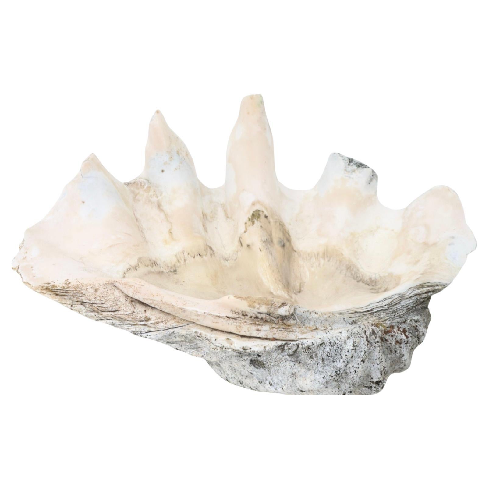
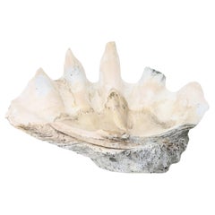
- Giant Natural South Seas Clam Shell SpecimenLocated in Bradenton, FLAuthentic giant clam shell specimen with its iconic sculptural form and sea inspired colors and textures.Category
20th Century Asian Organic Modern Nautical Objects
MaterialsShell
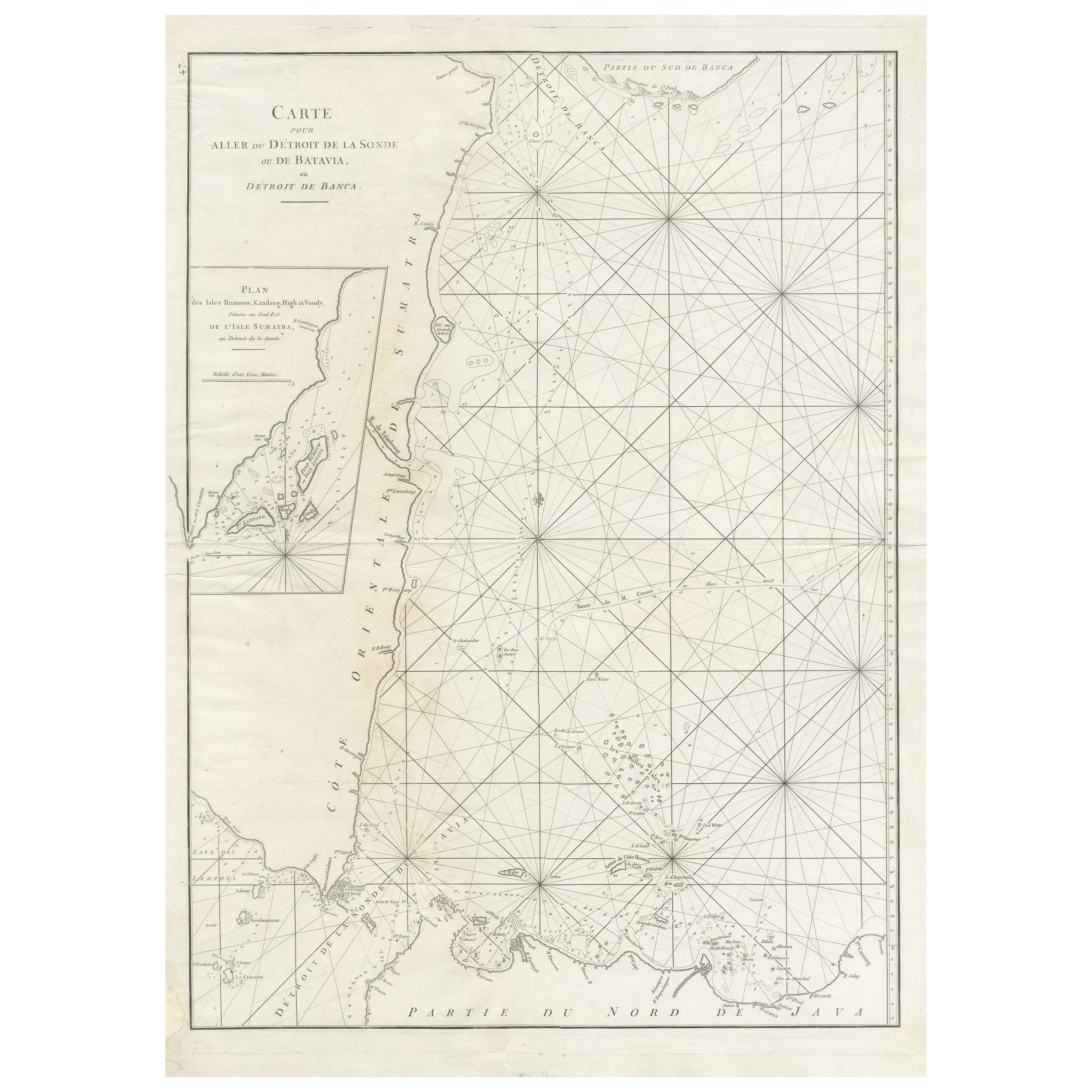
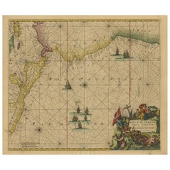
- Large Antique Sea Chart of the South-Eastern Coast of Sumatra, IndonesiaLocated in Langweer, NLAntique map titled 'Carte pour aller du Détroit de la Sonde ou de Batavia, au Détroit de Banca'. This uncommon sea chart shows northern Java and eastern Sumatra along with an inset of the small islands in the Detroit Sound. The handsome chart provides detailed navigational information, including the route of Julien Crozet in April 1772, who led a French expedition to the South Pacific after the voyage's commander, Marion De Fresne, and 26 crew members were killed (and allegedly eaten) by a Maori tribe in the Bay of Islands off the coast of New Zealand. With title upper left corner and small inset map of the small isles nearby the south-eastern coast of Sumatra. J. B. d'Apres de Mannevillette, from his atlas "Neptune orientale". French sailor...Category
Antique Late 18th Century Maps
MaterialsPaper
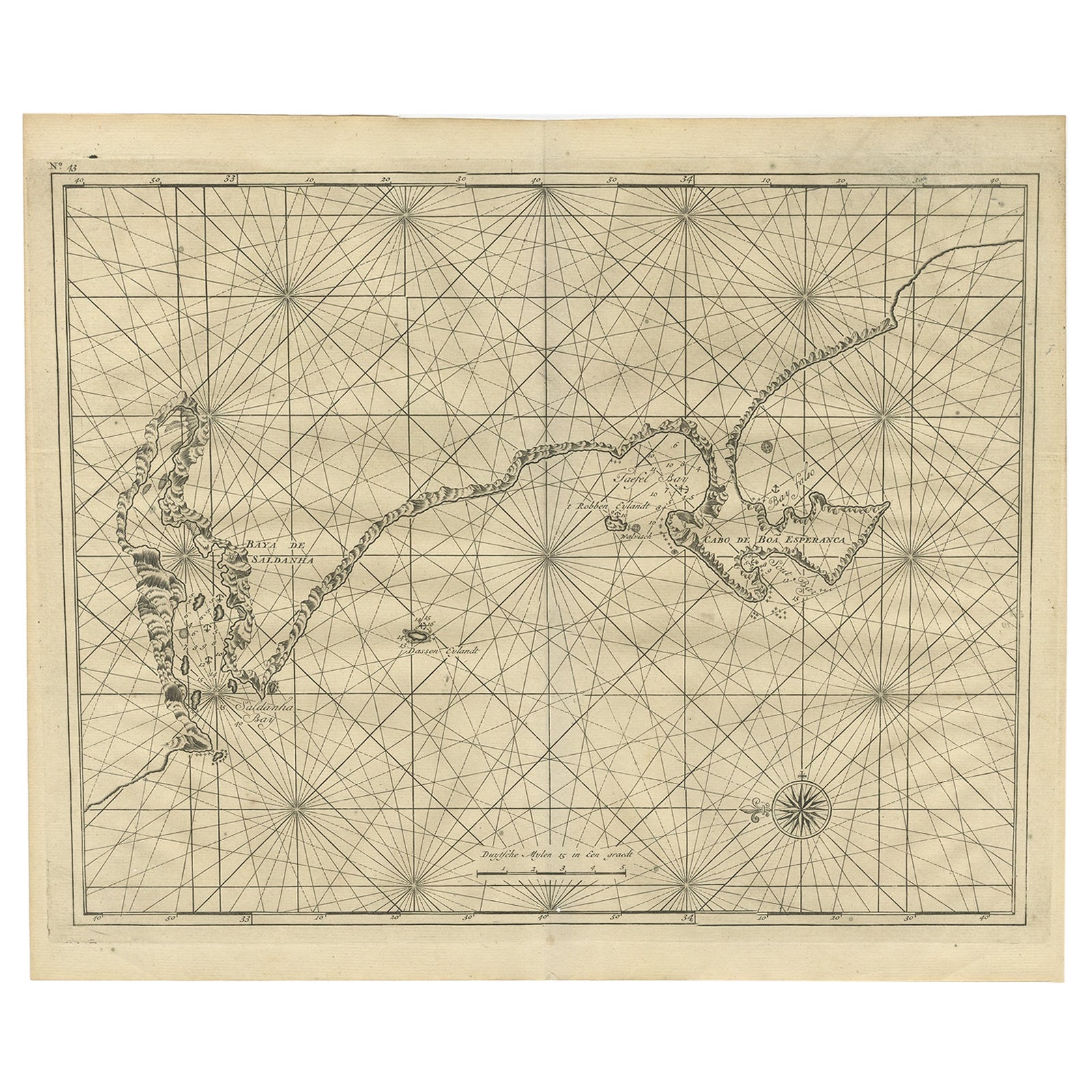
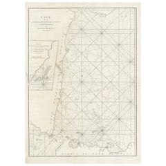
- Sea Chart Titled 'Baya de Saldanha' with Robben Island in South Africa, 1726Located in Langweer, NLAntique map titled 'Baya de Saldanha'. Sea chart covering the South African coast from the Cape of Good Hope to Saldanha Bay. This print originates from 'Oud en Nieuw Oost-Indiën...Category
Antique 1720s Maps
MaterialsPaper
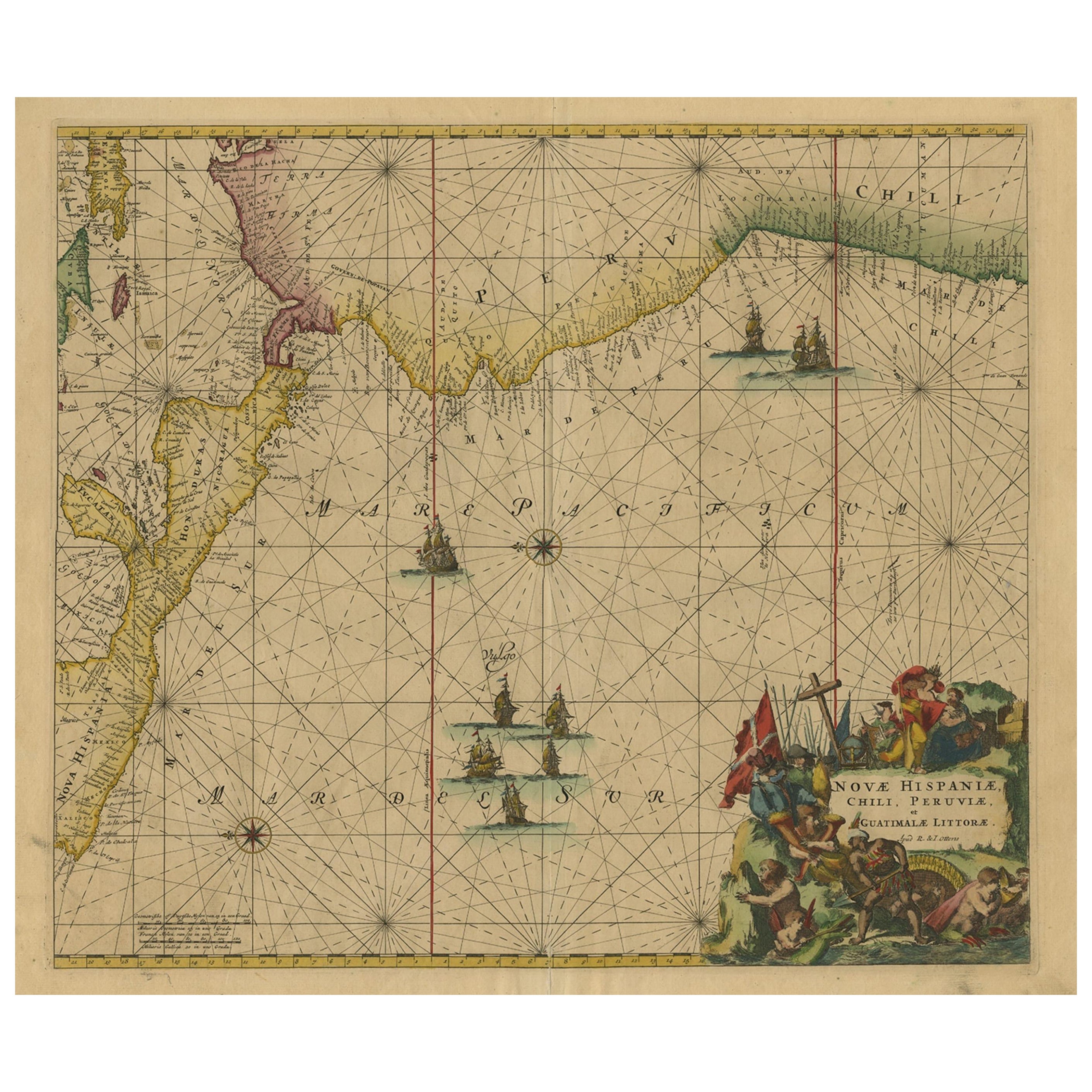
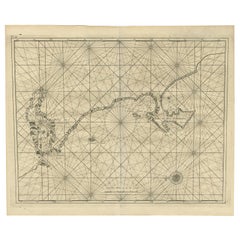
- Sea Chart of Central America and the Northwest Coast of South America, ca.1745Located in Langweer, NLAntique map titled 'Novae Hispaniae, Chili, Peruviae et Guatamala Littorae.' Sea chart of Central America and the northwest coast of South America, oriented to the east, by Reini...Category
Antique 1740s Maps
MaterialsPaper
 $2,152 Sale Price20% OffFree Shipping
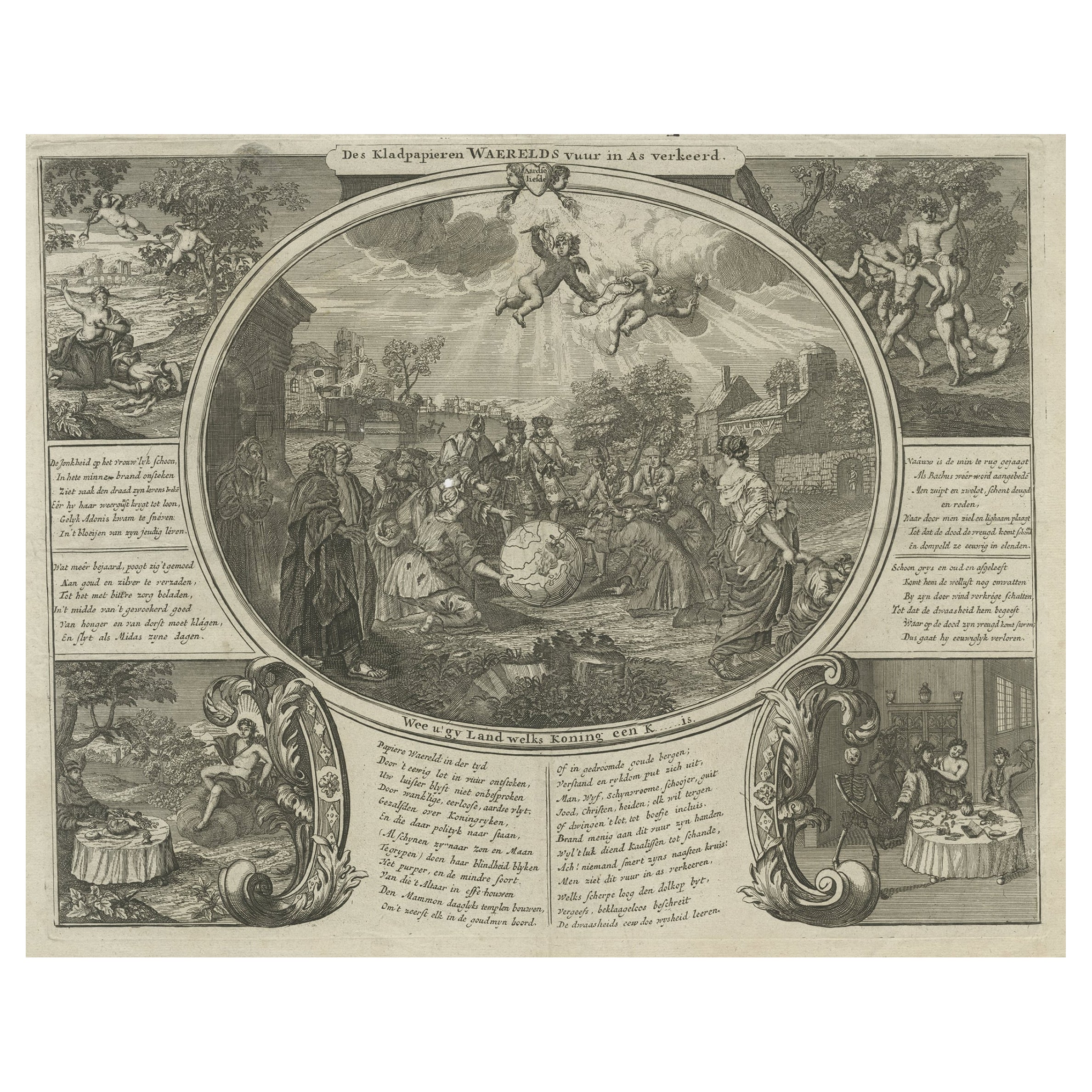
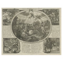
 - 'Waste Paper is Burned to Ashes', a Satire Print on the South Sea Bubble, 1720Located in Langweer, NLAntique print titled 'Des Kladpapieren Waerelds vuur in as verkeerd'. 'The world of waste paper is burned to ashes', a satire on the South Sea Bubble. The oval central image shows a group containing kings, churchmen, rich and poor surrounding a globe. The four corner images are: (TL) the death of Adonis; (TR) the death of Bacchus; (BL) King Midas sitting at a table with his food turning into gold...Category
Antique 1720s Maps
MaterialsPaper

Recently Viewed
View AllMore Ways To Browse
6 Carrot Ring
A.E. Jones On Sale
Alexander Calder Pin
Bracelet Under 500
Fuset Y Grau
Fuset Grau
G Town Jewelers New York
Destino Cufflinks
Corum For Cartier
Giraffe Link Bracelet
Gold Coller Necklaces
Grandma Jewelry
Double Strand Pearl Necklace With Diamond Clasp
Cartier Corum
Creeper Earrings
Omega Speedsonic
Lalique Hatpin
Suomen Kultasepp� Oy On Sale