Items Similar to Vintage School Chart of Coal Mining Operation Plus Cross Section on Verso, 1931


Want more images or videos?
Request additional images or videos from the seller
1 of 6
Vintage School Chart of Coal Mining Operation Plus Cross Section on Verso, 1931
About the Item
Title: De Mijn Maurits bij Sittard (The Maurits Mine near Sittard). On the verso 'Doorsnede van een kolen mijn in Limburg'. Translated: Cross Section of a Coalmine in Limburg (a province in the South of The Netherlands).
Sittard is a city in the province of Limburg, in the south of Holland. In 1947 this coal mine was connected to another mine: the Emma Mine, by a 13 km straight tunnel. In the second half of the 1940s and in the 1950s the mine was expanded, and mining reached a depth of 810 m. A third shaft was completed in 1958. At the time of completion of the third shaft, the Maurits mine was the largest two-shafts mine in the world. It was the largest coal mine in the Netherlands. When in the beginning of the 1960s the economic tide for coal mining turned, it was already anticipated to close the Maurits as one of the first mines. The mine was finally closed down in 1967. The surface facilities were afterwards demolished.
Directly adjacent to the mine site, DSM had already decades before started with cokes production and gasproduction. The "Stikstof Bindingsbedrijf" (SBB - or "nitrogen bonding plant") became the locus for the next step in the history of DSM: it became (and still is) a large chemicals company.
This school chart was Published in 1931 by J.B. Wolters' Uitgeversmaatschappij n.v. - Groningen, Den Haag, Batavia.
Maker: Gabriëlse
Light wear consistent with age and use, Patina consistent with age and use, a scratch on the lower left corner. Study the image carefully.
- Dimensions:Height: 26.38 in (67 cm)Width: 34.26 in (87 cm)Depth: 0.16 in (4 mm)
- Materials and Techniques:
- Place of Origin:
- Period:
- Date of Manufacture:1931
- Condition:
- Seller Location:Langweer, NL
- Reference Number:Seller: BG-11631-31stDibs: LU3054325871002
About the Seller
5.0
Recognized Seller
These prestigious sellers are industry leaders and represent the highest echelon for item quality and design.
Platinum Seller
Premium sellers with a 4.7+ rating and 24-hour response times
Established in 2009
1stDibs seller since 2017
2,422 sales on 1stDibs
Typical response time: 1 hour
- ShippingRetrieving quote...Shipping from: Langweer, Netherlands
- Return Policy
Authenticity Guarantee
In the unlikely event there’s an issue with an item’s authenticity, contact us within 1 year for a full refund. DetailsMoney-Back Guarantee
If your item is not as described, is damaged in transit, or does not arrive, contact us within 7 days for a full refund. Details24-Hour Cancellation
You have a 24-hour grace period in which to reconsider your purchase, with no questions asked.Vetted Professional Sellers
Our world-class sellers must adhere to strict standards for service and quality, maintaining the integrity of our listings.Price-Match Guarantee
If you find that a seller listed the same item for a lower price elsewhere, we’ll match it.Trusted Global Delivery
Our best-in-class carrier network provides specialized shipping options worldwide, including custom delivery.More From This Seller
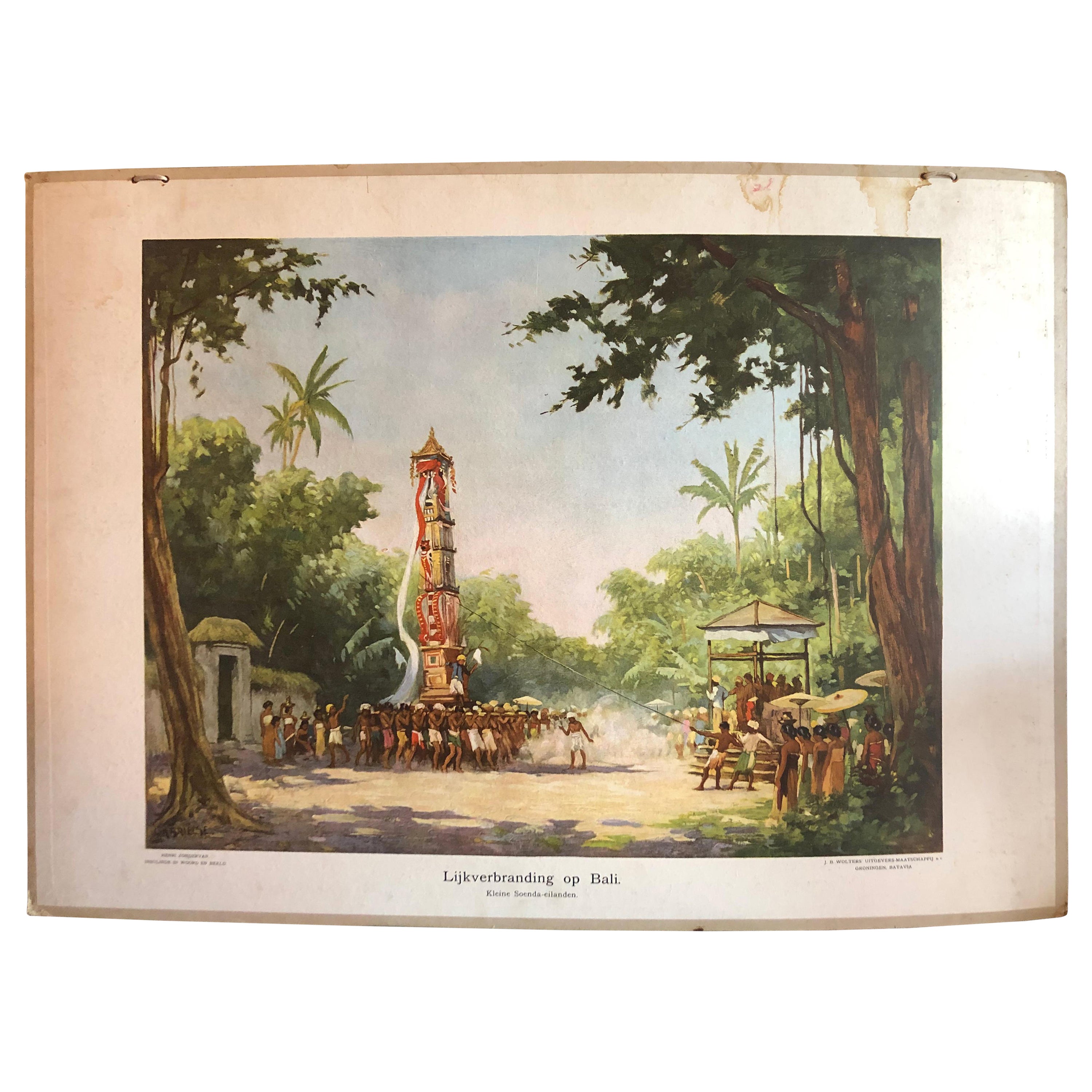
View AllCollection of 5 Vintage School-Charts of Indonesia, Incl Bali Ritual Cremation
Located in Langweer, NL
Collection of Old School Posters on cardboard of the early 20th century. Most of the images are still intact with bright colours, but the outer marg...
Category
Early 20th Century Dutch Historical Memorabilia
Materials
Paper

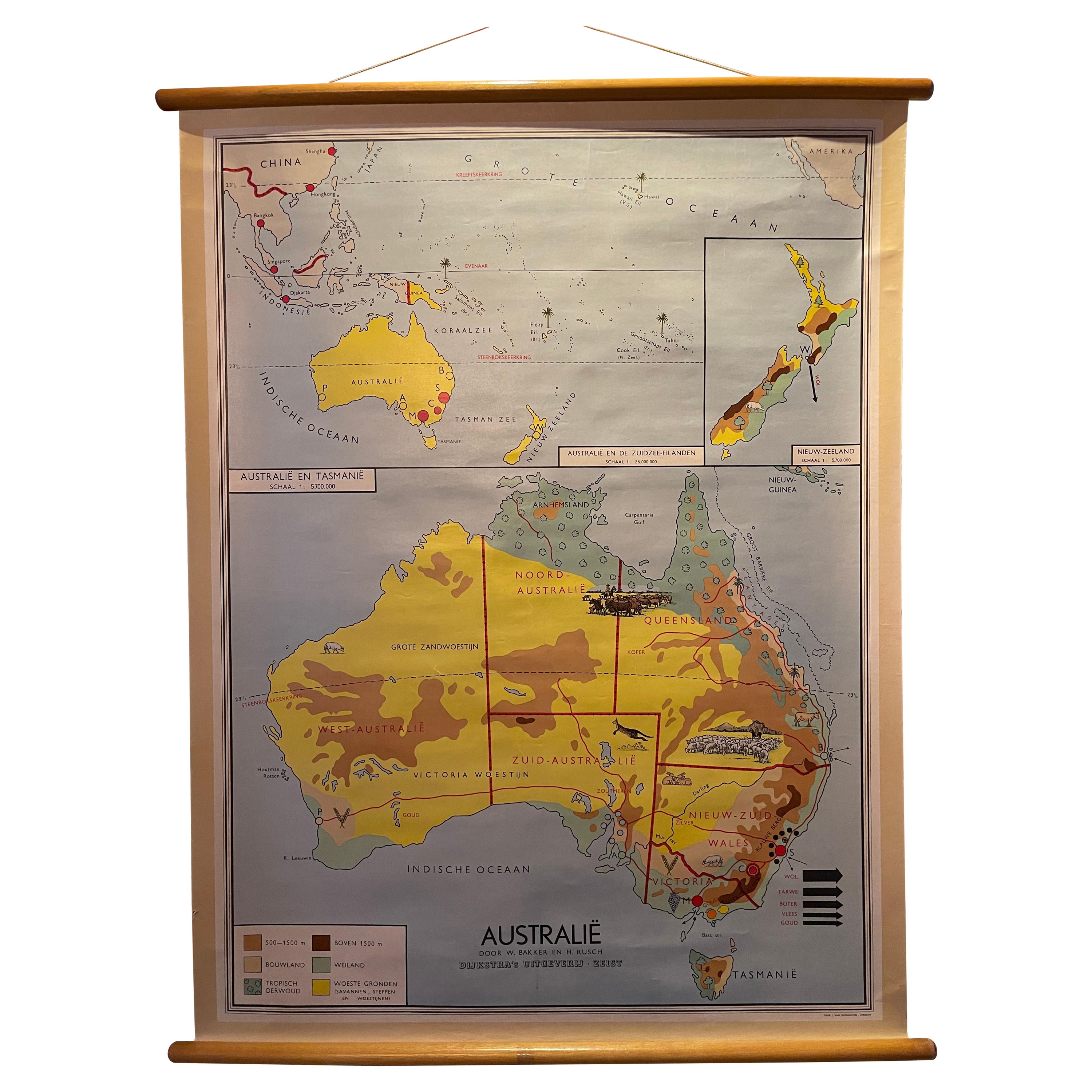
Decorative Vintage Print, Dutch Chart of Australia, 1st Edition, 1952
Located in Langweer, NL
The vintage school chart of Australia titled "Australië," created by W. Bakker & H. Rush and published in 1952:
**Title**: Australië
**Creators**: W. Bakker & H. Rush
**Publication ...
Category
Mid-20th Century European Maps
Materials
Canvas

$321 Sale Price
20% Off
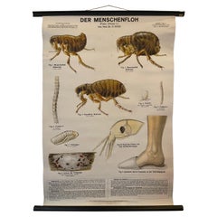
Vintage School Chart, a German Poster Depicting the Human Flea, Early 1900's
Located in Langweer, NL
This school chart has been made by Dr. Schlüter & Dr. Mass. The German title of this poster is "Der Menschenfloh" Von Prof. Dr. A. Hase. Verlag von Paul Parey in Berlin. Early 1900's...
Category
Early 20th Century European Posters
Materials
Linen
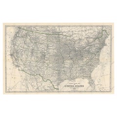
Old Map of the American Railroad Network and All Weather Roads on Verso, 1931
Located in Langweer, NL
This is the “New Census Edition” of Clason’s United States Green Guide. It features two large maps of the United States on a single sheet.
The recto map shows the complete road net...
Category
Vintage 1930s Maps
Materials
Paper
$413 Sale Price
20% Off
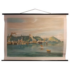
Vintage Wall Chart of Balikpapan 'Indonesia'
Located in Langweer, NL
Vintage wall chart titled 'Balikpapan'. View of Balikpapan, a seaport city in East Kalimantan, Indonesia. Published circa 1920.
The vintage wall ch...
Category
Early 20th Century Prints
Materials
Paper
$918 Sale Price
20% Off
Vintage Wall Chart of Australia, 1949
Located in Langweer, NL
Vintage wall chart of Australia and surroundings. Published by R. Bos and K. Zeeman, 1949.
Category
Mid-20th Century Prints
Materials
Paper

$688 Sale Price
25% Off
You May Also Like
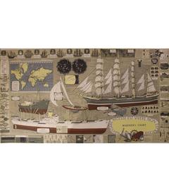
Mariner's Chart Poster
Located in Hamilton, Ontario
Mariner's chart poster (nautical).
Category
20th Century Posters
$1,795 Sale Price
20% Off
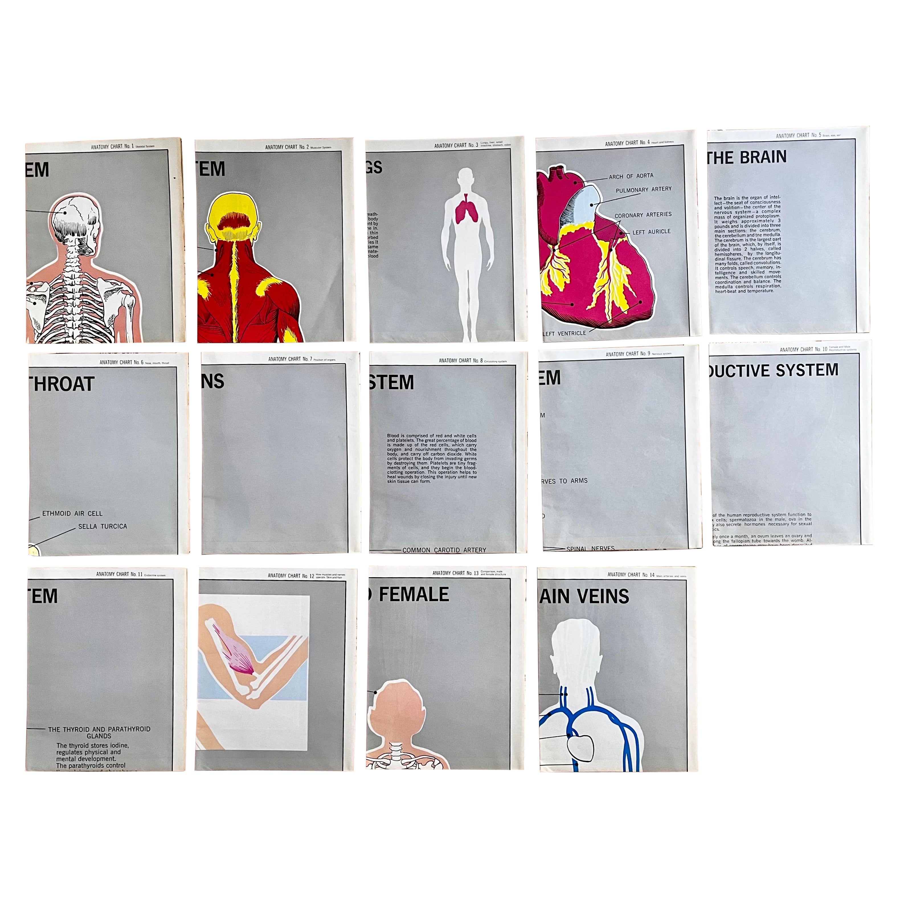
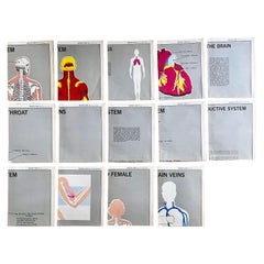
Set of (14) Vintage Anatomy Charts by American Map Co. - sold individually
Located in Philadelphia, PA
Set of (14) Vintage Anatomy Charts
American Map Co. - Circa 1950.
14 Total Charts - Sold Individually -( 14 available )
( discounted to buy as a set )
29" x 37" unfolded
9.5" x 12...
Category
Mid-20th Century American Mid-Century Modern Posters
Materials
Paper
Large University Chart “Physical Map of Africa” by Bacon
Located in Chillerton, Isle of Wight
Large university chart “Physical Map of Africa” by Bacon
W&A K Johnston’s Charts of Physical Maps By G W Bacon,
This is colorful Physical map of North America, it is large lithograph set...
Category
Early 20th Century Folk Art Posters
Materials
Linen

Set of Three Mid Century European Pictorial Charts of Warsaw, Belgrade & Vaduz
Located in Houston, TX
Collection of large, roll-up vintage teaching charts on linen backed paper with original wooden dowel rods. Dated 1956. Pictures portrait the era nicely. Used in a Belgian school ho...
Category
Vintage 1950s Belgian Mid-Century Modern Posters
Materials
Metal
Large University Chart “Political Map of North America” by Bacon
Located in Chillerton, Isle of Wight
Large University chart “Political Map of North America” by Bacon
W&A K Johnston’s Charts of Political Maps by G W Bacon,
This is colorful Physical ...
Category
Early 20th Century American Empire Posters
Materials
Linen

Large University Chart “Political Map of North America” by Bacon
Located in Chillerton, Isle of Wight
Large University Chart “Political Map of North America” by Bacon
W&A K Johnston’s Charts of Physical Maps By G W Bacon,
This is colourful Physical map ...
Category
Early 20th Century American Empire Posters
Materials
Linen
