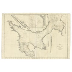
Antique English Chart of The Mediterranean Sea, 1795
View Similar Items


Want more images or videos?
Request additional images or videos from the seller
1 of 6
Antique English Chart of The Mediterranean Sea, 1795
About the Item
- Dimensions:Height: 8.08 in (20.5 cm)Width: 17.13 in (43.5 cm)Depth: 0 in (0.01 mm)
- Materials and Techniques:
- Period:
- Date of Manufacture:1795
- Condition:
- Seller Location:Langweer, NL
- Reference Number:Seller: BG-079651stDibs: LU3054326300012
About the Seller
5.0
Platinum Seller
These expertly vetted sellers are 1stDibs' most experienced sellers and are rated highest by our customers.
Established in 2009
1stDibs seller since 2017
1,933 sales on 1stDibs
More From This SellerView All
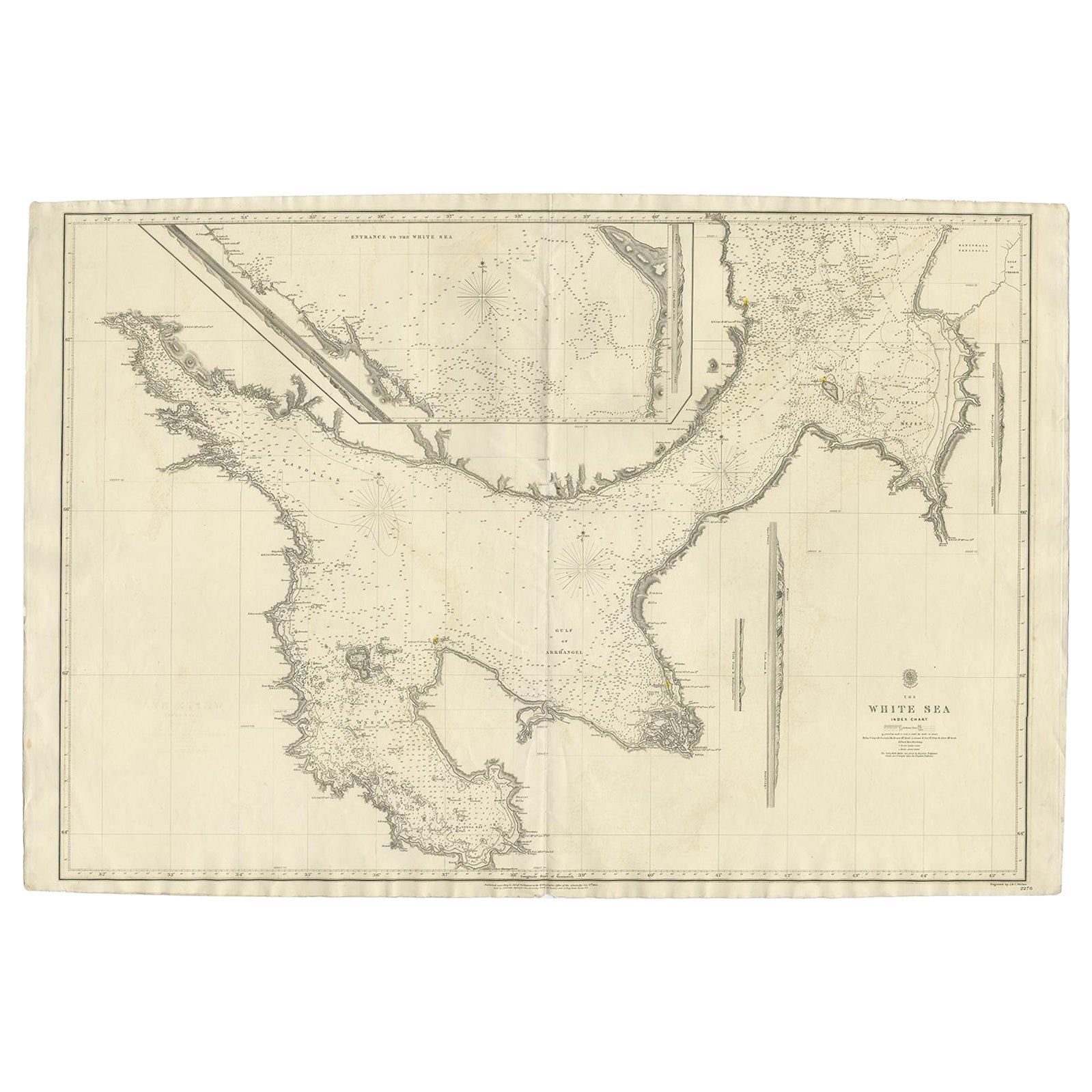
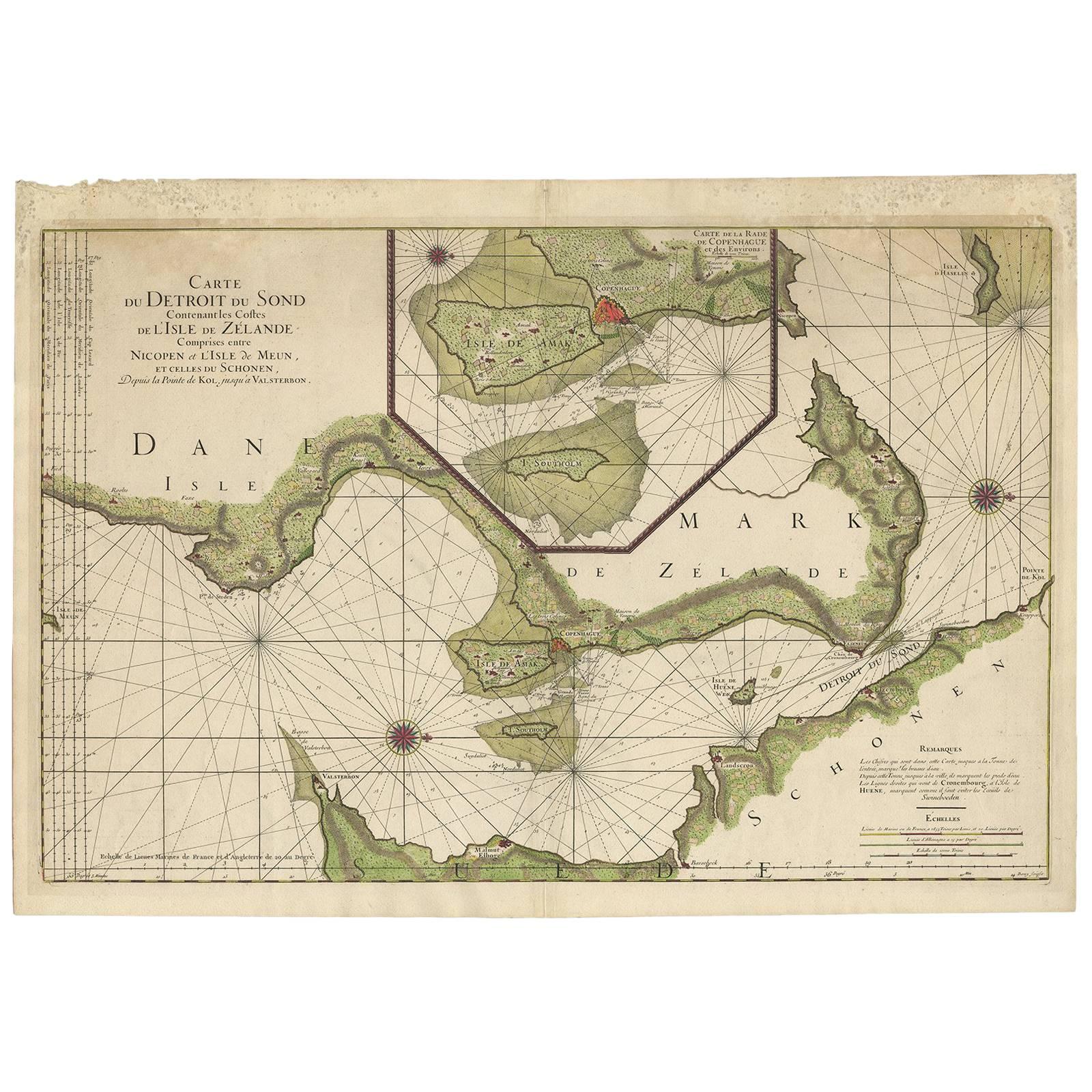
- Large Antique Chart of The White Sea, Russa 1854Located in Langweer, NLAntique map titled 'The White Sea Index Chart'. Large uncommon map of the White Sea with a smaller inset map of the entrance to the White Sea. The white sea is a southern inlet of th...Category
Antique 19th Century Maps
MaterialsPaper
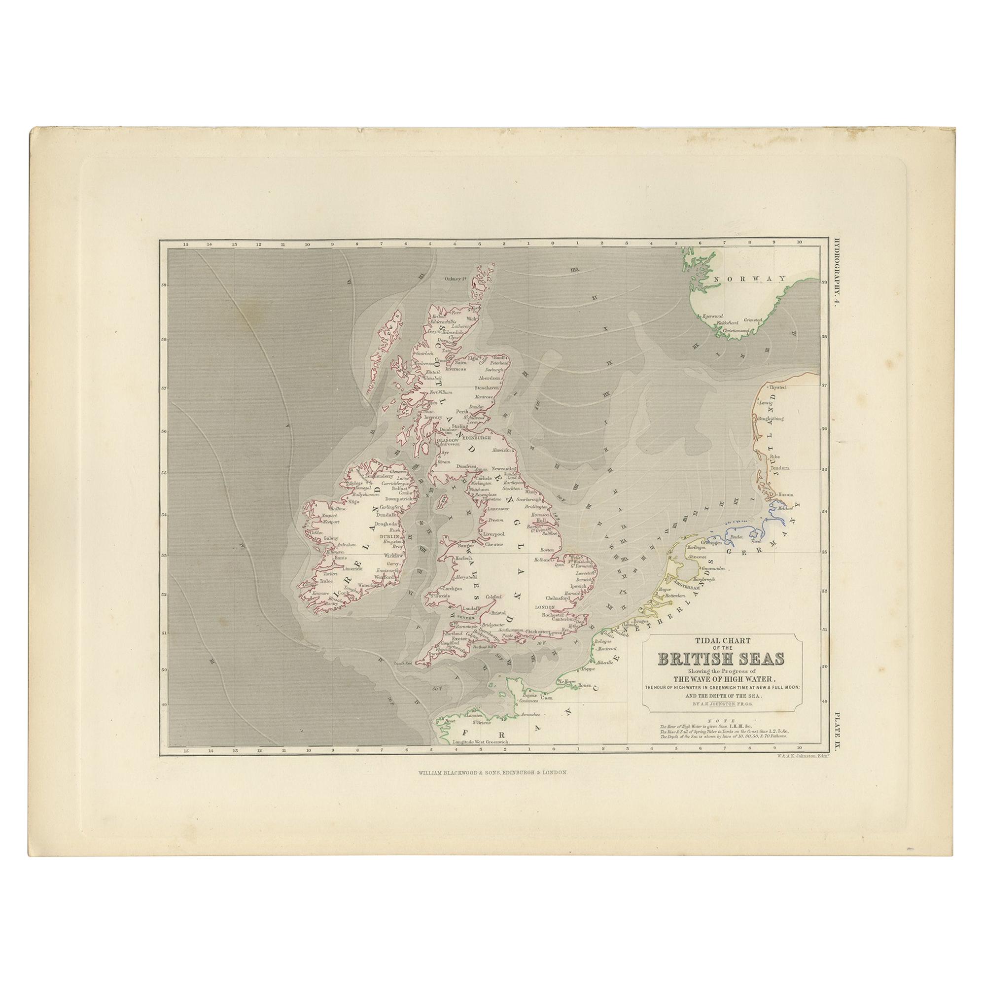
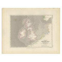
- Antique Tidal Chart of the British Seas by Johnston, '1850'Located in Langweer, NLAntique map titled 'Tidal Chart of the British Seas showing the progress of the wave of high water'. Original antique tidal chart of the British Seas. This map originates from 'The P...Category
Antique Mid-19th Century Maps
MaterialsPaper
- Antique Sea Chart of the Shetland Islands, Scotland, ca.1745Located in Langweer, NLAntique map of Scotland titled 'Nieuwe Paskaard van Hitland met de daar omleggende eylanden na de nieuwe aftekening gemaakt by den Lofwaarden en onvermoeyden Hit en Zeeman Ian Bruyst...Category
Antique 1740s Maps
MaterialsPaper
 $1,098 Sale Price20% Off
 - Large Sea Chart of the British Islands, 1918Located in Langweer, NLAntique map titled 'The British Islands'. Large sea chart of the British Islands. It shows Ireland, Scotland, England, the Shetland Islands and part of Fra...Category
Vintage 1910s Maps
MaterialsPaper
 $492 Sale Price20% Off
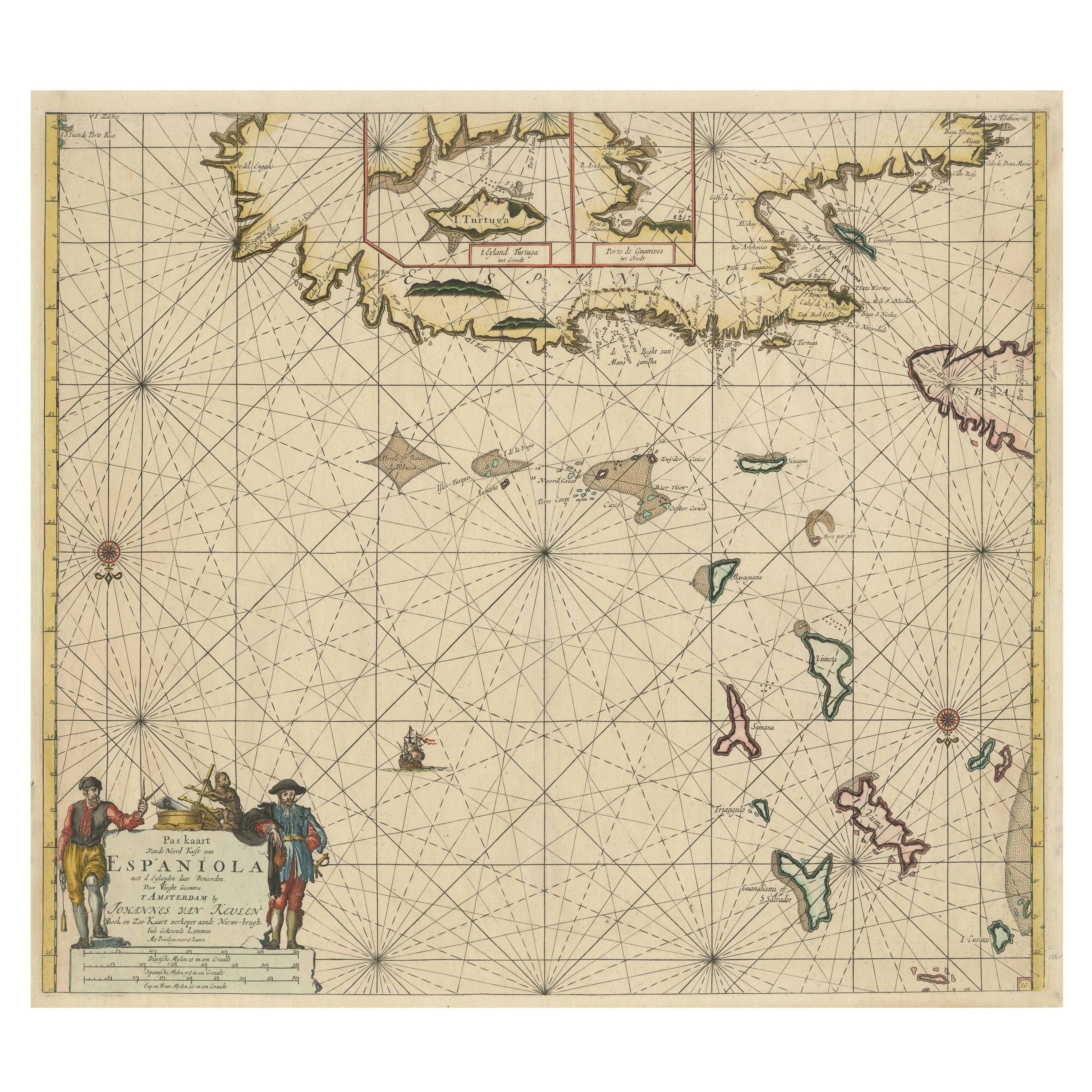
 - Original Antique Sea Chart of the Northern Part of Hispaniola, Western CubaLocated in Langweer, NLAntique map titled 'Pas kaart van de Noord Kust van Espaniola (..)'. Beautiful sea chart of the northern part of Hispaniola, western Cuba. The map includes the Turks & Caicos Islands and southern part of the Bahamas. Shows Guanahami or S. Salvador. Guanahani is an island in the Bahamas that was the first land in the New World sighted and visited by Christopher Columbus' first voyage, on October 12, 1492. It is not known precisely which island it was, and several theories have been put forth by historians. Guanahani is the native Taíno name; Columbus called it San Salvador. Originates from 'De Nieuwe Groote Lightende Zee-Fakkel'. Published by J. van Keulen, circa 1684. The Van Keulens were a family of chartmakers and publishers. The firm, In de Gekroonde Lootsman (In the Crowned Pilot), was founded in 1678 by Johannes van Keulen (1654-1715). Van Keulen originally registered his business as a vendor of books and instruments (specifically cross-staffs). In 1680, however, he gained a privilege from the States of Holland and West Friesland for the publication of pilot guides and sea atlases. In that year, van Keulen released his Zee-Atlas (Sea Atlas), which secured him a name in the competitive maritime publishing market. In 1681, he published the first volume of Nieuwe Lichtende Zee-Fakkel (New Shining Sea Torch). This would be the first of an eventual five volumes originally published between 1680 and 1684. A sixth volume was added in 1753. The Zee-Fakkel won van Keulen lasting fame. The atlas had charts compiled by Claes Jansz Vooght and artwork from Jan Luyken...Category
Antique Late 17th Century Maps
MaterialsPaper
 $1,669 Sale Price20% Off
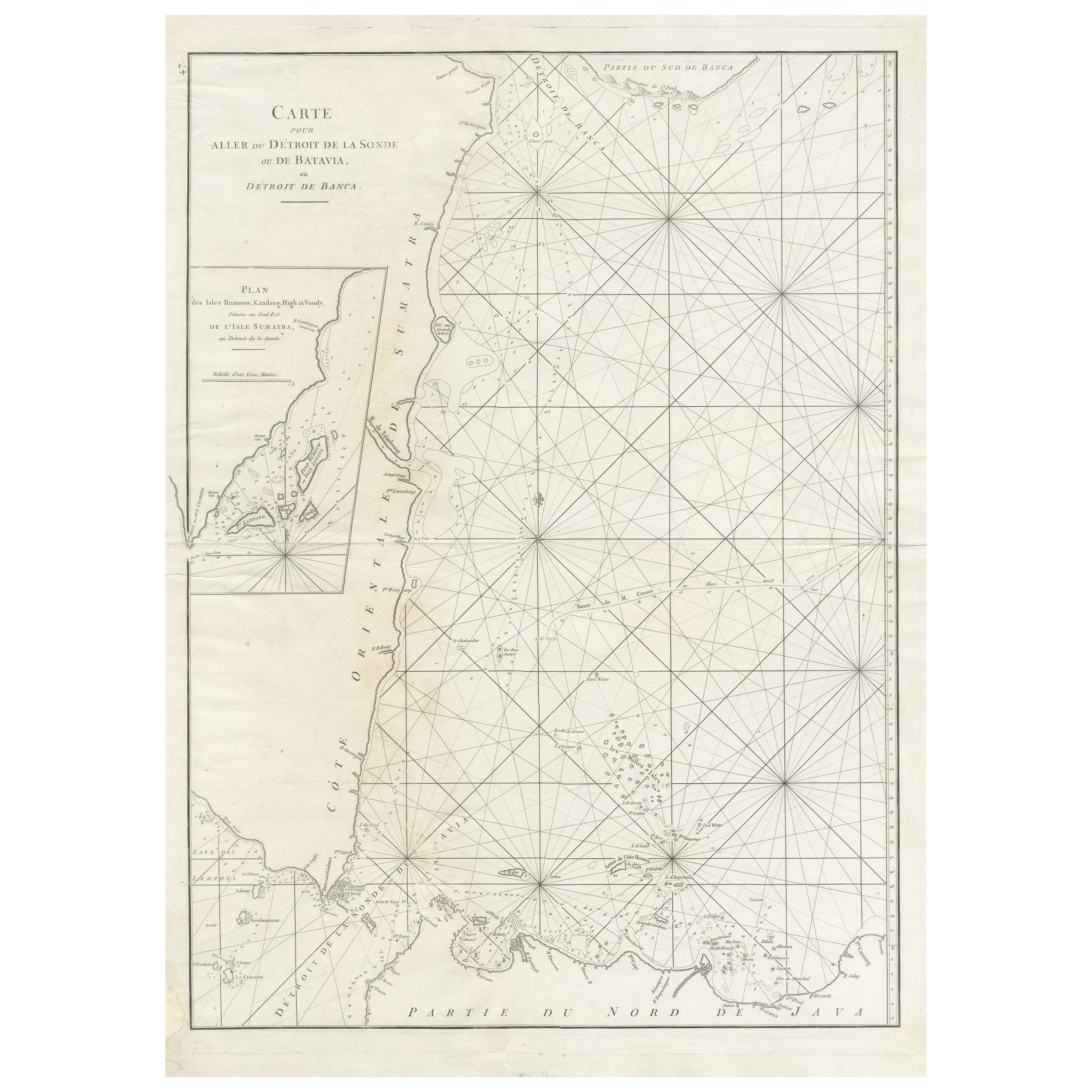
 - Large Antique Sea Chart of the South-Eastern Coast of Sumatra, IndonesiaLocated in Langweer, NLAntique map titled 'Carte pour aller du Détroit de la Sonde ou de Batavia, au Détroit de Banca'. This uncommon sea chart shows northern Java and eastern Sumatra along with an inset of the small islands in the Detroit Sound. The handsome chart provides detailed navigational information, including the route of Julien Crozet in April 1772, who led a French expedition to the South Pacific after the voyage's commander, Marion De Fresne, and 26 crew members were killed (and allegedly eaten) by a Maori tribe in the Bay of Islands off the coast of New Zealand. With title upper left corner and small inset map of the small isles nearby the south-eastern coast of Sumatra. J. B. d'Apres de Mannevillette, from his atlas "Neptune orientale". French sailor...Category
Antique Late 18th Century Maps
MaterialsPaper
You May Also Like
- Antique Anatomical Wall Chart Depicting the Human SkeletonLocated in Berghuelen, DEA rare 19th century anatomical wall chart depicting the human skeleton. On the sides On the sides are detailed description in German language. The wall...Category
Early 20th Century German Victorian Prints
MaterialsPaper
- Antique Foldable Anatomical Wall Chart Depicting Human MusculatureLocated in Berghuelen, DEAntique Foldable Anatomical Wall Chart Depicting Human Musculature The rare 19th century anatomical wall chart depicts the human musculature and inter...Category
Early 20th Century German Victorian Prints
MaterialsWood, Paper
- Anatomical Wall Chart Depicting the Human Lymphatic and Blood VesselsLocated in Berghuelen, DEA rare 19-carat anatomical wall chart depicting the human lymphatic and blood vessels. On the sides with detailed description in German language. Print...Category
Early 20th Century German Victorian Prints
MaterialsPaper
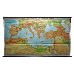
- Vintage Mural Map Mediterranean Sea Near East Countries Rollable Wall ChartLocated in Berghuelen, DEA large countrycore pull-down map showing the countries surrounding the Mediterranean Sea, published by Westermann. Colorful print on paper reinforced with canvas. Measurements: Width 269 cm (105.91 inch) Height 149 cm (58.66 inch) The measurements shown refer just to the canvas and do not include the poles. Background information on the history of school wall charts: The idea to upgrade every day school life by using pictures...Category
Vintage 1970s German Country Prints
MaterialsCanvas, Wood, Paper
- Genito-Urinary Anatomical Chart Fritz FrohseBy Nystrom / Frohse Art, Fritz FrohseLocated in Philadelphia, PAGenito-Urinary Anatomical Chart by Fritz Frohse. Dated 1922. Paper mounted on canvas. Shows wear but still presents very well!Category
Vintage 1920s German American Classical Prints
MaterialsCanvas, Paper
- Hand-Colored 18th Century Homann Map of the Black Sea, Turkey and Asia MinorBy Johann Baptist HomannLocated in Alamo, CAAn attractive original early 18th century hand-colored map of the Black Sea and Turkey entitled "Carte de L'Asie Minevre ou de la Natolie et du Pont Evxin Tiree des Voyages et des Ob...Category
Antique Early 18th Century German Maps
MaterialsPaper