Items Similar to Antique Plan of the City of Jerusalem

Want more images or videos?
Request additional images or videos from the seller
1 of 6
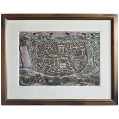
Antique Plan of the City of Jerusalem
About the Item
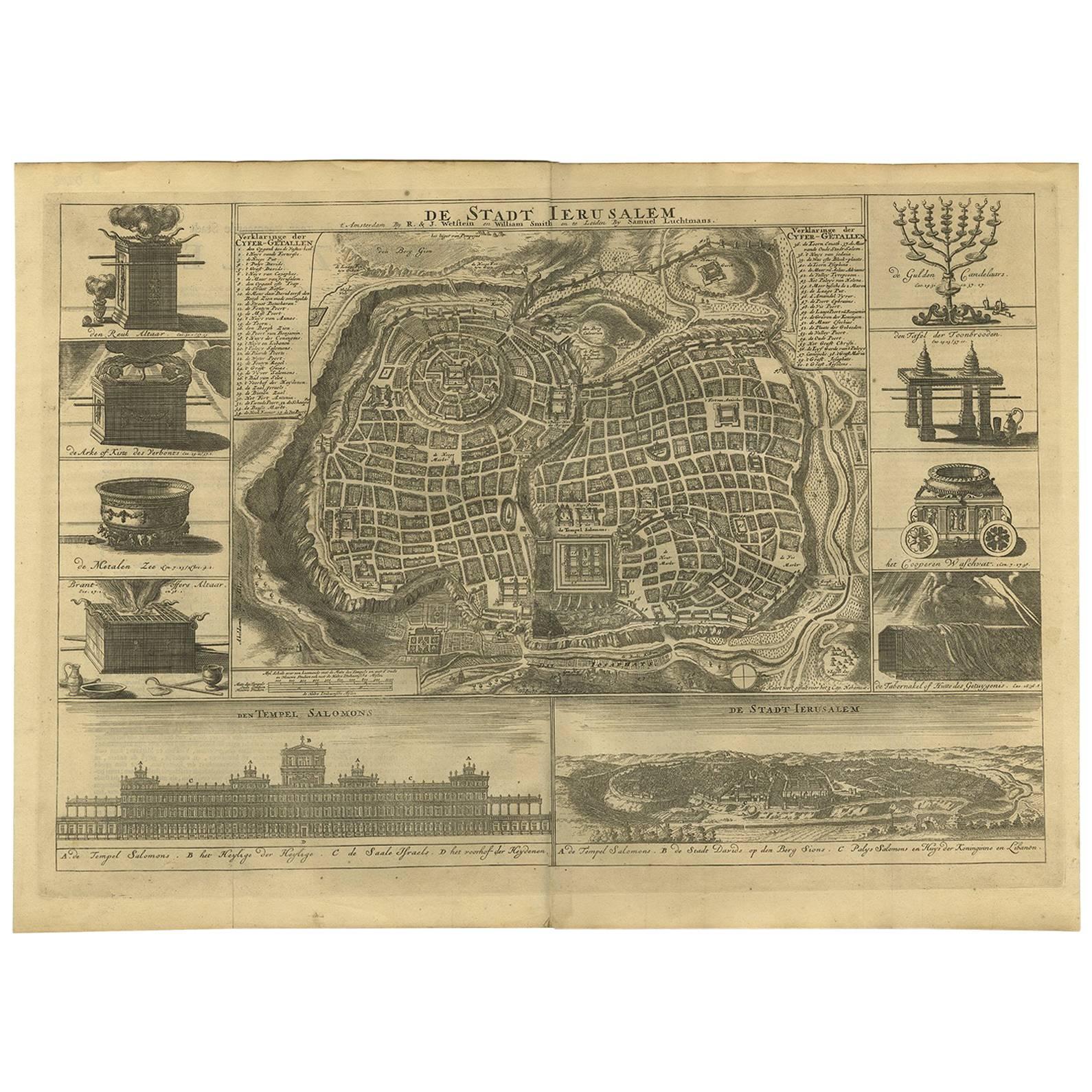
Antique map titled 'Jerusalem.' Plan of the ancient city of Jerusalem. With extensive key and scale. Source unknown, to be determined.
Cornelis de Bruijn (also spelled Cornelius de Bruyn)(1652 - 1726/7) was a Dutch artist and traveler. He made two large tours and published illustrated books with his observations of people, buildings, plants and animals. Best known as a landscape artist, Le Bruyn travelled widely from a young age to Vienna, on to Rome then to Smyrna, Constantinople, Egypt, Jerusalem, Syria, Lebanon, and Turkey. Everywhere he went Le Bruyn depicted the scenes around him, he was especially interested in places of antiquity or historic interest, and his are the first images of the interior of a pyramid and Jerusalem to be widely available to Westerners. After an eight-year stay in Venice, Le Bruyn returned to The Hague in 1693 to publish this first book.
- Dimensions:Height: 12.37 in (31.4 cm)Width: 14.97 in (38 cm)Depth: 0.02 in (0.5 mm)
- Materials and Techniques:Paper,Engraved
- Period:Late 17th Century
- Date of Manufacture:1698
- Condition:General age-related toning. Original folding lines. Minor wear and soiling, blank verso. Please study image carefully.
- Seller Location:Langweer, NL
- Reference Number:
About the Seller
5.0
Platinum Seller
These expertly vetted sellers are 1stDibs' most experienced sellers and are rated highest by our customers.
Established in 2009
1stDibs seller since 2017
1,919 sales on 1stDibs
Typical response time: <1 hour
- ShippingRetrieving quote...Ships From: Langweer, Netherlands
- Return PolicyA return for this item may be initiated within 14 days of delivery.
More From This SellerView All
- Antique Plan of the City of Bayonne, FranceLocated in Langweer, NLAntique map titled 'Plan de Bayonne'. Original old plan of the city of Bayonne, France. This map originates from 'Le Petit Atlas Maritime (..)' by J.N. Bellin. Published 1764. Be...Category
Antique Mid-18th Century Maps
MaterialsPaper
- Antique Bible Plan of Ancient Jerusalem, 1743Located in Langweer, NLThis plan originates from ‘Biblia Sacra, dat is, de H. Schriftuer van het Oude, en het Nieuwe Testament, naer de laetste Roomsche keure der gemeine Latijnsche overzettinge, in nederd...Category
Antique Mid-18th Century Maps
MaterialsPaper
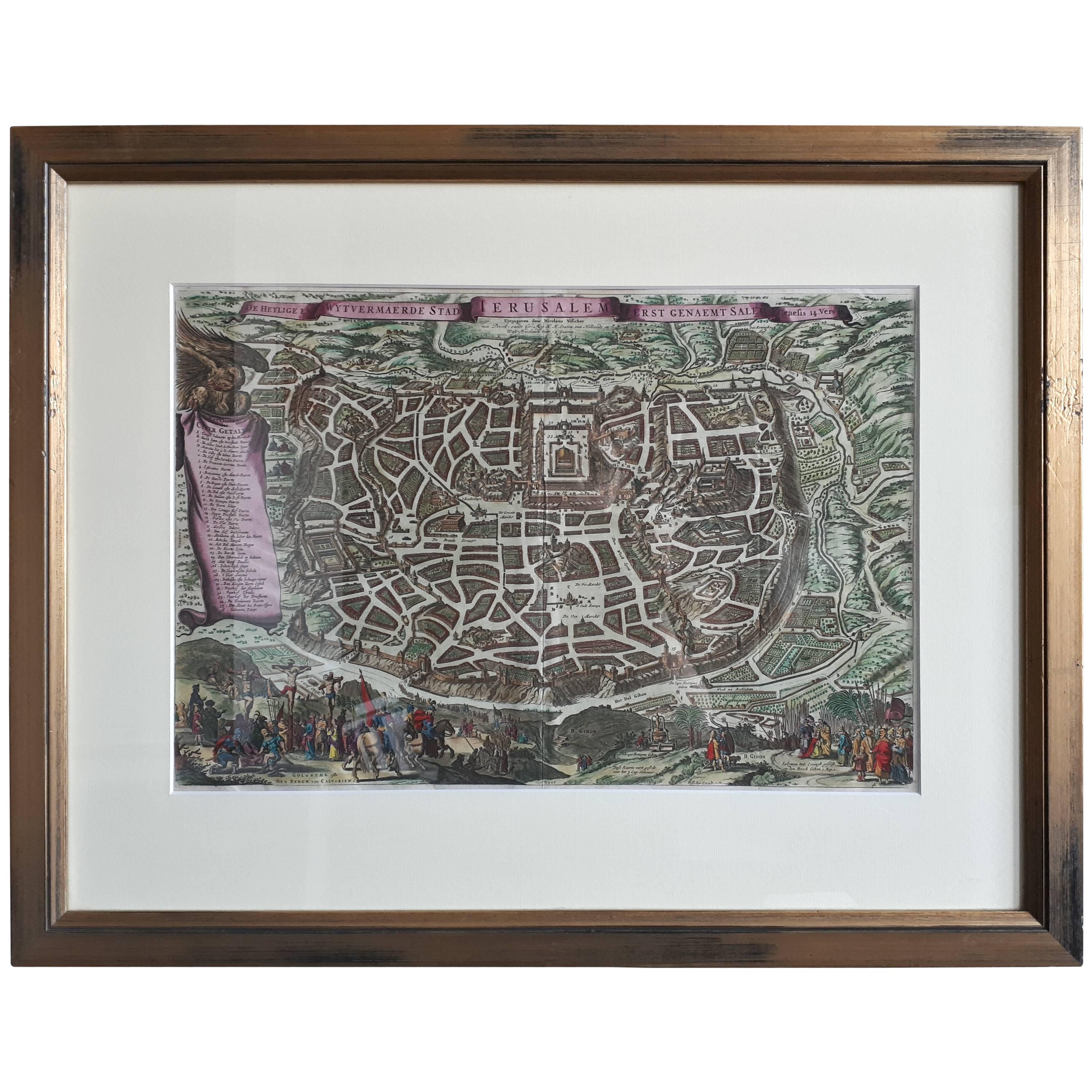
- Antique Map of the City of Jerusalem by N. Visscher, 1702Located in Langweer, NLAntique map titled 'Die Heylige en Wytvermaerde stadt Jerusalem Eerst Genaemt Salem, Genesis 14 vers 18'. This map originates from 'Biblia. Ouden ende Nieuwen Testaments (..)'. Publi...Category
Antique Early 18th Century Maps
MaterialsPaper
- Antique Print of the City of Jerusalem by Grégoire '1883'Located in Langweer, NLAntique print titled 'Jerusalem'. Original antique print of the city of Jerusalem, Middle East. This print originates from 'Géographie générale Physique, Politique et Économique' by ...Category
Antique Late 19th Century Prints
MaterialsPaper
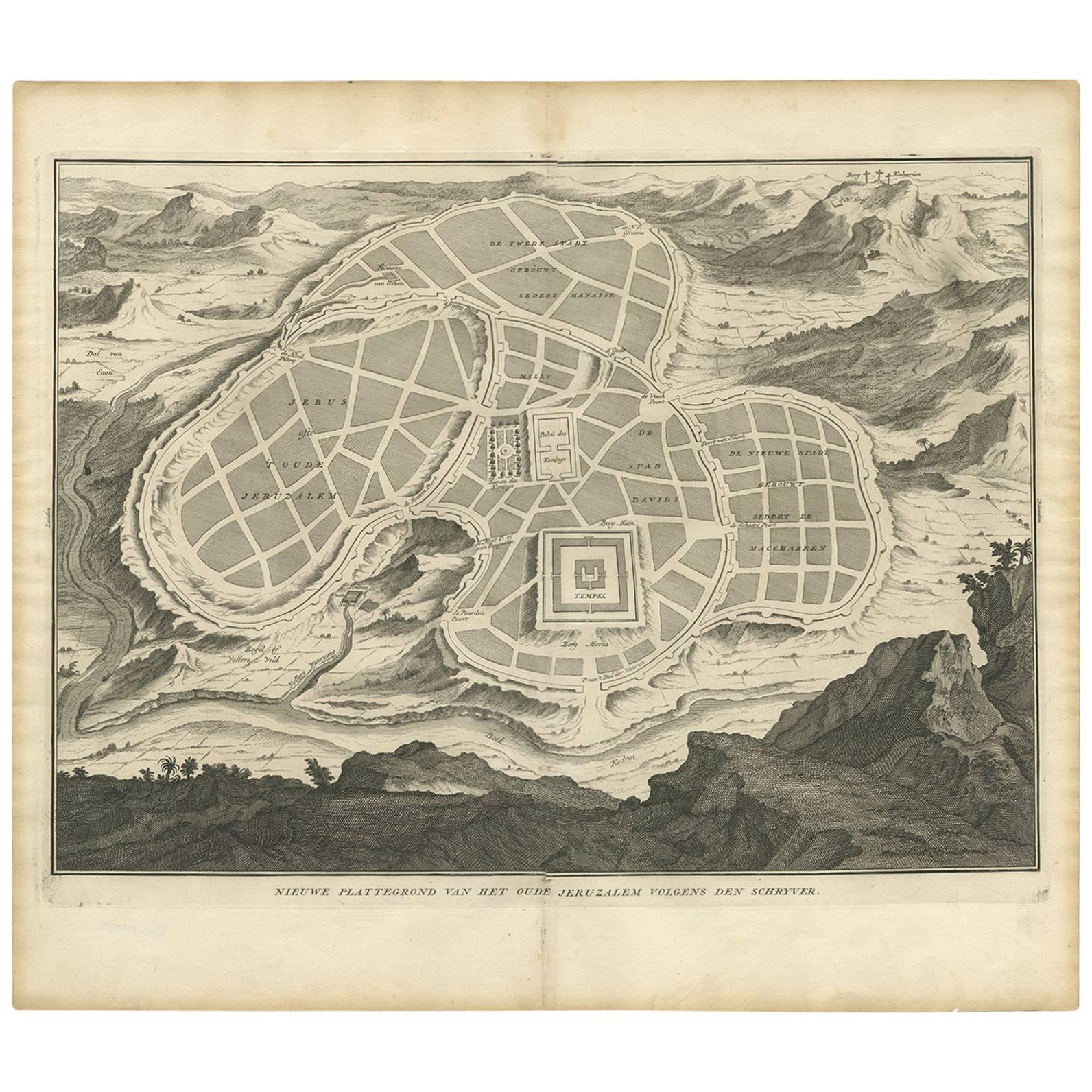
- Antique Map of the Ancient City of Jerusalem by A. Calmet, 1725Located in Langweer, NLAntique map, titled: 'Nieuwe Plattegrond van het Oude Jeruzalem Volgens den Schryver.' - Bird's-eye view of the ancient city of Jerusalem shows its divisions with prominent depiction...Category
Antique Early 18th Century Prints
MaterialsPaper
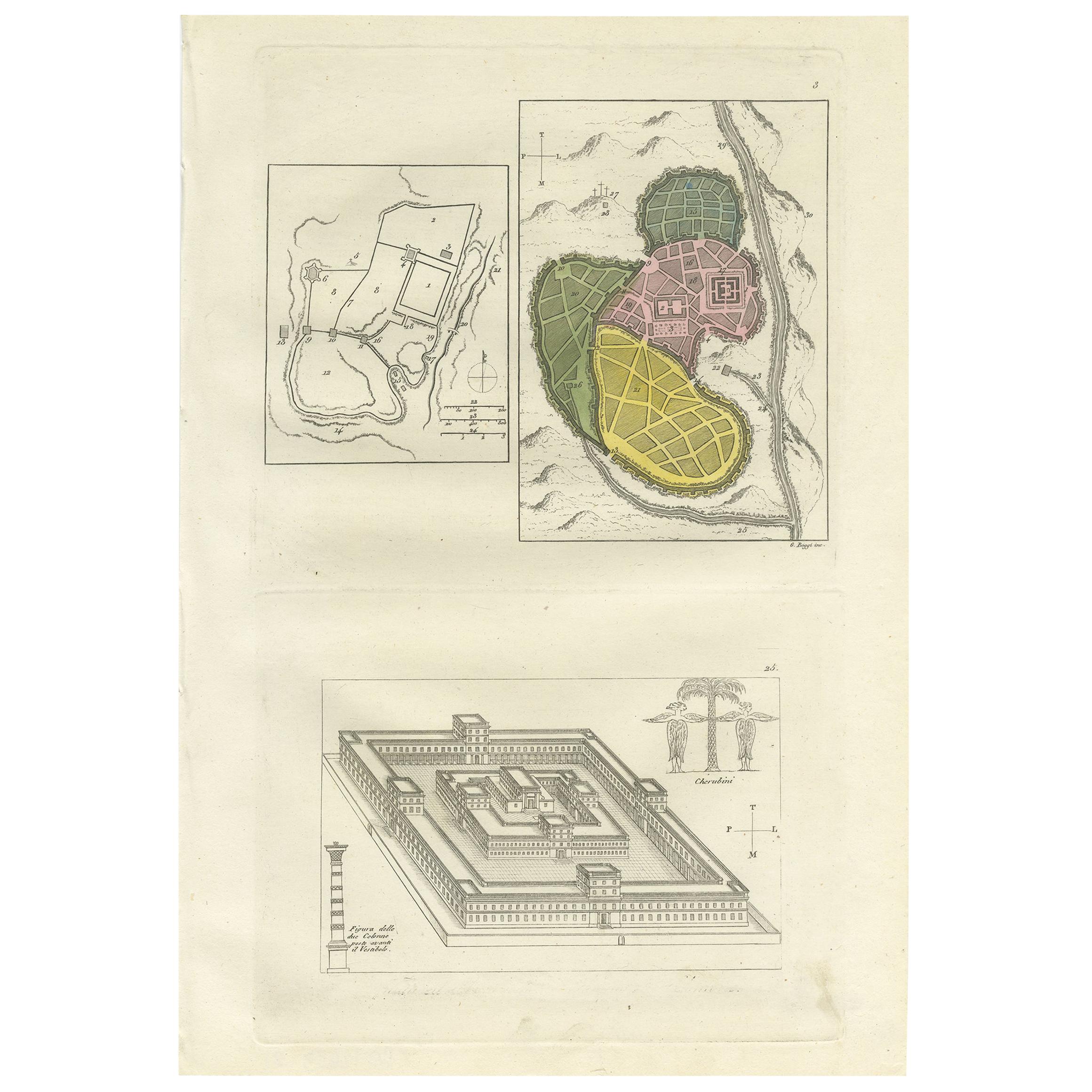
- Antique Print with Plans of Jerusalem by Ferrario, '1831'Located in Langweer, NLOriginal antique print with plans of Jerusalem. This print originates from 'Costume Antico e Moderno: Palestine, China, India, Oceania' by Ferrario. Published 1831.Category
Antique Mid-19th Century Prints
MaterialsPaper


You May Also Like
- Original Antique Map / City Plan of Brussels by Tallis, circa 1850Located in St Annes, LancashireGreat map of Brussels. Steel engraving. Published by London Printing & Publishing Co. (Formerly Tallis), C.1850 Free shipping.Category
Antique 1850s English Maps
MaterialsPaper
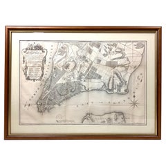
- Old Framed Map of a Plan of the City of New York as Surveyed in 1767Located in Lambertville, NJOld framed map of a plan of the City of New York as surveyed in 1767. Published by the Common Council and lithographed by George Hayward circa 1800. Repro...Category
Antique Late 19th Century American Prints
MaterialsWood, Paper
- Cabin Plan Blueprint of the Yacht “Spirit”Located in Norwell, MAOriginal blueprint of the yacht Spirit from naval architect John G. Alden of Boston. This is for Project 581, the yacht was built by Hodgdon Brothers of East...Category
Vintage 1930s North American Prints
MaterialsPaper
- Catalogue of Engraved Views, Plans, Etc., Of New York City, 1st EdLocated in valatie, NYA catalogue of engraved views, plans, etc., Of New York City, (The Collection of Percy R. Pyne II). Privately Printed by The De Vinne Press, New York, 1912. Limited to 100 copies. Gr...Category
Early 20th Century American Books
MaterialsPaper
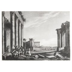
- Original Antique Print of The Ancient City of Palmyra, Syria, circa 1840Located in St Annes, LancashireWonderful image of Palmyra, Syria Fine mezzotint engraving Published by Thomas Kelly, London, circa 1840 Unframed.Category
Antique 1840s English Greco Roman Prints
MaterialsPaper
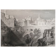
- Original Antique Print of Jerusalem After J.M.W Turner. Dated 1834Located in St Annes, LancashireWonderful image of Jerusalem Fine steel engraving after J.M.W Turner Published by John Murray & Son, London. Dated 1836 Unframed.Category
Antique 1830s English Moorish Prints
MaterialsPaper