Items Similar to Cabin Plan Blueprint of the Yacht “Spirit”

Want more images or videos?
Request additional images or videos from the seller
1 of 10
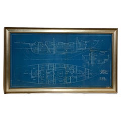
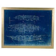
Cabin Plan Blueprint of the Yacht “Spirit”
About the Item
Original blueprint of the yacht Spirit from naval architect John G. Alden of Boston. This is for Project 581, the yacht was built by Hodgdon Brothers of East Boothbay Maine. Details include main cabin with transom berths, galley, forecastle, cockpit with seats, head, lockers, stateroom, crew’s quarters, etc.
Legend is dated February 13, 1934. Scale is ¾ inch equals one foot. Her length was forty-seven feet.
Weight: 8 LBS
Overall Dimensions: 15” H x 44” L
Made: America
Material: Paper
Date: 1934.
- Dimensions:Height: 15 in (38.1 cm)Width: 44 in (111.76 cm)Depth: 3 in (7.62 cm)
- Materials and Techniques:
- Place of Origin:
- Period:
- Date of Manufacture:1934
- Condition:
- Seller Location:Norwell, MA
- Reference Number:
About the Seller
5.0
Vetted Seller
These experienced sellers undergo a comprehensive evaluation by our team of in-house experts.
Established in 1967
1stDibs seller since 2015
346 sales on 1stDibs
Typical response time: 2 hours
- ShippingRetrieving quote...Ships From: Norwell, MA
- Return PolicyThis item cannot be returned.
More From This SellerView All
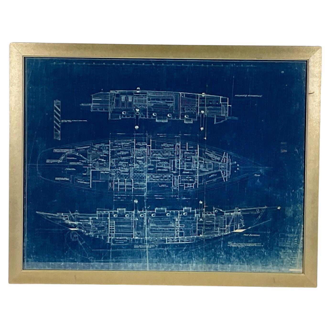
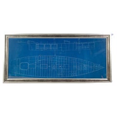
- Yacht Blueprint Showing Cabin of Sixty Two Foot SchoonerLocated in Norwell, MAAuthentic Naval Architects Blueprint of a Sixty Two Foot Schooner designed by John Alden of Boston. The plan was drawn by C.G. McGregor. This is a ...Category
Vintage 1920s North American Prints
MaterialsPaper
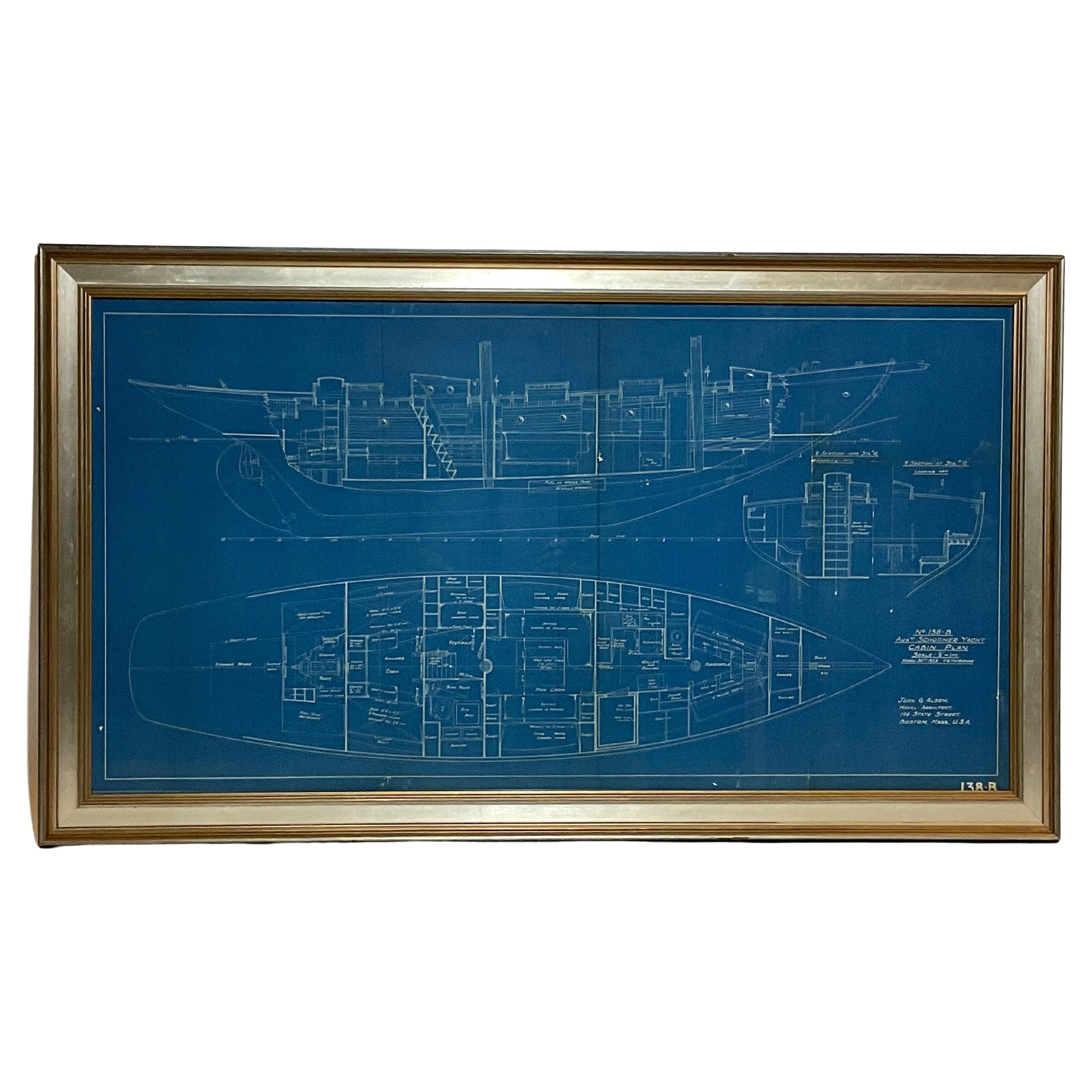
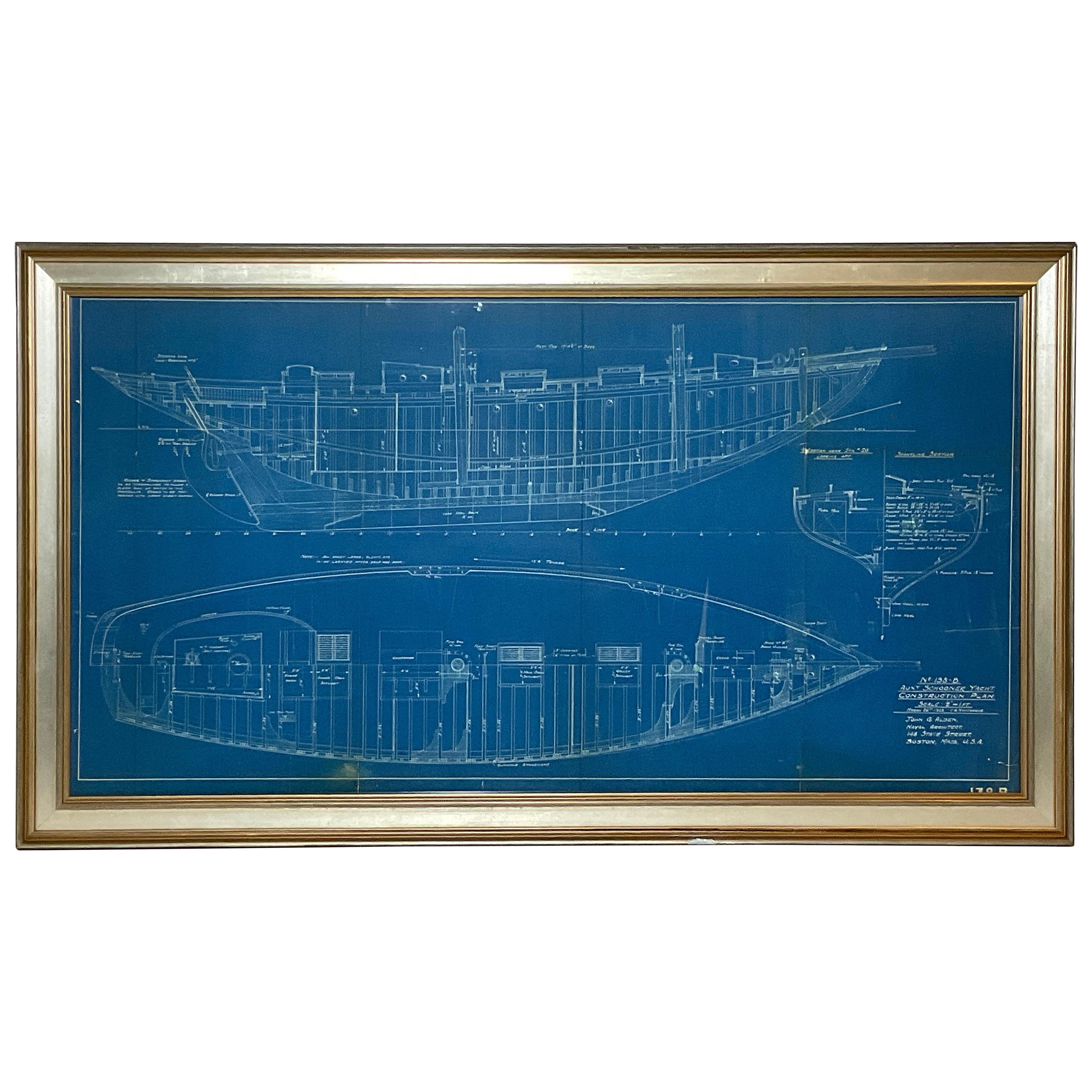
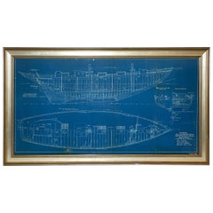
- Yacht Blueprint of an Auxiliary Schooner YachtLocated in Norwell, MAYacht blueprint showing plan for an auxiliary schooner yacht. This is the construction plan for John Alden Design 138B. This blueprint shows hull and deck frames, keel, skylights, masts, cockpit, rudder, prop, etc.. The drawing is to a scale of one half inch equals one foot, dated March 26, 1923 signed C.G. MacGregor. John G. Alden Naval Architect...Category
Vintage 1920s North American Prints
MaterialsPaper
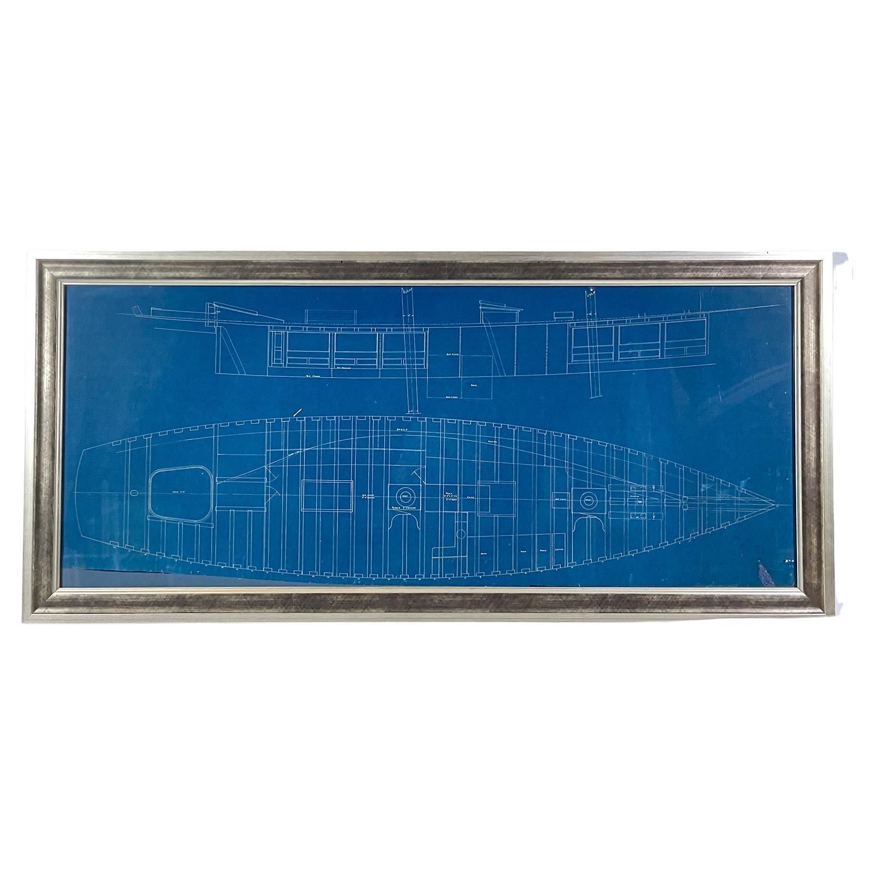
- Framing Blueprint For The Yacht "Columbia"Located in Norwell, MAFramed architect's drawing noted as "Columbia", "Plot Load Scale". 1/2 inch equals one foot. The drawing shows deck frames, hatches, mast placement, Cockpit, etc.. Circa 1935. With t...Category
Vintage 1930s North American Prints
MaterialsPaper
- John Alden Yacht BlueprintLocated in Norwell, MAShowing hull 397, the fifty eight foot auxiliary schooner yacht "Teragram" (Margaret spelled backwards) was built for George W. Mixter, New York. Mixter was the author of "Primer of ...Category
Vintage 1920s American Prints
MaterialsPaper
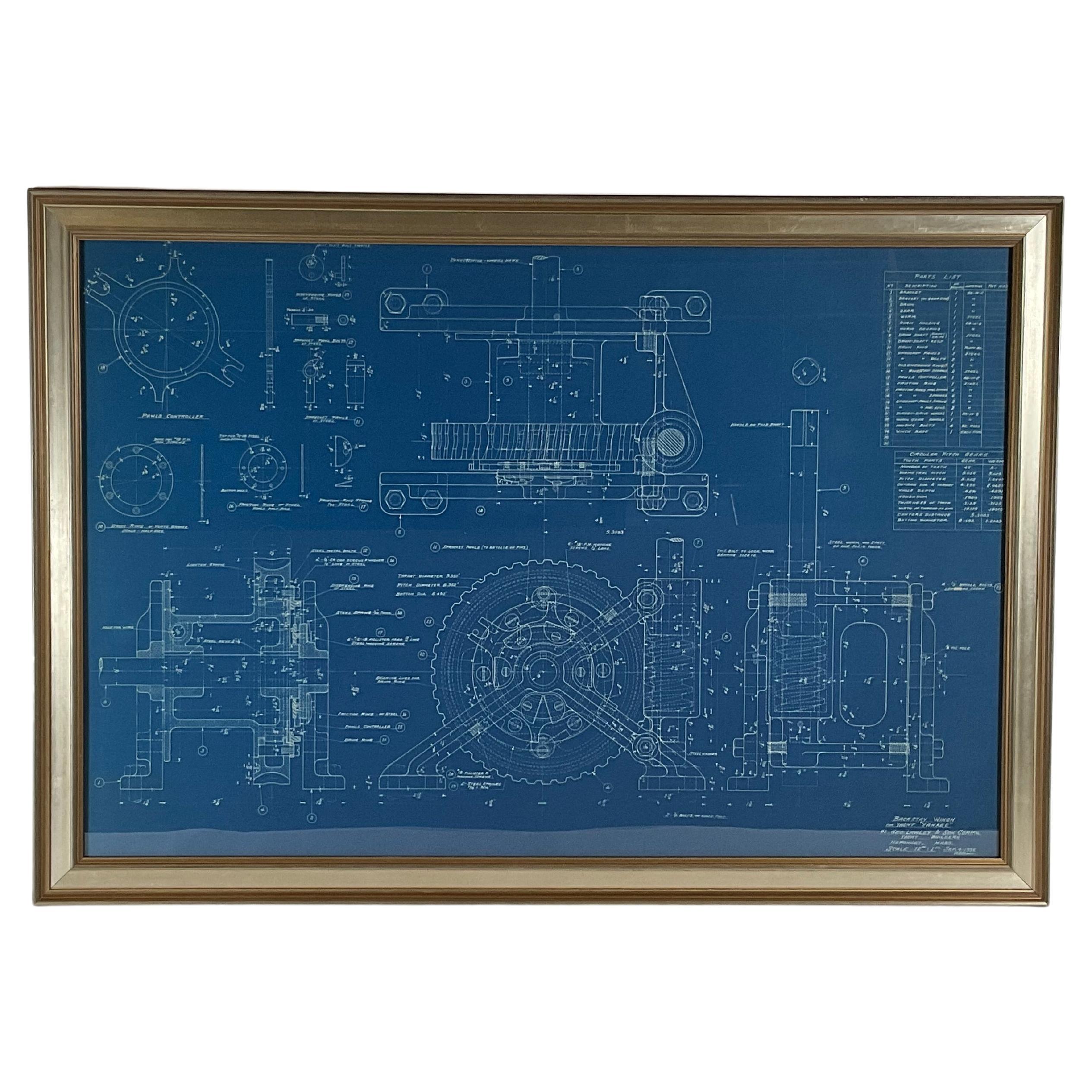
- New York Yacht Club Yacht Yankee BlueprintLocated in Norwell, MAHere we have an Americas cup yacht Yankee blueprint, a piece of yachting history here. Original blueprint from George Lawley and Sons, yacht builders showing the backstay winch. Draw...Category
Vintage 1930s North American Prints
MaterialsPaper
- Yacht Blueprint of a Fifty Foot Yacht by Howard ChapelleLocated in Norwell, MAOriginal blueprint drawing of a fifty foot "Express Cruiser" from the workshop of Eldredge-McInnis Inc. of Boston, Massachusetts. Interesting design...Category
Vintage 1930s American Nautical Objects
MaterialsPaper
You May Also Like
- Antique Plan of Plan of St. Julian's Harbour on the Coast of PatagoniaLocated in Langweer, NLAntique map titled 'Plan des Hafens St. Iulian auf der Küste von Patagonien'. Plan of St. Julian's Harbour on the Coast of Patagonia. This map originates from a German edition of 'Voyage around the World...Category
Antique Mid-18th Century Maps
MaterialsPaper
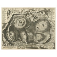
- Antique Plan of the City of JerusalemLocated in Langweer, NLAntique map titled 'Jerusalem.' Plan of the ancient city of Jerusalem. With extensive key and scale. Source unknown, to be determined. Cornelis de Bruijn (also spelled Cornelius de ...Category
Antique Late 17th Century Prints
MaterialsPaper
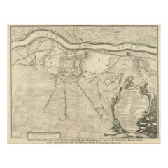
- Antique Plan of the Fortifications of Lleida, SpainLocated in Langweer, NLAntique print titled 'Plan of the Town and Castle of Lerida, with the Approaches Made Before It by the French & Spanish Armies Under the Command of the D. of Orleans During the Siege...Category
Antique Mid-18th Century Prints
MaterialsPaper
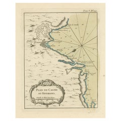
- Antique Plan of the Region of Cassis, FranceLocated in Langweer, NLAntique map titled 'Plan de Cassis et environs'. Original plan of the region of Cassis, France. This map originates from 'Le Petit Atlas Maritime (..)' by J.N. Bellin. Published 1764...Category
Antique Mid-18th Century Maps
MaterialsPaper
- Antique Plan of the City of Bayonne, FranceLocated in Langweer, NLAntique map titled 'Plan de Bayonne'. Original old plan of the city of Bayonne, France. This map originates from 'Le Petit Atlas Maritime (..)' by J.N. Bellin. Published 1764. Be...Category
Antique Mid-18th Century Maps
MaterialsPaper
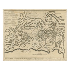
- Antique Plan of the Siege of the Castle of Cardona in 1714Located in Langweer, NLAntique print titled 'Plan of Cardona a strong city and castle of Catalonia, upon the river Cardoner as besieged by the French and defended by the Allies'. A plan of the siege of the...Category
Antique Mid-18th Century Prints
MaterialsPaper

Recently Viewed
View AllMore Ways To Browse
The Vintage Locker
Blue Lockers
Blue Locker
Original Blueprint
Wall Locker
Used Wall Lockers
Wall Lockers Used
Used Wall Locker
Used Foot Locker
8 Chair Dining Room With Table
Door Frame Mirror
Gray Door Antiques
Midcentury Modern Vanity With Mirror
China Cabinet Legs
Ancient Birds
24 W Cabinet
Antique Counter Top
Japanese Wood Door