Items Similar to Scarce Antique Map of South America


Want more images or videos?
Request additional images or videos from the seller
1 of 6
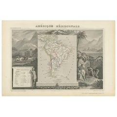
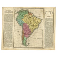
Scarce Antique Map of South America
About the Item
Antique map titled 'Carte de l'Amérique Méridionale'. Scarce map of South America, published in Paris in 1821. The map shows the continent in the midst its of several decades of revolution, which reshaped the geopolitical landscape and boundaries for the next several decades. The names Spanish Guyana and San Juan de Los Llos appear in the southern parts of what would become Venezuela and Colombia. Published by Tardieu.
Pierre Antoine Tardieu (1784-1869), also known to sign his works as PF Tardieu, was a prolific French map engraver and geographer. The Tardieu family, based in Paris, was well known for their talent in engraving, cartography, and illustration. Pierre Antoine’s father, Antoine Francois Tardieu, was an established cartographer who published numerous atlases. His son is said to have collaborated with him for many years before establishing his own independent career.
- Dimensions:Height: 23.63 in (60 cm)Width: 17.45 in (44.3 cm)Depth: 0.02 in (0.5 mm)
- Materials and Techniques:
- Period:
- Date of Manufacture:1821
- Condition:Wear consistent with age and use. General age-related toning. Original folding line. Minor wear and foxing, blank verso. Please study images carefully.
- Seller Location:Langweer, NL
- Reference Number:Seller: BG-13193-41stDibs: LU3054331100292
About the Seller
5.0
Recognized Seller
These prestigious sellers are industry leaders and represent the highest echelon for item quality and design.
Platinum Seller
Premium sellers with a 4.7+ rating and 24-hour response times
Established in 2009
1stDibs seller since 2017
2,442 sales on 1stDibs
Typical response time: 1 hour
- ShippingRetrieving quote...Shipping from: Langweer, Netherlands
- Return Policy
Authenticity Guarantee
In the unlikely event there’s an issue with an item’s authenticity, contact us within 1 year for a full refund. DetailsMoney-Back Guarantee
If your item is not as described, is damaged in transit, or does not arrive, contact us within 7 days for a full refund. Details24-Hour Cancellation
You have a 24-hour grace period in which to reconsider your purchase, with no questions asked.Vetted Professional Sellers
Our world-class sellers must adhere to strict standards for service and quality, maintaining the integrity of our listings.Price-Match Guarantee
If you find that a seller listed the same item for a lower price elsewhere, we’ll match it.Trusted Global Delivery
Our best-in-class carrier network provides specialized shipping options worldwide, including custom delivery.More From This Seller
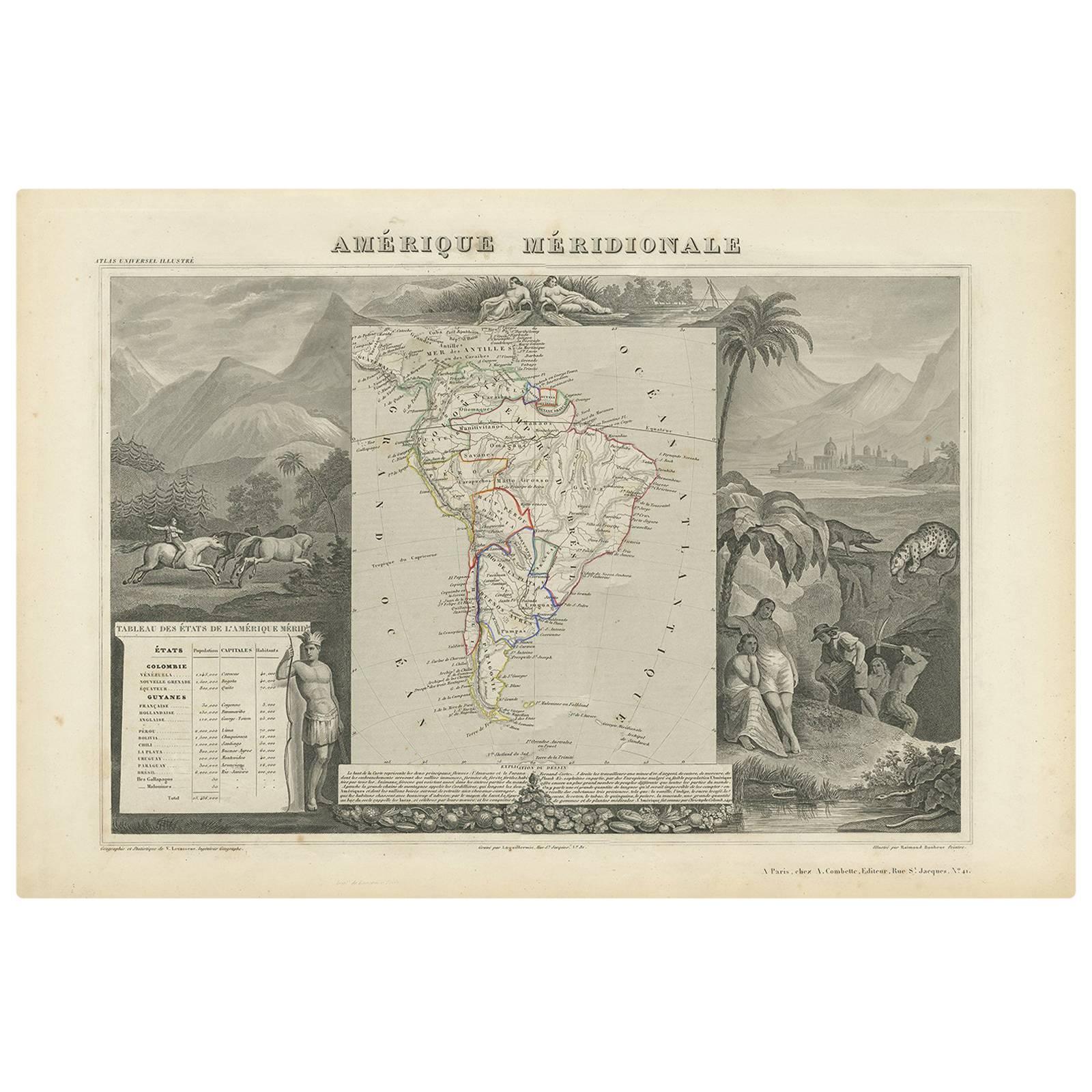
View AllAntique Map of South America by V. Levasseur, 1854
By Victor Levasseur
Located in Langweer, NL
Antique map titled 'Amérique Méridionale'. Map shows South America, beautiful surrounded by typical scenes of natives and their life. Depicting Colombia, Brazil, Chile, Bolivia and m...
Category
Antique Mid-19th Century Maps
Materials
Paper
$277 Sale Price
20% Off
Antique Map of South America by J. Cook, 1775
Located in Langweer, NL
Antique map titled 'Kaart van het Zuidlyk Eind van Amerika'. Map of the sourthern part of South America, focusing on Cook's tracks around the Cape Horn and T...
Category
Antique Mid-18th Century Maps
Materials
Paper

$787 Sale Price
20% Off
Antique Map of South America by Lapie '1842'
Located in Langweer, NL
Antique map titled 'Carte Générale de l'Amérique Meridionale'. Map of South America. This map originates from 'Atlas universel de géographie ancienne et moderne (..)' by Pierre M. La...
Category
Antique Mid-19th Century Maps
Materials
Paper

$555 Sale Price
20% Off
Antique Map of South America by G. Anson, 1749
Located in Langweer, NL
Antique map titled 'Kaart van het Zuidelykste Gedeelte van Zuider Amerika (..) - Carte de la Partie Meridionale de l'Amerique Meridionale (..)'. Detailed chart tracking the route of Capt. George Anson's ship The Centurion in 1745. The chart shows the tracks of Anson's ships around South America & Cape Horn to the Juan Fernandes Islands, with notes on currents and positions. This map originates from 'Reize rondsom de Werreld (..)' by George Anson, published 1749.
In 1740 Capt. George Anson (1697-1762) of the Royal Navy, was given command of a squadron of ships. As England was at war with France and Spain, Anson's task was to intercept and capture a Spanish treasure...
Category
Antique Mid-18th Century Dutch Maps
Materials
Paper

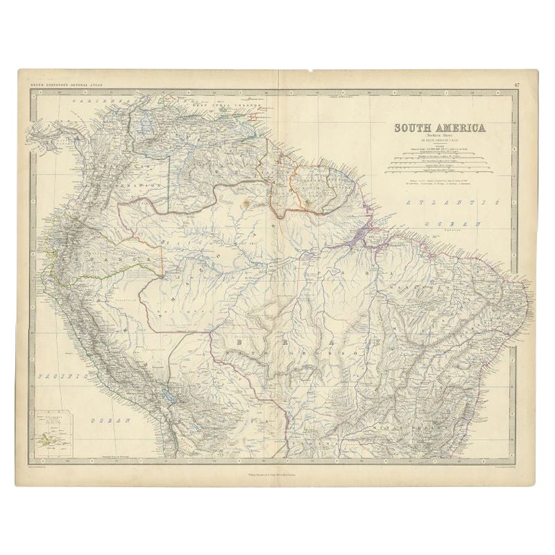
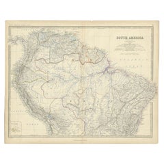
Antique Map of South America by Johnston, 1861
Located in Langweer, NL
Antique map titled 'South America'.
Old map of South America, with an inset map of the Galapagos Isles. This map originates from 'The Royal Atlas of Modern Geography, Exhibiting, i...
Category
Antique 19th Century Maps
Materials
Paper
Interesting Original Antique Map of South America, 1822
Located in Langweer, NL
Antique map titled 'South America'.
Map of South America with attractive topography, surrounded on three sides by text on the history, geography, and economy of the continent. Sh...
Category
Antique 19th Century Maps
Materials
Paper
You May Also Like
Original Antique Map of South America. C.1780
Located in St Annes, Lancashire
Great map of South America
Copper-plate engraving
Published C.1780
Two small worm holes to left side of map
Unframed.
Category
Antique Early 1800s English Georgian Maps
Materials
Paper

Original Antique Map of South Africa, Arrowsmith, 1820
Located in St Annes, Lancashire
Great map of South Africa.
Drawn under the direction of Arrowsmith.
Copper-plate engraving.
Published by Longman, Hurst, Rees, Orme and Br...
Category
Antique 1820s English Maps
Materials
Paper

Original Antique Map of Central America / Florida, Arrowsmith, 1820
Located in St Annes, Lancashire
Great map of Central America.
Drawn under the direction of Arrowsmith.
Copper-plate engraving.
Published by Longman, Hurst, Rees, Orme and Brown, 1820
Unframed.
Category
Antique 1820s English Maps
Materials
Paper

Original Antique Map of South East Asia by Thomas Clerk, 1817
Located in St Annes, Lancashire
Great map of South East Asia
Copper-plate engraving
Drawn and engraved by Thomas Clerk, Edinburgh.
Published by Mackenzie And Dent, 1817
Unframed.
Category
Antique 1810s English Maps
Materials
Paper

South America: Hand-colored 18th Century Framed Map by Thomas Jefferys
By Thomas Jefferys
Located in Alamo, CA
This detailed hand-colored map of South America by Thomas Jefferys was published in London in 1750. The map shows countries, early colonial possessions, towns, rivers, mountains, and...
Category
Antique Mid-18th Century English Maps
Materials
Paper

North & South America: A 17th Century Hand-colored Map by Jansson & Goos
By Johannes Janssonius
Located in Alamo, CA
A 17th century hand-colored map of North & South America entitled "Americae Descriptio" by the cartographer Johannes Jansson, published in Jansson's Atlas Minor in Amsterdam in 1628....
Category
Antique 1620s Dutch Maps
Materials
Paper

Recently Viewed
View AllMore Ways To Browse
Curved Back Settee Sofa
Danish Tufted Chair
Easy Chair Grey
English Wood Bench
Expandable Glass Tables
Farmhouse Consoles
Figured Walnut Side Table
Flora Fauna Plate
French Louis Xv Bureau Plat
French Metal Chair With Leather Seat
French Round Table With Leaves
Georg Jensen Acorn
German Coffee Pot
Gilt Embroidery
Glass Dining Table And Leather Chairs
Gold Moser Glass
Hand Painted Herend Hungary
Handmade Turkey Decoration