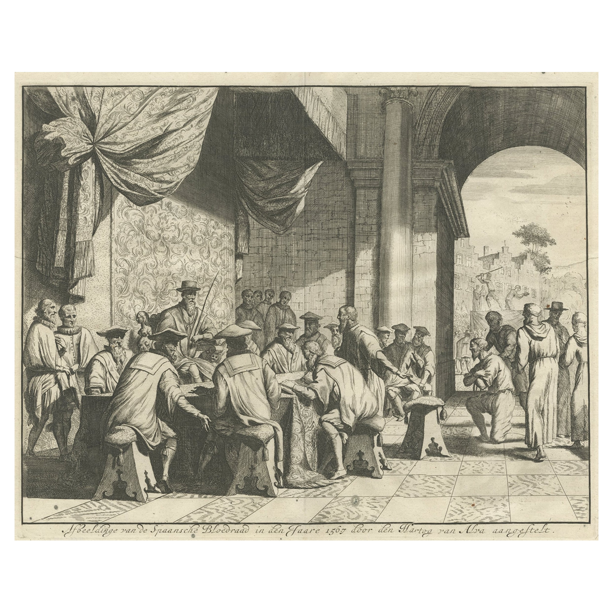
Items Similar to Duke of Alva Planning the Atrocities Against the Dutch in 1567, Ca 1680

Want more images or videos?
Request additional images or videos from the seller
1 of 5
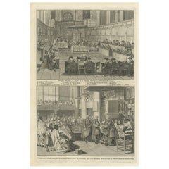
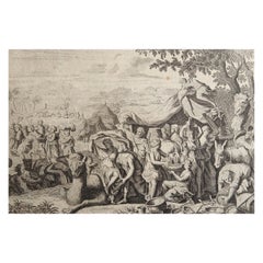
Duke of Alva Planning the Atrocities Against the Dutch in 1567, Ca 1680
$426.81
$533.5220% Off
£319.42
£399.2820% Off
€360
€45020% Off
CA$588.83
CA$736.0320% Off
A$654.80
A$818.5020% Off
CHF 343.92
CHF 429.8920% Off
MX$8,005.60
MX$10,00720% Off
NOK 4,285.52
NOK 5,356.9020% Off
SEK 4,040.09
SEK 5,050.1120% Off
DKK 2,740.50
DKK 3,425.6220% Off
About the Item
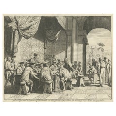
Antique print titled ‘Afbeeldinge van de Spaansche Bloedraad in den Jaare 1567 door den Hartog van Alva aangestelt’. The Duke of Alva and his entourage seated at a table planning the atrocities against the Dutch in 1567; a bound victim kneels at the right; illustration to Pieter Bor's "Nederlandsche Oorlogen" (Widow of Joannes van Someren, Abraham Wolfgangh & Hendrick en Dirck Boom, Amsterdam: 1679-1684).
Artists and Engravers: Author: Pieter Bor
Condition: Very good, given age. Minor spots. Please study image carefully.
Date: c.1680
Overall size: 38 x 32 cm
Image size: 0.001 x 34.2 x 27 cm.
- Dimensions:Height: 12.6 in (32 cm)Width: 14.97 in (38 cm)Depth: 0 in (0.01 mm)
- Materials and Techniques:
- Period:
- Date of Manufacture:circa 1680
- Condition:
- Seller Location:Langweer, NL
- Reference Number:Seller: BGI-005651stDibs: LU3054325691512
About the Seller
5.0
Recognized Seller
These prestigious sellers are industry leaders and represent the highest echelon for item quality and design.
Platinum Seller
Premium sellers with a 4.7+ rating and 24-hour response times
Established in 2009
1stDibs seller since 2017
2,607 sales on 1stDibs
Typical response time: <1 hour
- ShippingRetrieving quote...Shipping from: Langweer, Netherlands
- Return Policy
Authenticity Guarantee
In the unlikely event there’s an issue with an item’s authenticity, contact us within 1 year for a full refund. DetailsMoney-Back Guarantee
If your item is not as described, is damaged in transit, or does not arrive, contact us within 7 days for a full refund. Details24-Hour Cancellation
You have a 24-hour grace period in which to reconsider your purchase, with no questions asked.Vetted Professional Sellers
Our world-class sellers must adhere to strict standards for service and quality, maintaining the integrity of our listings.Price-Match Guarantee
If you find that a seller listed the same item for a lower price elsewhere, we’ll match it.Trusted Global Delivery
Our best-in-class carrier network provides specialized shipping options worldwide, including custom delivery.More From This Seller
View AllThe Iron Duke of Alva of Spain Planning the Atrocities Against the Dutch, c.1680
Located in Langweer, NL
Antique print titled ‘Afbeeldinge van de Spaansche Bloedraad in den Jaare 1567 door den Hartog van Alva aangestelt’.
The Duke of Alva and his entourage seated at a table planning...
Category
Antique 1680s Prints
Materials
Paper
$531 Sale Price
20% Off
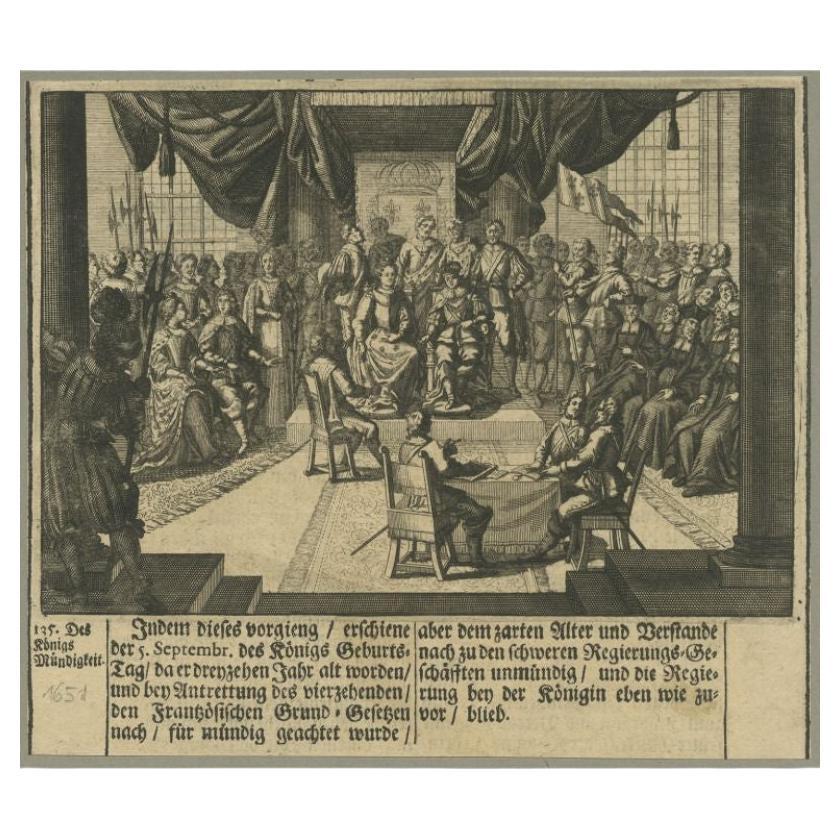
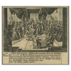
Antique German Print of a Meeting at Court, c.1650
Located in Langweer, NL
Antique print titled 'Des Königs Mündigkeit'. This print depicts a meeting at court. Source unknown, to be determined.
Artists and Engravers: Anonymous.
Condition: Good, genera...
Category
Antique 17th Century Prints
Materials
Paper
$93 Sale Price
20% Off
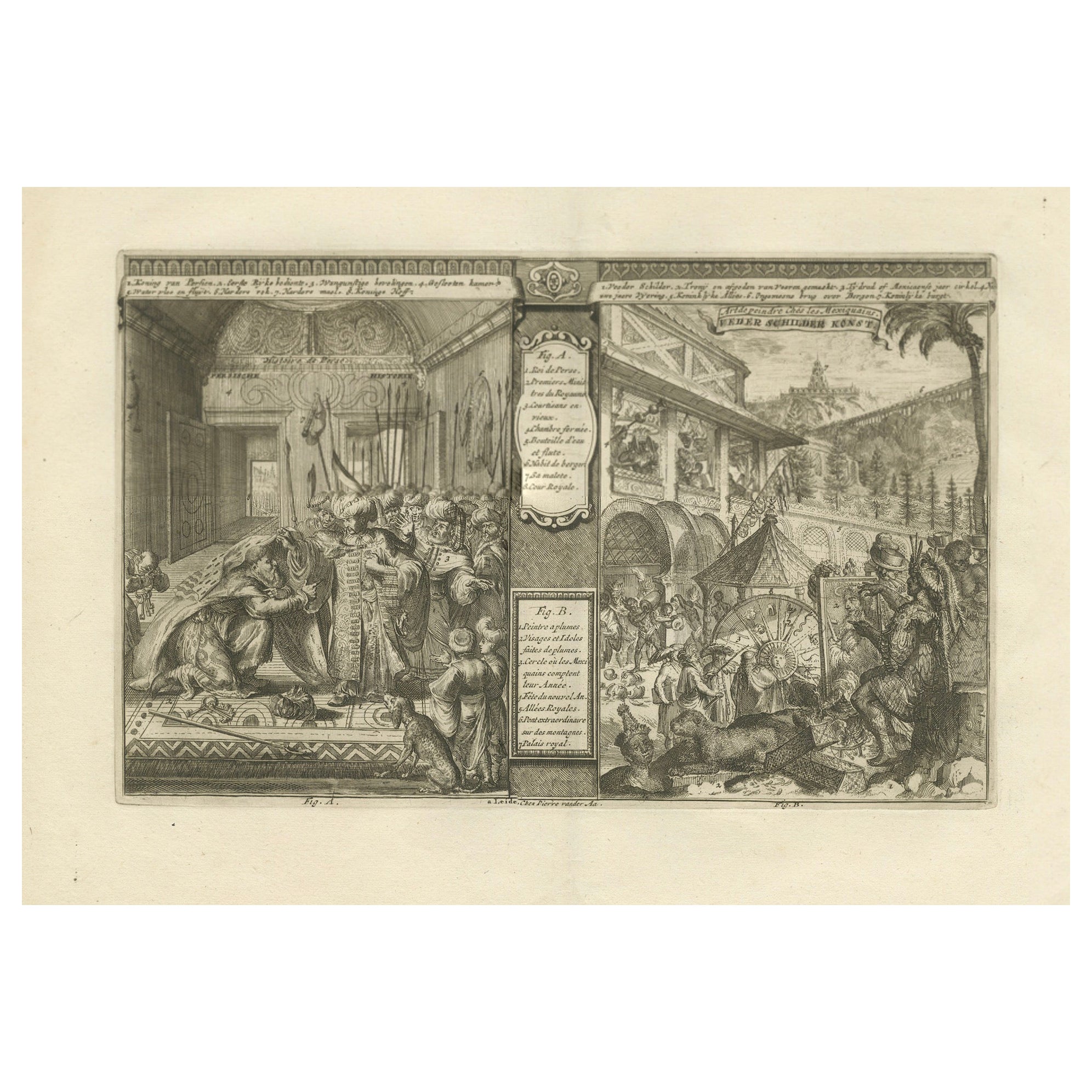
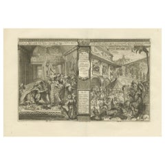
Justice and Diversity in the Early Modern World by R. de Hooghe, circa 1708
Located in Langweer, NL
"Justice and Diversity in the Early Modern World"
Description:
This detailed engraving presents a vivid tableau in two distinct parts, each illustrating significant cultural and hi...
Category
Antique Early 1700s Prints
Materials
Paper
$625 Sale Price
20% Off
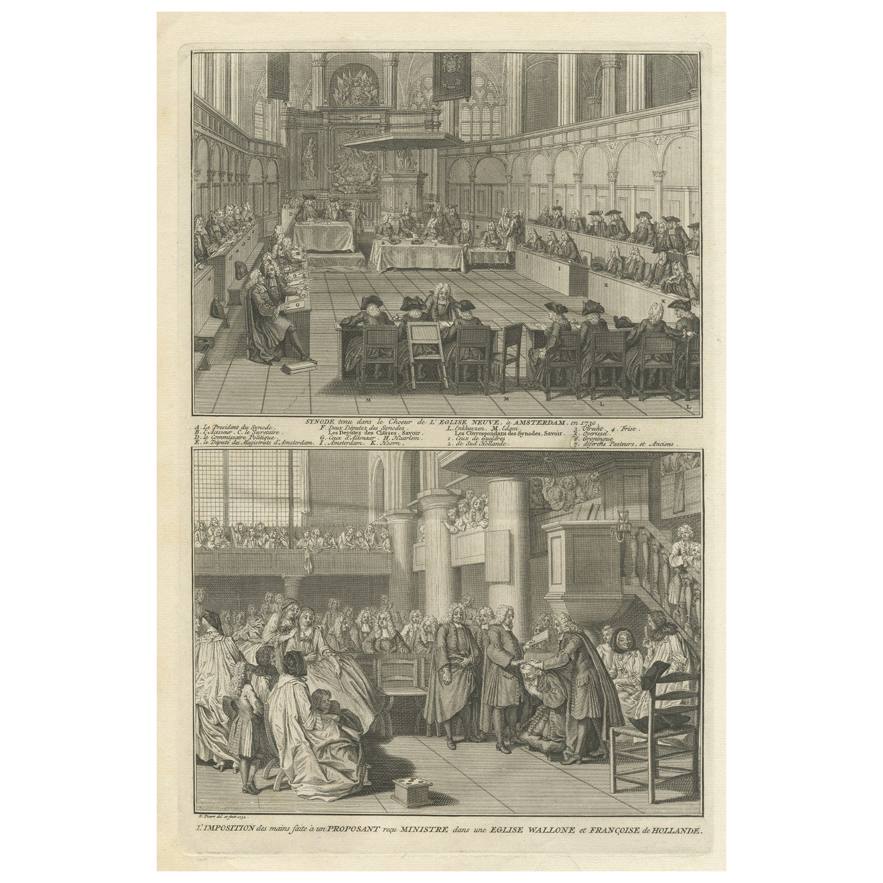
Engraving of a Meeting of the Dutch Synode in Amsterdam, The Netherlands, 1732
Located in Langweer, NL
Antique print titled 'Synode tenu dans le Choeur (..)'. Old print of a meeting of the Dutch Synode in 'De Nieuwe Kerk' in Amsterdam, The Netherlands in 1730. Also depicted the accept...
Category
Antique 18th Century Prints
Materials
Paper
$322 Sale Price
20% Off
The Siege of Nyborg, 1659: A Strategic Battle of the Dano-Swedish War, 1746
Located in Langweer, NL
Title: "The Siege of Nyborg, 1659: A Strategic Battle of the Dano-Swedish War"
Translated text (From Dutch) on copper engraving: "The city of Nyborg captured by the lord Michiel de ...
Category
Antique 1740s Prints
Materials
Paper
$208 Sale Price
20% Off
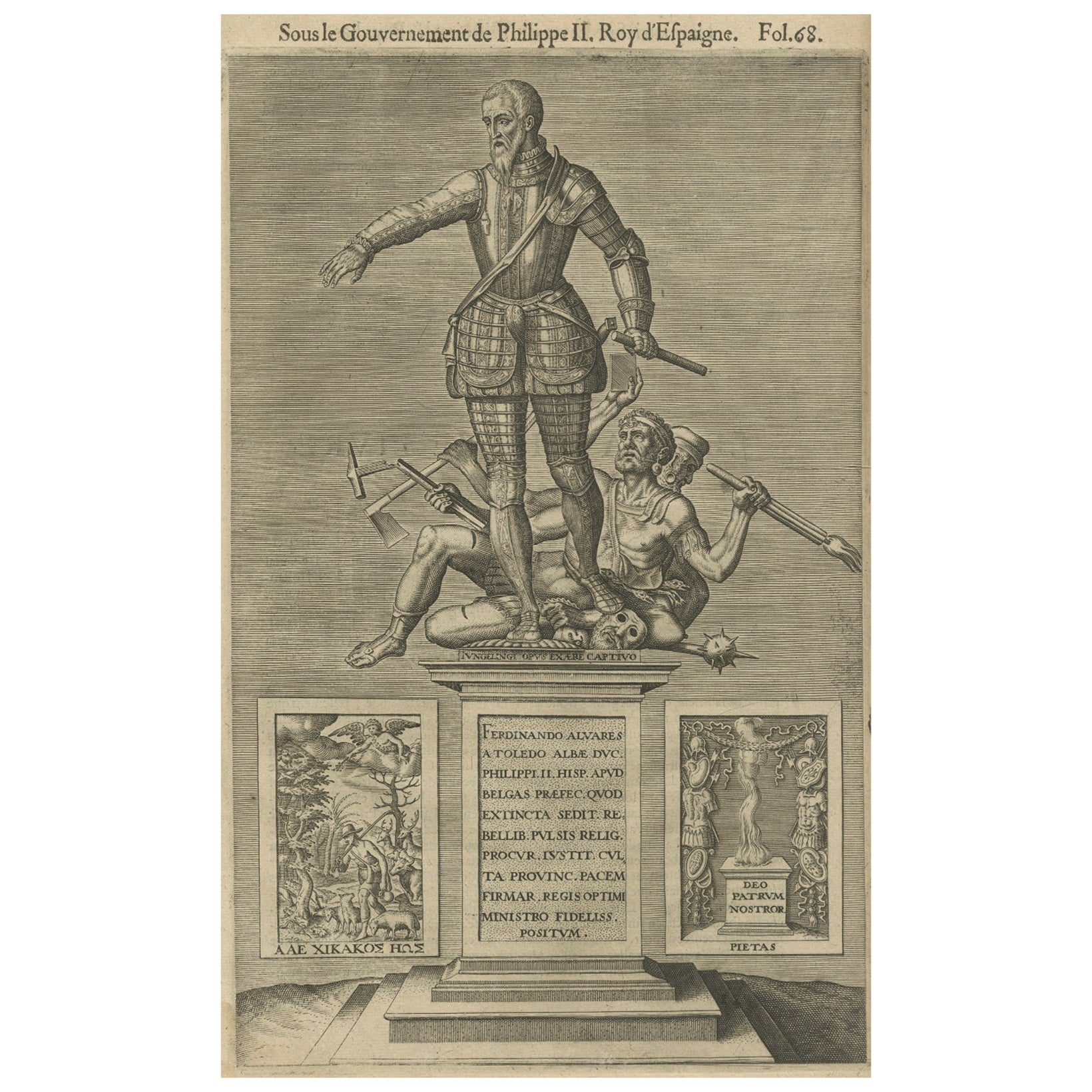
The Spanish Grand Duke of Alba or Iron Duke in the Netherlands, 1618
Located in Langweer, NL
Antique portrait titled 'Ferdinando Alvares a Toledo (..)'.
Old portrait of Fernando Alvarez de Toledo y Pimentel or Ferdinandus Toletanus Dux Albanus (1507 - 1582), known as the Grand Duke of Alba...
Category
Antique 1610s Prints
Materials
Paper
$246 Sale Price
20% Off
You May Also Like
Interior Meeting - Original Etching by Cornelis Meyssens - 17th Century
Located in Roma, IT
Interior Meeting is an original etching realized by Cornelis Meyssens ( 1640-1573).
Good conditions, except for some foldings.
Included a Passepartout: 34 x 49 cm
The artwork repres...
Category
17th Century Baroque Figurative Prints
Materials
Etching
Original Antique Print After Jan Luyken, Amsterdam, Genesis XXXI, 1724
Located in St Annes, Lancashire
Wonderful copper-plate engraving after Jan Luyken
Published by Marten Schagen, Amsterdam. 1724
Text on verso
The measurement given is the paper size.
Category
Antique 1720s Dutch Renaissance Prints
Materials
Paper
Rembrandt, Composition, Rembrandt, Drawings from the Bible (after)
By Rembrandt van Rijn
Located in Fairfield, CT
Medium: Lithograph on vélin Hamilton Kilmory paper
Year: 1947
Paper Size: 9.5 x 12.5 inches
Inscription: Unsigned and unnumbered, as issued
Notes: From the folio, Rembrandt, Drawings...
Category
1940s Baroque Figurative Prints
Materials
Lithograph
$716 Sale Price
20% Off
La Manière de se Bien Preparer à La Mort - Etching by Romeyn de Hooghe - 1700
By Romeyn de Hooghe
Located in Roma, IT
La Manière de se Bien Preparer à La Mort is an etching by Romeyn de Hooghe from the Suite by Chertablon de la Vigne, La manière de se bien preparer à la mort. Antwerp: Gallet 1700.
...
Category
Early 1700s Modern Figurative Prints
Materials
Etching
Original Antique Print After Jan Luyken, Amsterdam, Genesis IX, 1724
Located in St Annes, Lancashire
Wonderful copper-plate engraving after Jan Luyken
Published by Marten Schagen, Amsterdam. 1724
Text on verso
The measurement given is the paper size.
Category
Antique 1720s Dutch Renaissance Prints
Materials
Paper
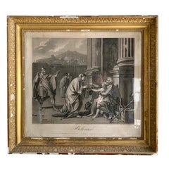
19th Century Empire Period Engraving
Located in Madrid, ES
A large early 19th century Empire period engraving. depicting Belisarius receiving Almas, original ilded frame in classical taste, with original gl...
Category
Antique Early 19th Century French Empire Drawings
Materials
Glass, Giltwood
$853 Sale Price
42% Off
More Ways To Browse
Asian Painted Plate Black
Asian Wooden Bowl
Asprey Leather
Bone Inlaid Chest
Brass Brazier
Breakfront Desk
Brittany Pottery
Bronze Pegasus
Buddha Shakyamuni
Carved Coconut
Cast Bronze Buddha Head
Cast Glass Stool
Cathedral Crown
Century French Fireplace Clock
Chinese Ceramic Statues
Chinese Soapstone Carving
Chippendale Pulls Antique Brass
Chippendale Secretary