Items Similar to Hand-Colored Print of Folkestone 'United Kingdom' as Seen from the East, 1822

Want more images or videos?
Request additional images or videos from the seller
1 of 5
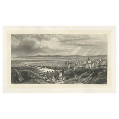
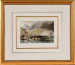
Hand-Colored Print of Folkestone 'United Kingdom' as Seen from the East, 1822
$374.01
$467.5120% Off
£277.84
£347.3020% Off
€312
€39020% Off
CA$519.36
CA$649.2020% Off
A$566.74
A$708.4220% Off
CHF 297.26
CHF 371.5820% Off
MX$6,883.22
MX$8,604.0320% Off
NOK 3,712.99
NOK 4,641.2320% Off
SEK 3,508.96
SEK 4,386.2020% Off
DKK 2,375.22
DKK 2,969.0320% Off
About the Item
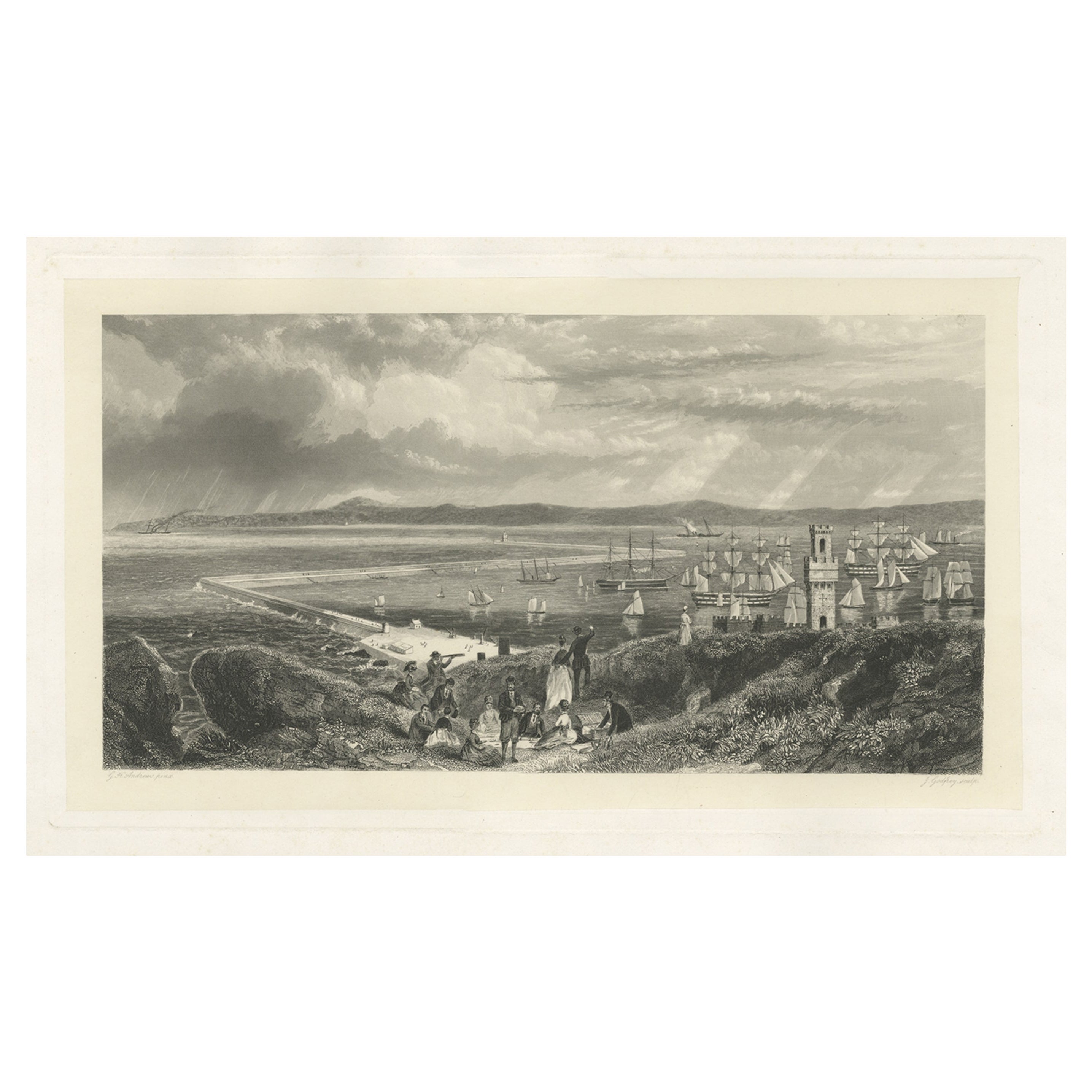
Antique print titled 'Folkestone'.
This print depicts the town of Folkestone (United Kingdom) as seen from the East, the viewpoint high on the cliffs above the Warren, with cattle and sheep grazing on the grassy chalk above Wear Bay. Beyond are two Martello Towers and, in the distance, with a dramatic sky as backdrop, lies the sunlit town with the parish church as its focus. Originates from 'Britannia Delineata' by Hullmandel.
Artists and Engravers: Charles Joseph Hullmandel (ca. 1789-ca. 1860) was a pupil of Senefelder. He was one of the very early lithographers in England.
- Dimensions:Height: 12.41 in (31.5 cm)Width: 16.93 in (43 cm)Depth: 0 in (0.02 mm)
- Materials and Techniques:
- Period:
- Date of Manufacture:1822
- Condition:Wear consistent with age and use. Condition: Good, some minor defects and a tear to the left. Please study image carefully.
- Seller Location:Langweer, NL
- Reference Number:Seller: BG-11319 1stDibs: LU3054326972932
About the Seller
5.0
Recognized Seller
These prestigious sellers are industry leaders and represent the highest echelon for item quality and design.
Platinum Seller
Premium sellers with a 4.7+ rating and 24-hour response times
Established in 2009
1stDibs seller since 2017
2,641 sales on 1stDibs
Typical response time: <1 hour
- ShippingRetrieving quote...Shipping from: Langweer, Netherlands
- Return Policy
Authenticity Guarantee
In the unlikely event there’s an issue with an item’s authenticity, contact us within 1 year for a full refund. DetailsMoney-Back Guarantee
If your item is not as described, is damaged in transit, or does not arrive, contact us within 7 days for a full refund. Details24-Hour Cancellation
You have a 24-hour grace period in which to reconsider your purchase, with no questions asked.Vetted Professional Sellers
Our world-class sellers must adhere to strict standards for service and quality, maintaining the integrity of our listings.Price-Match Guarantee
If you find that a seller listed the same item for a lower price elsewhere, we’ll match it.Trusted Global Delivery
Our best-in-class carrier network provides specialized shipping options worldwide, including custom delivery.More From This Seller
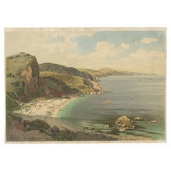
View AllChromolithograph of Oddicombe Sands (Babbacombe Bay), 19th Century
Located in Langweer, NL
Chromolithograph of Oddicombe Sands (Babbacombe Bay), 19th Century
This chromolithograph captures a vibrant and detailed view of Oddicombe Sands in Babbacombe Bay, a picturesque co...
Category
Antique 1880s Prints
Materials
Paper
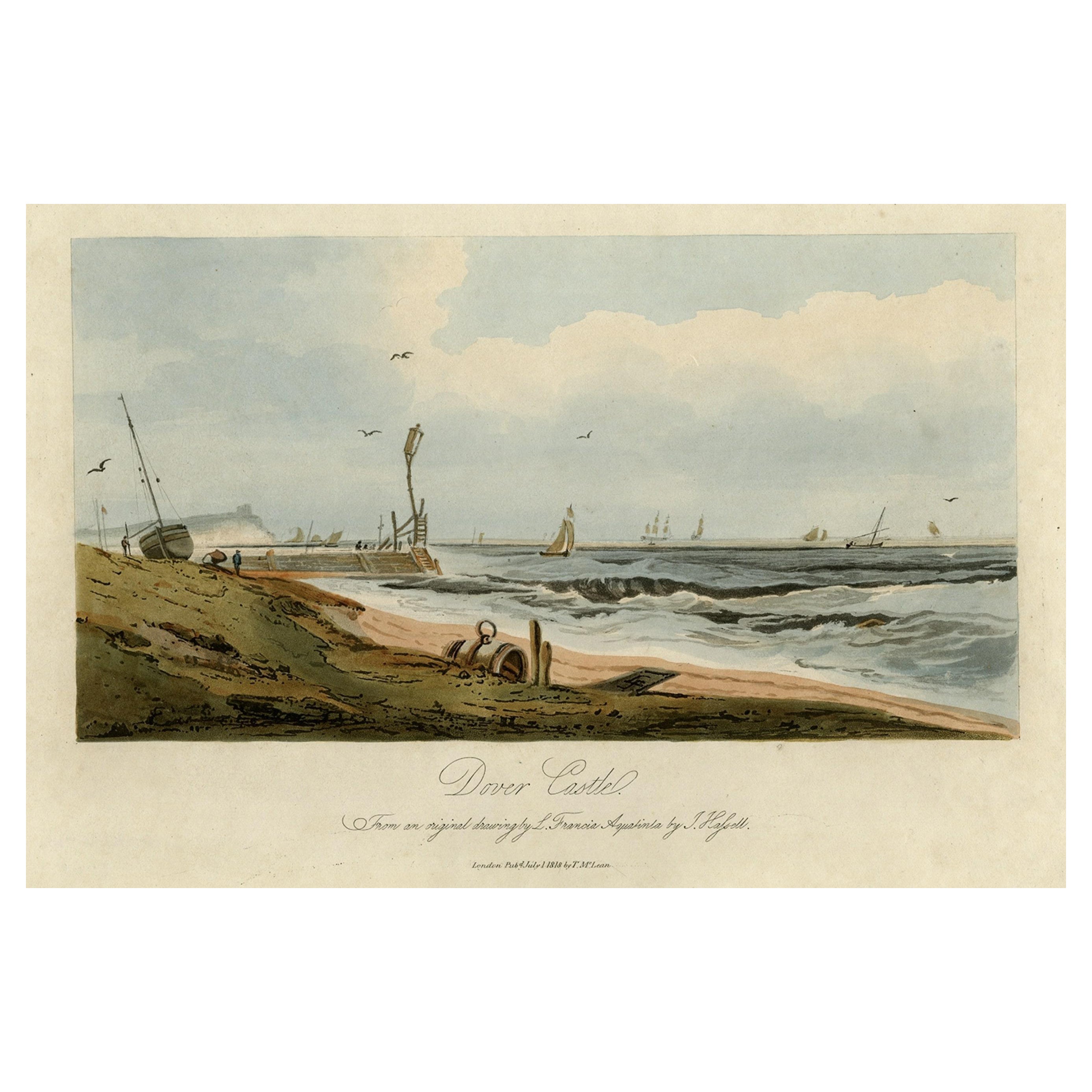
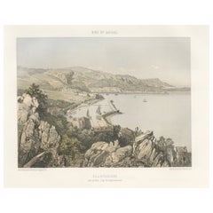
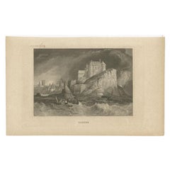
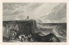
View of Dover Castle Atop the Cliffs in the Background, England, 1818
Located in Langweer, NL
Antique print, titled: 'Dover Castle.'
A view of the beach and sea with Dover Castle atop the cliffs in the background. Published by T. McLean in 1818.
Artists and Engravers: ...
Category
Antique 1810s Maps
Materials
Paper

$316 Sale Price
20% Off
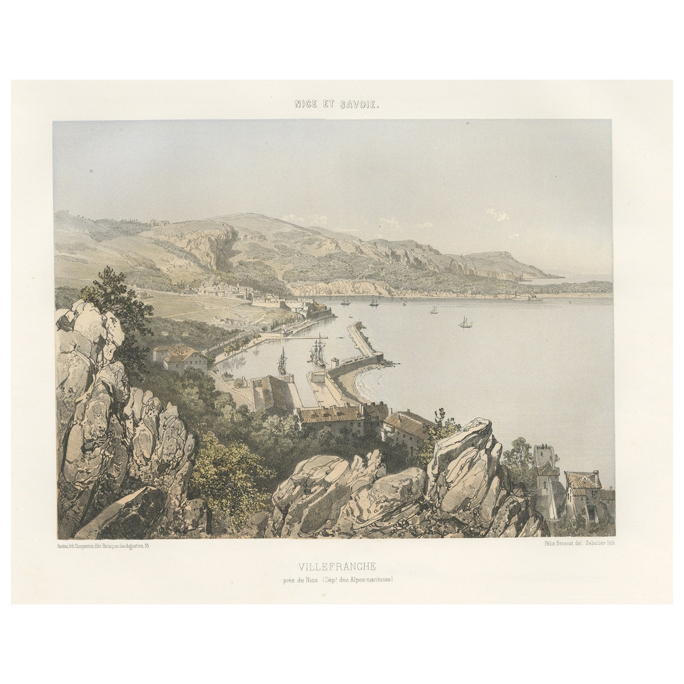
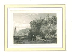
Antique Print of Villefranche in the Nice and Savoy Region of France, c.1865
Located in Langweer, NL
Antique print titled 'Villefranche près de Nice'. Original antique print of Villefranche near Nice, France. This print originates from 'Nice Et Savoie, Sites Pittoreques, Monuments, ...
Category
Antique 19th Century Prints
Materials
Paper
$441 Sale Price
20% Off
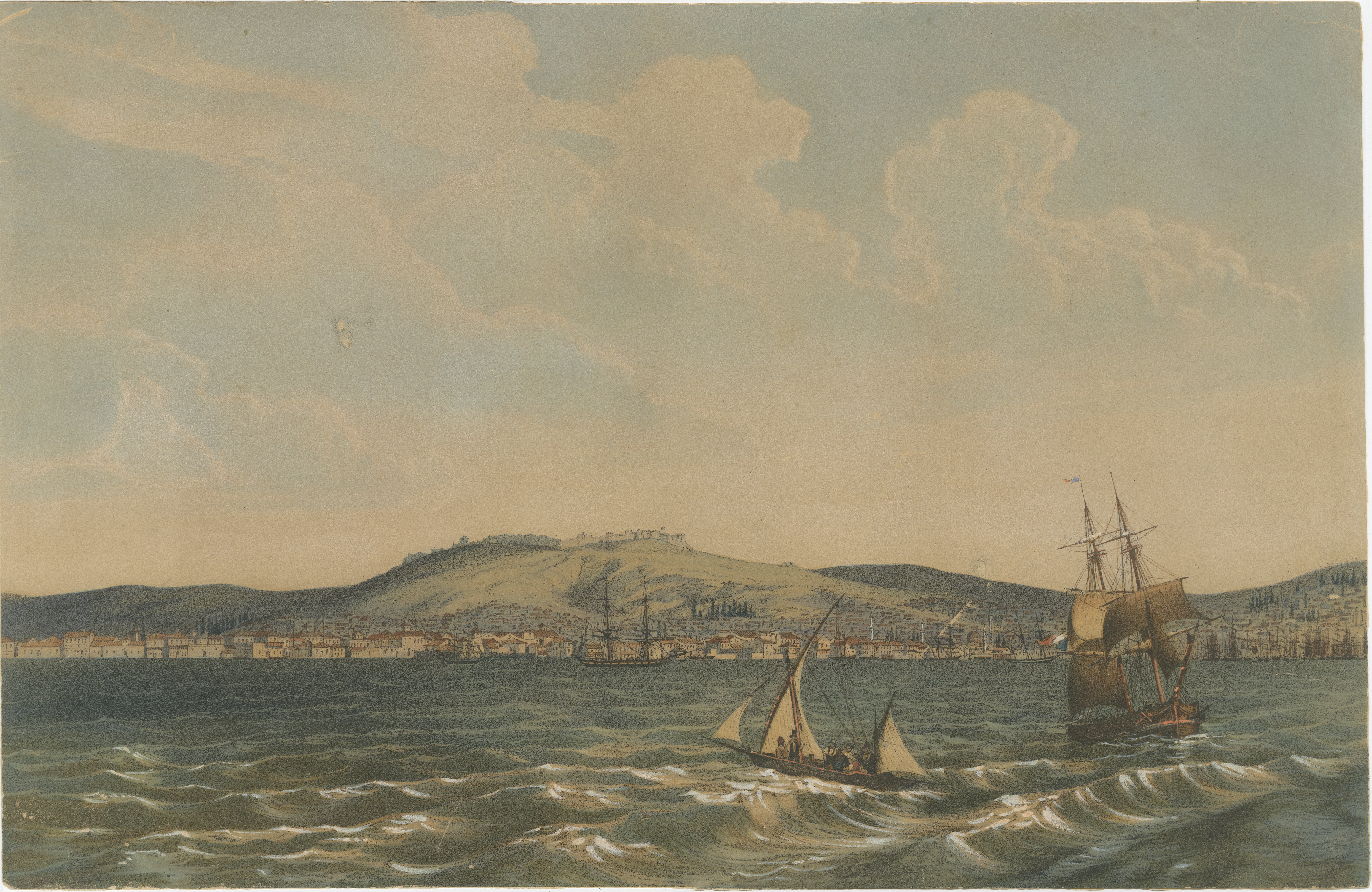
View of the Dardanelles: Fortified Hill and Ships, Hand-Colored Lithograph, 1840
Located in Langweer, NL
This work is a hand-colored toned lithograph, likely created by Théodore du Moncel around 1840. It depicts a picturesque view of a fortified hill with a bustling waterfront and a var...
Category
Antique 1840s French Prints
Materials
Paper
$1,006 Sale Price
30% Off
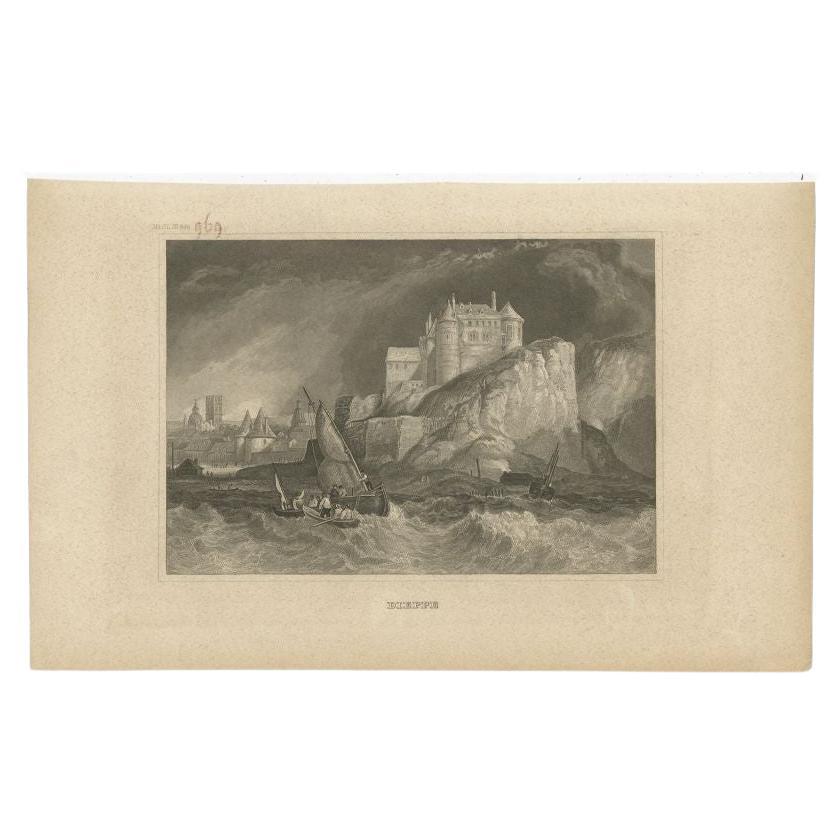
Antique Print of the City of Dieppe, Normandy in France, 1833
Located in Langweer, NL
Antique print titled 'Dieppe'. View of the city of Dieppe, France. Originates from 'Meyers Universum'.
Artists and Engravers: Joseph Meyer (May 9, 1796 - June 27, 1856) was a German...
Category
Antique 19th Century Prints
Materials
Paper
$86 Sale Price
20% Off
Old Decorative Maritime Print of Ships in an Harbour, Possibly England, C.1860
Located in Langweer, NL
Untitled antique maritime print. Antique print depicting an unidentified port/harbour. In the background various vessels. Source unknown, to be...
Category
Antique 19th Century Prints
Materials
Paper
$268 Sale Price
20% Off
You May Also Like
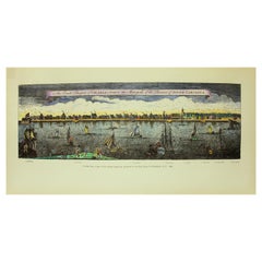
Hand Coloured Reprod, Print, Exact Prospect of Charlestown, the Metropolis of SC
Located in CHARLESTON, SC
Exact Prospect of CharlesTown, the Metropolis of the Province of South Carolina, Print made Circa 1950-60
Printed from a copy of the original engraving (original engraving likely circa 1760- 1770) presented to the City Council of Charleston, SC, 1882
Hand coloured by a Charleston artist. This is a very desirable water view of the Charleston Battery...
Category
Mid-20th Century American Prints
Materials
Paper
$235 Sale Price
20% Off
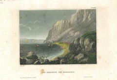
Ancient View of The Strait of Gibraltar - Original Lithograph - Mid-19th Century
Located in Roma, IT
The Strait of Gibraltar is an original modern artwork realized in the mid-19th Century.
Original Colored Lithograph on Ivory Paper.
Inscripted on the lower margin in Capital Lett...
Category
Mid-19th Century Figurative Prints
Materials
Paper, Lithograph
A View of Dover, England: A Framed 19th C. Engraving After J. M. W. Turner
By J.M.W. Turner
Located in Alamo, CA
This beautiful 19th century framed engraving "Dover" by Thomas Lupton is based on an original painting by the renowned British artist J.M.W. Turner, which depicts a panoramic view of the harbor of Dover, a town in southeastern England, that has been an important port for centuries. The engraving captures the dramatic sky and sea that Turner was known for, with billowing clouds and waves crashing against the shore. The town and its famous white cliffs are visible in the background, while ships and boats dot the harbor in the foreground. Several wooden rowboats...
Category
Mid-19th Century Romantic Landscape Prints
Materials
Engraving
"Folkestone" engraving
By (After) Joseph Mallord William Turner
Located in Henderson, NV
Medium: engraving (after the painting). Printed on Holland-style wove paper, from the rare large size deluxe portfolio entitled "Picturesque Views on the Southern Coast of England", ...
Category
Early 19th Century Prints and Multiples
Materials
Engraving
Ancient View of the Bay of Naples - Original Lithograph - Mid-19th Century
Located in Roma, IT
Ancient View of the Bay of Bay of Naples is an original modern artwork realized in Italy in the first half of the 19th Century.
Original Lithograph on Ivory Paper.
Inscripted in ...
Category
1850s Figurative Prints
Materials
Lithograph
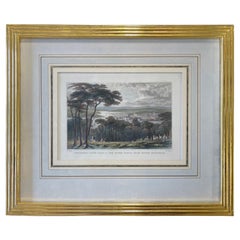
Engraving Devonport, Dockyard, and the River Tamar, From Mount Edgcumbe C 1829
Located in Atlanta, GA
English Engraving Devonport, Dockyard, and the River Tamar, From Mount Edgcumbe Circa 1829
Title: Devonport, Dock-Yard, and the River Tamar, from Mount Edgcumbe.
Artist: Thomas Al...
Category
Antique Early 19th Century Prints
Materials
Giltwood, Paper
$396 Sale Price
20% Off
More Ways To Browse
Piranesi Folio
Pour Robie
Richard Kemble
Robert E Marx
Shepard Fairey 2001
Sonny Zoback
Stained Glass Fairy
Superstudio Lithograph
Tretchikoff Vintage Prints
Trowbridge Gallery Print
Victor Ostrovsky
Vintage Maio Prints
Vintage Puppet Theater
Volkamer Prints
W Dendy Sadler
Werner Graeff
Woodblock Crow
Woodville Prints