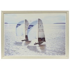
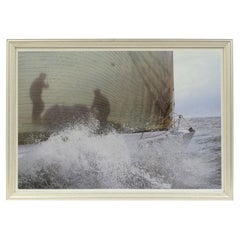
Lithograph with Frame of a Photo by Ivor Wilkins of 2001 Hauraki Gulf, Auckland
View Similar Items


Want more images or videos?
Request additional images or videos from the seller
1 of 9
Lithograph with Frame of a Photo by Ivor Wilkins of 2001 Hauraki Gulf, Auckland
About the Item
- Dimensions:Height: 15.56 in (39.5 cm)Width: 21.86 in (55.5 cm)Depth: 0.71 in (1.8 cm)
- Materials and Techniques:
- Place of Origin:
- Period:
- Date of Manufacture:2001
- Condition:
- Seller Location:Milan, IT
- Reference Number:1stDibs: LU1020219340261
About the Seller
4.9
Vetted Seller
These experienced sellers undergo a comprehensive evaluation by our team of in-house experts.
Established in 1999
1stDibs seller since 2014
370 sales on 1stDibs
More From This SellerView All
- 2001 Lithograph of a Racing Ship of a Photo by Daniel Forster Gotlant RantLocated in Milan, ITLithograph of a racing sailing ship with frame of a photo by Daniel Forster Gotlant Rant, 2001. Frame size 55.5 x 39.5 cm - 21.8 x 15.55 inches, frame thickness 1.8 cm - 0.7 inches. ...Category
Early 2000s American Sports Equipment and Memorabilia
MaterialsWood, Paper
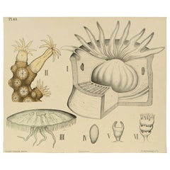
- Zoological Lithograph of Coelenterates 1912 Cardboard by H Aschehoug & Co NorwayLocated in Milan, ITZoological didactic plate n. 63 lithograph on cardboard made in 1912 depicting the family of coelenterates with jellyfish, coral and sea anemone. Dybdhals Zoologiske Plancher P.M.Bye...Category
Vintage 1910s Norwegian Prints
MaterialsPaper
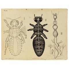
- Zoological Lithograph of a Cockroach 1925 Cardboard by H Aschehoug & Co NorwayLocated in Milan, ITZoological didactic plate n. 64 lithograph on cardboard made in 1925 depicting an enlarged cockroach with the digestive and reproductive system. Dybdhals Zoologiske Plancher P.M.Bye ...Category
Vintage 1920s Norwegian Prints
MaterialsPaper
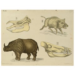
- Zoological Lithograph of Ungulates 1912 on Cardboard by H Aschehoug & Co, NorwayLocated in Milan, ITZoological didactic plate n. 25 lithograph on cardboard made in 1912 depicting ungulates. Dybdhals Zoologiske Plancher P.M.Bye & Co Oslo. Made by H Aschehoug & Co. Good condition. Me...Category
Vintage 1910s Norwegian Prints
MaterialsPaper
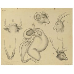
- Zoological Lithograph of Ungulates 1912 on Cardboard by H Aschehoug & Co NorwayLocated in Milan, ITZoological didactic plate n. 29 lithograph on cardboard made in 1912 depicting the digestive system of the ungulates; the plate depicts 4 different ty...Category
Vintage 1910s Norwegian Prints
MaterialsPaper
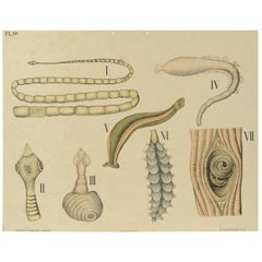
- Zoological Lithograph of Worm Organs 1925 Cardboard by H Aschehoug & Co NorwayLocated in Milan, ITZoological didactic plate n. 59 lithograph on cardboard made in 1925 depicting enlargements of worm organs. Dybdhals Zoologiske Plancher P.M.Bye & Co Oslo. Made by H Aschehoug & Co. ...Category
Vintage 1920s Norwegian Prints
MaterialsPaper
You May Also Like
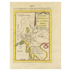
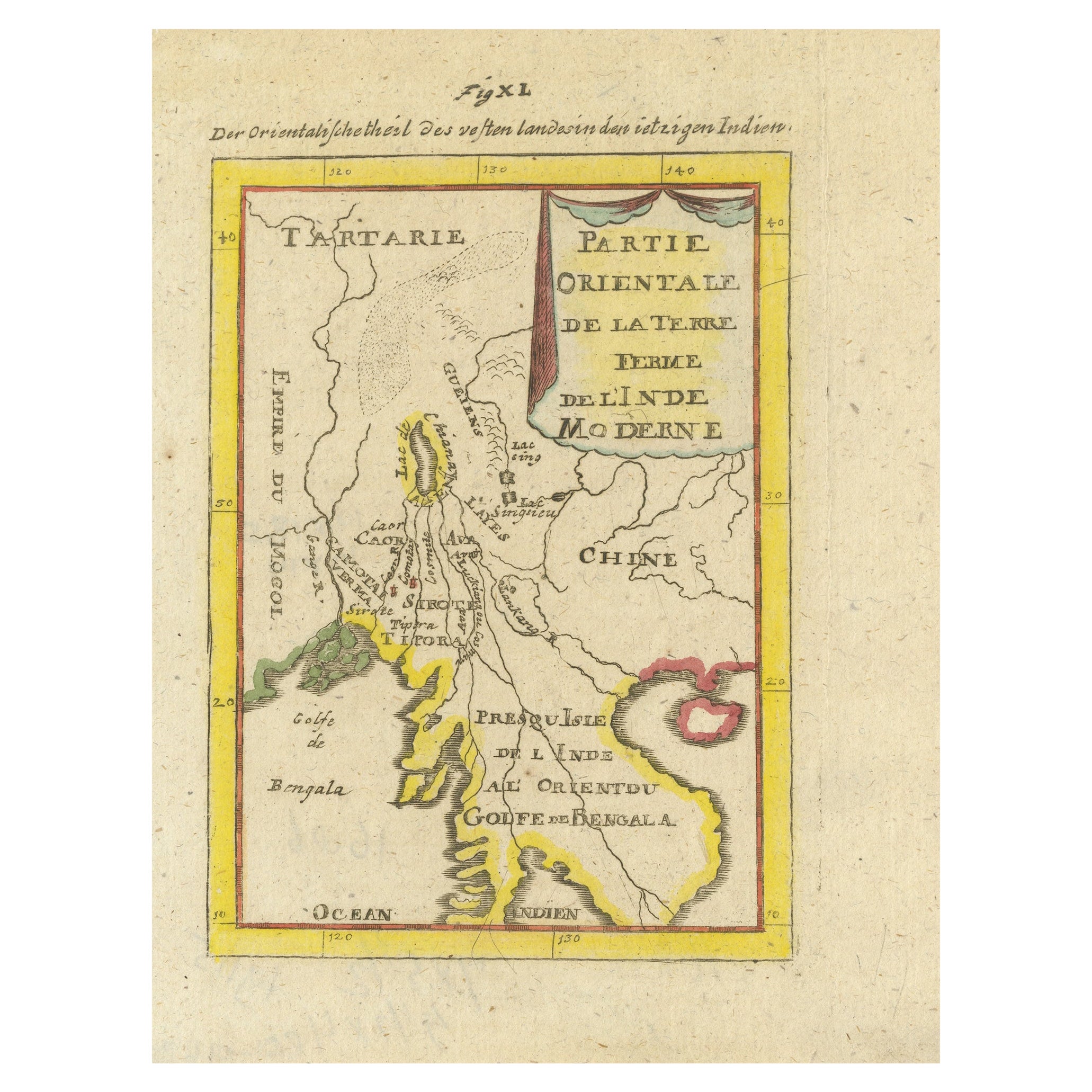
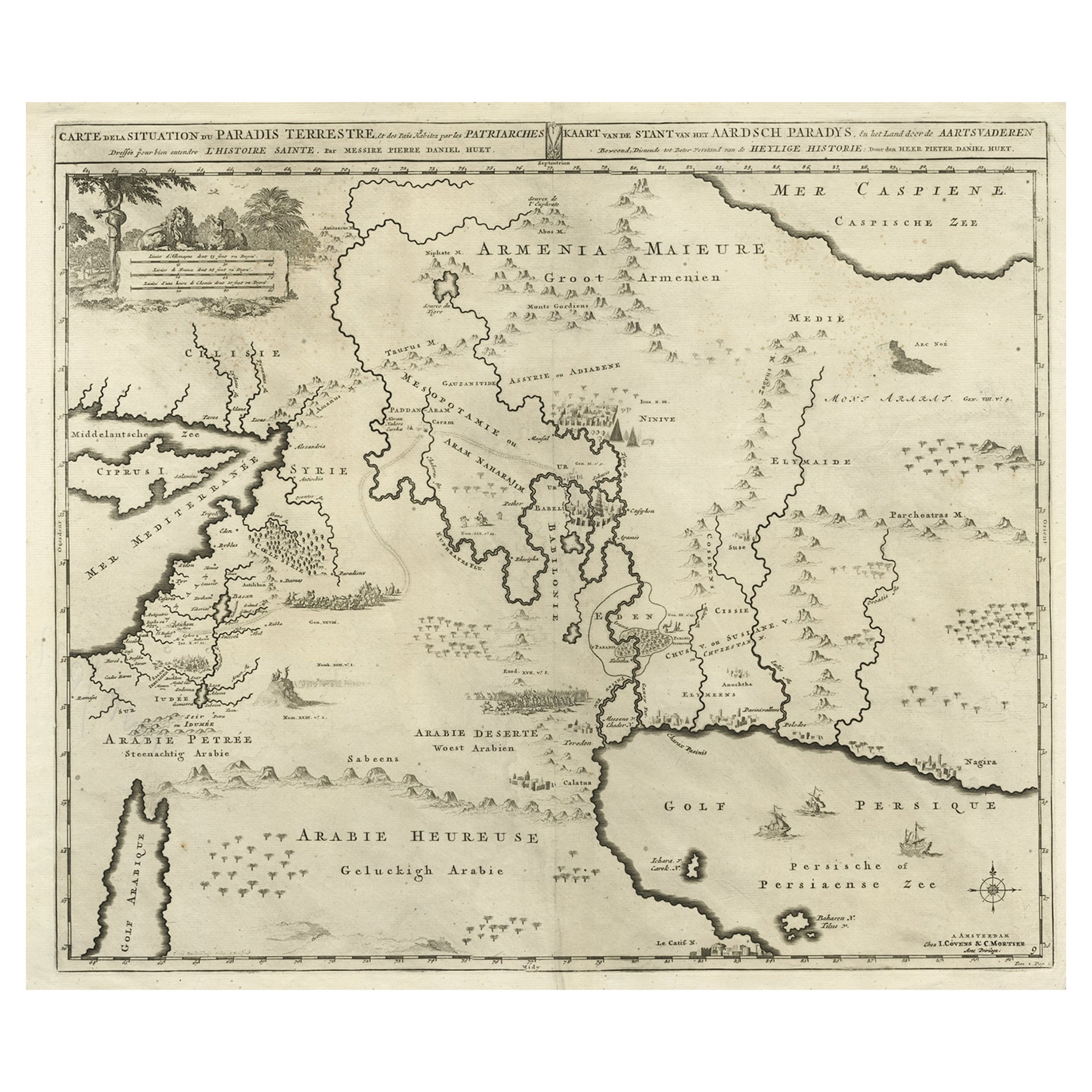
- Antique Map of India and the Gulf of Bengal by Mallet, c.1686Located in Langweer, NLAntique map titled ?Partie Orientale de la Terre Ferme de l'Inde Moderne. Small map of India and the Gulf of Bengal. This map originates from a German edition of 'Description de l' Univers'. Artists and Engravers: Alain Manesson Mallet (1630-1706) was a French cartographer and engineer. He started his career as a soldier in the army of Louis XIV, became a Sergeant-Major in the artillery and an Inspector of Fortifications. He also served under the King of Portugal, before returning to France, and his appointment to the court of Louis XIV. His military engineering and mathematical background led to his position teaching mathematics at court. His 'Description de L'Universe' contains a wide variety of information, including star maps...Category
Antique 17th Century Maps
MaterialsPaper
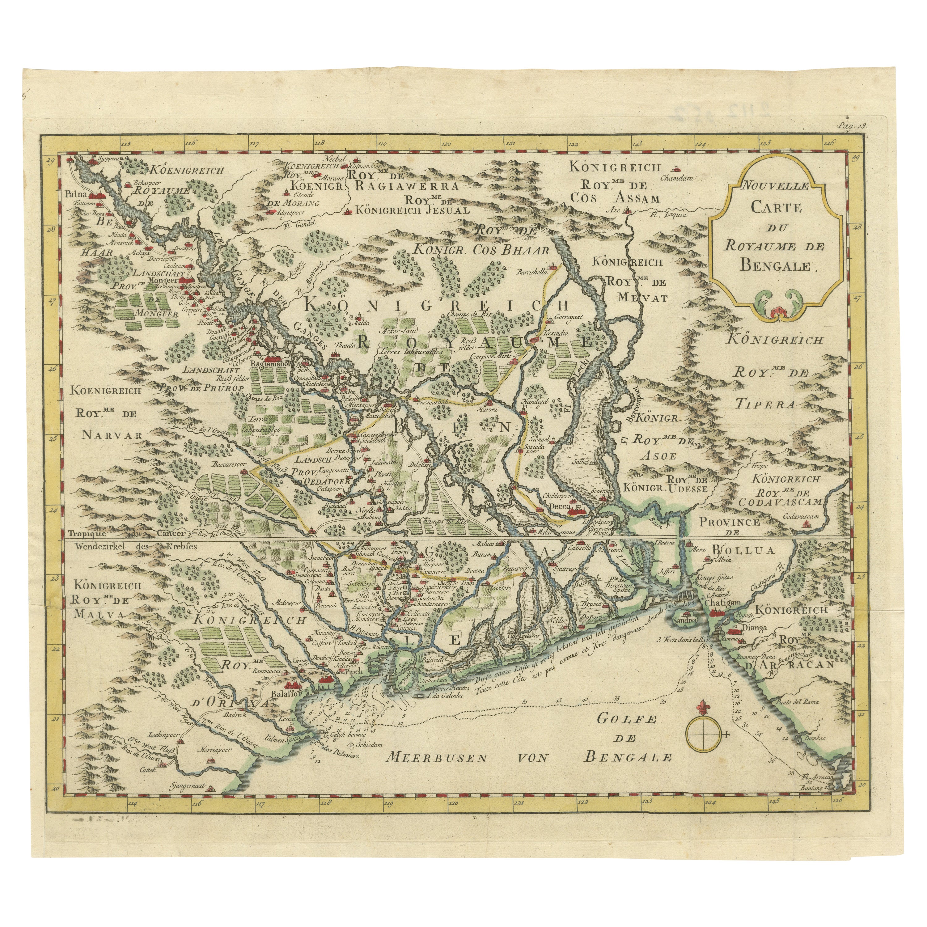
- Antique Map of the Gulf of Bengal by J.N. Bellin, circa 1760Located in Langweer, NLBeautiful chart of the Gulf of Bengal. The map extends from Malabar to Sumatra and today Phuket area in Thailand. Including Pegu, Ceylon, and the Andaman and Nicobar Islands. Numerou...Category
Antique Mid-18th Century Maps
MaterialsPaper
 $302 Sale Price20% Off
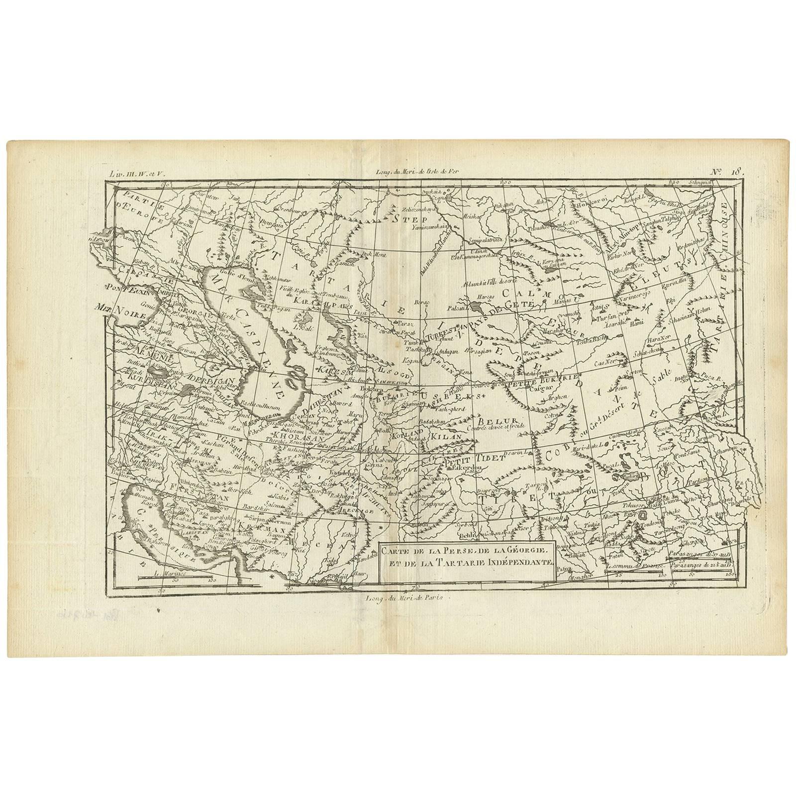
 - Antique Map of the Persian Gulf and Caspian Sea Region by R. Bonne, 1780Located in Langweer, NLAntique print titled 'Carte de la Perse, de la Georgie, et de la Tartarie Independante'. Shows the region from the Persian Gulf and Caspian Sea in the wes...Category
Antique Late 18th Century Maps
MaterialsPaper
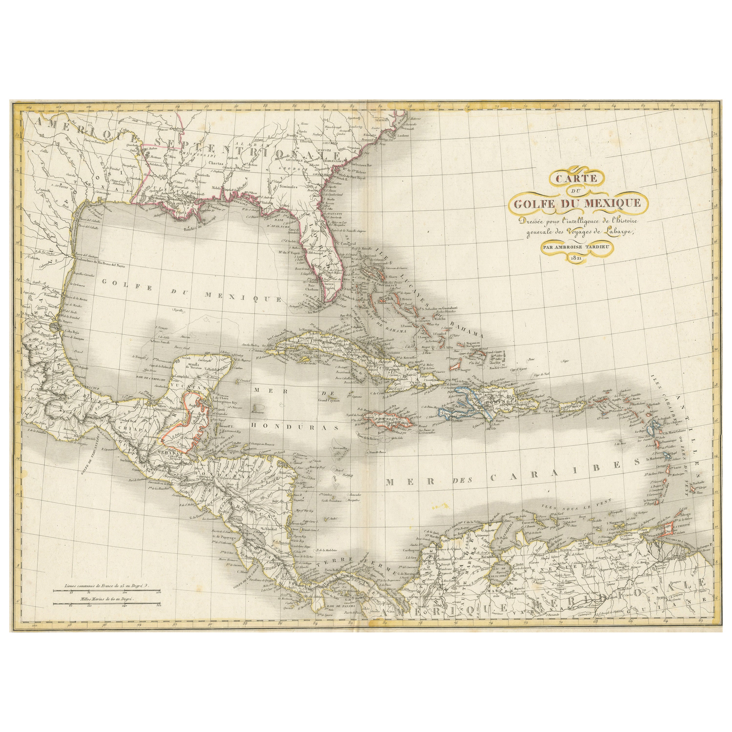
- Engraving of a Map of Florida, the Gulf Coast, Caribbean & Central America, 1728Located in Langweer, NLThis exceptional antique map, titled "Nouvelle Carte Marine de Toute les Cotes de l´Amerique" and alternatively known as "Nieuwe groote en seer Curieuse Paskaart van Geheel-WestIndie...Category
Antique Mid-18th Century European Maps
MaterialsPaper
 $12,356 Sale Price25% OffFree Shipping
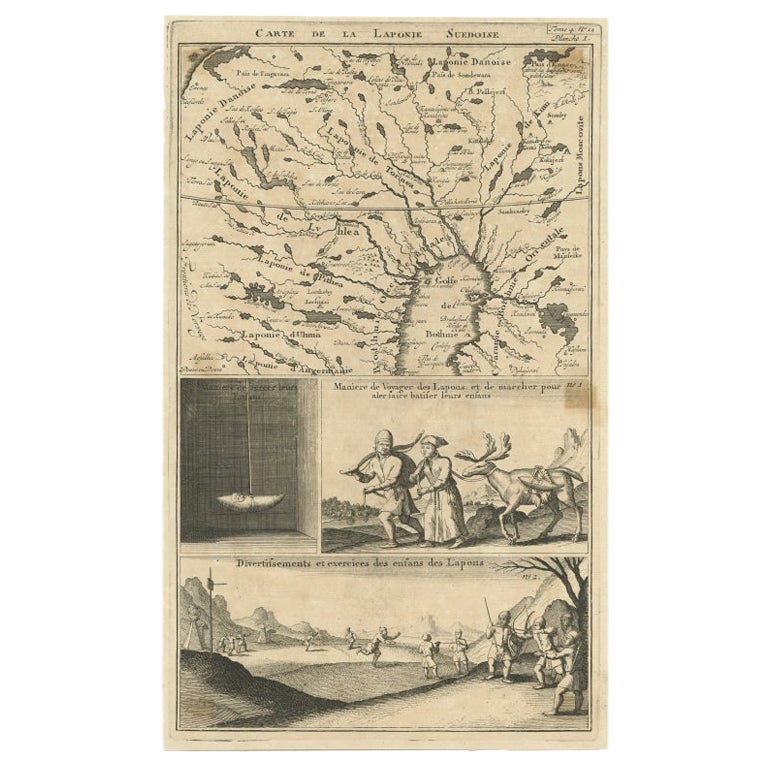
 - Antique Map of Lapland Covering all of Sweden around the Gulf of Bothnia, 1714Located in Langweer, NLAntique map titled 'Carte de la Laponie Suedoise (..)'. Includes an inset map of Lapland covering all of Sweden around the Gulf of Bothnia. A series of ...Category
Antique 18th Century Maps
MaterialsPaper
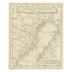
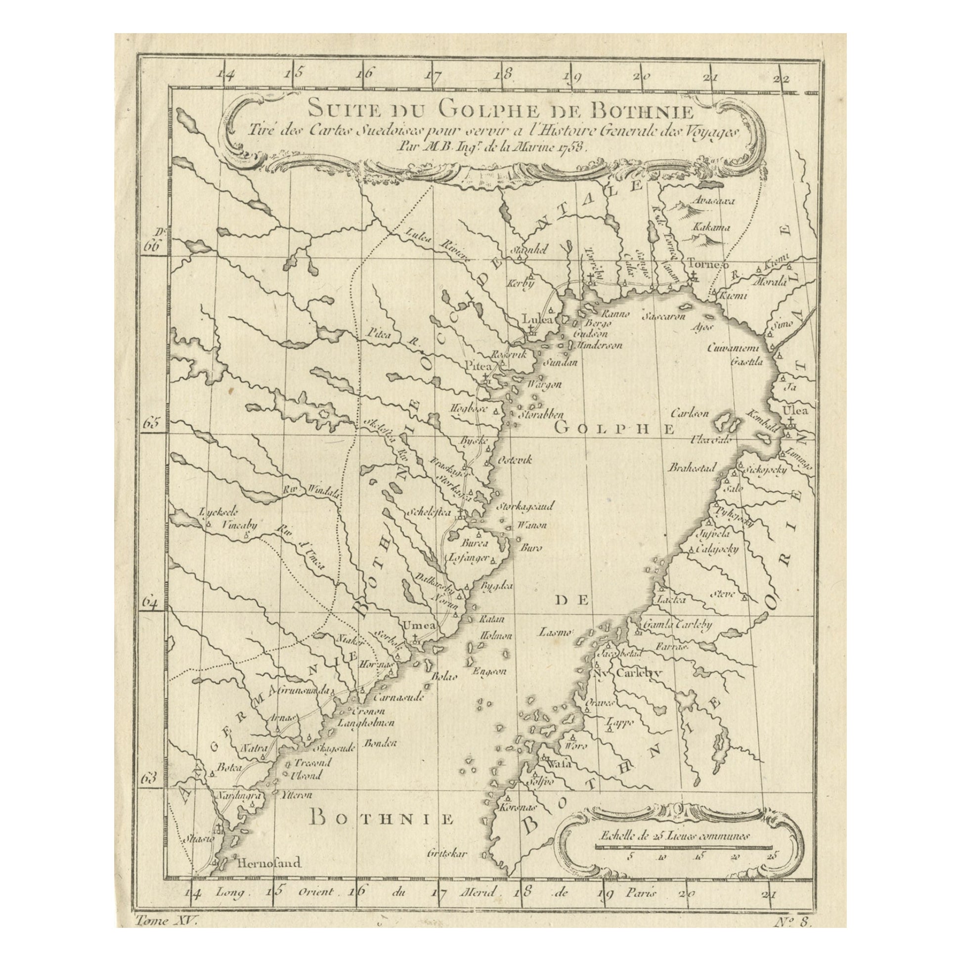
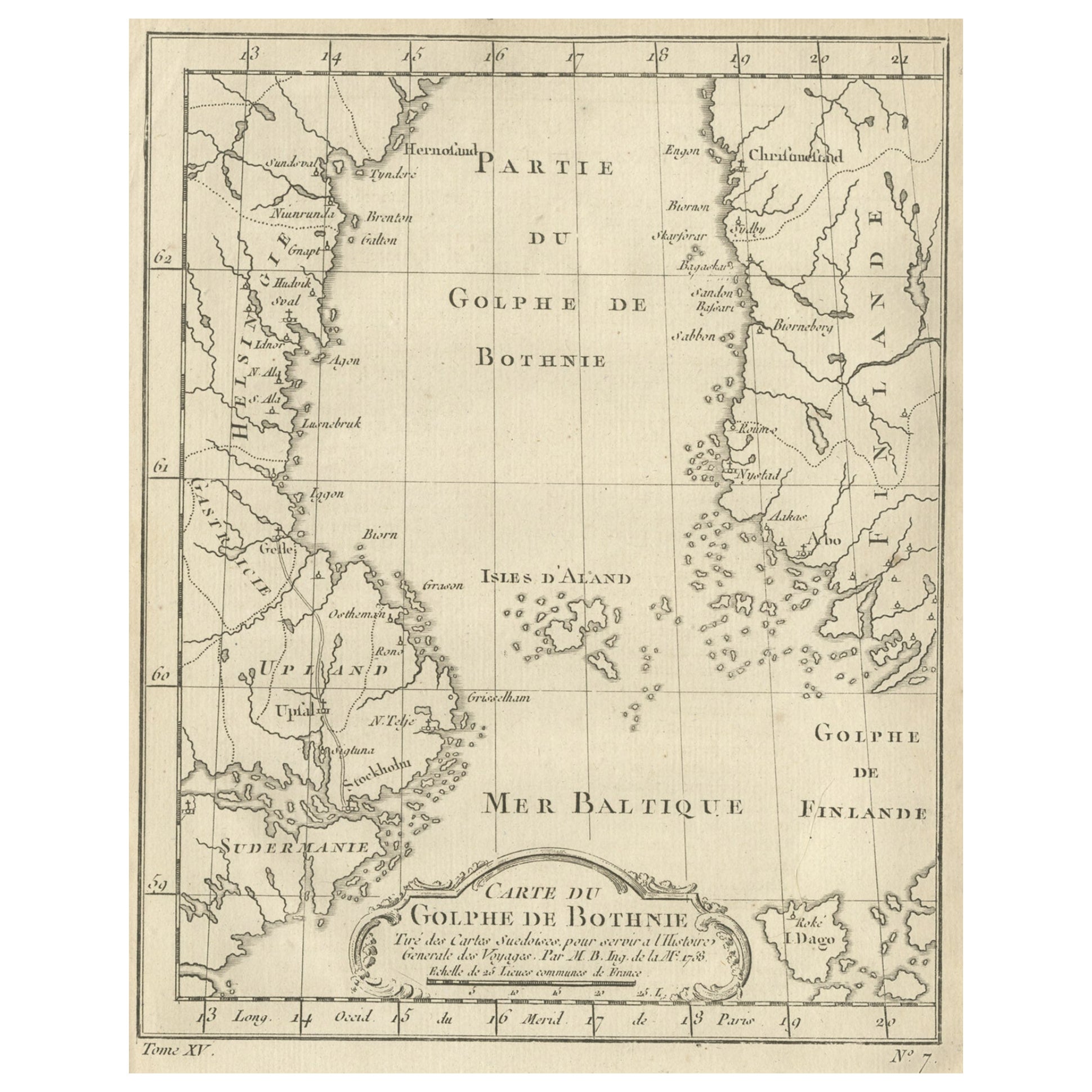
- Antique Map of the Gulf of Bothnia, the Northernmost Arm of the Baltic, 1759Located in Langweer, NLAntique map titled 'Suite du Golphe de Bothnie'. Original antique map of the Gulf of Bothnia, the northernmost arm of the Baltic Sea. It is situated between Finland's west coast ...Category
Antique 1750s Maps
MaterialsPaper