Items Similar to Map of Kerguelen’s Land: The Island of Desolation Explored by Captain Cook
Want more images or videos?
Request additional images or videos from the seller
1 of 9
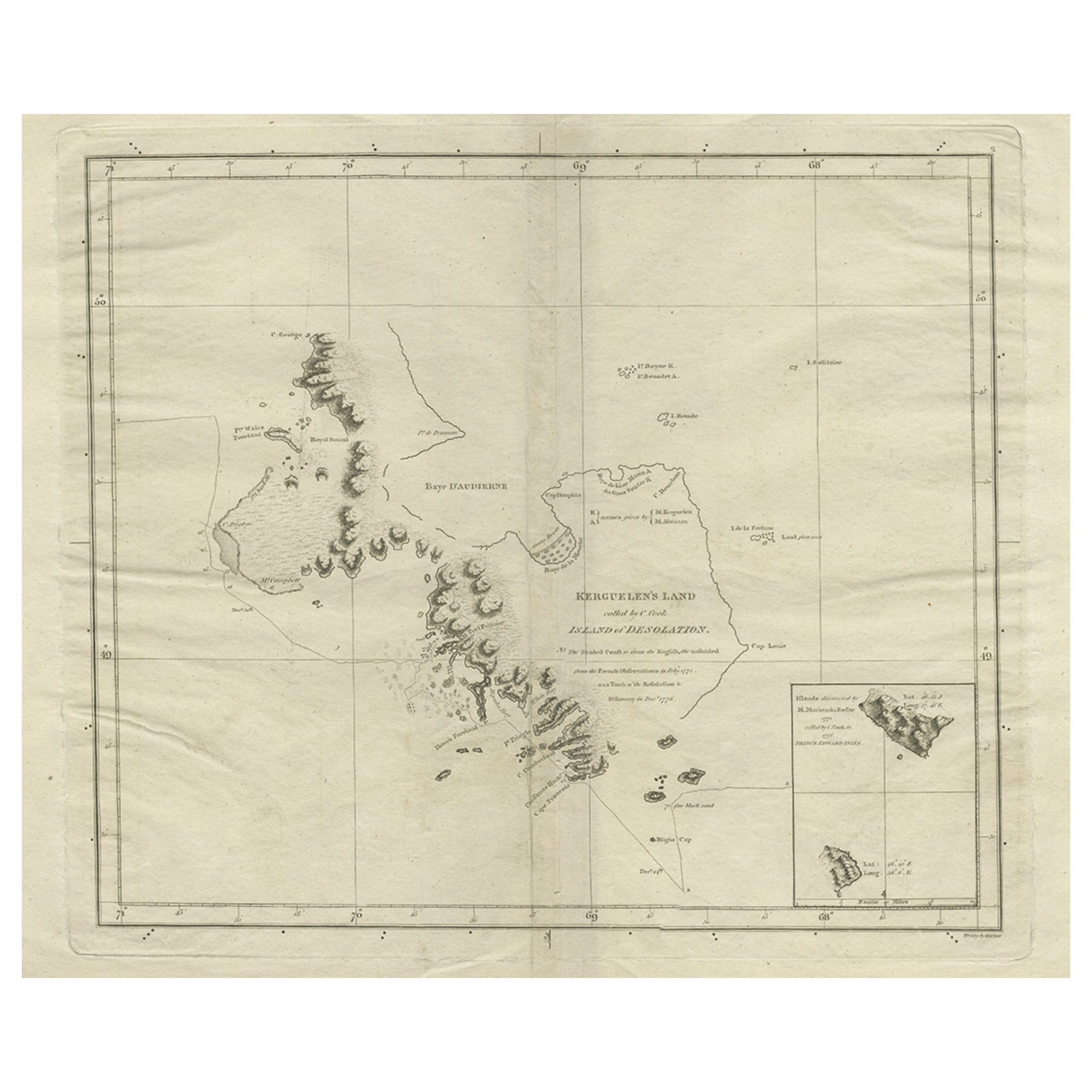
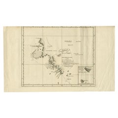
Map of Kerguelen’s Land: The Island of Desolation Explored by Captain Cook
$95.67
$119.5920% Off
£71.12
£88.9020% Off
€80
€10020% Off
CA$133.46
CA$166.8220% Off
A$144.77
A$180.9720% Off
CHF 76.13
CHF 95.1620% Off
MX$1,761.60
MX$2,20220% Off
NOK 951.75
NOK 1,189.6820% Off
SEK 897.61
SEK 1,122.0220% Off
DKK 609.25
DKK 761.5620% Off
About the Item
This map is titled "Map of Kerguelen’s Land, called by Cook Island of Desolation." It represents the geographic layout of Kerguelen Island, also known as the Island of Desolation, located in the southern Indian Ocean. This remote and uninhabited island was discovered by French navigator Yves-Joseph de Kerguelen-Trémarec in 1772 and later visited by Captain James Cook during his second voyage in 1776.
This 18th-century map was carefully engraved for Anderson’s Large Folio Edition of the Whole of Capt. Cook's Voyages. It offers a detailed geographic layout of Kerguelen’s Land (now Kerguelen Island) in the Southern Ocean, a desolate and harsh environment. The map includes important landmarks such as Royal Sound and Baye d’Audierne and notes both the French and British exploration efforts.
Captain James Cook visited the island during his third Pacific expedition (1776-1779) and referred to it as the Island of Desolation, due to its barren landscape and inhospitable climate. The island had previously been charted by the French expedition under Yves-Joseph de Kerguelen, who claimed it for France in 1772. Cook’s subsequent exploration and observations contributed to refining the map of this remote island, and his experience here was part of the broader narrative of his voyages to explore the southern hemisphere.
This map was part of a publication documenting the explorations of Captain Cook, with a specific focus on the uncharted or scarcely known territories. Kerguelen Island was significant as a potential stopover for explorers searching for resources or new landmasses in the southern oceans. However, its lack of resources and harsh environment made it unattractive for settlement or extended exploration.
Significance:
- Kerguelen Island holds importance in the history of exploration as one of the most remote islands in the world, reflecting the extent to which explorers like Cook ventured into uncharted territories.
- The map shows the rugged coastline, bays, and anchorages used by explorers and notes the tracks of the Resolution, Cook’s ship, during his 1776 voyage.
- It also highlights the ongoing French-British competition for territorial claims in the 18th century.
Interesting Aspects:
- The map is not only a geographic tool but also a historical record, showing the interaction between French and British exploratory efforts.
- The use of both French and British names on the map emphasizes the competing claims and contributions of both nations in the exploration of the Southern Ocean.
- The notation of islands discovered by Mr. Marion du Fresne highlights additional French contributions to Pacific exploration, particularly those of Marc-Joseph Marion du Fresne, who explored parts of the Indian and Pacific Oceans.
This map provides an intriguing glimpse into the process of 18th-century exploration and mapping, reflecting the collaborative and competitive nature of European expeditions during the age of discovery. It also serves as a reminder of the harsh and desolate environments that explorers like Cook encountered in their quest for new lands and trade routes.
- Dimensions:Height: 9.45 in (24 cm)Width: 15.04 in (38.2 cm)Depth: 0 in (0.02 mm)
- Materials and Techniques:Paper,Engraved
- Period:1780-1789
- Date of Manufacture:circa 1785
- Condition:Condition: fair, given age. With soiling and overall a brownish hue. General age-related toning and defects from handling. Lower border cut off rough, touching the image. A patina rich map. Study images carefully.
- Seller Location:Langweer, NL
- Reference Number:Seller: BG-13597-771stDibs: LU3054341693822
About the Seller
5.0
Recognized Seller
These prestigious sellers are industry leaders and represent the highest echelon for item quality and design.
Platinum Seller
Premium sellers with a 4.7+ rating and 24-hour response times
Established in 2009
1stDibs seller since 2017
2,660 sales on 1stDibs
Typical response time: <1 hour
- ShippingRetrieving quote...Shipping from: Langweer, Netherlands
- Return Policy
Authenticity Guarantee
In the unlikely event there’s an issue with an item’s authenticity, contact us within 1 year for a full refund. DetailsMoney-Back Guarantee
If your item is not as described, is damaged in transit, or does not arrive, contact us within 7 days for a full refund. Details24-Hour Cancellation
You have a 24-hour grace period in which to reconsider your purchase, with no questions asked.Vetted Professional Sellers
Our world-class sellers must adhere to strict standards for service and quality, maintaining the integrity of our listings.Price-Match Guarantee
If you find that a seller listed the same item for a lower price elsewhere, we’ll match it.Trusted Global Delivery
Our best-in-class carrier network provides specialized shipping options worldwide, including custom delivery.More From This Seller
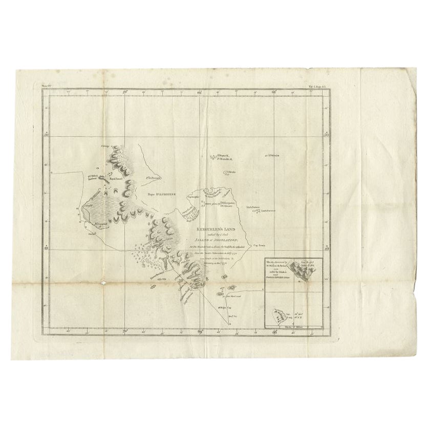
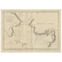
View AllAntique Map of Kerguelens Island Coast in the Indian Ocean by Cook, 1785
By James Cook
Located in Langweer, NL
Antique print titled 'Kerguelen's Land (..)'. Antique map of Kerguelens island coast, known today as the Desolation islands. Originates from 'Voyage to the Pacific Ocean, undertaken ...
Category
Antique 18th Century Prints
Materials
Paper
Antique Map of Kerguelens Island Coast by Cook, 1784
By James Cook
Located in Langweer, NL
Antique print titled 'Kerguelen's Land (..)'. Antique map of Kerguelens island coast, known today as the Desolation islands. Originates from 'A Voyage to the Pacific Ocean: Undertaken, by the Command of His Majesty, for Making Discoveries in the Northern Hemisphere (..)' published in Dublin.
Artists and Engravers: James Cook...
Category
Antique 18th Century Prints
Materials
Paper
$322 Sale Price
25% Off
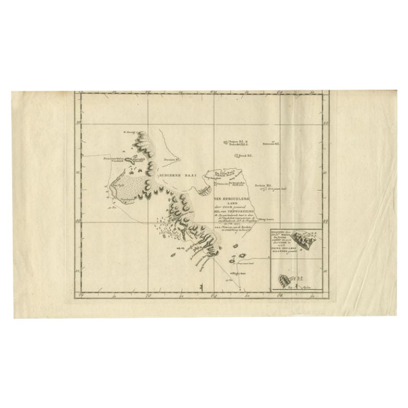
Antique Map of the Coast of Kerguelens Island by Cook, 1803
Located in Langweer, NL
Antique map Desolation Islands titled 'Van Kerguelens Land door Cook genaamd (..)'. Antique map of Kerguelens island coast, known today as the Desolation islands. Originates from 'Re...
Category
Antique 19th Century Maps
Materials
Paper
$293 Sale Price
20% Off
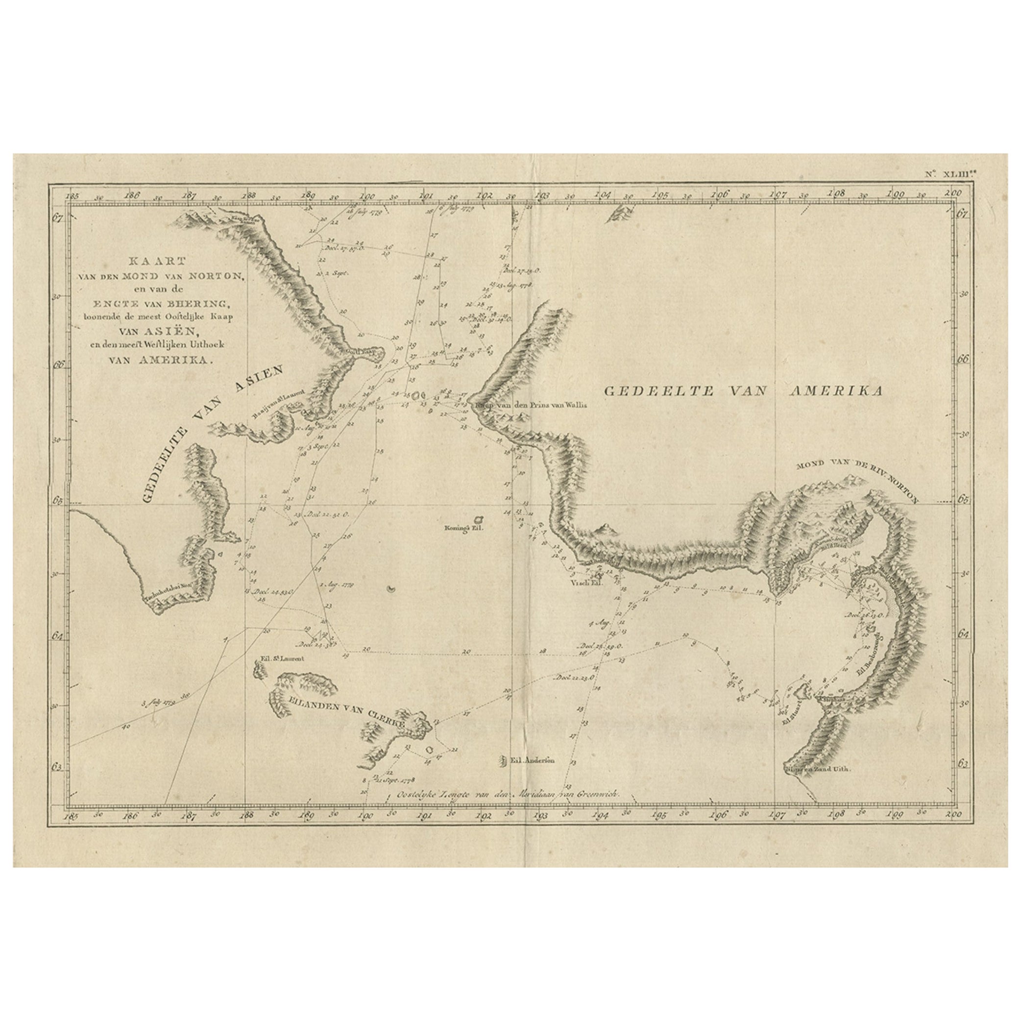
Original Copper Engraved Map of the Bering Strait by Captain Cook, 1803
Located in Langweer, NL
Antique map titled 'Kaart van den Mond van Norton, en van de Engte van Bhering, toonende de meest Oostlijke Kaap van Asien, en den meest Westlijken Urthoek van Amerika'.
Map of t...
Category
Antique Early 1800s Maps
Materials
Paper
$708 Sale Price
25% Off
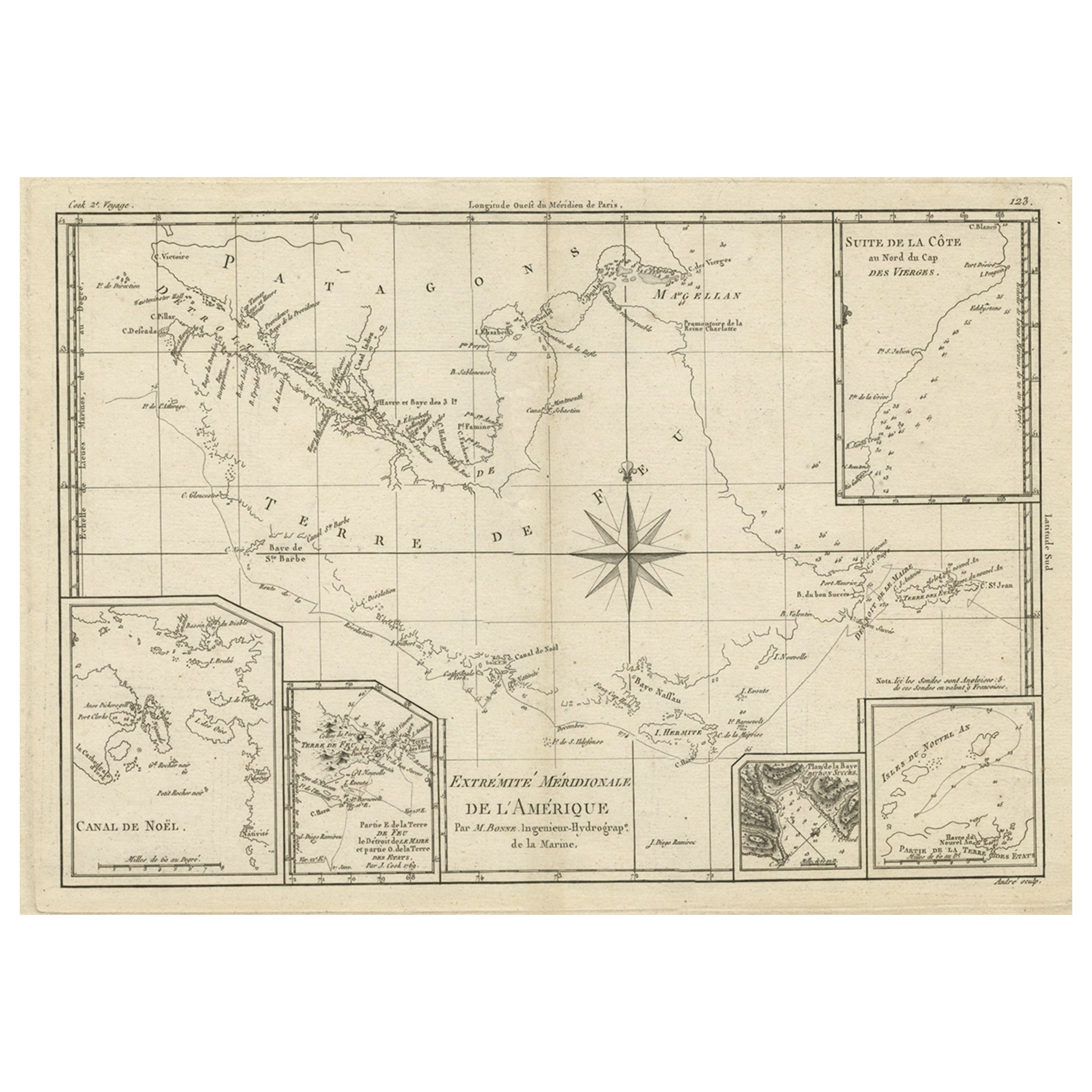
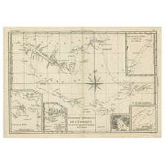
Copper Engraved Map of Tierra del Fuego and the Strait of Magellan, c1780
Located in Langweer, NL
Antique map titled 'Extremite Meridionale de l'Amerique.'
Copper engraved map of Tierra del Fuego and the Strait of Magellan with five detailed insets of the region showing soundings, anchorages, etc. Engraved by Andre. This map originates from 'Atlas de Toutes les Parties Connues du Globe Terrestre'.
Artists and Engravers: Rigobert Bonne (1727-1795 ) was one of the most important cartographers of the late 18th century. In 1773 he succeeded Jacques Bellin as Royal Cartographer to France in the office of the Hydrographer at the Depôt de la Marine. Working in his official capacity Bonne compiled some of the most detailed and accurate maps of the period. Bonne's work represents an important step in the evolution of the cartographic ideology away from the decorative work of the 17th and early 18th century towards a more detail oriented and practical aesthetic. With regard to the rendering of terrain Bonne maps...
Category
Antique 1780s Maps
Materials
Paper
$344 Sale Price
20% Off
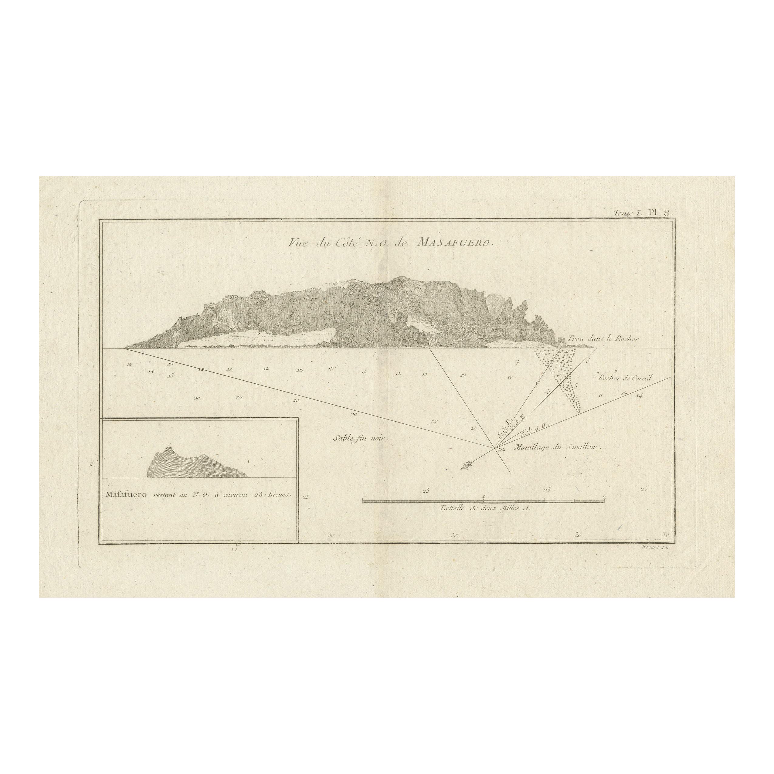
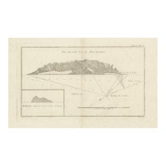
Antique Map of the Northwest Coast of Masafuera Island or Selkirk Island
Located in Langweer, NL
Antique map titled 'Vue de Cote N.O. de Masafuero'. Profile view of the north-west coast of Masafuera Island (also called Alejandro Selkirk Island...
Category
Antique Late 18th Century Maps
Materials
Paper
$325 Sale Price
20% Off
You May Also Like
Large Original Antique Map of The Falkland Islands. 1894
Located in St Annes, Lancashire
Superb Antique map of The Falkland Islands
Published Edward Stanford, Charing Cross, London 1894
Original colour
Good condition
Unframed.
Free shipping
Category
Antique 1890s English Maps
Materials
Paper

Original Antique Decorative Map of Iceland & Faroe, Fullarton, C.1870
Located in St Annes, Lancashire
Great map of Iceland and The Faroe Islands
Wonderful figural border
From the celebrated Royal Illustrated Atlas
Lithograph. Original color.
Published by Fullarton, Edinb...
Category
Antique 1870s Scottish Maps
Materials
Paper

Original Antique Map of South America. C.1780
Located in St Annes, Lancashire
Great map of South America
Copper-plate engraving
Published C.1780
Two small worm holes to left side of map
Unframed.
Category
Antique Early 1800s English Georgian Maps
Materials
Paper

Original Antique Map of US Possessions In The Pacific Ocean, C.1900
Located in St Annes, Lancashire
Fabulous map of US possessions in the Pacific Ocean
Original color.
Engraved and printed by the George F. Cram Company, Indianapolis.
Published, C.1900.
Unframed.
Free shipping.
Category
Antique 1890s American Maps
Materials
Paper

Large Original Antique Map of The Leeward Islands. 1894
Located in St Annes, Lancashire
Superb Antique map of The Leeward Islands
Published Edward Stanford, Charing Cross, London 1894
Original colour
Good condition
Unframed.
Free shipping
Category
Antique 1890s English Maps
Materials
Paper

Large Original Antique Map of the The Windward Islands. 1894
Located in St Annes, Lancashire
Superb Antique map of The Windward Islands
Published Edward Stanford, Charing Cross, London 1894
Original colour
Good condition
Unframed.
Free shipping
Category
Antique 1890s English Maps
Materials
Paper

More Ways To Browse
Vintage Rooster Plates
Vintage Stetson
Vintage Sunroom Furniture
Vintage Wall Thermometer
Vintage Woodworking Tools
Wall Secretary
Wheat Pattern
Whimsical Pottery
White Ceramic Elephant
White Lion Sculpture
White Swedish Commode
Wood Hand Carved Painted Chinese Statues
Wood Hindu
Zebra Cushion
15th Century Chinese Porcelain
1933 Worlds Fair
1950s Vintage Television
1970s Drexel