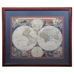
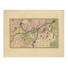
Novissima Totius Terrarum Orbis Tabula Map After Nicolaes Visscher Burled Frame
View Similar Items


Want more images or videos?
Request additional images or videos from the seller
1 of 13
Novissima Totius Terrarum Orbis Tabula Map After Nicolaes Visscher Burled Frame
About the Item
- Similar to:Nicolaes Visscher II (Artist)
- Dimensions:Height: 33 in (83.82 cm)Width: 1 in (2.54 cm)Depth: 39 in (99.06 cm)
- Materials and Techniques:
- Period:
- Date of Manufacture:Late 20th Century
- Condition:Very Good.
- Seller Location:Dayton, OH
- Reference Number:Seller: 394101stDibs: LU5343236795192

About the Seller
5.0
Platinum Seller
Premium sellers with a 4.7+ rating and 24-hour response times
Established in 2010
1stDibs seller since 2020
1,552 sales on 1stDibs
Authenticity Guarantee
In the unlikely event there’s an issue with an item’s authenticity, contact us within 1 year for a full refund. DetailsMoney-Back Guarantee
If your item is not as described, is damaged in transit, or does not arrive, contact us within 7 days for a full refund. Details24-Hour Cancellation
You have a 24-hour grace period in which to reconsider your purchase, with no questions asked.Vetted Professional Sellers
Our world-class sellers must adhere to strict standards for service and quality, maintaining the integrity of our listings.Price-Match Guarantee
If you find that a seller listed the same item for a lower price elsewhere, we’ll match it.Trusted Global Delivery
Our best-in-class carrier network provides specialized shipping options worldwide, including custom delivery.More From This Seller
View AllAntique Currier & Ives Nautical Maritime Clipper Ship Lithographs Mahogany Frame
By Currier & Ives
Located in Dayton, OH
Pair of antique late 19th century Currier & Ives hand colored lithograph prints: "The Miniature Ship Red, White, and Blue - On her Voyage from New York to London, August 1866, with C...
Category
Antique Late 19th Century American Victorian Prints
Materials
Wood, Paper
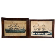
$580 Sale Price
20% Off
Vintage Nuremburg Germany Hangman's Bridge Canal Cityscape Etching 14"
Located in Dayton, OH
Mid to early 20th century hand colored etching depicting a view of the Hangmans Bridge over the canal through Nuremburg, Germany. Pencil signed along lower edge. Beveled silver gilt ...
Category
Mid-20th Century Black Forest Prints
Materials
Paper

$240 Sale Price
20% Off
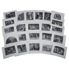
Lot of 23 Antique Virtue & Co Shakespeare Play Scene Engraving Prints 14"
Located in Dayton, OH
Lot of 23 late 19th - early 20th century black and white engravings depicting scenes from the plays of William Shakespeare, plates taken from The Works of Shakespeare Imperial Editio...
Category
Antique Late 19th Century Renaissance Prints
Materials
Paper
$235 Sale Price / set
20% Off
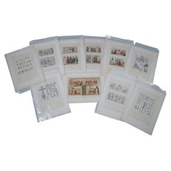
10 Antique 19th Century Grecian Roman Chromolithograph Prints Firmin Didot 16"
Located in Dayton, OH
Lot of 10 late 19th century chromolithograph prints, colored plates taken from a folio book published by Firmin Didot et Cie, Paris France. Plates each come with the facing page of d...
Category
Antique Late 19th Century Greco Roman Prints
Materials
Paper
$800 Sale Price / set
20% Off
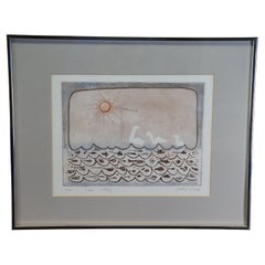
Mildred Hado Swans Deep Sea Subterranean Fish Ocean Seascape Etching 20"
Located in Dayton, OH
Vintage Mildred Hado etching titled Swans, circa 1970s. It features a nautical abstract seascape theme with three swans under the sun and a below water view of subterranean ocean de...
Category
Vintage 1970s Prints
Materials
Paper
$468 Sale Price
20% Off
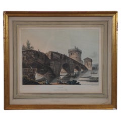
Antique Matthew Dubourg Rome Ponte Lucano Aquatint Engraving 18"
Located in Dayton, OH
Antique architectural Grecian / Roman aquatint engraving "Plate 11 - Ponte Lucano" engraved by Matthew Dubourg, extracted from the book "Views of the Remains of Ancient Buildings in ...
Category
Antique 19th Century Neoclassical Prints
Materials
Paper
$280 Sale Price / set
20% Off
You May Also Like
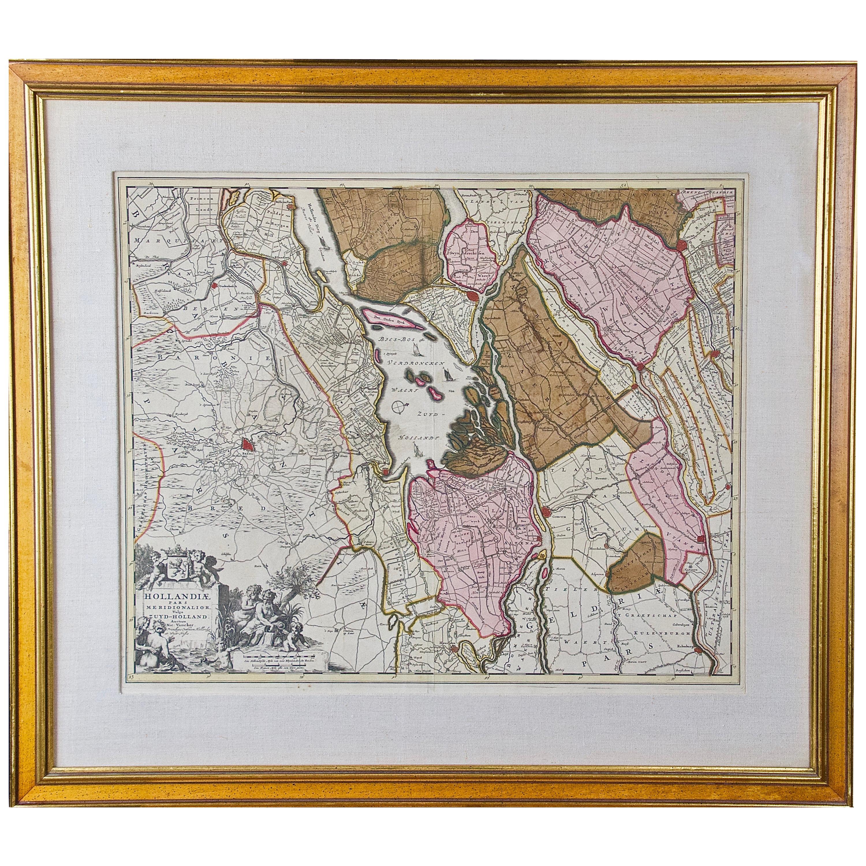
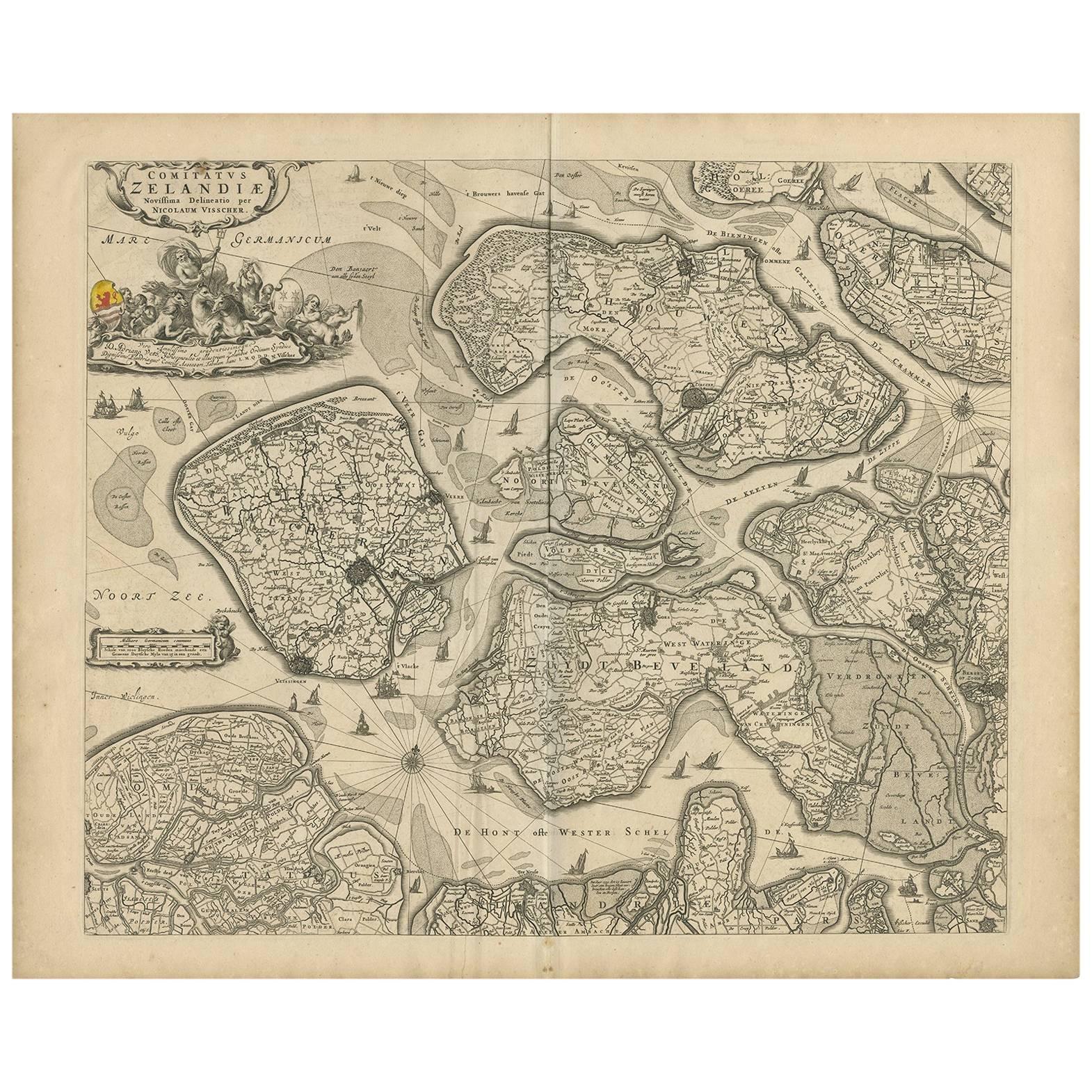
Hand Colored 17th Century Visscher Map "Hollandiae" Southern Holland
By Nicolaes Visscher II
Located in Alamo, CA
A hand colored 17th century map of the southern portions of Holland by Nicolaus (Nicolas) Visscher II entitled "Hollandiae pars Meridionalis, vulgo Zuyd-Holland", published in Amsterdam in 1678. The map shows the region between Breda, Heusden, Gornichem, Gouda, Dordrecht, and Willemstad. It includes a decorative cartouche in the lower left corner.
The map is presented in an attractive maple colored wood frame with gold trim and a fabric mat.
The Visscher family were one of the great cartographic families of the 17th century. Begun by Claes Jansz Visscher...
Category
Antique Early 18th Century Dutch Maps
Materials
Paper

18th Century Hand Colored Map of Spain and Portugal by Visscher
By Nicolaes Visscher II
Located in Alamo, CA
This is an early 18th century map of Spain and Portugal, with attractive original hand-coloring, entitled "Hispaniae et Portugalliae Regna per Nicolaum Visscher cum Privilegio Ordinu...
Category
Antique Early 18th Century Dutch Maps
Materials
Paper

Antique Map: Friesland and Terschelling with Inset Isles, by Visscher II, 1670
By Nicolaes Visscher II
Located in Langweer, NL
Antique Map: Friesland and Terschelling with Inset Isles, by Nicolaas Visscher II, 1670
This large copper-engraved map provides a detailed and visually stunning depiction of the coastline of Friesland and the island of Terschelling, along with portions of Groningen to the east. Originating from Nicolaas Visscher II’s *Germania Inferiorsive XVII Provinciarum Geographicae Generalis* (Kaert-Boeck van de XVII Nederlandtsche Provincien), this map was published in Amsterdam circa 1670.
The map highlights the main cities of Friesland, beautifully accented in red, and includes a decorative inset in the lower-right corner, illustrating the smaller isles belonging to the province. The finely engraved details make this map a remarkable artifact of 17th-century cartography, with its coastline features rendered with precision and artistic flair.
Adding to its charm, the map is adorned with elaborate decorative cartouches featuring putti (cherubs) and a coat of arms, hallmark elements of Nicolaas Visscher II’s cartographic artistry. Visscher was one of the most prominent Dutch mapmakers of the Golden Age of Cartography, known for his dedication to both geographical accuracy and artistic embellishment. His maps were highly sought after during his lifetime and remain prized by collectors today.
Keywords: antique map Friesland, Terschelling map, Nicolaas Visscher II, 17th-century Dutch cartography, Groningen coastline map, decorative map cartouches, Germania Inferiorsive XVII Provinciarum, Kaert-Boeck Nederlandtsche Provincien, historical Dutch maps, rare collectible maps, Golden Age cartography.
This map is a treasure for collectors of antique cartography...
Category
Antique Late 17th Century Maps
Materials
Paper

$894 Sale Price
20% Off
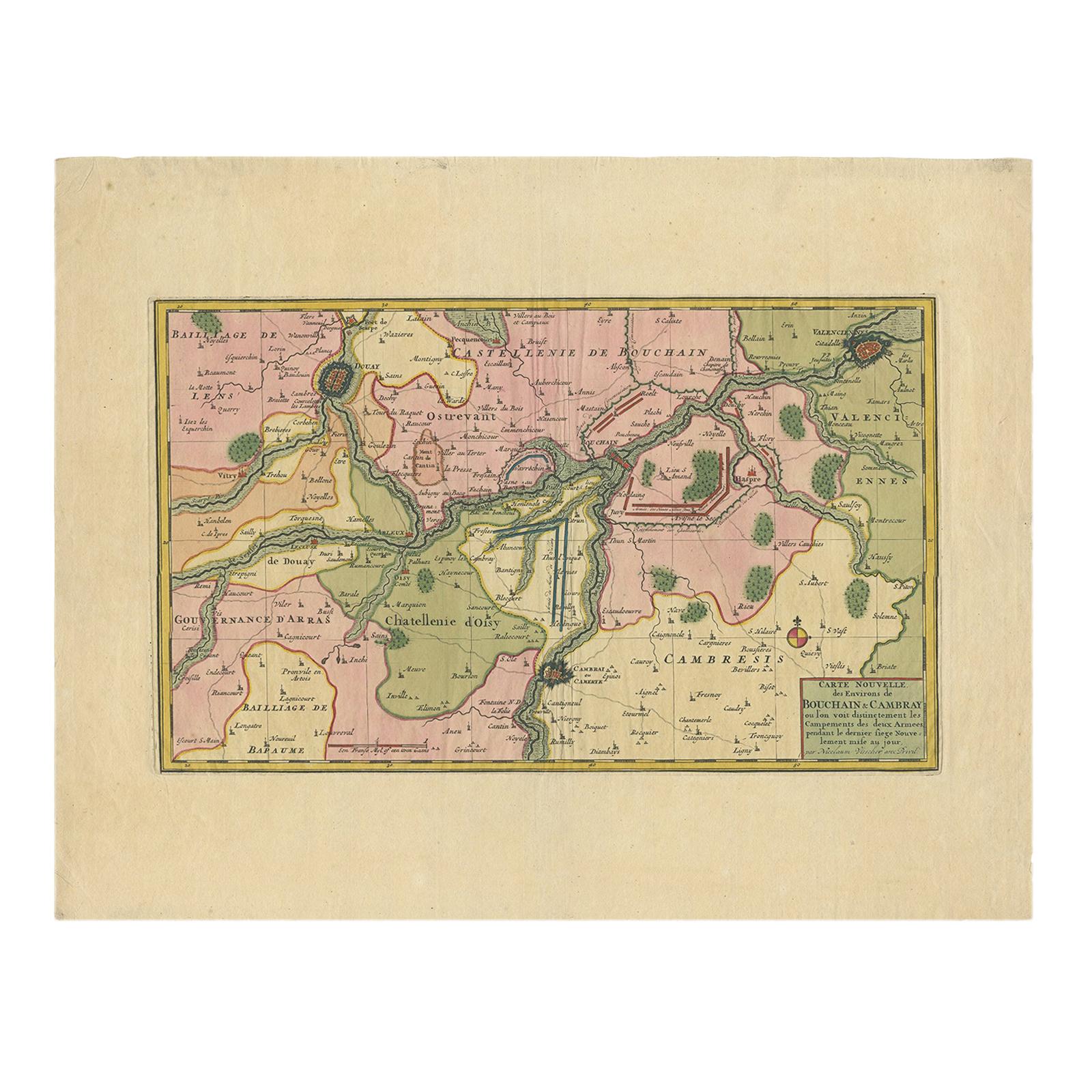
Antique Map of the Region of Bouchain and Cambrai by Visscher 'circa 1680'
By Nicolaes Visscher II
Located in Langweer, NL
Antique map titled 'Carte Nouvelle des Environs de Bouchain & Cambray'. Uncommon map of the region of Bouchain and Cambrai (Cambray, France) showing the camps of two armies.
Category
Antique Late 17th Century Maps
Materials
Paper
$458 Sale Price
20% Off
17th Century Hand Colored Map of the Liege Region in Belgium by Visscher
By Nicolaes Visscher II
Located in Alamo, CA
An original 17th century map entitled "Leodiensis Episcopatus in omnes Subjacentes Provincias distincté divisusVisscher, Leodiensis Episcopatus" by Nicolaes Visscher II, published in Amsterdam in 1688. The map is centered on Liege, Belgium, includes the area between Antwerp, Turnhout, Roermond, Cologne, Trier and Dinant.
This attractive map is presented in a cream-colored mat measuring 30" wide x 27.5" high. There is a central fold, as issued. There is minimal spotting in the upper margin and a tiny spot in the right lower margin, which are under the mat. The map is otherwise in excellent condition.
The Visscher family were one of the great cartographic families of the 17th century. Begun by Claes Jansz Visscher...
Category
Antique Late 17th Century Dutch Maps
Materials
Paper

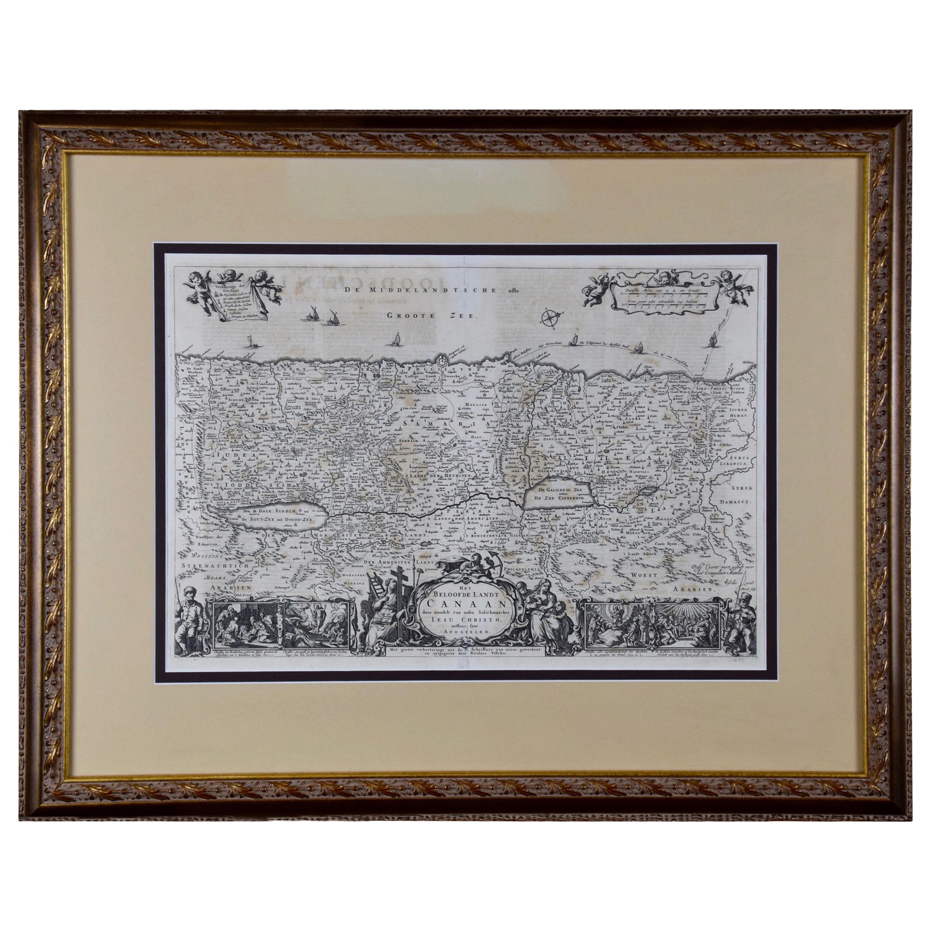
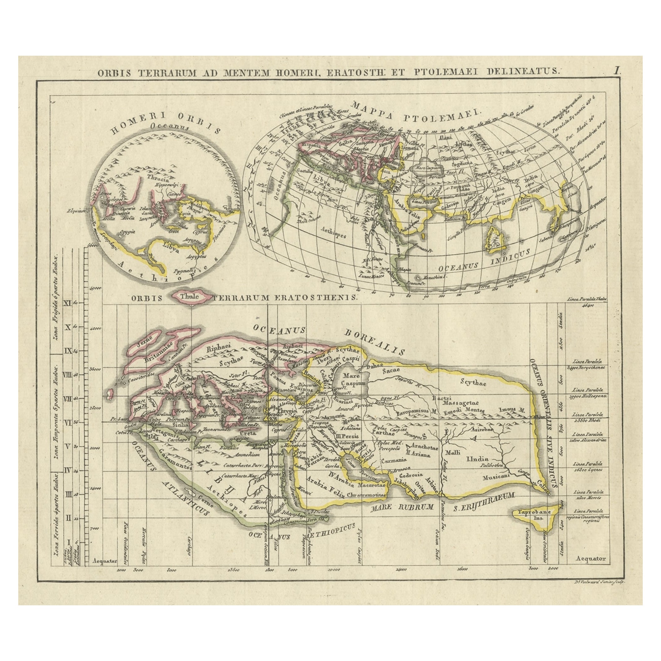
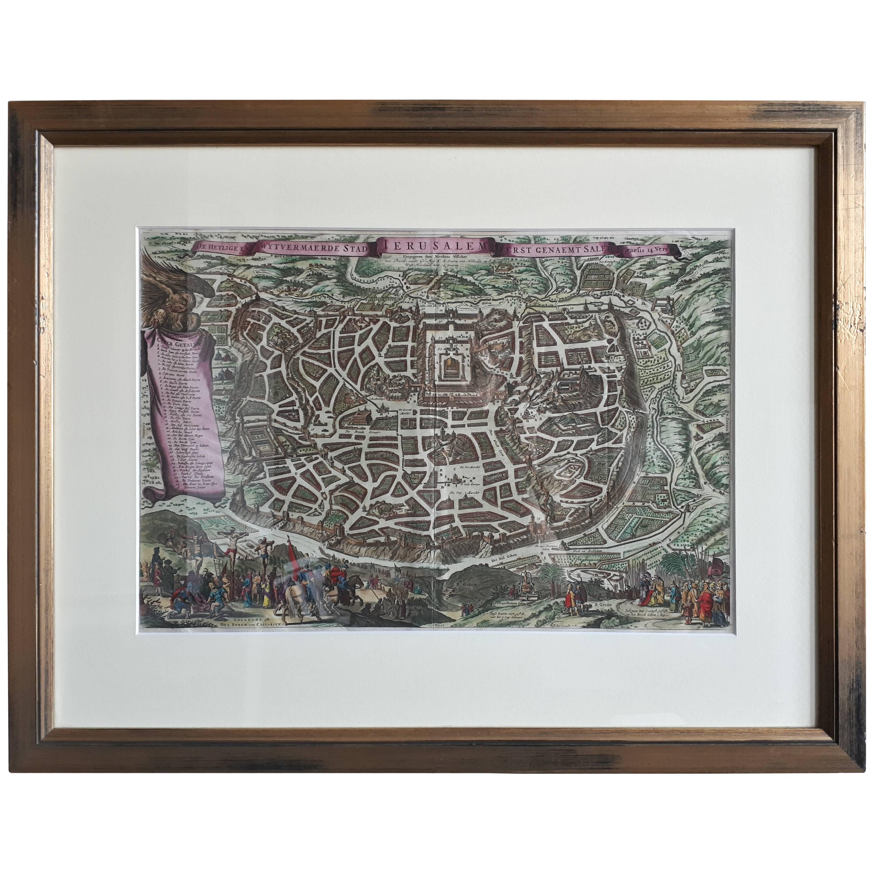
The Holy Land at the Time of Jesus: A 17th Century Dutch Map by Visscher
By Nicolaes Visscher II
Located in Alamo, CA
This detailed Dutch map entitled "Het Beloofe de Landt Canaan door wandelt van onsen Salichmaecker Iesu Christo, nessens syne Apostelen" by Nicolaes Visscher was published in Amsterd...
Category
Antique Mid-17th Century Dutch Maps
Materials
Paper
