Items Similar to Original Antique Chromolithograh of Srigonjo Bay, the South Coast of Java, 1872


Want more images or videos?
Request additional images or videos from the seller
1 of 7
Original Antique Chromolithograh of Srigonjo Bay, the South Coast of Java, 1872
About the Item
View of Srigonjo Bay on the south coast of Java (Indonesia)
Original title in Dutch: "De baai Srigonjo aan de zuidkust van Java"
One of a serie of twenty-four chromolithographs, finished by hand, mounted on later (acid-free) card with original small printed title label. After Abraham Salm (1801-1876)
It comes from the set of 24 very rare chromolithographs and was published by J.C. Grieve Jr. and edited by Frans Buffa & Zonen between 1865 and 1872. It is one of the most stunning of Buffa’s publications. The titel of the original complete set is “Java naar schilderijen en tekeningen van A. Salm”
The paintings and drawings by Abraham Salm are regarded as the finest depictions of the Javanese topography and culture. Abraham Salm established himself first as a merchant in Surabaya but afterwards became the owner of a tobacco plantation in Malang. He was a self-taught artist and spent twenty-nine years in Indonesia.
The complete set, with a number of them for sale in our 1stdibs shop, depicts the following scenes:
Landscape in the Bantam Residency
View on the river Solo, Assistant-Residency Toeban
Marriage procession in the valley of the Salakh
In the Tenger mountains, east side of Java
Landscape near Malang, Residency Pasoeroean
The main road from Buitenzorg passing the land of Tjisaroa over the Mogamendong to the Preanger Residencies
The land of Tjitrap, Assistant- Residency Buitenzorg
The small bay Srigonjo, south coast of Java
The sugar factory Pangka, Tagal Residency
In the Sumadang area, Preanger Regency
A view on the land of Tjiliboet, Assistant Residency Buitenzorg
Anjer, Strait Sunda, north coast of Java, Bantam Residency
The bathing place Wenditt, Assistant-Residency Malang
Erupting volcano Bromo in 1856, Probolingo Residency
A view of the land of Kedong Badak and the main road to Buitenzorg
Landscape in the “Ommelanden” of Batavia
Landscape in moonlight near Sumedang
The road from Buitenzorg to the valley of the Salakh
Wild landscape in east Javanese
Waterfall Singahan, Rembang Residency
The river Brantas in the mountains, Pasoeroean Residency
The volcano Smeroe, seen from the Pasoeroean Residency
- Dimensions:Height: 10.4 in (26.4 cm)Width: 14.18 in (36 cm)Depth: 0 in (0.02 mm)
- Materials and Techniques:
- Period:
- Date of Manufacture:1872
- Condition:Each mount (large folio) captioned with an original printed ticket on the outer right lower corner. The mounts foxed with marginal defects. Image itself clean and ideal for framing. Please study the images carefully.
- Seller Location:Langweer, NL
- Reference Number:
About the Seller
5.0
Platinum Seller
These expertly vetted sellers are 1stDibs' most experienced sellers and are rated highest by our customers.
Established in 2009
1stDibs seller since 2017
1,928 sales on 1stDibs
Typical response time: <1 hour
- ShippingRetrieving quote...Ships From: Langweer, Netherlands
- Return PolicyA return for this item may be initiated within 14 days of delivery.
More From This SellerView All
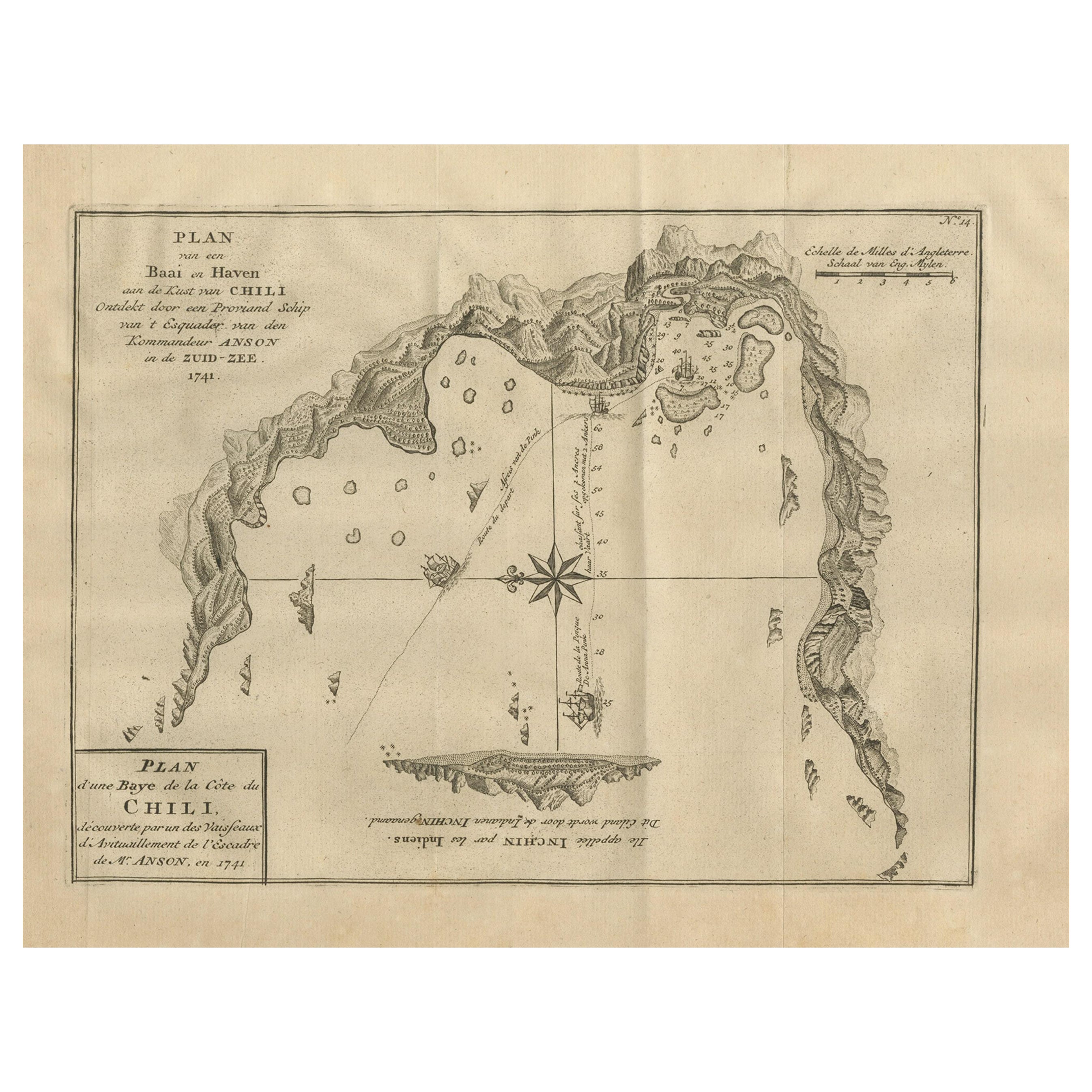
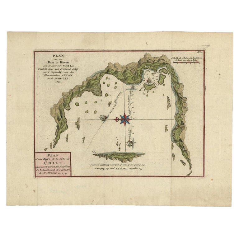
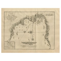
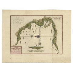
- Antique Map of a Bay on the Coast of Chile, South America, c.1749Located in Langweer, NLAntique map titled 'Plan van een Baai en Haven aan de Kust van Chili (..) - Plan d'une Baye de la Côte du Chili (..)'. Original antique map of a bay on the coast of Chile discovered ...Category
Antique 18th Century Maps
MaterialsPaper
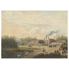
- Original Chromolithograph of a Sugar Factory in Java, Indonesia, 1872Located in Langweer, NLView of the sugar factory in Pangka Pangka sugar factory (Tegal residence, Java, Indonesia) Original title in Dutch: "Gezicht op de suikerfabriek in Pangka Suiker fabriek Pangka (re...Category
Antique 1870s Prints
MaterialsPaper
- Antique Map of Banten Bay, Java, Indonesia, c.1725Located in Langweer, NLA small early 18th century map of Banten Bay showing the islands of Pulo Dua and Pulo Batto together with soundings within the Bay and profiles of hills on the islands published by C...Category
Antique 18th Century Maps
MaterialsPaper
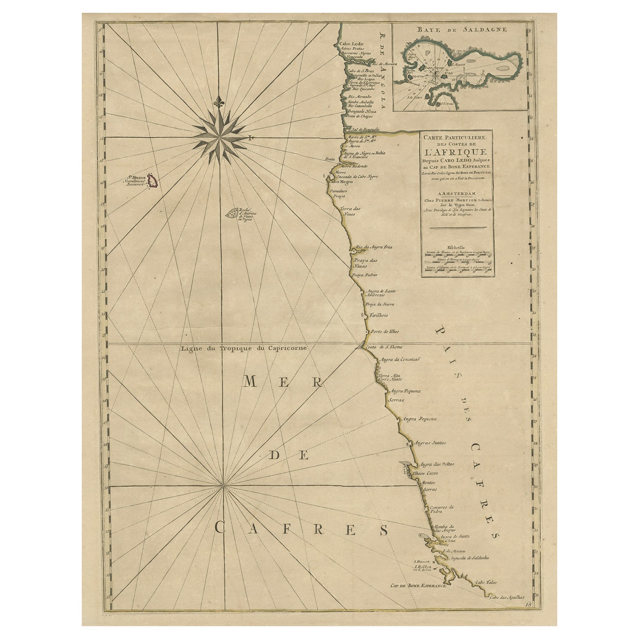
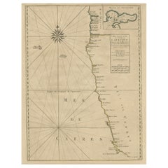
- Old Map of the Namibia and South Africa Coasts & Inset of Saldanha Bay, ca.1700Located in Langweer, NLAntique map titled 'Carte particuliere des Costes de l'Afrique'. Map of the coasts of Namibia and South Africa. With an inset map of Saldanha Bay. Artists and Engravers: Publ...Category
Antique Early 1700s Maps
MaterialsPaper
- Antique Map of a Bay on the Coast of Chile by Anson, 1749Located in Langweer, NLAntique map titled 'Plan van een Baai en Haven aan de Kust van Chili (..) - Plan d'une Baye de la Côte du Chili (..)'. Original antique map of a bay on the coast of Chile discovered ...Category
Antique 18th Century Maps
MaterialsPaper
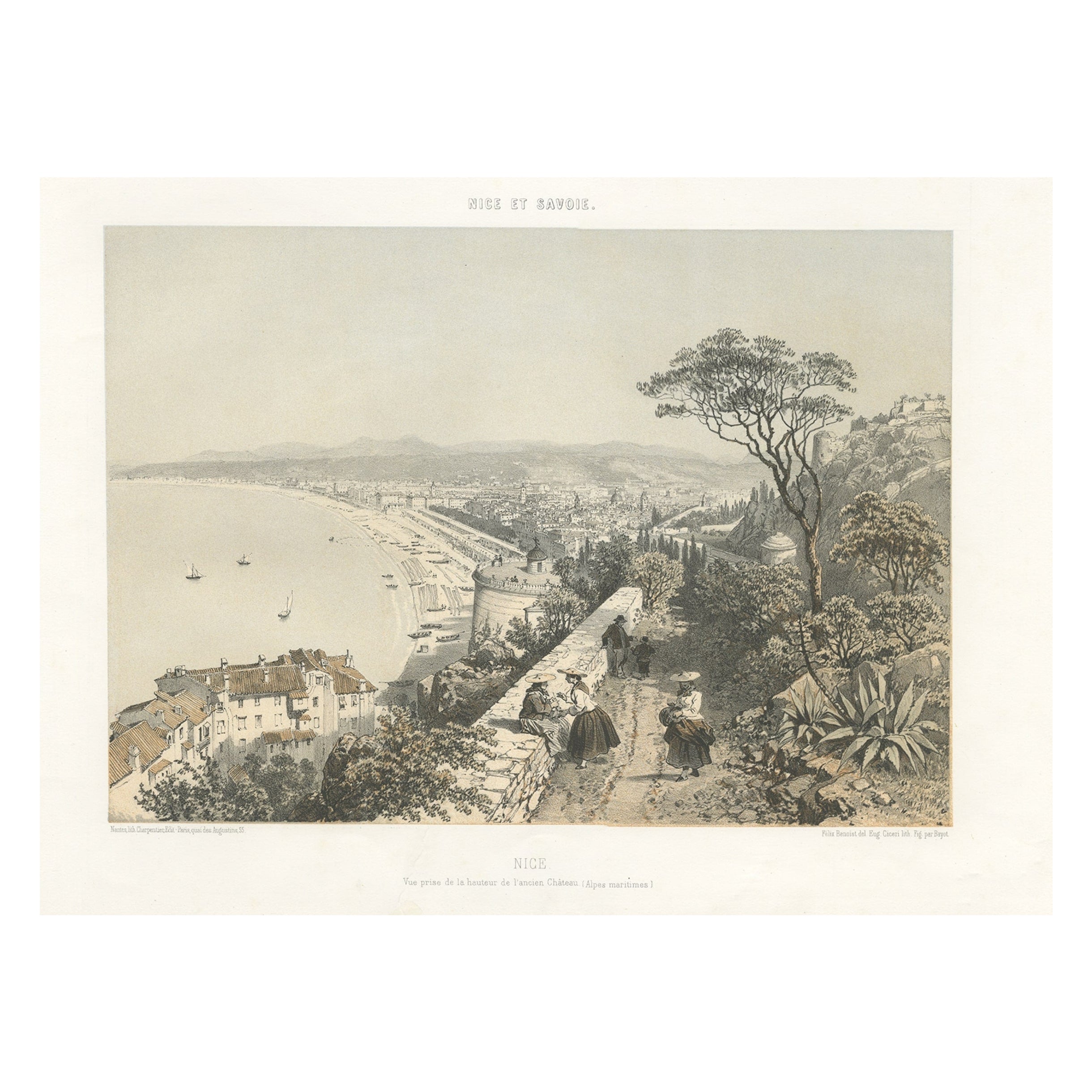
- Antique View of the City of Nice on the South-Coast of France, c.1865Located in Langweer, NLAntique print titled 'Nice, vue prise de la hauteur de l'ancien Château'. Original antique print of the city of Nice, France. This print originates from 'Nice Et Savoie, Sites Pittor...Category
Antique 19th Century Prints
MaterialsPaper


You May Also Like
- Original Antique Map of South America. C.1780Located in St Annes, LancashireGreat map of South America Copper-plate engraving Published C.1780 Two small worm holes to left side of map Unframed.Category
Antique Early 1800s English Georgian Maps
MaterialsPaper
- Original Antique Map of South America, circa 1830Located in St Annes, LancashireGreat map of South America Copper plate engraving Published by Butterworth, Livesey & Co., circa 1830 Unframed.Category
Antique Early 1800s English Other Maps
MaterialsPaper
- Original Antique Map of South Africa, Arrowsmith, 1820Located in St Annes, LancashireGreat map of South Africa. Drawn under the direction of Arrowsmith. Copper-plate engraving. Published by Longman, Hurst, Rees, Orme and Br...Category
Antique 1820s English Maps
MaterialsPaper
- Original Antique Map of South East Asia, Arrowsmith, 1820Located in St Annes, LancashireGreat map of South East Asia Drawn under the direction of Arrowsmith Copper-plate engraving Published by Longman, Hurst, Rees, Orme and Brown, 1820 Unframed.Category
Antique 1820s English Maps
MaterialsPaper
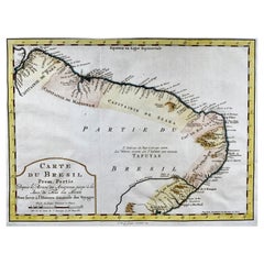
- Krevelt, Map, Coast of Brazil, South America, Amazon, Hand ColouredLocated in Norwich, GBCarte Du Bresil Prem. Partie Depuis la Riviere des Amazones jusqu' à la Baie de Tous les Saints Pour servir à l'Histoire des Etablissemens Europeens. A. v. Krevelt, sculpsit, ...Category
Antique Late 18th Century French Prints
MaterialsPaper
- Chart of the East Coast of EnglandLocated in Norwell, MAChart of the East Coast of England, from Dungeness to Flamborough, including the entrances to the Thames River. Drawn by hydrographer J.W. Norie in 1841. Includes Kent, Essex and Suf...Category
Antique 1840s English Nautical Objects
MaterialsPaper