Items Similar to Rare Old Copper Engraving of a Clove Tree in the East Indies, Asia, 1659

Want more images or videos?
Request additional images or videos from the seller
1 of 5
Rare Old Copper Engraving of a Clove Tree in the East Indies, Asia, 1659
About the Item
Antique print titled 'Clove Tree'.
Copper engraving of a clove tree. This print originates from 'Voyages and Travels to the East-Indies' by J. Nieuhof.
Artists and engravers: Johan / Jan / Johannes Nieuhof / Nieuhoff / Neuhof (1618-1672) was a Dutch traveler who wrote about his journeys to Brazil, China and India. The most famous of these was a trip of 2,400 km from Canton to Peking in 1655-1657, which enabled him to become an authoritative Western writer on China.
- Dimensions:Height: 12.21 in (31 cm)Width: 7.88 in (20 cm)Depth: 0 in (0.02 mm)
- Materials and Techniques:
- Period:1650-1659
- Date of Manufacture:1659
- Condition:Wear consistent with age and use. Condition: Good, general age-related toning. Minor wear, blank verso. English text page attached. Please study image carefully.
- Seller Location:Langweer, NL
- Reference Number:
About the Seller
5.0
Platinum Seller
These expertly vetted sellers are 1stDibs' most experienced sellers and are rated highest by our customers.
Established in 2009
1stDibs seller since 2017
1,928 sales on 1stDibs
Typical response time: <1 hour
- ShippingRetrieving quote...Ships From: Langweer, Netherlands
- Return PolicyA return for this item may be initiated within 14 days of delivery.
More From This SellerView All
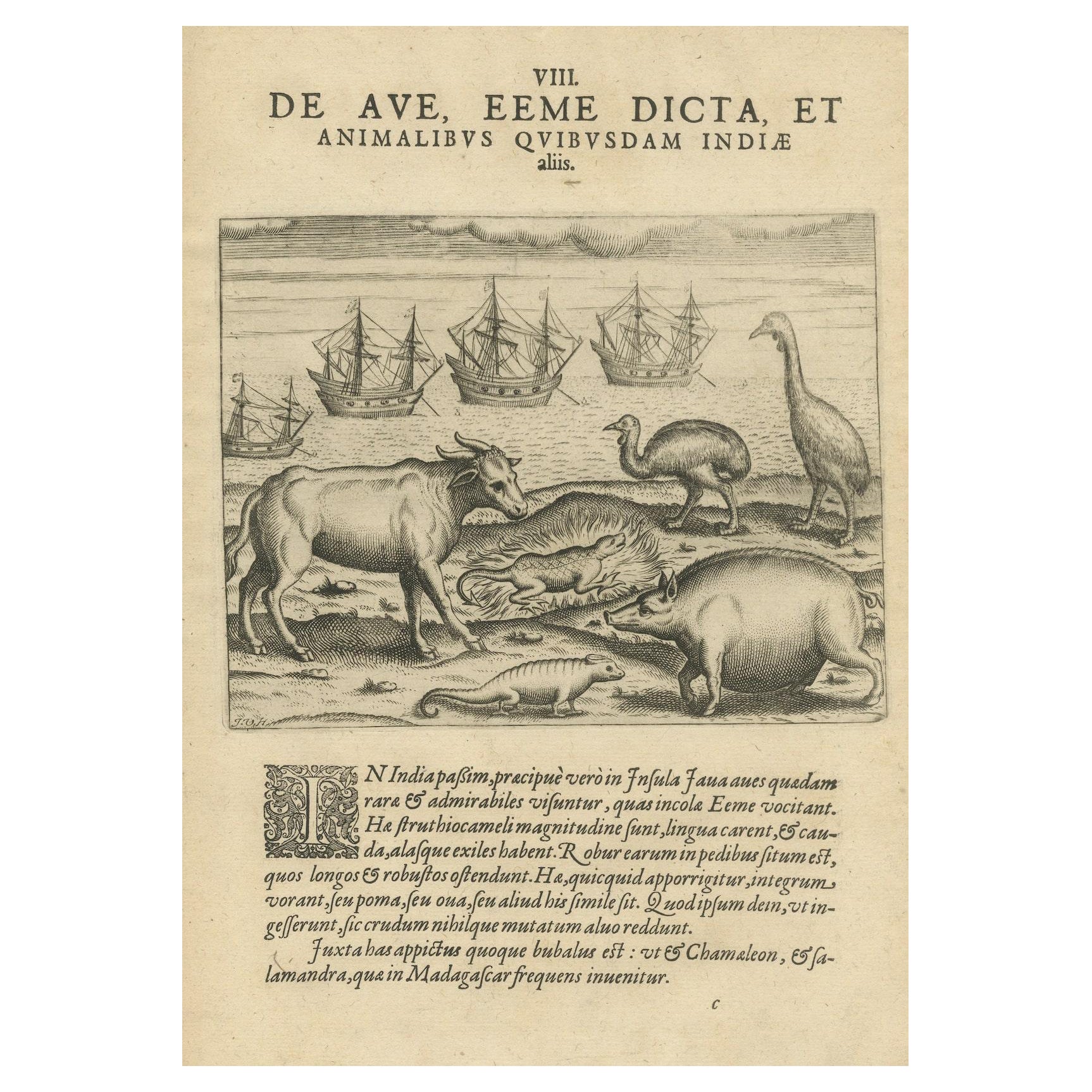
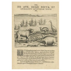
- Rare Creatures of the East: A 1601 de Bry Copper Engraving from the IndiesLocated in Langweer, NLTitle: "Rare Creatures of the East: A 1601 de Bry Engraving from the Indies" Description: This original 1601 engraving from Theodore de Bry's collection presents a fascinating array...Category
Antique Early 17th Century Prints
MaterialsPaper
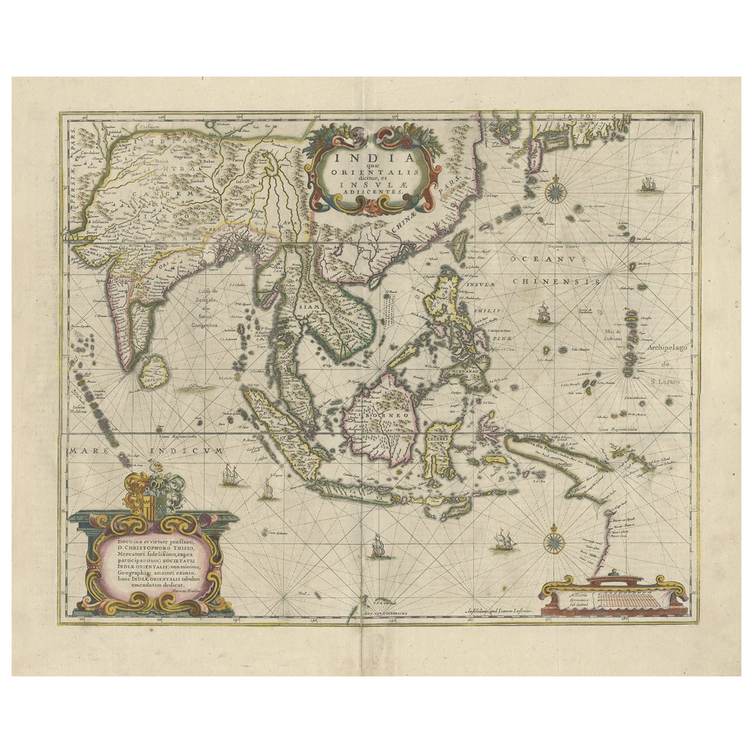
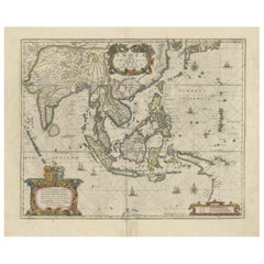
- Old Antique Map of the East Indies and Southeast Asia, ca.1644Located in Langweer, NLAntique map titled 'India quae Orientalis dicitur, et Insulae adiacentes'. Old map of the East Indies and Southeast Asia showing the area between India in the West and parts of Japan, the Marianas and New Guinea/Australia in the East. This map is dedicated to D. Christophorus Thisius by Henricus...Category
Antique 1640s Maps
MaterialsPaper
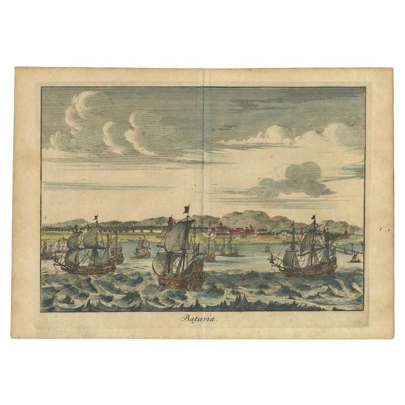
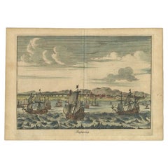
- Antique Print of Batavia 'Jakarta' in the Dutch East Indies in Asia, 1705Located in Langweer, NLAntique print Indonesia titled 'Batavia'. Beautiful view of Batavia, Indonesia. This print originates from 'Algemeene weereld-beschryving, nae de rechte verdeeling der landschappen (...Category
Antique 18th Century Prints
MaterialsPaper
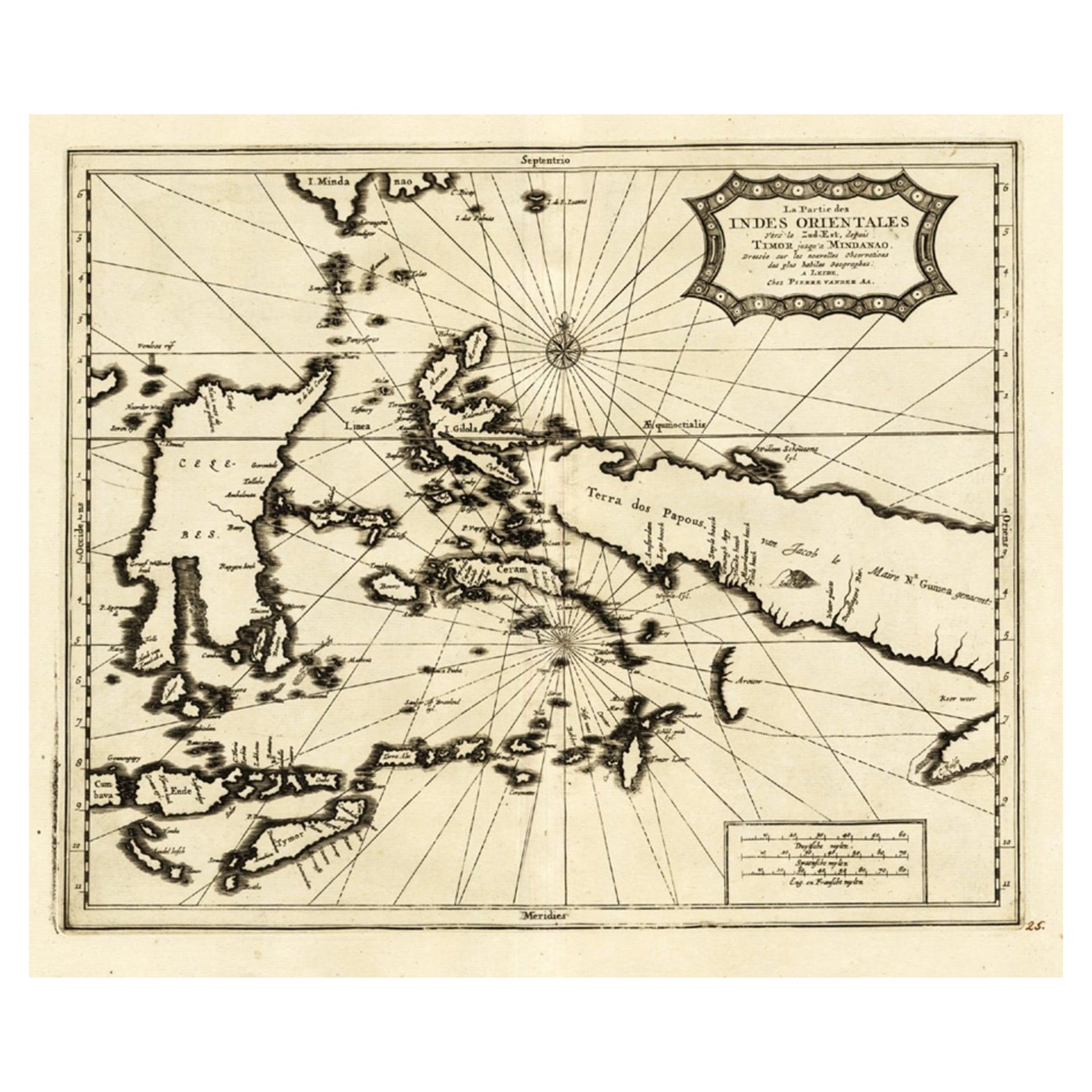
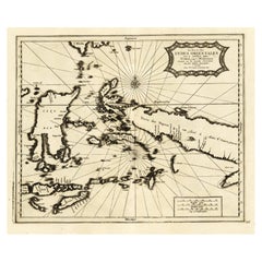
- Extremely Rare Map of the East-Indies towards the South-East 'Indonesia', 1725Located in Langweer, NLAntique map titled 'La partie des Indes Orientales vers le Zud-Est, depuis Timor jusqu'a Midanao (...).' (The part of the East-Indies towards the South-East, from Timor to Mindanao.)...Category
Antique 1720s Maps
MaterialsPaper
- Original Old Map of the Environs of Batavia in the Dutch East Indies (Indonesia)Located in Langweer, NLAntique map titled 'Carte des Environs de Batavia'. Map of the environs of Batavia (now Jakarta), Indonesia. This print originates from volume 8 of 'Histoire générale des voyages'. P...Category
Antique Mid-18th Century Maps
MaterialsPaper
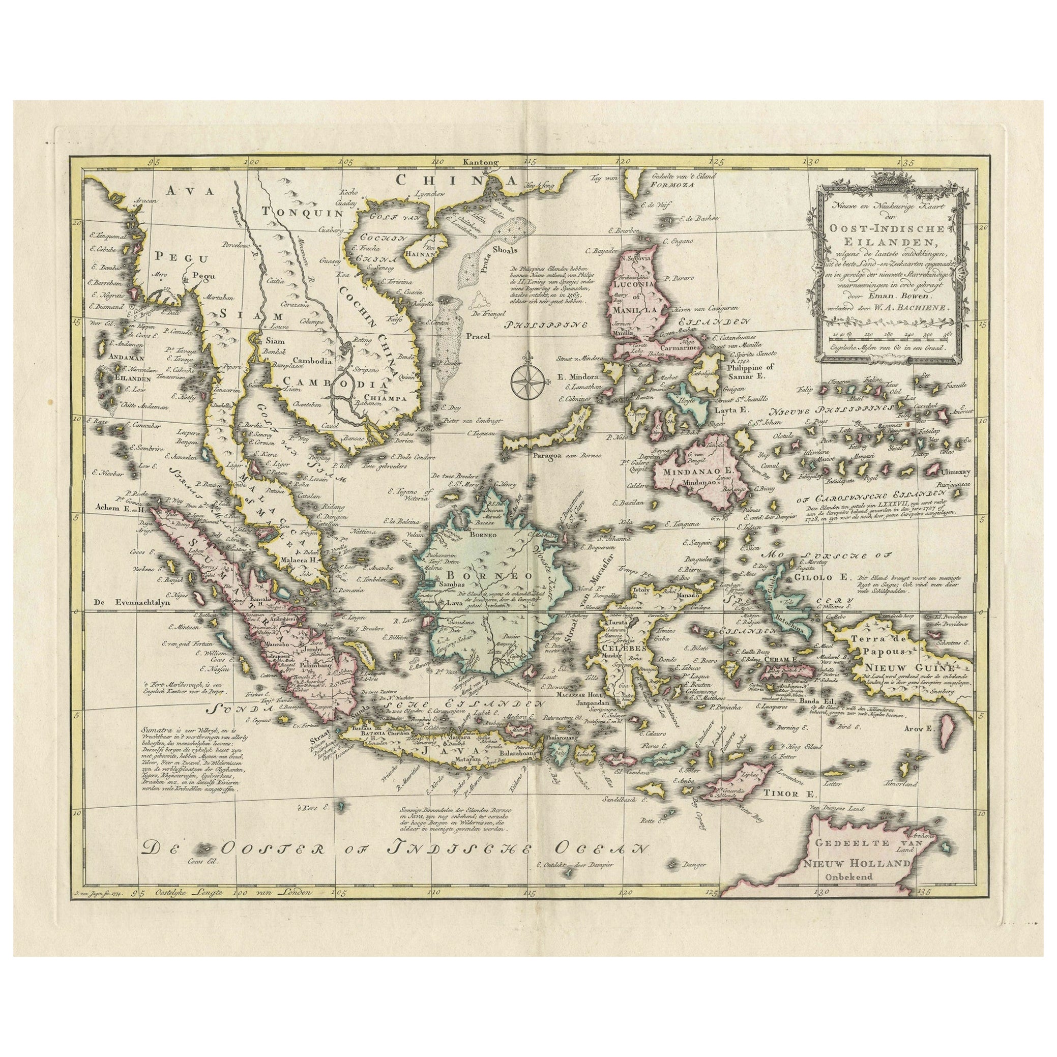
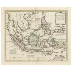
- Rare Antique Map of the Dutch East Indies 'Indonesia', 1774Located in Langweer, NLRare decorative engraved map of the Dutch East Indies, or nowadays Indonesia. Title (in old Dutch): NIEUWE EN NAUKEURIGE KAART DER OOST-INDISCHE ...Category
Antique 1770s Maps
MaterialsPaper

You May Also Like
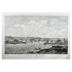
- Basel, Bale, Switzerland, Large Copper Engraving of the CityBy Beat Fidel ZurlaubenLocated in Norwich, GBView of the City of Basle, taken from above the Fortre?s of Huningue. Copper Engraving by Jean-Bapti?te Liénard after a Drawing by Nicolas Pérignon. Published 1780. Nicolas...Category
Antique 1780s Swiss Georgian Prints
MaterialsPaper
- Original Antique Map of South East Asia, Arrowsmith, 1820Located in St Annes, LancashireGreat map of South East Asia Drawn under the direction of Arrowsmith Copper-plate engraving Published by Longman, Hurst, Rees, Orme and Brown, 1820 Unframed.Category
Antique 1820s English Maps
MaterialsPaper
- Chart of the East Coast of EnglandLocated in Norwell, MAChart of the East Coast of England, from Dungeness to Flamborough, including the entrances to the Thames River. Drawn by hydrographer J.W. Norie in 1841. Includes Kent, Essex and Suf...Category
Antique 1840s English Nautical Objects
MaterialsPaper
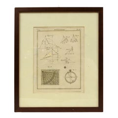
- Engraving on Copper Print from the Volume Navigazione Nautical Subject 1790Located in Milan, ITPrint by engraving on copper plate Tav III TIX fig. 17-22 from the volume Navigazione; with frame 28 x 33. Some calculations are depicted. Very good condition. Shipping is insured by...Category
Antique 1790s Italian Nautical Objects
MaterialsPaper
- Original Antique Map of South East Asia by Becker, circa 1840Located in St Annes, LancashireGreat map of South East Asia Steel engraving with original color outline Engraved by Becker Published by Virtue, circa 1840. Unframed.Category
Antique 1840s English Other Maps
MaterialsPaper
- Original Antique Map of South East Asia by Thomas Clerk, 1817Located in St Annes, LancashireGreat map of South East Asia Copper-plate engraving Drawn and engraved by Thomas Clerk, Edinburgh. Published by Mackenzie And Dent, 1817 Unframed.Category
Antique 1810s English Maps
MaterialsPaper


Recently Viewed
View AllMore Ways To Browse
Johannes Engravings
Old Canton
Brazilian Holland
Antique Dutch Copper
Antique Silk Tapestry
Silk Antique Tapestries Silk Tapestries
20th Century French Tapestry
Antique Wall Shelf
Single Glass Door Cabinet
Vintage Wood Corner Cabinet
Wall Shelf Antique
Hand Slicer
Oak Tall Cabinet
Antique Ladies Sign
Leaves Dress
Retro Country Kitchen
Sculptural Fashion Design
Antique French Wall Tapestry