Items Similar to Scozia – Antique Map of Scotland by Coronelli, circa 1690
Want more images or videos?
Request additional images or videos from the seller
1 of 10
Scozia – Antique Map of Scotland by Coronelli, circa 1690
$743.23
£552.11
€620
CA$1,032.05
A$1,126.21
CHF 590.72
MX$13,678.20
NOK 7,378.37
SEK 6,972.93
DKK 4,719.99
About the Item
Map of Scotland by Coronelli, c.1690 – “Scozia A.P. Coronelli”
This finely engraved and hand-colored map depicts Scotland, titled Scozia A.P. Coronelli, produced by the renowned Venetian cartographer Vincenzo Maria Coronelli (1650-1718). The map is in Italian, as typical of Coronelli’s works, and features detailed coastal outlines, major cities, rivers, and islands, including Islay, Skye, Lewis, Orkney, Shetland, and the Hebrides, along with inland towns such as Aberdeen, Elgin, Perth, Dunkeld, Stirling, and Glasgow.
Vincenzo Coronelli was one of the most important and prolific Italian cartographers of the late 17th century. He became famous for his detailed globes created for Louis XIV and his monumental atlases, including the Atlante Veneto (1690s), from which this map is likely derived. His works combined scientific accuracy with artistic engraving quality, and they remain highly valued by collectors and institutions worldwide.
This particular map shows clear baroque stylistic features, including decorative title cartouches, fine engraving with delicate hachuring to indicate relief, and an elegant coastal delineation with place names written in Italian. The seas are labeled Mare di Scozia and the Gulf of Edinburgh is noted as “Golfo d’Edenburgo.”
Such maps were not only practical navigational references but also symbols of knowledge, power, and curiosity in the Age of Exploration and Enlightenment. They make excellent additions to collections of Scottish, British Isles, or Italian cartography, as well as for display in libraries, studies, and offices.
Condition Report:
Overall very good condition. Strong early hand coloring. Paper is clean with only light age toning and occasional small marginal foxing spots, well outside the printed area. Wide margins preserved. No tears, repairs, or wormholes noted.
Framing Tip:
For best presentation, frame with a thin gold or black wooden frame and an archival off-white or cream mat. UV-protective glass will preserve the vibrant original colors. Consider adding a small brass title plaque for a museum-style display.
This map is signed “A.P. Coronelli” (Abbate Padre Coronelli) and engraved by P. A. Francesco as indicated. It dates to circa 1690-1700, likely from Atlante Veneto or his Corso Geografico Universale.
- Dimensions:Height: 7.92 in (20.1 cm)Width: 10.99 in (27.9 cm)Depth: 0.01 in (0.2 mm)
- Materials and Techniques:Paper,Engraved
- Place of Origin:
- Period:Late 17th Century
- Date of Manufacture:circa 1690
- Condition:Overall very good condition. Strong early hand coloring. Paper is clean with only light age toning and occasional small marginal foxing spots, well outside the printed area. Wide margins preserved. No tears, repairs, or wormholes noted.
- Seller Location:Langweer, NL
- Reference Number:Seller: BG-13130-21stDibs: LU3054345716062
About the Seller
5.0
Recognized Seller
These prestigious sellers are industry leaders and represent the highest echelon for item quality and design.
Platinum Seller
Premium sellers with a 4.7+ rating and 24-hour response times
Established in 2009
1stDibs seller since 2017
2,641 sales on 1stDibs
Typical response time: <1 hour
- ShippingRetrieving quote...Shipping from: Langweer, Netherlands
- Return Policy
Authenticity Guarantee
In the unlikely event there’s an issue with an item’s authenticity, contact us within 1 year for a full refund. DetailsMoney-Back Guarantee
If your item is not as described, is damaged in transit, or does not arrive, contact us within 7 days for a full refund. Details24-Hour Cancellation
You have a 24-hour grace period in which to reconsider your purchase, with no questions asked.Vetted Professional Sellers
Our world-class sellers must adhere to strict standards for service and quality, maintaining the integrity of our listings.Price-Match Guarantee
If you find that a seller listed the same item for a lower price elsewhere, we’ll match it.Trusted Global Delivery
Our best-in-class carrier network provides specialized shipping options worldwide, including custom delivery.More From This Seller
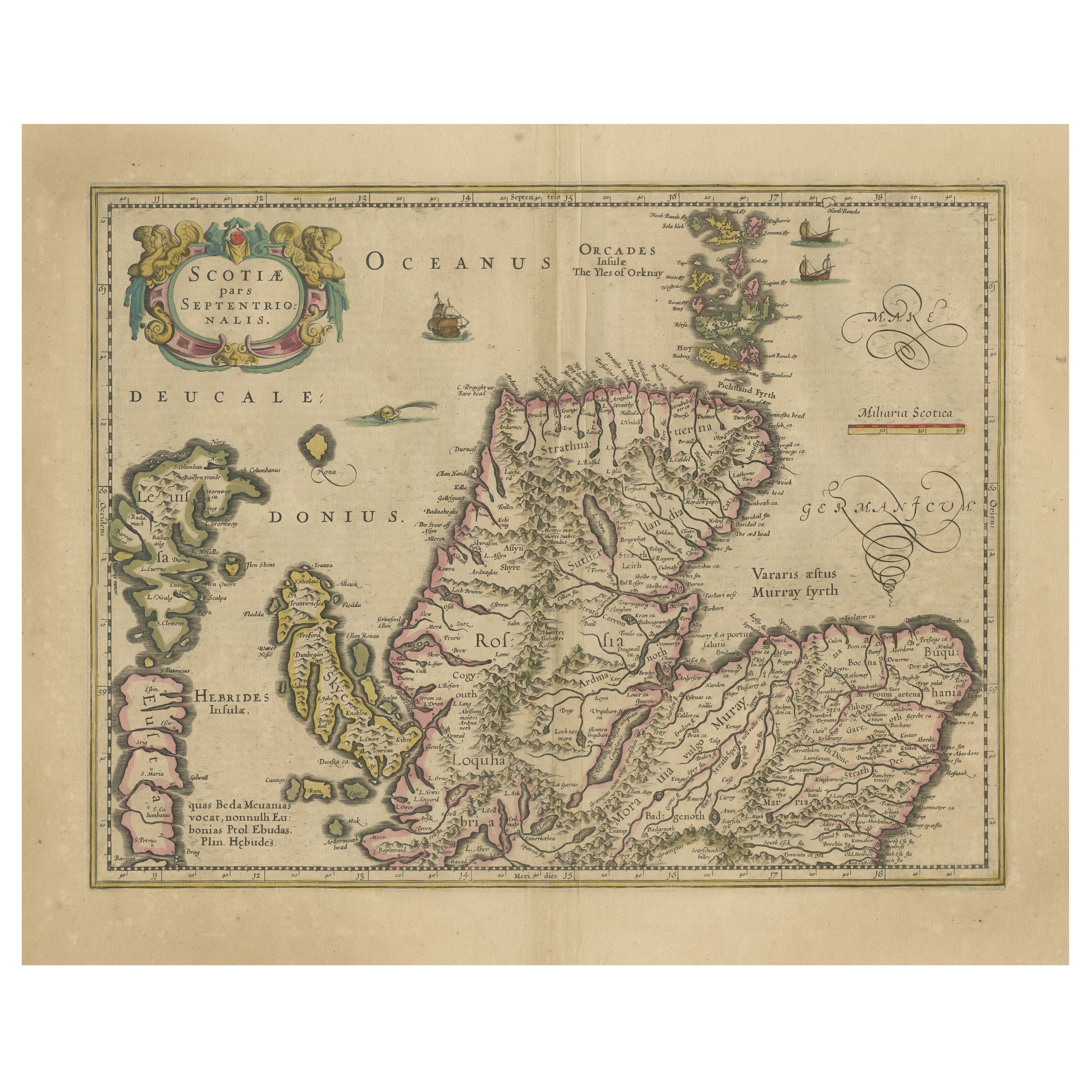
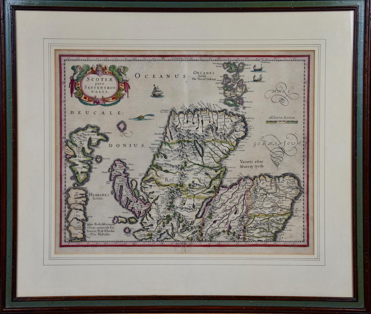
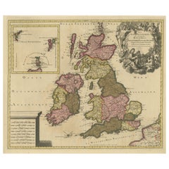
View AllOriginal Antique Map of the Northern Part of Scotland, circa 1640
Located in Langweer, NL
The antique map, titled 'Scotiae pars septentrionalis,' depicts the northern part of Scotland. Crafted by Hondius around 1640, this map is a historical treasure showcasing the geogra...
Category
Antique Mid-17th Century Maps
Materials
Paper
$843 Sale Price
20% Off
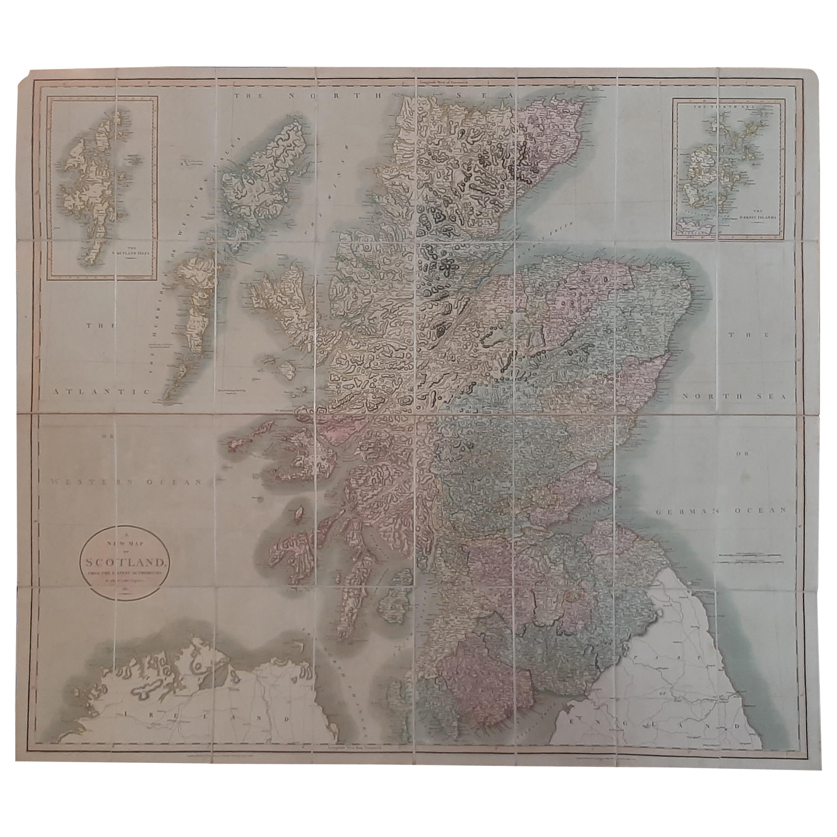
Antique Map of Scotland by Cary, '1811'
Located in Langweer, NL
Antique map titled 'A New Map of Scotland from the Latest Authorities':
**Title**: A New Map of Scotland from the Latest Authorities
**Publisher**: J....
Category
Antique Early 19th Century Maps
Materials
Linen, Paper

$767 Sale Price
20% Off
Antique Map of the Ancient British Isles by Janssonius 'circa 1640'
Located in Langweer, NL
Antique map titled 'Insularum Britannicarum Acurata Delineatio'. Original antique map of the ancient British Isles. England and Wales are labelled as B...
Category
Antique Mid-17th Century Maps
Materials
Paper

$911 Sale Price
20% Off
Antique Map of the British Isles by H. Chatelain, 1719
By Henri-Abraham Chatelain
Located in Langweer, NL
Beautiful hand colored large format map of the British Isles, with large insets of the Eastern and Western Hemispheres and the coats of arms for Engl...
Category
Antique Early 18th Century Maps
Materials
Paper

$722 Sale Price
20% Off
Antique Map of Southern Scotland, 1903, with Coastal and Inland Details
Located in Langweer, NL
Title: Antique Map of Southern Scotland, 1903, with Coastal and Inland Details
Description:
This exquisite antique map, titled "Scotland (Southern Sheet I)," was engraved and publis...
Category
Early 20th Century Maps
Materials
Paper
Rare Hand-colored Map of the British Isles by Gerard Valk, Published circa 1700
Located in Langweer, NL
Map of the British Isles by Gerard Valk circa 1700 – Hand-Colored Engraving
This elegant copperplate engraving titled *Les Isles Britanniques, qui contiennent les Royaumes d'Anglete...
Category
Antique Early 1700s Dutch Maps
Materials
Paper
You May Also Like
Map of the North of Scotland 17th century hand-coloured map by Gerardus Mercator
Located in London, GB
Gerardus Mercator (1512 - 1594)
Map of the North of Scotland (1683)
Engraving with later hand colouring
35 x 45 cm
A fantastically characterful and detailed map engraving of the North of Scotland from 1683. The highly detailed and beautifully coloured map is inscribed to the reverse with a description of the parts of Scotland illustrated, called the 'Troisieme Table d'Escosse'. The map comes from the 1683 French edition of Gerardus Mercator's Atlas Major, which was first published in 1585.
Gerardus Mercator was the Flemish father of mapmaking. He was a skilled geographer, cosmographer and cartographer and is most renowned for creating the 1569 world map based on a new projection which represented sailing courses of constant bearing (rhumb lines) as straight lines - an innovation that is still employed in today's nautical charts.
Mercator was a highly influential pioneer in the history of cartography and is generally considered one of the founders of the Netherlandish school of cartography and geography. He is also widely considered the most notable figure of the school. In his own day, he was a notable maker of globes and scientific instruments. In addition, he had interests in theology, philosophy, history, mathematics and geomagnetism. He was also an accomplished engraver and calligrapher. Unlike other great scholars of the age, he travelled little and his knowledge of geography came from his library of over a thousand books and maps, from his visitors and from his vast correspondence (in six languages) with other scholars, statesmen, travellers, merchants and seamen. Mercator's early maps were in large formats suitable for wall mounting but in the second half of his life, he produced over 100 new regional maps in a smaller format suitable for binding into his Atlas of 1595. This was the first appearance of the word Atlas in reference to a book of maps...
Category
1680s Prints and Multiples
Materials
Engraving
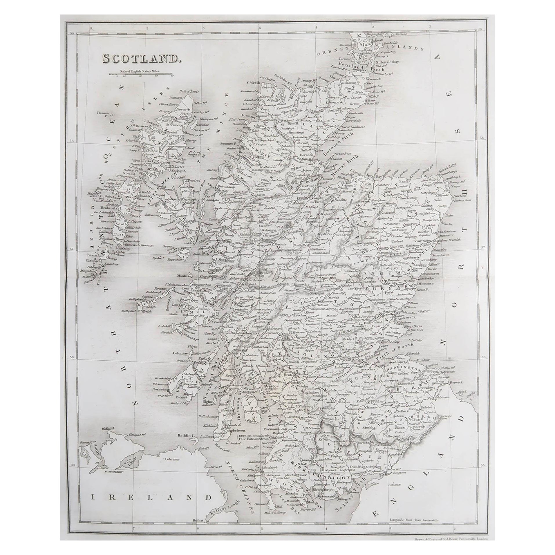
Original Antique Map of Scotland by Dower, circa 1835
Located in St Annes, Lancashire
Nice map of Scotland
Drawn and engraved by J.Dower
Published by Orr & Smith. C.1835
Unframed.
Free shipping
Category
Antique 1830s English Maps
Materials
Paper

Map of Scotland - Etching by Johannes Blaeu - 1650s
Located in Roma, IT
Map of Scotland is an geographic map realized by Johannes Blaeu.
Etching, printed in 1660 ca.
Copper engraving, colored (coeval coloring), on paper, with center fold;
Latin text. ...
Category
1650s Modern Figurative Prints
Materials
Etching
$449 Sale Price
20% Off
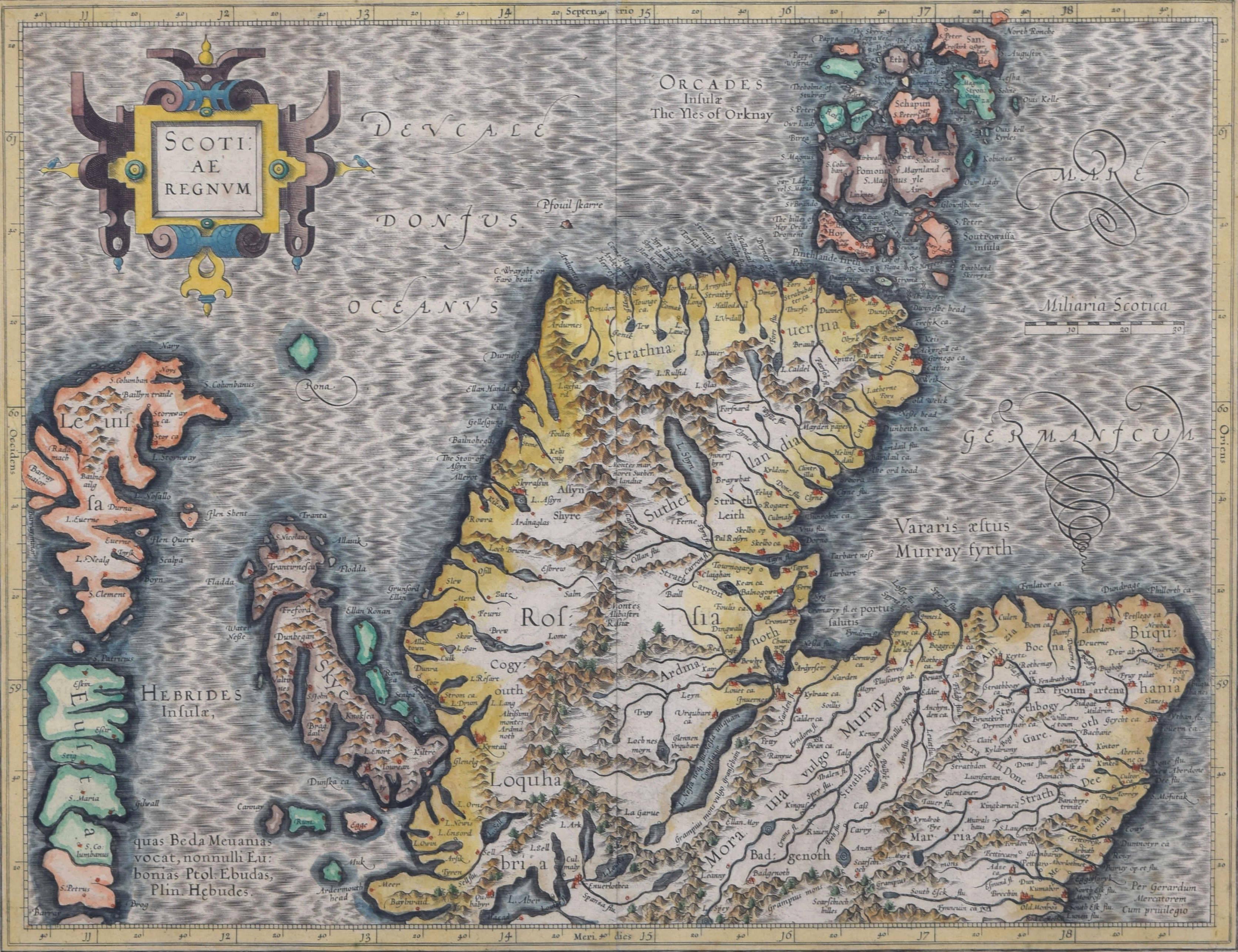
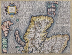
Northern Scotland: 17th Century Hand-colored Map by Mercator
By Gerard Mercator
Located in Alamo, CA
This is a framed hand-colored 17th century map of Northern Scotland by Gerard Mercator entitled "Scotiae pars Septentrionalis", published in Amsterdam in 1636. It is a highly detailed map of the northern part of Scotland, with the northwest Highlands and the cities Inverness and Aberdeen, as well as the Orkney Islands and the Hebrides. There is a decorative title cartouche in the upper left corner.
The map is presented in an antiqued brown wood...
Category
Mid-17th Century Other Art Style Landscape Prints
Materials
Engraving

Northern Scotland: 16th Century Hand-colored Map by Mercator
By Gerard Mercator
Located in Alamo, CA
This is a framed hand-colored 16th century map of Northern Scotland by Gerard Mercator entitled "Scotiae pars Septentrionalis", published in Amsterdam in 1636. It is a highly detailed map of the northern part of Scotland, with the northwest Highlands and the cities Inverness and Aberdeen, as well as the Orkney Islands and the Hebrides. There is a decorative title cartouche in the upper left corner.
The map is presented in an antiqued brown wood...
Category
16th Century Other Art Style Landscape Prints
Materials
Engraving
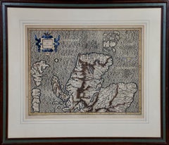
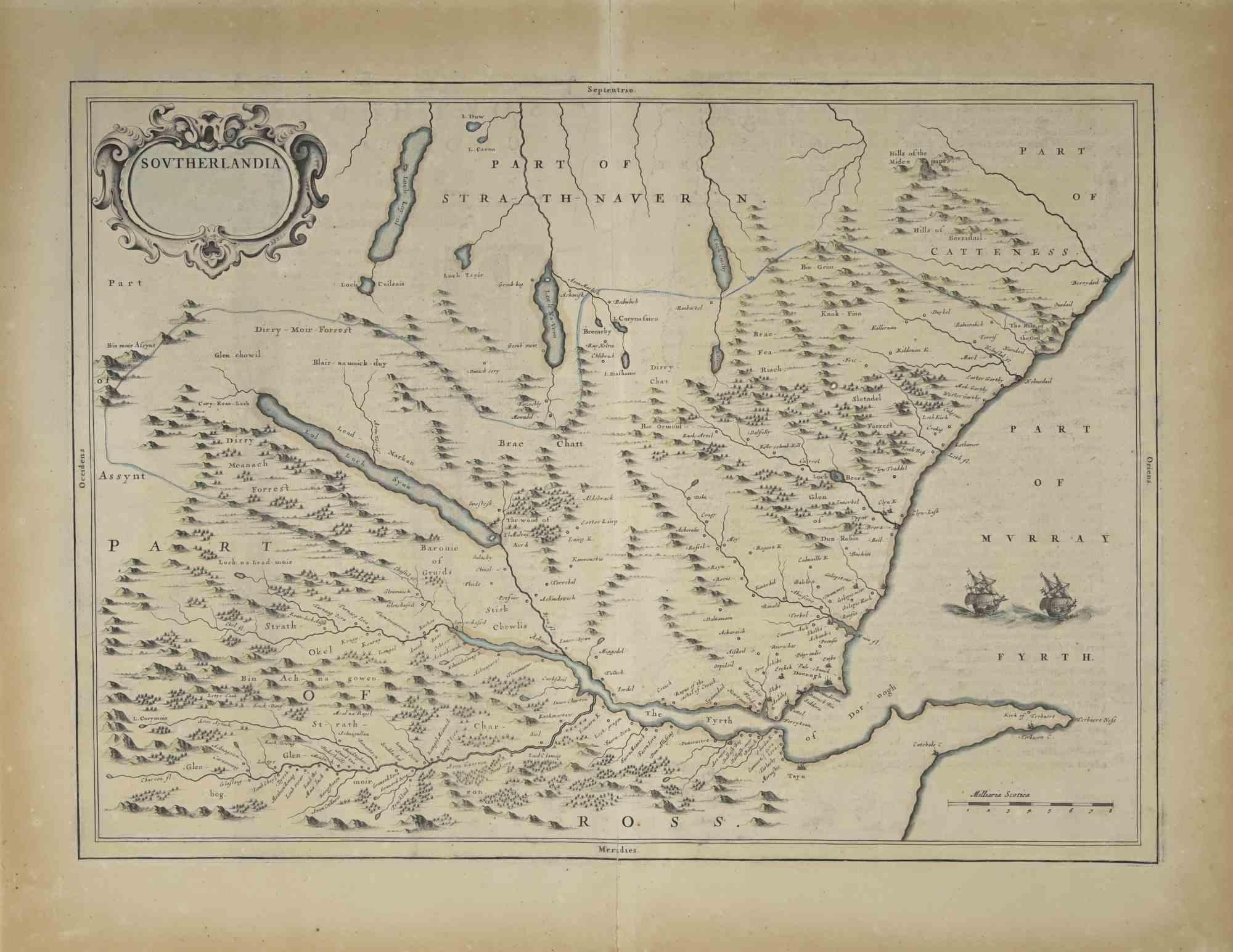
1654 Joan Blaeu Map the Sutherland, Scotland, Entitled "Southerlandia, "Ric0007
Located in Norton, MA
1654 Joan Blaeu map of the
Sutherland, Scotland, entitled
"Southerlandia,"
Hand Colored
Ric0007
Description:
Lovely map centered on Sedan and D...
Category
Antique 17th Century Dutch Maps
Materials
Paper

More Ways To Browse
17th Century Scottish
17th Century Scottish Furniture
Decorative Guns
Denmark Polar Bear
Dog Clock
Draper Black Lacquer
Drawers Mcm
Drop Drawer Cabinet
Dutch Bombe Chest
Dutch Crown
Edo Period Scroll
Empire Glass Clock
Etched Glass Window
European Ware
Fantoni Copper
Federal Style Chest
Film Reel
Folding Mirror Vanity