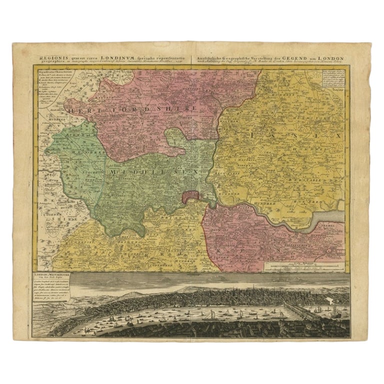
Original Map of London by John Rocque, 1741-1745
View Similar Items


1 of 10
Original Map of London by John Rocque, 1741-1745
About the Item
- Creator:John Roque 1 (Maker)
- Dimensions:Height: 76.5 in (194.31 cm)Width: 103 in (261.62 cm)Depth: 3 in (7.62 cm)
- Style:George III (Of the Period)
- Place of Origin:
- Period:1740-1749
- Date of Manufacture:1746
- Condition:Minor fading. Needs to have good paper restorer.
- Seller Location:Bantam, CT
- Reference Number:1stDibs: LU85244002343
Authenticity Guarantee
In the unlikely event there’s an issue with an item’s authenticity, contact us within 1 year for a full refund. DetailsMoney-Back Guarantee
If your item is not as described, is damaged in transit, or does not arrive, contact us within 7 days for a full refund. Details24-Hour Cancellation
You have a 24-hour grace period in which to reconsider your purchase, with no questions asked.Vetted Professional Sellers
Our world-class sellers must adhere to strict standards for service and quality, maintaining the integrity of our listings.Price-Match Guarantee
If you find that a seller listed the same item for a lower price elsewhere, we’ll match it.Trusted Global Delivery
Our best-in-class carrier network provides specialized shipping options worldwide, including custom delivery.You May Also Like
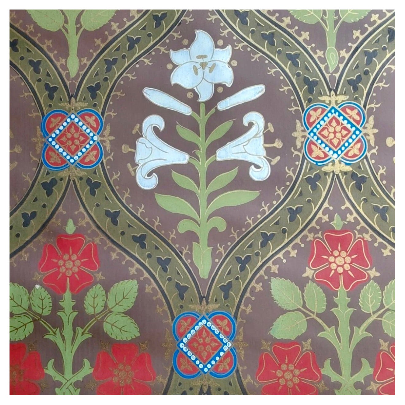
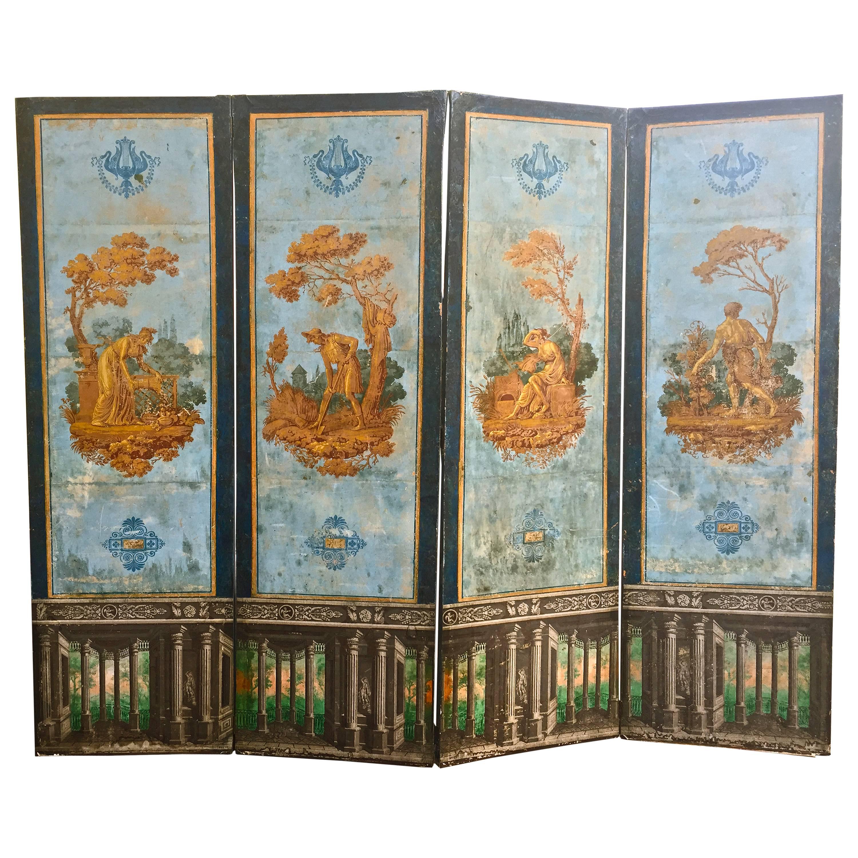
A.W.N. Pugin Gothic Lily Wallpaper Rolls, Woollam & Co. of London, 1850
By Augustus Welby Northmore Pugin
Located in Brooklyn, NY
Augustus Welby Northmore Pugin created around one hundred wallpapers, which were manufactured and flocked by William Woollams & Co of London.
Augustus Welby Northmore Pugin created a...
Category
Antique 19th Century English Gothic Revival Wallpaper
Materials
Paper

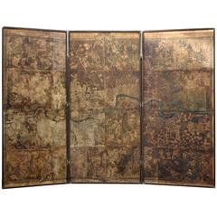
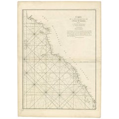
Antique Map of London Showing the Area from Essex to Surrey, England, 1741
Located in Langweer, NL
Antique map titled 'Regionis quae est circa Londinum specialis repraesentatio (..)'
Very detailed map showing the area from Essex to Surrey and shows a lovely view of London with a high level of detail, stretching from Old London Bridge...
Category
Antique 18th Century Maps
Materials
Paper

$1,349 Sale Price
20% Off
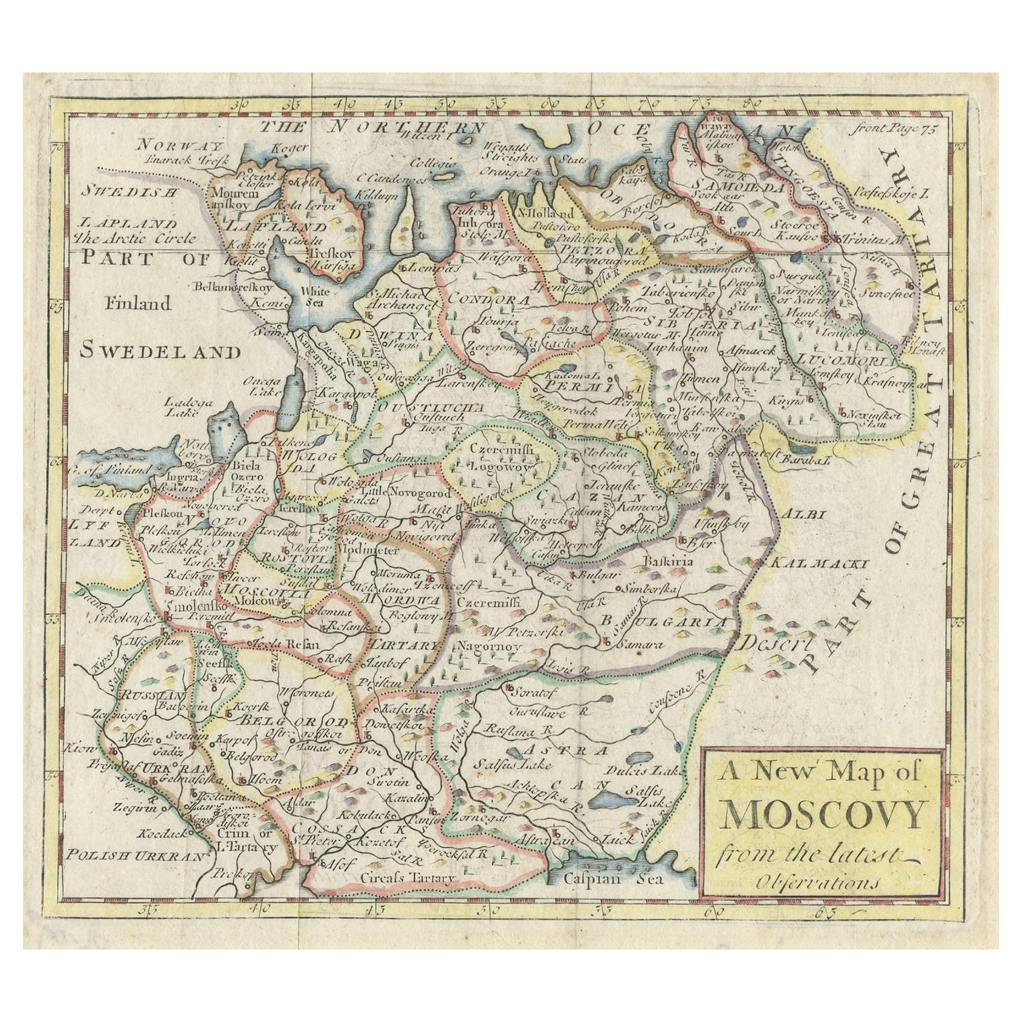
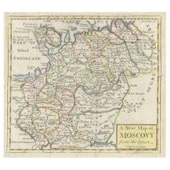
Antique Map of West Russia, with Title a New Map of Moskovy, 1741
Located in Langweer, NL
Antique map Russia titled 'A New Map of Moscovy from the latest observations'.
Muscovy is an alternative name for the Grand Duchy of Moscow (126...
Category
Antique 1740s Maps
Materials
Paper
Antique Coastal Map of West Sumatra 'Indonesia' by J. Mannevillette, 1745
Located in Langweer, NL
Antique map titled 'Carte de la côte occidentale de l'isle Sumatra depuis la ligne équinoctiale jusqu'au détroit de la Sonde'. Beautiful coastal map of We...
Category
Antique Mid-18th Century Maps
Materials
Paper
$460 Sale Price
20% Off
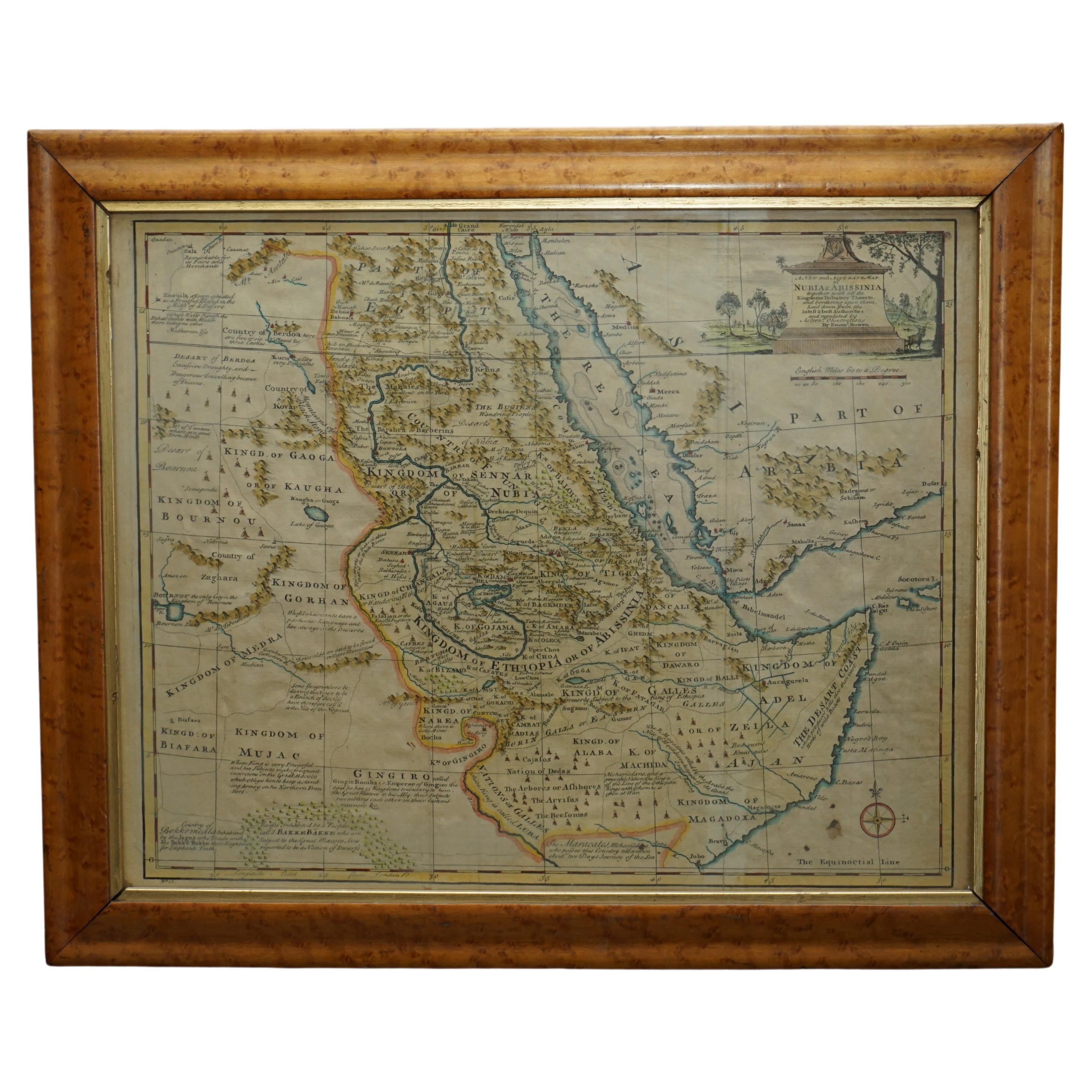
London 1744 Published Watercolour Antique Map of East Africa by Eman Bowen
Located in West Sussex, Pulborough
We are delighted to offer for sale this New and Accurate Map of Nubia & Abissinia, together with all the Kingdoms Tributary Thereto, and bordering upon them published in 1744 by Emanuel Bowen
This is a decorative antique engraved map of East Africa...
Category
Antique 1740s English George III Maps
Materials
Paper

$1,049 Sale Price
20% Off
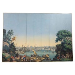
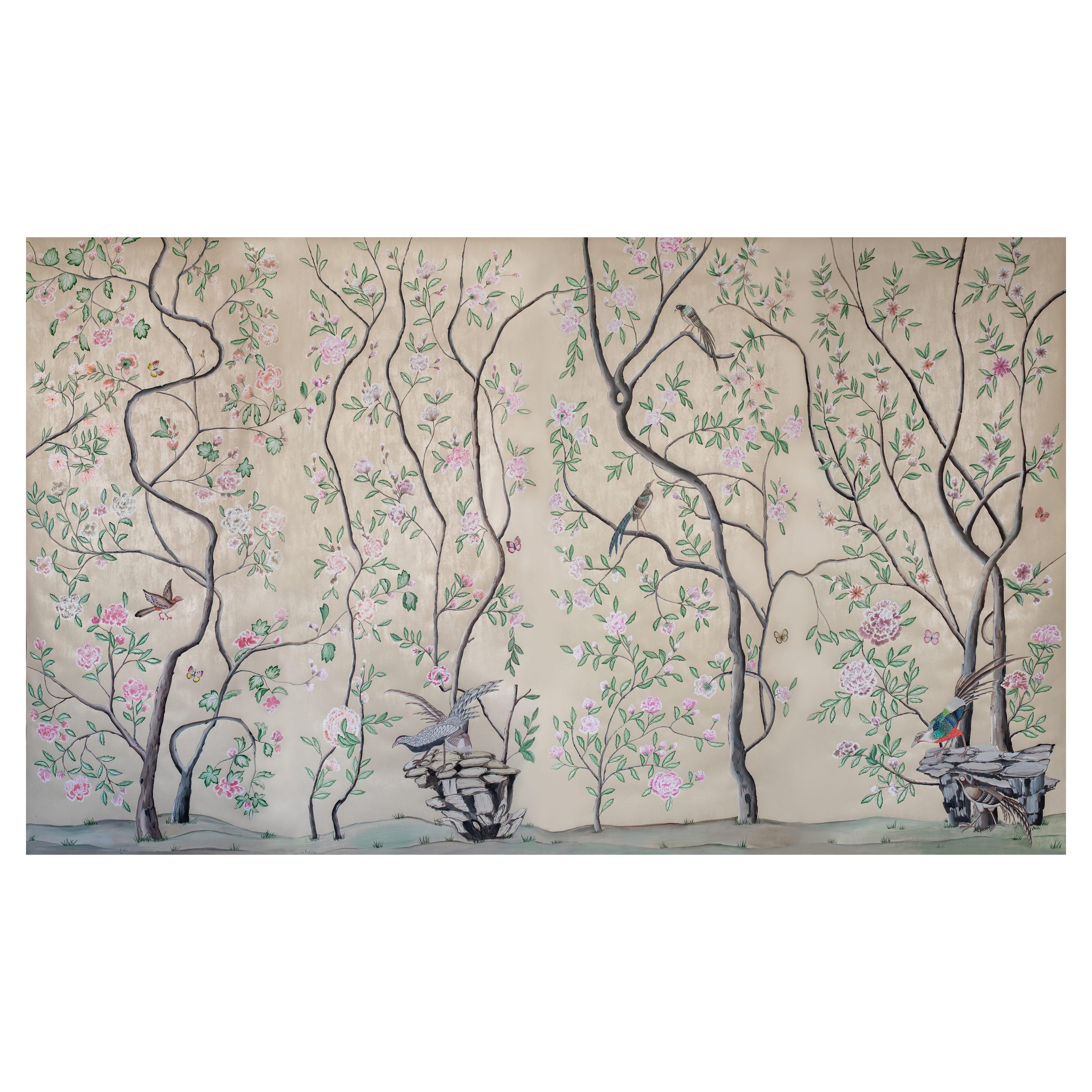
1797 Port of Boston from 'Views of North America' Panels Signed by Zuber Et Cie
By Jean Zuber
Located in IT
Panels decorated with printed paper, depicting an idyllic scene of Boston Harbour, France.
The motif comes from the 'Vues d'Amérique du Nord' series and was first presented by Jean ...
Category
Antique 1790s Italian Wallpaper
Materials
Wood