Benelux
14
to
96
412
911
402
40,859
21,504
15,913
13,456
10,982
9,101
8,725
7,504
6,788
6,309
4,722
4,400
3,359
3,268
2,311
2,109
1,520
1,387
1,198
1,024
930
861
823
804
634
586
412
407
406
376
298
267
253
217
207
184
177
141
137
134
132
118
101
100
97
92
92
80
75
65
58
57
55
51
49
43
42
29
26
25
20
13
28
7
4
3
3
Period: Mid-17th Century
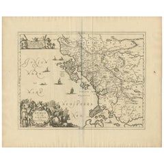
Antique Map of Epirus 'Albania, Greece' by J. Janssonius, circa 1650
Located in Langweer, NL
This map covers the northwestern coast of Greece and part of present-day Albania. The map was drawn by Johannes Wilhelm Laurenberg, a mathematician and historian who produced several...
Category
Mid-17th Century Antique Benelux
Materials
Paper
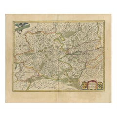
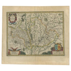
Antique Map of the Hainaut and Namur Region by Janssonius, 'circa 1640'
By Johannes Janssonius
Located in Langweer, NL
Antique map titled 'Comitatuum Hannoniae et Namurci Descriptio'. Old map of the region of Hainaut and Namur, France. Published by J. Janssonius, circa 1640.
Category
Mid-17th Century Antique Benelux
Materials
Paper
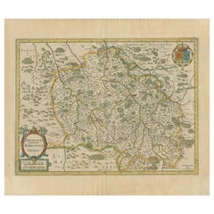
Antique Map of the Region of Bourbonnais by Janssonius, circa 1640
Located in Langweer, NL
Antique map titled 'Bourbonois - Borbonium Ducatus'. Old map of the former region of Bourbonnais, France. It includes the cities of Bourbon, Moulins, Charenton, Brulles, Varennes and...
Category
Mid-17th Century Antique Benelux
Materials
Paper
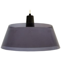
“Tuomas” Acrylic Pendant Light by Yki Nummi for Stockmann-Orno, Finland, 1950s
By Stockmann-Orno, Yki Nummi
Located in Steenwijk, NL
This nice grey and white acrylic pendant light was designed by Yki Nummi for Stockmann-Orno in the 1950's. The lamp is in a very good condition with some minor signs of age and use.
...
Category
1650s Finnish Mid-Century Modern Antique Benelux
Materials
Metal
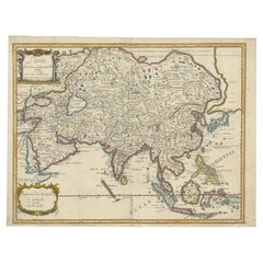
Antique Map of Asia by Pierre du Val, '1663'
Located in Langweer, NL
Antique map titled 'L'Asie'. Antique map of the Asian continent by Pierre Duval, dated 1663. Most place names represent geographical entities that currently exist or once existed. The rendition of the lower islands of Japan and the peninsula of Korea are improved over earlier studies. Details of the Great Wall of China...
Category
Mid-17th Century Antique Benelux
Materials
Paper
Antique Map of the Region of Blois by Janssonius, 'circa 1640'
By Johannes Janssonius
Located in Langweer, NL
Antique map titled 'Description du Blaisois'. Old map of the region of Blois, France. It shows the city of Blois, Amboise, the Loire River and more. Published by J. Janssonius, circa...
Category
Mid-17th Century Antique Benelux
Materials
Paper
Antique Map of the Region of Hauts-de-France by Hondius, circa 1630
Located in Langweer, NL
Antique map titled 'Description du Gouvernement de la Cappelle'. Old map of the region of Hauts-de-France including the cities of Vervins, Marle, Cappelle and others. This map origin...
Category
Mid-17th Century Antique Benelux
Materials
Paper
Antique Map of the Region of Lyon by Hondius, circa 1630
Located in Langweer, NL
Antique map titled 'Lionnois, Forest et Beauiolois'. Old map of the former region of Lyon, Vienne, Bresse, Rohan and the Rhône River. This map originates f...
Category
Mid-17th Century Antique Benelux
Materials
Paper
Antique Print of Angra 'Azores' by A. Montanus, 1671
By Arnoldus Montanus
Located in Langweer, NL
Antique print titled 'Angra op Tercera'. Antique print of Angra, Azores, in Portugal, during the mid-17th century. Shows roadways buildings, fortifications and geographical features;...
Category
Mid-17th Century Antique Benelux
Materials
Paper
Vintage Blue Glass Kastrup-Holmegaard Pendant Lamp, Denmark
By Holmegaard
Located in Steenwijk, NL
This is a very nice vintage blue glass pendant lamp with a metal wire detailing. The opaline inside gives a beautiful soft light. This light is of...
Category
1660s European Mid-Century Modern Antique Benelux
Materials
Metal
Antique Map of the Region of Saintonge by Janssonius, 1657
By Johannes Janssonius
Located in Langweer, NL
Antique map 'La Saintonge vers le Midy avecq le Brovageais'. Decorative map of the Saintonge region, a former province of France located on the west central Atlantic coast. This map ...
Category
Mid-17th Century Antique Benelux
Materials
Paper
Antique Map of the East Indies by Mariette, circa 1650
Located in Langweer, NL
Antique map titled 'Carte Generale Des Indes Orientales et des Isles Adiacentes'. Uncommon, early map of Southeast Asia from the Maldives to the South of Japan with parts of the nort...
Category
Mid-17th Century Antique Benelux
Materials
Paper
Antique Map of Turkey with Cyprus and Greece Islands by N. Sanson, circa 1652
Located in Langweer, NL
Antique map of Turkey, Anatolie with Cyprus and the Greece islands. Attractive scrolled title cartouche to top right corner. Blank verso.
Category
Mid-17th Century Antique Benelux
Materials
Paper
Antique Map of the Region of Bretagne by Janssonius '1657'
By Johannes Janssonius
Located in Langweer, NL
Antique map 'Duche de Bretaigne'. Detailed map of Bretagne, France. With decorative cartouches for the title, key and scale, a large armorial and several vignette galleons. This map ...
Category
Mid-17th Century Antique Benelux
Materials
Paper
1955, Arne Jacobsen, Set of Four Turquoise Upholstered 3207 Butterfly Armchairs
By Arne Jacobsen, Fritz Hansen
Located in Amsterdam IJMuiden, NL
This item is part of the private collection of Casey Godrie and is situated in his private house.
Ask him for competitive shipping quotes. His incredible Dune Villa, Amsterdam Beach...
Category
Mid-17th Century Danish Mid-Century Modern Antique Benelux
Materials
Metal
Antique Map of Beauce by Janssonius, 1657
By Johannes Janssonius
Located in Langweer, NL
Antique map 'Belsia vulgo la Beausse'. Decorative map of the region of Beauce, a natural region in northern France, located between the Seine and Loire rivers. This map originates fr...
Category
Mid-17th Century Antique Benelux
Materials
Paper
Antique Map of the Region of Lyonnais by Janssonius, '1657'
By Johannes Janssonius
Located in Langweer, NL
Antique map 'Lionnois, forest, beauviolois et masconnois'. Decorative map of the Lyonnais region, France. The Lyonnais is a historical province of France which owes its name to the c...
Category
Mid-17th Century Antique Benelux
Materials
Paper
Antique Map of Northern Switzerland by Janssonius '1657'
By Johannes Janssonius
Located in Langweer, NL
Antique map 'Zurichgow et Basiliensis provincia'. Detailed map of northern Switzerland, including Zurich and Basel. This map originates from 'Atlas Novus, Sive Theatrum Orbis Orbis T...
Category
Mid-17th Century Antique Benelux
Materials
Paper
Antique Map of the Region of Picardy by Janssonius, 1657
By Johannes Janssonius
Located in Langweer, NL
Antique map of France titled 'Picardia vera et inferior'. Detailed map of the Picardy region of France. This map originates from 'Atlas Novus, Sive Theatrum Orbis Orbis Terrarum: In ...
Category
Mid-17th Century Antique Benelux
Materials
Paper
Antique Map of the Region of Aiguillon by Janssonius, 1657
By Johannes Janssonius
Located in Langweer, NL
Antique map 'Le Duche d'Aiguillon'. Decorative map of the Aiguillon region, France. Located at the confluence of the Lot and Garonne rivers. The map is based on the cartography of Pi...
Category
Mid-17th Century Antique Benelux
Materials
Paper
Antique Map of the North-Western Part of France by Janssonius (c.1657)
By Johannes Janssonius
Located in Langweer, NL
Antique map of France titled 'Le Gouvernement de Calais'. Attractive map of the north-western part of France including the towns of Calais, Gravelines. This map originates from 'Atla...
Category
Mid-17th Century Antique Benelux
Materials
Paper
Antique Map of the Region of Charolais by Janssonius, 1657
By Johannes Janssonius
Located in Langweer, NL
Antique map 'Les environs de L'Estang de Longpendu, comprenant une grande partie du Comté de Charolois'. Decorative map of the Charolais region. This map originates from 'Atlas Novus...
Category
Mid-17th Century Antique Benelux
Materials
Paper
Antique Map of the Region of Aargau by Janssonius, '1657'
By Johannes Janssonius
Located in Langweer, NL
Antique map 'Argow cum parte merid. Zurichgow'. Detailed map of Switzerland showing Aargau with the southern part of Zürich. This map originates from 'Atlas Novus, Sive Theatrum Orbi...
Category
Mid-17th Century Antique Benelux
Materials
Paper
Antique Map of the Region of Poitou by Janssonius, 1657
By Johannes Janssonius
Located in Langweer, NL
Antique map 'Pictauiae Ducatus Descriptio vulgo le Pais de Poictov'. Decorative map of the region of Poitou with Rochelle, Nantes, etc., France. This map originates from 'Atlas Novus...
Category
Mid-17th Century Antique Benelux
Materials
Paper
Antique Map of the Region of Rethelois by Janssonius, 1657
By Johannes Janssonius
Located in Langweer, NL
Antique map of France titled 'Dioecese de Rheims et le Païs de Rethel'. Detailed map, centered on the River Ayne and the River Velle and sowing Reims, Chalons, Sedan, Charleville, as...
Category
Mid-17th Century Antique Benelux
Materials
Paper
Antique Map of the Region of Limoge by Janssonius, '1657'
By Johannes Janssonius
Located in Langweer, NL
Antique map 'Totius Lemovici et consinium provinciaru quantum ad dioecesin Lemovicensen spectant'. Decorative map of the province of Limoge based on the important map of Antoin-Jean ...
Category
Mid-17th Century Antique Benelux
Materials
Paper
Antique Map of Brabant 'The Netherlands' by N. Visscher, circa 1670
Located in Langweer, NL
Detailed map of the southern part of The Netherlands and the northern part of Belgium with Antwerp and Brussels. In the corner top left in Holland with Rotterdam partly on the map. S...
Category
Mid-17th Century Antique Benelux
Materials
Paper
Antique Map of Loudun and Mirebeau by Janssonius '1657'
By Johannes Janssonius
Located in Langweer, NL
Antique map 'Loudunois Laudunum - Mirebalais'. Decorative map of the region of Loudun and Mirebeau. This map originates from 'Atlas Novus, Sive Theatrum Orbis Orbis Terrarum: In quo ...
Category
Mid-17th Century Antique Benelux
Materials
Paper
Antique Map of the Region of Sedan and Doncheri by Janssonius, 1657
By Johannes Janssonius
Located in Langweer, NL
Antique map of France titled 'La Souveraineté de Sedan et de Raucourt, et la prevosté de Doncheri'. Lovely map centered on Sedan and Doncheri and the Meuze River from Charleville and...
Category
Mid-17th Century Antique Benelux
Materials
Paper
Original Antique Hand-Colored Map of Friesland by C. Merian, 1659
Located in Langweer, NL
This is a hand-colored engraving of the province of Friesland in the Netherlands, created by the Swiss-born engraver and artist Matthäus Merian (1593–1650) and included in "Topograph...
Category
Mid-17th Century Antique Benelux
Materials
Paper
Antique Print of the Imperial Palace in Beijing by J. Nieuhof, 1668
By Johannes Nieuhof
Located in Langweer, NL
Antique print titled 'Platte Grondt van s Keysers Hof in Pekin - Pdanum Aulae Penigensis'.
Old print of the Imperial Palace in Beijing, China.
Originates from Niehof's Latin edit...
Category
Mid-17th Century Antique Benelux
Materials
Paper
Antique Map of Chili by Montanus, circa 1671
By Arnoldus Montanus
Located in Langweer, NL
Antique map titled 'Chili'. A very attractive map covering the known coastal region of Chile. The Andes are shown prominently, with two live volcanoes in the vicinity of Villarrica. ...
Category
Mid-17th Century Antique Benelux
Materials
Paper
Antique Print of Horse Catching in Ceylon/Sri Lanka by P. Baldaeus (1672)
By Philip Baldaeus
Located in Langweer, NL
Antique print titled 'Paardevangst op Jafnapatnam'. This print depicts the catching of horses on Jaffnapatnam. Source unknown, to be determined.
Category
Mid-17th Century European Antique Benelux
Materials
Paper
Antique Map of the Adriatic Sea and the Balkan by J. Janssonius, circa 1650
Located in Langweer, NL
Striking large-scale map of the Greater Balkans. Decorated with two large-scale cartouches, one showing two swordsman at odds with one another and the other ...
Category
Mid-17th Century Antique Benelux
Materials
Paper
Antique Map of Paraguay by A. Montanus, circa 1671
By Arnoldus Montanus
Located in Langweer, NL
Antique map titled 'Paraquaria Vulgo Paraguay Cum adjacentibus'. Antique map extending from Rio de Janiero to the Rio de la Plata basin. The map include...
Category
Mid-17th Century Antique Benelux
Materials
Paper
Cartographic Tapestry: Antique Map of Asia Minor, circa 1640
Located in Langweer, NL
Title: "Historical Tapestry: Antique Map of Asia Minor, circa 1640"
Description:
This authentic antique map, created by Willem Blaeu and published in Amsterdam circa 1640, is a capt...
Category
Mid-17th Century Antique Benelux
Materials
Paper
Antique Map of the Spice Islands 'Moluccas', Indonesia by W. Blaeu, circa 1640
By Willem Blaeu
Located in Langweer, NL
Antique map titled 'Moluccae Insulae Celeberrimae'. Highly decorative antique map of the Spice Islands (Moluccas) published by W. Blaeu (circa 1640). This map features a large inset ...
Category
Mid-17th Century Antique Benelux
Materials
Paper
Antique Map of Greece by J. Jansson, circa 1653
Located in Langweer, NL
This is an authentic antique map of the Greece by Jan Jansson. The map was published in Amsterdam, circa 1653. This striking 17th century map of Greece was based on “Totius Graeciae ...
Category
Mid-17th Century Antique Benelux
Materials
Paper
Antique Map of Dunkirk 'France' by J. Blaeu, 1649
Located in Langweer, NL
Antique map titled 'Duynkercka'. Published by J. Blaeu, 1649. Dutch text on verso.
Category
Mid-17th Century Antique Benelux
Materials
Paper
Danish Imported White Opaline Glass Pendant Lamp with Black Metal Ring, 1960s
Located in Steenwijk, NL
We imported this nice midcentury pendant lamp from Denmark. The lamp is made of white opaline glass and has a black metal accent. It is in a very go...
Category
1660s Danish Mid-Century Modern Antique Benelux
Materials
Metal
Antique Plan of Fort Mardyck Mardijk, France by S. Beaulieu, 1649
Located in Langweer, NL
Plan of Fort Mardyck (Fort Mardijk) and surroundings by Sébastian de Pontault Beaulieu. Mardyck is a former commune in the Nord department in northern France. It is an associated com...
Category
Mid-17th Century Antique Benelux
Materials
Paper
Antique Map of Southeast Asia 'India, Indonesia' by N. Visscher, circa 1670
Located in Langweer, NL
Antique map titled 'Indiae Orientalis, nec non Insularum Adiacentium Nova Descriptio.' The map centers on the Strait of Malacca and Malay Peninsula. It extends from India and the Mal...
Category
Mid-17th Century Antique Benelux
Materials
Paper
Antique Print of the City of Tonglingh ‘China’ by J. Nieuhof, 1666
Located in Langweer, NL
Antique print titled 'Tonglingh'. This plate shows a view on the Chinese city of Tonglingh with its ramparts. Also depicted are ships and in the background is a mountainous landscape...
Category
Mid-17th Century Antique Benelux
Materials
Paper
Rare Antique Map of the Imperial Court in Peking China, 1665
Located in Langweer, NL
Antique print titled 'Platte Grondt van s Keysers Hof in Pekin. Forme de la Cour Imperiale de Peking'. This print originates from 'Joan Nieuhof, Het Gezands...
Category
Mid-17th Century Antique Benelux
Materials
Paper
Antique Print of the Domestic Cow by J. Jonston, 1657
Located in Langweer, NL
Antique print titled 'Tab XIIII Bos Domesticus'. This rare antique engraving originates from: 'Historiae Naturalis. De Quadrupetibus Libri I.' (Volume 1 of Historiae Naturalis.) by J...
Category
Mid-17th Century Antique Benelux
Materials
Paper
Antique Map of Central Sweden by J. Blaeu, 1662
Located in Langweer, NL
A striking, rare map with a cartouche dedicated to Gabriel Bengtsson Oxenstierna. Published by J. Bleau, Amsterdam, 1662. Contemporary coloring.
Category
Mid-17th Century Antique Benelux
Materials
Paper
Blue and White Plate with Flower Vase. Delft, 1650-1680
By Delft
Located in Verviers, BE
Blue and white plate decorated with of a vase with two flowers in a double circle. The well and flange are decorated with a continuous frieze of flowers, foliage and branches of leav...
Category
1660s Dutch Baroque Antique Benelux
Materials
Ceramic, Faience
Marriage William of Orange and Princess Mary
Located in UTRECHT, UT
Obverse: albionum genuit / rex me summusque / monarcha Carolus / et sponsam me iubet / esse tuam / princeps me Henricus / genuit fortissimus / heros nassoviæ, et / sponsum me iubet /...
Category
1640s Dutch Neoclassical Antique Benelux
Materials
Silver
Blue and White Dutch Delft Tile with Artist, Mid 17th Century
Located in AMSTERDAM, NH
The Netherlands
Hoorn
Circa 1630 – 1660
A very rare and fine blue and white tile with the decoration of a painter in his workshop, painting a still life painting.
Very nice details ...
Category
Mid-17th Century Dutch Baroque Antique Benelux
Materials
Ceramic, Faience, Majolica
Study of a dog
Located in Amsterdam, NL
Study of a dog
Oil on paper laid down on panel, 17.5 x 25.5 cm
Provenance
Private collection, the Netherlands
Note:
We are grateful to Mr Fred Meijer for his attribution to Ludolf de Jongh
Ludolf de Jongh was the son of a shoemaker. When his father moved to Rotterdam, the young Ludolf decided to learn art rather than shoemaking and became a pupil of Cornelis Saftleven. Later he studied under Anthony Palamedes in Delft and still later with Jan van Bijlert in Utrecht.
In 1635 he travelled to France with Francis Bacon. Seven years later, in 1642, he returned to the Netherlands when he heard that his mother had fallen ill. He set up a shop in Rotterdam, and his earliest signed paintings date from that year.
According to Houbraken, his travels had caused him to speak French so fluently, that his parents had to learn French in order to speak with him.
De Jongh’s work shows a strong influence from the Utrecht school of Caravaggio admirers, especially Jacob Duck...
Category
Mid-17th Century Old Masters Benelux
Materials
Paper, Oil, Wood Panel
Antique Map of Europe by J. Janssonius, circa 1650
Located in Langweer, NL
An uncommon map of Europe prepared by Nicolas Blankaart, extending to the Middle East and the northern tip of Africa, as it was during the time of the Roman Empire. The map is filled...
Category
Mid-17th Century Antique Benelux
Materials
Paper
Antique Print of the City of Coulang ‘Kollam, India’ by P. Baldaeus, 1672
Located in Langweer, NL
Antique print titled 'De Stadt Coulang'. This original engraving originates from the 1672 German edition of Baldaeus' 'Nauwkeurige beschrijving Malabar en Choromandel, derz. aangrenz...
Category
Mid-17th Century Antique Benelux
Materials
Paper
