Items Similar to Nova Totius Terrarum Orbis Geographica Ac Hydrographica Tabula

Want more images or videos?
Request additional images or videos from the seller
1 of 11
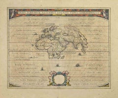
Pieter van den Keere (also, Kaeius)Nova Totius Terrarum Orbis Geographica Ac Hydrographica Tabula1608/1630
1608/1630
$19,000
£14,424.71
€16,530.29
CA$26,967.99
A$29,415.25
CHF 15,452.58
MX$355,864.28
NOK 193,316.91
SEK 182,529.64
DKK 123,387.21
About the Item
Copper-plate engraving, hand-colored, 1608 - c.1630 and published by Joannes Jansonius, Amsterdam. Image size 15.75 x 21.19 inches (40 x 53.9 cm).
A classic example of a world map based on Mercator's projection. This beautiful carte-a-figures map of the world by Pieter van den Keere was based on Blaeu's almost identical map that was issued in 1606. Some of the engraved ornamentations include allegorical representations of the Sun, Moon, and the five known planets. Down the sides are, on the left, four panels illustrating the elements and, on the right, the four seasons. Along the bottom are seven vignettes showing the Seven Wonders of the World. Geographically the map is largely copied from Blaeu but includes more legends and additions referring to explorations in the Arctic. A long note near the cartouche discusses the theory that the straits of Anian and Davis link to form a Northwest Passage. Also added are rhumb lines radiating from three compass roses arrayed along the equator. The map was first published in 1608. In 1621 Kaerius sold his plates to Jan Jansson who then issued the map with his imprint. This example is the fourth state with Jansson's imprint and no date. German text on verso. A scarce map.
Overall good condition. Some repaired splitting along lower centerfold, and a tiny repaired hole just above the Black Sea. There are several small chips and tears in the outer margins. All have been professionally repaired. Original hand-coloring with some minor modern enhancements. Framed in 1.25-inch wood molding painted black with gold metal leaf lip. 8 ply rag stock mat and rag stock backing. Finished in UV Plexiglas.
- Creator:Pieter van den Keere (also, Kaeius) (1571 - 1645)
- Creation Year:1608/1630
- Dimensions:Height: 24 in (60.96 cm)Width: 29 in (73.66 cm)Depth: 1.25 in (3.18 cm)
- Medium:
- Period:
- Condition:
- Gallery Location:New York, NY
- Reference Number:Seller: #809821stDibs: LU33126987802
About the Seller
4.7
Recognized Seller
These prestigious sellers are industry leaders and represent the highest echelon for item quality and design.
Established in 1898
1stDibs seller since 2015
58 sales on 1stDibs
Typical response time: 1 to 2 days
Associations
International Fine Print Dealers Association
- ShippingRetrieving quote...Shipping from: New York, NY
- Return Policy
Authenticity Guarantee
In the unlikely event there’s an issue with an item’s authenticity, contact us within 1 year for a full refund. DetailsMoney-Back Guarantee
If your item is not as described, is damaged in transit, or does not arrive, contact us within 7 days for a full refund. Details24-Hour Cancellation
You have a 24-hour grace period in which to reconsider your purchase, with no questions asked.Vetted Professional Sellers
Our world-class sellers must adhere to strict standards for service and quality, maintaining the integrity of our listings.Price-Match Guarantee
If you find that a seller listed the same item for a lower price elsewhere, we’ll match it.Trusted Global Delivery
Our best-in-class carrier network provides specialized shipping options worldwide, including custom delivery.More From This Seller
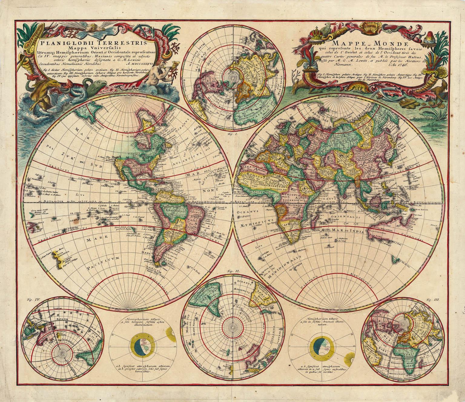
View AllPlaniglobii Terrestris Mappa Universalis / Mappe Monde
By Homann Heirs
Located in New York, NY
This map was printed from a copperplate engraving in 1746. The printed image size is 18.25 x 21.75 inches (46.3 x 55.2 cm) plus margins.
An attractive double hemisphere map...
Category
18th Century Other Art Style More Prints
Materials
Engraving

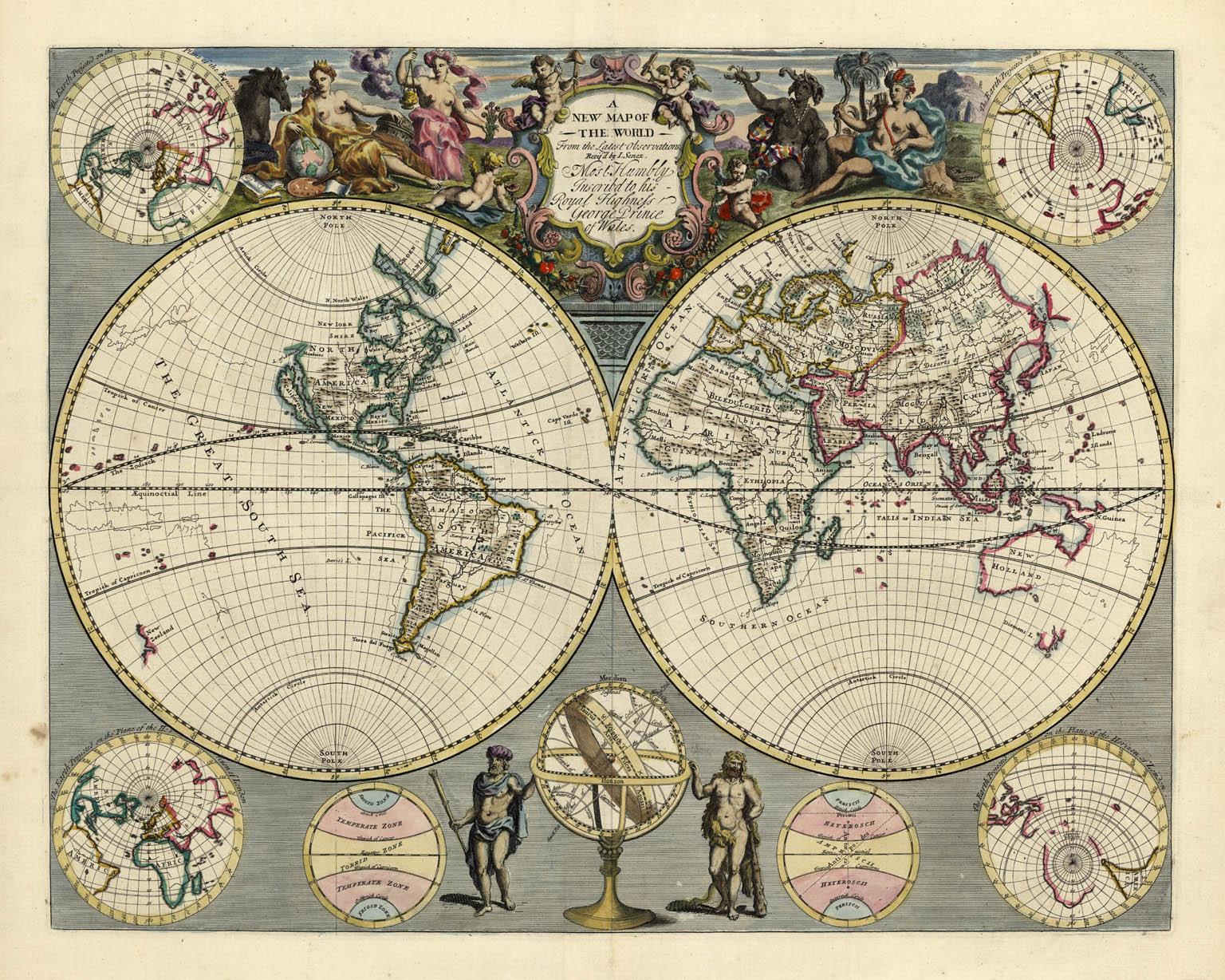
A NEW MAP OF THE WORLD from the Latest Observations.
By John Senex
Located in New York, NY
The title continues “…. Most Humbly Inscribd [sic] to his Royal Highness George Prince of Wales.”
A fine British produced double hemisphere world map. On this map, California is shown as an island on the main double hemisphere map...
Category
18th Century Other Art Style More Prints
Materials
Watercolor, Engraving
Indiarum Occidentalium Tractus Littorales cum Insulis Caribicis / Pascaert van W
By Louis Renard
Located in New York, NY
This early 18th-century engraved map was published by Louis Renard in Amsterdam. The image size is 19 x 22 " (48.3 x 55.9 cm) plus margins.
A beautifully engraved Dutch sea chart. Shown is the entire Caribbean basin including the eastern seaboard up to Cape Cod and includes Bermuda. Florida is shown with the classic flattened southeastern coast that was derived by Hessel Gerritz. Noted are the routes taken by the Spanish treasure...
Category
18th Century Other Art Style More Prints
Materials
Engraving

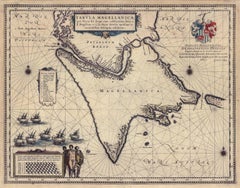
Tabula Magellanica, qua Tierra del fuego, cum celeberrimis fretis a F. Magellano
By Joan (Johannes) Blaeu
Located in New York, NY
This mid 17th-century map was published by Guiljelmum Blaeu in Amsterdam. The engraved map is 16 1/8 x 21" (41 x 53.1 cm) with beautiful original hand color. Tabula Magellanica is a highly decorative map of the southern tip of South America, including Tierra del Fuego...
Category
Mid-17th Century Other Art Style More Prints
Materials
Engraving
Nouvelle Mappe Monde, dediee au progres de nos connoissances.
Located in New York, NY
A handsome and well-engraved world map constructed with the prime meridian through Paris. The hemispheres are rotated through 45 degrees. This is an unusual projection for a world map and was based on the work of the French Academie Royale des Sciences. This particular impression is by Remondini who re-issued Santini's "Atlas Univ." in 1784. "Nouvelle Mappe Monde" is a copper plate engraving published by Giuseppe Remondini, Venice. The printed image size is just over 15 x 25 inches. Overall the map is in good condition with three small tears at the paper edge - all repaired. Modern (not 18th...
Category
18th Century Other Art Style More Prints
Materials
Watercolor, Engraving
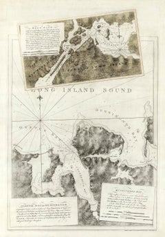
Hell Gate / Oyster Bay and Huntington / Huntington Bay
Located in New York, NY
HELL GATE / OYSTER BAY AND HUNTINGTON / HUNTINGTON BAY. This aquatint and line engraved map was published according to Act of Parliament Novr. 19th, 1778.
T...
Category
18th Century Naturalistic More Prints
Materials
Engraving, Aquatint
You May Also Like
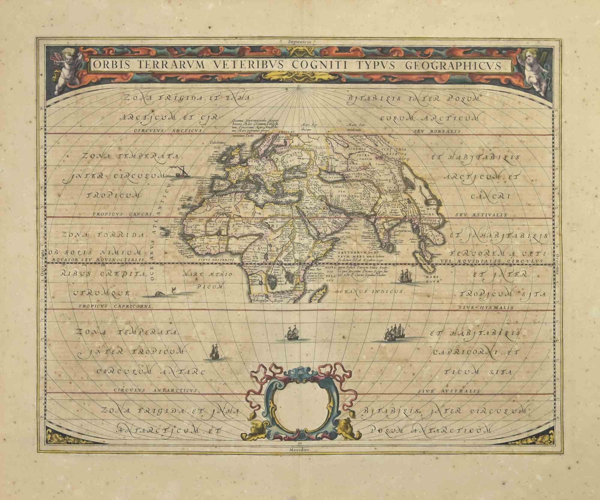
Orbis Terrarum - Etching by Johannes Janssonius - 1650s
By Johannes Janssonius
Located in Roma, IT
Antique Map - Orbis Terrarum is an antique map realized in 1650 by Johannes Janssonius (1588-1664).
The Map is Hand-colored etching, with coeval watercoloring.
Good conditions with...
Category
1650s Modern Figurative Prints
Materials
Etching
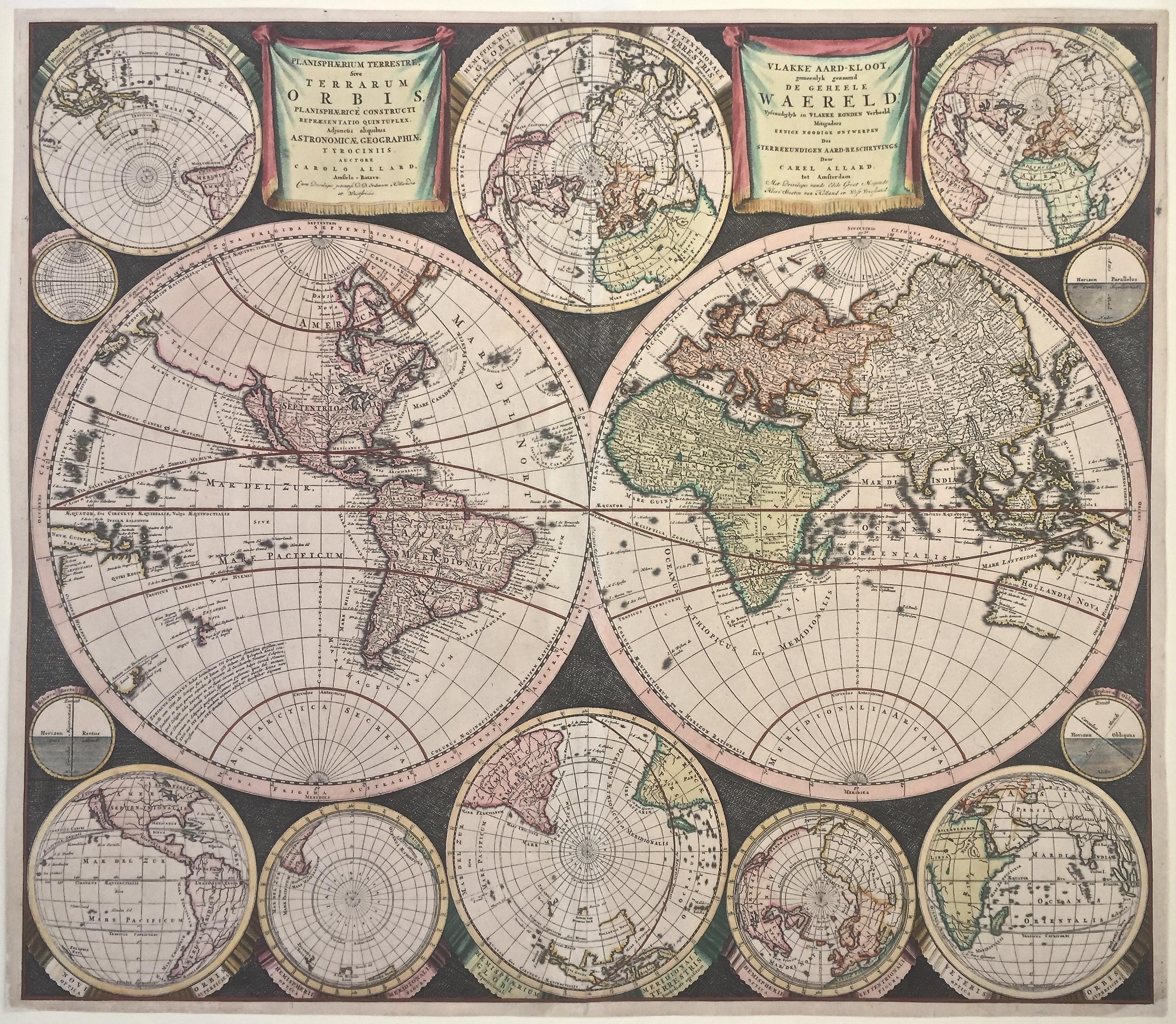
WORLD MAP - Planisphaerium Terrestre Sive Terrarum Orbis... 1696
By Carel Allard
Located in Santa Monica, CA
CAREL ALLARD (1648 – 1709)
PLANISPHAERIUM TERRESTRE SIVE TERRARUM ORBIS… 1696 (Shirley 578)
Engraving, 20 ½ x 23 ½”, sheet 21 x 24 1/8". A stunning double hemisphere World Map...
Category
17th Century Old Masters Landscape Prints
Materials
Engraving

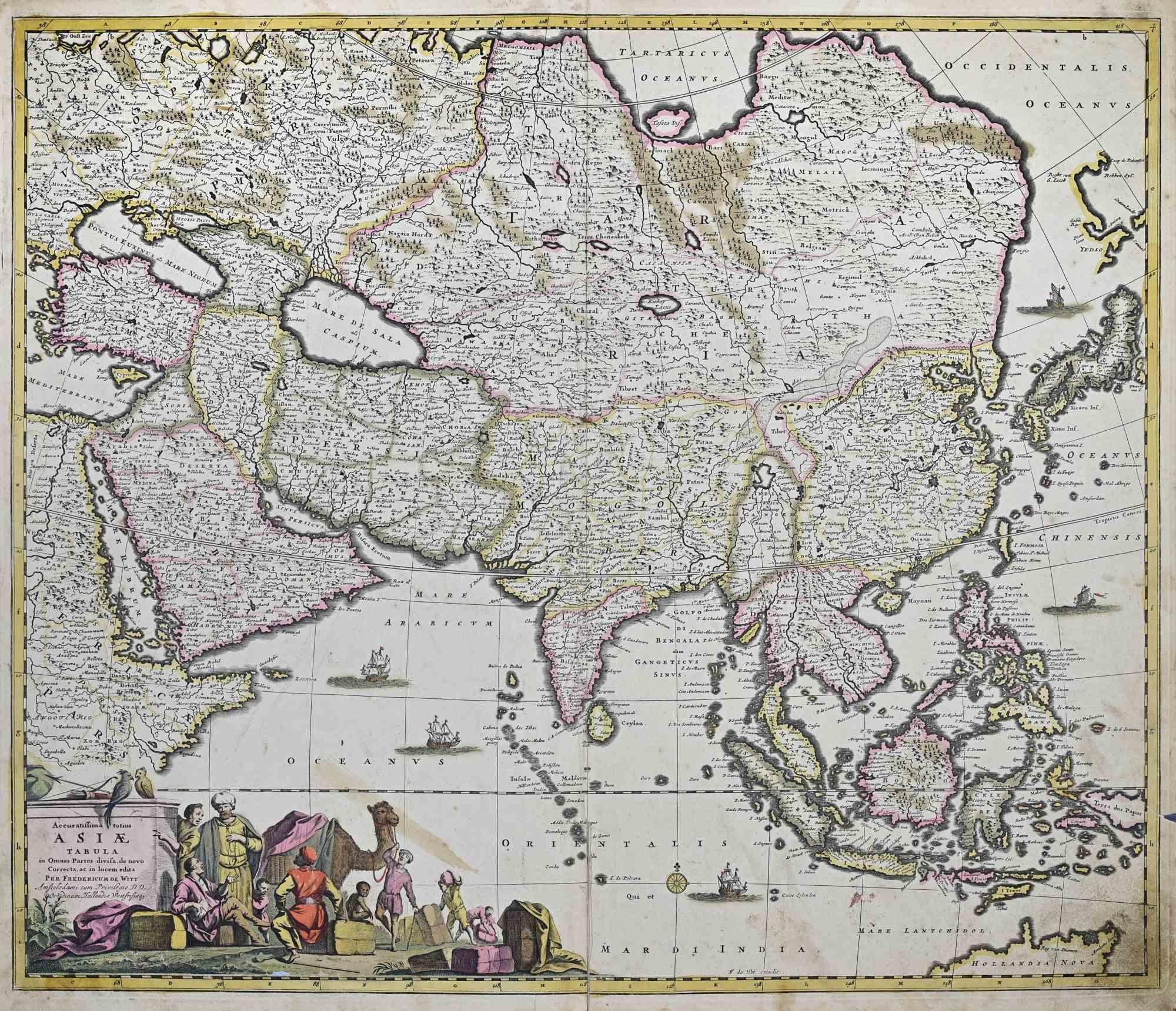
Accuratissima Totius Asiae Tabula - Etching by Frederick de Wit - 1680 ca
By Frederick de Wit
Located in Roma, IT
This double-page etching with contemporary coloring, entitled Accuratissima totius Asiae Tabula, was realized by the cartographer Frederick de Wit for the famous Atlas published in A...
Category
1680s Modern Figurative Prints
Materials
Etching

Antique Map of the Eastern Hemisphere by Valk & Chenk '1708'
Located in Langweer, NL
Antique map titled 'Hemispherium Orbis Antiqui, Cumzonis Circulis, Et Sity populorum Diverso'. Decorative example of Andreas Cellarius's map of the Eastern Hemisphere, illustrating with climatic zones ranging from Frigida Borealis to Torrida, with planetary details superimposed. The elaborate border includes fine scrollwork, numerous putti, and additional diagrams showing armillary spheres and climatic zones. Andreas Cellarius was born in 1596 in Neuhausen and educated in Heidelberg. He emigrated to Holland in the early 17th century and 1637 moved to Hoorn, where he became the rector of the Latin School. Cellarius' best known work is his Harmonia Macrocosmica, first issued in 1660 by Jan Jansson, as a supplement to Jansson's Atlas Novus. The work consists of a series of Celestial Charts...
Category
Antique Early 18th Century Dutch Maps
Materials
Paper

$4,035 Sale Price
25% Off
Map of the World: An Original 18th Century Hand-colored Map by E. Bowen
Located in Alamo, CA
This is an original 18th century hand-colored map entitled "A New & Correct Chart of All The Known World Laid down according to Mercator's Projection" by Emanuel Bowen. It was published in 1744 in London in John Harris's "Navigantium atque Itinerantium Bibliotheca" or "A Complete Collection of Voyages and Travels". This highly detailed and colorful map depicts the world. as it was known in the mid 18th century. A majority of the northern and central portions of Canada and America are left blank due to the purity of knowledge at the time this map was published.
The map is embellished with four Compass Roses in the lower left, lower center, lower right and center, along with many rhumb lines. There a is a decorative title cartouche in the upper left. This colorful, attractive, historical and interesting 1744 map presents the entire world on Mercator's projection as it was understood in the middle part of the 18th century, before the landmark explorations of Captain’s Cook, Vancouver, Wilkes and others. It is an example of a nautical chart, a type of map that was designed specifically for use by mariners. The map is centered on the equator and includes both the Eastern and Western Hemispheres. The continents of North America, South America, Europe, Africa, and Asia are depicted, as well as various islands in the Atlantic, Pacific, and Indian Oceans. The map is laid out according to the Mercator projection, a type of cylindrical map projection that was developed in the 16th century by Flemish cartographer Gerardus Mercator. This projection has the advantage of preserving angles and shapes, making it useful for navigation. The map presents a paucity of inland detail, particularly for the Americas, but major cities, geographical landmarks, and regions are included. Ocean currents and Tradewinds are identified, as well as the magnetic declination lines or magnetic variance, which refers to the difference between true north and compass north. The continents are color coded, enhancing the beauty of this map. The three compass roses indicate the directions of the cardinal points.
The depiction of the western coast of America, the Pacific and Australia are interesting. There was very little exploration of Australia between the navigations of William Damper in 1699 and Tobias Furneaux in 1773. Most of the maps detail relies on the 17th century Dutch expeditions to Australia's western coast, by Abel Tasman and William Janszoon. Van Diemen's Land (Tasmania) and New Guinea appear connected to the Australian continent. New Zealand appears as a single landmass. North of New Zealand there is a landmass labelled 'Ter d' St. Esprit' which probably represents the New Hebrides Islands. This map precedes the accurate exploration of the South Pacific and east coast of Australia by Captain James Cook later in the 18th century. The map includes ‘Drakes' Port,' the site where Sir Francis Drake supposedly landed in 1579 during his 1579 circumnavigation of the globe. Here he claimed territory for England, restocked, and repaired his vessels. Drake named the region New Albion. The exact location of Drake's Port is a cartographic mystery. Drake's Harbor is believed to be in the region of San Francisco Bay, Bodega Bay, San Pablo Bay...
Category
Mid-18th Century Old Masters Landscape Prints
Materials
Engraving

Map of Mar Del Nort - Etching by Johannes Janssonius - 1650s
By Johannes Janssonius
Located in Roma, IT
Antique Map -Mar Del Nort is an antique map realized in 1650 by Johannes Janssonius (1588-1664).
The Map is Hand-colored etching, with coeval watercolorang.
Good conditions with sl...
Category
1650s Modern Figurative Prints
Materials
Etching

More Ways To Browse
Copper Engraving Plate
Blaeu Maps
Mercator Map
Tiffany Basketball
Tiffany Studio New York Belt Buckles
Tintin Rocket
Tyrannosaurus Rex Tooth
Used Aermotor Windmill
Vintage Cowboy Guitars
Vintage Playboy Watch
Virgin And Child Russian
Wakao Toshisada
Warren Mackenzie Teapot
Wifredo Lam Ceramic
Willa Vennema Art
William Morris Art Prints
Wilson Pottery
Wunderlich Nike