Items Similar to 1911 No's 3 & 4 Map Of The Adirondack Forest

Want more images or videos?
Request additional images or videos from the seller
1 of 9
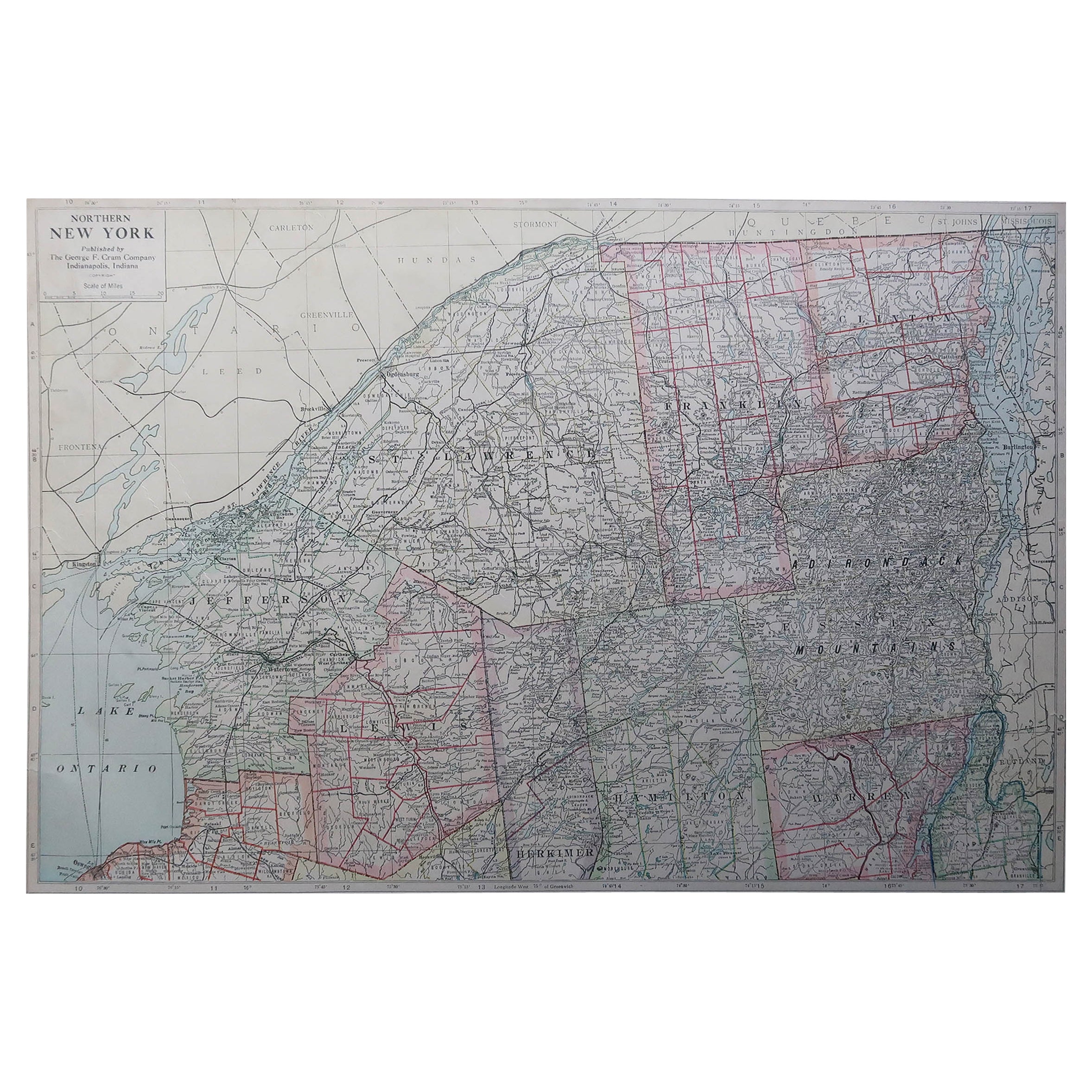
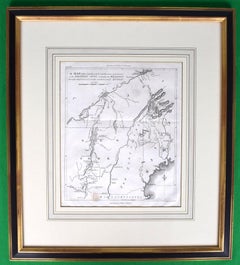
Unknown1911 No's 3 & 4 Map Of The Adirondack Forest1911
1911
$1,800
£1,354.86
€1,558.32
CA$2,532.73
A$2,776.70
CHF 1,455.22
MX$33,720.05
NOK 18,155.70
SEK 17,181.91
DKK 11,630.94
About the Seller
4.8
Vetted Professional Seller
Every seller passes strict standards for authenticity and reliability
Established in 2000
1stDibs seller since 2019
131 sales on 1stDibs
Typical response time: 1 hour
- ShippingRetrieving quote...Shipping from: Bristol, CT
- Return Policy
Authenticity Guarantee
In the unlikely event there’s an issue with an item’s authenticity, contact us within 1 year for a full refund. DetailsMoney-Back Guarantee
If your item is not as described, is damaged in transit, or does not arrive, contact us within 7 days for a full refund. Details24-Hour Cancellation
You have a 24-hour grace period in which to reconsider your purchase, with no questions asked.Vetted Professional Sellers
Our world-class sellers must adhere to strict standards for service and quality, maintaining the integrity of our listings.Price-Match Guarantee
If you find that a seller listed the same item for a lower price elsewhere, we’ll match it.Trusted Global Delivery
Our best-in-class carrier network provides specialized shipping options worldwide, including custom delivery.More From This Seller
View All"Rhode Island Map, 1933"
Located in Bristol, CT
Classic c1933 colour (12 fold) red framed map of Rhode Island designed by H.W. Hetherington from Narragansett Bay to Buzzard's Bay
Map Sz: 17 3/8"...
Category
1930s Prints and Multiples
Materials
Lithograph
Plan Of The Northern Part Of New Jersey Showing The Positions Of The American &
By Richard Phillips
Located in Bristol, CT
After Crossing The North River in 1776
Map Sz: 9 7/8"H x 7 1/4"W
Frame Sz: 18 5/8"H x 15 3/4"W
Engraved by J Yeagen
Uncolored map of Northern New Jersey, Staten Island and the lo...
Category
Early 1800s Prints and Multiples
Materials
Lithograph
Territory Of The Potomac Hunt
Located in Bristol, CT
Classic map compiled by: C.W. Owen, Jr 1948 of the 'Territory of the Potomac Hunt' Kennels: Travilah, MD
Map Sz: 17"H x 18"W
Frame Sz: 22"H x 23"W
The Potomac Hunt is one of Maryl...
Category
1940s Prints and Multiples
Materials
Lithograph
American Revolution Map Drawn For John Marshall's "Life Of Washington" First Acc
Located in Bristol, CT
A Map Of The Country Which Was The Scene Of Operations Of The Northern Army: Including The Wilderness Through Which Gerneral Arnold Marched To Attack Plate VI
Map Sz: 11"H x 9 1/4"W...
Category
Early 1800s Prints and Multiples
Materials
Paper, Engraving
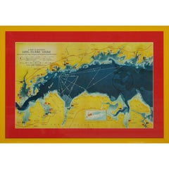
A Map Of Western Long Island Sound Showing Yacht Clubs, Aids To Navigation...
Located in Bristol, CT
Classic color map/ nautical chart (by Nolf Klep '39) of the North Shore of Long Island Sound
for members of the Larchmont Yacht Club (see verso)
Map Sz: 13 ...
Category
1930s More Prints
Materials
Paper
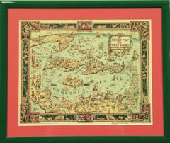
"The Story Map Of The West Indies" 1936
Located in Bristol, CT
Framed colour map of the West Indies published 1936 w/ border design motif adapted from native West Indian handicraft and indigenous tropical fruits
Colorte...
Category
1930s More Prints
Materials
Paper
You May Also Like
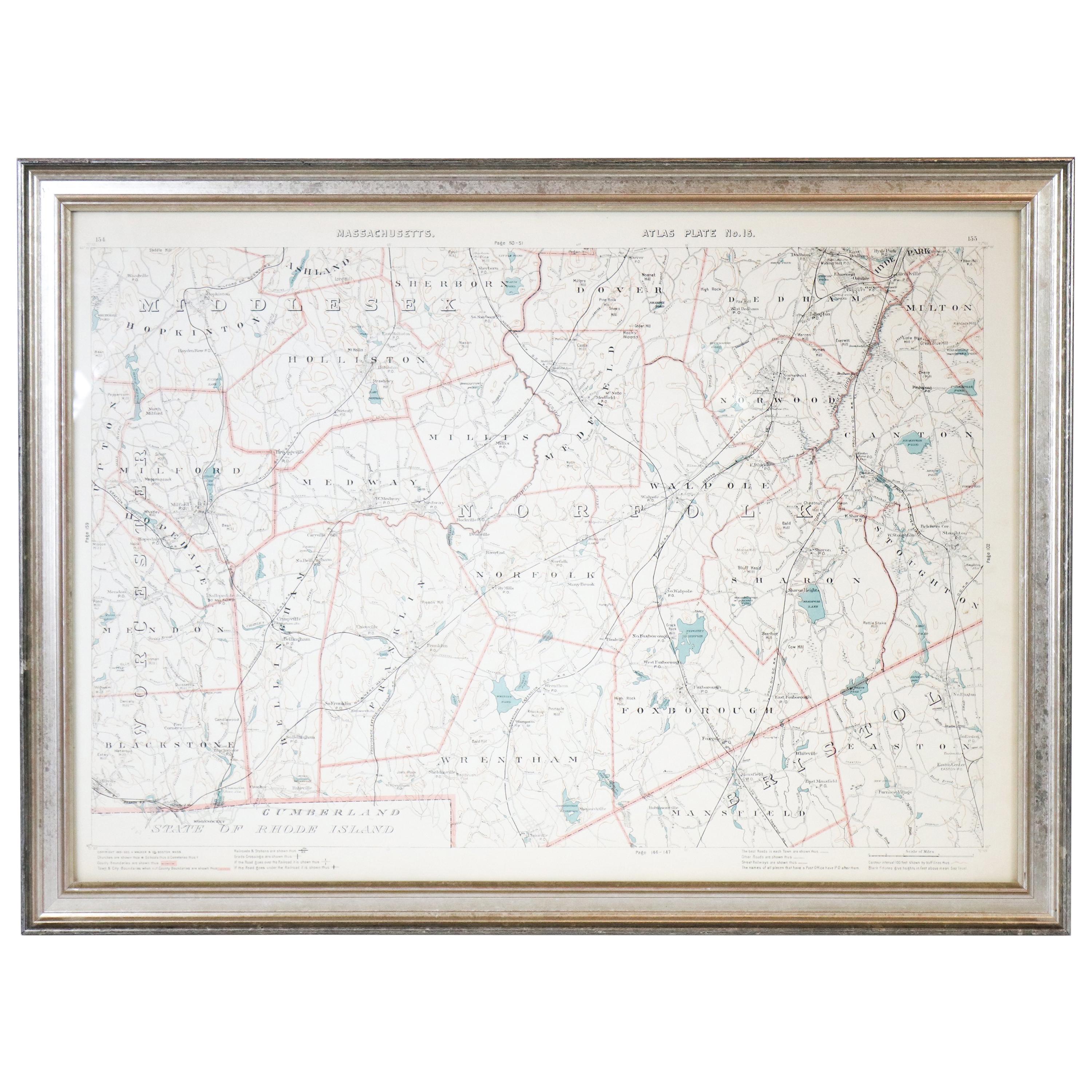
1891 Map of Norfolk County Massachusetts
Located in Norwell, MA
1891 map of Norfolk county Massachusetts including the towns of Wrentham, Franklin, Medfield, Sherborn, Norwood etc., measures: 23 x 31.
Category
Antique 19th Century Maps

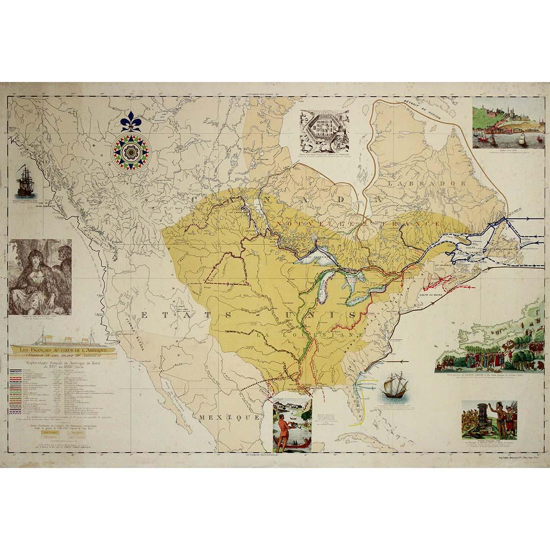
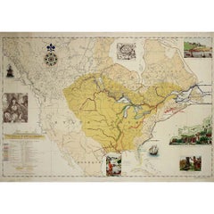
1935 original map French exploration in North America
Located in PARIS, FR
In 1935, a remarkable map titled "Les Français au Cœur de l'Amérique" was produced, highlighting the rich history of French exploration and influence in North America. This map is a ...
Category
1930s Prints and Multiples
Materials
Lithograph, Paper
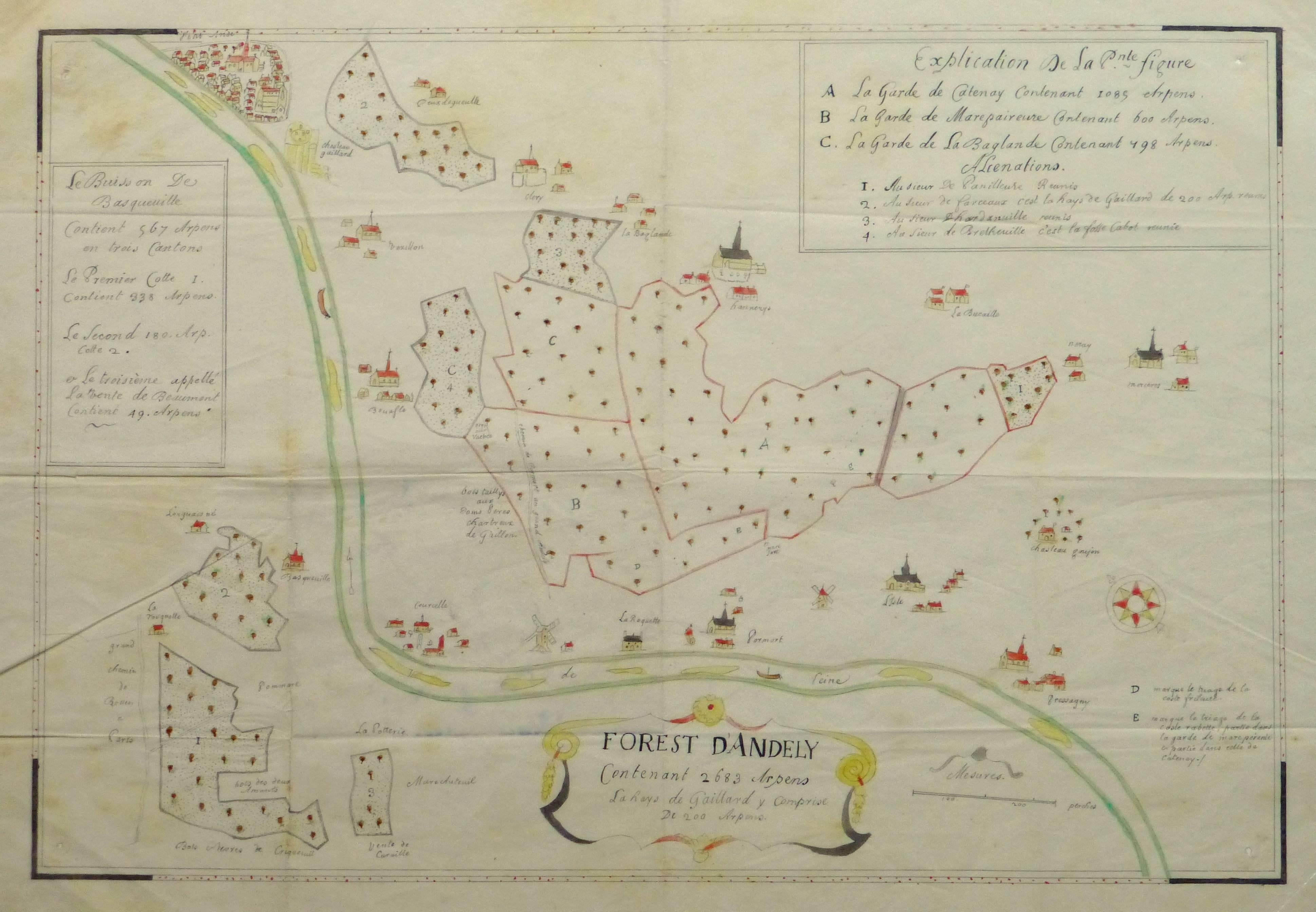
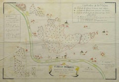
Antique Manuscript Map - Forest of Andely
Located in Houston, TX
Charming hand drawn ink and watercolor map of the Forest of Andely, in the Normandy area, France, circa 1890.
Original artwork on paper displayed on...
Category
1890s More Art
Materials
Ink, Paper, Watercolor
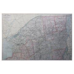
Large Original Antique Map of New York State ( Northern ), USA, C.1900
Located in St Annes, Lancashire
Fabulous map of Northern New York
Original color.
Engraved and printed by the George F. Cram Company, Indianapolis.
Published, C.1900.
Unframed.
Repairs to minor edge tears
Fr...
Category
Antique 1890s American Maps
Materials
Paper
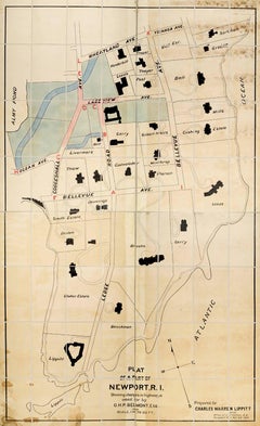
Plan of a Part of Newport, R. I. Showing Changes... O. H. P, Belmont, Esq.
Located in New York, NY
PLAN OF A PART OF NEWPORT, R.I. SHOWING CHANGES IN HIGHWAYS ASKED FOR BY O.H.P. BELMONT, ESQ.
The original ink and watercolor plan on paper from 1907. The plan is extremely large; if fully assembled it would measure no less than 11.5 feet in height and 6.5 feet in breadth. Segmented and backed on modern linen in four sections – each section is 70 x 39 inches. This grand oversized folding map can be folded down to four sections each 17.5 x 11 inches and stored in a modern made leather and marble paper case 18 x 11.75 x 3 inches.
Text continues, "Prepared for Charles Warren Lippitt at the office of J. P. Cotton, C.E. Newport, R.I. Oct. 28, 1907." A fine manuscript plan of the Bellevue neighborhood of Newport, depicting the street layout and the detailed footprints of the area’s many mansions.
The plan was produced at the behest of Charles Warren Lippett (1846-1924), who served as governor of Rhode Island from 1895-1897. The Lippett “Breakwater” mansion is also shown on this plan, situated at the southernmost tip of the peninsula. Though the circumstances are unclear, Lippitt seems to have requested the plan be drawn out of some concern for road construction proposed by Oliver Hazard Perry...
Category
Early 20th Century Naturalistic More Art
Materials
Ink, Watercolor
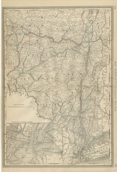
Antique Map of Southeastern New York – Rand McNally, circa 1888
Located in Langweer, NL
Antique Map of Southeastern New York – Rand McNally, circa 1888
This antique map of southeastern New York was published by Rand, McNally & Co. around 1888. It offers a detailed depi...
Category
Antique Late 19th Century American Maps
Materials
Paper
More Ways To Browse
Adirondack Antique
Pop Art Lithograph
Original Travel Posters
Large Scale Sculptures
Atelier Vintage Paris
Limited Edition Prints Framed
Vintage Op Art
Vintage Adult
1960s Black And White Photos
Ex Libris
Framed Giclee Prints
Vanity Fair Vintage
Advertising Art
Signed And Numbered Lithograph
Hollywood Black And White Photography
Used Album Cover
Hand Colored Lithographs
Horse Photographs