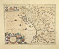
Items Similar to Map of Greece - Original Etching by Antonio Zatta - 18th Century


Want more images or videos?
Request additional images or videos from the seller
1 of 5
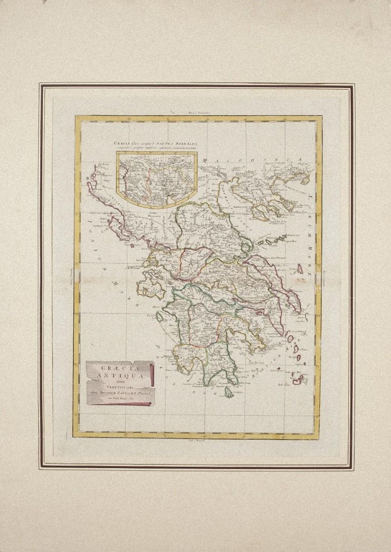
Antonio ZattaMap of Greece - Original Etching by Antonio Zatta - 18th Century18th Century
18th Century
$472.64
£359.69
€400
CA$661.62
A$729.05
CHF 378.15
MX$8,671.12
NOK 4,783.47
SEK 4,481.10
DKK 3,047.15
About the Item
This Map of Greece is an etching realized by Antonio Zatta, Cartographer, publisher and typographer.
The state of preservation of the artwork is good except for the worn paper and the paper is repaired in the middle.
Passepartout 70x50 cm.
- Creator:Antonio Zatta (1757 - 1797)
- Creation Year:18th Century
- Dimensions:Height: 16.54 in (42 cm)Width: 13.39 in (34 cm)Depth: 0.04 in (1 mm)
- Medium:
- Period:1780-1789
- Framing:Framing Options Available
- Condition:Insurance may be requested by customers as additional service, contact us for more information.
- Gallery Location:Roma, IT
- Reference Number:Seller: M-1141221stDibs: LU65037483002
About the Seller
4.9
Platinum Seller
Premium sellers with a 4.7+ rating and 24-hour response times
1stDibs seller since 2017
7,813 sales on 1stDibs
Typical response time: 1 hour
- ShippingRetrieving quote...Shipping from: Roma, Italy
- Return Policy
More From This Seller
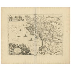
View AllMap of Ancient Greece - Original Etching by Antonio Zatta - 1785
Located in Roma, IT
This Map of ancient Greek is an etching realized by Antonio Zatta in Venice in 1785.
The state of preservation of the artwork is good expect for the worn paper.
Mounted on a cardbo...
Category
1770s Landscape Prints
Materials
Etching

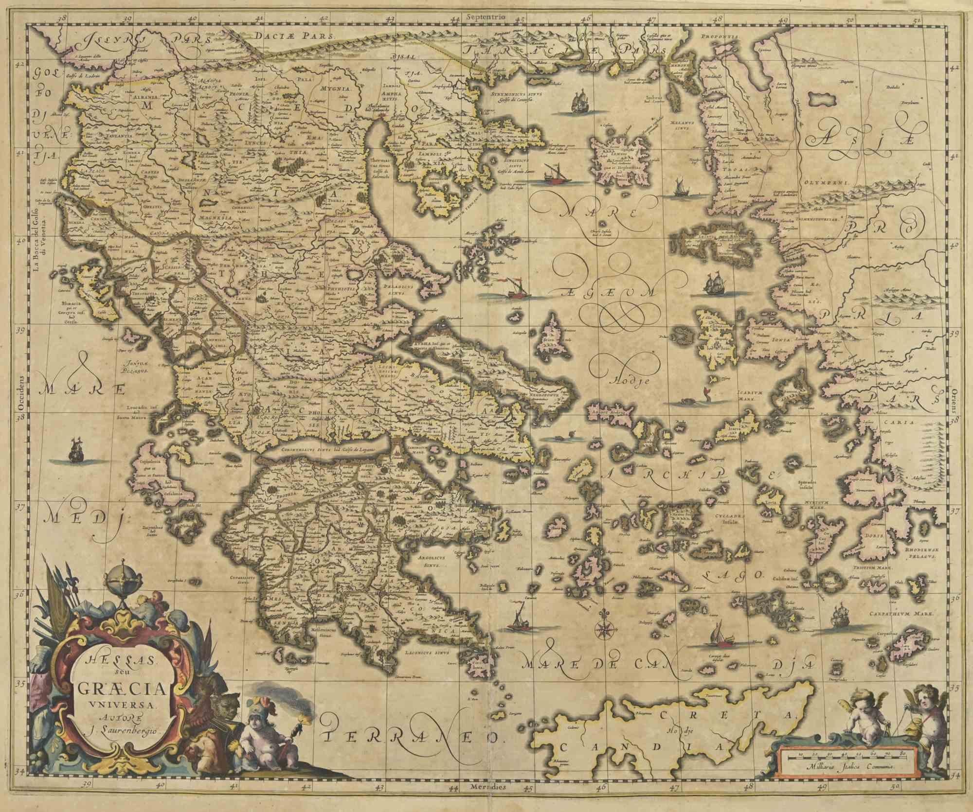
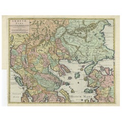
Antique Map - Map of Greece - Etching by Johannes Janssonius - 1650s
By Johannes Janssonius
Located in Roma, IT
Antique Map of Greece - Graecia Vniversa is an antique map realized in 1650 by Johannes Janssonius (1588-1664).
The Map is Hand-colored etching, with coeval watercoloring.
Good co...
Category
1650s Modern Figurative Prints
Materials
Etching

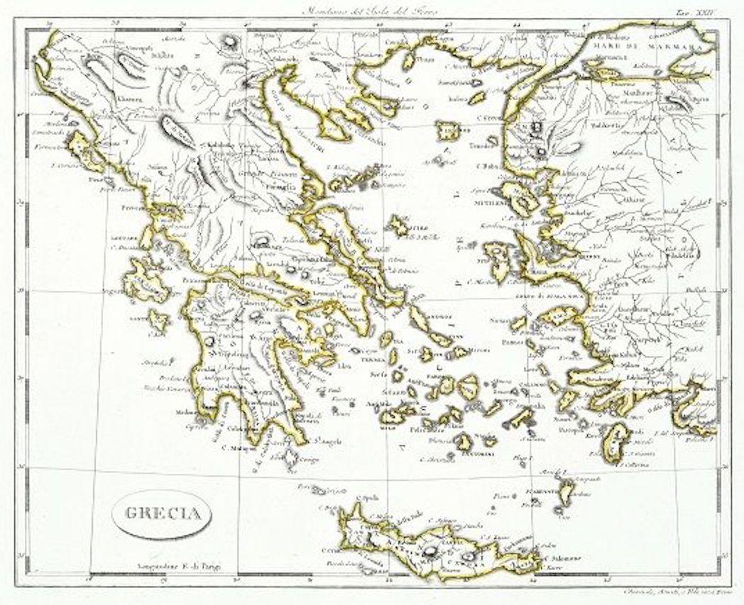
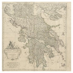
Map of Greece - Etching on Paper 19th Century
Located in Roma, IT
Image dimensions: 22.2 x 27.8 cm.
Grecia is an interesting hand-colored etching on paper, realized by an anonymous artist in the first half of the XIX century.
With the inscriptions in Italian, this original print describes the geography of Greece with the great charisma of the antique maps.
In very good conditions, except for a usual yellowing of the paper at the edges and minor defects and signs of the time, and some light yellow strips...
Category
19th Century Modern Figurative Prints
Materials
Etching

Antique Map - Mar Di Athiopia - Etching by Johannes Janssonius - 1650s
By Johannes Janssonius
Located in Roma, IT
Antique Map - Mar Di Athiopia is an antique map realized in 1650 by Johannes Janssonius (1588-1664).
The Map is Hand-colored etching, with coeval watercolorang.
Good conditions wit...
Category
1650s Modern Figurative Prints
Materials
Etching

Ancient Map - Macedonia - Etching by Johannes Janssonius - 1650s
By Johannes Janssonius
Located in Roma, IT
Macedonia is an ancient map realized in 1650 by Johannes Janssonius (1588-1664).
The Map is Hand-colored etching, with coeval watercoloring.
Good condit...
Category
1650s Modern Figurative Prints
Materials
Etching

Epirus Albania - Etching by Johannes Janssonius - 1650s
By Johannes Janssonius
Located in Roma, IT
Epirus Albania is an ancient map realized in 1650 by Johannes Janssonius (1588-1664).
Good conditions.
From Atlantis majoris quinta pars, Orbem maritimum [Novus Atlas, volume V: ca...
Category
1650s Modern Figurative Prints
Materials
Etching
You May Also Like
Antique Map of Greece by Allard (c.1698)
Located in Langweer, NL
Antique map titled 'Hellas seu Graecia Universa' Detailed map of Greece, with Crete, the Aegean Islands, and part of Turkey. With two cartouches, compass rose and scale. Carolus Alla...
Category
Antique Late 17th Century Maps
Materials
Paper

$926 Sale Price
20% Off
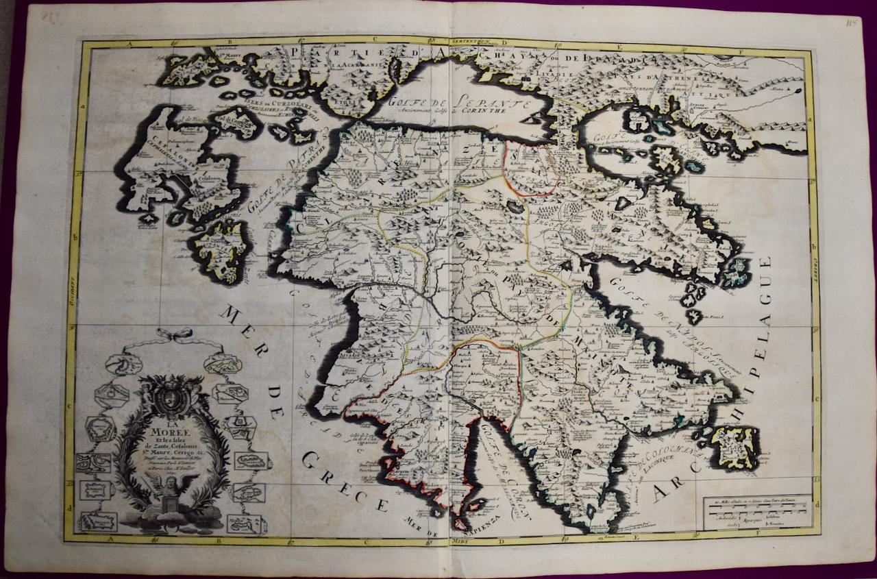
Southern Greece: A Large 17th Century Hand-colored Map By Sanson and Jaillot
By Nicholas Sanson d'Abbeville
Located in Alamo, CA
This large original hand-colored copperplate engraved map of southern Greece and the Pelopponese Peninsula entitled "La Moree Et Les Isles De Zante, Cefalonie, Ste. Marie, Cerigo & C...
Category
1690s Landscape Prints
Materials
Engraving

Antique Map of Epirus 'Albania, Greece' by J. Janssonius, circa 1650
Located in Langweer, NL
This map covers the northwestern coast of Greece and part of present-day Albania. The map was drawn by Johannes Wilhelm Laurenberg, a mathematician and historian who produced several...
Category
Antique Mid-17th Century Maps
Materials
Paper
Antique Engraved Map of the Northern Part of Greece and the Aegean Sea, Ca.1730
Located in Langweer, NL
Title: "GRÆCIÆ PARS Septentrionalis".
Hand Coloured Engraved map by G. Delisle of the northern part of the Aegean. In the top left corner a distance scale included.
Condition...
Category
Antique 1730s Maps
Materials
Paper
Large Scale Map of Greece with Inset Map of Macedonia, c.1786
Located in Langweer, NL
Antique map titled 'Graeciae Antiquae'. Large scale map of Greece, extends south to the island of Cythera. Inset map shows details of Macedonia. Publis...
Category
Antique 18th Century Maps
Materials
Paper
Antique Map of Greece by Seutter or Lotter, 'c.1740'
Located in Langweer, NL
Antique map titled 'Graecia pars Septentrionalis'. Original antique map of Greece, uncommon. Signed cum Gratia et Privil. S.R.I. Vicariatus (..)'. Published by Seutter or Lotter, cir...
Category
Antique Mid-18th Century Maps
Materials
Paper

$652 Sale Price
35% Off
More Ways To Browse
Map Greece
Antique Maps Of Greece
Frank Cassara
Fred Larson
Frederic Remington Lithographs
Frederic Vidalens
Fritz Eichenberg. On Sale
Fudo Myoo
Fuller Potter
G Hoffman
Gaetano Dura On Sale
George Grosz On Sale
George Jo Mess
Giovanni Battista Piranesi Vaso Di Marmo Antico Che Si Vede Nel Museo Capitolino Etching 1778
Grace Albee
Gustave Adolph Hoffman On Sale
H Hargrove
H Otsuka