Items Similar to Epirus Albania - Etching by Johannes Janssonius - 1650s

Want more images or videos?
Request additional images or videos from the seller
1 of 6
Johannes JanssoniusEpirus Albania - Etching by Johannes Janssonius - 1650s1650s
1650s
$2,615.90
£1,962.13
€2,200
CA$3,651.78
A$3,955.32
CHF 2,094.91
MX$47,853.43
NOK 26,336.29
SEK 24,551.02
DKK 16,759.22
About the Item
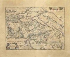
Epirus Albania is an ancient map realized in 1650 by Johannes Janssonius (1588-1664).
Good conditions.
From Atlantis majoris quinta pars, Orbem maritimum [Novus Atlas, volume V: carte marittime]. Amsterdam: Janssonius, 1650. Technique is etching and they are hand watercolored, with coeval watercoloring.
First edition of this famous work by Janssonius also known as the "Waterwereld"; It is the first "maritime atlas (in the true sense of the word) printed in the Netherlands" (Koeman) and published as the fifth volume of the Atlas Novus.
- Creator:Johannes Janssonius (1588 - 1664, Dutch)
- Creation Year:1650s
- Dimensions:Height: 18.71 in (47.5 cm)Width: 23.23 in (59 cm)Depth: 0.04 in (1 mm)
- Medium:
- Movement & Style:
- Period:1650-1659
- Framing:Framing Options Available
- Condition:Insurance may be requested by customers as additional service, contact us for more information.a.
- Gallery Location:Roma, IT
- Reference Number:Seller: T-1411031stDibs: LU650312774062
About the Seller
4.9
Platinum Seller
Premium sellers with a 4.7+ rating and 24-hour response times
1stDibs seller since 2017
7,837 sales on 1stDibs
Typical response time: 1 hour
- ShippingRetrieving quote...Shipping from: Grasse, France
- Return Policy
More From This Seller
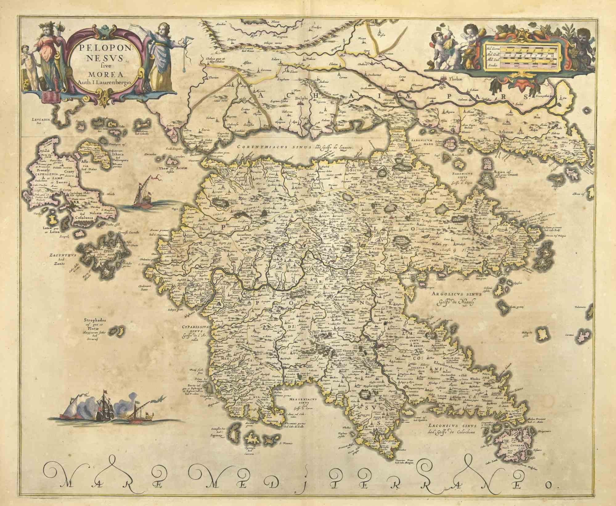
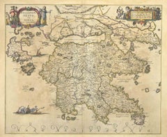
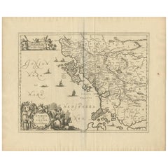
View AllPeloponnesvs (Greece) - Etching by Johannes Janssonius - 1650s
By Johannes Janssonius
Located in Roma, IT
Peloponnesvs is an antique map realized in 1650 by Johannes Janssonius (1588-1664).
The Map is Hand-colored etching, with coeval watercoloring.
Good conditions with slight foxing.
...
Category
1650s Modern Figurative Prints
Materials
Etching
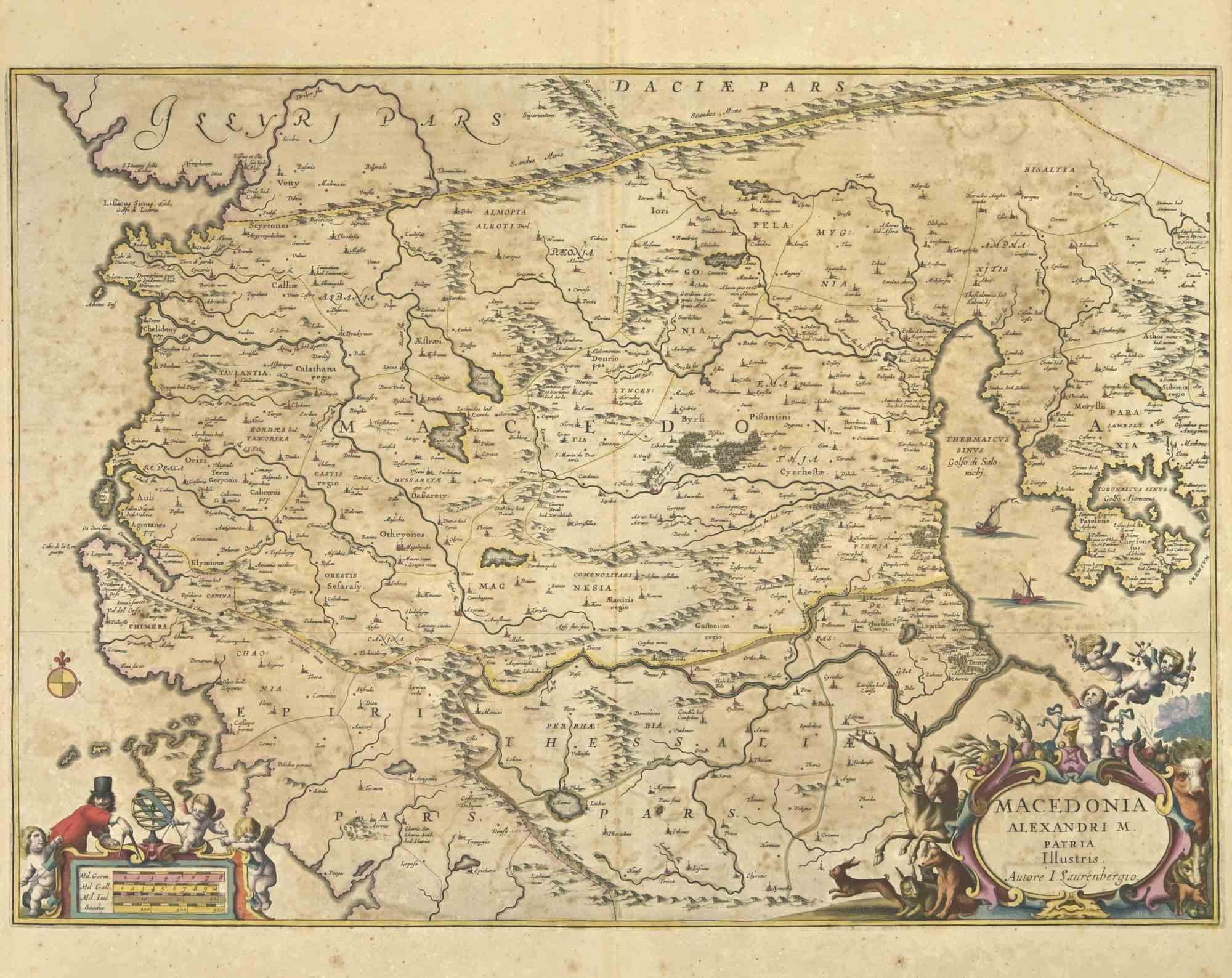
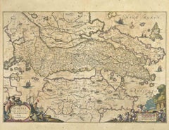
Ancient Map - Macedonia - Etching by Johannes Janssonius - 1650s
By Johannes Janssonius
Located in Roma, IT
Macedonia is an ancient map realized in 1650 by Johannes Janssonius (1588-1664).
The Map is Hand-colored etching, with coeval watercoloring.
Good condit...
Category
1650s Modern Figurative Prints
Materials
Etching

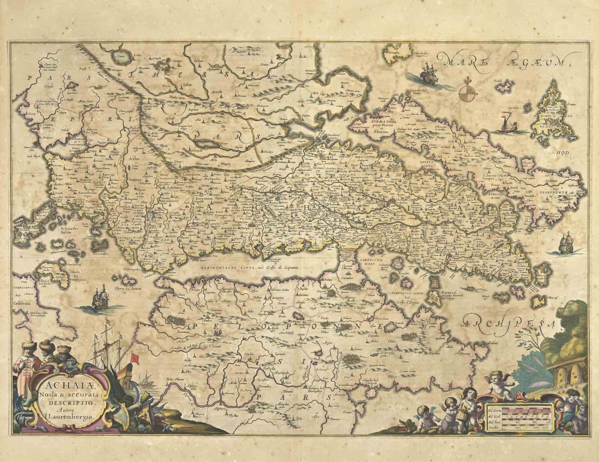
Achaiae Noua - Etching by Johannes Janssonius - 1650s
By Johannes Janssonius
Located in Roma, IT
Achaiae Noua is an ancient map realized in 1650 by Johannes Janssonius (1588-1664).
Good conditions.
From Atlantis majoris quinta pars, Orbem maritimum [Novus Atlas, volume V: cart...
Category
1650s Modern Figurative Prints
Materials
Etching
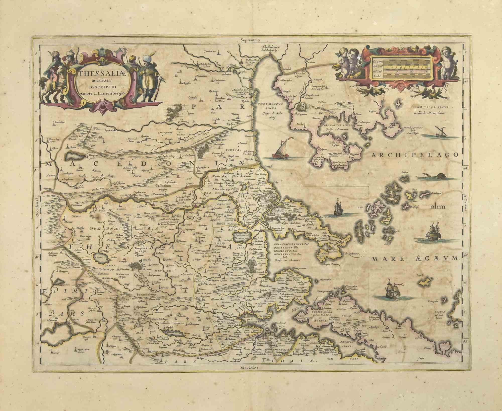
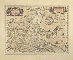
Thesssalia Map - Etching by Johannes Janssonius - 1650s
By Johannes Janssonius
Located in Roma, IT
Thessalia Map is an ancient map realized in 1650 by Johannes Janssonius (1588-1664).
The Map is Hand-colored etching, with coeval watercoloring.
Good conditions.
From Atlantis maj...
Category
1650s Modern Figurative Prints
Materials
Etching
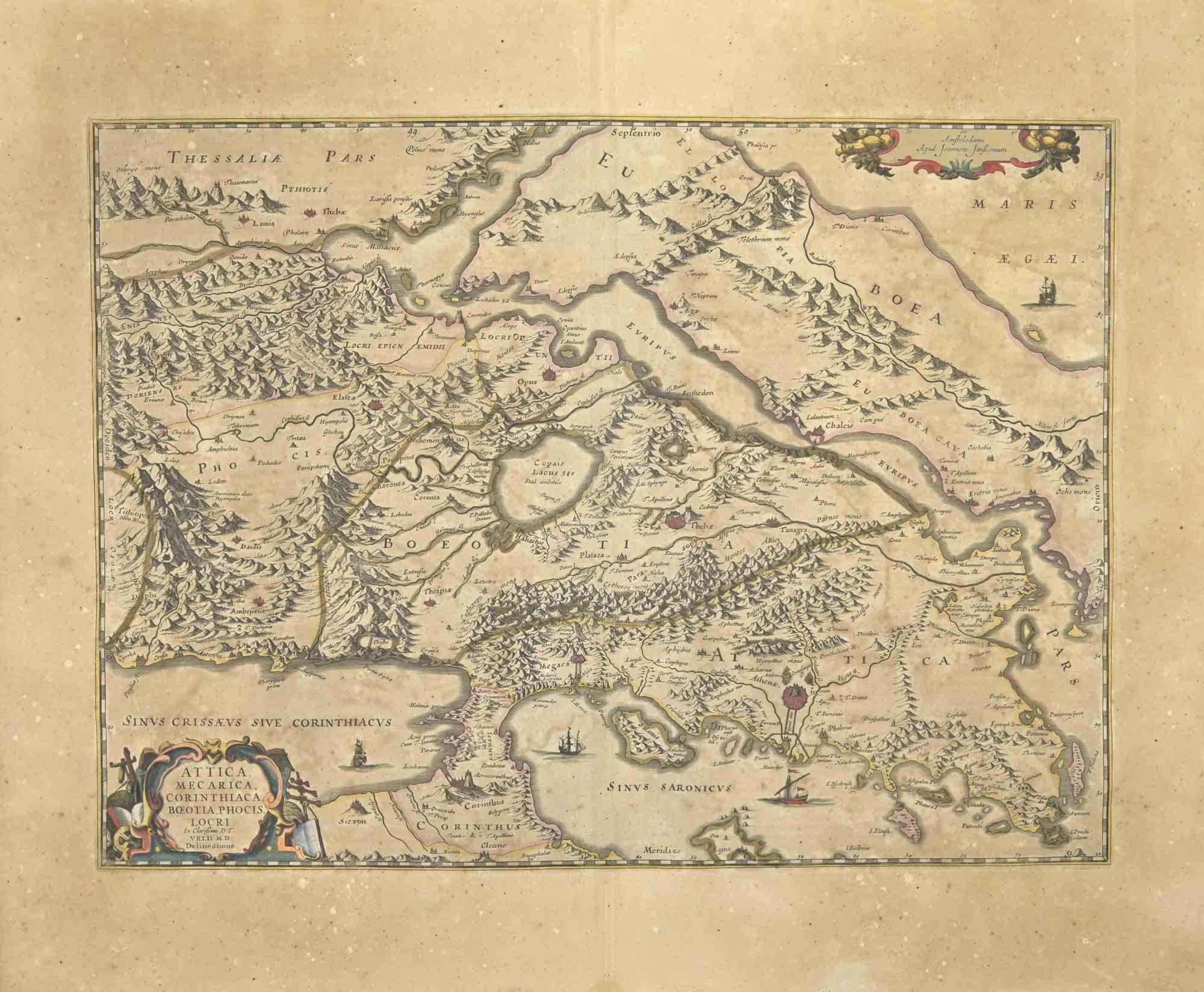
Attica - Etching by Johannes Janssonius - 1650s
By Johannes Janssonius
Located in Roma, IT
Antique Map - Attica is an antique map realized in 1650 by Johannes Janssonius (1588-1664).
The Map is Hand-colored etching, with coeval watercoloring.
Good conditions with slight ...
Category
1650s Modern Figurative Prints
Materials
Etching
Map of Greece - Original Etching by Antonio Zatta - 18th Century
Located in Roma, IT
This Map of Greece is an etching realized by Antonio Zatta, Cartographer, publisher and typographer.
The state of preservation of the artwork is good except for the worn paper and t...
Category
1780s Figurative Prints
Materials
Etching

You May Also Like
Antique Map of Epirus 'Albania, Greece' by J. Janssonius, circa 1650
Located in Langweer, NL
This map covers the northwestern coast of Greece and part of present-day Albania. The map was drawn by Johannes Wilhelm Laurenberg, a mathematician and historian who produced several...
Category
Antique Mid-17th Century Maps
Materials
Paper
Southern Greece: A Large 17th Century Hand-colored Map By Sanson and Jaillot
By Nicholas Sanson d'Abbeville
Located in Alamo, CA
This large original hand-colored copperplate engraved map of southern Greece and the Pelopponese Peninsula entitled "La Moree Et Les Isles De Zante, Cefalonie, Ste. Marie, Cerigo & C...
Category
1690s Landscape Prints
Materials
Engraving

Greece and Ottoman Balkans Map – Homann Engraving ca. 1720
Located in Langweer, NL
Greece and the Danube Basin Map c.1720 – Antique Engraving of the Balkans
This remarkable early 18th-century map presents a sweeping view of southeastern Europe, centering on the co...
Category
Antique 18th Century German Maps
Materials
Paper

Antique Map of Piedmont, Savoy and Liguria by Justus Danckerts, Amsterdam c.1690
Located in Langweer, NL
Map of Piedmont, Savoy and Liguria by Justus Danckerts, Amsterdam c.1690
This richly detailed and decorative map, titled *Tabula Generalis Ducatus Sabaudiae Principatus Pedemontii C...
Category
Antique Late 17th Century Maps
Materials
Paper
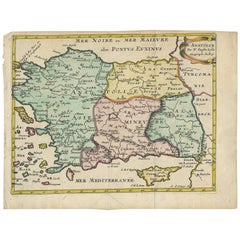
Antique Map of Turkey with Cyprus and Greece Islands by N. Sanson, circa 1652
Located in Langweer, NL
Antique map of Turkey, Anatolie with Cyprus and the Greece islands. Attractive scrolled title cartouche to top right corner. Blank verso.
Category
Antique Mid-17th Century Maps
Materials
Paper
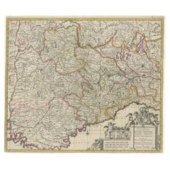
Antique Map of the Region of Lyonnais by Janssonius, '1657'
By Johannes Janssonius
Located in Langweer, NL
Antique map 'Lionnois, forest, beauviolois et masconnois'. Decorative map of the Lyonnais region, France. The Lyonnais is a historical province of France which owes its name to the c...
Category
Antique Mid-17th Century Maps
Materials
Paper

More Ways To Browse
Albanian Antique
Albania Antique Map
Stanislao Lepri
The Fables Chagall
Vintage Berry Picker
Abraham Bloemaert
African Woodcut
Against Apartheid
Ai Weiwei Signed
Albrecht Durer Woodcuts
Alexandra Exter
Allen Jones Lithograph
Antique Prints New Orleans
Botero Poster
Calder Clown
Calder Etching
Cavalier Picasso
Chagall Acrobats