Items Similar to Nova Zemla - Etching by Johannes Janssonius - 1650s
Want more images or videos?
Request additional images or videos from the seller
1 of 5
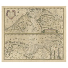
Johannes JanssoniusNova Zemla - Etching by Johannes Janssonius - 1650s1650s
1650s
$2,634.02
£1,959.68
€2,200
CA$3,669.73
A$3,994.06
CHF 2,096.84
MX$48,254.02
NOK 26,317.70
SEK 24,814.48
DKK 16,751.26
About the Item
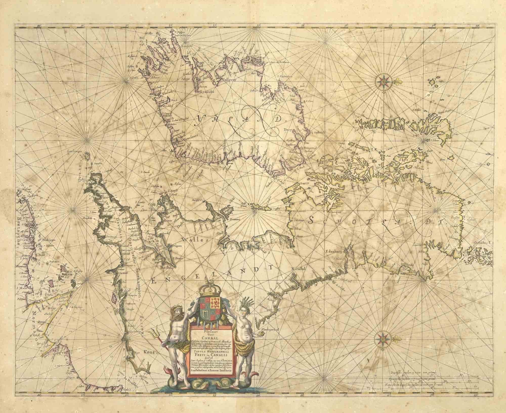
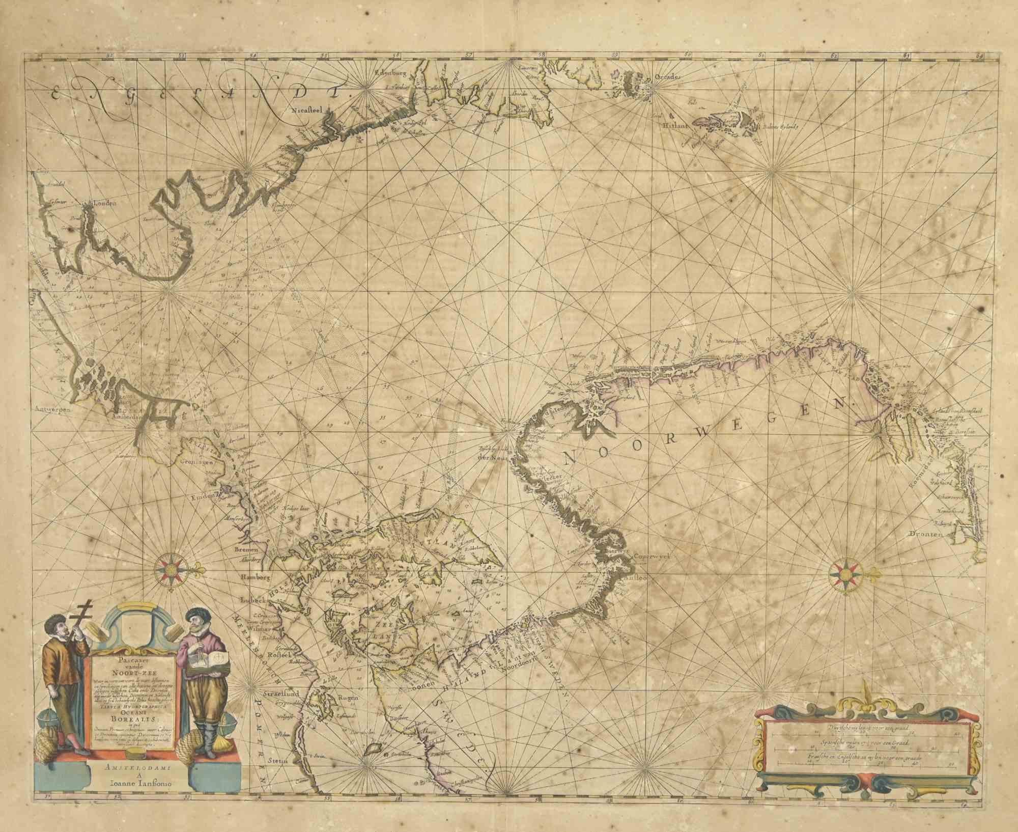
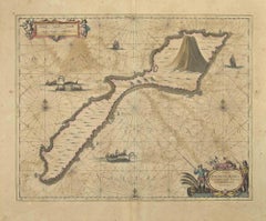
Nova Zemla is an ancient map realized in 1650 by Johannes Janssonius (1588-1664).
Good conditions.
From Atlantis majoris quinta pars, Orbem maritimum [Novus Atlas, volume V: carte marittime]. Amsterdam: Janssonius, 1650. Technique is etching and they are hand watercolored, with coeval watercoloring.
First edition of this famous work by Janssonius also known as the "Waterwereld"; It is the first "maritime atlas (in the true sense of the word) printed in the Netherlands" (Koeman) and published as the fifth volume of the Atlas Novus.
- Creator:Johannes Janssonius (1588 - 1664, Dutch)
- Creation Year:1650s
- Dimensions:Height: 18.71 in (47.5 cm)Width: 23.23 in (59 cm)Depth: 0.04 in (1 mm)
- Medium:
- Movement & Style:
- Period:1650-1659
- Framing:Framing Options Available
- Condition:Insurance may be requested by customers as additional service, contact us for more information.a.
- Gallery Location:Roma, IT
- Reference Number:Seller: T-1411121stDibs: LU650312774252
About the Seller
4.9
Platinum Seller
Premium sellers with a 4.7+ rating and 24-hour response times
1stDibs seller since 2017
7,726 sales on 1stDibs
Typical response time: 2 hours
- ShippingRetrieving quote...Shipping from: Grasse, France
- Return Policy
Authenticity Guarantee
In the unlikely event there’s an issue with an item’s authenticity, contact us within 1 year for a full refund. DetailsMoney-Back Guarantee
If your item is not as described, is damaged in transit, or does not arrive, contact us within 7 days for a full refund. Details24-Hour Cancellation
You have a 24-hour grace period in which to reconsider your purchase, with no questions asked.Vetted Professional Sellers
Our world-class sellers must adhere to strict standards for service and quality, maintaining the integrity of our listings.Price-Match Guarantee
If you find that a seller listed the same item for a lower price elsewhere, we’ll match it.Trusted Global Delivery
Our best-in-class carrier network provides specialized shipping options worldwide, including custom delivery.More From This Seller
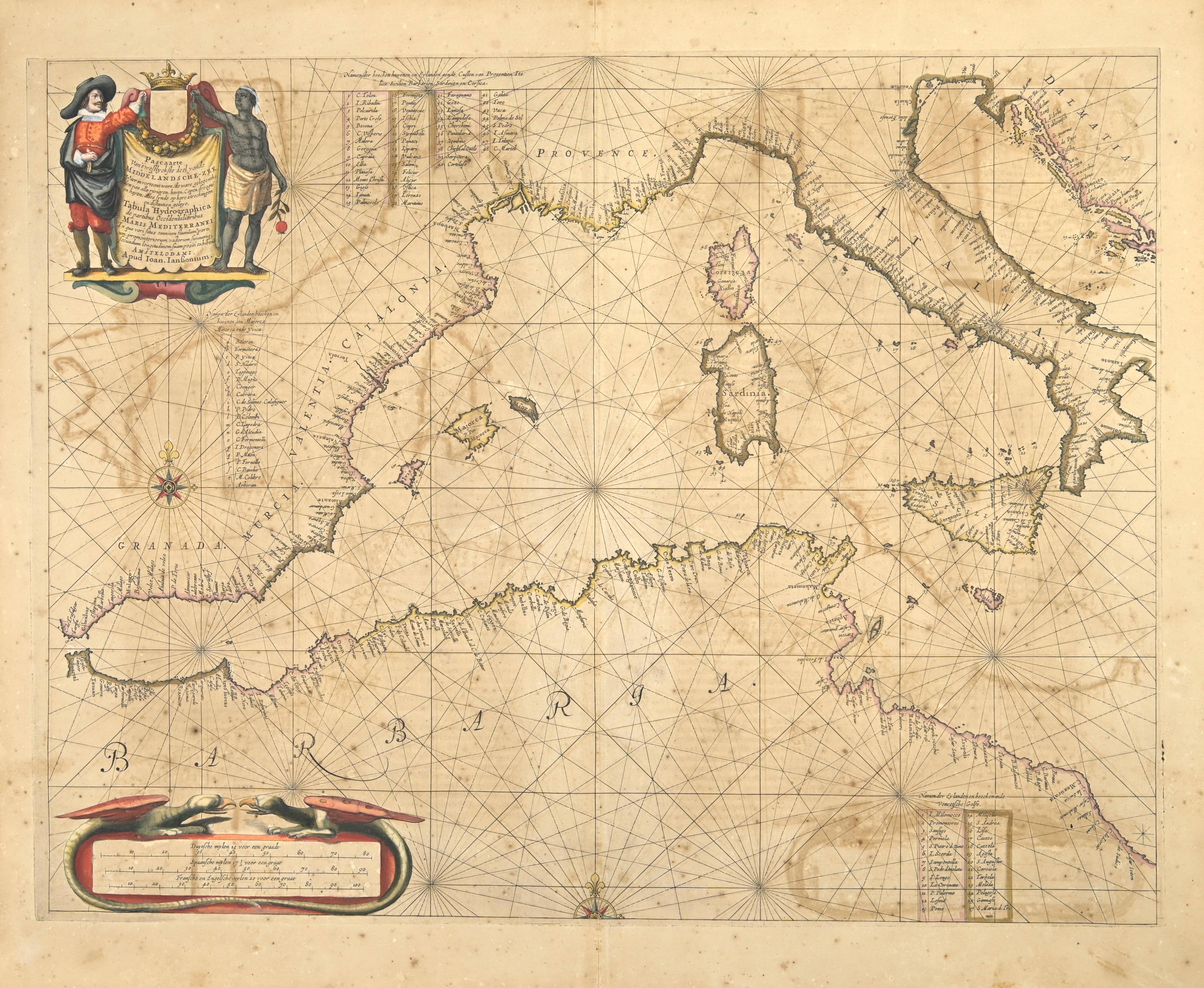
View AllFreti Canalis - Etching by Johannes Janssonius - 1650s
By Johannes Janssonius
Located in Roma, IT
Freti Canalis is an ancient map realized in 1650 by Johannes Janssonius (1588-1664).
Good conditions.
From Atlantis majoris quinta pars, Orbem maritimum [Novus Atlas, volume V: car...
Category
1650s Modern Figurative Prints
Materials
Etching
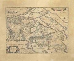
Barbarga - Etching by Johannes Janssonius - 1650s
By Johannes Janssonius
Located in Roma, IT
Barbarga is an ancient map realized in 1650 by Johannes Janssonius (1588-1664).
Good conditions.
From Atlantis majoris quinta pars, Orbem maritimum [Novus Atlas, volume V: carte ma...
Category
1650s Modern Figurative Prints
Materials
Etching
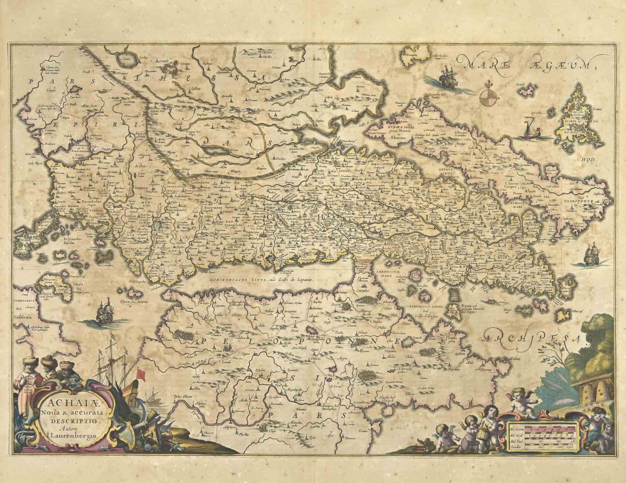
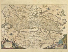
Achaiae Noua - Etching by Johannes Janssonius - 1650s
By Johannes Janssonius
Located in Roma, IT
Achaiae Noua is an ancient map realized in 1650 by Johannes Janssonius (1588-1664).
Good conditions.
From Atlantis majoris quinta pars, Orbem maritimum [Novus Atlas, volume V: cart...
Category
1650s Modern Figurative Prints
Materials
Etching
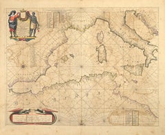
Oceanus - Etching by Johannes Janssonius - 1650s
By Johannes Janssonius
Located in Roma, IT
Antique Map - Oceanus is an antique map realized in 1650 by Johannes Janssonius (1588-1664).
The Map is Hand-colored etching, with coeval watercoloring.
Good conditions with slight...
Category
1650s Modern Figurative Prints
Materials
Etching
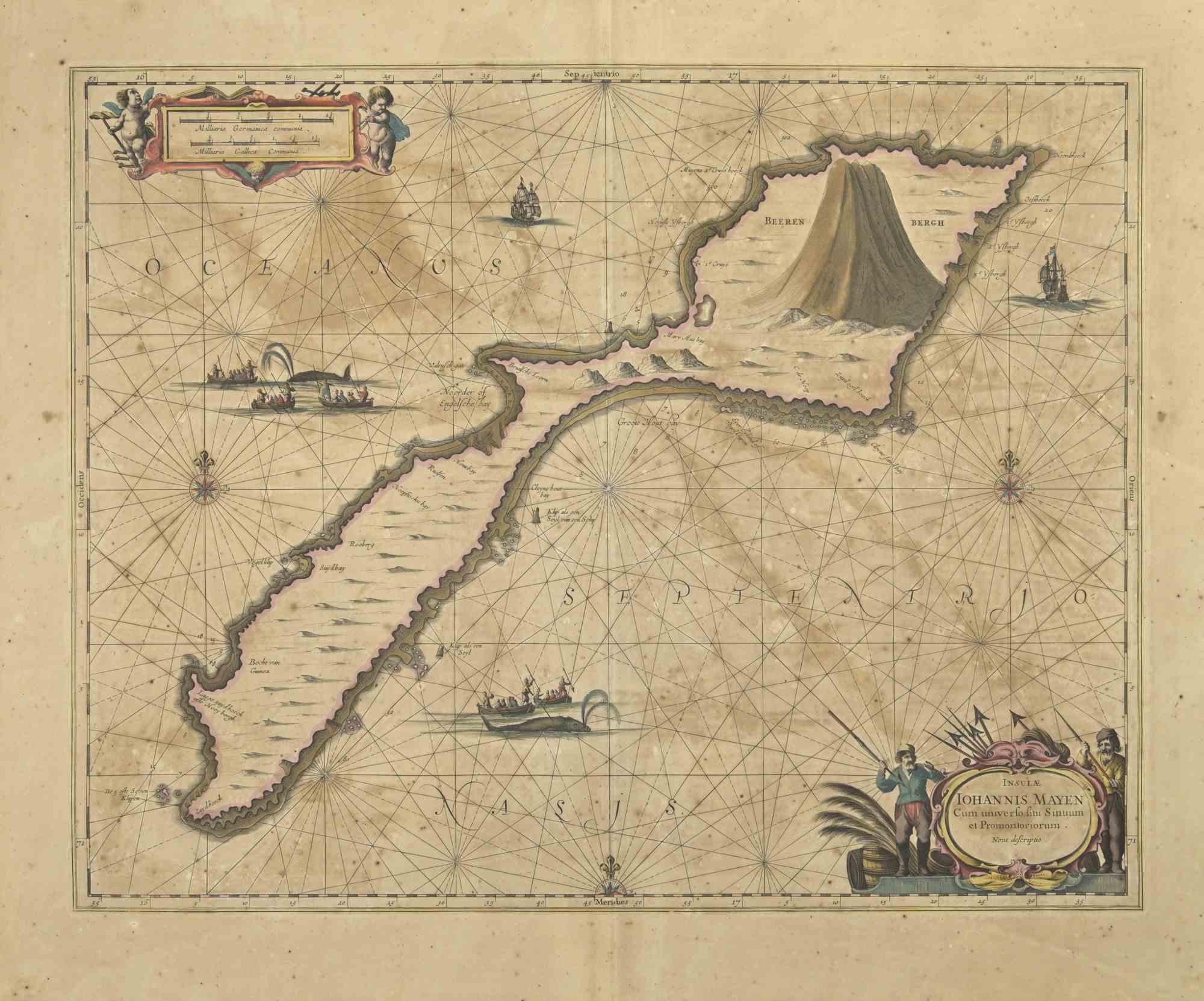
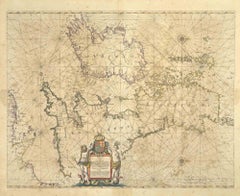
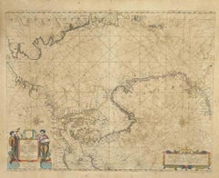
Oceani Borealis - Etching by Johannes Janssonius - 1660s
By Johannes Janssonius
Located in Roma, IT
Oceani Borealis is an ancient map realized in 1650 by Johannes Janssonius (1588-1664).
Good conditions.
From Atlantis majoris quinta pars, Orbem maritimum [Novus Atlas, volume V: c...
Category
1660s Modern Figurative Prints
Materials
Etching
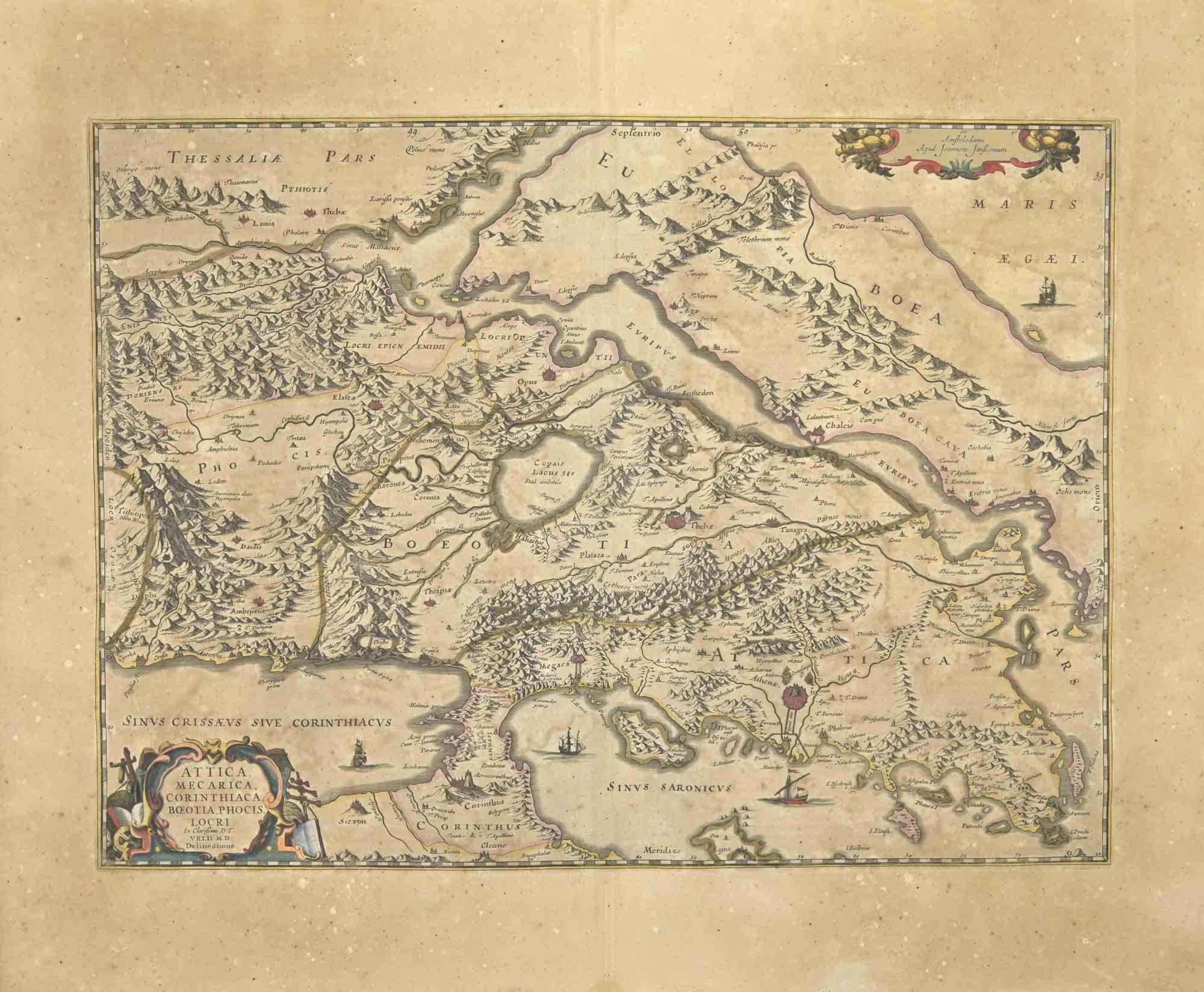
Attica - Etching by Johannes Janssonius - 1650s
By Johannes Janssonius
Located in Roma, IT
Antique Map - Attica is an antique map realized in 1650 by Johannes Janssonius (1588-1664).
The Map is Hand-colored etching, with coeval watercoloring.
Good conditions with slight ...
Category
1650s Modern Figurative Prints
Materials
Etching
You May Also Like
Antique Map of Nova Zembla by Janssonius, c.1650
Located in Langweer, NL
Antique map titled 'Nova Zemla, waygats fretum Nassovi cum et terra Samoiedum singula omnium emendatissime descripta'. This map depicts Nova Zembla and the northern continental coast...
Category
Antique 17th Century Maps
Materials
Paper

$380 Sale Price
20% Off
Rugen Island, Germany: An Early 17th Century Map by Mercator and Hondius
By Gerard Mercator
Located in Alamo, CA
This is an early 17th century map entitled "Nova Famigerabilis Insulae Ac Ducatus Rugiae Desciptio" (Map of Rugen Island, Germany) by Gerard Mercator and Henricus and Joducus Hondiu...
Category
Early 17th Century Old Masters Landscape Prints
Materials
Engraving

Two Original Antique Engravings with the Dutch and German North Sea Coast, c1650
Located in Langweer, NL
Antique map titled 'Nieuwe Caerte waerinne vertoont wordt de gantsche Vaert van Amsterdam over de Watten tot de stadt Hamborch toe'.
Two maps with the Dutch and German North Sea ...
Category
Antique 1650s Maps
Materials
Paper
$564 Sale Price
20% Off
Westras: A Jan van Aveelen Engraving from 'Suecia Antiqua et Hodierna', 1701
Located in Langweer, NL
Original antique engraving of 'Westras' or Västerås in Sweden
The location referred to in the print is likely "Westras," which seems to be a historic name or variant spelling relate...
Category
Antique Early 1700s Prints
Materials
Paper
$431 Sale Price
20% Off
Free Shipping
Antique Engraving of Dutch and German North Sea Coast of Friesland, ca.1680
Located in Langweer, NL
Antique map titled 'Tabula Nova In qua accuratè demonstratur tota Navigatio ab Amstelodami Statione per Vada vulgo de Watten Hamburgum usq.' -
Two maps with the Dutch and German North Sea coast of Friesland, with West Frisian Islands and below East Frisian Islands with inset map of the Elbe around Hamburg. With title and a scale cartouche. Map by Henricus Hondius...
Category
Antique 1680s Maps
Materials
Paper
$1,101 Sale Price
20% Off
Antique Map of Nova Zembla ‘Russia’ by J.N. Bellin, 1758
Located in Langweer, NL
An interesting map of Nova Zembla and surrounding areas. With details on the eastern tip of Nova Zembla of the place where the stranded Dutch sailors under Willem Barentsz spent the ...
Category
Antique Mid-18th Century Maps
Materials
Paper

$229 Sale Price
20% Off
More Ways To Browse
Stanislao Lepri
The Fables Chagall
Vintage Berry Picker
Abraham Bloemaert
African Woodcut
Against Apartheid
Ai Weiwei Signed
Albrecht Durer Woodcuts
Alexandra Exter
Allen Jones Lithograph
Antique Prints New Orleans
Botero Poster
Calder Clown
Calder Etching
Cavalier Picasso
Chagall Acrobats
Chagall Daphnis And Chloe
Chagall Esther