Items Similar to Map of Battle of Smolensk - Etching by Pierre François Tardieu - 1837

Want more images or videos?
Request additional images or videos from the seller
1 of 2
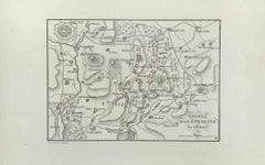
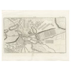
Pierre Francois TardieuMap of Battle of Smolensk - Etching by Pierre François Tardieu - 18371837
1837
$295.09
£224.74
€250
CA$413.65
A$452.54
CHF 236.35
MX$5,407.97
NOK 2,969.45
SEK 2,794.73
DKK 1,904.30
About the Item
Map of Battle of Smolensk is an Etching realized by Pierre François Tardieu in 1837.
Good conditions.
The artwork is realized in a well-balanced composition. the artwork and belongs to the suite suite "AtlasBatt" realized within Jacques Norvins' Histoire de Napoleon, published in 1837. Author Jacques Norvins published one of the most comprehensive and influential histories on the life and military career of Napoleon, trought the works of the most important engravers of the time.
- Creator:Pierre Francois Tardieu
- Creation Year:1837
- Dimensions:Height: 5.12 in (13 cm)Width: 8.67 in (22 cm)Depth: 0.04 in (1 mm)
- Medium:
- Movement & Style:
- Period:
- Framing:Framing Options Available
- Condition:Insurance may be requested by customers as additional service, contact us for more information.
- Gallery Location:Roma, IT
- Reference Number:Seller: T-1475711stDibs: LU650314140222
About the Seller
4.9
Platinum Seller
Premium sellers with a 4.7+ rating and 24-hour response times
1stDibs seller since 2017
7,797 sales on 1stDibs
Typical response time: 1 hour
- ShippingRetrieving quote...Shipping from: Grasse, France
- Return Policy
More From This Seller
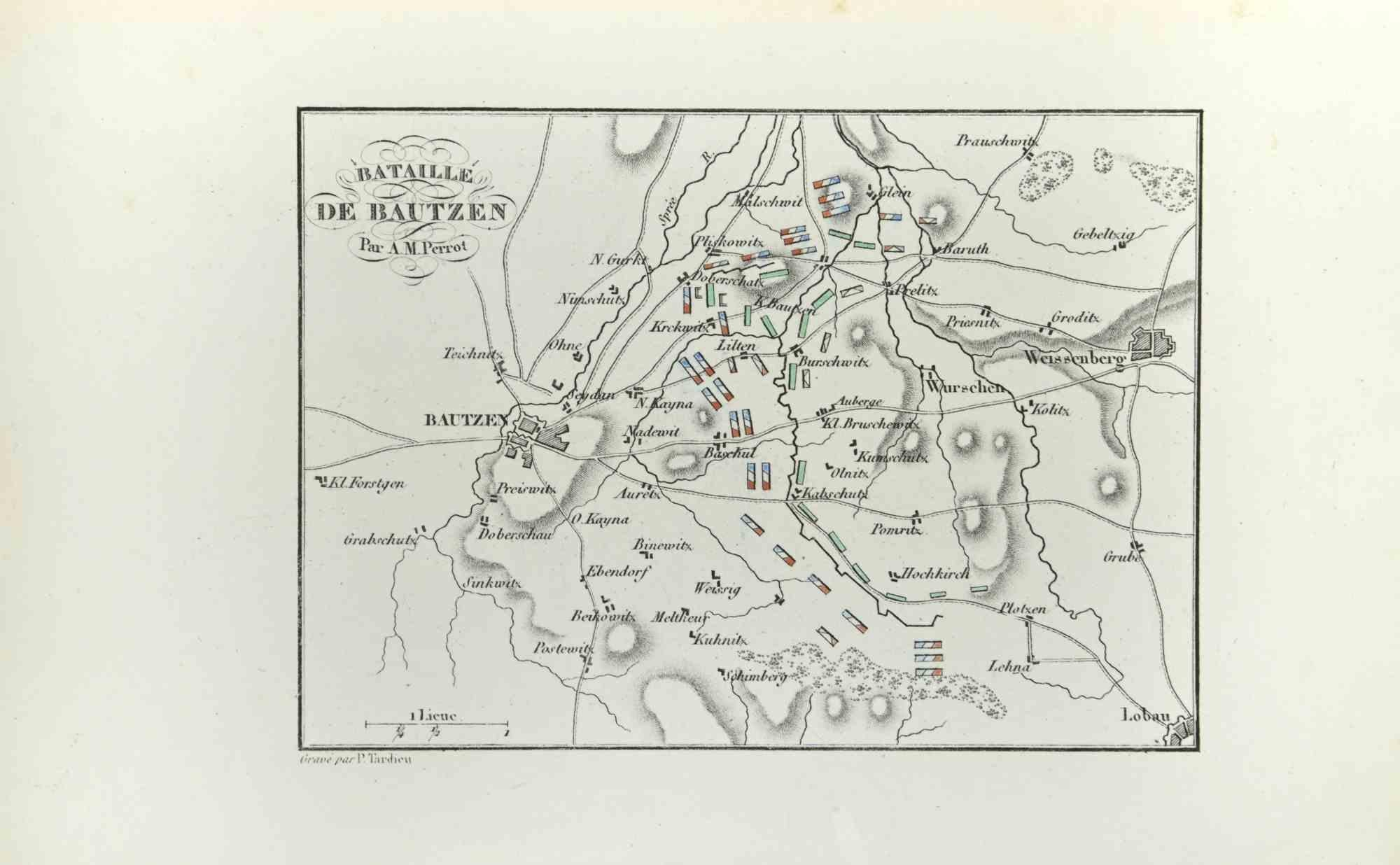
View AllBattle of Bautzen - Etching by Pierre François Tardieu - 1837
Located in Roma, IT
Battle of Bautzen is an Etching realized by Pierre François Tardieu in 1837.
Good conditions.
The artwork is realized in a well-balanced composition. the artwork and belongs to the...
Category
1830s Modern Figurative Prints
Materials
Lithograph
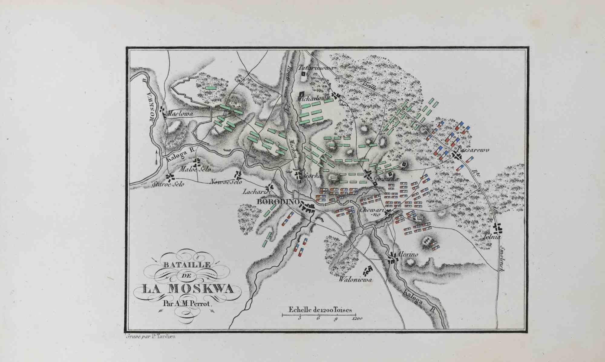
Bataille de la Moskwa - Etching by Pierre François Tardieu - 1837
Located in Roma, IT
Bataille de la Moskwa is an Etching realized by Pierre François Tardieu in 1837.
It represents one of the most famous battles of Napoleon.
Good conditions.
The artwork is realized...
Category
1830s Modern Figurative Prints
Materials
Lithograph

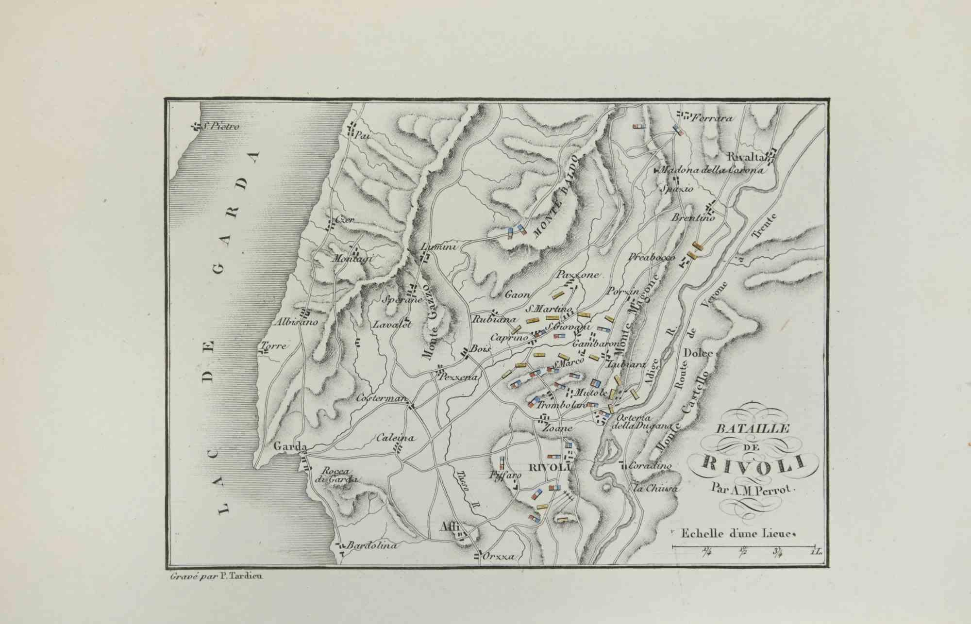
Map of Battle of Rivoli - Etching by Pierre François Tardieu - 1837
Located in Roma, IT
Map of Battle of Rivoli is an Etching realized by Pierre François Tardieu in 1837.
Good conditions.
The artwork is realized in a well-balanced composition. the artwork and belongs ...
Category
1830s Modern Figurative Prints
Materials
Lithograph
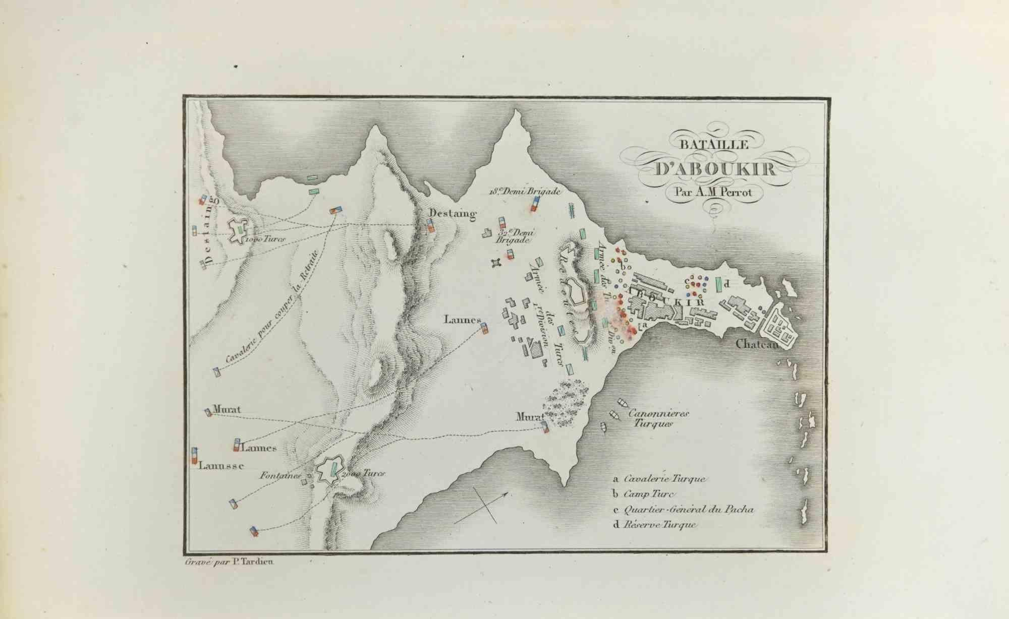
Map of Battle of Aboukir - Etching by Pierre François Tardieu - 1837
Located in Roma, IT
Map of Battle of Aboukir is an Etching realized by Pierre François Tardieu in 1837.
Good conditions.
The artwork is realized in a well-balanced composition. and belongs to the sui...
Category
1830s Modern Figurative Prints
Materials
Etching
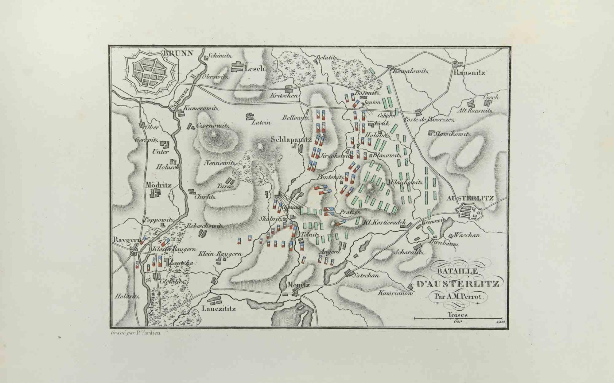
Battle of Austerlitz - Etching by Pierre François Tardieu - 1837
Located in Roma, IT
Battle of Austerlitz is an Etching realized by Pierre François Tardieu in 1837.
Good conditions.
The artwork is realized in a well-balanced composition. the artwork and belongs to ...
Category
1830s Modern Figurative Prints
Materials
Lithograph
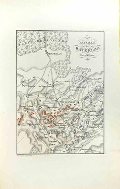
Map of Battle of Waterloo - Etching by Pierre François Tardieu - 1837
Located in Roma, IT
Map of Battle of Waterloo is an Etching realized by Pierre François Tardieu in 1837.
Good conditions.
The artwork is realized in a well-balanced composition. the artwork and belong...
Category
1830s Modern Figurative Prints
Materials
Etching
You May Also Like
Detailed 1720s Map – Siege of Douay and Lines of Circumvallation, France
Located in Langweer, NL
Detailed 1720s Map – Siege of Douay and Lines of Circumvallation, France
This engraved map shows the detailed fortifications and surrounding region of Douay (Douai) in northern Fran...
Category
Antique Early 18th Century French Maps
Materials
Paper
Detailed 1729 Battle Map – Allied Army Camp at Denain France, 1712 Siege
Located in Langweer, NL
Map of Allied Camp at Denain, France, 1712 Attack – Published 1729
This engraved map depicts the army camp of the Allied forces at Denain, attacked by the French on July 24, 1712 du...
Category
Antique Early 18th Century Dutch Maps
Materials
Paper
Antique War Map of the Region of Mons 'Bergen', Belgium, circa 1810
Located in Langweer, NL
Antique print titled 'Plate DLIV War'. Old print depicting a war map of the region of Mons (Bergen), Belgium. This print originates from 'Encyclopedia Britannica'.
Artists and En...
Category
Antique 19th Century Prints
Materials
Paper
$122 Sale Price
20% Off
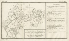
Antique Map of the Region of the Sok River in Russia, 1794
Located in Langweer, NL
Antique map titled 'Carte de la Contrée qui s’étend le long de la Soka, depuis sa source jusquá Sergiefskoi Prigorod et le long des petites rivieres de Sourgout et de Schoumbout’.
...
Category
Antique 18th Century Maps
Materials
Paper
Henri Liebaux and Guillaume De L'Isle - 1706 Engraving, Map Of The Moscovites
Located in Corsham, GB
A early 18th Century map showing a section of Muscovite Russia. This is the lower half of the complete original map, finished with hand colouring. The artist's names are engraved in ...
Category
18th Century More Prints
Materials
Engraving
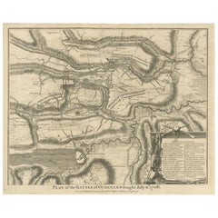
Antique Print of the Battle of Oudenard by I. Basire, 1751
Located in Langweer, NL
Plan of the Battle of Oudenard, fought during the war of the Spanish Succession (1701-1714), in which the Allies, led by Marlborough and Prince Eugene of Savoy, beat the French under the leadership of Louis Joseph, duc de Vendôme, and Louis, duc de Bourgogne (later the Dauphin, but died of measles at 29). The French commanders had quarrelled, resulting in a divided force that was easily beaten. Nicholas Tindal (1687-1774), at one time Chaplain to Greenwich Hospital...
Category
Antique Mid-18th Century Prints
Materials
Paper
More Ways To Browse
Die Schaffenden
Diego Rivera Print New York Graphic Society
Foujita Woodcut
Francois Langlois
G Barbier
George Bellows Lithographs
George Harrison Marks
George Rouault Woodcut
Gerard Dou
Giacometti Annette
Giorgio Morandi Etching
Goupil Prints
Henry Moore Sculptural Ideas
Hermes Paris Rue Du Faubourg Saint Honore
Hockney Glasses
Hockney Olympic
Homage To Chagall
Howard Smith