Items Similar to Direccion de Hidrografia... - Etching by Tomàs Gozàlez - 1802

Want more images or videos?
Request additional images or videos from the seller
1 of 5
Tomàs GozàlezDireccion de Hidrografia... - Etching by Tomàs Gozàlez - 18021802
1802
$1,017.80
£773.91
€860
CA$1,428.08
A$1,560.47
CHF 809
MX$18,642.05
NOK 10,295.02
SEK 9,638.58
DKK 6,550.23
About the Item
Etching on paper realized, among the others, by Tomàs Gozàlez.
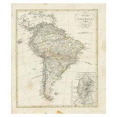
From Juan Corradi, Descubrimiento y conquista de la América o Compendio de la historia general del Nuevo Mundo, Madrid, Imprenta Real, 1803 (translated by William Robertson, History of America, Edinburgh,1777). At the bottom margin are the indications of responsibility: Tomás González (principal author), José María Cardano, Felipe Cardano (engravers), Juan Morata y Gangoiti (engraver of the text). Rare map of Mexico, Texas, Alta and Baja California, Rocky Mountains and contiguous regions, published in Spain at the beginning of the 19th century. Fascinating topographical restitution, finely engraved and with good representation of the hydrography of the rivers of the region, although it retains an unnamed lake, Timpanagos and a Rio de Dolores that flow into the San Francisco Bay. The lack of detail in the map is probably a product of the Spanish doctrine of secrecy in the regions then controlled by Spain: it allowed a topographical representation of the region but omitted place names.
Three margins as originally, left resected at the framing line. Editorial folds from insertion in volume.
- Creator:Tomàs Gozàlez
- Creation Year:1802
- Dimensions:Height: 20.87 in (53 cm)Width: 14.1 in (35.8 cm)Depth: 0.04 in (1 mm)
- Medium:
- Movement & Style:
- Period:
- Framing:Framing Options Available
- Condition:Insurance may be requested by customers as additional service, contact us for more information.
- Gallery Location:Roma, IT
- Reference Number:Seller: T-1532381stDibs: LU650315863972
About the Seller
4.9
Platinum Seller
Premium sellers with a 4.7+ rating and 24-hour response times
1stDibs seller since 2017
7,810 sales on 1stDibs
Typical response time: 1 hour
- ShippingRetrieving quote...Shipping from: Grasse, France
- Return Policy
More From This Seller
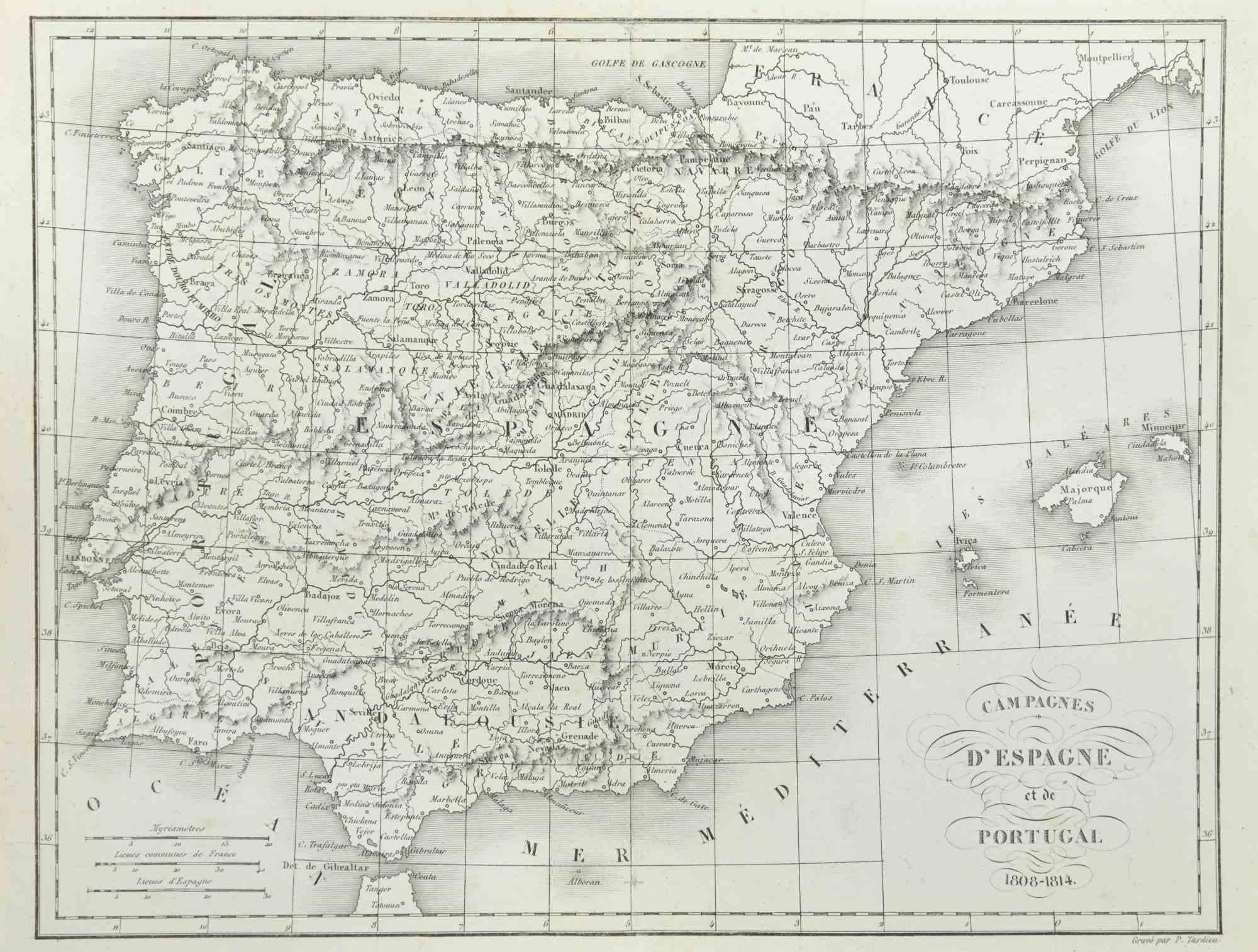
View AllMap of Spain and Portugal - Etching by Pierre François Tardieu - 1837
Located in Roma, IT
Map of Spain and Portugal is an Etching realized by Pierre François Tardieu in 1837.
Good conditions.
The artwork is realized in a well-balanced composition. the artwork and belong...
Category
1830s Modern Figurative Prints
Materials
Lithograph

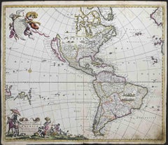
Novissima et Accuratissima... - Etching by Frederick de Wit - 1680 ca
By Frederick de Wit
Located in Roma, IT
This double-page etching with contemporary coloring, entitled Novissima et Accuratissima Septentrionalis ac Meridionalis Americae, was realized by the cartographer Frederick de Wit f...
Category
1680s Modern Figurative Prints
Materials
Etching
$1,325 Sale Price
20% Off
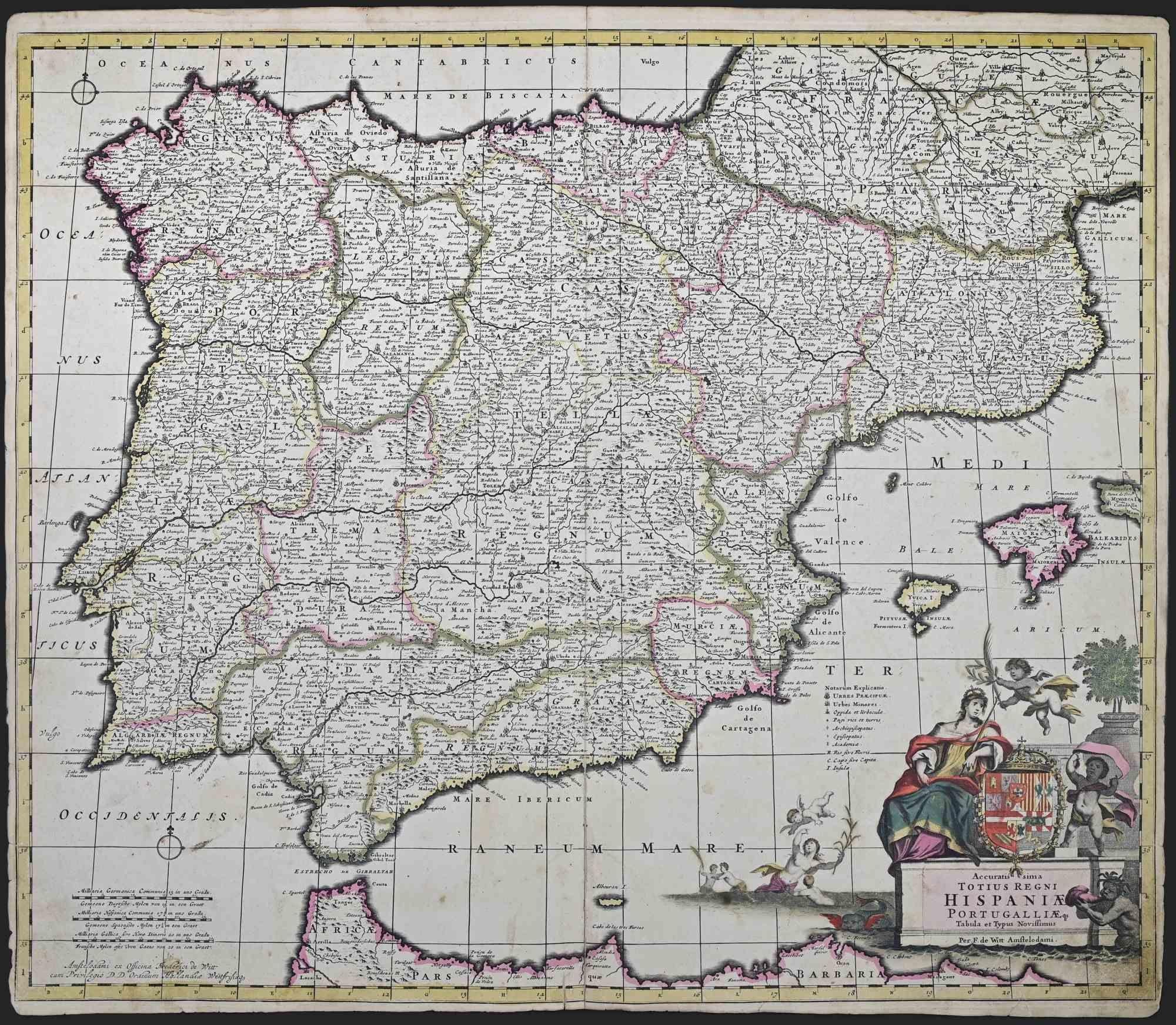
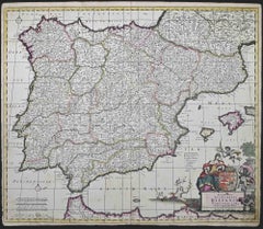
Accuratissima Totius Regni Hispaniae... - Etching by Frederick de Wit - 1680ca
By Frederick de Wit
Located in Roma, IT
This double-page etching with contemporary coloring, entitled Accuratissima Totius Regni Hispaniae Portugalliae, was realized by the cartographer Frederick de Wit for the famous Atla...
Category
1680s Modern Figurative Prints
Materials
Etching
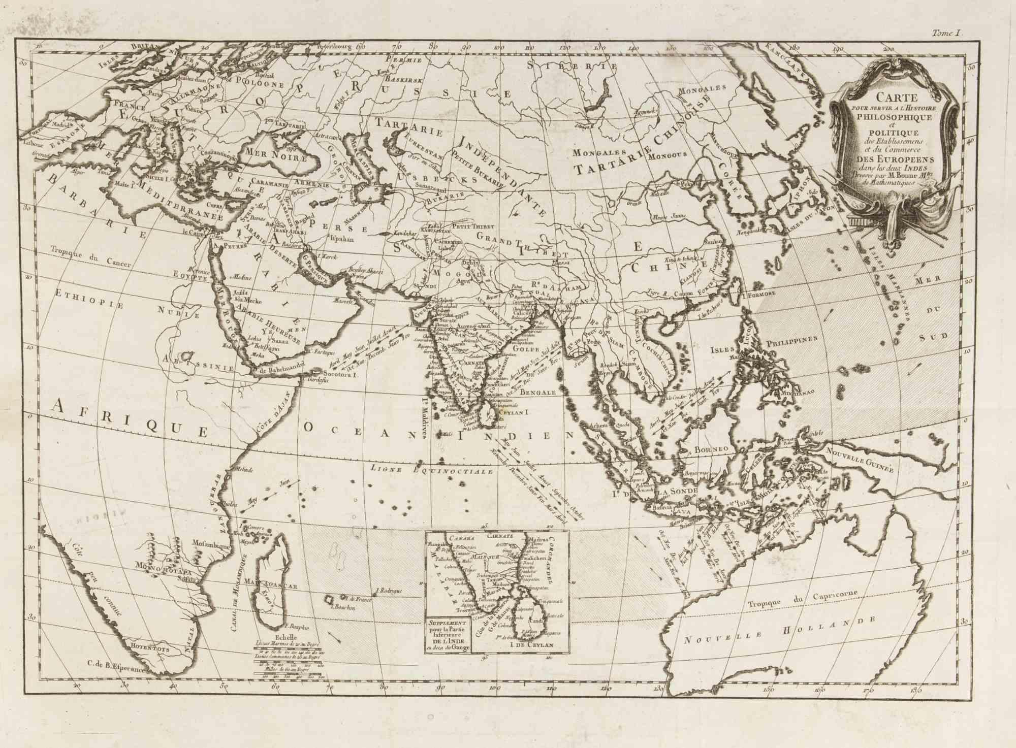
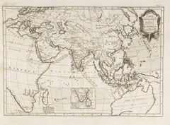
Carte Pour Servir a l'Histoire Philosophique.. - Etching by Rigobert Bonne- 1780
Located in Roma, IT
Etching on paper.
From Guillaume-Thomas Raynal, Histoire philosophique et politique des établissemens et du commerce des Européens dans les deux Indes, Geneva 1780.
This interestin...
Category
1780s Modern Figurative Prints
Materials
Etching
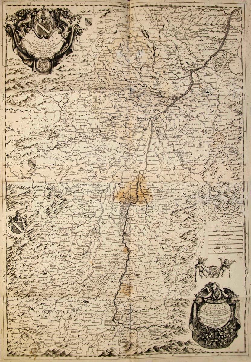
Valsavia Superiore e Inferiore - Etching by V. M. Coronelli - Late 17th century
By Vincenzo Maria Coronelli
Located in Roma, IT
Valsavia Superiore e Inferiore is a beautiful historical etching on ivory-colored paper, realized by Vincenzo Maria Coronelli (1650-1718) in the late 17th century.
This interesting ...
Category
Late 17th Century Figurative Prints
Materials
Paper, Etching

Map of Spain and Portugal - Original Etching - Late 19th Century
Located in Roma, IT
This Map of Spain and Portugal is an etching realized by an anonymous artist.
The state of preservation of the artwork is good with some small diffused stains.
Sheet dimension: 28...
Category
Late 19th Century Modern Figurative Prints
Materials
Etching

You May Also Like
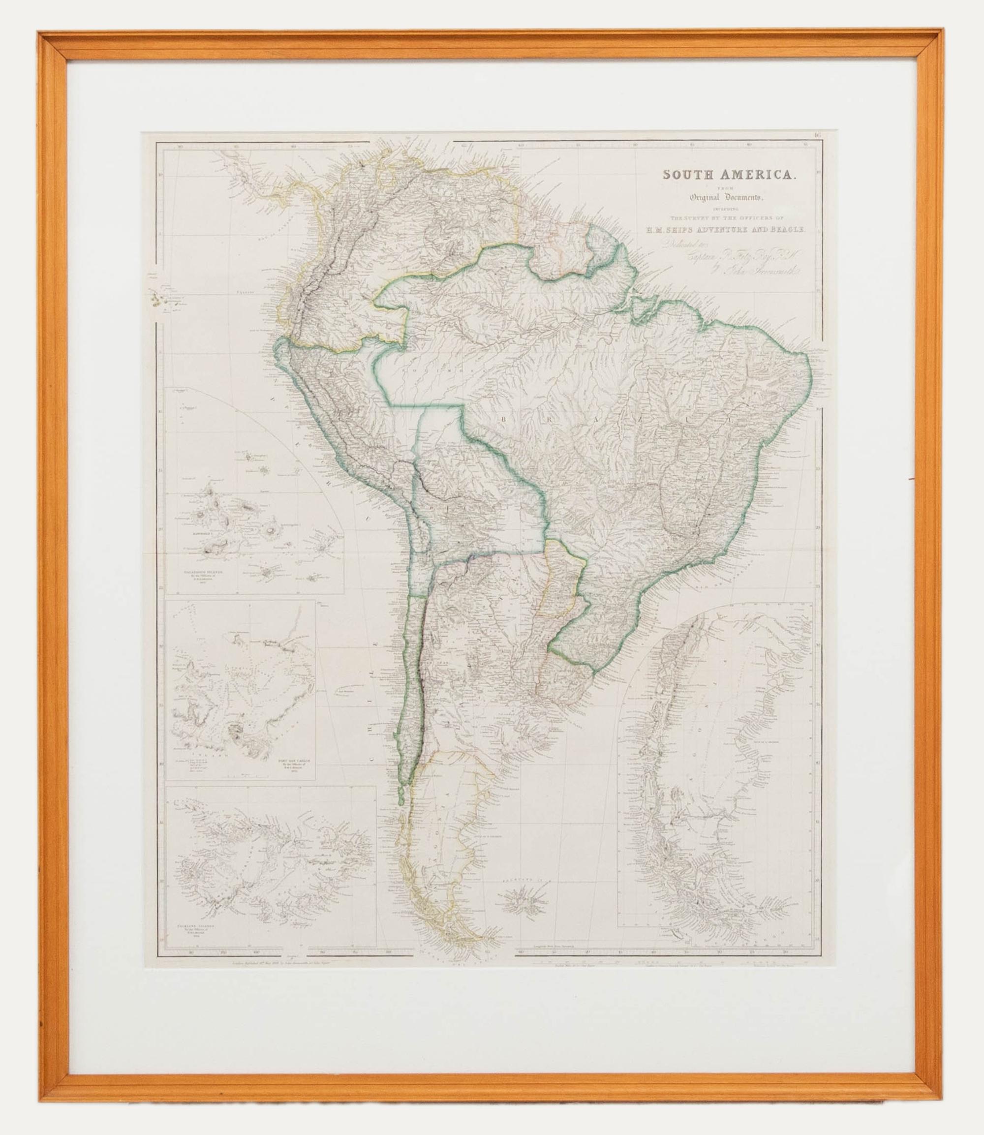
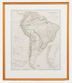
After John Arrowsmith (1790-1873) - 20th Century Digital Print, South America
Located in Corsham, GB
Inscribed: South America from original documents. Including the survey by the officers of H.M. Ships Adventure and Beagle. Presented in a light wooden frame. On paper.
Category
20th Century More Prints
Materials
Digital
$196 Sale Price
20% Off
Original Antique Map of Spain and Portugal, circa 1790
Located in St Annes, Lancashire
Super map of Spain and Portugal
Copper plate engraving by A. Bell
Published, circa 1790.
Unframed.
Category
Antique 1790s English Other Maps
Materials
Paper

Charte von Sud-America (Map of South America) - Etching with Hand-Drawn Outlines
Located in Soquel, CA
Map of south America, engraved by Franz Pluth (Czech, 1800-1871), from the book "Neueste Länder - und Völkerkunde, ein geographisches Lesebuch für alle Stände" by Linder, F. L. (Prag...
Category
1820s Other Art Style More Prints
Materials
Paper, Printer's Ink, Etching

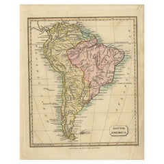
Antique Map of South America by Tyrer, 1821
By Thomas Kitchin
Located in Langweer, NL
Antique map titled 'South America'. Beautiful antique map of South America engraved by Tyrer. Artists and Engravers: Published by J. Soute...
Category
Antique 19th Century Maps
Materials
Paper
$121 Sale Price
20% Off
Antique Map of South America by Reichard, 1820
By Thomas Kitchin
Located in Langweer, NL
Antique map titled 'Süd America'. Decorative antique map of South America with an inset map of Ecuador. Artists and Engravers: Published b...
Category
Antique 19th Century Maps
Materials
Paper
$82 Sale Price
20% Off
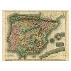
Antique Map of Spain and Portugal by Thomson, 1815
Located in Langweer, NL
Antique map titled 'Spain & Portugal.' Map of Spain and Portugal. From Thomson's 'New General Atlas', 1815. Artists and Engravers: Made by 'J. & G. Menzies'. Publisher: John Thomson ...
Category
Antique 19th Century Maps
Materials
Paper
$165 Sale Price
20% Off
More Ways To Browse
Antique Map Mexico
Antique Maps Of Texas
Map Of Mexican California
Picasso Picador Et Taureau
Picasso Satyr
Pierre Bonnard Signed
Pkz Posters
Rare Vintage Original Skate Decks
Rembrandt Etching Amsterdam
Renoir Hand Signed
Roger Jourdain
Rouault Passion
Roy Lichtenstein Composition
Roz Chast
Sally Michael
Salvador Dali Cerberus
Salvador Dali Ea
Salvador Dali Heart