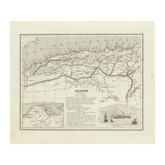
Items Similar to Colonie d'Alger - Original Etching - 19th century
Want more images or videos?
Request additional images or videos from the seller
1 of 2
UnknownColonie d'Alger - Original Etching - 19th century19th century
19th century
$353.77
£268.98
€300
CA$496.27
A$542.21
CHF 285.17
MX$6,518.78
NOK 3,590.56
SEK 3,371.06
DKK 2,284.96
About the Item
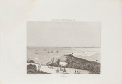
Colonie d'Alger is an original etching realized by an Anonymous engraver of the 19th Century.
Printed in series of "France Pittoresque" at the top center.
The state of preservation of the artwork is good except for foxing due to timing.
A fascinating piece of history and a beautiful piece of art represented in this geographical map, with precise borders and names of places.
- Creation Year:19th century
- Dimensions:Height: 6.7 in (17 cm)Width: 9.85 in (25 cm)Depth: 0.04 in (1 mm)
- Medium:
- Movement & Style:
- Period:
- Framing:Framing Options Available
- Condition:Insurance may be requested by customers as additional service, contact us for more information.
- Gallery Location:Roma, IT
- Reference Number:Seller: M-1156151stDibs: LU65037623992
About the Seller
4.9
Platinum Seller
Premium sellers with a 4.7+ rating and 24-hour response times
1stDibs seller since 2017
7,793 sales on 1stDibs
Typical response time: 1 hour
- ShippingRetrieving quote...Shipping from: Roma, Italy
- Return Policy
Authenticity Guarantee
In the unlikely event there’s an issue with an item’s authenticity, contact us within 1 year for a full refund. DetailsMoney-Back Guarantee
If your item is not as described, is damaged in transit, or does not arrive, contact us within 7 days for a full refund. Details24-Hour Cancellation
You have a 24-hour grace period in which to reconsider your purchase, with no questions asked.Vetted Professional Sellers
Our world-class sellers must adhere to strict standards for service and quality, maintaining the integrity of our listings.Price-Match Guarantee
If you find that a seller listed the same item for a lower price elsewhere, we’ll match it.Trusted Global Delivery
Our best-in-class carrier network provides specialized shipping options worldwide, including custom delivery.More From This Seller
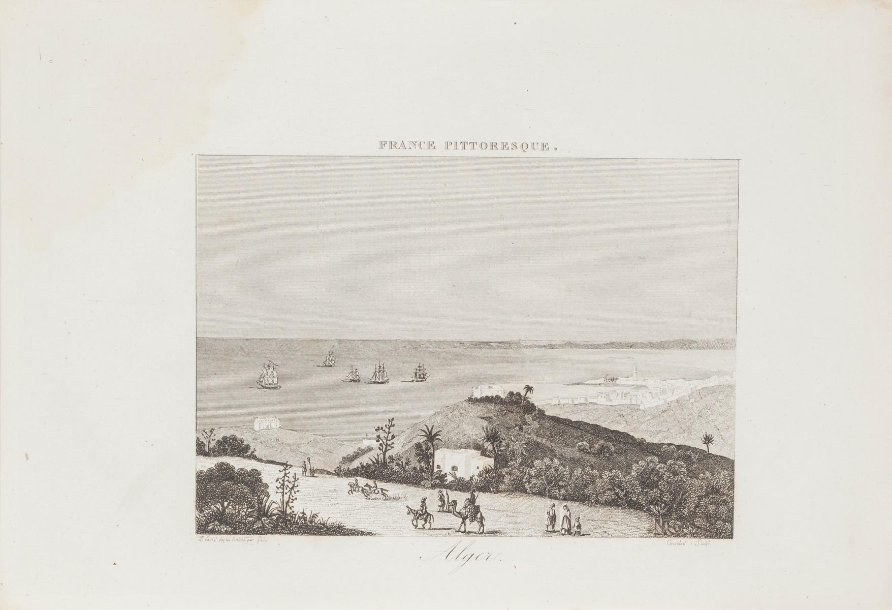
View AllAlger - Original Lithograph - 19th Century
Located in Roma, IT
Alger is an original lithograph on paper realized by an Anonymous artist of the 19th Century.
Printed in series of "France Pittoresque" at the top center.
Titled in France on the ...
Category
19th Century Landscape Prints
Materials
Lithograph
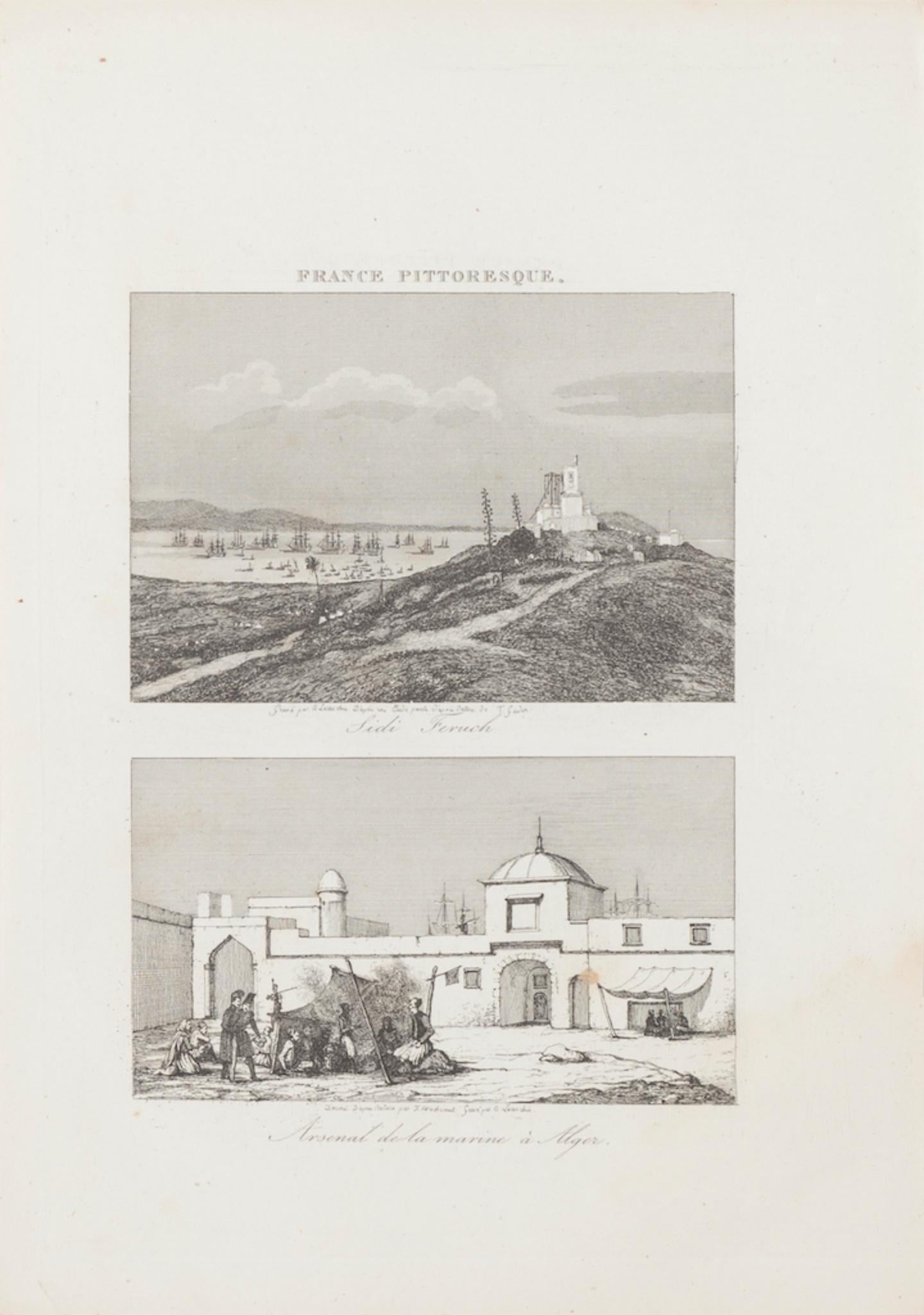
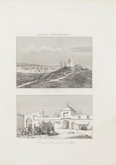
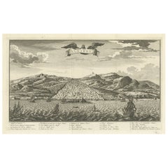
Sidi French and Arsenal d'Algier - Original Lithograph - 19th century
Located in Roma, IT
Sidi French and Arsenal d'Algier is an original lithograph on paper realized by an Anonymous artist of the XIX century.
Printed in series of "France Pittoresque" at the top center....
Category
19th Century Landscape Prints
Materials
Lithograph
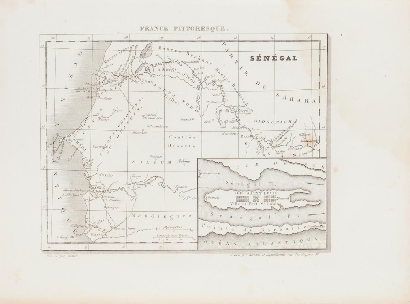
Ancient Map of Senegal - Original Etching - 19th Century
Located in Roma, IT
Map of Senegal is an original etching realized by an anonymous engraver of the 19th Century.
Printed in series of "France Pittoresque" at the top center.
The state of preservation ...
Category
19th Century Figurative Prints
Materials
Etching

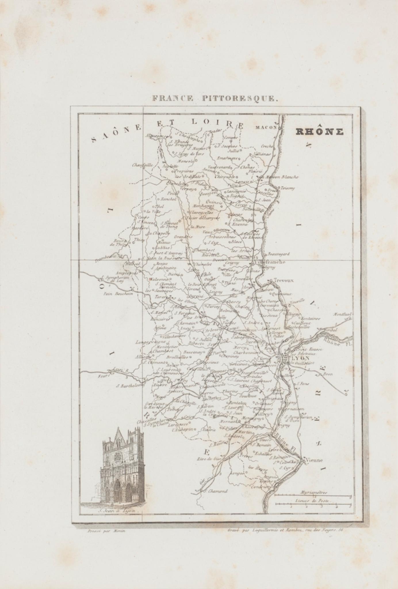
Map of Rhône - Original Etching - 19th Century
Located in Roma, IT
Map of Rhône is an original antique etching realized by an anonymous engraver of the 19th Century.
Printed in series of "France Pittoresque" at the top center.
The state of preserv...
Category
19th Century Modern Figurative Prints
Materials
Etching

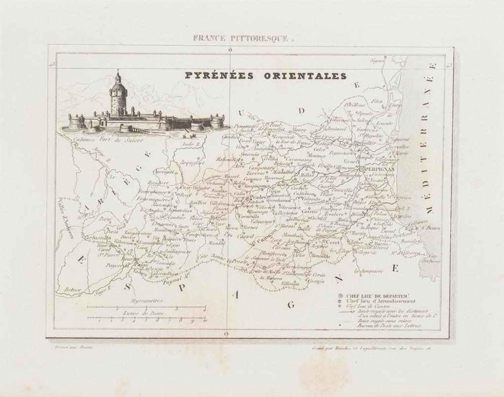
Map of Pyrénées - Original Etching - 19th Century
Located in Roma, IT
Map of Pyrénées is an original antique etching realized by an anonymous engraver of the XIX century.
Printed in series of "France Pittoresque" at the top center.
The state of prese...
Category
19th Century Modern Figurative Prints
Materials
Etching

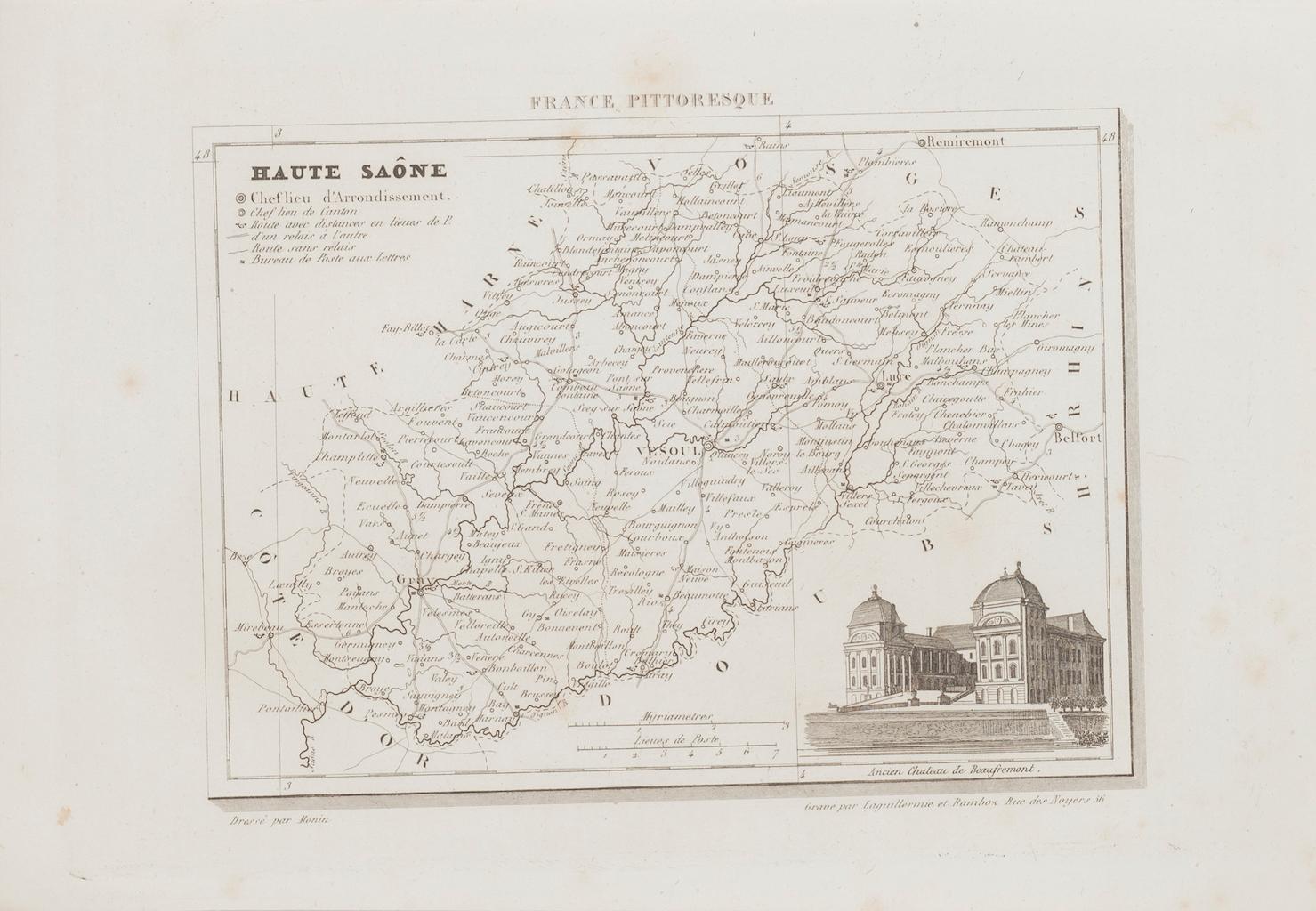
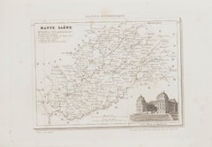
Map of Haute-Saône - Original Etching - 19th Century
Located in Roma, IT
Map of Haute-Saône is an original antique etching realized by an anonymous engraver of the 19th Century.
Printed in series of "France Pittoresque" at the top center.
The state of p...
Category
19th Century Modern Figurative Prints
Materials
Etching
You May Also Like
Antique Map of the French Colony of Algeria by V. Levasseur, 1854
By Victor Levasseur
Located in Langweer, NL
Antique map titled 'Algérie, Colonie Francaise'. Shows the region divided into the administrative provinces of Oban, Alger, and Constantine. The map proper is surrounded by elaborate...
Category
Antique Mid-19th Century Maps
Materials
Paper

Pyrenees Orientales, France. Antique map of a French department, 1856
By Victor Levasseur
Located in Melbourne, Victoria
'Dept. des Pyrenees Orientales', steel engraving with original outline hand-colouring., 1856, from Levasseur's 'Atlas National Illustre'.
This area is well-known wine producing reg...
Category
19th Century Naturalistic Landscape Prints
Materials
Engraving

Original Antique Engraving of Algiers in Algeria, 1773
Located in Langweer, NL
Antique print titled 'Algiers'. Old print with a view of Algiers, Algeria. With Dutch legend. Originates from the first Dutch editon of an interesting travel account of Northern Afri...
Category
Antique 18th Century Prints
Materials
Paper
$462 Sale Price
20% Off
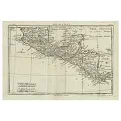
Antique French Engraving of Mexico with Lots of Details, c.1780
Located in Langweer, NL
Antique map titled 'Partie Meridionale, de L'Ancien Mexique ou de la Nouvelle Espagne.'
Detailed map of Mexico, the Yucatan and Central America, prepared under the direction of Rigobert Bonne. Shows towns, rivers, mountains, lakes, etc. Detailed map of the region. Source unknown, to be determined.
Artists and Engravers: Rigobert Bonne (1727-1795 ) was one of the most important cartographers of the late 18th century. In 1773 he succeeded Jacques Bellin as Royal Cartographer to France in the office of the Hydrographer at the Depôt de la Marine. Working in his official capacity Bonne compiled some of the most detailed and accurate maps of the period. Bonne's work represents an important step in the evolution of the cartographic ideology away from the decorative work of the 17th and early 18th century towards a more detail oriented and practical aesthetic. With regard to the rendering of terrain Bonne maps...
Category
Antique 18th Century Maps
Materials
Paper
Antique engraving of a state prison in Sicily by Zeyer & French, c.1850
Located in Langweer, NL
Antique engraving of a state prison in Sicily by Zeyer & French, c.1840–1860
This dramatic antique engraving presents a coastal view of a state prison in Sicily, titled in German “...
Category
Antique 1850s German Prints
Materials
Paper

Antique Map of the Region of Algiers, Algeria
Located in Langweer, NL
Antique map titled 'Alger'. This map shows the region of Algiers, Algeria. With a small inset map of the region of Algiers and a decorative vignette with a harbor view. Originates fr...
Category
Antique Mid-19th Century Maps
Materials
Paper
$160 Sale Price
20% Off
More Ways To Browse
Jose Francisco Borges
Jose Royo Serigraph
Joze Ciuha
Julian Opie Paper Heads
Kalman Kubinyi
Karl Gerich
Karl Neumann
Katarina Vavrova
Keith Haring Untitled D
Large Erte
Large Signed Picasso Prints
Le Blanc Seing
Leger Hand Signed Lithograph
Leonard H Mersky
Leroy Neiman Americas Cup
Leroy Neiman Silkscreens
Leroy Neiman Skier
Leroy Neiman Stud Poker