Items Similar to Map of Greece - Etching on Paper 19th Century


Want more images or videos?
Request additional images or videos from the seller
1 of 6
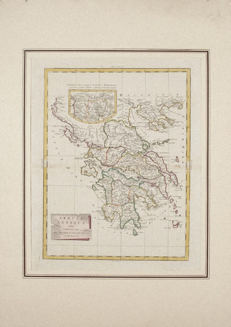
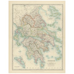
UnknownMap of Greece - Etching on Paper 19th Century19th Century
19th Century
$296.85
£224.35
€250
CA$414.67
A$451.12
CHF 238.05
MX$5,425.53
NOK 3,002.92
SEK 2,794.69
DKK 1,904.43
About the Item
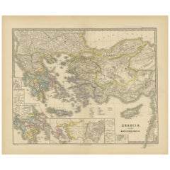
Image dimensions: 22.2 x 27.8 cm.
Grecia is an interesting hand-colored etching on paper, realized by an anonymous artist in the first half of the XIX century.
With the inscriptions in Italian, this original print describes the geography of Greece with the great charisma of the antique maps.
In very good conditions, except for a usual yellowing of the paper at the edges and minor defects and signs of the time, and some light yellow strips, this is a precious artwork, map, or souvenir of summer holidays!
- Creation Year:19th Century
- Dimensions:Height: 11.7 in (29.7 cm)Width: 18.39 in (46.7 cm)Depth: 0.04 in (1 mm)
- Medium:
- Movement & Style:
- Period:
- Condition:Insurance may be requested by customers as additional service, contact us for more information.
- Gallery Location:Roma, IT
- Reference Number:Seller: M-1033761stDibs: LU65035063641
About the Seller
4.9
Platinum Seller
Premium sellers with a 4.7+ rating and 24-hour response times
1stDibs seller since 2017
7,837 sales on 1stDibs
Typical response time: 1 hour
- ShippingRetrieving quote...Shipping from: Monaco, Monaco
- Return Policy
More From This Seller
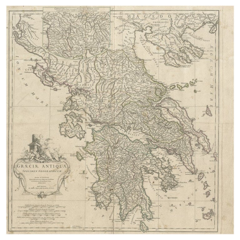
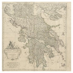
View AllMap of Ancient Greece - Original Etching by Antonio Zatta - 1785
Located in Roma, IT
This Map of ancient Greek is an etching realized by Antonio Zatta in Venice in 1785.
The state of preservation of the artwork is good expect for the worn paper.
Mounted on a cardbo...
Category
1770s Landscape Prints
Materials
Etching

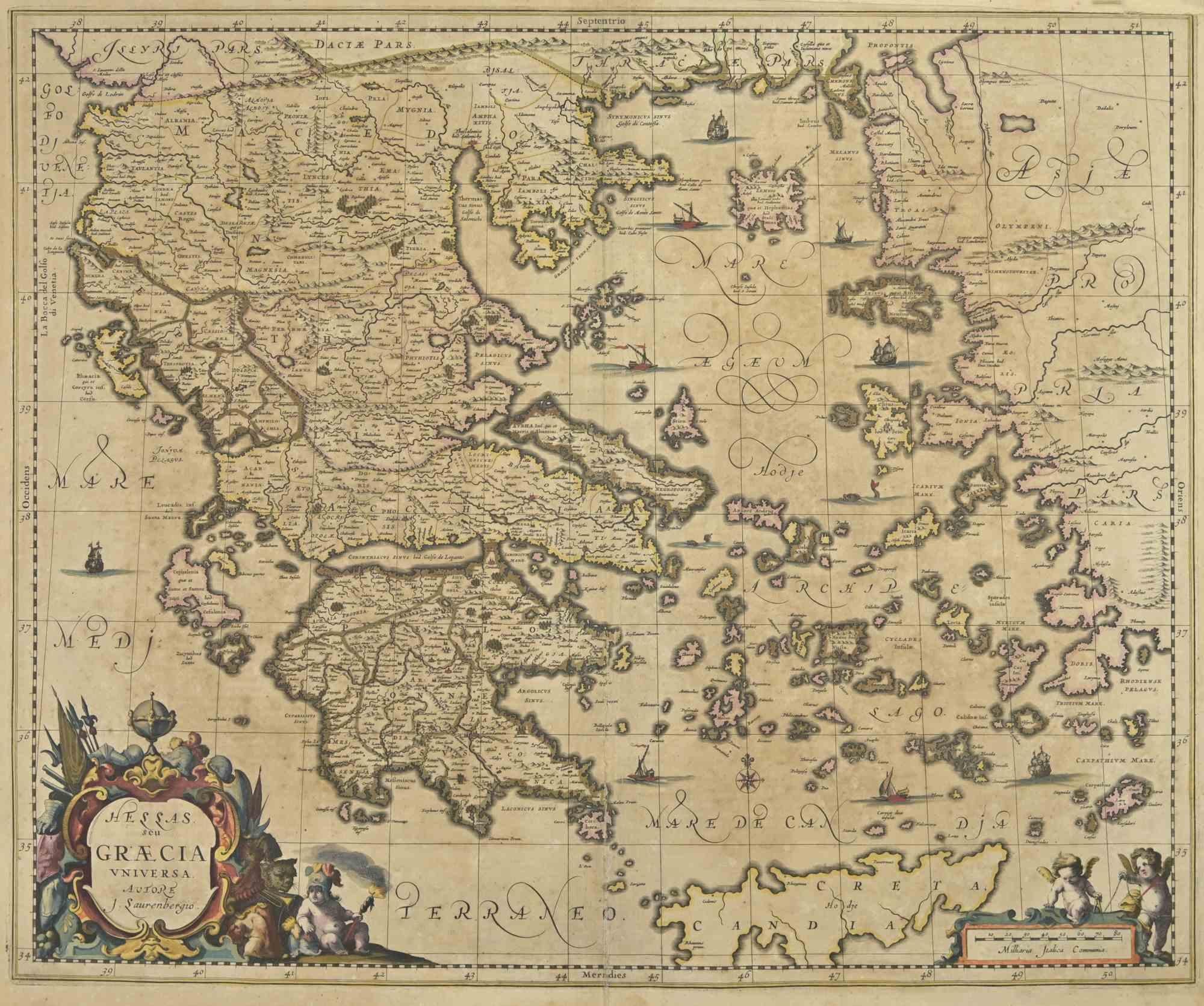
Antique Map - Map of Greece - Etching by Johannes Janssonius - 1650s
By Johannes Janssonius
Located in Roma, IT
Antique Map of Greece - Graecia Vniversa is an antique map realized in 1650 by Johannes Janssonius (1588-1664).
The Map is Hand-colored etching, with coeval watercoloring.
Good co...
Category
1650s Modern Figurative Prints
Materials
Etching

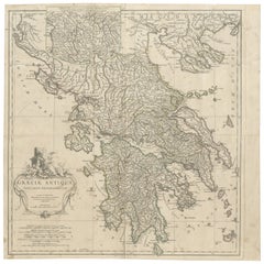
Map of Greece - Original Etching by Antonio Zatta - 18th Century
Located in Roma, IT
This Map of Greece is an etching realized by Antonio Zatta, Cartographer, publisher and typographer.
The state of preservation of the artwork is good except for the worn paper and t...
Category
1780s Figurative Prints
Materials
Etching

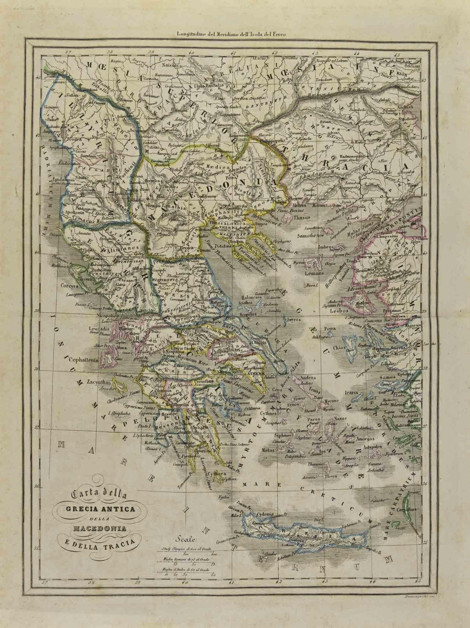
Map of Ancient Greece of Macedonia and... - Lithograph by Auguste Wahlen - 1844
Located in Roma, IT
Map of Ancient Greece of Macedonia and Thrace is a lithograph made by Auguste Wahlen in 1844.
Hand colored.
Good condition.
Bottom left is the original title "Carta della Grecia A...
Category
1840s Modern Figurative Prints
Materials
Lithograph

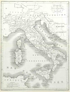
Map of Italy - Etching by Pierre François Tardieu - 1837
Located in Roma, IT
Map of Italy is an Etching realized in 1837.
Good conditions.
The artwork is realized in a well-balanced composition. the artwork and belongs to the suite suite "AtlasBatt" realize...
Category
1830s Modern Figurative Prints
Materials
Lithograph
Antique Map - Mar Di Athiopia - Etching by Johannes Janssonius - 1650s
By Johannes Janssonius
Located in Roma, IT
Antique Map - Mar Di Athiopia is an antique map realized in 1650 by Johannes Janssonius (1588-1664).
The Map is Hand-colored etching, with coeval watercolorang.
Good conditions wit...
Category
1650s Modern Figurative Prints
Materials
Etching

You May Also Like
Antique Map of Greece by Allard (c.1698)
Located in Langweer, NL
Antique map titled 'Hellas seu Graecia Universa' Detailed map of Greece, with Crete, the Aegean Islands, and part of Turkey. With two cartouches, compass rose and scale. Carolus Alla...
Category
Antique Late 17th Century Maps
Materials
Paper

$932 Sale Price
20% Off
Large Scale Map of Greece with Inset Map of Macedonia, c.1786
Located in Langweer, NL
Antique map titled 'Graeciae Antiquae'. Large scale map of Greece, extends south to the island of Cythera. Inset map shows details of Macedonia. Publis...
Category
Antique 18th Century Maps
Materials
Paper
Antique Map of Greece and the Cyclades, 1903, with Many Details and Inset Maps
Located in Langweer, NL
Title: Antique Map of Greece and the Cyclades, 1903, with Intricate Detail and Inset Maps
Description: This antique map, titled "Greece with Its Islands, Including the Cyclades," wa...
Category
Early 20th Century Maps
Materials
Paper
Large Scale Map of Greece, Extending to Cythera with Inset of Macedonia, ca.1786
Located in Langweer, NL
Antique map titled 'Graeciae Antiquae'.
Large scale map of Greece, extends south to the island of Cythera. Inset map shows details of Macedonia. Pu...
Category
Antique 1780s Maps
Materials
Paper
$589 Sale Price
20% Off
Antique Map of Southern Greece, 1892
Located in Langweer, NL
Antique map of Greece titled 'Griechenland. Südlicher Theil'. Old map of Southern Greece with inset maps of the Acropolis of Athens, the region of Athens, Thermopylae and Olympia. So...
Category
Antique 19th Century Maps
Materials
Paper
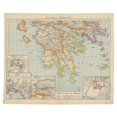
$59 Sale Price
41% Off
Original Map of Greece at the Time of the Dorian Migration, Published in 1880
Located in Langweer, NL
The map titled "GRAECIA TEMPORI MIGRATIONIS DORICAE," translates to "Greece at the Time of the Dorian Migration." This map showcases the regions of ancient Greece during the period f...
Category
Antique 1880s Maps
Materials
Paper
More Ways To Browse
Map Greece
Antique Maps Of Greece
Iona Rozeal Brown
Iris Woodblock Print
Irving Amen On Sale
Israel Museum Poster
Itzchak Tarkay Afternoon Tea
Itzchak Tarkay Serigraph
Ivory Cigarette Holder
J Alphege Brewer
J Didier
Jack Chandler
James A Pritchard
Jane Rogers
Japanese Warrior Woodblock Print
Japanese Woodblock Print Kuniyoshi
Japanese Woodblock Tree
Jean Jacques Sempe