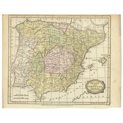
Items Similar to Map of Spain and Portugal - Original Etching - Late 19th Century


Want more images or videos?
Request additional images or videos from the seller
1 of 3
UnknownMap of Spain and Portugal - Original Etching - Late 19th CenturyLate 19th Century
Late 19th Century
$235
£179.37
€200
CA$331.41
A$364.11
CHF 190.29
MX$4,342.34
NOK 2,409.55
SEK 2,244.70
DKK 1,524.38
About the Item
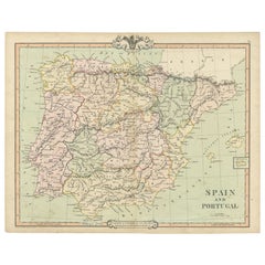
This Map of Spain and Portugal is an etching realized by an anonymous artist.
The state of preservation of the artwork is good with some small diffused stains.
Sheet dimension: 28.5 x 44
At the top of the paper, the inscription “Longitudine del Meridiano dell' Isola del Ferro”, whilst at the bottom, just below the image, the inscription “Longitudine Est del Meridiano Parigi”. At the top right, the number of the sheet "Tav.XXI is printed.
- Creation Year:Late 19th Century
- Dimensions:Height: 7.68 in (19.5 cm)Width: 9.45 in (24 cm)Depth: 0.04 in (1 mm)
- Medium:
- Movement & Style:
- Period:
- Framing:Framing Options Available
- Condition:Insurance may be requested by customers as additional service, contact us for more information.
- Gallery Location:Roma, IT
- Reference Number:Seller: M-1133011stDibs: LU65037308832
About the Seller
4.9
Platinum Seller
Premium sellers with a 4.7+ rating and 24-hour response times
1stDibs seller since 2017
7,816 sales on 1stDibs
Typical response time: 1 hour
- ShippingRetrieving quote...Shipping from: Roma, Italy
- Return Policy
More From This Seller
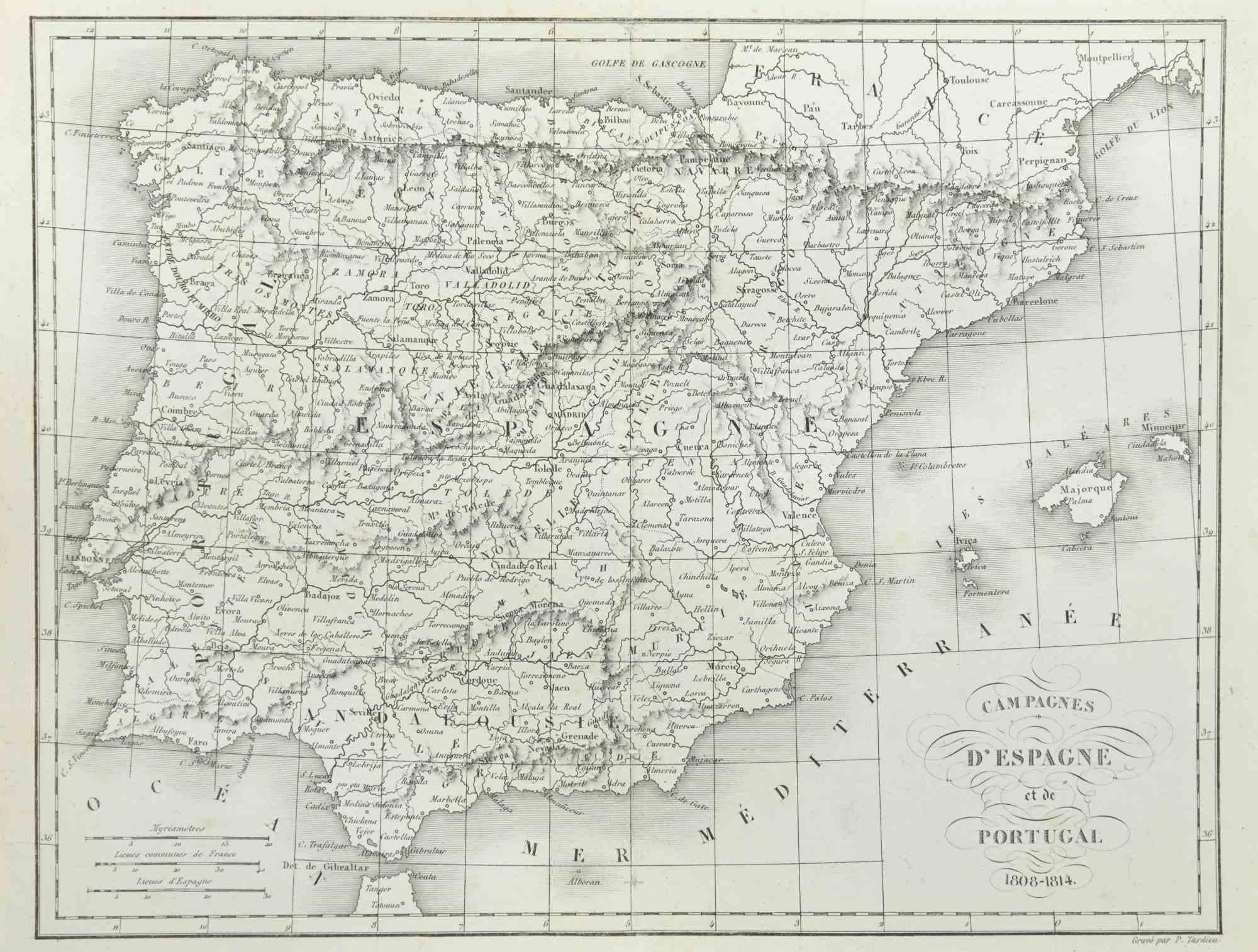
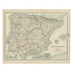
View AllMap of Spain and Portugal - Etching by Pierre François Tardieu - 1837
Located in Roma, IT
Map of Spain and Portugal is an Etching realized by Pierre François Tardieu in 1837.
Good conditions.
The artwork is realized in a well-balanced composition. the artwork and belong...
Category
1830s Modern Figurative Prints
Materials
Lithograph

Map of Germany - Original Etching - 1820
Located in Roma, IT
Map of Germany is an Original Etching realized by an unknown artist of 19th century in 1820.
Very good condition on two sheets of white paper joined at...
Category
1820s Modern Figurative Prints
Materials
Etching

Map of Rhône - Original Etching - 19th Century
Located in Roma, IT
Map of Rhône is an original antique etching realized by an anonymous engraver of the 19th Century.
Printed in series of "France Pittoresque" at the top center.
The state of preserv...
Category
19th Century Modern Figurative Prints
Materials
Etching

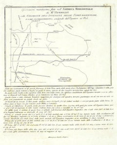
Map of South America - Original Etching - Late 19th Century
Located in Roma, IT
This Map of South America is an etching realized by an anonymous artist.
The state of preservation of the artwork is good with some small diffused stains.
Sheet dimension: 41.5 x 27
The artwork represents the map South America...
Category
Late 19th Century Modern Figurative Prints
Materials
Etching
Map of Pyrénées - Original Etching - 19th Century
Located in Roma, IT
Map of Pyrénées is an original antique etching realized by an anonymous engraver of the XIX century.
Printed in series of "France Pittoresque" at the top center.
The state of prese...
Category
19th Century Modern Figurative Prints
Materials
Etching

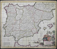
Accuratissima Totius Regni Hispaniae... - Etching by Frederick de Wit - 1680ca
By Frederick de Wit
Located in Roma, IT
This double-page etching with contemporary coloring, entitled Accuratissima Totius Regni Hispaniae Portugalliae, was realized by the cartographer Frederick de Wit for the famous Atla...
Category
1680s Modern Figurative Prints
Materials
Etching
You May Also Like
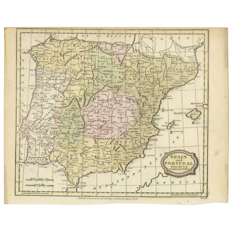
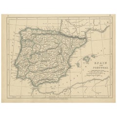
Antique Map of Spain and Portugal by Barlow, 1809
Located in Langweer, NL
"Antique map titled 'Spain and Portugal from the best Authorities'. Detailed antique map of Spain and Portugal. This map originates from 'The Gen...
Category
Antique 19th Century Maps
Materials
Paper
$75 Sale Price
20% Off
Antique Map of Spain and Portugal by Lowry, '1852'
Located in Langweer, NL
Antique map titled 'Spain and Portugal'. Original map of Spain and Portugal. This map originates from 'Lowry's Table Atlas constructed and engraved ...
Category
Antique Mid-19th Century Maps
Materials
Paper
$94 Sale Price
20% Off
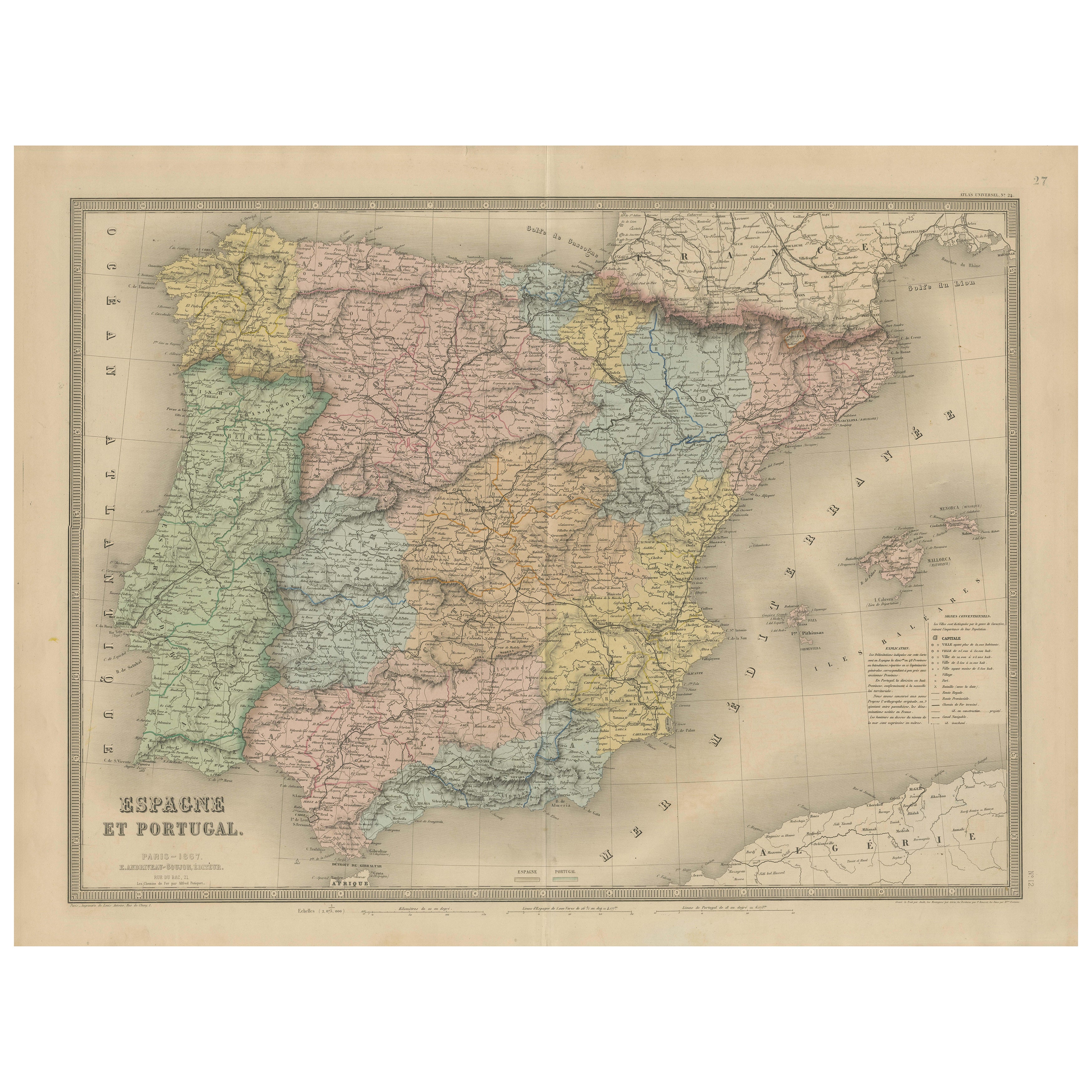
Spain & Portugal Map – Antique 1867 Engraving by Andriveau-Goujon, Paris
Located in Langweer, NL
Antique Map of Spain and Portugal – “Espagne et Portugal” by Andriveau-Goujon, 1867
This finely detailed antique map titled “Espagne et Portugal” was published in Paris in 1867 by t...
Category
Antique Mid-19th Century French Maps
Materials
Paper

Antique Map of Spain and Portugal by Levasseur, '1875'
Located in Langweer, NL
Antique map titled 'Carte générale de l'Espagne et du Portugal (..)'. Large map of Spain and Portugal. This map originates from 'Atlas de Géographie Moder...
Category
Antique Late 19th Century Maps
Materials
Paper

$352 Sale Price
40% Off
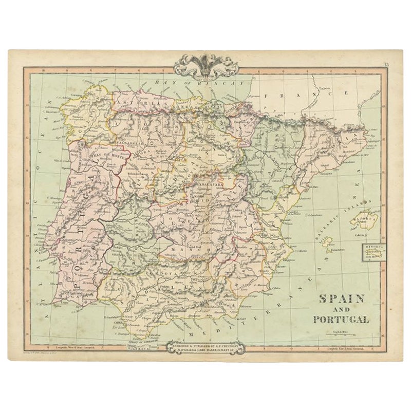
Antique Map of Spain and Portugal by Cruchley, 1854
Located in Langweer, NL
"Antique map of Spain and Portugal. Also depicts the islands Formentera, Ibiza, Mallorca and Minorca. Artists and Engravers: Engraved and publishe...
Category
Antique 19th Century Maps
Materials
Paper
$112 Sale Price
20% Off
Antique Map of Spain and Portugal by Johnston, '1909'
Located in Langweer, NL
Antique map titled 'Spain and Portugal'. Original antique map of Spain and Portugal. With inset maps of the Canary Islands, Madeira, Lisbon and Ma...
Category
Early 20th Century Maps
Materials
Paper
$235 Sale Price
20% Off
More Ways To Browse
Dali Illustrates Casanova
Dali Man Of La Mancha
Dali Othello
Dali Pig And Pepper
Dali Purgatory Signed
Dali Saba
Dali Signed Ecstatic
Dali Skeleton
Dali Spinning Man
Dali The Annunciation
Dali Thus Was Earth Created
Dame Laura Knight On Sale
Danos Flower Shop
Daumier Actualites
David Ham
David Schluss Serigraph
David Shrigley You Are Special
Degas Poster